Krimpen aan den IJssel
Encyclopedia
Krimpen aan den IJssel is a town and municipality in the western Netherlands
, in the province of South Holland
. The municipality had a population of 28800 in 2006, and covers an area of 8.93 km² (3.45 mile²) of which 1.10 km² (0.42 mile²) is water.
. For many centuries, the only buildings in Krimpen were farm houses built along the river dike. They formed more or less autonomous communities along the dike.
Before the 20th century, the two principal industrial employers were the brick factory Mijnlieff and the shipyard Van der Giessen de Noord
.
In the beginning of the 20th century development began inland from the river dikes, and the municipality began to lose its agricultural character.
During the North Sea flood of 1953
, the tidal barrier in the river IJssel proved to be inadequate. So in 1954 construction started on a new storm surge barrier, the first installation of the Delta Works
.
In 1958 it was completed together with the Algera Bridge which connects Krimpen with Capelle aan den IJssel
.
In the mid 1960s, Krimpen became a commuter town for people working in Rotterdam, resulting in major expansion. Today most of the municipality has been built up, except for the Krimpenerwaard where the town council aims to retain the rural character.

Netherlands
The Netherlands is a constituent country of the Kingdom of the Netherlands, located mainly in North-West Europe and with several islands in the Caribbean. Mainland Netherlands borders the North Sea to the north and west, Belgium to the south, and Germany to the east, and shares maritime borders...
, in the province of South Holland
South Holland
South Holland is a province situated on the North Sea in the western part of the Netherlands. The provincial capital is The Hague and its largest city is Rotterdam.South Holland is one of the most densely populated and industrialised areas in the world...
. The municipality had a population of 28800 in 2006, and covers an area of 8.93 km² (3.45 mile²) of which 1.10 km² (0.42 mile²) is water.
History
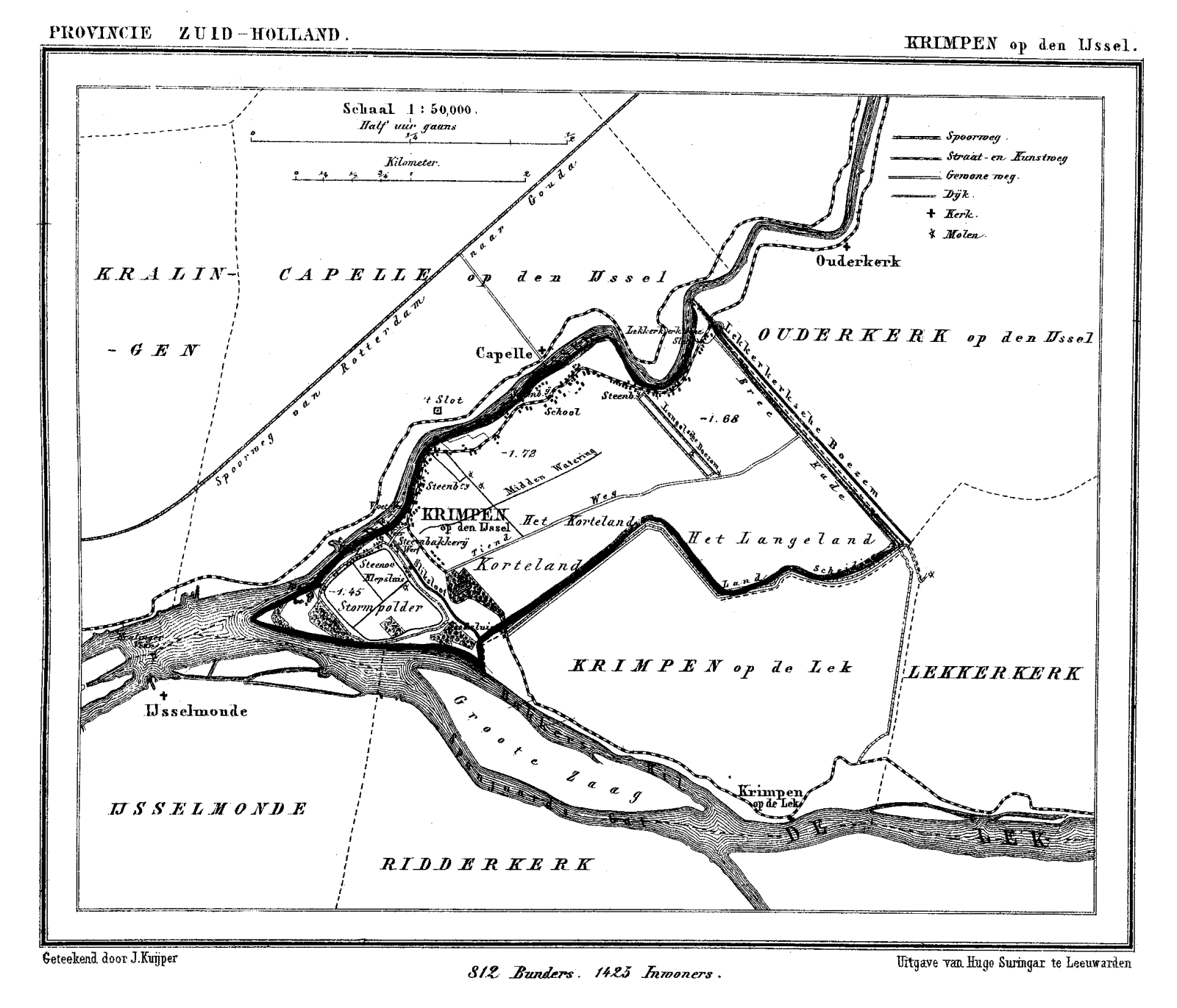
Krimpen is first mentioned in a document from 1277. Like other hamlets, many different spellings of its name have occurred over time, among which the name Tingenijssel deviated the most from today's spelling. The municipality is on the south shore of the river IJsselHollandse IJssel
The Hollandse IJssel is a branch of the Rhine delta that flows westward from Nieuwegein on river Lek through IJsselstein, Gouda and Capelle aan den IJssel to Krimpen aan den IJssel, where it ends in the Nieuwe Maas. Another branch called Enge IJssel flows southwest from Nieuwegein...
. For many centuries, the only buildings in Krimpen were farm houses built along the river dike. They formed more or less autonomous communities along the dike.
Before the 20th century, the two principal industrial employers were the brick factory Mijnlieff and the shipyard Van der Giessen de Noord
Van der Giessen de Noord
Van der Giessen de Noord was a shipyard that mainly built ferries, located in Krimpen aan den IJssel, a town in the western Netherlands. The yard was especially suited to the construction of large vessels due to its developed undercover facilities....
.
In the beginning of the 20th century development began inland from the river dikes, and the municipality began to lose its agricultural character.
During the North Sea flood of 1953
North Sea flood of 1953
The 1953 North Sea flood was a major flood caused by a heavy storm, that occurred on the night of Saturday 31 January 1953 and morning of 1 February 1953. The floods struck the Netherlands, Belgium, England and Scotland.A combination of a high spring tide and a severe European windstorm caused a...
, the tidal barrier in the river IJssel proved to be inadequate. So in 1954 construction started on a new storm surge barrier, the first installation of the Delta Works
Delta Works
The Delta Works is a series of construction projects in the southwest of the Netherlands to protect a large area of land around the Rhine-Meuse-Scheldt delta from the sea. The works consist of dams, sluices, locks, dikes, levees, and storm surge barriers...
.
In 1958 it was completed together with the Algera Bridge which connects Krimpen with Capelle aan den IJssel
Capelle aan den IJssel
Capelle aan den IJssel is a town and municipality in the western Netherlands, in the province of South Holland. The municipality had a population of 65,605 in 2005, and covers an area of 15.42 km² of which 1.13 km² is water...
.
In the mid 1960s, Krimpen became a commuter town for people working in Rotterdam, resulting in major expansion. Today most of the municipality has been built up, except for the Krimpenerwaard where the town council aims to retain the rural character.
Public transportation
- Waterbus route 1:
- RotterdamRotterdamRotterdam is the second-largest city in the Netherlands and one of the largest ports in the world. Starting as a dam on the Rotte river, Rotterdam has grown into a major international commercial centre...
Willemskade - Krimpen aan den IJssel Stormpolder - RidderkerkRidderkerkRidderkerk is a town and municipality in the western Netherlands, in the province of South Holland. The municipality had a population of 44,886 in 2010, and covers an area of 25.10 km² ....
De Schans - AlblasserdamAlblasserdamAlblasserdam is a town in the western Netherlands, in the province of South Holland. The municipality covers an area of , of which is water. Alblasserdam is officially a part of the Drechtsteden...
Kade - DordrechtDordrechtDordrecht , colloquially Dordt, historically in English named Dort, is a city and municipality in the western Netherlands, located in the province of South Holland. It is the fourth largest city of the province, having a population of 118,601 in 2009...
Merwekade.
- Rotterdam

External links
- official website
- http://www.plattegronden.nl/krimpenadijssel/

