

Place names in Irish
Encyclopedia
The vast majority of placenames in Ireland
are anglicisation
s of Irish language
names; that is, adaptations of the Irish names to English phonology
and spelling. However, some names come directly from the English language
, and a handful come from Old Norse
and Ulster Scots. The study of placenames
in Ireland unveils features of the country's history and geography, and the development of the Irish language. The name of Ireland itself comes from the Irish
name Éire
, added to the Germanic
word land. In mythology
, Éire was an Irish goddess of the land and of sovereignty (see Ériu
).
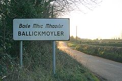
In some cases, the official English or anglicised name is wholly different from the official Irish language name. An example is Dublin. Its name is derived from the Irish dubh linn (meaning "black pool"), but its official Irish name is Baile Átha Cliath (meaning "town of the hurdled ford").
", there were very few towns or large settlements in Ireland. Hence, most places were named after noteworthy features of the landscape, such as hills, rocks, valleys, lakes, islands, and harbours. As time went on, more places were named after man-made features, such as churches, castles, and bridges. Some of the most common elements found in Irish placenames are shown in the table below. The differences in spelling are often due to differences in pronunciation.
raided monasteries
along Ireland's coasts and waterways. The Vikings spoke the Old Norse language and are also called Norsemen
. They set up small coastal camps called longphorts — these were used as bases for their raiding parties and as shelters during the winter. Eventually some longphorts grew into Norse settlements and trading ports. The biggest of these were Dublin (which became a Norse-Gaelic kingdom), Wexford
, Waterford
, Cork
and Limerick
. Over time, the Norsemen embraced Gaelic language and culture, becoming known as the Norse-Gaels
(or Gall-Gaidhel in Irish).
Placenames derived from Old Norse:
, which began in 1169, Anglo-Norman
and English language placenames emerged in the areas under Anglo-Norman control. Most of these are within the bounds of "The Pale
" — the area that stayed under direct English control for the longest, and where English language and culture held sway. It stretched along the east coast from Dundalk
in the north to Dalkey
in the south.
Between 1556 and 1641, during its "conquest of Ireland", the English colonised
parts of the country with settlers from Great Britain. This is known as the "Plantations of Ireland
". The northern province of Ulster
was the most heavily colonised. Those who settled as part of the "Plantation of Ulster
" were required to be English speaking. The result is that northeast Ulster also has a great number of English-derived placenames.
Such placenames often refer to buildings and other manmade features. They often include forms such as -town, -ton, -ville, -borough, -bury, bridge, mill, castle, abbey, church, etc. However, forms such as hill, mount, mont, wood, bay, brook etc. are not uncommon.
In the Republic of Ireland
, both Irish and English names have equal status and are displayed on roadsigns. However, in the Gaeltacht
, the English/anglicized names have no official status and do not appear on roadsigns.
During and after the foundation of the Irish Free State
in 1922, some English names were reverted to their Irish or anglicized forms. This included:
Pursuant to the Official Languages Act, 2003 and the advice of the Coimisiún Logainmneacha (Place-Names Commission), the Placenames (Centres of Population and Districts) Order 2005 was issued, listing the equivalent in the Irish language of place-names specified in the Order with its English form. The Irish words then had the same meaning and same force and effect as the place-name. This order lists a little fewer than 2,000 place-names, many of which were changed from the Irish form used since independence, e.g. Bray
went from Brí Chualann to Bré and Naas
changed from Nás na Rí to An Nás.
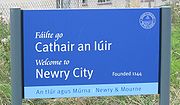
In Northern Ireland
, the new recognition of the status of the Irish language
does not extend to bilingual roadsigns — it is down to individual district councils
to decide to place them. Some towns in Fermanagh
, Omagh
, Armagh
Moyle
, Magherafelt
, Newry and Mourne
and Cookstown
council areas display bilingual names on some welcome signs (e.g. "OMAGH" An Ómaigh).
Irish street signs may be erected at the request of locals, provided there is enough support.
in Ireland, three of which derive their English
name from a mixture of their ancient Irish provincial name with the Old Norse term for land/territory/place; staðr.
In Irish the provinces are known as cúigí, the singular of which is cúige. The word cúige originally meant "a fifth", as in one-fifth part of Ireland. This is because Meath
, as seat of the High King of Ireland, was once a province in its own right, incorporating modern counties Meath, Westmeath and parts of surrounding counties. Meath was later absorbed into Leinster.
Most of the counties were named after a town in that county (commonly referred to as a county town
); usually an administrative centre. Some of these towns, such as Louth, have declined into small villages or have lost their county town status to other towns.
Counties named after their present or former county towns: Antrim
, Armagh
, Cavan
, Donegal
, Down
, Dublin
, Galway
, Kildare
, Kilkenny
, Leitrim
, Limerick
, Longford
, Louth
, Mayo
, Monaghan
, Roscommon
, Sligo, Tipperary
, Waterford
, Wexford
, and Wicklow
. The county of Londonderry
is named after the city of Derry
, though its county town was Coleraine
until 1972 when counties were abolished as administrative units in Northern Ireland and replaced with unitary councils.
Some counties derive their names from ancient Irish túath
a, kingdoms or people:
In 1994, County Dublin was abolished as an administrative unit and replaced with three new administrative counties:
In Irish, a street is sráid, a road is bóthar (meaning "cow path"), a lane is lána, and an avenue is ascaill. A linear village
is called a sráidbhaile ("[one]-street settlement")—this has been anglicised as Stradbally, which is the name of a number of villages on the island. Whilst Irish forms only have official status in the Republic of Ireland, Northern Ireland district councils are allowed to erect bilingual roadsigns.
Origins of some streets and roads in Belfast
, Northern Ireland
Origins of some streets and roads in Dublin, Republic of Ireland
Ireland
Ireland is an island to the northwest of continental Europe. It is the third-largest island in Europe and the twentieth-largest island on Earth...
are anglicisation
Anglicisation
Anglicisation, or anglicization , is the process of converting verbal or written elements of any other language into a form that is more comprehensible to an English speaker, or, more generally, of altering something such that it becomes English in form or character.The term most often refers to...
s of Irish language
Irish language
Irish , also known as Irish Gaelic, is a Goidelic language of the Indo-European language family, originating in Ireland and historically spoken by the Irish people. Irish is now spoken as a first language by a minority of Irish people, as well as being a second language of a larger proportion of...
names; that is, adaptations of the Irish names to English phonology
Phonology
Phonology is, broadly speaking, the subdiscipline of linguistics concerned with the sounds of language. That is, it is the systematic use of sound to encode meaning in any spoken human language, or the field of linguistics studying this use...
and spelling. However, some names come directly from the English language
English language
English is a West Germanic language that arose in the Anglo-Saxon kingdoms of England and spread into what was to become south-east Scotland under the influence of the Anglian medieval kingdom of Northumbria...
, and a handful come from Old Norse
Old Norse
Old Norse is a North Germanic language that was spoken by inhabitants of Scandinavia and inhabitants of their overseas settlements during the Viking Age, until about 1300....
and Ulster Scots. The study of placenames
Toponymy
Toponymy is the scientific study of place names , their origins, meanings, use and typology. The word "toponymy" is derived from the Greek words tópos and ónoma . Toponymy is itself a branch of onomastics, the study of names of all kinds...
in Ireland unveils features of the country's history and geography, and the development of the Irish language. The name of Ireland itself comes from the Irish
Irish language
Irish , also known as Irish Gaelic, is a Goidelic language of the Indo-European language family, originating in Ireland and historically spoken by the Irish people. Irish is now spoken as a first language by a minority of Irish people, as well as being a second language of a larger proportion of...
name Éire
Éire
is the Irish name for the island of Ireland and the sovereign state of the same name.- Etymology :The modern Irish Éire evolved from the Old Irish word Ériu, which was the name of a Gaelic goddess. Ériu is generally believed to have been the matron goddess of Ireland, a goddess of sovereignty, or...
, added to the Germanic
Germanic languages
The Germanic languages constitute a sub-branch of the Indo-European language family. The common ancestor of all of the languages in this branch is called Proto-Germanic , which was spoken in approximately the mid-1st millennium BC in Iron Age northern Europe...
word land. In mythology
Irish mythology
The mythology of pre-Christian Ireland did not entirely survive the conversion to Christianity, but much of it was preserved, shorn of its religious meanings, in medieval Irish literature, which represents the most extensive and best preserved of all the branch and the Historical Cycle. There are...
, Éire was an Irish goddess of the land and of sovereignty (see Ériu
Ériu
In Irish mythology, Ériu , daughter of Ernmas of the Tuatha Dé Danann, was the eponymous matron goddess of Ireland. Her husband was Mac Gréine ....
).
In some cases, the official English or anglicised name is wholly different from the official Irish language name. An example is Dublin. Its name is derived from the Irish dubh linn (meaning "black pool"), but its official Irish name is Baile Átha Cliath (meaning "town of the hurdled ford").
Names of Irish Gaelic origin
For most of the "Gaelic periodGaelic Ireland
Gaelic Ireland is the name given to the period when a Gaelic political order existed in Ireland. The order continued to exist after the arrival of the Anglo-Normans until about 1607 AD...
", there were very few towns or large settlements in Ireland. Hence, most places were named after noteworthy features of the landscape, such as hills, rocks, valleys, lakes, islands, and harbours. As time went on, more places were named after man-made features, such as churches, castles, and bridges. Some of the most common elements found in Irish placenames are shown in the table below. The differences in spelling are often due to differences in pronunciation.
| Anglicised spelling Anglicisation Anglicisation, or anglicization , is the process of converting verbal or written elements of any other language into a form that is more comprehensible to an English speaker, or, more generally, of altering something such that it becomes English in form or character.The term most often refers to... |
Irish | English translation | Example |
|---|---|---|---|
| agha, aghy, aghey, augha | field | Aghalee Aghalee Aghalee is a village in County Antrim, Northern Ireland. It is three miles from the southeast corner of Lough Neagh on the main road between Lurgan and Antrim and about 13 kilometres west of Lisburn. The village lies on the steep wooded slopes of Friary Glen and is beside the now disused Lagan... , Aughagower Aughagower Aughagower or Aghagower is a tiny village in rural County Mayo in western Ireland. It is located about 5 km from Westport. Modern Aughagower has only a few houses and pubs in a pastoral setting. It also forms the centre of a parish of the same name. The village is primarily known today for... |
|
| ard | high/height | Ardglass Ardglass Ardglass is a coastal village in County Down, Northern Ireland and still a relatively important fishing harbour. It is situated on the B1 Ardglass to Downpatrick road, about 11 kilometres to the south east of Downpatrick, in the Lecale peninsula on the Irish Sea. It had a population of 1,668... |
|
| ath | ford Ford (crossing) A ford is a shallow place with good footing where a river or stream may be crossed by wading or in a vehicle. A ford is mostly a natural phenomenon, in contrast to a low water crossing, which is an artificial bridge that allows crossing a river or stream when water is low.The names of many towns... |
Athlone | |
| bally | homestead/settlement | Ballymena Ballymena Ballymena is a large town in County Antrim, Northern Ireland and the seat of Ballymena Borough Council. Ballymena had a population of 28,717 people in the 2001 Census.... |
|
| bally, balla(gh), bella(gh) | pass/passage | Ballyclare Ballyclare Ballyclare is a small town in County Antrim, Northern Ireland. It had a population of 8,770 people in the 2001 Census... , Ballaghmore Ballaghmore Ballaghmore is a small village situated on the western side of County Laois, Ireland, southwest of Portlaoise.... |
|
| bane, baun, bain | white | Strabane Strabane Strabane , historically spelt Straban,is a town in west County Tyrone, Northern Ireland. It contains the headquarters of Strabane District Council.... , Cregganbaun Cregganbaun -Geology:In 2007 there were reports of a proposal by a company called Mayo’s Gold to open a niche tourism gold mine in Cregganbaun, and an interpretative visitor centre in Louisburgh. This re-ignited a 20 years controversy when several mining companies attempted to open commercial quantity gold... , Kinbain Whitehead, County Antrim Whitehead is a small seaside town on the east coast of County Antrim, Northern Ireland, lying almost midway between the towns of Carrickfergus and Larne. It lies within the civil parishes of Island Magee and Templecorran, the barony of Belfast Lower, and is part of Carrickfergus Borough Council... |
|
| beg | small | Carrickbeg Carrickbeg Carrickbeg is a village on the County Waterford side of the Waterford-Tipperary border in southern Ireland. Carrickbeg comprises that part of the town of Carrick-on-Suir on the southern side of the River Suir and hence in County Waterford.-History:... |
|
| bel, bell | mouth/rivermouth | Belfast Belfast Belfast is the capital of and largest city in Northern Ireland. By population, it is the 14th biggest city in the United Kingdom and second biggest on the island of Ireland . It is the seat of the devolved government and legislative Northern Ireland Assembly... |
|
| ben, bin | peak | Benbaun Benbaun Benbaun is a mountain in County Galway, Ireland, the highest of the Twelve Bens, and the highest peak in Galway. As the highest point in Galway, it is the 10th highest county peak in Ireland.... , Binevenagh Binevenagh Binevenagh or Benevenagh marks the western extent of the Antrim Plateau formed around 60 million years ago by molten lava. The plateau and steep cliffs extend for over 6 miles across the peninsula of Magilligan and dominating the skyline over the villages of Bellarena, Downhill, Castlerock and... |
|
| boy | yellow | Bawnboy Bawnboy Bawnboy is a small village in a valley at the foot of Slieve Rushen, between Ballyconnell and Swanlinbar, in County Cavan, Ireland). The current population is about 250. A bawn is the defensive wall surrounding an Irish tower house... |
|
| brack | mottled | Mullaghbrack Mullaghbrack Mullaghbrack or Mullaghbrac is a small village and townland in County Armagh, Northern Ireland. It is on the road between Markethill and Hamiltonsbawn, just north of Gosford Forest Park. In the 2001 Census it had a population of 75.-History:... |
|
| bun | river's bottom/foot/mouth | Bundoran Bundoran Bundoran is a town in County Donegal, part of the Province of Ulster in the north of Ireland. The town is located on the N15 road near Ballyshannon, 3 hours drive from Dublin and around two and a quarter hours drive from Belfast... |
|
| cashel | stone ring-fort | Cashel (Tipperary) Cashel, County Tipperary Cashel is a town in South Tipperary in Ireland. Its population was 2936 at the 2006 census. The town gives its name to the ecclesiastical province of Cashel. Additionally, the cathedra of the Roman Catholic Archdiocese of Cashel and Emly was originally in the town prior to the English Reformation.... , Cashel (Galway) Cashel, County Galway Cashel is a village in County Galway, in the province of Connacht, Ireland. It is located west of Galway city and southeast of Clifden, on the coast.-History:... |
|
| cappa(gh) | plot/tillage | Cappamore Cappamore Cappamore is a small town in the barony of Owneybeg, northeast County Limerick in the midwest of Ireland. It is also a parish in the Roman Catholic Archdiocese of Cashel and Emly.-Location and facilities:... , Cappagh Cappagh Cappagh is a small village in County Tyrone, Northern Ireland. It is between Pomeroy, Ballygawley, Galbally and Carrickmore, with the hamlet of Galbally about one mile to the east... |
|
| carn | cairn Cairn Cairn is a term used mainly in the English-speaking world for a man-made pile of stones. It comes from the or . Cairns are found all over the world in uplands, on moorland, on mountaintops, near waterways and on sea cliffs, and also in barren desert and tundra areas... |
Carnmoney Carnmoney Carnmoney is the name of a townland and electoral ward in County Antrim, Northern Ireland. Carnmoney is within the urban area called Newtownabbey and the wider Newtownabbey Borough. It lies 7 miles from Belfast city centre.... |
|
| carrow, carry | quarter | Carrowdore Carrowdore Carrowdore is a small village on the Ards Peninsula in County Down, Northern Ireland. It lies within the Borough of Ards. In the 2001 Census it had a population of 816.- Education :... , Carryduff Carryduff Carryduff is a small town and townland in County Down, Northern Ireland, about south of Belfast city centre. It had a population of 6,595 people in the 2001 Census.... |
|
| carrig, carrick, craig | rock/rocky outcrop | Carrigaline Carrigaline Carrigaline is a single-street town in County Cork, Ireland. It is about 12 km from Cork City which can be reached by car in 25 minutes... , Carrickfergus Carrickfergus Carrickfergus , known locally and colloquially as "Carrick", is a large town in County Antrim, Northern Ireland. It is located on the north shore of Belfast Lough, from Belfast. The town had a population of 27,201 at the 2001 Census and takes its name from Fergus Mór mac Eirc, the 6th century king... , Craigarogan Craigarogan Craigarogan is a small village and townland to the west of Newtownabbey in County Antrim, Northern Ireland. The settlement has developed at the junction of the Bernice Road and the Clarke Lodge Road. The settlement of Roughfort is also within the townland. In the 2001 Census it had a population of... |
|
| cahir, caher | stone ring-fort | Cahircon Cahircon Cahiracon , sometimes written as Caheracon, is a small coastal village and townland in County Clare, Ireland. The village is just off the R473 road and is directly across the Shannon Estuary from Foynes in County Limerick. It is home to Saint John Bosco Community College, founded in 2002 as the... , Caherdaniel Caherdaniel Caherdaniel is a village in County Kerry, Ireland, located on the Iveragh peninsula on the Ring of Kerry. It is situated on the southwestern side of the peninsula, facing onto Derrynane Bay, at a T-junction on the N70 road.... |
|
| clare | level land | Cooraclare Cooraclare Cooraclare , a village near Kilrush, in County Clare, Ireland, was formally part of the parish of Kilmacduane. Nearby is the village of Cree which is in the parish of Cooraclare.-Amenities:... |
|
| clough, clogh | rock | Cloughjordan Cloughjordan Cloughjordan, officially Cloghjordan , is a town in North Tipperary in Ireland. It is in the barony of Ormond Lower, and it is also a parish in the Roman Catholic Diocese of Killaloe.... , Clogheen Clogheen Clogheen is the name of several places in Ireland*Clogheen, County Tipperary*Clogheen, County Waterford*Clogheen, County Cork... |
|
| clon, clone, cloon | meadow | Clonmel Clonmel Clonmel is the county town of South Tipperary in Ireland. It is the largest town in the county. While the borough had a population of 15,482 in 2006, another 17,008 people were in the rural hinterland. The town is noted in Irish history for its resistance to the Cromwellian army which sacked both... , Cloondara Cloondara Cloondara is a village in County Longford, Ireland. It is situated just off the N5 road near Termonbarry, where the Royal Canal terminates at the River Shannon. It lies west of Longford Town. The Royal Canal is being upgraded so that canal boats can once again travel along it. The village of... |
|
| coom | hollow | Coomkeen Coomkeen Coomkeen is a townland located near Durrus in West Cork, Province of Munster, Ireland. It is a small valley home to approximately 14 families, it is also the home of the world famous Durrus Cheese.-History:... |
|
| cor | small round hill | Corblonog Corblonog Corblonog is a townland in the north of County Monaghan in Ireland, to the east of the townland of Sheskin in the parish of Tydavnet.During the late 19th century, and during the Irish famine, most of the townland, if not all, was owned by the Williamson family... |
|
| corry, curry | corrie Cirque Cirque may refer to:* Cirque, a geological formation* Makhtesh, an erosional landform found in the Negev desert of Israel and Sinai of Egypt*Cirque , an album by Biosphere* Cirque Corporation, a company that makes touchpads... |
Rockcorry Rockcorry Rockcorry, historically known as Buagher or Boyher , is a village in County Monaghan, Ireland, set on the outskirts of Dartrey forest. It is situated on the R188 road which links Cootehill to Monaghan town.-History:... , Tubbercurry Tubbercurry Tubbercurry or Tobercurry is a town in County Sligo, Ireland. It lies at the foot of the Ox Mountains, on the N17 national primary road.Tubbercurry has a very active Tidy Towns Project which is setting out to transform the town's visual appearance... |
|
| croagh | stack | Croaghgorm Croaghgorm Croaghgorm or Bluestack is a 674 m mountain in County Donegal, Ireland. It is the highest of the Bluestack Mountains and the third-highest mountain in County Donegal.... |
|
| cul, cool | back | Coolmine Coolmine Coolmine is a residential area in West Dublin, Ireland.-Location and access:Coolmine is located between the suburban centres of Blanchardstown and Clonsilla, in the Dublin 15 postcode. It is roughly 15 kilometres from Dublin city centre. It is a townland in the civil parish of Castleknock which is... , Cultra Cultra Cultra is a residential suburban area adjacent to Holywood, County Down, Northern Ireland, part of Greater Belfast. It is also the name of an electoral ward of North Down Borough Council. It is comfortably one of Northern Ireland's most affluent areas... |
|
| cul, cool | nook/corner | Coolock Coolock Coolock is a large suburban area, centred on a village, on Dublin city's Northside in Ireland. Coolock is crossed by the Santry River, a prominent feature in the middle of the district, with a linear park and ponds... |
|
| derry | grove/oak-grove | Derry Derry Derry or Londonderry is the second-biggest city in Northern Ireland and the fourth-biggest city on the island of Ireland. The name Derry is an anglicisation of the Irish name Doire or Doire Cholmcille meaning "oak-wood of Colmcille"... |
|
| dona(gh) | church | Donaghadee Donaghadee Donaghadee is a small town in County Down, Northern Ireland. It lies on the northeast coast of the Ards Peninsula, about east of Belfast and about six miles south east of Bangor. It had a population of 6,470 people in the 2001 Census... , Donabate Donabate Donabate is a small suburban coastal town in Ireland, some 20 km north-northeast of Dublin City. The town is situated on a peninsula which it shares with the town of Portrane. This peninsula lies on Ireland's east coast, between the Rogerstown Estuary to the north and Broadmeadow Estuary to... |
|
| droghed, drohed, drohid | bridge | Drogheda Drogheda Drogheda is an industrial and port town in County Louth on the east coast of Ireland, 56 km north of Dublin. It is the last bridging point on the River Boyne before it enters the Irish Sea.... , Clondrohid Clondrohid Clondrohid is a small village in County Cork, Ireland, four miles north of Macroom. Population is estimated as 55 people living in the village, with a further 45 living nearby. The name of the village means 'the meadow of the bridges'... |
|
| drum, drom | ridge | Dromore Dromore, County Down Dromore is a small market town in the Banbridge District of County Down, Northern Ireland. It is south-west of Belfast, on the A1 Belfast – Dublin road. The 2001 Census recorded a population of 4,968 people.... , Drumshanbo Drumshanbo Drumshanbo is a small town situated in the heart of County Leitrim, Ireland. The town takes its name from the Irish, Druim-Sean-Bhoth or "Ridge of the old huts". Drumshanbo is surrounded by a scenic area of soft rolling hills, woodlands, lakes and the Sliabh an Iarainn and Arigna mountains... |
|
| duff, duv | black | Claddaghduff Claddaghduff Claddaghduff is a village in County Galway, in the province of Connacht, Ireland. It is located northwest of Clifden, the gateway to Omey Island, and like much of Connemara is noted for its beautiful seascapes.-History:The village, now sparsely populated, offers much history... , Cloughduv Cloughduv Cloghduv or Cloghduff is a village in County Cork, Ireland. It has a population of 300 people. The main industry is agriculture, although it is rapidly becoming a commuter village for Cork City.-See also:* List of towns and villages in Ireland... |
|
| dun, doon | stronghold/fort | Dungannon Dungannon Dungannon is a medium-sized town in County Tyrone, Northern Ireland. It is the third-largest town in the county and a population of 11,139 people was recorded in the 2001 Census. In August 2006, Dungannon won Ulster In Bloom's Best Kept Town Award for the fifth time... , Doonbeg Doonbeg Doonbeg is a village in West County Clare in Ireland. It is situated on the N67 between the towns of Kilkee and Miltown Malbay. The nearest large towns are Kilrush and Kilkee which are both approximately 7 miles away.... |
|
| ennis | island | Enniskillen Enniskillen Enniskillen is a town in County Fermanagh, Northern Ireland. It is located almost exactly in the centre of the county between the Upper and Lower sections of Lough Erne. It had a population of 13,599 in the 2001 Census... |
|
| esk, eish | esker Esker An esker is a long winding ridge of stratified sand and gravel, examples of which occur in glaciated and formerly glaciated regions of Europe and North America... |
Eskra Eskra Eskra or Eskragh is a small village and townland in southwest County Tyrone, Northern Ireland. It is on the Omagh to Clogher road, about 10 miles from Omagh and about 4 miles from Clogher.-Buildings:... |
|
| fin, finn | clear/white/fair | Finglas Finglas -See also:* List of towns and villages in Ireland* List of abbeys and priories in Ireland... |
|
| freagh, frack | heather | Letterfrack Letterfrack Letterfrack or Letterfrac is a small village in the Connemara area of County Galway, Ireland. It was founded by the Quakers in the mid-19th century. The village is 15 km north-east of Clifden on Barnaderg Bay and lies at the head of Ballinakill harbour... |
|
| garv | rough | Garvaghey Garvaghey Garvaghey or Garvaghy is a hamlet in County Tyrone, Northern Ireland. It is between Ballygawley and Omagh... |
|
| glas, glass | green | Glasnevin Glasnevin Glasnevin is a largely residential neighbourhood of Dublin, Ireland.-Geography:A mainly residential neighbourhood, it is located on the Northside of the city of Dublin . It was originally established on the northern bank of the River Tolka... |
|
| glen, glan | valley | Glenties Glenties Glenties is a village in the northwest of Ireland in central County Donegal. It is situated where two glens meet, northwest of the Blue Stack Mountains, near the confluence of two rivers. Glenties is the largest centre of population in the parish of Iniskeel... , Glanmire Glanmire Glanmire literally meaning ‘The valley of the small fish; The valley of the ploughed land:' The Still Vale: The Valley of the Young Fish) is a town in County Cork, Ireland with a population of 15,498.... |
|
| gorm | blue | Glengormley Glengormley Glengormley or Glengormly is the name of a townland and electoral ward in County Antrim, Northern Ireland. Glengormley is within the urban area called Newtownabbey and the wider Newtownabbey Borough.-Location:... |
|
| gort | field | Gortnahoe | |
| illan, illaun | island | Illaunmaistir Illanmaster Illanmaster or Illaunmaistir is an uninhabited steep rocky island rising to about 100m, lying just off the north coast of County Mayo, Ireland and 19km west of Ballycastle. Grid ref: F 933 435. The island is separated from the mainland by a narrow sound.... |
|
| inish, innish, innis | island | Inniskeen Inniskeen Inniskeen, officially Inishkeen , is a small village and parish in County Monaghan, Ireland, close to the County Louth and County Armagh borders. It is located about 17 km from Dundalk and 12 km from Carrickmacross and 5 km from Crossmaglen... , Inishmaan Inishmaan Inishmaan is the middle of the three main Aran Islands in Galway Bay on the west coast of Ireland. It is part of County Galway in the province of Connacht. Inishmaan has a population of about 160, making it the smallest of the Aran Islands in terms of population. It is also quieter and less... |
|
| kil, kill | church | Kildare Kildare -External links:*******... |
|
| kil, kill | woodland | Kilcogy Kilcogy Kilcogy , is a small village and townland in the parish of Mullahoran in south-western County Cavan. It is located on the R394 road.KIlcogy is in the parish of Mullahoran. It has a strong sporting tradition, winning numerous title from underage to senior both men and women.-See also:* List of towns... |
|
| kin, ken | head | Kinallen Kinallen Kinallen is a small village and townland in County Down, Northern Ireland. It is four miles from Dromore and two miles from Dromara.- Education :There is one school in the village, Fair Hill Primary School .... , Kenmare Kenmare Kenmare is a small town in the south of County Kerry, Ireland. The name Kenmare is the anglicised form of Ceann Mara meaning "head of the sea", referring to the head of Kenmare Bay.-Location:... |
|
| knock | hill | Knockcloghrim Knockcloghrim Knockloughrim or Knockcloghrim is a small village near Maghera in County Londonderry, Northern Ireland. In the 2001 Census it had a population of 186 people. Knockloughrim lies within the civil parish of Termoneeny and was part of the former barony of Loughinsholin.- Name :The village's name is... |
|
| lea | grey | Killylea Killylea Killylea is a small village and townland in County Armagh, Northern Ireland. In the 2001 Census the village had a population of 219 people. It is within the Armagh City and District Council area... |
|
| letter | hillside | Letterkenny Letterkenny Letterkenny , with a population of 17,568, is the largest town in County Donegal, part of the Province of Ulster in Ireland. The town is located on the River Swilly... |
|
| lis | earthen ring-fort | Liscannor Liscannor Liscannor is a coastal village in County Clare, Ireland. Lying on the west coast of Ireland, on Liscannor Bay, the village is located on the R478 road between Lahinch, to the east, and Doolin, to the north. The Cliffs of Moher are about west of the village... |
|
| lough | lake | Loughgall Loughgall Loughgall is a small village and townland in County Armagh, Northern Ireland. In the 2001 Census it had a population of 285 people.Loughgall was named after a small nearby loch. The village is at the heart of the apple-growing industry and is surrounded by orchards. Along the village's main street... |
|
| lurgan | long ridge | Lurgan Lurgan Lurgan is a town in County Armagh, Northern Ireland. The town is near the southern shore of Lough Neagh and in the north-eastern corner of the county. Part of the Craigavon Borough Council area, Lurgan is about 18 miles south-west of Belfast and is linked to the city by both the M1 motorway... |
|
| maum, maam | mountain pass | Maum Maum An Mám is a village in County Galway, Ireland. Its name is Irish for "the pass".-See also:* List of towns and villages in Ireland... , Maam Cross Maam Cross Maam Cross is a crossroads in Connemara, County Galway, Ireland. It lies within the townland of Shindilla.-Transport:*Maam Cross railway station opened on 1 January 1896 and finally closed on 29 April 1935.-See also:... |
|
| magh, may, moy, moi(gh) | plain | Magherafelt Magherafelt Magherafelt is a small town in County Londonderry, Northern Ireland. It had a population of 8,372 people recorded in the 2001 Census. It is the biggest town in the south of County Londonderry and is the social, economic and political hub of the area... , Maynooth Maynooth Maynooth is a town in north County Kildare, Ireland. It is home to a branch of the National University of Ireland, a Papal University and Ireland's main Roman Catholic seminary, St. Patrick's College... , Moycullen Moycullen Moycullen Moycullen Moycullen (official name: Maigh Cuilinn, Plain of Holly, or Plain of Cullen (a local giant) is a suburban village in County Galway, Ireland, about 10 km (7 mi) north west of Galway city. It is located near Lough Corrib, on the N59 road to Oughterard and Clifden in... |
|
| mona, money | peatland/turf | Cornamona Cornamona Corr na Móna is a village and townland in County Galway, Ireland. It is part of the Gaeltacht of North Connemara.... , Ballymoney Ballymoney Ballymoney is a small town in County Antrim, Northern Ireland. It had a population of 9,021 people in the 2001 Census. It is currently served by Ballymoney Borough Council.... |
|
| mulla(gh) | summit | Mullaghbawn Mullaghbawn Mullaghbawn or Mullaghbane is a small village and townland near Slieve Gullion in County Armagh, Northern Ireland. In the 2001 Census it had a population of 402... |
|
| mullin | mill | Mullingar Mullingar Mullingar is the county town of County Westmeath in Ireland. The Counties of Meath and Westmeath Act of 1542, proclaimed Westmeath a county, separating it from Meath. Mullingar became the administrative centre for County Westmeath... |
|
| more | big/great | Tullamore Tullamore Tullamore is a town in County Offaly, in the midlands of Ireland. It is Offaly's county town and the centre of the district.Tullamore is an important commercial and industrial centre in the region. Major international employers in the town include 'Tyco Healthcare' and 'Boston Scientific'. In... |
|
| noe | new | Ballynoe Ballynoe Ballynoe is a small settlement and townland south of Downpatrick in County Down, Northern Ireland. The main feature of note is Ballynoe Stone Circle, a large circle of over 50 closely spaced upright stones, surrounding a mound which, when excavated, was found to contain two cists in which cremated... |
|
| owen | river | Owenbeg Owenbeg Owenbeg is a town in County Sligo in Ireland. The name is an anglicisation of the Irish-language words abhainn beag, or "little river", after the river on which it is situated: a tributary of the Owenmore .... |
|
| poll, poul | hole | Pollagh Pollagh There is also a Pollagh on Achill Island, County Mayo Pollagh also spelled Pullough is a village in County Offaly, Ireland, located in the midlands of Ireland. The name Pollagh comes from the Irish Poll ach, literally meaning expansive hole, but practically meaning "broad expanse of shallow water"... , Poulaphouca Poulaphouca Poulaphouca, officially Pollaphuca , is a townland in County Wicklow, Ireland, on the border with County Kildare. It is primarily known for its hydroelectric generating station and artificial lake, known as Poulaphouca Reservoir, Poulaphouca Lake, or Blessington Lake... |
|
| port | stronghold/fort | Portlaoise | |
| port | landing place | Portadown Portadown Portadown is a town in County Armagh, Northern Ireland. The town sits on the River Bann in the north of the county, about 23 miles south-west of Belfast... |
|
| rath, rah | earthen ring-fort | Rathfarnham Rathfarnham Rathfarnham or Rathfarnam is a Southside suburb of Dublin, Ireland. It is south of Terenure, east of Templeogue, and is in the postal districts of Dublin 14 and 16. It is within the administrative areas of both Dun Laoghaire-Rathdown and South Dublin County Councils.The area of Rathfarnham... , Raheny Raheny Raheny is a northern suburb of Dublin, the capital city of Ireland. It is an old area, centred around an old village, and is referenced back to 570 AD but after years of light settlement, with a main village and a coastal hamlet, grew rapidly in the 20th century, and is now a mid-density... |
|
| rea(gh), reva(gh) | brindle Brindle Brindle is a coat coloring pattern in animals, particularly dogs, cats, cattle, guinea pigs, crested geckos and, rarely, horses. It is sometimes described as "tiger striped", although the brindle pattern is more subtle than that of a tiger's coat... d/speckled |
Moneyreagh Moneyreagh Moneyreagh or Moneyrea is a small village and townland in County Down, Northern Ireland. It is just off the main road between Belfast and Ballygowan.... , Cloonsheerevagh Cloonsheerevagh Cloonsheerevagh is a townland in County Leitrim.As this townland is almost parallel with Cloonsheebane, the landscape and name are both similar. It is likely that this meadow may have been speckled with bushes or field enclosures, thus giving the name riabach.... |
|
| roe | red | Carraroe Carraroe An Cheathrú Rua is a village in County Galway, Ireland. The village is within the Irish-speaking region of Connemara, and is famous for its traditional fishing boats known as Galway Hookers. Its population is widely dispersed over Carraroe peninsula between Greatman's Bay and Casla Bay... |
|
| ros, rosh, rus, rush | wooded promontory | Roscrea Roscrea Roscrea is a small heritage town in North Tipperary, Ireland. The town has a population of 4,910. Its main industries include meat processing and pharmaceuticals. It is a civil parish in the historical barony of Ikerrin... , Kilrush Kilrush Kilrush is a coastal town in County Clare, Ireland. It is located near the mouth of the River Shannon in the south-west of the county. Kilrush is a town of great historical significance, being one of the listed Heritage Towns of Ireland.-History:... |
|
| sall, salla, sally | willow(s) | Ballysally, Sallins Sallins Sallins is a suburban town in County Kildare, Ireland, situated 3.5 km north of the town centre of Naas, from which it is separated by the M7 motorway. Sallins is the anglicised name of Na Solláin which means "The Willows".... |
|
| shan | old | Shandon Shandon, Cork Shandon is a district in Cork city noted for The Bells of Shandon, a song celebrating the bells of the Church of St Anne written by Francis Sylvester Mahony under the pen name of "Father Prout".-People associated with Shandon:* John Arnott, 1st... |
|
| sheskin | marsh/quagmire | Sheskin Sheskin Sheskin , traditionally written Sheskinmore, is a townland in the north of County Monaghan in Republic of Ireland. It is in the foothills of Sliabh Beagh. Sheskin is part of the Parish of Tydavnet, situated about 3 miles from the village of Scotstown and about 8 miles from Monaghan town... |
|
| ske, skey, skay, skea(gh) | hawthorn | Skeheenarinky Skeheenarinky Skeheenarinky is a townland in south-west County Tipperary, Ireland.It is a dispersed settlement with a focal point at Skeheenarinky Crosswhere a school, shop and pub are located.-Location:... , Ballyskeagh Ballyskeagh Ballyskeagh is a small village and townland near Lambeg in County Down, Northern Ireland. In the 2001 Census it had a population of 186 people. It lies within the Lagan Valley Regional Park and the Lisburn City Council area.- Places of interest :... |
|
| slieve | mountain | Slieve Donard Slieve Donard Slieve Donard is a 850 m mountain in County Down, Northern Ireland. It is part of the Mourne Mountains and the highest peak in Northern Ireland and in the wider province of Ulster. It is the 19th highest peak on the island of Ireland... |
|
| termon | refuge/sanctuary | Termonfeckin Termonfeckin Termonfeckin or Termonfechin is a small village and townland in County Louth, Ireland. It is within the parish of the same name, and lies north-east of Drogheda. The population of the village was 653 as per census 2006.-History:... |
|
| tieve | hillside | Tievebulliagh Tievebulliagh Tievebulliagh is a 402m high mountain in the Glens of Antrim, Northern Ireland. It forms part of the watershed between Glenann to the north and Glenballyeamon to the south... |
|
| tyr, tir | territory | Tyrone County Tyrone Historically Tyrone stretched as far north as Lough Foyle, and comprised part of modern day County Londonderry east of the River Foyle. The majority of County Londonderry was carved out of Tyrone between 1610-1620 when that land went to the Guilds of London to set up profit making schemes based on... , Tirconnell County Donegal County Donegal is a county in Ireland. It is part of the Border Region and is also located in the province of Ulster. It is named after the town of Donegal. Donegal County Council is the local authority for the county... |
|
| tober, tubber | water well Water well A water well is an excavation or structure created in the ground by digging, driving, boring or drilling to access groundwater in underground aquifers. The well water is drawn by an electric submersible pump, a trash pump, a vertical turbine pump, a handpump or a mechanical pump... |
Tobermore Tobermore Tobermore is a small village in County Londonderry, Northern Ireland. It is located two and a half miles south of Maghera and five miles west of Magherafelt. Tobermore lies within the civil parish of Kilcronaghan and is part of Magherafelt District Council... , Tubberclare Tubberclare Toberclare is a small village and townland in County Westmeath, Ireland. It lies from Athlone, on the N55 national secondary road, and north of Glassan.-See also:* List of towns and villages in Ireland... |
|
| tra | beach/strand | Tramore | |
| tuam, toom | burial mound | Tuam Tuam Tuam is a town in County Galway, Ireland. The name is pronounced choo-um . It is situated west of the midlands of Ireland, and north of Galway city.-History:... , Toomevara Toomevara Toomevara, officially Toomyvara , is a village in North Tipperary, Ireland. The village is at the junction on the R445 where it meets the R499 regional road. The village was bypassed in December 2010 by the M7 Dublin - Limerick motorway. It is also a parish in the Roman Catholic Diocese of... |
|
| tully, tulla(gh) | hillock/mound/heap | Tullyhogue Tullyhogue Tullyhogue, also called Tullaghoge or Tullahoge , is a small village and townland in County Tyrone, Northern Ireland. It is within the civil parish of Desertcreat and is about three kilometres south of Cookstown.... , Tullamore Tullamore Tullamore is a town in County Offaly, in the midlands of Ireland. It is Offaly's county town and the centre of the district.Tullamore is an important commercial and industrial centre in the region. Major international employers in the town include 'Tyco Healthcare' and 'Boston Scientific'. In... |
|
| vea(gh), vei(gh) | (of) birch | Ballyveagh |
Names of Norse origin
During the 800s and 900s, Vikings from ScandinaviaScandinavia
Scandinavia is a cultural, historical and ethno-linguistic region in northern Europe that includes the three kingdoms of Denmark, Norway and Sweden, characterized by their common ethno-cultural heritage and language. Modern Norway and Sweden proper are situated on the Scandinavian Peninsula,...
raided monasteries
Monastery
Monastery denotes the building, or complex of buildings, that houses a room reserved for prayer as well as the domestic quarters and workplace of monastics, whether monks or nuns, and whether living in community or alone .Monasteries may vary greatly in size – a small dwelling accommodating only...
along Ireland's coasts and waterways. The Vikings spoke the Old Norse language and are also called Norsemen
Norsemen
Norsemen is used to refer to the group of people as a whole who spoke what is now called the Old Norse language belonging to the North Germanic branch of Indo-European languages, especially Norwegian, Icelandic, Faroese, Swedish and Danish in their earlier forms.The meaning of Norseman was "people...
. They set up small coastal camps called longphorts — these were used as bases for their raiding parties and as shelters during the winter. Eventually some longphorts grew into Norse settlements and trading ports. The biggest of these were Dublin (which became a Norse-Gaelic kingdom), Wexford
Wexford
Wexford is the county town of County Wexford, Ireland. It is situated near the southeastern corner of Ireland, close to Rosslare Europort. The town is connected to Dublin via the M11/N11 National Primary Route, and the national rail network...
, Waterford
Waterford
Waterford is a city in the South-East Region of Ireland. It is the oldest city in the country and fifth largest by population. Waterford City Council is the local government authority for the city and its immediate hinterland...
, Cork
Cork (city)
Cork is the second largest city in the Republic of Ireland and the island of Ireland's third most populous city. It is the principal city and administrative centre of County Cork and the largest city in the province of Munster. Cork has a population of 119,418, while the addition of the suburban...
and Limerick
Limerick
Limerick is the third largest city in the Republic of Ireland, and the principal city of County Limerick and Ireland's Mid-West Region. It is the fifth most populous city in all of Ireland. When taking the extra-municipal suburbs into account, Limerick is the third largest conurbation in the...
. Over time, the Norsemen embraced Gaelic language and culture, becoming known as the Norse-Gaels
Norse-Gaels
The Norse–Gaels were a people who dominated much of the Irish Sea region, including the Isle of Man, and western Scotland for a part of the Middle Ages; they were of Gaelic and Scandinavian origin and as a whole exhibited a great deal of Gaelic and Norse cultural syncretism...
(or Gall-Gaidhel in Irish).
Placenames derived from Old Norse:
| Place | Old Norse (approximation) |
Old Norse translated |
Irish (modern) |
Notes |
|---|---|---|---|---|
| Arklow Arklow Arklow , also known as Inbhear Dé from the Avonmore river's older name Abhainn Dé, is a historic town located in County Wicklow on the east coast of Ireland. Founded by the Vikings in the ninth century, Arklow was the site of one of the bloodiest battles of the 1798 rebellion... |
Arkells-lág | Arkell's low place | an tInbhear Mór | The Irish was historically anglicised as Invermore. |
| Carlingford Carlingford, County Louth Carlingford is a coastal town and townland in northern County Louth, Ireland. It is situated between Carlingford Lough and Slieve Foy, sometimes known as Carlingford Mountain... |
Kerling-fjorðr | Old Woman Fjord | Cairlinn | The name is a meld of cairlinn (Irish) + fjorðr Fjord Geologically, a fjord is a long, narrow inlet with steep sides or cliffs, created in a valley carved by glacial activity.-Formation:A fjord is formed when a glacier cuts a U-shaped valley by abrasion of the surrounding bedrock. Glacial melting is accompanied by rebound of Earth's crust as the ice... (Norse). |
| Dalkey Dalkey Dalkey is suburb of Dublin and seaside resort in Dun Laoghaire-Rathdown County, Ireland. It was founded as a Viking settlement and became an important port during the Middle Ages. According to John Clyn, it was one of the ports through which the plague entered Ireland in the mid-14th century... |
Dalk-øy | Column Island | Deilginis | The name is a meld of deilg (Irish) + øy Island An island or isle is any piece of sub-continental land that is surrounded by water. Very small islands such as emergent land features on atolls can be called islets, cays or keys. An island in a river or lake may be called an eyot , or holm... (Norse). |
| Fastnet Fastnet Rock Fastnet Rock is a small island in the Atlantic Ocean and the most southerly point of Ireland. It lies southwest of Cape Clear Island and from County Cork on the Irish mainland... |
Hvasstann-ait | Windy Tooth + "ait" | Carraig Aonair | — |
| Howth Howth Howth is an area in Fingal County near Dublin city in Ireland. Originally just a small fishing village, Howth with its surrounding rural district is now a busy suburb of Dublin, with a mix of dense residential development and wild hillside, all on the peninsula of Howth Head. The only... |
Hovuð | Head | Binn Éadair | — |
| Lambay Lambay Island Lambay lies off the coast of Fingal / north County Dublin, Ireland in the Irish Sea. It is located north of Ireland's Eye at and is the easternmost point of the Republic of Ireland... |
Lamb-øy | Lamb Island | Reachrainn | — |
| Leixlip Leixlip -Politics:Since 1988 Leixlip has had a nine member Town Council , headed by a Cathaoirleach , which has control over many local matters, although it is limited in that it is not also a planning authority... |
Lax Hlaup | Salmon Leap | Léim an Bhradáin | The Irish is a translation of the Old Norse, meaning "salmon leap". |
| Saltee Saltee Islands The Saltee Islands are a pair of small islands lying 5 kilometres off the southern coast of County Wexford in Ireland. The two islands are Great Saltee and Little Saltee . They have been uninhabited since the early 20th century... |
Salt-øy | |Salt Island | Na Sailtí | The Irish is a Gaelicisation of the Old Norse. |
| Strangford Strangford Strangford is a small village at the mouth of Strangford Lough in County Down, Northern Ireland. It had a population of 475 people at the 2001 Census.On the other side of the lough is Portaferry and there is a ferry service between the two villages... |
Strangr-fjorðr | strict or narrow fjord | Loch Cuan | — |
| Skerries Skerries, Dublin -The 20th century and today:Historically, Skerries has been a thriving fishing port and a major center of hand embroidery. In the late 20th century, it became a resort town , and another suburb for commuters to the city of Dublin.... |
Skeri | skerries Skerries Skerries is the plural of skerry, meaning a small rocky island.Skerries may refer to a number of geographical locations:-Ireland:*Skerries, Dublin, a seaside town in Ireland*The Skerries, Northern Ireland... |
Na Sceirí | The Irish is a Gaelicisation of the Old Norse. |
| Waterford Waterford Waterford is a city in the South-East Region of Ireland. It is the oldest city in the country and fifth largest by population. Waterford City Council is the local government authority for the city and its immediate hinterland... |
Veðra-fjorðr | Weather Fjord | Port Láirge | The English name is a folk etymology. |
| Wexford Wexford Wexford is the county town of County Wexford, Ireland. It is situated near the southeastern corner of Ireland, close to Rosslare Europort. The town is connected to Dublin via the M11/N11 National Primary Route, and the national rail network... |
Veisa-fjorðr | Loch Garman | The Irish was historically anglicised as Loughgarman. | |
| Wicklow Wicklow Wicklow) is the county town of County Wicklow in Ireland. Located south of Dublin on the east coast of the island, it has a population of 10,070 according to the 2006 census. The town is situated to the east of the N11 route between Dublin and Wexford. Wicklow is also connected to the rail... |
Víkinga-lág | vikings' low place | Cill Mhantáin | The Irish was historically anglicised as Kilmantan. |
Names of English origin
After the Norman invasion of IrelandNorman Invasion of Ireland
The Norman invasion of Ireland was a two-stage process, which began on 1 May 1169 when a force of loosely associated Norman knights landed near Bannow, County Wexford...
, which began in 1169, Anglo-Norman
Anglo-Norman language
Anglo-Norman is the name traditionally given to the kind of Old Norman used in England and to some extent elsewhere in the British Isles during the Anglo-Norman period....
and English language placenames emerged in the areas under Anglo-Norman control. Most of these are within the bounds of "The Pale
The Pale
The Pale or the English Pale , was the part of Ireland that was directly under the control of the English government in the late Middle Ages. It had reduced by the late 15th century to an area along the east coast stretching from Dalkey, south of Dublin, to the garrison town of Dundalk...
" — the area that stayed under direct English control for the longest, and where English language and culture held sway. It stretched along the east coast from Dundalk
Dundalk
Dundalk is the county town of County Louth in Ireland. It is situated where the Castletown River flows into Dundalk Bay. The town is close to the border with Northern Ireland and equi-distant from Dublin and Belfast. The town's name, which was historically written as Dundalgan, has associations...
in the north to Dalkey
Dalkey
Dalkey is suburb of Dublin and seaside resort in Dun Laoghaire-Rathdown County, Ireland. It was founded as a Viking settlement and became an important port during the Middle Ages. According to John Clyn, it was one of the ports through which the plague entered Ireland in the mid-14th century...
in the south.
Between 1556 and 1641, during its "conquest of Ireland", the English colonised
Colonisation
Colonization occurs whenever any one or more species populate an area. The term, which is derived from the Latin colere, "to inhabit, cultivate, frequent, practice, tend, guard, respect", originally related to humans. However, 19th century biogeographers dominated the term to describe the...
parts of the country with settlers from Great Britain. This is known as the "Plantations of Ireland
Plantations of Ireland
Plantations in 16th and 17th century Ireland were the confiscation of land by the English crown and the colonisation of this land with settlers from England and the Scottish Lowlands....
". The northern province of Ulster
Ulster
Ulster is one of the four provinces of Ireland, located in the north of the island. In ancient Ireland, it was one of the fifths ruled by a "king of over-kings" . Following the Norman invasion of Ireland, the ancient kingdoms were shired into a number of counties for administrative and judicial...
was the most heavily colonised. Those who settled as part of the "Plantation of Ulster
Plantation of Ulster
The Plantation of Ulster was the organised colonisation of Ulster—a province of Ireland—by people from Great Britain. Private plantation by wealthy landowners began in 1606, while official plantation controlled by King James I of England and VI of Scotland began in 1609...
" were required to be English speaking. The result is that northeast Ulster also has a great number of English-derived placenames.
Such placenames often refer to buildings and other manmade features. They often include forms such as -town, -ton, -ville, -borough, -bury, bridge, mill, castle, abbey, church, etc. However, forms such as hill, mount, mont, wood, bay, brook etc. are not uncommon.
Republic of Ireland
In the Republic of Ireland
Republic of Ireland
Ireland , described as the Republic of Ireland , is a sovereign state in Europe occupying approximately five-sixths of the island of the same name. Its capital is Dublin. Ireland, which had a population of 4.58 million in 2011, is a constitutional republic governed as a parliamentary democracy,...
, both Irish and English names have equal status and are displayed on roadsigns. However, in the Gaeltacht
Gaeltacht
is the Irish language word meaning an Irish-speaking region. In Ireland, the Gaeltacht, or an Ghaeltacht, refers individually to any, or collectively to all, of the districts where the government recognises that the Irish language is the predominant language, that is, the vernacular spoken at home...
, the English/anglicized names have no official status and do not appear on roadsigns.
During and after the foundation of the Irish Free State
Irish Free State
The Irish Free State was the state established as a Dominion on 6 December 1922 under the Anglo-Irish Treaty, signed by the British government and Irish representatives exactly twelve months beforehand...
in 1922, some English names were reverted to their Irish or anglicized forms. This included:
- Bagenalstown, which became Muine Bheag (1932)
- Charleville, which became Ráth LuircCharleville, County CorkCharleville or Ráth Luirc is a town in north County Cork, Ireland, situated in Ireland's Golden Vale, near the border with County Limerick. It is located on the "Glen" tributary river, which flows into the Maigue River in Co. Limerick...
(1920s) - Newbridge, which became Droichead NuaNewbridge, County KildareThe earliest known mention of Newbridge was by traveller and bookseller John Dunton in 1698, though he does not refer to any settlement other than at Ballymany....
(1930s) - Kingstown, which became Dún LaoghaireDún LaoghaireDún Laoghaire or Dún Laoire , sometimes anglicised as "Dunleary" , is a suburban seaside town in County Dublin, Ireland, about twelve kilometres south of Dublin city centre. It is the county town of Dun Laoghaire-Rathdown County and a major port of entry from Great Britain...
(1921) - King's County, which became County OffalyCounty OffalyCounty Offaly is a county in Ireland. It is part of the Midlands Region and is also located in the province of Leinster. It is named after the ancient Kingdom of Uí Failghe and was formerly known as King's County until the establishment of the Irish Free State in 1922. Offaly County Council is...
(1922)- Philipstown, which became DaingeanDaingeanDaingean , formerly Philipstown, is a small town in east County Offaly, Ireland. It is situated midway between the towns of Tullamore and Edenderry on the R402 regional road. The town or townland of Daingean has a population of 777 while the District Electoral Division has a total population of...
(1921)
- Philipstown, which became Daingean
- Queenstown, which became CobhCobhCobh is a seaport town on the south coast of County Cork, Ireland. Cobh is on the south side of Great Island in Cork Harbour. Facing the town are Spike Island and Haulbowline Island...
(1922) - Queen's County, which became County LaoisCounty LaoisCounty Laois is a county in Ireland. It is part of the Midlands Region and is also located in the province of Leinster. It was formerly known as Queen's County until the establishment of the Irish Free State in 1922. The county's name was formerly spelt as Laoighis and Leix. Laois County Council...
(1922)- Maryborough, which became Port LaoisePort LaoisePortlaoise or Port Laoise , historically spelled Port Laoighise or Portlaoighise, is the county town of County Laois in the midlands of Ireland. The population was 14,613.-History:...
(1929)
- Maryborough, which became Port Laoise
Pursuant to the Official Languages Act, 2003 and the advice of the Coimisiún Logainmneacha (Place-Names Commission), the Placenames (Centres of Population and Districts) Order 2005 was issued, listing the equivalent in the Irish language of place-names specified in the Order with its English form. The Irish words then had the same meaning and same force and effect as the place-name. This order lists a little fewer than 2,000 place-names, many of which were changed from the Irish form used since independence, e.g. Bray
Bray
Bray is a town in north County Wicklow, Ireland. It is a busy urban centre and seaside resort, with a population of 31,901 making it the fourth largest in Ireland as of the 2006 census...
went from Brí Chualann to Bré and Naas
Naas
Naas is the county town of County Kildare in Ireland. With a population of just over twenty thousand, it is also the largest town in the county. Naas is a major commuter suburb, with many people residing there and working in Dublin...
changed from Nás na Rí to An Nás.
Northern Ireland
In Northern Ireland
Northern Ireland
Northern Ireland is one of the four countries of the United Kingdom. Situated in the north-east of the island of Ireland, it shares a border with the Republic of Ireland to the south and west...
, the new recognition of the status of the Irish language
Irish language in Northern Ireland
The Irish language is a minority language in Northern Ireland. The dialect spoken there is known as Ulster Irish....
does not extend to bilingual roadsigns — it is down to individual district councils
Districts of Northern Ireland
Northern Ireland is divided into 26 districts for local government purposes. In Northern Ireland local councils do not carry out the same range of functions as those in the rest of the United Kingdom, for example they have no responsibility for education, for road building or for housing...
to decide to place them. Some towns in Fermanagh
Fermanagh District Council
Fermanagh District Council is a local council in Northern Ireland. The borders of the district are very similar to those of the traditional County Fermanagh, containing all of that county plus a small section of County Tyrone in the Dromore Road and Kilskeery Road areas. Council headquarters are...
, Omagh
Omagh District Council
Omagh District Council is a local council in County Tyrone in Northern Ireland. Its headquarters is in the town of Omagh, which is the traditional county town of Tyrone. The council area is about , making it the second largest local council area in Northern Ireland with a population of just over...
, Armagh
Armagh City and District Council
Armagh City and District Council is a district council in County Armagh in Northern Ireland. It includes the city of Armagh, as well as the surrounding area and its population is about 54,000. City status was officially conferred in 1995...
Moyle
Moyle District Council
Moyle District Council is a Local Council in County Antrim in the north-east corner of Northern Ireland. It covers a largely rural area of approximately 190 square miles and has a population of 15,000...
, Magherafelt
Magherafelt District Council
Magherafelt District Council is a district council in County Londonderry in Northern Ireland. Council headquarters are in Magherafelt. The Council area stretches from Lough Neagh and the River Bann in the east and into the Sperrin Mountains in the west and is divided by the Moyola River. It covers...
, Newry and Mourne
Newry and Mourne District Council
Newry and Mourne District Council is a local council in Northern Ireland. It includes much of the south of County Armagh and the south of County Down and has a population of approximately 93,400. Council headquarters are in Newry, the largest settlement and only city in the area; it has a...
and Cookstown
Cookstown District Council
Cookstown District Council is a district council covering an area largely in County Tyrone and partly in County Londonderry. Council headquarters are in Cookstown. Small towns in the council area include Pomeroy, Moneymore, Coagh and Stewartstown and in the east the area is bounded by Lough Neagh...
council areas display bilingual names on some welcome signs (e.g. "OMAGH" An Ómaigh).
Irish street signs may be erected at the request of locals, provided there is enough support.
Names of provinces
There are four provincesProvinces of Ireland
Ireland has historically been divided into four provinces: Leinster, Ulster, Munster and Connacht. The Irish word for this territorial division, cúige, literally meaning "fifth part", indicates that there were once five; the fifth province, Meath, was incorporated into Leinster, with parts going to...
in Ireland, three of which derive their English
English language
English is a West Germanic language that arose in the Anglo-Saxon kingdoms of England and spread into what was to become south-east Scotland under the influence of the Anglian medieval kingdom of Northumbria...
name from a mixture of their ancient Irish provincial name with the Old Norse term for land/territory/place; staðr.
- ConnachtConnachtConnacht , formerly anglicised as Connaught, is one of the Provinces of Ireland situated in the west of Ireland. In Ancient Ireland, it was one of the fifths ruled by a "king of over-kings" . Following the Norman invasion of Ireland, the ancient kingdoms were shired into a number of counties for...
, formerly anglicised as "Connaught", is derived from the ConnachtaConnachtaThe Connachta are a group of medieval Irish dynasties who claimed descent from the legendary High King Conn Cétchathach...
dynasty, which means "the descendants of Conn". In modern Irish it is called Connachta or Cúige Chonnacht. - MunsterMunsterMunster is one of the Provinces of Ireland situated in the south of Ireland. In Ancient Ireland, it was one of the fifths ruled by a "king of over-kings" . Following the Norman invasion of Ireland, the ancient kingdoms were shired into a number of counties for administrative and judicial purposes...
, derived from + Old NorseOld NorseOld Norse is a North Germanic language that was spoken by inhabitants of Scandinavia and inhabitants of their overseas settlements during the Viking Age, until about 1300....
staðr, meaning "land of Mumha". In modern Irish it is called an Mhumhain or Cúige Mumhan. - LeinsterLeinsterLeinster is one of the Provinces of Ireland situated in the east of Ireland. It comprises the ancient Kingdoms of Mide, Osraige and Leinster. Following the Norman invasion of Ireland, the historic fifths of Leinster and Mide gradually merged, mainly due to the impact of the Pale, which straddled...
, derived from + Old NorseOld NorseOld Norse is a North Germanic language that was spoken by inhabitants of Scandinavia and inhabitants of their overseas settlements during the Viking Age, until about 1300....
staðr, meaning "land of the LaighinLaiginThe Laigin, modern spelling Laighin , were a population group of early Ireland who gave their name to the province of Leinster...
". In modern Irish it is called Laighin or Cúige Laighean. - UlsterUlsterUlster is one of the four provinces of Ireland, located in the north of the island. In ancient Ireland, it was one of the fifths ruled by a "king of over-kings" . Following the Norman invasion of Ireland, the ancient kingdoms were shired into a number of counties for administrative and judicial...
, derived from + Old NorseOld NorseOld Norse is a North Germanic language that was spoken by inhabitants of Scandinavia and inhabitants of their overseas settlements during the Viking Age, until about 1300....
staðr, meaning "land of the UlaidUlaidThe Ulaid or Ulaidh were a people of early Ireland who gave their name to the modern province of Ulster...
h". In modern Irish it is called Ulaidh or Cúige Uladh.
In Irish the provinces are known as cúigí, the singular of which is cúige. The word cúige originally meant "a fifth", as in one-fifth part of Ireland. This is because Meath
Kingdom of Mide
Mide , spelt Midhe in modern Irish and anglicised as Meath, was a medieval kingdom in Ireland for over 1,000 years. Its name means "middle", denoting the fact that lay in the middle of Ireland....
, as seat of the High King of Ireland, was once a province in its own right, incorporating modern counties Meath, Westmeath and parts of surrounding counties. Meath was later absorbed into Leinster.
Names of counties
In Irish, the counties are known as contaetha, the singular of which is contae. Irish versions of county names only have official status in the Republic of Ireland.Most of the counties were named after a town in that county (commonly referred to as a county town
County town
A county town is a county's administrative centre in the United Kingdom or Ireland. County towns are usually the location of administrative or judicial functions, or established over time as the de facto main town of a county. The concept of a county town eventually became detached from its...
); usually an administrative centre. Some of these towns, such as Louth, have declined into small villages or have lost their county town status to other towns.
Counties named after their present or former county towns: Antrim
County Antrim
County Antrim is one of six counties that form Northern Ireland, situated in the north-east of the island of Ireland. Adjoined to the north-east shore of Lough Neagh, the county covers an area of 2,844 km², with a population of approximately 616,000...
, Armagh
County Armagh
-History:Ancient Armagh was the territory of the Ulaid before the fourth century AD. It was ruled by the Red Branch, whose capital was Emain Macha near Armagh. The site, and subsequently the city, were named after the goddess Macha...
, Cavan
County Cavan
County Cavan is a county in Ireland. It is part of the Border Region and is also located in the province of Ulster. It is named after the town of Cavan. Cavan County Council is the local authority for the county...
, Donegal
County Donegal
County Donegal is a county in Ireland. It is part of the Border Region and is also located in the province of Ulster. It is named after the town of Donegal. Donegal County Council is the local authority for the county...
, Down
County Down
-Cities:*Belfast *Newry -Large towns:*Dundonald*Newtownards*Bangor-Medium towns:...
, Dublin
County Dublin
County Dublin is a county in Ireland. It is part of the Dublin Region and is also located in the province of Leinster. It is named after the city of Dublin which is the capital of Ireland. County Dublin was one of the first of the parts of Ireland to be shired by King John of England following the...
, Galway
County Galway
County Galway is a county in Ireland. It is located in the West Region and is also part of the province of Connacht. It is named after the city of Galway. Galway County Council is the local authority for the county. There are several strongly Irish-speaking areas in the west of the county...
, Kildare
County Kildare
County Kildare is a county in Ireland. It is part of the Mid-East Region and is also located in the province of Leinster. It is named after the town of Kildare. Kildare County Council is the local authority for the county...
, Kilkenny
County Kilkenny
County Kilkenny is a county in Ireland. It is part of the South-East Region and is also located in the province of Leinster. It is named after the city of Kilkenny. The territory of the county was the core part of the ancient Irish Kingdom of Osraige which in turn was the core of the Diocese of...
, Leitrim
County Leitrim
County Leitrim is a county in Ireland. It is located in the West Region and is also part of the province of Connacht. It is named after the village of Leitrim. Leitrim County Council is the local authority for the county...
, Limerick
County Limerick
It is thought that humans had established themselves in the Lough Gur area of the county as early as 3000 BC, while megalithic remains found at Duntryleague date back further to 3500 BC...
, Longford
County Longford
County Longford is a county in Ireland. It is part of the Midlands Region and is also located in the province of Leinster. It is named after the town of Longford.Longford County Council is the local authority for the county...
, Louth
County Louth
County Louth is a county of Ireland. It is part of the Border Region and is also located in the province of Leinster. It is named after the town of Louth. Louth County Council is the local authority for the county...
, Mayo
County Mayo
County Mayo is a county in Ireland. It is located in the West Region and is also part of the province of Connacht. It is named after the village of Mayo, which is now generally known as Mayo Abbey. Mayo County Council is the local authority for the county. The population of the county is 130,552...
, Monaghan
County Monaghan
County Monaghan is a county in Ireland. It is part of the Border Region and is also located in the province of Ulster. It is named after the town of Monaghan. Monaghan County Council is the local authority for the county...
, Roscommon
County Roscommon
County Roscommon is a county in Ireland. It is located in the West Region and is also part of the province of Connacht. It is named after the town of Roscommon. Roscommon County Council is the local authority for the county...
, Sligo, Tipperary
County Tipperary
County Tipperary is a county of Ireland. It is located in the province of Munster and is named after the town of Tipperary. The area of the county does not have a single local authority; local government is split between two authorities. In North Tipperary, part of the Mid-West Region, local...
, Waterford
County Waterford
*Abbeyside, Affane, Aglish, Annestown, An Rinn, Ardmore*Ballinacourty, Ballinameela, Ballinamult, Ballinroad, Ballybeg, Ballybricken, Ballyduff Lower, Ballyduff Upper, Ballydurn, Ballygunner, Ballylaneen, Ballymacarbry, Ballymacart, Ballynaneashagh, Ballysaggart, Ballytruckle, Bilberry, Bunmahon,...
, Wexford
County Wexford
County Wexford is a county in Ireland. It is part of the South-East Region and is also located in the province of Leinster. It is named after the town of Wexford. In pre-Norman times it was part of the Kingdom of Uí Cheinnselaig, whose capital was at Ferns. Wexford County Council is the local...
, and Wicklow
County Wicklow
County Wicklow is a county in Ireland. It is part of the Mid-East Region and is also located in the province of Leinster. It is named after the town of Wicklow, which derives from the Old Norse name Víkingalág or Wykynlo. Wicklow County Council is the local authority for the county...
. The county of Londonderry
County Londonderry
The place name Derry is an anglicisation of the old Irish Daire meaning oak-grove or oak-wood. As with the city, its name is subject to the Derry/Londonderry name dispute, with the form Derry preferred by nationalists and Londonderry preferred by unionists...
is named after the city of Derry
Derry
Derry or Londonderry is the second-biggest city in Northern Ireland and the fourth-biggest city on the island of Ireland. The name Derry is an anglicisation of the Irish name Doire or Doire Cholmcille meaning "oak-wood of Colmcille"...
, though its county town was Coleraine
Coleraine
Coleraine is a large town near the mouth of the River Bann in County Londonderry, Northern Ireland. It is northwest of Belfast and east of Derry, both of which are linked by major roads and railway connections...
until 1972 when counties were abolished as administrative units in Northern Ireland and replaced with unitary councils.
Some counties derive their names from ancient Irish túath
Tuath
Túath is an Old Irish word, often translated as "people" or "nation". It is cognate with the Welsh and Breton tud , and with the Germanic þeudō ....
a, kingdoms or people:
- FermanaghCounty FermanaghFermanagh District Council is the only one of the 26 district councils in Northern Ireland that contains all of the county it is named after. The district council also contains a small section of County Tyrone in the Dromore and Kilskeery road areas....
, which is derived from Fear Manach meaning "men of Manach". - KerryCounty KerryKerry means the "people of Ciar" which was the name of the pre-Gaelic tribe who lived in part of the present county. The legendary founder of the tribe was Ciar, son of Fergus mac Róich. In Old Irish "Ciar" meant black or dark brown, and the word continues in use in modern Irish as an adjective...
, which is derived from Ciarraí, which is itself derived from Ciarraighe, meaning "people of Ciar". - LaoisCounty LaoisCounty Laois is a county in Ireland. It is part of the Midlands Region and is also located in the province of Leinster. It was formerly known as Queen's County until the establishment of the Irish Free State in 1922. The county's name was formerly spelt as Laoighis and Leix. Laois County Council...
, which is derived from Uí Laoighis, the name of a túath. - MeathCounty MeathCounty Meath is a county in Ireland. It is part of the Mid-East Region and is also located in the province of Leinster. It is named after the ancient Kingdom of Mide . Meath County Council is the local authority for the county...
, which is derived from MidheKingdom of MideMide , spelt Midhe in modern Irish and anglicised as Meath, was a medieval kingdom in Ireland for over 1,000 years. Its name means "middle", denoting the fact that lay in the middle of Ireland....
, the name of a former province. - OffalyCounty OffalyCounty Offaly is a county in Ireland. It is part of the Midlands Region and is also located in the province of Leinster. It is named after the ancient Kingdom of Uí Failghe and was formerly known as King's County until the establishment of the Irish Free State in 1922. Offaly County Council is...
, which is derived from Uí FailgheKingdom of Uí FailgheUí Failghe was a Gaelic-Irish kingdom, which is preserved in the name of County Offaly, Ireland.-Background:Uí Failghe may have existed as a kingdom since the early historic era, and successfully fought off encroachments by the Uí Néill, the Eóganachta, and the Normans.From the mid eleventh century...
, the name of a túath. - TyroneCounty TyroneHistorically Tyrone stretched as far north as Lough Foyle, and comprised part of modern day County Londonderry east of the River Foyle. The majority of County Londonderry was carved out of Tyrone between 1610-1620 when that land went to the Guilds of London to set up profit making schemes based on...
, which is derived from Tír Eoghain meaning "land of Owen". - WestmeathCounty Westmeath-Economy:Westmeath has a strong agricultural economy. Initially, development occurred around the major market centres of Mullingar, Moate, and Kinnegad. Athlone developed due to its military significance, and its strategic location on the main Dublin–Galway route across the River Shannon. Mullingar...
, which was formerly part of Meath until 1543, is likewise derived from Midhe.
In 1994, County Dublin was abolished as an administrative unit and replaced with three new administrative counties:
- Dun Laoghaire–Rathdown, which is named after the town of Dún LaoghaireDún LaoghaireDún Laoghaire or Dún Laoire , sometimes anglicised as "Dunleary" , is a suburban seaside town in County Dublin, Ireland, about twelve kilometres south of Dublin city centre. It is the county town of Dun Laoghaire-Rathdown County and a major port of entry from Great Britain...
(meaning "Laoghaire's stronghold"); and the former barony of Rathdown (Ráth an Dúin in Irish, meaning "ringfort of the stronghold"). - FingalFingalFingal is a county in Ireland. It is one of three smaller counties into which County Dublin was divided in 1994. With its county seat located in Swords, it has a population of 239,992 according to the 2006 census...
, which is derived from the Irish Fine Gall, meaning "bloodline of the foreigner", referring to the NorseNorsemenNorsemen is used to refer to the group of people as a whole who spoke what is now called the Old Norse language belonging to the North Germanic branch of Indo-European languages, especially Norwegian, Icelandic, Faroese, Swedish and Danish in their earlier forms.The meaning of Norseman was "people...
who invaded and settled the area. - South DublinSouth DublinSouth Dublin is a county in Ireland. It is one of three smaller counties into which County Dublin was divided in 1994. The county seat is Tallaght, the largest suburb of Dublin and the biggest urban centre in the county. Other important centres of population are Lucan and Clondalkin...
, which is named after Dublin.
Names of streets and roads
Many streets and roads in Ireland derive their name from that of the townland, settlement or parish it goes through or heads towards, many of which are of Irish origin. Other streets and roads derive their names from local buildings, manufacturies or people etc.In Irish, a street is sráid, a road is bóthar (meaning "cow path"), a lane is lána, and an avenue is ascaill. A linear village
Linear village
In geography, a linear village, or linear settlement, is a small to medium-sized settlement that is formed around a transport route, such as a road, river, or canal. Wraysbury, a village in Berkshire, is one of the longest villages in England....
is called a sráidbhaile ("[one]-street settlement")—this has been anglicised as Stradbally, which is the name of a number of villages on the island. Whilst Irish forms only have official status in the Republic of Ireland, Northern Ireland district councils are allowed to erect bilingual roadsigns.
Origins of some streets and roads in Belfast
Belfast
Belfast is the capital of and largest city in Northern Ireland. By population, it is the 14th biggest city in the United Kingdom and second biggest on the island of Ireland . It is the seat of the devolved government and legislative Northern Ireland Assembly...
, Northern Ireland
- Antrim Road, takes its name from the settlement it leads to, AntrimAntrim, County AntrimAntrim is a town in County Antrim in the northeast of Northern Ireland, on the banks of the Six Mile Water, half a mile north-east of Lough Neagh. It had a population of 20,001 people in the 2001 Census. The town is the administrative centre of Antrim Borough Council...
town. - Ballymurphy Road, derives its name from the townland of Ballymurphy, which itself is derived from the , meaning "homestead of O'Murphy".
- Crumlin Road takes its name from the settlement the road leads to, CrumlinCrumlin, County AntrimCrumlin is a village in County Antrim, Northern Ireland. It is at the head of a wooded glen on the Camlin River, near Lough Neagh, and west of Belfast city centre. It had a population of over 4,259 people in the 2001 Census...
. - Donegall SquareDonegall SquareDonegall Square is a square in the centre of Belfast, County Antrim, Northern Ireland. In the centre is Belfast City Hall, the headquarters of Belfast City Council. Each side of the square is named according to its geographical location, ie Donegall Square North, South, East and West. It is named...
and Donegall Pass, both named after Lord Donegall, who opened six wide avenues also known as passes. - Falls Road was originally called the Pound, however it derives its present name from an older Irish name Tuath-na-bhfal, meaning "district of the falls" or "hedges".
- Hercules Street, is named after Sir Hercules Langford.
- Mountpottinger and Pottinger's Lane both derive from the famous Pottinger family.
- Mustard Street is named after a mustard works.
- Old Forge and New Forge both derive their names from forges for smelting iron.
- Shankill Road derives its name from meaning "old church", which is also the name of the local parish.
Origins of some streets and roads in Dublin, Republic of Ireland
- O'Connell StreetO'Connell StreetO'Connell Street is Dublin's main thoroughfare. It measures 49 m in width at its southern end, 46 m at the north, and is 500 m in length...
, formerly known as Sackville Street, it was renamed after Daniel O'Connell. Its Irish name is Sráid Uí Chonaill. - Grafton Street, developed by the Dawson family, it is named after the Earls of Grafton who owned land in the area. Its Irish name is Sráid Grafton.
- Pearse Street, originally called Moss Lane, then Great Brunswick Street, it was renamed after Padraig Pearse. Its Irish name is Sráid an Phiarsaigh
- St. James's Street takes its name from a Holy Well in the vicinity, dedicated to St James.
See also
- List of places in the Republic of Ireland (includes cities, towns and villages only)
- List of places in Northern Ireland (includes cities, towns and villages only)
- List of longest placenames in Ireland
- List of Irish place names in other countries
- List of Irish exonyms
- Welsh placenamesWelsh placenamesThe placenames of Wales derive in most cases from the Welsh language, but have also been influenced by linguistic contact with the Romans, Anglo-Saxons, Vikings, Anglo-Normans and modern English...
- Scottish Gaelic placenames