
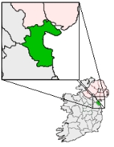
Carlingford, County Louth
Encyclopedia
Town
A town is a human settlement larger than a village but smaller than a city. The size a settlement must be in order to be called a "town" varies considerably in different parts of the world, so that, for example, many American "small towns" seem to British people to be no more than villages, while...
and townland
Townland
A townland or bally is a small geographical division of land used in Ireland. The townland system is of Gaelic origin—most townlands are believed to pre-date the Norman invasion and most have names derived from the Irish language...
in northern County Louth
County Louth
County Louth is a county of Ireland. It is part of the Border Region and is also located in the province of Leinster. It is named after the town of Louth. Louth County Council is the local authority for the county...
, Ireland
Republic of Ireland
Ireland , described as the Republic of Ireland , is a sovereign state in Europe occupying approximately five-sixths of the island of the same name. Its capital is Dublin. Ireland, which had a population of 4.58 million in 2011, is a constitutional republic governed as a parliamentary democracy,...
. It is situated between Carlingford Lough
Carlingford Lough
Carlingford Lough is a glacial fjord or sea inlet that forms part of the border between Northern Ireland to the north and the Republic of Ireland to the south. On its northern shore is County Down and on its southern shore is County Louth...
(to the east) and Slieve Foy
Slieve Foy
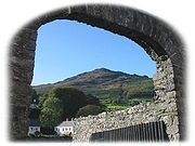
Slieve Foy or Slieve Foye is the highest peak of a ridge of mountains collectively referred to as Carlingford Mountain, which rises near the town of Carlingford, County Louth, Ireland. Slieve Foy rises to an altitude of 588 metres, and at this is the highest peak in County Louth...
, sometimes known as Carlingford Mountain (to the west). Located on the R176
R176 road
The R176 road is a regional road in Ireland, running its full length on the Cooley Peninsula in County Louth. It runs between its junction with R173 at Ghan Road, Carlingford and its junction with R175 at Saint James' Well via Carlingford Relief Road and Mullatee.Its total length is .-References:*...
/R173
R173 road
The R173 road is a regional road in Ireland, running its full length in County Louth. It loops around Cooley Peninsula, mainly along the coast...
roads between Greenore
Greenore
Greenore is a small town, townland and deep water port on Carlingford Lough in County Louth, Ireland. The population of Greenore and the surrounding rural area was 898 in the 2002 Irish census....
Point and Omeath
Omeath
Omeath is a village on the R173 regional road in County Louth, Ireland, close to the border with Northern Ireland. It is roughly mid way between Dublin and Belfast, very near the County Louth and County Armagh / County Down border. Omeath has a population of 439, and is approximately from...
townland, Carlingford is approximately 27 km north (by road) from Dundalk
Dundalk
Dundalk is the county town of County Louth in Ireland. It is situated where the Castletown River flows into Dundalk Bay. The town is close to the border with Northern Ireland and equi-distant from Dublin and Belfast. The town's name, which was historically written as Dundalgan, has associations...
(15.6 km directly), 90 km north of Dublin and 11 km south of the border
Republic of Ireland-United Kingdom border
The Republic of Ireland–United Kingdom border is the boundary between the sovereign states of the Republic of Ireland and the United Kingdom of Great Britain and Northern Ireland...
with Northern Ireland
Northern Ireland
Northern Ireland is one of the four countries of the United Kingdom. Situated in the north-east of the island of Ireland, it shares a border with the Republic of Ireland to the south and west...
. Carlingford won the Irish Tidy Towns Competition
Irish Tidy Towns Competition
Tidy Towns is an annual competition, first held in 1958, organised by the Irish Department of the Environment, Heritage and Local Government in order to honour the tidiest and most attractive cities, towns and villages in the Republic of Ireland...
in 1988.
Carlingford has many streets with a mediaeval aspect — the main one being Tholsel Street.
Foundation
Carlingford was occupied approximately 800 years ago by NormanNormans
The Normans were the people who gave their name to Normandy, a region in northern France. They were descended from Norse Viking conquerors of the territory and the native population of Frankish and Gallo-Roman stock...
knight Hugh de Lacy
Hugh de Lacy, Lord of Meath
Hugh de Lacy, Lord of Meath was an Anglo-Norman magnate granted the lands of the Kingdom of Meath by Henry II in 1172, during the Norman Invasion of Ireland.-Early life:Hugh de Lacy was born before 1135...
after laying the foundation stone for a castle on a strategic outcrop of rock. A settlement sprang up close to this fortress.
The Prosperous Years
Carlingford’s strategic position on the east coast of Ireland (along with CarrickfergusCarrickfergus
Carrickfergus , known locally and colloquially as "Carrick", is a large town in County Antrim, Northern Ireland. It is located on the north shore of Belfast Lough, from Belfast. The town had a population of 27,201 at the 2001 Census and takes its name from Fergus Mór mac Eirc, the 6th century king...
and Dundalk
Dundalk
Dundalk is the county town of County Louth in Ireland. It is situated where the Castletown River flows into Dundalk Bay. The town is close to the border with Northern Ireland and equi-distant from Dublin and Belfast. The town's name, which was historically written as Dundalgan, has associations...
) made it a vital trading port. This trade led to its relative prosperity during the 14th, 15th and early 16th Centuries. Carlingford's early prosperity faltered when, in 1388, the town was burnt to the ground, by a Scots
Kingdom of Scotland
The Kingdom of Scotland was a Sovereign state in North-West Europe that existed from 843 until 1707. It occupied the northern third of the island of Great Britain and shared a land border to the south with the Kingdom of England...
force under the command of Sir William Douglas of Nithsdale. This was a punitive raid, following Irish attacks on Galloway
Galloway
Galloway is an area in southwestern Scotland. It usually refers to the former counties of Wigtownshire and Kirkcudbrightshire...
, the Lord of which was Nithsdale's father, Archibald the Grim.
Carlingford received five charter
Charter
A charter is the grant of authority or rights, stating that the granter formally recognizes the prerogative of the recipient to exercise the rights specified...
s in total—the first in 1326 by Edward II
Edward II of England
Edward II , called Edward of Caernarfon, was King of England from 1307 until he was deposed by his wife Isabella in January 1327. He was the sixth Plantagenet king, in a line that began with the reign of Henry II...
and the last in 1619 under James I
James I of England
James VI and I was King of Scots as James VI from 24 July 1567 and King of England and Ireland as James I from the union of the English and Scottish crowns on 24 March 1603...
. The increased trade encouraged the rich mercantile class to build, the results of which can be seen today in the remains of the Mint
Mint (coin)
A mint is an industrial facility which manufactures coins for currency.The history of mints correlates closely with the history of coins. One difference is that the history of the mint is usually closely tied to the political situation of an era...
and Taffe’s Castle.
In 1637, the Surveyor General of Customs issued a report compiled from accounts of customs due from each port and their "subsidiary creeks". Of the Ulster ports on the list, Carrickfergus
Carrickfergus
Carrickfergus , known locally and colloquially as "Carrick", is a large town in County Antrim, Northern Ireland. It is located on the north shore of Belfast Lough, from Belfast. The town had a population of 27,201 at the 2001 Census and takes its name from Fergus Mór mac Eirc, the 6th century king...
was first, followed by Bangor
Bangor, County Down
Bangor is a large town in County Down, Northern Ireland. It is a seaside resort on the southern side of Belfast Lough and within the Belfast Metropolitan Area. Bangor Marina is one of the largest in Ireland, and holds Blue Flag status...
, Donaghadee
Donaghadee
Donaghadee is a small town in County Down, Northern Ireland. It lies on the northeast coast of the Ards Peninsula, about east of Belfast and about six miles south east of Bangor. It had a population of 6,470 people in the 2001 Census...
, and Strangford
Strangford
Strangford is a small village at the mouth of Strangford Lough in County Down, Northern Ireland. It had a population of 475 people at the 2001 Census.On the other side of the lough is Portaferry and there is a ferry service between the two villages...
. Carlingford and Coleraine
Coleraine
Coleraine is a large town near the mouth of the River Bann in County Londonderry, Northern Ireland. It is northwest of Belfast and east of Derry, both of which are linked by major roads and railway connections...
each had £244 customs due and had equal ranking.
War and Ruin
The 1641 Rising by the Irish of UlsterIrish Rebellion of 1641
The Irish Rebellion of 1641 began as an attempted coup d'état by Irish Catholic gentry, who tried to seize control of the English administration in Ireland to force concessions for the Catholics living under English rule...
, the Cromwellian Conquest
Cromwellian conquest of Ireland
The Cromwellian conquest of Ireland refers to the conquest of Ireland by the forces of the English Parliament, led by Oliver Cromwell during the Wars of the Three Kingdoms. Cromwell landed in Ireland with his New Model Army on behalf of England's Rump Parliament in 1649...
of 1649, and the subsequent Williamite wars
Williamite war in Ireland
The Williamite War in Ireland—also called the Jacobite War in Ireland, the Williamite-Jacobite War in Ireland and in Irish as Cogadh an Dá Rí —was a conflict between Catholic King James II and Protestant King William of Orange over who would be King of England, Scotland and Ireland...
of the 1690s all took their toll on the local economy. As recorded in the Journal of Isaac Butler, Carlingford the town was in a "state of ruin" by 1744. However, the final nail in coffin was the desertion to open water of the prosperous herring shoals that occupied the lough by the early 18th century.
The Modern Era
Carlingford's inability to develop a heavy industry allowed its mediaeval charm and archaeological artefacts to remain relatively intact. The area was opened up to tourism in the 1870s by the Dundalk, Newry and Greenore railway, which passed through Carlingford. This line closed in 1951. Better transport led to tourism being the main source of employment. Also significant is fishing, particularly of oysters and crabs from the nearby harbour. A passenger ferry operates daily out of the village of OmeathOmeath
Omeath is a village on the R173 regional road in County Louth, Ireland, close to the border with Northern Ireland. It is roughly mid way between Dublin and Belfast, very near the County Louth and County Armagh / County Down border. Omeath has a population of 439, and is approximately from...
, 5 km (3.1 mi) away, during the summer months. Carlingford has expanded in recent years.
Miscellaneous
The Irish singer-songwriter Tommy MakemTommy Makem
Thomas "Tommy" Makem was an internationally celebrated Irish folk musician, artist, poet and storyteller. He was best known as a member of The Clancy Brothers and Tommy Makem. He played the long-necked 5-string banjo, guitar, tin whistle, and bagpipes, and sang in a distinctive baritone...
wrote a melancholy song about the town, "Farewell to Carlingford", covered by The Clancy Brothers and Tommy Makem and The Dubliners
The Dubliners
The Dubliners are an Irish folk band founded in 1962.-Formation and history:The Dubliners, initially known as "The Ronnie Drew Ballad Group", formed in 1962 and made a name for themselves playing regularly in O'Donoghue's Pub in Dublin...
.
Places of interest
- King John’s Castle. Despite the western part being commissioned by Hugh de Lacy before 1186, the castle owes its name to King JohnJohn of EnglandJohn , also known as John Lackland , was King of England from 6 April 1199 until his death...
(Richard the Lionheart’s brother) who visited Carlingford in 1210. The eastern part was constructed in the mid 13th century with alterations and editions occurring in the 15th and 16th centuries. In the 1950s the Office of Public Works (OPW) undertook conservation work to stabilize the structure. An excellent view of the north pier and lough can be had from the viewing area on the eastern side of the castle, though the castle itself is closed to the general public for health and safety reasons.
- Taaffe’s Castle. A fortified town house that belonged to the rich mercantile TaaffeViscount TaaffeThe title Viscount Taaffe, of Corren, was created in the Peerage of Ireland in 1628, together with the subsidiary title Baron Ballymote. From the 18th century onwards, the Viscounts Taaffe also held the title Count Taaffe in the Holy Roman Empire...
family who became Earls of Carlingford in 1661. Its close proximity to the harbour would suggest a trading depot on the ground floor with the upper floors reserved for residence. The construction suggests two phases—the main tower built in the early 16th century while the extension to the side occurred later.
- The Tholsel. The TholselTholselThe term Tholsel refers to extant and former public buildings in Ireland's towns and cities.The actual meaning of the word is uncertain...
or "town-gate" is the only remaining example of its nature in Carlingford and one of the few left in Ireland. Originally it was three stories high—the present appearance due to alteration made in the 19th century. The original function was of course to levy taxes on goods entering the town—the murder-holes on the side of the walls are testaments to that fact. In 1834 it was used by the Corporation of Carlingford for meeting and a Parliament is said to have used it to make laws for the Pale. It was also used as a town gaol in the 18th century.
- The Mint. A fortified three-storey town house belonging to a wealthy merchant family in the centre of Carlingford. While the right to mint coinage was not granted to Carlingford until 1467, it is unlikely that it was actually used as a mint. The most interesting feature is the five highly decorated limestone windows. The patterns and motifs are an example of the influence of the Celtic Renaissance on art during the 16th century.
- Dominican Friary. The DominicansDominican OrderThe Order of Preachers , after the 15th century more commonly known as the Dominican Order or Dominicans, is a Catholic religious order founded by Saint Dominic and approved by Pope Honorius III on 22 December 1216 in France...
were established in Carlingford in 1305 primarily because of their patron Richard Óg de Burgh, 2nd Earl of UlsterRichard Óg de Burgh, 2nd Earl of UlsterRichard Óg de Burgh, 2nd Earl of Ulster and 3rd Baron of Connaught , called The Red Earl, was one of the most powerful Irish nobles of the late 13th and early 14th centuries.-Early life:...
, with the friary itself being dedicated to St. Malachy. Dissolved in 1540 by Henry VIIIHenry VIII of EnglandHenry VIII was King of England from 21 April 1509 until his death. He was Lord, and later King, of Ireland, as well as continuing the nominal claim by the English monarchs to the Kingdom of France...
, it became the centre of a repossession struggle between the Dominicans and Franciscans in the 1670s. It was resolved in favour of the Dominicans by Oliver PlunkettOliver PlunkettSaint Oliver Plunkett was the Roman Catholic Archbishop of Armagh and Primate of All Ireland....
. However the friary itself was subsequently abandoned in the 18th century by the Dominicans to their present location of Dundalk. The remains today consist of a naveNaveIn Romanesque and Gothic Christian abbey, cathedral basilica and church architecture, the nave is the central approach to the high altar, the main body of the church. "Nave" was probably suggested by the keel shape of its vaulting...
and chancelChancelIn church architecture, the chancel is the space around the altar in the sanctuary at the liturgical east end of a traditional Christian church building...
divided by a tower. Also, there are possible remains of some domestic buildings to the south like a mill, mill raceMill raceA mill race, raceway or mill lade is the current or channel of a stream, especially one for conducting water to or from a water wheel or other device for utilizing its energy...
and mill pond.
- Town Wall. Established by charter in 1326 by Edward IIEdward II of EnglandEdward II , called Edward of Caernarfon, was King of England from 1307 until he was deposed by his wife Isabella in January 1327. He was the sixth Plantagenet king, in a line that began with the reign of Henry II...
to the Bailiffs of Carlingford it allowed them to levyTaxTo tax is to impose a financial charge or other levy upon a taxpayer by a state or the functional equivalent of a state such that failure to pay is punishable by law. Taxes are also imposed by many subnational entities...
murageMurageMurage was a medieval toll for the building or repair of town walls in England and Wales.This was granted by the king by letters patent for a limited term, but the walls were frequently not completed within the term, so that the grant was periodically renewed....
for its building. Not much remains however but the little that does has some externally splayed musket loops that would indicate the arrival of firearms to Ireland in the late 15th century. It is likely that the wall had an external ditch to strengthen its defences. Its purpose was to serve as a barrier to ensure that goods entering the town had to pass through a town gate (and hence could be taxed) but it also had the purpose of creating a boundary between GaelGaëlGaël is a commune in the Ille-et-Vilaine department of Brittany in north-western France.It lies southwest of Rennes between Saint-Méen-le-Grand and Mauron...
and NormanNormansThe Normans were the people who gave their name to Normandy, a region in northern France. They were descended from Norse Viking conquerors of the territory and the native population of Frankish and Gallo-Roman stock...
.
- Ghan House. A fine Georgian House built by William Stannus in 1727 it is surrounded by castellated walls and a guard tower. The first floor contains the drawing room which has a decorative ceiling of rococo plaster work of flower garlands and medallion busts reputed to be of Stannus ladies. The basement contains two underground passageways (now blocked) that led to the Heritage Centre and the bakers (now chemist). The latter tunnel was reportedly used by a silent order of monks who once lived on the site and apparently supplied the local bakery but wished to avoid contact with townspeople. Today Ghan House is used as a luxury guest house (with wine bar), ballroom, meeting room and cookery school.
- Church of the Holy Trinity. Donated by the Church of IrelandChurch of IrelandThe Church of Ireland is an autonomous province of the Anglican Communion. The church operates in all parts of Ireland and is the second largest religious body on the island after the Roman Catholic Church...
to Carlingford this restored medieval church is also known as the Holy Trinity Heritage Centre. Exhibits inside display the history of Carlingford from VikingVikingThe term Viking is customarily used to refer to the Norse explorers, warriors, merchants, and pirates who raided, traded, explored and settled in wide areas of Europe, Asia and the North Atlantic islands from the late 8th to the mid-11th century.These Norsemen used their famed longships to...
times to the present period. The video and beautiful stained glass window are popular with visitors. Musical recitals are common. The grounds outside contain a graveyard.
- De Gaulle. Carlingford has a pseudo historical, comical head affectionately known as De Gaulle. This feature is situated on the south facing gable on a building on Newry Street. Some enterprising Francophile placed a piece of slate for the cap and the attraction was born.
- Market Square. Now the main street of Carlingford, this was the area where a weekly market was held with records of its layout going back to 1358. It is now the intersection of Dundalk Street and the beginning of River Lane.
Transport
Carlingford railway station opened on 1 August 1876, but finally closed on 1 January 1952 when the Dundalk, Newry & Greenore Railway ceased operations. In 1948 the film 'Saints and Sinners' used various locations around Carlingford including a scene at the beginning at the station of a DN&GR train arriving.A regular bus route serves Carlingford from both Dundalk and Newry( The 161). This service does not run on Sundays or Bank Holidays.
Carlingford also has a marina.
People
- Thomas D'Arcy McGee (13 April 1825, Carlingford - 7 April 1868, Ottawa, Canada) was the first Canadian politician to be assassinated, reportedly by a Fenian. A formerly radical politician, McGee became a moderate and urged Irish Catholics to address grievances via parliamentary rather than physical force methods.
- Peter BoylePeter BoylePeter Lawrence Boyle, Jr. was an American actor, best known for his role as Frank Barone on the sitcom Everybody Loves Raymond, and as a comical monster in Mel Brooks' film spoof Young Frankenstein ....
(26 Apr 1876, Carlingford - 24 Jun 1939, Doncaster, Yorkshire, England) was a footballer. Capped five times for Ireland, played for FA Cup Winners Sheffield United in 1899 and 1902. - Rev. Lorcán Ó MuireadaisLorcán Ó MuireadaisLorcán Ó Muireadais was an Irish Roman Catholic priest, Irish language educator and nationalist activist. Another Celtisation of his name is Lorcan Ó Muireadhaigh....
(1883–1941) was a Roman Catholic priest and Irish language activist. - Daniel Joseph Anthony "Tony" MeehanTony MeehanDaniel Joseph Anthony "Tony" Meehan was a founder member of the British group The Shadows with Jet Harris, Hank Marvin and Bruce Welch...
(2 March 1943 – 28 November 2005) was a LondonLondonLondon is the capital city of :England and the :United Kingdom, the largest metropolitan area in the United Kingdom, and the largest urban zone in the European Union by most measures. Located on the River Thames, London has been a major settlement for two millennia, its history going back to its...
-born and raised musician and founder member of The ShadowsThe ShadowsThe Shadows are a British pop group with a total of 69 UK hit-charted singles: 35 as 'The Shadows' and 34 as 'Cliff Richard and the Shadows', from the 1950s to the 2000s. Cliff Richard in casual conversation with the British rock press frequently refers to the Shadows by their nickname: 'The Shads'...
, along with Jet Harris, Hank B. Marvin and Bruce Welch; he played drums on all the early Cliff RichardCliff RichardSir Cliff Richard, OBE is a British pop singer, musician, performer, actor, and philanthropist who has sold over an estimated 250 million records worldwide....
and The Shadows hits; buried in Carlingford cemetery. - Kevin J. Woods, author of The Last Leprechauns of Ireland ISBN 978-1-908477-30-9. A hardback book recording the geological, mythological, and social history of Ireland and the Cooley Peninsula in particular, as witnessed by the 236 leprechauns who still live below Carlingford mountain.
See also
- List of abbeys and priories in Ireland (County Louth)
- List of towns and villages in Ireland