
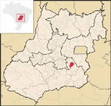
Vianópolis
Encyclopedia
| Vianópolis | |
|---|---|
| State | Goiás Goiás Goiás is a state of Brazil, located in the central part of the country. The name Goiás comes from the name of an indigenous community... |
| Coordinates: | 16°45′00"S 48°30′40"W |
| Area: | 954.3 km² |
| Population: | 12,187 (IBGE 2007) |
| Elevation: | 1,002 m |
| Postcode (CEP): | 75260-000 |
| IBGE statistical microregion: | 016 Pires do Rio Microregion Pires do Rio Microregion The Pires do Rio Microregion is a statistical region of south-central Goiás state, Brazil. The most important city is Pires do Rio. The area includes 10 cities with a population of 90,327 in an area of 9,449.80 km²... |
| Became a city: | 1948 |
| Distance to Goiânia Goiânia -Climate:The city has a tropical wet and dry climate with an average temperature of . There's a wet season, from October to April, and a dry one, from May to September. Annual rainfall is around 1,520 mm.... : |
90 km. |
| Website: | none |

Town
A town is a human settlement larger than a village but smaller than a city. The size a settlement must be in order to be called a "town" varies considerably in different parts of the world, so that, for example, many American "small towns" seem to British people to be no more than villages, while...
and municipality
Municipality
A municipality is essentially an urban administrative division having corporate status and usually powers of self-government. It can also be used to mean the governing body of a municipality. A municipality is a general-purpose administrative subdivision, as opposed to a special-purpose district...
in the center of the Brazil
Brazil
Brazil , officially the Federative Republic of Brazil , is the largest country in South America. It is the world's fifth largest country, both by geographical area and by population with over 192 million people...
ian state of Goiás
Goiás
Goiás is a state of Brazil, located in the central part of the country. The name Goiás comes from the name of an indigenous community...
.
Location
Vianópolis is located 90 km. from the state capital, GoiâniaGoiânia
-Climate:The city has a tropical wet and dry climate with an average temperature of . There's a wet season, from October to April, and a dry one, from May to September. Annual rainfall is around 1,520 mm....
. Highway connections are made by BR-457 / GO-010 / GO-330 / passing through the cities of Bonfinópolis
Bonfinópolis
Bonfinópolis is a small town and municipality in central Goiás state, Brazil. It is located a short distance east of Goiânia and is part of the Goiânia metropolitan area.The distance to Goiânia is 33 km...
, Leopoldo de Bulhões
Leopoldo de Bulhões
Leopoldo de Bulhões is a small town and municipality in central Goiás state, Brazil. The total area was 495.0 km² in October 2002) and the population was 8,916 in 2007...
and Silvânia
Silvânia
Silvânia is a small city and municipality in southcentral Goiás state, Brazil.-Location and highway connections:Silvânia is located 77 kilometers from the state capital of Goiânia, 180 km...
. It is in the Pires do Rio Microregion
Pires do Rio Microregion
The Pires do Rio Microregion is a statistical region of south-central Goiás state, Brazil. The most important city is Pires do Rio. The area includes 10 cities with a population of 90,327 in an area of 9,449.80 km²...
and has boundaries with Orizona
Orizona
Orizona is a small town and municipality in Goiás state, Brazil.-Location:Orizona is 138 km from the state capital of Goiânia, 200 km from Brasília, 150 from Catalão and 260 from Uberlândia, which is located in the rich Triângulo Mineiro of Minas Gerais. It is part of the Pires do Rio...
, Pires do Rio
Pires do Rio
Pires do Rio is a small city and municipality in Goiás state, Brazil. It is a prosperous town and a major producer of poultry.-Location:It is located in the Pires do Rio Microregion. . It is located 144 kilometers from the state capital and is served by highways GO-020, 330 and 414, as well as...
, São Miguel do Passa Quatro
São Miguel do Passa Quatro
São Miguel do Passa Quatro is a small town and municipality in central Goiás state, Brazil.-Location:São Miguel is located in the Pires do Rio Microregion, at a distance of 112 kilometers from the state capital of Goiânia....
and Silvânia
Silvânia
Silvânia is a small city and municipality in southcentral Goiás state, Brazil.-Location and highway connections:Silvânia is located 77 kilometers from the state capital of Goiânia, 180 km...
.
Political information
- Mayor: Antônio Divino de Resende (January 2005)
- City council: 09 members
- Eligible voters: 8,328 (December/2007)
Demographics
- Population density: 12.77 inhab/km² (2007)
- Population in 1980: 7,934
- Population in 2007: 12,187
- Urban population: 9,105 (2007)
- Rural population: 3,082 (2007)
- Population growth rate: 2.27% 1996/2007
The economy
The economy is based on subsistence agriculture, cattle raising, services, public administration, and small transformation industries.- Industrial units: 32 (2007)
- Commercial units: 143 (2007)
- Dairy: - Ind. e Com. de Laticínios Ponte Funda Ltda (22/05/2006)
- Financial institutions (01/06/2005): Banco do Brasil S.A., BRADESCO S.A.
- Cattle herd: 52,500 head (12,200 milk cows) (2006)
- Main crops: cotton, rice, bananas, sugarcane, barley, beans, manioc, corn, sorghum, tangerines, wheat, tomatoes, and soybeans (25,000 hectares).
Agricultural data 2006
- Number of farms: 656
- Total area: 37,221 ha.
- Area of permanent crops: 2,597 ha.
- Area of perennial crops: 13,648 ha.
- Area of natural pasture: 15,018 ha.
- Area of woodland and forests: 5,391 ha.
- Persons dependent on farming: 1,450
- Farms with tractors: 124
- Number of tractors: 322
- Cattle herd: 52,500 head IBGE
Education (2006)
- Schools: 13
- Classrooms: 97
- Teachers: 179
- Students: 3,641
- Higher education: none
- Adult literacy rate: 87.6% (2000) (national average was 86.4%)
Health (2007)
- Hospitals: 1
- Hospital beds: 37
- Ambulatory clinics: 8
- Infant mortality rate: 22.64 (2000) (national average was 33.0).
Municipal Human Development Index
Human Development Index
The Human Development Index is a composite statistic used to rank countries by level of "human development" and separate "very high human development", "high human development", "medium human development", and "low human development" countries...
- MHDI: 0.784
- State ranking: 24 (out of 242 municipalities in 2000)
- National ranking: 970 (out of 5,507 municipalities in 2000) For the complete list see Frigoletto.com
See also
- List of municipalities in Goiás
- Microregions of Goiás