

Numbered routes in Rhode Island
Encyclopedia
The U.S. state
of Rhode Island
has 70 numbered routes, coordinated and signed by the Rhode Island Department of Transportation
(RIDOT). Most of these are partly or fully state highways, roads owned and maintained by RIDOT. Every city and town in Rhode Island, except for New Shoreham (Block Island
), has at least one numbered route.
U.S. state
A U.S. state is any one of the 50 federated states of the United States of America that share sovereignty with the federal government. Because of this shared sovereignty, an American is a citizen both of the federal entity and of his or her state of domicile. Four states use the official title of...
of Rhode Island
Rhode Island
The state of Rhode Island and Providence Plantations, more commonly referred to as Rhode Island , is a state in the New England region of the United States. It is the smallest U.S. state by area...
has 70 numbered routes, coordinated and signed by the Rhode Island Department of Transportation
Rhode Island Department of Transportation
The Rhode Island Department of Transportation is a Rhode Island state government agency charged with construction, maintenance and inspection of a wide range of transportation infrastructure. These include 1,102 miles of state roads and highways, 772 bridges, and 777 traffic signals...
(RIDOT). Most of these are partly or fully state highways, roads owned and maintained by RIDOT. Every city and town in Rhode Island, except for New Shoreham (Block Island
Block Island
Block Island is part of the U.S. state of Rhode Island and is located in the Atlantic Ocean approximately south of the coast of Rhode Island, east of Montauk Point on Long Island, and is separated from the Rhode Island mainland by Block Island Sound. The United States Census Bureau defines Block...
), has at least one numbered route.
List of routes
| 1-89 | 90-119 | 120-999 | Former/Unbuilt |
|---|---|---|---|
 U.S. Route 1 U.S. Route 1 U.S. Route 1A U.S. Route 1A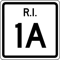 Route 1A Route 1ARoute 1A (Rhode Island) Route 1A is a numbered state highway in Rhode Island, running in five sections.-Route:Route 1A follows U.S. 1 closely through South County. It can be separated into five sections:...  Route 2 Route 2Route 2 (Rhode Island) Route 2 is a state highway in the U.S. state of Rhode Island.-Route:Route 2 takes the following route through the State:*Charlestown: ; U.S... 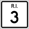 Route 3 Route 3Route 3 (Rhode Island) Route 3 is a state highway in the U.S. state of Rhode Island.-Route:Route 3 takes the following route through the State:*Westerly: ; U.S...  Route 4 Route 4Route 4 (Rhode Island) Route 4, also known as the Colonel Rodman Highway, is a long numbered state highway located in Washington County and southern Kent County, Rhode Island, United States...  Route 5 Route 5Route 5 (Rhode Island) -Route description:Route 5 takes the following route through the State:*Warwick: ; US 1 to Cranston city line**Greenwich Avenue and Lambert Lind Highway*Cranston: ; Warwick city line to Johnston town line**Oaklawn Avenue and Atwood Avenue...  U.S. Route 6 U.S. Route 6 U.S. Route 6A U.S. Route 6A Route 7 Route 7Route 7 (Rhode Island) -Route description:Route 7 begins in Providence at an intersection with Route 246, carrying Orms Street in a western direction. As it passes over I-95, the route meets Douglas Avenue and turns onto it, flanking a residential area. It then enters North Providence and continues for another ,...  Route 10 Route 10Route 10 (Rhode Island) Route 10 is a numbered state highway connector in the U.S. state of Rhode Island, running along the Huntington Expressway, the first freeway in the state. It connects Route 12 on the Cranston-Providence border with Interstate 95, U.S. Route 6 and Memorial Boulevard in downtown Providence, passing...  Route 12 Route 12Route 12 (Rhode Island) -Route:Route 12 takes the following route through the State:*Scituate: ; Route 14/Route 102 to Cranston city line**Tunk Hill Road and Scituate Avenue*Cranston: ; Scituate town line to Broad Street**Scituate Avenue, Phenix Avenue and Park Avenue-Notes:...  Route 14 Route 14Route 14 (Rhode Island) Route 14 is a numbered State Highway running in the U.S. State of Rhode Island.-Route:Route 14 takes the following route through the State:*Coventry: ; Connecticut State line at CT 14/CT 14A to Foster town line**Plainfield Pike...  Route 15 Route 15Route 15 (Rhode Island) -Route:Route 15 takes the following route through the State:*North Providence: ; US 44 to Pawtucket city line**Mineral Spring Avenue*Pawtucket: ; North Providence town line to Massachusetts State line at Brook Street...  Route 24 Route 24Route 24 (Rhode Island) -Route:Route 24 takes the following route through the State:*Portsmouth: ; Route 114 to Tiverton town line**Fall River Expressway*Tiverton: ; Portsmouth town line to Massachusetts State line at Route 24**Fall River Expressway-Notes:...  Route 33 Route 33Route 33 (Rhode Island) Route 33 is a state highway in the U.S. state of Rhode Island.Route 33 takes the following route through the State:*Coventry: ; Route 3 to West Warwick town line**Sandy Bottom Road and Washington Street...  Route 37 Route 37Route 37 (Rhode Island) Route 37, also known as the Lincoln Avenue Freeway, is a numbered state highway running in Providence County and Kent County, Rhode Island, United States. The route is a nominally east–west freeway for its entire length. Route 37 serves the cities of Cranston and Warwick and is also a major...  U.S. Route 44 U.S. Route 44 Route 51 Route 51Route 51 (Rhode Island) -Route:Route 51 takes the following route through the State:*West Warwick: ; Route 115 to Cranston city line**Phenix Avenue*Cranston: ; West Warwick town line to Route 12**Phenix Avenue-Notes:...  Route 77 Route 77Route 77 (Rhode Island) -Route:Route 77 takes the following route through the State:*Little Compton: ; Rhode Island Road to Tiverton town line**Town Landing, Sakonnet Point Road and West Main Road*Tiverton: ; Little Compton town line to Route 24**Main Road-History:...  Route 78 Route 78Route 78 (Rhode Island) Route 78, also known as the Westerly Bypass is a two-lane arterial boulevard and expressway between Stonington, Connecticut to Westerly, Rhode Island. The route is about long and begins at Connecticut Route 2 in Stonington, crossing into Rhode Island at the Pawcatuck River, where it continues as...  Route 81 Route 81Route 81 (Rhode Island) -Route:Route 81 takes the following route through the State:*Little Compton: : Route 179 to Tiverton town line**Crandall Road*Tiverton: ; Little Compton town line to Massachusetts State line at Route 81... |
 Route 91 Route 91Route 91 (Rhode Island) -Route:Route 91 takes the following route through the State:*Westerly: ; Route 3 to Hopkinton town line**Oak Street, Westerly-Bradford Road*Hopkinton: ; Westerly town line to Richmond town line**Alton-Bradford Road...  Route 94 Route 94Route 94 (Rhode Island) -Route:Route 94 takes the following route through the State:*Foster: ; Route 14/Route 102 to Glocester town line**Foster Center Road and Mount Hygeia Road*Glocester: ; Foster town line to US 44**Reynolds Road-Notes:...  Interstate 95 Interstate 95 Route 96 Route 96Route 96 (Rhode Island) -Route:Route 96 takes the following route through the State:*Burrillville: ; Route 98 to Massachusetts State line at Route 96**Callahan School Street and Round Top Road-Notes:Route 96 travels through some very rural and scenic areas of Burrillville....  Route 98 Route 98Route 98 (Rhode Island) -Route:Route 98 takes the following route through the State:*Glocester: : Route 100 to Burrillville town line**Steere Farm Road*Burrillville: ; Glocester town line to Massachusetts State line at Route 98**Steere Farm Road and Sherman Farm Road-Notes:...  Route 99 Route 99Route 99 (Rhode Island) Route 99, also known as the Woonsocket Industrial Highway, is a numbered state highway running in Providence County, Rhode Island, United States. The route is a nominally north–south limited-access freeway for its entire length...  Route 100 Route 100Route 100 (Rhode Island) -Route:Route 100 takes the following route through the State:*Glocester: ; Route 102 to Burrillville town line**Money Hill Road*Burrillville: ; Glocester town line to Massachusetts State line at Wallum Lake Road...  Route 101 Route 101Route 101 (Rhode Island) Route 101 is a numbered State Highway running in Rhode Island. It begins at the Connecticut state line in the town of Foster and ends at U.S. Route 6 in the town of Scituate.-Route description:...  Route 102 Route 102Route 102 (Rhode Island) Route 102 is a numbered State Highway running 44.5 miles in Rhode Island. Route 102 serves as a non-freeway beltway around the Providence metro area. It begins in the village of Wickford and travels through less developed areas of western Rhode Island...  Route 103 Route 103Route 103 (Rhode Island) Route 103 is a numbered State Highway running in Rhode Island. It runs from I-195 in East Providence to the Massachusetts state line in the town of Warren, where the road continues as Massachusetts Route 103...  Route 103A Route 103ARoute 103A (Rhode Island) Route 103A is a numbered State Highway running in Rhode Island. It serves the Riverside section of East Providence.-Route:Route 103A is a loop route of Route 103 in the Riverside section of East Providence. It leaves Route 103, continuing straight along Bullocks Point Avenue where Route 103 veers...  Route 104 Route 104Route 104 (Rhode Island) Route 104 is a numbered State Highway running in Rhode Island. It runs from US 44 in North Providence to Worrall Street in Downtown Woonsocket. The route connects the cities of Providence and Woonsocket via the town center of Smithfield.-Route description:...  Route 107 Route 107Route 107 (Rhode Island) Route 107 is a numbered State Highway running in Rhode Island, United States. The route serves the town of Burrillville and connects Route 100 with Route 102.-Route description:...  Route 108 Route 108Route 108 (Rhode Island) Route 108 is state route in Narragansett and South Kingstown. The route stretches for 8.6 miles , beginning at Ocean Road in Point Judith to Route 138 in Kingston. The road intersects with US 1 in Wakefield...  Route 110 Route 110Route 110 (Rhode Island) Route 110 is a numbered State Highway running wholly within the town of South Kingstown in Rhode Island. It serves to connect the University of Rhode Island to points south via U.S. 1.-Route description:...  Route 112 Route 112Route 112 (Rhode Island) Route 112 is a numbered State Highway running in Rhode Island. It connects U.S. Route 1 in the town center of Charlestown and Route 138 in the town of Richmond.-Route description:...  Route 113 Route 113 Route 114 Route 114Route 114 (Rhode Island) Route 114 is a numbered State Highway running in the U.S. state of Rhode Island. It connects the city of Newport to the city of Woonsocket. Route 114 was a major north–south artery for its entire length until the arrival of the Interstate Highway System...  Route 114A Route 114ARoute 114A (Rhode Island) Route 114A is an alternate to Rhode Island Route 114, located along the Massachusetts – Rhode Island border in East Providence, RI and Seekonk, MA. The road begins and ends within East Providence in Rhode Island at Route 114...  Route 115 Route 115Route 115 (Rhode Island) -Route:Route 115 takes the following route through the State:*Scituate: ; Route 116 to Cranston city line**Main Street, Jackson Flat Road and Main Street*Cranston: ; Scituate town line to Coventry town line**Main Street...  Route 116 Route 116Route 116 (Rhode Island) -Route:Route 116 takes the following route through the State:*Coventry: ; Route 117 to Scituate town line**Knotty Oak Road*Scituate: ; Coventry town line to Glocester town line**North Road, East Road and West Greenville Road...  Route 117 Route 117Route 117 (Rhode Island) -Route:*Coventry: 14.0 miles ; Route 14 to West Warwick town line**Flat River Road, Main Street and Washington Street*West Warwick: 1.8 miles ; Coventry town line to Warwick city line**West Warwick Avenue, Main Street and Legris Avenue...  Route 117A Route 117A Route 118 Route 118Route 118 (Rhode Island) Route 118 is a numbered state highway in the U.S. state of Rhode Island, running along Harkney Hill Road from Route 3 to Route 102 in Coventry, R.I. It is one of the more recent state highways, having been designated and signed ca. 1999.... |
 Route 120 Route 120Route 120 (Rhode Island) -Route:Route 120 takes the following route through the State:*Cumberland: ; Route 122 to Massachusetts State line at Route 120**Nate Whipple Highway-Notes:...  Route 121 Route 121Route 121 (Rhode Island) Route 121 is a numbered State Highway running in Rhode Island and in Massachusetts. It is part of the route connecting the city of Woonsocket with the town of Wrentham.-Route:Route 121 takes the following route:...  Route 122 Route 122Route 122 (Rhode Island) -Route:Route 122 takes the following route through the State:*Pawtucket: ; U.S. 1 to Central Falls city line**Main Street and Lonsdale Avenue*Central Falls: ; Pawtucket city line to Lincoln town line**Lonsdale Avenue...  Route 123 Route 123Route 123 (Rhode Island) Route 123 is a state highway running in the U.S. state of Rhode Island. Route 123 is not a very heavily traveled road as compared to others in the region.-Route description:...  Route 126 Route 126Route 126 (Rhode Island) Route 126 is a state highway running for in the U.S. state of Rhode Island. Route 126 is a heavily traveled route in Pawtucket.-Route description:Route 126 begins at an intersection with Providence's Main Street, which is carried by US 1 and Route 122...  Route 128 Route 128Route 128 (Rhode Island) Route 128 is a numbered State Highway running in Rhode Island. It is heavily traveled.-Route:Route 128 takes the following route through the State:*Providence: ; US 6A to Johnston town line**Killingly Street*Johnston: ; Providence city line to US 44...  Route 136 Route 136Route 136 (Rhode Island) -Route:Route 136 takes the following route through the State:*Bristol: ; Route 114 to Warren town line**Metacom Avenue*Warren: ; Bristol town line to Massachusetts State line at Route 136...  Route 138 Route 138Route 138 (Rhode Island) Route 138 is a numbered State Highway running in Rhode Island. It runs from the Connecticut state line to the Massachusetts state line and is the only state-numbered route that traverses the entire state.-Route description:...  Route 138A Route 138A Route 146 Route 146Route 146 (Rhode Island) Route 146, also known as the Louisquisset Pike, the Eddie Dowling Highway and the North Smithfield Expressway, is a long numbered state highway located in Providence County, Rhode Island, United States...  Route 146A Route 146ARoute 146A (Rhode Island) -Route:Route 146A takes the following route through the State:*North Smithfield: ; Route 146 to Massachusetts State line at Route 146A**Eddie Dowling Highway, Smithfield Road, Great Road, Victory Highway, North Main Street and Quaker Highway-History:...  Route 152 Route 152Route 152 (Rhode Island) -Route:Route 152 takes the following route through the State:*East Providence: ; Route 114/US 1A to Massachusetts State line at Route 152**Newman Avenue-Notes:...  Route 165 Route 165Route 165 (Rhode Island) Route 165 is a numbered State Highway running in Rhode Island in the USA.-Route:Route 165 takes the following route through the State:*Exeter: ; Connecticut State line at Route 165 to Route 3**Ten Rod Road...  Route 177 Route 177 Route 179 Route 179Route 179 (Rhode Island) Route 179 is a long state highway running in Rhode Island. Route 179 is a short connector between Route 77 and Route 81 which are the two main roads in Tiverton and Little Compton...  Interstate 195 Interstate 195Interstate 195 (Rhode Island-Massachusetts) Interstate 195 is an Interstate Highway running a combined 40.1 miles in the U.S. states of Massachusetts and Rhode Island. It travels from a junction with Interstate 95 in Providence, Rhode Island east to a junction with Interstate 495 and Route 25 in Wareham, Massachusetts...  Route 214 Route 214Route 214 (Rhode Island) -Route:Route 214 takes the following route through the State:*Middletown: ; Route 138A to Route 114**Valley Road-Notes:Route 214 is a spur from Route 114 which serves an industrial park....  Route 216 Route 216Route 216 (Rhode Island) -Route:Route 216 takes the following route through the State:*Charlestown: ; U.S. 1 to Westerly city line**Ross Hill Road*Westerly: ; Charlestown town line to Hopkinton town line**Ross Hill Road, Church Street, South Main Street and North Main Street...  Route 238 Route 238Route 238 (Rhode Island) Route 238 is a numbered state highway running in Newport, Rhode Island.-Route:Route 238 is a spur from Route 138 providing access to Goat Island in Newport. It begins at the intersection of the Newport Bridge Access Road and J.T. Connell Highway, and runs south along J.T. Connell Highway,...  Route 246 Route 246Route 246 (Rhode Island) -Route:Route 246 takes the following route through the State:*Providence: ; U.S. Route 1 to North Providence town line**Mill Street, Charles Street, [Charles Street] and Charles Street...  Interstate 295 Interstate 295Interstate 295 (Rhode Island-Massachusetts) Interstate 295 is an Interstate route in length within the U.S. states of Rhode Island and Massachusetts. It serves as a western bypass around Providence, Rhode Island. The southern terminus is a junction with I-95 in Warwick, Rhode Island...  Route 401 Route 401 Route 402 Route 402Route 402 (Rhode Island) Route 402 is a numbered State Highway running in the U.S. state of Rhode Island.-Route:Route 402 takes the following route through the State:*East Greenwich: ; Route 2 to North Kingstown town line**Frenchtown Road...  Route 403 Route 403Route 403 (Rhode Island) Route 403, also known as the Quonset Freeway, is a numbered state highway located in Washington County and Kent County, Rhode Island, United States. The route is a nominally east–west limited-access freeway for its entire length... |
Route 1B (former)  Route 1C (former) Route 1C (former) Route 11 (former) Route 11 (former) Interstate 84 (unbuilt) Interstate 84 (unbuilt) Route 84 (former) Route 84 (former) Route 95 (former) Route 95 (former) Route 142 (former) Route 142 (former) Route 195 (former) Route 195 (former) Interstate 895 (unbuilt) Interstate 895 (unbuilt)  New England Route 1 New England Route 1U.S. Route 1 in Massachusetts In the U.S. state of Massachusetts, U.S. Route 1 is a major north–south state highway through Boston. The portion of US 1 south of Boston is also known as the Boston-Providence Turnpike, and portions north of the city are known as the Northeast Expressway and the Newburyport Turnpike.-Route...  New England Route 1A New England Route 1ARoute 3 (Rhode Island) Route 3 is a state highway in the U.S. state of Rhode Island.-Route:Route 3 takes the following route through the State:*Westerly: ; U.S...  New England Route 3 New England Route 3U.S. Route 6 in Rhode Island U.S. Route 6 is a major east–west road in the U.S. state of Rhode Island. Nationally, the route continues west to Bishop, California and east to Provincetown, Massachusetts. In western Rhode Island, it forms part of one of several routes between Hartford, Connecticut and Providence, Rhode...  New England Route 17 New England Route 17Route 17 (New England) Route 17 was a east–west New England Interstate Highway known as the Westerly Route. It ran from the New York-Massachusetts state line through Great Barrington, Massachusetts and Hartford, Connecticut to Westerly, Rhode Island.-Route description:The modern designations of the old... |
See also
- 19th century turnpikes in Rhode Island19th century turnpikes in Rhode IslandThe following turnpikes were chartered and built in Rhode Island:# West Glocester Turnpike 1794# Providence and Norwich Turnpike 1794# Rhode Island and Connecticut Turnpike 1803# Glocester Turnpike 1804# Providence and Douglass Turnpike 1805...
- Comparison of sources for Rhode Island State Highway numbers
- Downtown Circulator (Pawtucket)
- Meshanticut Interchange
- Rhode Island State Highways/Map sources
- New England Interstate RoutesNew England Interstate RoutesThe New England road marking system was an interstate system of marked numbered routes in New England. The routes were marked by a yellow rectangular shield with black numbers and border. Many shields were painted on telephone poles...