
.gif)
Route 99 (Rhode Island)
Encyclopedia
Route 99, also known as the Woonsocket Industrial Highway, is a numbered state highway
running 2.9 miles (4.7 km) in Providence County, Rhode Island
, United States
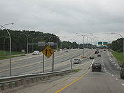
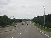
. The route is a nominally north–south limited-access
freeway for its entire length. Route 99 serves Manville
and the Highland Industrial Park, providing freeway access to the city of Woonsocket
from Rhode Island Route 146, which bypasses the city. The southern terminus of Route 99 is at a partial interchange with Route 146 in Lincoln
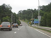
. The freeway has one unnumbered interchange in Manville, a village in Lincoln, before terminating at an at-grade intersection
with Rhode Island Route 122 in Woonsocket.
Originally conceived as a freeway linking Route 146 and Interstate 295
with Interstate 495
in Bellingham
, Massachusetts
, Route 99 was constructed primarily to provide freeway access to Woonsocket and the developing Highland Industrial Park. Although originally proposed to serve Downtown Woonsocket, an alternate routing that terminated at Route 122 and ran closer to the Woonsocket–Cumberland
border was later constructed by the Rhode Island Department of Transportation
(RIDOT). The four-lane freeway began construction in 1987 and was completed in 1993. RIDOT has long-range plans to extend Route 99 north to Route 114 in Downtown Woonsocket, but plans for a northerly extension to I-495 have been abandoned.
 Route 99 begins at a partial interchange with Route 146 in Lincoln
; the route is only accessible from Route 146 north, and the mainline of Route 99 south defaults onto Route 146 south with no direct access to Route 146 north. The exit for Route 99 off Route 146 north is accessed via a collector road that also serves Interstate 295
from Route 146; I-295 has an alignment slightly south of Route 99 but has no direct interchange with it.
Route 99 north diverges from Route 146 north and heads in an almost due north direction. The freeway has its only interchange with Sayles Hill Road, an unnumbered road that is used to access the village of Manville
and Route 126 (Old River Road). Sayles Hill Road is also used to access Route 146 north, which has no direct freeway connection with Route 99 south.
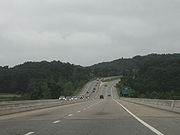
After the Sayles Hill Road interchange, Route 99 begins to head in a northeastern direction, passing to the west of the densely populated village of Manville and the St. James Cemetery. Route 99 passes over Route 126 (Old River Road), Railroad Street, and the Providence and Worcester Railroad
on a single-span bridge before crossing over the Blackstone River
into the town of Cumberland
. The freeway passes over 2nd Avenue before entering the city of Woonsocket shortly before its northern terminus at a traffic signal with Route 122 (Mendon Road). The road continues northward as Highland Corporate Drive, an unnumbered route that enters the Highland Industrial Park.
 The origins of Route 99 date back to 1959, when the Rhode Island Department of Public Works (RIDPW) began planning studies for a freeway linking I-95
in Pawtucket
with the city of Woonsocket
. The freeway was planned in addition to Route 146, the Louisquisset Expressway, to serve the cities and towns of northern Providence County
. In 1964, $535,000 (1964 USD
) was allocated for further planning studies, but the proposed freeway was ultimately dropped by RIDPW. In 1968, plans for a freeway were revived when the Massachusetts Department of Public Works proposed the construction of a "Woonsocket Connector" linking Woonsocket with Bellingham, Massachusetts
and I-495
on a route similar to that of Massachusetts Route 126.
In 1971, RIDOT again began studies on a new freeway to Woonsocket, this time to connect the city's developing industrial parks to Route 146, I-295
, and the rest of the Providence metropolitan area
. Four different alignments were proposed for the new route, each beginning near the intersection of Route 146 and I-295 and ending near Downtown Woonsocket. The first proposal began the freeway at the intersection of Route 146 and Route 104 in North Smithfield
, north of I-295. The freeway would have taken a northeast route to the downtown area. The second proposal began the freeway near the intersection of Route 146 and Route 146A in North Smithfield; this route would have also taken a northeastern route to the border between Woonsocket and the town
of Cumberland
. The third proposal called for a similar route to the Cumberland border, but had the freeway beginning at the intersection of Route 146 and Sayles Hill Road in the North Smithfield business district. Finally, the fourth alignment called for the freeway to begin just north of the Route 146 and I-295 interchange in Lincoln
, with a northern route heading to either Downtown Woonsocket or the Cumberland–Woonsocket border. RIDOT eventually constructed the fourth alignment, with the freeway beginning north of the I-295 interchange and proceeding north to the border between Woonsocket and Cumberland. The route was assigned the number "Route 325" by RIDOT.
 RIDOT conducted further planning and environmental studies in the 1970s, proposing to construct the four-lane freeway with a dual carriageway and a 65 feet (20 m) landscaped median. The freeway would be constructed over a 400 feet (122 m) right-of-way, running through mostly undeveloped land in the Blackstone River Valley
. RIDOT planned to construct the highway first as a two-lane freeway
to be upgraded at a later date.
Further environmental studies in the late 1980s altered the plans for the construction of the Woonsocket Industrial Highway; after studies indicated that the freeway, as originally planned, would interfere with the water supply for the city of Woonsocket, RIDOT revised the proposal, removing the large median and reducing the right-of-way. The freeway was instead planned with a 150 feet (46 m) right-of-way and concrete barriers to separate the opposing traffic lanes. The plan to open the highway as a two-lane freeway was also abandoned; instead, all four lanes would be constructed at one time. In the 1980s, the planned Route 325 was also renumbered to Route 99. Construction on Route 99 began in 1987. The project, which included the construction of a four-lane bridge over the Providence and Worcester Railroad
and the Blackstone River
and new collector/distributor roads on Route 146 between I-295 and Route 99, was completed in 1993.
 The proposal to extend the Woonsocket freeway north to I-495 in Bellingham was placed on RIDOT long-range planning studies in 1971, resurrecting the proposal made by the Massachusetts Department of Public Works in the 1960s. Throughout the 1980s, RIDOT planned the alignment or Route 99 to allow for a northern extension of the freeway beyond Route 122. In 1977, however, RIDOT officially abandoned plans for an extension north to Bellingham, Massachusetts and I-495, instead opting for a shorter route that would extend the freeway north to Route 114 (Diamond Hill Road) in northern Woonsocket. The freeway extension remains on RIDOT's long-term plans.
In 2009, RIDOT announced that it would begin resurfacing and repaving the collector/distributor roads serving I-295 and Route 99 from Route 146. Resurfacing the most deteriorated portions of the roads began in March 2009, with a complete repaving scheduled for June 2009. Repaving was later rescheduled for August 2009, but has since been postponed until September.
.
State highway
State highway, state road or state route can refer to one of three related concepts, two of them related to a state or provincial government in a country that is divided into states or provinces :#A...
running 2.9 miles (4.7 km) in Providence County, Rhode Island
Providence County, Rhode Island
-Demographics:As of the census of 2000, there were 621,602 people, 239,936 households, and 152,839 families residing in the county. The population density was 1,504 people per square mile . There were 253,214 housing units at an average density of 613 per square mile...
, United States
United States
The United States of America is a federal constitutional republic comprising fifty states and a federal district...
. The route is a nominally north–south limited-access
Limited-access road
A limited-access road known by various terms worldwide, including limited-access highway, dual-carriageway and expressway, is a highway or arterial road for high-speed traffic which has many or most characteristics of a controlled-access highway , including limited or no access to adjacent...
freeway for its entire length. Route 99 serves Manville
Manville, Rhode Island
Manville is a village in the town of Lincoln in Providence County, Rhode Island, United States. It is located at latitude 41.9616° North, longitude 71.4744° West. It has been assigned the ZIP Code 02838....
and the Highland Industrial Park, providing freeway access to the city of Woonsocket
Woonsocket, Rhode Island
Woonsocket is a city in Providence County, Rhode Island, United States. The population was 41,186 at the 2010 census, making it the sixth largest city in the state. Woonsocket lies directly south of the Massachusetts border....
from Rhode Island Route 146, which bypasses the city. The southern terminus of Route 99 is at a partial interchange with Route 146 in Lincoln
Lincoln, Rhode Island
Lincoln is a town in Providence County, Rhode Island, United States. The population was 21,105 at the 2010 census. Lincoln is located in northeastern Rhode Island, north of Providence....
. The freeway has one unnumbered interchange in Manville, a village in Lincoln, before terminating at an at-grade intersection
At-grade intersection
An at-grade intersection is a junction at which two or more transport axes cross at the same level .-Traffic management:With areas of high or fast traffic, an at-grade intersection normally requires a traffic control device such as a stop sign, traffic light or railway signal to manage conflicting...
with Rhode Island Route 122 in Woonsocket.
Originally conceived as a freeway linking Route 146 and Interstate 295
Interstate 295 (Rhode Island-Massachusetts)
Interstate 295 is an Interstate route in length within the U.S. states of Rhode Island and Massachusetts. It serves as a western bypass around Providence, Rhode Island. The southern terminus is a junction with I-95 in Warwick, Rhode Island...
with Interstate 495
Interstate 495 (Massachusetts)
Interstate 495 is the designation of an Interstate Highway half-beltway in Massachusetts. It was the longest auxiliary Interstate Highway of its kind—measuring 120.74 miles —until 1996, when the PA Route 9 section of the Pennsylvania Turnpike was redesignated as Interstate 476, making it about ...
in Bellingham
Bellingham, Massachusetts
Bellingham is a town in Norfolk County, Massachusetts, United States. The population was 16,332 at the 2010 census. The town sits on the southwestern fringe of Metropolitan Boston, along the rapidly growing "outer belt" that is Route 495...
, Massachusetts
Massachusetts
The Commonwealth of Massachusetts is a state in the New England region of the northeastern United States of America. It is bordered by Rhode Island and Connecticut to the south, New York to the west, and Vermont and New Hampshire to the north; at its east lies the Atlantic Ocean. As of the 2010...
, Route 99 was constructed primarily to provide freeway access to Woonsocket and the developing Highland Industrial Park. Although originally proposed to serve Downtown Woonsocket, an alternate routing that terminated at Route 122 and ran closer to the Woonsocket–Cumberland
Cumberland, Rhode Island
Cumberland is a town in Providence County, Rhode Island, United States, incorporated in 1746. The population was 33,506 at the 2010 census.-History:...
border was later constructed by the Rhode Island Department of Transportation
Rhode Island Department of Transportation
The Rhode Island Department of Transportation is a Rhode Island state government agency charged with construction, maintenance and inspection of a wide range of transportation infrastructure. These include 1,102 miles of state roads and highways, 772 bridges, and 777 traffic signals...
(RIDOT). The four-lane freeway began construction in 1987 and was completed in 1993. RIDOT has long-range plans to extend Route 99 north to Route 114 in Downtown Woonsocket, but plans for a northerly extension to I-495 have been abandoned.
Route description
Lincoln, Rhode Island
Lincoln is a town in Providence County, Rhode Island, United States. The population was 21,105 at the 2010 census. Lincoln is located in northeastern Rhode Island, north of Providence....
; the route is only accessible from Route 146 north, and the mainline of Route 99 south defaults onto Route 146 south with no direct access to Route 146 north. The exit for Route 99 off Route 146 north is accessed via a collector road that also serves Interstate 295
Interstate 295 (Rhode Island-Massachusetts)
Interstate 295 is an Interstate route in length within the U.S. states of Rhode Island and Massachusetts. It serves as a western bypass around Providence, Rhode Island. The southern terminus is a junction with I-95 in Warwick, Rhode Island...
from Route 146; I-295 has an alignment slightly south of Route 99 but has no direct interchange with it.
Route 99 north diverges from Route 146 north and heads in an almost due north direction. The freeway has its only interchange with Sayles Hill Road, an unnumbered road that is used to access the village of Manville
Manville, Rhode Island
Manville is a village in the town of Lincoln in Providence County, Rhode Island, United States. It is located at latitude 41.9616° North, longitude 71.4744° West. It has been assigned the ZIP Code 02838....
and Route 126 (Old River Road). Sayles Hill Road is also used to access Route 146 north, which has no direct freeway connection with Route 99 south.
After the Sayles Hill Road interchange, Route 99 begins to head in a northeastern direction, passing to the west of the densely populated village of Manville and the St. James Cemetery. Route 99 passes over Route 126 (Old River Road), Railroad Street, and the Providence and Worcester Railroad
Providence and Worcester Railroad
The Providence and Worcester Railroad is a Class II railroad in the United States. The railroad connects from Gardner in central Massachusetts, south through its namesake cities of Worcester and Providence, Rhode Island, and west from Rhode Island through Connecticut and into New York City...
on a single-span bridge before crossing over the Blackstone River
Blackstone River
The Blackstone River is a river in the U.S. states of Massachusetts and Rhode Island. It flows approximately 48 mi and drains a watershed of approximately 540 sq. mi...
into the town of Cumberland
Cumberland, Rhode Island
Cumberland is a town in Providence County, Rhode Island, United States, incorporated in 1746. The population was 33,506 at the 2010 census.-History:...
. The freeway passes over 2nd Avenue before entering the city of Woonsocket shortly before its northern terminus at a traffic signal with Route 122 (Mendon Road). The road continues northward as Highland Corporate Drive, an unnumbered route that enters the Highland Industrial Park.
History
Interstate 95 in Rhode Island
Interstate 95, the main north–south Interstate Highway on the east coast of the United States, runs generally southwest-northeast through the U.S. state of Rhode Island. It runs from the border with Connecticut near Westerly through Warwick and Providence and to the Massachusetts state line...
in Pawtucket
Pawtucket, Rhode Island
Pawtucket is a city in Providence County, Rhode Island, United States. The population was 71,148 at the 2010 census. It is the fourth largest city in the state.-History:...
with the city of Woonsocket
Woonsocket, Rhode Island
Woonsocket is a city in Providence County, Rhode Island, United States. The population was 41,186 at the 2010 census, making it the sixth largest city in the state. Woonsocket lies directly south of the Massachusetts border....
. The freeway was planned in addition to Route 146, the Louisquisset Expressway, to serve the cities and towns of northern Providence County
Providence County, Rhode Island
-Demographics:As of the census of 2000, there were 621,602 people, 239,936 households, and 152,839 families residing in the county. The population density was 1,504 people per square mile . There were 253,214 housing units at an average density of 613 per square mile...
. In 1964, $535,000 (1964 USD
United States dollar
The United States dollar , also referred to as the American dollar, is the official currency of the United States of America. It is divided into 100 smaller units called cents or pennies....
) was allocated for further planning studies, but the proposed freeway was ultimately dropped by RIDPW. In 1968, plans for a freeway were revived when the Massachusetts Department of Public Works proposed the construction of a "Woonsocket Connector" linking Woonsocket with Bellingham, Massachusetts
Bellingham, Massachusetts
Bellingham is a town in Norfolk County, Massachusetts, United States. The population was 16,332 at the 2010 census. The town sits on the southwestern fringe of Metropolitan Boston, along the rapidly growing "outer belt" that is Route 495...
and I-495
Interstate 495 (Massachusetts)
Interstate 495 is the designation of an Interstate Highway half-beltway in Massachusetts. It was the longest auxiliary Interstate Highway of its kind—measuring 120.74 miles —until 1996, when the PA Route 9 section of the Pennsylvania Turnpike was redesignated as Interstate 476, making it about ...
on a route similar to that of Massachusetts Route 126.
In 1971, RIDOT again began studies on a new freeway to Woonsocket, this time to connect the city's developing industrial parks to Route 146, I-295
Interstate 295 (Rhode Island-Massachusetts)
Interstate 295 is an Interstate route in length within the U.S. states of Rhode Island and Massachusetts. It serves as a western bypass around Providence, Rhode Island. The southern terminus is a junction with I-95 in Warwick, Rhode Island...
, and the rest of the Providence metropolitan area
Providence metropolitan area
The Providence metropolitan area is a region covering six counties in two states, and is the 37th largest metropolitan area in the United States. Anchored by the city of Providence, Rhode Island, it has an estimated population of 1,622,520, exceeding that of Rhode Island by slightly over 60%. The...
. Four different alignments were proposed for the new route, each beginning near the intersection of Route 146 and I-295 and ending near Downtown Woonsocket. The first proposal began the freeway at the intersection of Route 146 and Route 104 in North Smithfield
North Smithfield, Rhode Island
North Smithfield is a town in Providence County, Rhode Island, United States, settled as a farming community in 1666 and incorporated into its present form in 1871. North Smithfield includes the historic villages of Forestdale, Primrose, Waterford, Branch Village, Union Village, Park Square, and...
, north of I-295. The freeway would have taken a northeast route to the downtown area. The second proposal began the freeway near the intersection of Route 146 and Route 146A in North Smithfield; this route would have also taken a northeastern route to the border between Woonsocket and the town
New England town
The New England town is the basic unit of local government in each of the six New England states. Without a direct counterpart in most other U.S. states, New England towns are conceptually similar to civil townships in other states, but are incorporated, possessing powers like cities in other...
of Cumberland
Cumberland, Rhode Island
Cumberland is a town in Providence County, Rhode Island, United States, incorporated in 1746. The population was 33,506 at the 2010 census.-History:...
. The third proposal called for a similar route to the Cumberland border, but had the freeway beginning at the intersection of Route 146 and Sayles Hill Road in the North Smithfield business district. Finally, the fourth alignment called for the freeway to begin just north of the Route 146 and I-295 interchange in Lincoln
Lincoln, Rhode Island
Lincoln is a town in Providence County, Rhode Island, United States. The population was 21,105 at the 2010 census. Lincoln is located in northeastern Rhode Island, north of Providence....
, with a northern route heading to either Downtown Woonsocket or the Cumberland–Woonsocket border. RIDOT eventually constructed the fourth alignment, with the freeway beginning north of the I-295 interchange and proceeding north to the border between Woonsocket and Cumberland. The route was assigned the number "Route 325" by RIDOT.
Blackstone Valley
The Blackstone Valley or Blackstone River Valley is a region of Massachusetts and Rhode Island. It was a major contributor to the American Industrial Revolution...
. RIDOT planned to construct the highway first as a two-lane freeway
Two-lane freeway
A two-lane expressway is an expressway with only one lane in each direction, and usually no median barrier. It may be built that way because of constraints, or may be intended for expansion once traffic volumes rise. The term super two is often used by roadgeeks for this type of road, but traffic...
to be upgraded at a later date.
Further environmental studies in the late 1980s altered the plans for the construction of the Woonsocket Industrial Highway; after studies indicated that the freeway, as originally planned, would interfere with the water supply for the city of Woonsocket, RIDOT revised the proposal, removing the large median and reducing the right-of-way. The freeway was instead planned with a 150 feet (46 m) right-of-way and concrete barriers to separate the opposing traffic lanes. The plan to open the highway as a two-lane freeway was also abandoned; instead, all four lanes would be constructed at one time. In the 1980s, the planned Route 325 was also renumbered to Route 99. Construction on Route 99 began in 1987. The project, which included the construction of a four-lane bridge over the Providence and Worcester Railroad
Providence and Worcester Railroad
The Providence and Worcester Railroad is a Class II railroad in the United States. The railroad connects from Gardner in central Massachusetts, south through its namesake cities of Worcester and Providence, Rhode Island, and west from Rhode Island through Connecticut and into New York City...
and the Blackstone River
Blackstone River
The Blackstone River is a river in the U.S. states of Massachusetts and Rhode Island. It flows approximately 48 mi and drains a watershed of approximately 540 sq. mi...
and new collector/distributor roads on Route 146 between I-295 and Route 99, was completed in 1993.
Future
In 2009, RIDOT announced that it would begin resurfacing and repaving the collector/distributor roads serving I-295 and Route 99 from Route 146. Resurfacing the most deteriorated portions of the roads began in March 2009, with a complete repaving scheduled for June 2009. Repaving was later rescheduled for August 2009, but has since been postponed until September.
Exit list
All exits along the length of Route 99 are unnumbered. The entire route is located in Providence CountyProvidence County, Rhode Island
-Demographics:As of the census of 2000, there were 621,602 people, 239,936 households, and 152,839 families residing in the county. The population density was 1,504 people per square mile . There were 253,214 housing units at an average density of 613 per square mile...
.
| Town New England town The New England town is the basic unit of local government in each of the six New England states. Without a direct counterpart in most other U.S. states, New England towns are conceptually similar to civil townships in other states, but are incorporated, possessing powers like cities in other... |
Mile | Destinations | Notes |
|---|---|---|---|
| Lincoln Lincoln, Rhode Island Lincoln is a town in Providence County, Rhode Island, United States. The population was 21,105 at the 2010 census. Lincoln is located in northeastern Rhode Island, north of Providence.... |
Route 99 begins at Route 146 | ||
| 0.0 | , Boston Boston Boston is the capital of and largest city in Massachusetts, and is one of the oldest cities in the United States. The largest city in New England, Boston is regarded as the unofficial "Capital of New England" for its economic and cultural impact on the entire New England region. The city proper had... |
Southbound exit and northbound entrance | |
| 1.1 | |||
| Blackstone River Blackstone River The Blackstone River is a river in the U.S. states of Massachusetts and Rhode Island. It flows approximately 48 mi and drains a watershed of approximately 540 sq. mi... crossing |
|||
| Cumberland Cumberland, Rhode Island Cumberland is a town in Providence County, Rhode Island, United States, incorporated in 1746. The population was 33,506 at the 2010 census.-History:... |
|||
| Woonsocket Woonsocket, Rhode Island Woonsocket is a city in Providence County, Rhode Island, United States. The population was 41,186 at the 2010 census, making it the sixth largest city in the state. Woonsocket lies directly south of the Massachusetts border.... |
2.9 | , Highland Industrial Park | At-grade intersection At-grade intersection An at-grade intersection is a junction at which two or more transport axes cross at the same level .-Traffic management:With areas of high or fast traffic, an at-grade intersection normally requires a traffic control device such as a stop sign, traffic light or railway signal to manage conflicting... ; northbound exit and southbound entrance; mainline continues northbound as Highland Corporate Drive |
| Route 99 ends at Route 122 | |||