
.gif)
Route 114 (Rhode Island)
Encyclopedia
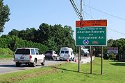
Route 114 is a numbered State Highway running 45.6 miles (73.4 km) in the U.S. state
of Rhode Island
. It connects the city of Newport
to the city of Woonsocket
. Route 114 was a major north–south artery for its entire length until the arrival of the Interstate Highway System
. It is still a major commercial corridor on Aquidneck Island
and in northern Rhode Island
(mainly Central Falls
, Cumberland
and Woonsocket).
 Route 114 begins at the Newport city line in the town of Middletown
, at an intersection with Route 138
. The road continues into Newport as Broadway. Route 114 heads north as West Main Road in Middletown and Portsmouth
. Soon after Route 24
leaves Route 114 in Portsmouth, Route 114 turns onto Bristol Ferry Road then crosses Mount Hope Bay
into the town of Bristol
along the Mount Hope Bridge
. In Bristol, it continues north along Ferry Road then shifts to Hope Street. The route then enters the town of Warren
, running along Main Street through the town center, where it meets and is joined by Route 103
. The two routes cross the Palmer
and Barrington rivers into the town of Barrington
. Routes 114 and 103 continue together along County Road, with Route 114 soon splitting to the north using Wampanoag Trail. Route 114 eventually reaches the city of East Providence
, where the road curves west to meet Route 103 again at Pawtucket Avenue. Along the way, the East Shore Expressway begins at Wampanoag Trail to connect to I-195. Pawtucket Avenue continues north through downtown East Providence, crossing over I-195, where it is joined by US 1A.
Routes 1A and 114 continue through the northern part of East Providence towards the city of Pawtucket
, with US 1A later splitting off to the north as Route 114 heads northwest into the city of Pawtucket
. In Pawtucket, Route 114 splits into a one-way couplet with the northbound direction using Prospect Street and the southbound direction using School Street. After running through several Pawtucket city streets, including an interchange with I-95, Route 114 crosses the Blackstone River
and continues north along Broad Street into the city of Central Falls
. After crossing the Blackstone River
into the town of Cumberland
, Route 114 shifts one block east to High Street as it heads towards the village of Valley Falls
. The road continues north as Diamond Hill Road towards the rural areas of Cumberland, intersecting I-295 along the way. At the intersection with Route 121
, Route 114 turns west along Pine Swamp Road towards the city of Woonsocket
. In Woonsocket, Route 114 continues west as Diamond Hill Road, Rathbun Street, Privilege Street and Winter Street, ending at Route 122
.
 Two sections of modern Route 114 were previously laid out as turnpikes
in the early 19th century. In 1805, a charter was granted to the Rhode Island Turnpike corporation, which constructed a road from Portsmouth center to the Bristol Ferry at the north end of Aquidneck Island
. The road is now Bristol Ferry Road (Route 114) and Turnpike Avenue. In 1813, the road from northern Pawtucket to the village of Valley Falls in Cumberland was also laid out as a turnpike, known as the Valley Falls Turnpike. The old road is what is now Broad Street in Pawtucket, Central Falls, and Cumberland.
Route 114 was an original Rhode Island route designated in 1923, running from Newport to Grants Mills in Cumberland. Until the 1960s, Route 114 ended at the intersection of Pine Swamp Road and Diamond Hill Road in Cumberland
. Present-day Route 114 from that point west to Route 122
in Woonsocket, Rhode Island
was given the Route 142 and later the Route 11 designation. When Route 11 became Route 121
in the 1960s, Route 121
's terminus was cut back to the same intersection where Route 114 originally ended, and the route west to Woonsocket
became Route 114.
In 2000, part of Route 114 northbound south of downtown Pawtucket
was re-routed. The old alignment left Prospect Street at Pond Street, went east along Pond Street to Summit Street, north on Summit Street (this turn onto Summit is still signed as of July 2005) and re-joined Route 114 southbound at the corner of Summit Street and Division Street.
U.S. state
A U.S. state is any one of the 50 federated states of the United States of America that share sovereignty with the federal government. Because of this shared sovereignty, an American is a citizen both of the federal entity and of his or her state of domicile. Four states use the official title of...
of Rhode Island
Rhode Island
The state of Rhode Island and Providence Plantations, more commonly referred to as Rhode Island , is a state in the New England region of the United States. It is the smallest U.S. state by area...
. It connects the city of Newport
Newport, Rhode Island
Newport is a city on Aquidneck Island in Newport County, Rhode Island, United States, about south of Providence. Known as a New England summer resort and for the famous Newport Mansions, it is the home of Salve Regina University and Naval Station Newport which houses the United States Naval War...
to the city of Woonsocket
Woonsocket, Rhode Island
Woonsocket is a city in Providence County, Rhode Island, United States. The population was 41,186 at the 2010 census, making it the sixth largest city in the state. Woonsocket lies directly south of the Massachusetts border....
. Route 114 was a major north–south artery for its entire length until the arrival of the Interstate Highway System
Interstate Highway System
The Dwight D. Eisenhower National System of Interstate and Defense Highways, , is a network of limited-access roads including freeways, highways, and expressways forming part of the National Highway System of the United States of America...
. It is still a major commercial corridor on Aquidneck Island
Aquidneck Island
Aquidneck Island, located in the state of Rhode Island, is the largest island in Narragansett Bay. The island's official name is Rhode Island, and the common use of name "Aquidneck Island" helps distinguish the island from the state. The total land area is 97.9 km²...
and in northern Rhode Island
Rhode Island
The state of Rhode Island and Providence Plantations, more commonly referred to as Rhode Island , is a state in the New England region of the United States. It is the smallest U.S. state by area...
(mainly Central Falls
Central Falls, Rhode Island
Central Falls is a city in Providence County, Rhode Island, United States. The population was 19,376 at the 2010 census. With an area of only , it is the smallest and most densely populated city in the smallest state, and the thirty-second most densely populated incorporated place in the United...
, Cumberland
Cumberland, Rhode Island
Cumberland is a town in Providence County, Rhode Island, United States, incorporated in 1746. The population was 33,506 at the 2010 census.-History:...
and Woonsocket).
Route description
Middletown, Rhode Island
Middletown is a town in Newport County, Rhode Island, United States. The population was 16,150 at the 2010 census. It lies to the south of Portsmouth and to the north of Newport on Aquidneck Island, hence the name "Middletown."-Geography:...
, at an intersection with Route 138
Route 138 (Rhode Island)
Route 138 is a numbered State Highway running in Rhode Island. It runs from the Connecticut state line to the Massachusetts state line and is the only state-numbered route that traverses the entire state.-Route description:...
. The road continues into Newport as Broadway. Route 114 heads north as West Main Road in Middletown and Portsmouth
Portsmouth, Rhode Island
Portsmouth is a town in Newport County, Rhode Island, United States. The population was 17,389 at the 2010 U.S. Census.-Geography:According to the United States Census Bureau, the town has a total area of , of which, of it is land and of it is water. Most of its land area lies on Aquidneck...
. Soon after Route 24
Route 24 (Rhode Island)
-Route:Route 24 takes the following route through the State:*Portsmouth: ; Route 114 to Tiverton town line**Fall River Expressway*Tiverton: ; Portsmouth town line to Massachusetts State line at Route 24**Fall River Expressway-Notes:...
leaves Route 114 in Portsmouth, Route 114 turns onto Bristol Ferry Road then crosses Mount Hope Bay
Mount Hope Bay
Mount Hope Bay is a tidal estuary located at the mouth of the Taunton River on the Massachusetts and Rhode Island border. It is an arm of Narragansett Bay. The bay is named after Mount Hope, a small hill located on its western shore in what is now Bristol, Rhode Island. It flows into the East...
into the town of Bristol
Bristol, Rhode Island
Bristol is a town in and the historic county seat of Bristol County, Rhode Island, United States. The population was 22,954 at the 2010 census. Bristol, a deepwater seaport, is named after Bristol, England....
along the Mount Hope Bridge
Mount Hope Bridge
The Mount Hope Bridge is a two-lane suspension bridge spanning the Mount Hope Bay in eastern Rhode Island, at one of the narrowest gaps in Narragansett Bay. The bridge connects the Rhode Island towns of Portsmouth and Bristol, and is part of Route 114...
. In Bristol, it continues north along Ferry Road then shifts to Hope Street. The route then enters the town of Warren
Warren, Rhode Island
Warren is a town in Bristol County, Rhode Island, United States. The population was 10,611 at the 2010 census.-History:Warren was the site of the Indian village of Sowams on the peninsula called Pokanoket , and was first explored by Europeans in 1621, by Edward Winslow and Stephen Hopkins...
, running along Main Street through the town center, where it meets and is joined by Route 103
Route 103 (Rhode Island)
Route 103 is a numbered State Highway running in Rhode Island. It runs from I-195 in East Providence to the Massachusetts state line in the town of Warren, where the road continues as Massachusetts Route 103...
. The two routes cross the Palmer
Palmer River
The Palmer River is a river southwest of Cooktown in northeastern Australia. It was the site of a gold rush in the late 19th century which started in 1872. The Palmer River flows west across Cape York to the Gulf of Carpentaria, via the Mitchell River...
and Barrington rivers into the town of Barrington
Barrington, Rhode Island
Barrington is a town in Bristol County, Rhode Island, United States. The population was 16,310 at the 2010 census.In July 2005, CNN/Money and Money magazine ranked Barrington sixth on its list of the 100 best places to live in the United States.-History:...
. Routes 114 and 103 continue together along County Road, with Route 114 soon splitting to the north using Wampanoag Trail. Route 114 eventually reaches the city of East Providence
East Providence, Rhode Island
East Providence is a city in Providence County, Rhode Island, United States. The population was 47,037 at the 2010 census, making it the fifth largest city in the state.-Geography:East Providence is located at ....
, where the road curves west to meet Route 103 again at Pawtucket Avenue. Along the way, the East Shore Expressway begins at Wampanoag Trail to connect to I-195. Pawtucket Avenue continues north through downtown East Providence, crossing over I-195, where it is joined by US 1A.
Routes 1A and 114 continue through the northern part of East Providence towards the city of Pawtucket
Pawtucket, Rhode Island
Pawtucket is a city in Providence County, Rhode Island, United States. The population was 71,148 at the 2010 census. It is the fourth largest city in the state.-History:...
, with US 1A later splitting off to the north as Route 114 heads northwest into the city of Pawtucket
Pawtucket, Rhode Island
Pawtucket is a city in Providence County, Rhode Island, United States. The population was 71,148 at the 2010 census. It is the fourth largest city in the state.-History:...
. In Pawtucket, Route 114 splits into a one-way couplet with the northbound direction using Prospect Street and the southbound direction using School Street. After running through several Pawtucket city streets, including an interchange with I-95, Route 114 crosses the Blackstone River
Blackstone River
The Blackstone River is a river in the U.S. states of Massachusetts and Rhode Island. It flows approximately 48 mi and drains a watershed of approximately 540 sq. mi...
and continues north along Broad Street into the city of Central Falls
Central Falls, Rhode Island
Central Falls is a city in Providence County, Rhode Island, United States. The population was 19,376 at the 2010 census. With an area of only , it is the smallest and most densely populated city in the smallest state, and the thirty-second most densely populated incorporated place in the United...
. After crossing the Blackstone River
Blackstone River
The Blackstone River is a river in the U.S. states of Massachusetts and Rhode Island. It flows approximately 48 mi and drains a watershed of approximately 540 sq. mi...
into the town of Cumberland
Cumberland, Rhode Island
Cumberland is a town in Providence County, Rhode Island, United States, incorporated in 1746. The population was 33,506 at the 2010 census.-History:...
, Route 114 shifts one block east to High Street as it heads towards the village of Valley Falls
Valley Falls, Rhode Island
Valley Falls is a village and census-designated place in the town of Cumberland, Providence County, Rhode Island, United States. Valley Falls is located in the southern part of Cumberland, Rhode Island and borders the city of Central Falls, Rhode Island,the city of Attleboro, Massachusetts, and...
. The road continues north as Diamond Hill Road towards the rural areas of Cumberland, intersecting I-295 along the way. At the intersection with Route 121
Route 121 (Rhode Island)
Route 121 is a numbered State Highway running in Rhode Island and in Massachusetts. It is part of the route connecting the city of Woonsocket with the town of Wrentham.-Route:Route 121 takes the following route:...
, Route 114 turns west along Pine Swamp Road towards the city of Woonsocket
Woonsocket, Rhode Island
Woonsocket is a city in Providence County, Rhode Island, United States. The population was 41,186 at the 2010 census, making it the sixth largest city in the state. Woonsocket lies directly south of the Massachusetts border....
. In Woonsocket, Route 114 continues west as Diamond Hill Road, Rathbun Street, Privilege Street and Winter Street, ending at Route 122
Route 122 (Rhode Island)
-Route:Route 122 takes the following route through the State:*Pawtucket: ; U.S. 1 to Central Falls city line**Main Street and Lonsdale Avenue*Central Falls: ; Pawtucket city line to Lincoln town line**Lonsdale Avenue...
.
History
Toll road
A toll road is a privately or publicly built road for which a driver pays a toll for use. Structures for which tolls are charged include toll bridges and toll tunnels. Non-toll roads are financed using other sources of revenue, most typically fuel tax or general tax funds...
in the early 19th century. In 1805, a charter was granted to the Rhode Island Turnpike corporation, which constructed a road from Portsmouth center to the Bristol Ferry at the north end of Aquidneck Island
Aquidneck Island
Aquidneck Island, located in the state of Rhode Island, is the largest island in Narragansett Bay. The island's official name is Rhode Island, and the common use of name "Aquidneck Island" helps distinguish the island from the state. The total land area is 97.9 km²...
. The road is now Bristol Ferry Road (Route 114) and Turnpike Avenue. In 1813, the road from northern Pawtucket to the village of Valley Falls in Cumberland was also laid out as a turnpike, known as the Valley Falls Turnpike. The old road is what is now Broad Street in Pawtucket, Central Falls, and Cumberland.
Route 114 was an original Rhode Island route designated in 1923, running from Newport to Grants Mills in Cumberland. Until the 1960s, Route 114 ended at the intersection of Pine Swamp Road and Diamond Hill Road in Cumberland
Cumberland, Rhode Island
Cumberland is a town in Providence County, Rhode Island, United States, incorporated in 1746. The population was 33,506 at the 2010 census.-History:...
. Present-day Route 114 from that point west to Route 122
Route 122 (Rhode Island)
-Route:Route 122 takes the following route through the State:*Pawtucket: ; U.S. 1 to Central Falls city line**Main Street and Lonsdale Avenue*Central Falls: ; Pawtucket city line to Lincoln town line**Lonsdale Avenue...
in Woonsocket, Rhode Island
Woonsocket, Rhode Island
Woonsocket is a city in Providence County, Rhode Island, United States. The population was 41,186 at the 2010 census, making it the sixth largest city in the state. Woonsocket lies directly south of the Massachusetts border....
was given the Route 142 and later the Route 11 designation. When Route 11 became Route 121
Route 121 (Rhode Island)
Route 121 is a numbered State Highway running in Rhode Island and in Massachusetts. It is part of the route connecting the city of Woonsocket with the town of Wrentham.-Route:Route 121 takes the following route:...
in the 1960s, Route 121
Route 121 (Rhode Island)
Route 121 is a numbered State Highway running in Rhode Island and in Massachusetts. It is part of the route connecting the city of Woonsocket with the town of Wrentham.-Route:Route 121 takes the following route:...
's terminus was cut back to the same intersection where Route 114 originally ended, and the route west to Woonsocket
Woonsocket, Rhode Island
Woonsocket is a city in Providence County, Rhode Island, United States. The population was 41,186 at the 2010 census, making it the sixth largest city in the state. Woonsocket lies directly south of the Massachusetts border....
became Route 114.
In 2000, part of Route 114 northbound south of downtown Pawtucket
Pawtucket, Rhode Island
Pawtucket is a city in Providence County, Rhode Island, United States. The population was 71,148 at the 2010 census. It is the fourth largest city in the state.-History:...
was re-routed. The old alignment left Prospect Street at Pond Street, went east along Pond Street to Summit Street, north on Summit Street (this turn onto Summit is still signed as of July 2005) and re-joined Route 114 southbound at the corner of Summit Street and Division Street.
Junction list
| Town | Mile | Junction | Notes |
|---|---|---|---|
| Middletown | |||
| Portsmouth | |||
| Bristol | |||
| Warren | Begin overlap | ||
| Barrington | End overlap | ||
| East Providence | |||
| Shore Expressway to I-195 west | |||
| Begin overlap | |||
| End overlap | |||
| Pawtucket | |||
| Central Falls | (No junctions) | ||
| Cumberland | |||
| Woonsocket | |||