
.gif)
Route 102 (Rhode Island)
Encyclopedia
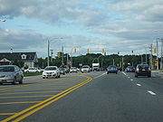
Route 102 is a numbered State Highway running 44.5 miles (71.6 km) in Rhode Island
. Route 102 serves as a non-freeway beltway around the Providence metro area. It begins in the village of Wickford
and travels through less developed areas of western Rhode Island. The route ends in the village of Slatersville
.
 Route 102 begins as Philips Street at Route 1A
in the Wickford section of the town of North Kingstown
on Narragansett Bay
. It proceeds west through the town of Exeter
along Ten Rod Road. Route 102 then turns northwest to follow Victory Highway as it goes through the towns of West Greenwich
and Coventry
. Route 102 soon enters the town of Foster
, where it continues north and briefly overlaps with Route 14
(Plainfield Pike) through the town of Scituate
. In Scituate, it continues north along Chopmist Hill Road, crossing US 6 as it heads towards the town of Glocester
. After crossing US 44 in the Glocester village of Chepachet, Route 102 continues northeast into the town of Burrillville
along the Bronco Highway. The route ends in the town of North Smithfield
in the village of Slatersville at an intersection with Routes 5
and 146A
.
along Victory Highway and Great Road (modern Route 146A), then along South Main Street and Main Street to end at Route 122
. The route was truncated to Route 146 (now Route 146A) by 1938.
Rhode Island
The state of Rhode Island and Providence Plantations, more commonly referred to as Rhode Island , is a state in the New England region of the United States. It is the smallest U.S. state by area...
. Route 102 serves as a non-freeway beltway around the Providence metro area. It begins in the village of Wickford
Wickford, Rhode Island
Wickford is a small village in the town of North Kingstown, Rhode Island, United States, which is named after Wickford in Essex, England. Wickford is located on the west side of Narragansett Bay, just about a 20 minute drive across two bridges from Newport, Rhode Island...
and travels through less developed areas of western Rhode Island. The route ends in the village of Slatersville
Slatersville, Rhode Island
Slatersville is a village on the Branch River in the town of North Smithfield, Rhode Island, United States. It includes the Slatersville Historic District, a historic district listed on the National Register of Historic Places....
.
Route description
Route 1A (Rhode Island)
Route 1A is a numbered state highway in Rhode Island, running in five sections.-Route:Route 1A follows U.S. 1 closely through South County. It can be separated into five sections:...
in the Wickford section of the town of North Kingstown
North Kingstown, Rhode Island
North Kingstown is a town in Washington County, Rhode Island, United States. The population was 26,486 at the 2010 census. The famous American portraitist Gilbert Stuart was born in the village of Saunderstown, located in the southern region of North Kingstown....
on Narragansett Bay
Narragansett Bay
Narragansett Bay is a bay and estuary on the north side of Rhode Island Sound. Covering 147 mi2 , the Bay forms New England's largest estuary, which functions as an expansive natural harbor, and includes a small archipelago...
. It proceeds west through the town of Exeter
Exeter, Rhode Island
Exeter is a town in Washington County, Rhode Island, United States. Exeter extends east from the Connecticut border to the town of North Kingstown. It is bordered to the north by West Greenwich and East Greenwich, and to the south by Hopkinton, Richmond and South Kingstown. Exeter's postal code...
along Ten Rod Road. Route 102 then turns northwest to follow Victory Highway as it goes through the towns of West Greenwich
West Greenwich, Rhode Island
West Greenwich is a town in Kent County, Rhode Island, United States. The population was 6,135 at the 2010 census. West Greenwich was named for Greenwich, Kent, England...
and Coventry
Coventry, Rhode Island
Coventry is a town in Kent County, Rhode Island, United States. The population was 35,014 at the 2010 census.-Geography:According to the United States Census Bureau, the town has a total area of . of it is land and of it is water...
. Route 102 soon enters the town of Foster
Foster, Rhode Island
Foster is a town in Providence County, Rhode Island, in the United States. The population was 4,606 at the 2010 census.- History :Foster was originally settled in the 17th century by British colonists as a farming community...
, where it continues north and briefly overlaps with Route 14
Route 14 (Rhode Island)
Route 14 is a numbered State Highway running in the U.S. State of Rhode Island.-Route:Route 14 takes the following route through the State:*Coventry: ; Connecticut State line at CT 14/CT 14A to Foster town line**Plainfield Pike...
(Plainfield Pike) through the town of Scituate
Scituate, Rhode Island
Scituate is a town in Providence County, Rhode Island, United States. The population was 10,329 at the 2010 census.-History:Scituate was first settled in 1710 by emigrants from Scituate, Massachusetts...
. In Scituate, it continues north along Chopmist Hill Road, crossing US 6 as it heads towards the town of Glocester
Glocester, Rhode Island
Glocester is a town in Providence County, Rhode Island, United States. The population was 9,746 as of the 2010 census. The villages of Chepachet and Harmony are in Glocester. Putnam Pike Glocester is a town in Providence County, Rhode Island, United States. The population was 9,746 as of the 2010...
. After crossing US 44 in the Glocester village of Chepachet, Route 102 continues northeast into the town of Burrillville
Burrillville, Rhode Island
Burrillville is a town in Providence County, Rhode Island, United States. It was incorporated as an independent municipality on November 17, 1806 when the Rhode Island General Assembly authorized the residents of then North Glocester to elect its own officers. The population was 15,955 at the 2010...
along the Bronco Highway. The route ends in the town of North Smithfield
North Smithfield, Rhode Island
North Smithfield is a town in Providence County, Rhode Island, United States, settled as a farming community in 1666 and incorporated into its present form in 1871. North Smithfield includes the historic villages of Forestdale, Primrose, Waterford, Branch Village, Union Village, Park Square, and...
in the village of Slatersville at an intersection with Routes 5
Route 5 (Rhode Island)
-Route description:Route 5 takes the following route through the State:*Warwick: ; US 1 to Cranston city line**Greenwich Avenue and Lambert Lind Highway*Cranston: ; Warwick city line to Johnston town line**Oaklawn Avenue and Atwood Avenue...
and 146A
Route 146A (Rhode Island)
-Route:Route 146A takes the following route through the State:*North Smithfield: ; Route 146 to Massachusetts State line at Route 146A**Eddie Dowling Highway, Smithfield Road, Great Road, Victory Highway, North Main Street and Quaker Highway-History:...
.
History
Route 102 is an original Rhode Island route designation assigned in 1923. The original route extended beyond North Smithfield into the city of WoonsocketWoonsocket, Rhode Island
Woonsocket is a city in Providence County, Rhode Island, United States. The population was 41,186 at the 2010 census, making it the sixth largest city in the state. Woonsocket lies directly south of the Massachusetts border....
along Victory Highway and Great Road (modern Route 146A), then along South Main Street and Main Street to end at Route 122
Route 122 (Rhode Island)
-Route:Route 122 takes the following route through the State:*Pawtucket: ; U.S. 1 to Central Falls city line**Main Street and Lonsdale Avenue*Central Falls: ; Pawtucket city line to Lincoln town line**Lonsdale Avenue...
. The route was truncated to Route 146 (now Route 146A) by 1938.