.gif)
Route 101 (Rhode Island)
Encyclopedia
Route 101 is a numbered State Highway running 12.1 miles (19.5 km) in Rhode Island
. It begins at the Connecticut
state line in the town of Foster
and ends at U.S. Route 6 in the town of Scituate
.
and Foster as a continuation of Connecticut Route 101
. The route, known locally as Hartford Pike, runs for about 12 miles (19.3 km) through several reservoirs before ending at US 6 Bypass in the town of Scituate, near the north edge of the Scituate Reservoir
. Route 101 passes near Jerimoth Hill
, the highest point in Rhode Island
.
 In the 19th century, modern Route 101 was a toll road
that was administered by the Rhode Island and Connecticut Turnpike corporation. The former turnpike route was not assigned a route number in 1923 when the state first designated route numbers. At the time, the Route 101 designation was assigned to what is now U.S. Route 44. In 1934, US 44 was designated by AASHO along its current alignment. Connecticut and Rhode Island reassigned the Route 101 designation by the following year to the Rhode Island and Connecticut Turnpike route and its continuation in Connecticut.
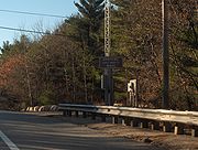
Until 2003, eastbound signage clearly showed Route 101 beginning concurrent with the US 6 Bypass, from the eastern split of US 6 Business (Danielson Pike) and US 6 Bypass in Scituate
. Signage westbound at that intersection has now been changed to say "TO Route 101", leading to the belief that the western terminus is now the split between Hartford Pike and the US 6 Bypass, where the concurrency ended.
Rhode Island
The state of Rhode Island and Providence Plantations, more commonly referred to as Rhode Island , is a state in the New England region of the United States. It is the smallest U.S. state by area...
. It begins at the Connecticut
Connecticut
Connecticut is a state in the New England region of the northeastern United States. It is bordered by Rhode Island to the east, Massachusetts to the north, and the state of New York to the west and the south .Connecticut is named for the Connecticut River, the major U.S. river that approximately...
state line in the town of Foster
Foster, Rhode Island
Foster is a town in Providence County, Rhode Island, in the United States. The population was 4,606 at the 2010 census.- History :Foster was originally settled in the 17th century by British colonists as a farming community...
and ends at U.S. Route 6 in the town of Scituate
Scituate, Rhode Island
Scituate is a town in Providence County, Rhode Island, United States. The population was 10,329 at the 2010 census.-History:Scituate was first settled in 1710 by emigrants from Scituate, Massachusetts...
.
Route description
Route 101 begins at the Connecticut state line between the towns of KillinglyKillingly, Connecticut
Killingly is a town in Windham County, Connecticut, United States. The population was 16,472 at the 2000 census. It consists of the borough of Danielson and the villages of Attawaugan, Ballouville, Dayville, East Killingly, Rogers, and South Killingly....
and Foster as a continuation of Connecticut Route 101
Connecticut Route 101
Route 101 is a state highway in northeastern Connecticut running from Pomfret to the Rhode Island state line in Killingly. The road originated as a 19th-century toll road known as the Connecticut and Rhode Island Turnpike. Route 101 was designated along the modern alignment in 1935 when an earlier...
. The route, known locally as Hartford Pike, runs for about 12 miles (19.3 km) through several reservoirs before ending at US 6 Bypass in the town of Scituate, near the north edge of the Scituate Reservoir
Scituate Reservoir
The Scituate Reservoir is the largest inland body of water in the state of Rhode Island. It has an aggregate capacity of and a surface area of 5.3 square miles...
. Route 101 passes near Jerimoth Hill
Jerimoth Hill
Jerimoth Hill is the name of the highest natural point in the U.S. state of Rhode Island, at 812 feet above sea level. It was once one of the most controversial U.S. highpoints due to property complications, but it is now accessible to the public 7 days a week 8AM to 4PM...
, the highest point in Rhode Island
Rhode Island
The state of Rhode Island and Providence Plantations, more commonly referred to as Rhode Island , is a state in the New England region of the United States. It is the smallest U.S. state by area...
.
History

Toll road
A toll road is a privately or publicly built road for which a driver pays a toll for use. Structures for which tolls are charged include toll bridges and toll tunnels. Non-toll roads are financed using other sources of revenue, most typically fuel tax or general tax funds...
that was administered by the Rhode Island and Connecticut Turnpike corporation. The former turnpike route was not assigned a route number in 1923 when the state first designated route numbers. At the time, the Route 101 designation was assigned to what is now U.S. Route 44. In 1934, US 44 was designated by AASHO along its current alignment. Connecticut and Rhode Island reassigned the Route 101 designation by the following year to the Rhode Island and Connecticut Turnpike route and its continuation in Connecticut.
Until 2003, eastbound signage clearly showed Route 101 beginning concurrent with the US 6 Bypass, from the eastern split of US 6 Business (Danielson Pike) and US 6 Bypass in Scituate
Scituate, Rhode Island
Scituate is a town in Providence County, Rhode Island, United States. The population was 10,329 at the 2010 census.-History:Scituate was first settled in 1710 by emigrants from Scituate, Massachusetts...
. Signage westbound at that intersection has now been changed to say "TO Route 101", leading to the belief that the western terminus is now the split between Hartford Pike and the US 6 Bypass, where the concurrency ended.

