
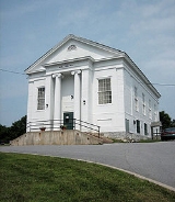
Orwell, Vermont
Encyclopedia
Orwell is a town in Addison County
, Vermont
, United States
. The population was 1,185 at the 2000 census. Mount Independence
was the largest fortification constructed by the American colonial forces. The 300 acres (1.2 km²) site is now one of Vermont's premier state-operated historic sites.
, the town has a total area of 49.7 square miles (128.7 km2), of which 47.4 square miles (122.7 km2) is land and 2.3 square miles (6.0 km2) (4.63%) is water.
of 2000, there were 1,185 people, 441 households, and 340 families residing in the town. The population density
was 25.0 people per square mile (9.7/km2). There were 577 housing units at an average density of 12.2 per square mile (4.7/km2). The racial makeup of the town was 99.24% White, 0.08% African American, 0.08% Native American, 0.42% Asian, and 0.17% from two or more races. Hispanic or Latino of any race were 0.84% of the population.
There were 441 households out of which 38.1% had children under the age of 18 living with them, 65.5% were married couples
living together, 6.1% had a female householder with no husband present, and 22.9% were non-families. 17.9% of all households were made up of individuals and 6.6% had someone living alone who was 65 years of age or older. The average household size was 2.69 and the average family size was 3.02.
In the town the population was spread out with 27.3% under the age of 18, 5.6% from 18 to 24, 27.4% from 25 to 44, 27.8% from 45 to 64, and 11.9% who were 65 years of age or older. The median age was 39 years. For every 100 females there were 95.9 males. For every 100 females age 18 and over, there were 98.2 males.
The median income for a household in the town was $40,978, and the median income for a family was $42,438. Males had a median income of $29,671 versus $23,304 for females. The per capita income
for the town was $19,835. About 6.2% of families and 10.4% of the population were below the poverty line, including 17.4% of those under age 18 and 3.6% of those age 65 or over.
on Mount Independence
in 1775, rebel soldiers bravely manned the lesser fortifications of the Vermont-side defenses. While those soldiers billeted at Fort Ticonderoga
enjoyed comparatively splendid conditions in the French-style fort, Mount Independence proved a trying and difficult environment for its small cadre of revolutionary defenders, who frequently returned to their farms in the surrounding countryside to tend to their homesteads. The fortress was passed between the British and Colonials, until it was eventually abandoned at the cessation of hostilities on the northern front of the war.
Orwell enjoyed a time of peace and prosperity after the war's conclusion, marking a time of great emotional uprising and town glee, however, these bright times would be marred by several major tragedies that coincided with the attempted industrialization of the area's farmlands in the 1870s, when several young men were lost in a thresher accident near what is now the intersection of Main Street and Route 22A
. This tragedy was keenly remembered by the community, which banned industrial farming later that year in a special town meeting. Industrialized farm equipment was only allowed back into Orwell after the economic collapse of the early 1900s, and even then, special restrictions were placed to limit the capabilities of such farm instruments. The town's law against the use of "Modern Farm Machinery of All Kinds" was never actually repealed, and continues to be a curio law on the books that the town refuses to repeal.
Orwell attempted in the late 1990s to obtain a franchised fast-food restaurant, as a vital link in the food availability between Whitehall, New York
, and Vergennes, Vermont
, but the residents of the surrounding townships blocked the move, claiming it would upset the rural beauty of the western Vermont countryside. Orwell is known as the Fortress of America. The town motto is 'First in Revolution, First in Recreation'.
Addison County, Vermont
Addison County is a county located in the U.S. state of Vermont. In 2010, the population was 36,821. Its shire town is Middlebury.-Geography:...
, Vermont
Vermont
Vermont is a state in the New England region of the northeastern United States of America. The state ranks 43rd in land area, , and 45th in total area. Its population according to the 2010 census, 630,337, is the second smallest in the country, larger only than Wyoming. It is the only New England...
, United States
United States
The United States of America is a federal constitutional republic comprising fifty states and a federal district...
. The population was 1,185 at the 2000 census. Mount Independence
Mount Independence
Mount Independence is a high hill on the Vermont side of Lake Champlain, in the northeastern United States.It is a Vermont State Historic Site and was the site of Fort Independence, an American revolutionary war fortification built opposite Fort Ticonderoga...
was the largest fortification constructed by the American colonial forces. The 300 acres (1.2 km²) site is now one of Vermont's premier state-operated historic sites.
Geography
According to the United States Census BureauUnited States Census Bureau
The United States Census Bureau is the government agency that is responsible for the United States Census. It also gathers other national demographic and economic data...
, the town has a total area of 49.7 square miles (128.7 km2), of which 47.4 square miles (122.7 km2) is land and 2.3 square miles (6.0 km2) (4.63%) is water.
Demographics
As of the censusCensus
A census is the procedure of systematically acquiring and recording information about the members of a given population. It is a regularly occurring and official count of a particular population. The term is used mostly in connection with national population and housing censuses; other common...
of 2000, there were 1,185 people, 441 households, and 340 families residing in the town. The population density
Population density
Population density is a measurement of population per unit area or unit volume. It is frequently applied to living organisms, and particularly to humans...
was 25.0 people per square mile (9.7/km2). There were 577 housing units at an average density of 12.2 per square mile (4.7/km2). The racial makeup of the town was 99.24% White, 0.08% African American, 0.08% Native American, 0.42% Asian, and 0.17% from two or more races. Hispanic or Latino of any race were 0.84% of the population.
There were 441 households out of which 38.1% had children under the age of 18 living with them, 65.5% were married couples
Marriage
Marriage is a social union or legal contract between people that creates kinship. It is an institution in which interpersonal relationships, usually intimate and sexual, are acknowledged in a variety of ways, depending on the culture or subculture in which it is found...
living together, 6.1% had a female householder with no husband present, and 22.9% were non-families. 17.9% of all households were made up of individuals and 6.6% had someone living alone who was 65 years of age or older. The average household size was 2.69 and the average family size was 3.02.
In the town the population was spread out with 27.3% under the age of 18, 5.6% from 18 to 24, 27.4% from 25 to 44, 27.8% from 45 to 64, and 11.9% who were 65 years of age or older. The median age was 39 years. For every 100 females there were 95.9 males. For every 100 females age 18 and over, there were 98.2 males.
The median income for a household in the town was $40,978, and the median income for a family was $42,438. Males had a median income of $29,671 versus $23,304 for females. The per capita income
Per capita income
Per capita income or income per person is a measure of mean income within an economic aggregate, such as a country or city. It is calculated by taking a measure of all sources of income in the aggregate and dividing it by the total population...
for the town was $19,835. About 6.2% of families and 10.4% of the population were below the poverty line, including 17.4% of those under age 18 and 3.6% of those age 65 or over.
History
After the construction of Fort IndependenceFort Independence (Vermont)
Fort Independence was a fort built in 1775 on Mount Independence next to Lake Champlain. It was placed directly across from Fort Ticonderoga to help fortify the approach to Albany. The intent was to provide a combined, two-shore defense to approaching British Forces...
on Mount Independence
Mount Independence
Mount Independence is a high hill on the Vermont side of Lake Champlain, in the northeastern United States.It is a Vermont State Historic Site and was the site of Fort Independence, an American revolutionary war fortification built opposite Fort Ticonderoga...
in 1775, rebel soldiers bravely manned the lesser fortifications of the Vermont-side defenses. While those soldiers billeted at Fort Ticonderoga
Fort Ticonderoga
Fort Ticonderoga, formerly Fort Carillon, is a large 18th-century fort built by the Canadians and the French at a narrows near the south end of Lake Champlain in upstate New York in the United States...
enjoyed comparatively splendid conditions in the French-style fort, Mount Independence proved a trying and difficult environment for its small cadre of revolutionary defenders, who frequently returned to their farms in the surrounding countryside to tend to their homesteads. The fortress was passed between the British and Colonials, until it was eventually abandoned at the cessation of hostilities on the northern front of the war.
Orwell enjoyed a time of peace and prosperity after the war's conclusion, marking a time of great emotional uprising and town glee, however, these bright times would be marred by several major tragedies that coincided with the attempted industrialization of the area's farmlands in the 1870s, when several young men were lost in a thresher accident near what is now the intersection of Main Street and Route 22A
Vermont Route 22A
Vermont Route 22A is a state highway in western Vermont, United States. It is the northward continuation of New York State Route 22A. Its southern end is at the New York state line in Fair Haven and its northern end is in Ferrisburgh at U.S. Route 7...
. This tragedy was keenly remembered by the community, which banned industrial farming later that year in a special town meeting. Industrialized farm equipment was only allowed back into Orwell after the economic collapse of the early 1900s, and even then, special restrictions were placed to limit the capabilities of such farm instruments. The town's law against the use of "Modern Farm Machinery of All Kinds" was never actually repealed, and continues to be a curio law on the books that the town refuses to repeal.
Orwell attempted in the late 1990s to obtain a franchised fast-food restaurant, as a vital link in the food availability between Whitehall, New York
Whitehall (village), New York
Whitehall is a village located in the town of Whitehall in Washington County, New York, USA. It is part of the Glens Falls Metropolitan Statistical Area...
, and Vergennes, Vermont
Vergennes, Vermont
Vergennes is a city located in the northwest quadrant of Addison County, Vermont, in the United States. Bordered by the towns of Ferrisburgh, Panton and Waltham, as of the 2000 census the city population was 2,741. It is the smallest of Vermont's nine cities in terms of population...
, but the residents of the surrounding townships blocked the move, claiming it would upset the rural beauty of the western Vermont countryside. Orwell is known as the Fortress of America. The town motto is 'First in Revolution, First in Recreation'.
Notable people
- Louis Winslow AustinLouis Winslow AustinLouis Winslow Austin was an American physicist known for his research on long-range radio transmissions.Austin was born in Orwell, Vermont, and educated at Middlebury College and the University of Strasbourg , from which he received a Ph.D. in 1893...
, physicist. - Oliver BascomOliver BascomOliver Bascom was an American businessman and politician from New York.-Life:...
(1815-1869), politician - John CatlinJohn CatlinJohn Catlin was an American lawyer, politician, public official, and officer within the railroad industry.Catlin served as acting governor of the Wisconsin Territory from June 23, 1848 until March 3, 1849, when Henry Dodge ceased to be the governor of the Wisconsin Territory, upon becoming a...
, acting governor of the Wisconsin TerritoryWisconsin TerritoryThe Territory of Wisconsin was an organized incorporated territory of the United States that existed from July 3, 1836, until May 29, 1848, when an eastern portion of the territory was admitted to the Union as the State of Wisconsin...
(1848–1849). - Marsena E. CuttsMarsena E. CuttsMarsena Edgar Cutts was a nineteenth century politician, lawyer and teacher from Iowa.Born in Orwell, Vermont, Cutts attended common schools in his native village and later attended St. Lawrence Academy in Potsdam, New York. He moved to Sheboygan Falls, Wisconsin in 1853 where he taught school for...
, politician. - William P. KelloggWilliam P. KelloggWilliam Pitt Kellogg was an American politician and a governor of Louisiana from 1873-1877 during Reconstruction. He was one of the most important politicians in Louisiana during and immediately after Reconstruction...
, politician.