
Melbourne tram route 57
Encyclopedia
Tram
route 57 is a public transport service in Melbourne, Victoria, Australia. It runs from the corner of Flinders Street
and Elizabeth Street
in the city centre to West Maribyrnong in the inner Western suburbs.
Like most Melbourne tram routes, route 57 operates entirely in Metcard
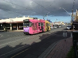
ticketing Zone 1. The route is operated by Z3 class trams from Essendon tram depot.
The route runs along Elizabeth Street in the city, Victoria Street in West Melbourne, Errol Street, Queensberry Street and Abbotsford Street in North Melbourne
, Flemington Road
in Parkville
, Racecourse Road through North Melbourne, Kensington, Newmarket and Flemington
, Epsom Road through Flemington and Ascot Vale
, Union Road and Maribyrnong Road
in Ascot Vale, and Raleigh Road and Cordite Avenue in Maribyrnong
where it terminates at the corner of Cordite Avenue and Central Park Avenue.
Route 57 shares track with route 82
between the intersection of Maribyrnong Road and Union Road, Ascot Vale; and Raleigh Road and Wests Road, Maribyrnong. A loop siding exists at the south end of Union Road in Ascot Vale, and is used during special events at the Royal Melbourne Showgrounds
and Flemington Racecourse
to handle the additional trams used to move the crowds of passengers.
There have been proposal, supported by the Public Transport Users Association
and local politicians, to extend route 57 north-west along Milleara Road to Avondale Heights and East Keilor. Variations of this proposal including building a park and ride
facility near the terminus, or establishing a high frequency bus service between the terminus and East Keilor down Milleara Road.
on route 57. Commencing at the Sir Robert Risson tram terminus at the intersection of Flinders and Elizabeth Streets, opposite Flinders Street Station
(stop 1), route 57 then runs via:
Ends at Cordite Avenue, West Maribyrnong (stop 49).
Tram
A tram is a passenger rail vehicle which runs on tracks along public urban streets and also sometimes on separate rights of way. It may also run between cities and/or towns , and/or partially grade separated even in the cities...
route 57 is a public transport service in Melbourne, Victoria, Australia. It runs from the corner of Flinders Street
Flinders Street, Melbourne
Flinders Street is a notable street in Melbourne, Victoria, Australia. Running roughly parallel to the Yarra River, Flinders Street forms the southern edge of the Hoddle Grid. It is exactly one mile in length and one and half chains in width...
and Elizabeth Street
Elizabeth Street, Melbourne
Elizabeth Street is one of the main north-south streets in the central business district of Melbourne, Australia, part of the Hoddle Grid laid out in 1837.- Geography :...
in the city centre to West Maribyrnong in the inner Western suburbs.
Like most Melbourne tram routes, route 57 operates entirely in Metcard
Metcard
"OneLink" redirects here. For the computer/cable company, see OneLink Communications.Metcard is the brand name of an integrated ticketing system used to access public transport in Melbourne, Australia. It is a universal ticket which allows users to ride on the city's Metlink network, consisting of...
ticketing Zone 1. The route is operated by Z3 class trams from Essendon tram depot.
The route runs along Elizabeth Street in the city, Victoria Street in West Melbourne, Errol Street, Queensberry Street and Abbotsford Street in North Melbourne
North Melbourne, Victoria
North Melbourne is a large inner city suburb of Melbourne, Victoria, Australia, 2 km north-west from Melbourne's central business district. It is bounded by the CityLink freeway to the west, Victoria Street to the south, O'Connell and Peel Streets to the east and Flemington Road to the north. Its...
, Flemington Road
Flemington Road, Melbourne
Flemington Road is a major thoroughfare in the inner suburbs of North Melbourne and Parkville in Melbourne, Victoria, Australia. It runs from the north end of Elizabeth Street to the south end of Mount Alexander Road, Flemington, and provides a main connection between the Melbourne CBD and the...
in Parkville
Parkville, Victoria
Parkville is an inner city suburb in Melbourne, Victoria, Australia, 3 km north from Melbourne's central business district. Its Local Government Area is the City of Melbourne. At the 2006 Census, the population was 4,980....
, Racecourse Road through North Melbourne, Kensington, Newmarket and Flemington
Flemington, Victoria
Flemington is a suburb in Melbourne, Victoria, Australia, situated between the Maribyrnong River and Moonee Ponds Creek 4 km north-west from Melbourne's central business district. It was named by settler James Watson after Flemington estate in Scotland. Its Local Government Areas are the...
, Epsom Road through Flemington and Ascot Vale
Ascot Vale, Victoria
Ascot Vale is a suburb 7 km north-west of Melbourne, Victoria, Australia. Its Local Government Area is the City of Moonee Valley. At the 2006 Census, Ascot Vale had a population of 12,398....
, Union Road and Maribyrnong Road
Maribyrnong Road
Maribyrnong Road is a major road in northwestern Melbourne, Australia. It forms the boundary between the suburbs of Moonee Ponds and Ascot Vale for its entire length. The road is used frequently by trucks, and also has a tram line...
in Ascot Vale, and Raleigh Road and Cordite Avenue in Maribyrnong
Maribyrnong, Victoria
Maribyrnong is a suburb 8 km north-west of Melbourne, Victoria, Australia. Its Local Government Area is the City of Maribyrnong, part of River Ward. At the 2006 Census, Maribyrnong had a population of 8242....
where it terminates at the corner of Cordite Avenue and Central Park Avenue.
Route 57 shares track with route 82
Melbourne tram route 82
Tram route 82 is a public transport service in Melbourne, Victoria, Australia. It runs from the corner of Leeds and Irving Streets near Footscray railway station in Footscray to the corner of Ascot Vale Road and Puckle Street in Moonee Ponds. It is one of Melbourne's very few tram routes which...
between the intersection of Maribyrnong Road and Union Road, Ascot Vale; and Raleigh Road and Wests Road, Maribyrnong. A loop siding exists at the south end of Union Road in Ascot Vale, and is used during special events at the Royal Melbourne Showgrounds
Royal Melbourne Showgrounds
The Melbourne Showgrounds is located in the inner north-western suburb of Ascot Vale, Victoria, Australia, next door to Flemington Racecourse. Is the home of the annual Royal Melbourne Show, as well as major exhibitions, trade shows, and music concerts....
and Flemington Racecourse
Flemington Racecourse
Flemington Racecourse is a major horse racing venue located in Melbourne, Victoria, Australia. It is most notable for hosting the Melbourne Cup, which is Australia's richest horse race. The racecourse is situated on low alluvial flats, next to the Maribyrnong River...
to handle the additional trams used to move the crowds of passengers.
There have been proposal, supported by the Public Transport Users Association
Public Transport Users Association
The Public Transport Users Association is a community-based public transport lobby group in Victoria, Australia, based in Melbourne.- History and Aims :...
and local politicians, to extend route 57 north-west along Milleara Road to Avondale Heights and East Keilor. Variations of this proposal including building a park and ride
Park and ride
Park and ride facilities are car parks with connections to public transport that allow commuters and other people wishing to travel into city centres to leave their vehicles and transfer to a bus, rail system , or carpool for the rest of their trip...
facility near the terminus, or establishing a high frequency bus service between the terminus and East Keilor down Milleara Road.
Route
There are 49 stopsTram stop
A tram stop is a place designated for a tram to stop so passengers can board or alight it. Tram stops share most characteristics of bus stops, but because trams operate on rails, they often include railway platforms, especially if stepless entries are provided for accessibility...
on route 57. Commencing at the Sir Robert Risson tram terminus at the intersection of Flinders and Elizabeth Streets, opposite Flinders Street Station
Flinders Street Station
Flinders Street Station is the central railway station of the suburban railway network of Melbourne, Victoria, Australia. It is on the corner of Flinders and Swanston Streets next to the Yarra River in the heart of the city, stretching from Swanston Street to Queen Street and covering two city...
(stop 1), route 57 then runs via:
- Elizabeth StreetElizabeth Street, MelbourneElizabeth Street is one of the main north-south streets in the central business district of Melbourne, Australia, part of the Hoddle Grid laid out in 1837.- Geography :...
(stops 1 - 9)- Collins StreetCollins Street, MelbourneCollins Street is a major street in the Melbourne central business district and runs approximately east to west.It is notable as Melbourne's traditional main street and best known street, is often regarded as Australia's premier street, with some of the country's finest Victorian era buildings.The...
, tram routes 11, 12, 42, 48Melbourne tram route 48Tram route 48 is a public transport service in Melbourne, Victoria, Australia. It runs from Victoria Harbour, Docklands to North Balwyn via Collins Street, Spring Street, Wellington Parade and Bridge Road...
, 109Melbourne tram route 109Tram route 109 or simply The 109 is a public transport service in Melbourne, Victoria, Australia. It runs between a terminus in Box Hill and a terminus near Station Pier in Port Melbourne...
, and 112Melbourne tram route 112Tram route 112 is a public transport service in Melbourne, Victoria, Australia. It runs from West Preston, in the northern suburbs to St Kilda.Like most tram routes in Melbourne, it falls within Metcard/myki ticketing Zone 1....
(stop 2) - Bourke StreetBourke Street, MelbourneBourke Street is one of Melbourne's best known streets. Historically been regarded as Melbourne's "second street", with the main street being Collins Street and "busier than Bourke Street" is a popular catchphrase. Bourke Street has traditionally been Melbourne's entertainment hub...
, GPOGeneral Post Office, MelbourneThe Melbourne General Post Office , is a former post office in Melbourne, Victoria, Australia...
, tram routes 86Melbourne tram route 86Tram route 86 is a public transport service in Melbourne, Victoria, Australia. It runs from Bundoora in the northern suburbs to Waterfront City Docklands in the city. It is one of Melbourne's busiest tram routes carrying 44,200 passengers a day...
, 95, and 96Melbourne tram route 96Melbourne tram route 96 is a public transport tram and light rail route in Melbourne, Victoria, Australia.It is one of Melbourne's busiest tram route carrying 39,700 passengers a day with a frequency of every 10 minutes or less during peak...
(stop 3) - Lonsdale StreetLonsdale Street, MelbourneLonsdale Street is located in the centre of Melbourne, Victoria, Australia, part of the Hoddle Grid, it runs roughly east-west. Lonsdale Street's eastern end intersects with Spring Street while its western end intersects with Spencer Street. It is home to multiple office buildings, courts,...
, St Francis' ChurchSt Francis Catholic Church (Melbourne)St Francis' Church is the oldest Catholic church in Victoria, Australia. Located on the corner of Lonsdale Street and Elizabeth Street, it is one of only three buildings in central Melbourne which predates the Gold Rush of 1851.- History :...
(stop 4) - La Trobe StreetLa Trobe Street, MelbourneLa Trobe Street is a major street in the central business district of Melbourne, Victoria, Australia. It runs roughly from east to west and forms the northern boundary of the CBD ....
, Melbourne CentralMelbourne CentralMelbourne Central may refer to:*Melbourne Central Shopping Centre*Melbourne Central railway station...
shopping centre and railway station, tram routes 24Melbourne tram route 24Tram route 24 is a public transport service in Melbourne, Victoria, Australia, which runs from La Trobe Street in the city centre, to North Balwyn. Like most tram routes in Melbourne, it falls within Metcard ticketing Zone 1....
, 30Melbourne tram route 30Tram route 30 is a public transport service in Melbourne, Victoria, Australia. It runs from St Vincents Plaza to Etihad Stadium. It only runs on weekdays, during daylight hours and is one of three fare paying routes to use heritage W class trams....
, 34, and City CircleCity Circle (tram route)The City Circle is a zero-fare tram running around the central business district of Melbourne, Australia. Aimed towards tourists the route passes many Melbourne attractions while running along the CBD's outermost thoroughfares, as well as the developing Docklands waterfront precinct.- History :The...
(stop 5) - Victoria Street, Queen Victoria MarketQueen Victoria MarketThe Queen Victoria Market is a major landmark in Melbourne, Australia, and at around seven hectares is the largest open air market in the Southern Hemisphere. The Market is significant to Melbourne's culture and heritage and has been listed on the Victorian Heritage Register...
, tram routes 19Melbourne tram route 19Tram route 19 is a public transport service in Melbourne, Victoria, Australia. It runs from Flinders Street in the city centre to North Coburg in the northern suburbs. It runs through the suburbs of Melbourne, Parkville, Brunswick, Coburg, and Coburg North...
and 59Melbourne tram route 59Tram route 59 is a public transport service in Melbourne, Victoria, Australia. It runs from the intersection of Flinders Street and Elizabeth Street in the city centre to Airport West in the north western suburbs....
(stop 7)
- Collins Street
- Victoria StreetVictoria Street, MelbourneVictoria Street is one of the major thoroughfares of inner Melbourne. Running east to west, Victoria Street touches the Hoddle Grid at the intersection of La Trobe Street and Spring Street, opposite the Carlton Gardens. It runs from its terminus at the intersection of Munster Terrace in North...
- Errol Street/Queensberry Street/Abbotsford Street
- Flemington RoadFlemington Road, MelbourneFlemington Road is a major thoroughfare in the inner suburbs of North Melbourne and Parkville in Melbourne, Victoria, Australia. It runs from the north end of Elizabeth Street to the south end of Mount Alexander Road, Flemington, and provides a main connection between the Melbourne CBD and the...
- Abbotsford Street, Royal ParkRoyal Park, MelbourneRoyal Park is the largest of Melbourne's inner city parks . It is located north of the Melbourne Central Business District, Victoria, Australia, in the suburb of Parkville....
, tram route 55Melbourne tram route 55Tram route 55 is a public transport service in Melbourne, Victoria, Australia. It runs from the corner of Bell Street and Melville Road in West Coburg to the Domain Road Interchange - Domain Road and St Kilda Road east of the city....
(stop 19)
- Abbotsford Street, Royal Park
- Racecourse Road/Epsom Road/Union Road
- Boundary Road, Flemington Bridge station, tram route 59Melbourne tram route 59Tram route 59 is a public transport service in Melbourne, Victoria, Australia. It runs from the intersection of Flinders Street and Elizabeth Street in the city centre to Airport West in the north western suburbs....
(stop 22) - Newmarket Plaza, Newmarket stationNewmarket railway station, MelbourneNewmarket is a railway station in Melbourne, Victoria, Australia, located in the suburb of Flemington, on the Craigieburn railway line. Newmarket is classed as a Host station and is in Metcard Zone 1.-Facilities:...
(stop 26) - Flemington RacecourseFlemington RacecourseFlemington Racecourse is a major horse racing venue located in Melbourne, Victoria, Australia. It is most notable for hosting the Melbourne Cup, which is Australia's richest horse race. The racecourse is situated on low alluvial flats, next to the Maribyrnong River...
(stop 29) - Royal Melbourne ShowgroundsRoyal Melbourne ShowgroundsThe Melbourne Showgrounds is located in the inner north-western suburb of Ascot Vale, Victoria, Australia, next door to Flemington Racecourse. Is the home of the annual Royal Melbourne Show, as well as major exhibitions, trade shows, and music concerts....
(stop 33) - Maribyrnong Road, tram route 82Melbourne tram route 82Tram route 82 is a public transport service in Melbourne, Victoria, Australia. It runs from the corner of Leeds and Irving Streets near Footscray railway station in Footscray to the corner of Ascot Vale Road and Puckle Street in Moonee Ponds. It is one of Melbourne's very few tram routes which...
(stop 37)
- Boundary Road, Flemington Bridge station, tram route 59
- Maribyrnong RoadMaribyrnong RoadMaribyrnong Road is a major road in northwestern Melbourne, Australia. It forms the boundary between the suburbs of Moonee Ponds and Ascot Vale for its entire length. The road is used frequently by trucks, and also has a tram line...
- Maribyrnong River TrailMaribyrnong River TrailThe Maribyrnong River Trail is a shared use path for cyclists and pedestrians, which follows the Maribyrnong River through the north western suburbs of Melbourne, Victoria, Australia....
(stop 41)
- Maribyrnong River Trail
- Raleigh Road/Cordite Avenue
- Highpoint Shopping CentreHighpoint Shopping CentreHighpoint Shopping Centre is a major shopping centre located in Maribyrnong, Victoria, in the western suburbs of Melbourne, Victoria, Australia. The centre has over 400 stores including a four-level Myer department store, Target, Big W, Harris Scarfe, Safeway supermarket, Best and Less, Rebel...
(stop 46) - Wests Road, tram route 82Melbourne tram route 82Tram route 82 is a public transport service in Melbourne, Victoria, Australia. It runs from the corner of Leeds and Irving Streets near Footscray railway station in Footscray to the corner of Ascot Vale Road and Puckle Street in Moonee Ponds. It is one of Melbourne's very few tram routes which...
(stop 47)
- Highpoint Shopping Centre
Ends at Cordite Avenue, West Maribyrnong (stop 49).