
List of places in East Lothian
Encyclopedia
The List of places in East Lothian is a list for any town
, village
, hamlet
, castle
, golf course
, historic house
, hillfort, lighthouse
, nature reserve
, reservoir
, river
, and other place of interest in East Lothian
, Scotland
.


Town
A town is a human settlement larger than a village but smaller than a city. The size a settlement must be in order to be called a "town" varies considerably in different parts of the world, so that, for example, many American "small towns" seem to British people to be no more than villages, while...
, village
Village
A village is a clustered human settlement or community, larger than a hamlet with the population ranging from a few hundred to a few thousand , Though often located in rural areas, the term urban village is also applied to certain urban neighbourhoods, such as the West Village in Manhattan, New...
, hamlet
Hamlet
The Tragical History of Hamlet, Prince of Denmark, or more simply Hamlet, is a tragedy by William Shakespeare, believed to have been written between 1599 and 1601...
, castle
Castle
A castle is a type of fortified structure built in Europe and the Middle East during the Middle Ages by European nobility. Scholars debate the scope of the word castle, but usually consider it to be the private fortified residence of a lord or noble...
, golf course
Golf course
A golf course comprises a series of holes, each consisting of a teeing ground, fairway, rough and other hazards, and a green with a flagstick and cup, all designed for the game of golf. A standard round of golf consists of playing 18 holes, thus most golf courses have this number of holes...
, historic house
Historic house
A historic house can be a stately home, the birthplace of a famous person, or a house with an interesting history or architecture.- Background :...
, hillfort, lighthouse
Lighthouse
A lighthouse is a tower, building, or other type of structure designed to emit light from a system of lamps and lenses or, in older times, from a fire, and used as an aid to navigation for maritime pilots at sea or on inland waterways....
, nature reserve
Nature reserve
A nature reserve is a protected area of importance for wildlife, flora, fauna or features of geological or other special interest, which is reserved and managed for conservation and to provide special opportunities for study or research...
, reservoir
Reservoir
A reservoir , artificial lake or dam is used to store water.Reservoirs may be created in river valleys by the construction of a dam or may be built by excavation in the ground or by conventional construction techniques such as brickwork or cast concrete.The term reservoir may also be used to...
, river
River
A river is a natural watercourse, usually freshwater, flowing towards an ocean, a lake, a sea, or another river. In a few cases, a river simply flows into the ground or dries up completely before reaching another body of water. Small rivers may also be called by several other names, including...
, and other place of interest in East Lothian
East Lothian
East Lothian is one of the 32 council areas of Scotland, and a lieutenancy Area. It borders the City of Edinburgh, Scottish Borders and Midlothian. Its administrative centre is Haddington, although its largest town is Musselburgh....
, Scotland
Scotland
Scotland is a country that is part of the United Kingdom. Occupying the northern third of the island of Great Britain, it shares a border with England to the south and is bounded by the North Sea to the east, the Atlantic Ocean to the north and west, and the North Channel and Irish Sea to the...
.
A
- AberladyAberladyAberlady is a coastal village in the Scottish council area of East Lothian. On Aberlady Bay, it is five miles northwest of Haddington and approximately 18 miles east of Edinburgh, to which it is linked by the A198 Dunbar - Edinburgh road.Aberlady Parish Church dates back to the 15th century. It...
and Aberlady BayAberlady BayAberlady Bay is a bay in East Lothian, Scotland between Aberlady and Gullane.In 1952, Aberlady Bay became the UK's first Local Nature Reserve and is served by the East Lothian Council Rangers.... - Aberlady Bay Local Nature ReserveLocal Nature ReserveLocal nature reserve or LNR is a designation for nature reserves in the United Kingdom. The designation has its origin in the recommendations of the Wild Life Conservation Special Committee which established the framework for nature conservation in the United Kingdom and suggested a national suite...
or LNRLocal Nature ReserveLocal nature reserve or LNR is a designation for nature reserves in the United Kingdom. The designation has its origin in the recommendations of the Wild Life Conservation Special Committee which established the framework for nature conservation in the United Kingdom and suggested a national suite... - Aldhamstocks: see OldhamstocksOldhamstocksOldhamstocks or Aldhamstocks is a civil parish and small village in the east of East Lothian, Scotland, overlooking the North Sea. It has a population of 193, and overlooks the North Sea. The parish church was consecrated in 1292.The summer Gala Day hosts activities such as sporting events...
- Archerfield Estate, Archerfield House, Archerfield Links
- AthelstanefordAthelstanefordAthelstaneford is a village in East Lothian, Scotland. It is close to the town of Haddington and lies approximately 20 miles east of Edinburgh. The village is also known locally as Elshingford....
and the Flag Heritage Centre (Saltire) - Auldhame & ScoughallAuldhame & ScoughallAuldhame and Scoughall are hamlets in East Lothian, Scotland. They are close to the town of North Berwick and the village of Whitekirk, and are approximately 25 miles east of Edinburgh.- Saint Baldred's legacy :...
B
- Baldred of TyninghameBaldred of TyninghameBalthere of Tyninghame was a Northumbrian hermit and abbot, resident in East Lothian during the 8th century.-Dating:According to Hovendeus the date of Baldred's death is given as 756. Symeon of Durham says "the twentieth year of King Eadberht of Northumbria " and Turgot of Durham "the...
, a saint - BallencrieffBallencrieffBallencrieff is a rural community in East Lothian, Scotland. It is located between the towns of Aberlady, Drem, Haddington and Longniddry and is approximately 20 miles from Edinburgh...
, Ballencrieff CastleBallencrieff CastleBallencrieff Castle, also known as Ballencrieff House, is a large tower house at Ballencrieff, East Lothian, Scotland. It is located three miles north west of Haddington, and one mile south of Aberlady.... - Bankton HouseBankton HouseBankton House is a late 17th century house situated south of Prestonpans in East Lothian, Scotland. The house is located between the A1 road and the East Coast Main Line railway at .-Pre-Reformation:...
- Bara, East LothianBara, East LothianBara, anciently spelt Baro, is an agricultural parish in East Lothian, Scotland, which adjoins the parish of Garvald to the east, and Lauder across the Lammermuir Hills...
- Barnes CastleBarnes CastleBarnes Castle is an unfinished castle, with a number of defensive banks, on the slope of the Garleton Hills, located north-east of Haddington and close to Athelstaneford in East Lothian, Scotland...
- Barns Ness, Barns Ness LighthouseBarns Ness LighthouseBarns Ness Lighthouse is located 5 km from Dunbar and was constructed by engineer David A. Stevenson between 1899-1901. Taking approximately 2.5 years to construct, it was illuminated in October 1901 and was constructed from stone quarried from Craigree and Barnton.The stone proved resilient...
- Bass RockBass RockThe Bass Rock, or simply The Bass, , is an island in the outer part of the Firth of Forth in the east of Scotland. It is approximately offshore, and north-east of North Berwick. It is a steep-sided volcanic rock, at its highest point, and is home to a large colony of gannets...
- Battle of DunbarBattle of Dunbar (1296)The Battle of Dunbar was the only significant field action in the campaign of 1296. King Edward I of England had invaded Scotland in 1296 to punish King John Balliol for his refusal to support English military action in France.-Background:...
- Belhaven, Scotland, Belhaven BreweryBelhaven BreweryBelhaven brewery is a brewery near Dunbar in Scotland owned by Greene King.-History:Belhaven claims to have begun brewing in 1719. In that year the burgh of Dunbar levied a local tax on brewers to fund civic improvements...
, Belhaven Sands - Berwick Law at North BerwickNorth BerwickThe Royal Burgh of North Berwick is a seaside town in East Lothian, Scotland. It is situated on the south shore of the Firth of Forth, approximately 25 miles east of Edinburgh. North Berwick became a fashionable holiday resort in the 19th century because of its two sandy bays, the East Bay and the...
- BielBiel, East LothianBiel is a village in East Lothian, Scotland, UK, to the south of Dunbar, off the B6370 road. It is situated on the Biel Estate, close to Biel House...
, Biel HouseBiel HouseBiel House is a historic house on the Biel Estate near Stenton, East Lothian, Scotland, UK.-House:The present Biel House dates from the 16th century, is statutorily listed, and is a castellated three storey building. It was formerly owned by the Earls of Belhaven...
, Biel WaterBiel WaterThe Biel Water is a river running through the Biel Estate in Biel, East Lothian.It runs for 4.5 kilometres from the Luggate Burn and the Whittinghame Water, via Stenton, Biel House, West Barns, and finally to Belhaven Bay with its rather unusual bridge....
, BilsdeanBilsdeanBilsdean is a village between Thorntonloch and Cockburnspath on the East Lothian coast of Scotland.The place-name derives from Biel, East Lothian, also Biel House, Biel Water, Belhaven, and Belhaven Bay.-External links:****... - Birns Water (Saltoun)
- Birsley Brae (Battle of PrestonpansBattle of PrestonpansThe Battle of Prestonpans was the first significant conflict in the Jacobite Rising of 1745. The battle took place at 4 am on 21 September 1745. The Jacobite army loyal to James Francis Edward Stuart and led by his son Charles Edward Stuart defeated the government army loyal to the Hanoverian...
) - Black Castle, East LothianBlack Castle, East LothianBlack Castle, East Lothian is an Iron Age hillfort with a number of defensive banks, located south-east of Gifford, East Lothian, Scotland. It is south of the B6355, between Darent House and Green Castle hillfort....
- Blackcastle Hill hillfort, InnerwickInnerwickInnerwick is a coastal civil parish and small village, which lies in the east of East Lothian, from Dunbar and approximately from Edinburgh....
- BoltonBolton, East LothianBolton is a hamlet and the third smallest parish in East Lothian, Scotland. It lies approximately south of Haddington and east of Edinburgh, and is an entirely agricultural parish, long by about wide...
, Bolton Parish Church - Broad Sands Bay, also known as YellowcraigsYellowcraigsYellowcraigs, less commonly known as Broad Sands Bay, is a coastal area of forest, beach and grassland in East Lothian, south-east Scotland. Yellowcraigs is designated as a Local Nature Reserve and a Site of Special Scientific Interest...
- BroxburnBroxburn, East LothianBroxburn is a hamlet consisting of a handful of scattered houses which serve the Broxmouth estate in East Lothian, Scotland. It is named after the creek upon which it stands, the Brox Burn. It lies about south-east of Dunbar. On the Brox Burn is Brand's Mill, dating from mediaeval times...
- Brunton Theatre (MusselburghMusselburghMusselburgh is the largest settlement in East Lothian, Scotland, on the coast of the Firth of Forth, six miles east of Edinburgh city centre.-History:...
) - Burns' Mother's Well
C
- Canty BayCanty BayCanty Bay is a coastal hamlet off the A198, in East Lothian, Scotland, situated opposite the Bass Rock and Tantallon Castle. Settlements nearby include Auldhame, Scoughall, Seacliff, and the Peffer Sands....
, a coastal hamlet opposite Bass RockBass RockThe Bass Rock, or simply The Bass, , is an island in the outer part of the Firth of Forth in the east of Scotland. It is approximately offshore, and north-east of North Berwick. It is a steep-sided volcanic rock, at its highest point, and is home to a large colony of gannets... - CarberryCarberry, East LothianCarberry is a village in East Lothian, Scotland, UK.It is situated off the A6124 road, a mile east of Whitecraig, two miles south east of Musselburgh, and 2 miles south west of Dalkeith....
, Carberry TowerCarberry TowerCarberry Tower is an historic house in East Lothian, Scotland. The house is situated off the A6124 road, south-east of Musselburgh. Carberry, like Musselburgh is in the parish of Inveresk...
, Battle of Carberry HillBattle of Carberry HillThe Battle of Carberry Hill took place on the 15th June 1567, near Musselburgh, East Lothian, a few miles east of Edinburgh, Scotland, UK. It was part of the ongoing civil war that surrounded Mary, Queen of Scots and the ever changing sides that opposed her and supported her.-The conflict:In May of... - Castleton, East Lothian
- Chesters Hill FortChesters Hill FortChesters Hill Fort is an Iron Age hill fort in East Lothian, Scotland. It lies one mile south of Drem, 1.5 miles east of Ballencrieff Castle, 2.5 miles north of Haddington, and 2 miles west of Athelstaneford...
, Iron AgeIron AgeThe Iron Age is the archaeological period generally occurring after the Bronze Age, marked by the prevalent use of iron. The early period of the age is characterized by the widespread use of iron or steel. The adoption of such material coincided with other changes in society, including differing...
hill fortHill fortA hill fort is a type of earthworks used as a fortified refuge or defended settlement, located to exploit a rise in elevation for defensive advantage. They are typically European and of the Bronze and Iron Ages. Some were used in the post-Roman period...
- see also Traprain LawTraprain LawTraprain Law is a hill about 221m in elevation, located east of Haddington in East Lothian, Scotland. It is the site of an oppidum or hill fort, which covered at its maximum extent about 16 ha and must have been a veritable town... - Cockenzie - see also Port Seton, Seton SandsSeton SandsSeton Sands is a rocky beach to the east of Port Seton, East Lothian, Scotland. It is situated at the western end of Longniddry Bents and is part of the John Muir Way coastal walk....
- Cockenzie Power StationCockenzie power stationCockenzie power station is a coal-fired power station in East Lothian, Scotland, capable of co-firing biomass. It is situated on the south shore of the Firth of Forth, near the town of Cockenzie and Port Seton, east of the Scottish capital of Edinburgh. The station has dominated the local...
, see also Torness Nuclear Power StationTorness nuclear power stationTorness nuclear power station was the last of the United Kingdom's second generation nuclear power plants to be commissioned. Construction of this facility began in 1980 for the then South of Scotland Electricity Board and it was commissioned in 1988... - Cottyburn
- Craigielaw Golf Course
- CraigleithCraigleithCraigleith is a small island in the Firth of Forth off North Berwick in East Lothian, Scotland. Its name comes from the Scottish Gaelic Creag Lìte meaning "rock of Leith". It is 24 m at its highest point.-Geography and geology:...
, an island in the Firth of ForthFirth of ForthThe Firth of Forth is the estuary or firth of Scotland's River Forth, where it flows into the North Sea, between Fife to the north, and West Lothian, the City of Edinburgh and East Lothian to the south... - Crossgatehall
D
- Danskine
- DirletonDirletonDirleton is a village and parish in East Lothian, Scotland approximately east of Edinburgh on the A198. It contains . Dirleton lies between North Berwick , Gullane , Fenton Barns and the Yellowcraigs nature reserve, Archerfield Estate and the Firth of Forth...
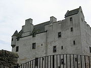
, Dirleton CastleDirleton CastleDirleton Castle is a medieval fortress in the village of Dirleton, East Lothian, Scotland. It lies around west of North Berwick, and around east of Edinburgh...
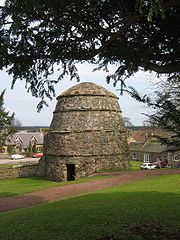
and Dirleton Parish ChurchDirleton Parish ChurchDirleton Parish Church is situated to the north of the village green in the picturesque village of Dirleton in East Lothian, Scotland. Dirleton villlage lies on the south shore of the Firth of Forth 21 miles east of Edinburgh and two miles west of North Berwick on the A198 road. The church is at .-... - Dolphinstone Castle ruin
- Donolly Reservoir
- Doonhill Homestead
- DremDremDrem is a small village in East Lothian, Scotland. It is approximately 20 miles east of Edinburgh and is close to Haddington , North Berwick , Dirleton and Gullane ....
- Drummore House (or Drummhor) at PrestongrangePrestongrangePrestongrange is a place in East Lothian, Scotland, UK, situated between Musselburgh to the west, and Prestonpans in the east.The placename derives from "Preston", meaning "priest's town", and a grange which was worked by the Cistercian monks of Newbattle Abbey.In the 16th century the Morison...
- DunbarDunbarDunbar is a town in East Lothian on the southeast coast of Scotland, approximately 28 miles east of Edinburgh and 28 miles from the English Border at Berwick-upon-Tweed....
, Battle of DunbarBattle of Dunbar (1296)The Battle of Dunbar was the only significant field action in the campaign of 1296. King Edward I of England had invaded Scotland in 1296 to punish King John Balliol for his refusal to support English military action in France.-Background:...
, Dunbar Priory, John Muir's BirthplaceJohn Muir's BirthplaceJohn Muir's Birthplace, in Dunbar, East Lothian, Scotland, is a museum run by East Lothian Council Museums Service as a centre for study and interpretation of the work of John Muir.-History:...
, Dunbar Collegiate ChurchDunbar Collegiate Churchthumb|right|Dunbar Parish Church - The successor to Dunbar Collegiate ChurchDunbar Collegiate Church is renowned as having been the first collegiate church, in 1342, to have been established in the Lothians... - DunglassDunglassDunglass is a location in East Lothian, Scotland, lying east of the Lammermuir Hills on the North Sea coast. It has a 15th century Dunglass Collegiate Church, now in the care of Historic Scotland...
, Dunglass Viaduct, Dunglass Collegiate Church, East LothianDunglass Collegiate Church, East LothianDunglass Collegiate Church is situated in south-east East Lothian just off the old A1 highway, one mile north of Cockburnspath in Berwickshire, Scotland, UK.-History:...
E
- East Links Family Park
- East Fenton
- East FortuneEast FortuneEast Fortune is a village in East Lothian, Scotland, located 2 miles north west of East Linton. The area is known for its airfield which was constructed in 1915 to help protect Britain from attack by German Zeppelin airships during the First World War. The RNAS airship station also included an...
, see also Museum of FlightMuseum of FlightThe Museum of Flight is a private non-profit air and space museum at King County International Airport , south of downtown Seattle, Washington. It was established in 1965 and is fully accredited by the American Association of Museums... - East LintonEast LintonEast Linton is a town in East Lothian, Scotland, situated on the River Tyne and A199 road five miles east of Haddington, with a population of 1,774...
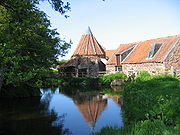
- see Preston MillPreston MillPreston Mill is a watermill on the River Tyne at the eastern edge of East Linton on the B1407 Preston Road, in East Lothian, Scotland, UK. It is situated close to Prestonkirk Parish Church, the Smeaton Hepburn Estate, Smeaton Lake, and Phantassie Doocot....
, Prestonkirk Parish ChurchPrestonkirk Parish ChurchPrestonkirk Parish Church is a Church of Scotland parish church at East Linton, in the parish of Traprain, East Lothian, Scotland, UK, close to Preston Mill, Smeaton, Phantassie, and the River Tyne.-Building:...
, PhantassiePhantassiePhantassie is an agricultural hamlet near East Linton, East Lothian, Scotland. It is close to the River Tyne, Preston Mill, and Prestonkirk Parish Church....
, Phantassie Doocot - East Lothian Yacht ClubEast Lothian Yacht ClubThe East Lothian Yacht Club or ELYC is based at the harbour in North Berwick, East Lothian, Scotland. It was founded in 1928 and moved from its temporary base at the Fishermans Hall to the current building in 1931, since which time various expansions and redevelopments have taken place. Some of the...
at North BerwickNorth BerwickThe Royal Burgh of North Berwick is a seaside town in East Lothian, Scotland. It is situated on the south shore of the Firth of Forth, approximately 25 miles east of Edinburgh. North Berwick became a fashionable holiday resort in the 19th century because of its two sandy bays, the East Bay and the...
harbour - East SaltounEast Saltoun and West SaltounEast Saltoun and West Saltoun are separate villages in East Lothian, Scotland, about 5 miles south-west of Haddington and 20 miles east of Edinburgh.- Geography :...
- see also Saltoun Parish ChurchSaltoun Parish ChurchSaltoun Parish Church is a church in East Saltoun, East Lothian, Scotland. It is part of the Church of Scotland, and serves the parish of Bolton and Saltoun, which includes the villages of Bolton, East Saltoun and West Saltoun.... - ElphinstoneElphinstone, East LothianElphinstone is a village in East Lothian, Scotland, UK.It lies two miles south-west of Tranent on the B6414, and one mile north-west of Ormiston....
, Elphinstone Tower - Elvingston
- Eskmills in MusselburghMusselburghMusselburgh is the largest settlement in East Lothian, Scotland, on the coast of the Firth of Forth, six miles east of Edinburgh city centre.-History:...
- EyebroughyEyebroughyEyebroughy is an islet in the Firth of Forth, 200 m off East Lothian, Scotland. It is not far from Gullane and 3 miles from North Berwick, and forms part of the parish of Dirleton ....
- see also Ibris
F
- Fa'side CastleFa'side CastleFa'side Castle, sometimes known as Fawside, Falside, Ffauside, Fauxside, or Fawsyde, is a 15th-century keep located in East Lothian, approximately southwest of Tranent, and southeast of Musselburgh...
or Fawside Castle, at Fa'side - Fenton Barns, Fenton Tower, also East Fenton and West Fenton
- FidraFidraFidra is an uninhabited island in the Firth of Forth, north-west of North Berwick, on the east coast of Scotland.-Geography:...
island - Firth of Forth Islands Special Protection AreaSpecial Protection AreaA Special Protection Area or SPA is a designation under the European Union Directive on the Conservation of Wild Birds.Under the Directive, Member States of the European Union have a duty to safeguard the habitats of migratory birds and certain particularly threatened birds.Together with Special...
(SPA) - see Islands of the ForthIslands of the ForthThe Islands of the Forth are a minor island group to the east of Scotland. The open waters of the Firth of Forth lie between Fife and the Lothians and contain most of the islands. The majority lie east of city of Edinburgh although two are to the west and two more lie in the estuary of the River... - FisherrowFisherrowFisherrow is a harbour and former fishing village at Musselburgh, East Lothian, Scotland, UK, to the east of Portobello and Joppa, and on the left bank of the River Esk.-History:...
harbour, west of MusselburghMusselburghMusselburgh is the largest settlement in East Lothian, Scotland, on the coast of the Firth of Forth, six miles east of Edinburgh city centre.-History:... - Flag Heritage Centre at AthelstanefordAthelstanefordAthelstaneford is a village in East Lothian, Scotland. It is close to the town of Haddington and lies approximately 20 miles east of Edinburgh. The village is also known locally as Elshingford....
- Fountainhall historic houseHistoric houseA historic house can be a stately home, the birthplace of a famous person, or a house with an interesting history or architecture.- Background :...
, see: PencaitlandPencaitlandPencaitland is a village in East Lothian, Scotland, about south-east of Edinburgh, south-west of Haddington, and east of Ormiston.The land where the village lies is said to have been granted by William the Lion to Calum Cormack in 1169, who gave the church, with the tithes and other property...
G
- Gamelshiel CastleGamelshiel CastleGamelshiel Castle is a ruined castle in the Lammermuir Hills, East Lothian, Scotland. It is located at grid reference , half a mile north-east of the northern end of Whiteadder Reservoir, near to the B6355 and Whiteadder Water....
near Whiteadder ReservoirWhiteadder ReservoirWhiteadder Reservoir is a reservoir in East Lothian, Scotland, UK, in the Lammermuir Hills, north west of Duns in the Scottish Borders, and five miles south east of Garvald.... - Garleton Monument, Garleton, Garleton CastleGarleton CastleGarleton Castle is a courtyard castle, dating from the sixteenth century, about north of Haddington, just north of the Garleton Hills in East Lothian, Scotland.-Structure:...
, Garleton hillsGarleton HillsThe Garleton Hills, in East Lothian, Scotland, are a range of igneous hills, to the north of Haddington, formed largely from Carboniferous tuffs and trachytic lavas. Although the highest point is only , the hills are conspicuous throughout the county... - GarvaldGarvald, East LothianGarvald, is a village south of Haddington in East Lothian, Scotland. The combined parish of Garvald and Bara, borders Whittingehame to the East, Morham to the North, Yester to the West, and Lauder to the South. It is mainly an agricultural parish...
, see Nunraw - GiffordGifford, East LothianGifford is a village in the parish of Yester in East Lothian, Scotland. It lies approximately 4 miles south of Haddington and 25 miles east of Edinburgh.-History:...
- Gilchriston
- GladsmuirGladsmuirGladsmuir is a village and parish in East Lothian, Scotland, situated on the A199 and near Tranent and Prestonpans.-Description:The name Gladsmuir stems from the Scots word Gled, meaning a bird of prey, , combined with Muir; the Scots form of Moor...
- GlenkinchieGlenkinchieGlenkinchie is a Scotch single malt whisky, produced at the Glenkinchie Distillery in East Lothian, Scotland. It is one of only three remaining Lowland malt whiskies in production.- The Distillery:...
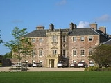
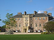
Distillery - Gosford HouseGosford HouseGosford House is the family seat of the Charteris family and is situated near Longniddry in East Lothian, Scotland. It was recently the home of the late Rt. Hon. David Charteris, 12th Earl of Wemyss and 8th Earl of March, chief of the name and arms of Charteris.Gosford was built by the 7th Earl of...
, Gosford Estate, Gosford Bay, Gosford Sands - GullaneGullaneGullane is a town on the southern shore of the Firth of Forth in East Lothian on the east coast of Scotland. There has been a church in the village since the 9th century. The ruins of the Old Church of St...
, Gullane Bents, Gullane railway stationGullane railway stationGullane railway station served the village of Gullane in Scotland. It was served by the Aberlady, Gullane and North Berwick railway. This line diverged from the North British Main Line at Aberlady Junction, east of the current Longniddry station.-History:...
H
- HaddingtonHaddington, East LothianThe Royal Burgh of Haddington is a town in East Lothian, Scotland. It is the main administrative, cultural and geographical centre for East Lothian, which was known officially as Haddingtonshire before 1921. It lies about east of Edinburgh. The name Haddington is Anglo-Saxon, dating from the 6th...
, the administrative centre for East Lothian - Hailes CastleHailes CastleHailes Castle is a mainly 14th century castle about a mile and a half south west of East Linton, East Lothian, Scotland. This castle, which has a fine riverside setting, belonged to the Hepburn family during the most important centuries of its existence....
- Halls, East Lothian
- Hamilton HouseHamilton House, East LothianHamilton House is a historic house in the village of Preston in East Lothian, Scotland, UK. It is situated very close to its neighbouring communities of Prestonpans and Prestongrange.-History:...
near Preston TowerPreston TowerPreston Tower is a ruined L-plan keep in the ancient village of Prestonpans. It is situated within a few metres from two other historic houses, Hamilton House and Northfield House.... - Heritage of Golf Museum
- Hopetoun MonumentHopetoun MonumentThe Hopetoun Monument is a monument in the Garleton Hills, near Camptoun, East Lothian, Scotland. It is tall. Situated on Byres Hill near Haddington, the monument was erected in 1824 in memory of John Hope, 4th Earl of Hopetoun . The foundation stone was laid on May 3, 1824...
- see also Chesters Hill FortChesters Hill FortChesters Hill Fort is an Iron Age hill fort in East Lothian, Scotland. It lies one mile south of Drem, 1.5 miles east of Ballencrieff Castle, 2.5 miles north of Haddington, and 2 miles west of Athelstaneford... - HumbieHumbieHumbie is a hamlet and rural parish in East Lothian, Scotland. It lies in the south-west of the county, approximately 10 miles south-west of Haddington and 15 miles south-east of Edinburgh. Humbie as we know it today was formed as the result of the union between Keith Marischal and Keith Hundeby in...
, Humbie Parish ChurchHumbie Parish ChurchHumbie Parish Church is a church in the small village of Humbie, East Lothian, Scotland. It is part of the Church of Scotland, and is a linked charge which joins the parishes of Bolton & Saltoun, Yester and Humbie....
, and Humbie Water - Hume CastleHume CastleHume Castle is the heavily modified remnants of a late 12th or early 13th century "Castle of enceinte".The village of Hume is located between Greenlaw and Kelso, two miles north of the village of Stichill, in Berwickshire, Scotland....
I
- Ibris, an island, also known as EyebroughyEyebroughyEyebroughy is an islet in the Firth of Forth, 200 m off East Lothian, Scotland. It is not far from Gullane and 3 miles from North Berwick, and forms part of the parish of Dirleton ....
- InnerwickInnerwickInnerwick is a coastal civil parish and small village, which lies in the east of East Lothian, from Dunbar and approximately from Edinburgh....
, Innerwick CastleInnerwick CastleInnerwick Castle is a ruined castle in East Lothian, Scotland, near the village of Innerwick, from Dunbar, on the Thornton Burn, and overlooking Thornton Glen.... - InvereskInvereskInveresk is a civil parish and was formerly a village that now forms the southern part of Musselburgh. It is situated on slightly elevated ground at the south of Musselburgh in East Lothian, Scotland...
, Inveresk Lodge GardenInveresk Lodge GardenInveresk Lodge Garden is a garden in the care of the National Trust for Scotland, in the village of Inveresk, East Lothian, Scotland, UK, south of Musselburgh.-History:...
- (NTSNational Trust for ScotlandThe National Trust for Scotland for Places of Historic Interest or Natural Beauty, commonly known as the National Trust for Scotland describes itself as the conservation charity that protects and promotes Scotland's natural and cultural heritage for present and future generations to...
)
J
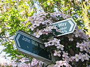
- John Muir Country ParkJohn Muir Country ParkThe John Muir Country Park is an area of woodland, grassland and coastline near Dunbar in East Lothian, Scotland. It is named after John Muir, a famous naturalist and geologist who was born in Dunbar and later emigrated to the USA where he developed his ideas....
- John Muir's BirthplaceJohn Muir's BirthplaceJohn Muir's Birthplace, in Dunbar, East Lothian, Scotland, is a museum run by East Lothian Council Museums Service as a centre for study and interpretation of the work of John Muir.-History:...
- John Muir WayJohn Muir WayThe John Muir Way is a continuous coastal path in East Lothian, Scotland, UK. It is named in honour of the Scottish 19th-century conservationist John Muir, who was born at Dunbar, East Lothian, in 1838 and became a founder of America's national park system...
- Johnscleugh, Lammermuir HillsLammermuir HillsThe Lammermuir Hills, usually simply called the Lammermuirs , in southern Scotland, form a natural boundary between Lothian and the Scottish Borders....
K
- Keith MarischalKeith MarischalKeith Marischal is a Scottish Baronial Country house lying in the parish of Humbie, East Lothian, Scotland. The original building was an "L-shaped" Tower house, built long before 1589 when it was extended into a "U-shaped" courtyard house. In the nineteenth century the courtyard was filled in...
- Kilspindie, East Lothian, Kilspindie CastleKilspindie CastleKilspindie Castle is located to the north of the village of Aberlady, in East Lothian, Scotland. The remains of the castle are sited behind the Victorian St Mary's Kirk. An early castle was destroyed in the 16th century, and the rebuilt tower was pulled down by the 1700s...
- KingstonKingston, East LothianKingston is a small hamlet near North Berwick in East Lothian, Scotland.- Fenton Tower :Fenton Tower in Kingston is a refurbished 16th century tower house. Fenton Tower was used as the location for Archie's castle in the BBC children's programme "Balamory." - External links :* official site...
L
- LambThe Lamb (island)The Lamb, sometimes called Lamb Island or just Lamb, is a small , uninhabited island between the islands of Fidra and Craigleith in the Firth of Forth, off the south-east coast of Scotland...
- Lammermuir HillsLammermuir HillsThe Lammermuir Hills, usually simply called the Lammermuirs , in southern Scotland, form a natural boundary between Lothian and the Scottish Borders....
- Lammer Law and Meikle Says Law - Lamp of Lothian Collegiate Centre
- Lennoxlove HouseLennoxlove HouseLennoxlove House is a historic house set in woodlands half a mile south of Haddington in East Lothian, Scotland. The house comprises a 15th-century tower, originally known as Lethington, and has been extended several times, principally in the 17th, 19th and 20th centuries...
- Levenhall LinksLevenhall LinksLevenhall Links is a coastal, industrial, and recreational area at Musselburgh, East Lothian, Scotland, UK; it is adjacent to Musselburgh Racecourse, Morrison's Haven and Prestongrange Industrial Heritage Museum....
- Lewisvale Park
- Lochend Wood
- Long Newton
- LongniddryLongniddryLongniddry is a village in East Lothian, Scotland, with a population of 2,613 .Longniddry is primarily a dormitory village for commuters to Edinburgh, with good transport links by road and rail to the capital...
, Longniddry BentsLongniddry BentsLongniddry Bents is a beach just north of Longniddry in East Lothian, Scotland.The beach is almost 2 miles in length, which includes Gosford Bay to the east side, and the rockier Seton Sands to the west. Along the beach are the remains of a wall of concrete tank traps erected during World War II as...
, Longniddry railway stationLongniddry railway stationLongniddry railway station is located at the southeast corner of the village of Longniddry, East Lothian, Scotland. The station is on the East Coast Main Line 21 km east of Edinburgh Waverley, and is served by stopping passenger trains on the North Berwick Line.-History:The main line between...
, Longniddry Primary School - Longyester
- Loretto SchoolLoretto SchoolLoretto School is an independent school in Scotland, founded in 1827. The campus occupies in Musselburgh, near Edinburgh.-History:Loretto was founded by the Reverend Thomas Langhorne in 1827. Langhorne came from Crosby Ravensworth, near Kirkby Stephen. The school was later taken over by his son,...
, MusselburghMusselburghMusselburgh is the largest settlement in East Lothian, Scotland, on the coast of the Firth of Forth, six miles east of Edinburgh city centre.-History:... - LuffnessLuffnessLuffness is a hamlet in East Lothian, Scotland. It lies between the towns of Gullane and Aberlady and is approximately 20 miles east of Edinburgh....
, Luffness CastleLuffness CastleLuffness Castle, sometimes known as Luffness House or Aberlady Castle, is a castle of 13th century origin in Luffness, not far from Aberlady, in East Lothian, Scotland...
, Luffness Friary - LuggateLuggateLuggate is a small township in the South Island of New Zealand. It is located on State Highway 6 between Wanaka and Cromwell, near the junction with State Highway 8A, approximately 15 km from the Wanaka township, just past Wanaka Airport....
, Luggateburn
M
- MacmerryMacmerryMacmerry is a large village located on the old A1 just east of Tranent.The village has a primary school with a roll of around 100.There is an industrial estate to the east of the town...
- Markle
- Meadowmill, part of Battle of PrestonpansBattle of PrestonpansThe Battle of Prestonpans was the first significant conflict in the Jacobite Rising of 1745. The battle took place at 4 am on 21 September 1745. The Jacobite army loyal to James Francis Edward Stuart and led by his son Charles Edward Stuart defeated the government army loyal to the Hanoverian...
site - MorhamMorhamMorham, East Lothian, sometimes spelt Moram, Morum, Morhame, etc., in old records, is the smallest parish in Scotland, sandwiched between five other parishes: Haddington, Garvald, Yester, Whittingehame, and Prestonkirk, in the undulating lower reaches of the Lammermuir Hills.-Church and hamlet:For...
- Morrison's HavenMorrison's HavenMorrison's Haven is a harbour at Prestongrange, East Lothian, Scotland, UK, on the B1348, close to Levenhall Links, Prestongrange Industrial Heritage Museum, Prestonpans, and Prestongrange House.-History:...
at Prestongrange Industrial Heritage MuseumPrestongrange Industrial Heritage MuseumThe Prestongrange Industrial Heritage Museum is an industrial heritage museum at Prestongrange between Musselburgh and Prestonpans on the B1348 on the East Lothian coast, Scotland UK.... - Muirfield golf courseGolf courseA golf course comprises a series of holes, each consisting of a teeing ground, fairway, rough and other hazards, and a green with a flagstick and cup, all designed for the game of golf. A standard round of golf consists of playing 18 holes, thus most golf courses have this number of holes...
- Museum of FlightMuseum of FlightThe Museum of Flight is a private non-profit air and space museum at King County International Airport , south of downtown Seattle, Washington. It was established in 1965 and is fully accredited by the American Association of Museums...
- MusselburghMusselburghMusselburgh is the largest settlement in East Lothian, Scotland, on the coast of the Firth of Forth, six miles east of Edinburgh city centre.-History:...
, Musselburgh Cricket Club, Musselburgh LinksMusselburgh LinksMusselburgh Links in Musselburgh, East Lothian, Scotland, is generally recognised as the oldest golf course in the world, and the oldest on which play has been continuous...
, Musselburgh RacecourseMusselburgh RacecourseMusselburgh Racecourse, known until the 1990s as Edinburgh Racecourse, is a horse racing venue located in the Millhill area of Musselburgh, East Lothian, Scotland, UK, close to the River Esk....
, Musselburgh railway stationMusselburgh railway stationMusselburgh railway station is a railway station serving the town of Musselburgh, East Lothian near Edinburgh in Scotland. It was opened in 1988 and is located on the North Berwick Line, 8 km east of... - Myreton Motor MuseumMyreton Motor MuseumThe Myreton Motor Museum is a museum located near the village of Aberlady, East Lothian, Scotland, which has a motoring history collection which covers most of the twentieth century.- Collection :...
N
- National Flag Heritage Centre, AthelstanefordAthelstanefordAthelstaneford is a village in East Lothian, Scotland. It is close to the town of Haddington and lies approximately 20 miles east of Edinburgh. The village is also known locally as Elshingford....
- New Hailes
- New Winton
- Newbyth and Newbyth House
- North BerwickNorth BerwickThe Royal Burgh of North Berwick is a seaside town in East Lothian, Scotland. It is situated on the south shore of the Firth of Forth, approximately 25 miles east of Edinburgh. North Berwick became a fashionable holiday resort in the 19th century because of its two sandy bays, the East Bay and the...
, North Berwick HarbourNorth Berwick HarbourThe Harbour at North Berwick in East Lothian, Scotland, was originally a ferry port for pilgrims travelling to St. Andrews in Fife. Today the water is home to leisure craft, a famous tourist launch and the remains of the fishing fleet that once dominated the area, while on dry land the Scottish...
, North Berwick LawNorth Berwick LawNorth Berwick Law is a conical hill which rises incongruously from the surrounding landscape . It overlooks the East Lothian town of North Berwick and stands at 613 ft above sea level.Geologically, the law is a volcanic plug of hard phonolitic trachyte rock of Carboniferous age...
, North Berwick LineNorth Berwick LineThe North Berwick Line is a railway line linking Edinburgh with North Berwick in Scotland. The route follows the East Coast Main Line as far as Drem where it then branches to the north....
, North Berwick Museum, North Berwick Priory - North Berwick Golf ClubNorth Berwick Golf ClubThe North Berwick Golf Club , at North Berwick, East Lothian, was founded in 1832. It is the 13th oldest golf club in the world and only St Andrews hosts a club which has played continuously over the same course for longer. Although the NBGC was the first club in the world to allow female members,...
, North Berwick West LinksNorth Berwick West LinksOne of two golf courses within North Berwick, the West Links is by far the more renowned. It regularly holds various championships and is used as a qualifying venue when The Open Championship is held at Muirfield... - Northfield House, East LothianNorthfield House, East LothianNorthfield House is a seventeenth century historic house at Preston, East Lothian, Scotland, UK. It is situated very close to Hamilton House and Preston Tower, and one mile east to Prestongrange House and the Royal Musselburgh Golf Club....
at PrestonPreston, East LothianPreston is a village on the East Lothian coast of Scotland, to the south of Prestonpans, the east of Prestongrange, and the southwest of Cockenzie and Port Seton....
and PrestongrangePrestongrangePrestongrange is a place in East Lothian, Scotland, UK, situated between Musselburgh to the west, and Prestonpans in the east.The placename derives from "Preston", meaning "priest's town", and a grange which was worked by the Cistercian monks of Newbattle Abbey.In the 16th century the Morison... - Nunraw Abbey is the guest house and conference centre belonging to Sancta Maria Abbey, NunrawSancta Maria Abbey, NunrawNunraw Abbey or Sancta Maria Abbey, Nunraw is a working Trappist monastery. It was the first Cistercian house to be founded in Scotland since the Reformation.Founded in 1946 by monks from Mount St...
P
- Papana Water
- Papple
- PeastonPeastonPeaston is a small settlement on the B6371 in the parish of Ormiston in East Lothian, Scotland, about south-east of Edinburgh, south-west of Haddington, east of Ormiston and east of Pencaitland....
- Peffer Burn
- PencaitlandPencaitlandPencaitland is a village in East Lothian, Scotland, about south-east of Edinburgh, south-west of Haddington, and east of Ormiston.The land where the village lies is said to have been granted by William the Lion to Calum Cormack in 1169, who gave the church, with the tithes and other property...
- Pencraig Brae
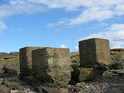
- PhantassiePhantassiePhantassie is an agricultural hamlet near East Linton, East Lothian, Scotland. It is close to the River Tyne, Preston Mill, and Prestonkirk Parish Church....
and Phantassie Doocot, see also Preston MillPreston MillPreston Mill is a watermill on the River Tyne at the eastern edge of East Linton on the B1407 Preston Road, in East Lothian, Scotland, UK. It is situated close to Prestonkirk Parish Church, the Smeaton Hepburn Estate, Smeaton Lake, and Phantassie Doocot.... - Pitcox
- Poldrate Mill
- Port Seton, see also Cockenzie
- Preston, East LothianPreston, East LothianPreston is a village on the East Lothian coast of Scotland, to the south of Prestonpans, the east of Prestongrange, and the southwest of Cockenzie and Port Seton....
- Preston House, East Lothian
- Preston MillPreston MillPreston Mill is a watermill on the River Tyne at the eastern edge of East Linton on the B1407 Preston Road, in East Lothian, Scotland, UK. It is situated close to Prestonkirk Parish Church, the Smeaton Hepburn Estate, Smeaton Lake, and Phantassie Doocot....
at East LintonEast LintonEast Linton is a town in East Lothian, Scotland, situated on the River Tyne and A199 road five miles east of Haddington, with a population of 1,774...
- see also Phantassie Doocot - Preston TowerPreston TowerPreston Tower is a ruined L-plan keep in the ancient village of Prestonpans. It is situated within a few metres from two other historic houses, Hamilton House and Northfield House....
in Preston, East LothianPreston, East LothianPreston is a village on the East Lothian coast of Scotland, to the south of Prestonpans, the east of Prestongrange, and the southwest of Cockenzie and Port Seton....
near PrestonpansPrestonpansPrestonpans is a small town to the east of Edinburgh, Scotland, in the unitary council area of East Lothian. It has a population of 7,153 . It is the site of the 1745 Battle of Prestonpans, and has a history dating back to the 11th century... - Prestongrange Colliery - see also Matthias DunnMatthias DunnMatthias Dunn was an Inspector of Mines in the North-east of England, United Kingdom during the 19th century. He lived at Stella Hall, Newcastle-on-Tyne, and owned a quarter share in the Stargate Pit which was the site of the Stargate Pit Explosion of 1826.In 1830 he sunk a new shaft, the "Great...
- Prestongrange HousePrestongrange HousePrestongrange House is a historic house at Prestongrange near Prestonpans, East Lothian, Scotland, UK. It is situated near to two other historic houses, Hamilton House and Northfield House....
, now Royal Musselburgh Golf ClubRoyal Musselburgh Golf ClubThe Royal Musselburgh Golf Club is a golf club at Prestongrange House, Prestongrange near Prestonpans, East Lothian, Scotland, on the B1361.Between 1774 and 1926, the club was based at Levenhall Links, Musselburgh.-History:... - Prestongrange Industrial Heritage MuseumPrestongrange Industrial Heritage MuseumThe Prestongrange Industrial Heritage Museum is an industrial heritage museum at Prestongrange between Musselburgh and Prestonpans on the B1348 on the East Lothian coast, Scotland UK....
at Prestongrange - Prestongrange Parish ChurchPrestongrange Parish ChurchPrestongrange Parish Church is a Church of Scotland kirk situated in the small, former mining town of Prestonpans in East Lothian. The church was built in 1596, one of the first churches to be built in Scotland following the Scottish Reformation in 1560...
at Prestonpans - Prestonkirk Parish ChurchPrestonkirk Parish ChurchPrestonkirk Parish Church is a Church of Scotland parish church at East Linton, in the parish of Traprain, East Lothian, Scotland, UK, close to Preston Mill, Smeaton, Phantassie, and the River Tyne.-Building:...
and Prestonkirk House at East LintonEast LintonEast Linton is a town in East Lothian, Scotland, situated on the River Tyne and A199 road five miles east of Haddington, with a population of 1,774... - PrestonpansPrestonpansPrestonpans is a small town to the east of Edinburgh, Scotland, in the unitary council area of East Lothian. It has a population of 7,153 . It is the site of the 1745 Battle of Prestonpans, and has a history dating back to the 11th century...
, Prestonpans TapestryPrestonpans TapestryThe Prestonpans Tapestry is a large embroidery created - and normally situated in - Prestonpans, East Lothian, Scotland.Its full title is "The Battle of Prestonpans Tapestry 1754"....
R
- Ravensheugh Sands
- Redhouse CastleRedhouse CastleRedhouse Castle is a ruined tower house castle, 2 km east of Longniddry, East Lothian, Scotland, UK, on the B1377, close to Spittal. The castle is protected as a category A listed building, and as a scheduled monument.-History:...
- River EskRiver Esk, LothianThe River Esk is a river which flows through Midlothian and East Lothian, Scotland.It initially runs as two separate rivers, the North Esk and the South Esk....
- River TyneRiver Tyne, ScotlandThe River Tyne is a river in Scotland, UK. It rises in the Moorfoot Hills in Midlothian near Tynehead to the south of Edinburgh, at the junction of the B6458 and the B6367. It continues for approx...
- Royal Musselburgh Golf ClubRoyal Musselburgh Golf ClubThe Royal Musselburgh Golf Club is a golf club at Prestongrange House, Prestongrange near Prestonpans, East Lothian, Scotland, on the B1361.Between 1774 and 1926, the club was based at Levenhall Links, Musselburgh.-History:...
at Prestongrange HousePrestongrange HousePrestongrange House is a historic house at Prestongrange near Prestonpans, East Lothian, Scotland, UK. It is situated near to two other historic houses, Hamilton House and Northfield House....
S
- Saltcoats CastleSaltcoats CastleSaltcoats Castle is a courtyard castle dating from the sixteenth century, about south of Gullane in East Lothian, Scotland.-History:Saltcoats Castle was a property of the Livingstones. Thereafter it passed to the Hamiltons of Pencaitland in the 18th century. It was occupied until after 1800, but...
- Saltoun HallSaltoun HallSaltoun Hall is an historic house standing in extensive lands off the B6355, Pencaitland to East Saltoun road, about 1.5 miles from each village, in East Lothian, Scotland...
, Saltoun Big Wood, Saltoun Parish ChurchSaltoun Parish ChurchSaltoun Parish Church is a church in East Saltoun, East Lothian, Scotland. It is part of the Church of Scotland, and serves the parish of Bolton and Saltoun, which includes the villages of Bolton, East Saltoun and West Saltoun.... - Samuelston
- Sancta Maria Abbey, NunrawSancta Maria Abbey, NunrawNunraw Abbey or Sancta Maria Abbey, Nunraw is a working Trappist monastery. It was the first Cistercian house to be founded in Scotland since the Reformation.Founded in 1946 by monks from Mount St...
(monastery). Nunraw Abbey is the guest house and conference centre for Sancta Maria Abbey - Scottish Flag Heritage Centre
- Scottish Seabird CentreScottish Seabird CentreThe Scottish Seabird Centre is a visitor attraction in North Berwick, East Lothian, Scotland. Opened by HRH The Prince of Wales in 2000 and funded by the Millennium Commission, the showpiece of the centre is the network of cameras which beam back live pictures from the bird colonies on islands such...
at North Berwick HarbourNorth Berwick HarbourThe Harbour at North Berwick in East Lothian, Scotland, was originally a ferry port for pilgrims travelling to St. Andrews in Fife. Today the water is home to leisure craft, a famous tourist launch and the remains of the fishing fleet that once dominated the area, while on dry land the Scottish...
, North BerwickNorth BerwickThe Royal Burgh of North Berwick is a seaside town in East Lothian, Scotland. It is situated on the south shore of the Firth of Forth, approximately 25 miles east of Edinburgh. North Berwick became a fashionable holiday resort in the 19th century because of its two sandy bays, the East Bay and the... - Scoughall
- SeacliffSeacliffSeacliff comprises a beach, an estate and a harbour. It lies 4 miles east of North Berwick, East Lothian, Scotland.- History :The beach and estate command a strategic position at the mouth of the Firth of Forth, and control of the area has been contested through the ages...
Beach - Seton Collegiate ChurchSeton Collegiate ChurchSeton Collegiate Church, known locally as Seton Chapel, is a collegiate church south of Port Seton, East Lothian, Scotland. It is adjacent to Seton House.-Description:...
, Seton SandsSeton SandsSeton Sands is a rocky beach to the east of Port Seton, East Lothian, Scotland. It is situated at the western end of Longniddry Bents and is part of the John Muir Way coastal walk....
, Seton House, Port Seton - Skateraw
- SmeatonSmeaton, East LothianSmeaton is a village and country estate in East Lothian, Scotland. It is off the B1407, near East Linton, and very close to Prestonkirk Parish Church as well as the National Trust for Scotland properties Preston Mill and Phantassie Doocot.-The Estate:...
with Smeaton Lake - SpittalSpittal, East LothianSpittal is a hamlet or small village in East Lothian, Scotland, UK, on the B1377, east of Longniddry, south-south-west of Aberlady and to the west of Garleton and north of Gladsmuir...
- Spott, East LothianSpott, East LothianSpott is a small village on the eastern fringes of East Lothian in Scotland, just over south-west of Dunbar. The village straddles an unclassified road leading from the main A1 highway at .- History :...
- St. Baldred's Cradle
- StentonStentonStenton is a parish and village in East Lothian, Scotland. It is bounded on the north by parts of the parishes of Prestonkirk and Dunbar, on the east by Spott and on the west by Whittingehame. The name is said to be of Saxon derivation. In earlier times, when names were often written phonetically,...
- Stoneypath TowerStoneypath TowerStoneypath Tower, is an L-plan tower house dating from the late sixteenth, about south of East Linton, and east of the Whittinghame Water in East Lothian, Scotland.-History:...
T
- Tantallon CastleTantallon CastleTantallon Castle is a mid-14th-century fortress, located east of North Berwick, in East Lothian, Scotland. It sits atop a promontory opposite the Bass Rock, looking out onto the Firth of Forth...
- Thornton Castle near Innerwick CastleInnerwick CastleInnerwick Castle is a ruined castle in East Lothian, Scotland, near the village of Innerwick, from Dunbar, on the Thornton Burn, and overlooking Thornton Glen....
- Thorntonloch
- Thurston Manor
- Torness nuclear power stationTorness nuclear power stationTorness nuclear power station was the last of the United Kingdom's second generation nuclear power plants to be commissioned. Construction of this facility began in 1980 for the then South of Scotland Electricity Board and it was commissioned in 1988...
, see also Cockenzie Power StationCockenzie power stationCockenzie power station is a coal-fired power station in East Lothian, Scotland, capable of co-firing biomass. It is situated on the south shore of the Firth of Forth, near the town of Cockenzie and Port Seton, east of the Scottish capital of Edinburgh. The station has dominated the local... - TranentTranentTranent is a town in East Lothian, Scotland. It is close to the A1 road and approximately east of Edinburgh. It is one of the oldest towns in East Lothian, and built on a gentle slope, about 300 feet above sea level.Population of the town is 9,917....
, Tranent to Cockenzie WaggonwayTranent to Cockenzie WaggonwayThe Tranent to Cockenzie Waggonway was the first railway in Scotland, opened in 1722. It was 2½ miles long and connected two towns in East Lothian, transporting coal from the pit heads at Tranent to Cockenzie harbour via Meadowmill. Horse drawn wagons were used which held 2 tons of coal...
, Tranent Parish ChurchTranent Parish ChurchTranent Parish Church is a kirk belonging to the Church of Scotland. It is situated in the East Lothian town of Tranent south-east of Edinburgh... - Traprain LawTraprain LawTraprain Law is a hill about 221m in elevation, located east of Haddington in East Lothian, Scotland. It is the site of an oppidum or hill fort, which covered at its maximum extent about 16 ha and must have been a veritable town...
hill fortHill fortA hill fort is a type of earthworks used as a fortified refuge or defended settlement, located to exploit a rise in elevation for defensive advantage. They are typically European and of the Bronze and Iron Ages. Some were used in the post-Roman period...
; see also Chesters Hill FortChesters Hill FortChesters Hill Fort is an Iron Age hill fort in East Lothian, Scotland. It lies one mile south of Drem, 1.5 miles east of Ballencrieff Castle, 2.5 miles north of Haddington, and 2 miles west of Athelstaneford... - Tyne Mouth
- Tyninghame
W
- WallyfordWallyfordWallyford is a village in East Lothian, Scotland. It is close to the larger town of Musselburgh and approximately 7 miles east of Edinburgh.-Amenities:...
- Waterston House at AberladyAberladyAberlady is a coastal village in the Scottish council area of East Lothian. On Aberlady Bay, it is five miles northwest of Haddington and approximately 18 miles east of Edinburgh, to which it is linked by the A198 Dunbar - Edinburgh road.Aberlady Parish Church dates back to the 15th century. It...
, Headquarters of the Scottish Ornithologists' ClubScottish Ornithologists' ClubThe Scottish Ornithologists' Club is a Scottish ornithological body, founded in March 1936 at the premises of the Royal Scottish Geographical Society. As of 2008, the SOC has 2,200 members. The Club runs the Scottish Birds Records Committee, which maintains a list of birds recorded in Scotland... - Waughton CastleWaughton CastleWaughton Castle is a ruined castle, dating from the fourteenth century, about north of East Linton, and west of Whitekirk in East Lothian, Scotland.-Structure:...
ruin - West BarnsWest BarnsWest Barns is a small village in East Lothian, Scotland. It lies 2 miles west of Dunbar and approximately 28 miles east of Edinburgh. It is close to the John Muir Country Park and Belhaven Bay. It is home to the West Barns Inn and a John Deere manufacturer. There is also a local amateur football...
- West Fenton
- West Pans between PrestongrangePrestongrangePrestongrange is a place in East Lothian, Scotland, UK, situated between Musselburgh to the west, and Prestonpans in the east.The placename derives from "Preston", meaning "priest's town", and a grange which was worked by the Cistercian monks of Newbattle Abbey.In the 16th century the Morison...
and MusselburghMusselburghMusselburgh is the largest settlement in East Lothian, Scotland, on the coast of the Firth of Forth, six miles east of Edinburgh city centre.-History:... - West SaltounEast Saltoun and West SaltounEast Saltoun and West Saltoun are separate villages in East Lothian, Scotland, about 5 miles south-west of Haddington and 20 miles east of Edinburgh.- Geography :...
- see also Saltoun Parish ChurchSaltoun Parish ChurchSaltoun Parish Church is a church in East Saltoun, East Lothian, Scotland. It is part of the Church of Scotland, and serves the parish of Bolton and Saltoun, which includes the villages of Bolton, East Saltoun and West Saltoun.... - Whiteadder WaterWhiteadder WaterWhiteadder Water is a river in East Lothian and Berwickshire, Scotland. It also flows for a very short distance through Northumberland before joining the River Tweed...
and Whiteadder ReservoirWhiteadder ReservoirWhiteadder Reservoir is a reservoir in East Lothian, Scotland, UK, in the Lammermuir Hills, north west of Duns in the Scottish Borders, and five miles south east of Garvald.... - White Castle, East LothianWhite Castle, East LothianWhitecastle was originally a hillfort in East Lothian, Scotland, situated on the edge of the Lammermuir Hills, two miles south of the village of Garvald, . It later formed part of a landed estate which is known today as Nunraw...
hill fortHill fortA hill fort is a type of earthworks used as a fortified refuge or defended settlement, located to exploit a rise in elevation for defensive advantage. They are typically European and of the Bronze and Iron Ages. Some were used in the post-Roman period...
in Lammermuir HillsLammermuir HillsThe Lammermuir Hills, usually simply called the Lammermuirs , in southern Scotland, form a natural boundary between Lothian and the Scottish Borders.... - WhitecraigWhitecraigWhitecraig is a village in East Lothian in Scotland. It is between Musselburgh and Dalkeith, to the east of the city of Edinburgh....
- Whitekirk
- WhittingehameWhittingehameWhittingehame is a parish with a small village in East Lothian, Scotland, about halfway between Haddington and Dunbar, and near East Linton. The area is on the slopes of the Lammermuir Hills...
, Whittinghame House, Whittinghame Water - Winton HouseWinton HouseWinton House is a historic house set in a large estate between Pencaitland and Tranent in East Lothian, Scotland. The house is situated off the B6355 road approximately north of Pencaitland at - History :...
historic houseHistoric houseA historic house can be a stately home, the birthplace of a famous person, or a house with an interesting history or architecture.- Background :...
, see: PencaitlandPencaitlandPencaitland is a village in East Lothian, Scotland, about south-east of Edinburgh, south-west of Haddington, and east of Ormiston.The land where the village lies is said to have been granted by William the Lion to Calum Cormack in 1169, who gave the church, with the tithes and other property...
Y
- YellowcraigsYellowcraigsYellowcraigs, less commonly known as Broad Sands Bay, is a coastal area of forest, beach and grassland in East Lothian, south-east Scotland. Yellowcraigs is designated as a Local Nature Reserve and a Site of Special Scientific Interest...
Nature Reserve, also known as Broad Sands Bay - Yester CastleYester CastleYester Castle is a ruined castle, located south east of the village of Gifford in East Lothian, Scotland. The only remaining structure is the subterranean Goblin Ha' or Hobgoblin Ha' ...
, Yester Parish and Yester Parish ChurchYester Parish ChurchYester Parish Church is a church of the Church of Scotland in the village of Gifford, East Lothian, Scotland. The village forms part of Yester Parish, and is a linked charge which combines the parishes of Bolton & Saltoun, and Humbie.- History and design :...
, Yester ChapelYester ChapelYester Chapel is situated on the estate of Yester House, at the south-east edge of the village of Gifford in East Lothian, Scotland. The chapel is situated at .- History :...
see also Gifford, East LothianGifford, East LothianGifford is a village in the parish of Yester in East Lothian, Scotland. It lies approximately 4 miles south of Haddington and 25 miles east of Edinburgh.-History:...
See also
- List of places in Scotland
- List of places in Midlothian
- List of places in West Lothian
- List of places in Edinburgh
- List of places in the Scottish Borders
- List of generic forms in place names in the United Kingdom and Ireland
- ToponymyToponymyToponymy is the scientific study of place names , their origins, meanings, use and typology. The word "toponymy" is derived from the Greek words tópos and ónoma . Toponymy is itself a branch of onomastics, the study of names of all kinds...
, Toponymy in Great Britain - Toponymical list of counties of the United Kingdom
- Etymological list of traditional counties of the United Kingdom
- United Nations Group of Experts on Geographical NamesUnited Nations Group of Experts on Geographical NamesThe United Nations Group of Experts on Geographical Names was set up by the Secretary General of the United Nations on April 23, 1959....