
List of bridges on the National Register of Historic Places in Minnesota
Encyclopedia
This is a list of bridge
s and tunnel
s on the National Register of Historic Places
in the U.S. state
of Minnesota
.
Bridge
A bridge is a structure built to span physical obstacles such as a body of water, valley, or road, for the purpose of providing passage over the obstacle...
s and tunnel
Tunnel
A tunnel is an underground passageway, completely enclosed except for openings for egress, commonly at each end.A tunnel may be for foot or vehicular road traffic, for rail traffic, or for a canal. Some tunnels are aqueducts to supply water for consumption or for hydroelectric stations or are sewers...
s on the National Register of Historic Places
National Register of Historic Places
The National Register of Historic Places is the United States government's official list of districts, sites, buildings, structures, and objects deemed worthy of preservation...
in the U.S. state
U.S. state
A U.S. state is any one of the 50 federated states of the United States of America that share sovereignty with the federal government. Because of this shared sovereignty, an American is a citizen both of the federal entity and of his or her state of domicile. Four states use the official title of...
of Minnesota
Minnesota
Minnesota is a U.S. state located in the Midwestern United States. The twelfth largest state of the U.S., it is the twenty-first most populous, with 5.3 million residents. Minnesota was carved out of the eastern half of the Minnesota Territory and admitted to the Union as the thirty-second state...
.
| Name | Image | Built | Listed | Location | County | Type |
|---|---|---|---|---|---|---|
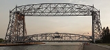
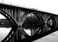
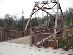
| Aerial Lift Bridge Aerial Lift Bridge The Aerial Lift Bridge is a major landmark in the port city of Duluth, Minnesota. The span is a vertical lift bridge, which is rather uncommon, but it began life as an extremely rare transporter bridge—the first of just two such bridges ever constructed in the United States... |
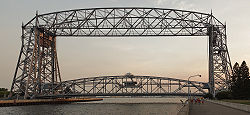 |
1901, 1905, 1929 | 1973-05-22 | Duluth Duluth, Minnesota Duluth is a port city in the U.S. state of Minnesota and is the county seat of Saint Louis County. The fourth largest city in Minnesota, Duluth had a total population of 86,265 in the 2010 census. Duluth is also the second largest city that is located on Lake Superior after Thunder Bay, Ontario,... 46°46′45"N 92°5′34"W |
St. Louis St. Louis County, Minnesota St. Louis County is a county located in the U.S. state of Minnesota. As of 2010, the population was 200,226. Its county seat is Duluth. It is the largest county by total area in Minnesota, and the second largest in the United States east of the Mississippi River; in land area alone, after Aroostook... |
|
| Anoka-Champlin Mississippi River Bridge Anoka-Champlin Mississippi River Bridge The Anoka-Champlin Mississippi River Bridge, also known as the Ferry Street Bridge, is a 10-span open spandrel concrete deck arch bridge that spans the Mississippi River between Champlin, Minnesota and Anoka, Minnesota. The bridge is listed on the National Register of Historic Places... |
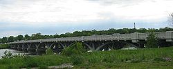 |
1929 | 1979-12-31 | Anoka Anoka, Minnesota At the 2000 census, there were 18,076 people, 7,262 households and 4,408 families residing in the city. The population density was 2,709.0 per square mile . There were 7,398 housing units at an average density of 1,108.7 per square mile... , Champlin Champlin, Minnesota Champlin is a city in Hennepin County, Minnesota, United States. The population was 23,089 at the 2010 census.U.S. Route 169 serves as a main arterial route in the city.- Geography :... 45°11′25"N 93°23′45"W |
Anoka Anoka County, Minnesota Anoka County is the fourth-most populous county in the U.S. state of Minnesota. The county is bordered by the counties of Isanti on the north, Chisago and Washington on the east, Hennepin and Ramsey on the south, Sherburne on the west, and the Mississippi River on the southwest.As of 2010, Anoka... , Hennepin Hennepin County, Minnesota Hennepin County is a county located in the U.S. state of Minnesota, named in honor of the 17th-century explorer Father Louis Hennepin. As of 2010 the population was 1,152,425. Its county seat is Minneapolis. It is by far the most populous county in Minnesota; more than one in five Minnesotans live... |
|
| Bridge No. 12 | 1908 | 1989-11-06 | Red Wing Red Wing, Minnesota Red Wing is a city in Goodhue County, Minnesota, United States, on the Mississippi River. The population was 16,459 at the 2010 census. It is the county seat of Goodhue County.... 44°32′31"N 92°26′19"W |
Goodhue Goodhue County, Minnesota Goodhue County is a county located in the U.S. state of Minnesota. As of 2010, the population was 46,183. Its county seat is Red Wing. Nearly all of Prairie Island Indian Community is within the county.-History:... |
Warren pony truss | |
| Bridge No. 1482 | 1908 | 1992-06-25 | Luverne Luverne, Minnesota As of the census of 2000, there were 4,617 people, 1,968 households, and 1,247 families residing in the city. The population density was 1,356.1 people per square mile . There were 2,161 housing units at an average density of 634.7 per square mile... 43°37′45"N 96°12′36"W |
Rock Rock County, Minnesota As of the census of 2000, there were 9,721 people, 3,843 households, and 2,705 families residing in the county. The population density was 20 people per square mile . There were 4,137 housing units at an average density of 9 per square mile... |
Single-span pony truss | |
| Bridge No. 3355-Kathio Township | 1939 | 1998-06-29 | Kathio Township Kathio Township, Minnesota Kathio Township is a township in Mille Lacs County, Minnesota, United States. The population was 1,309 at the 2000 census.-Geography:According to the United States Census Bureau, the township has a total area of , of which, of it is land and of it is water.-Demographics:As of the census of 2000,... 46°12′56"N 93°47′33"W |
Mille Lacs Mille Lacs County, Minnesota As of the census of 2000, there were 22,330 people, 8,638 households, and 6,003 families residing in the county. The population density was 39 people per square mile . There were 10,467 housing units at an average density of 18 per square mile... |
Concrete slab | |
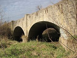
| Bridge No. 3589-Silver Creek Township |  |
1924, 1939 | 1998-06-29 | Silver Creek Township Silver Creek Township, Lake County, Minnesota Silver Creek Township is a township in Lake County, Minnesota, United States. The population was 1,178 at the 2000 census.Minnesota State Highway 61 serves as a main arterial route in the township.-Geography:... 47°2′59"N 91°37′50"W |
Lake Lake County, Minnesota Lake County is a county located in the U.S. state of Minnesota. As of 2010, the population was 10,866. Its county seat is Two Harbors. Lake County was founded on February 20, 1855, as Superior County, though its name was changed on March 3, of that year to St. Louis County. On March 1, 1856, St... |
Reinforced concrete arch |
| Bridge No. 4846 | 1875, 1929 | 1981-02-17 | Kasota Kasota, Minnesota Kasota is a city in Le Sueur County, Minnesota, United States. The population was 675 at the 2010 census.-Geography:According to the United States Census Bureau, the city has a total area of , all of it land.... 44°18′24"N 93°57′31"W |
Le Sueur Le Sueur County, Minnesota As of the census of 2000, there were 25,426 people, 9,630 households, and 6,923 families residing in the county. The population density was 57 people per square mile . There were 10,858 housing units at an average density of 24 per square mile... |
Pratt truss highway bridge | |
| Bridge No. 5083-Marshall Bridge No. 5083-Marshall The MN 19 over Redwood River in Marshall, Minnesota was built 1931 and is one of two bridges on the historic register in the city. It was listed on the National Register of Historic Places in 1998. Bridge No. 5083 was completed at a cost of $23,277 in October 1931. This bridge is between a... |
1931 | 1998-06-29 | Marshall Marshall, Minnesota As of the census of 2000, there were 12,735 people, 4,914 households, and 2,914 families residing in the city. The population density was 1,537.0 people per square mile . There were 5,182 housing units at an average density of 625.4 per square mile... 44°26′58"N 95°47′6"W |
Lyon Lyon County, Minnesota As of the census of 2000, there were 25,425 people, 9,715 households, and 6,334 families residing in the county. The population density was 36 people per square mile . There were 10,298 housing units at an average density of 14 per square mile... |
Concrete girder | |
| Bridge No. 5151-Marshall Bridge No. 5151-Marshall The MN 19 over Redwood River in Marshall, Minnesota was built 1931. It was listed on the National Register of Historic Places in 1998.... |
1931 | 1998-06-29 | Marshall Marshall, Minnesota As of the census of 2000, there were 12,735 people, 4,914 households, and 2,914 families residing in the city. The population density was 1,537.0 people per square mile . There were 5,182 housing units at an average density of 625.4 per square mile... 44°26′35"N 95°47′58"W |
Lyon Lyon County, Minnesota As of the census of 2000, there were 25,425 people, 9,715 households, and 6,334 families residing in the county. The population density was 36 people per square mile . There were 10,298 housing units at an average density of 14 per square mile... |
Concrete girder | |
| Bridge No. 5265-Garrison | 1938 | 1998-06-29 | Garrison Garrison, Minnesota As of the census of 2000, there were 213 people, 113 households, and 48 families residing in the city. The population density was 198.9 people per square mile . There were 191 housing units at an average density of 178.4 per square mile . The racial makeup of the city was 97.65% White, 0.94%... 46°17′19"N 93°49′29"W |
Crow Wing Crow Wing County, Minnesota Crow Wing County is a county located in the U.S. state of Minnesota. As of 2010, the population was 62,500. Its county seat is Brainerd.-Geography:... |
Multi-plate arch | |
| Bridge No. 5388 | 1935 | 1998-06-26 | Kingston Kingston, Minnesota Kingston is a city in Meeker County, Minnesota, along the North Fork of the Crow River. The population was 161 at the 2010 census.-Geography:According to the United States Census Bureau, the city has a total area of , all of it land.... 45°12′13"N 94°23′17"W |
Meeker Meeker County, Minnesota As of the census of 2000, there were 22,644 people, 8,590 households, and 6,133 families residing in the county. The population density was 37 people per square mile . There were 9,821 housing units at an average density of 16 per square mile... |
Warren polygonal pony truss | |
| Bridge No. 5721 Bridge No. 5721 Bridge No. 5721 is a Parker iron truss bridge created in Sauk Centre, Minnesota, spent many years in northern Minnesota south of Silverdale, Minnesota, and is now in the process of being put to use again as a part of the Gateway Trail just west of Stillwater, Minnesota.-Names throughout the... |
1998-07-13 | Silverdale 47°58′34"N 93°8′37"W |
Koochiching Koochiching County, Minnesota Koochiching County is a county located in the U.S. state of Minnesota. As of 2010, the population was 13,311. Its county seat is International Falls. A portion of the Bois Forte Indian Reservation is in the county. A small part of Voyageurs National Park extends into its northeast... |
Camelback Through Truss | ||
| Bridge No. 5757 Bridge No. 5757 Bridge No. 5757 is a bridge on Minnesota State Highway 23 in Duluth, Minnesota listed on the National Register of Historic Places. The bridge, spanning Mission Creek, is in the Fond du Lac neighborhood of Duluth. The bridge was built in 1937 by A. Bodin and Co. It is a double-span, multi-plate... |
 |
1937 | 1998-06-26 | Duluth Duluth, Minnesota Duluth is a port city in the U.S. state of Minnesota and is the county seat of Saint Louis County. The fourth largest city in Minnesota, Duluth had a total population of 86,265 in the 2010 census. Duluth is also the second largest city that is located on Lake Superior after Thunder Bay, Ontario,... 46°39′38"N 92°16′32"W |
St. Louis St. Louis County, Minnesota St. Louis County is a county located in the U.S. state of Minnesota. As of 2010, the population was 200,226. Its county seat is Duluth. It is the largest county by total area in Minnesota, and the second largest in the United States east of the Mississippi River; in land area alone, after Aroostook... |
Multi-plate arch |
| Bridge No. 5827-Zumbro Falls Bridge No. 5827-Zumbro Falls Bridge No 5827 is a highway bridge in Zumbro Falls, Minnesota. It is listed on the National Register of Historic Places under "Iron and Steel Bridges in Minnesota, 1873-1945".The bridge is on Minnesota State Highway 60, 0.1 miles east of the US 63 intersection... |
 |
1938 | 1998-06-29 | Zumbro Falls Zumbro Falls, Minnesota Zumbro Falls is a city along the Zumbro River in Wabasha County, Minnesota, United States. The population was 207 at the 2010 census. U.S. Highway 63 and Minnesota 60 intersect in Zumbro Falls.... 44°16′59"N 92°25′6"W |
Wabasha Wabasha County, Minnesota As of the census of 2000, there were 21,610 people, 8,277 households, and 5,876 families residing in the county. The population density was 41 people per square mile . There were 9,066 housing units at an average density of 17 per square mile... |
Multi-plate arch |
| Bridge No. 8096 | 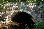 |
1947 | 1998-06-26 | Northfield Northfield, Minnesota As of the census of 2000, there were 17,147 people, 4,909 households, and 3,210 families residing in the city. The population density was 2,452.2 people per square mile . There were 5,119 housing units at an average density of 732.1 per square mile... 44°27′51"N 93°9′13"W |
Rice Rice County, Minnesota As of the census of 2000, there were 56,665 people, 18,888 households, and 13,353 families residing in the county. The population density was 114 people per square mile . There were 20,061 housing units at an average density of 40 per square mile... |
reinforced concrete arch |
| Bridge No. 90980 | 1899 | 1997-01-09 | Forest City 45°12′8"N 94°22′44"W |
Meeker Meeker County, Minnesota As of the census of 2000, there were 22,644 people, 8,590 households, and 6,133 families residing in the county. The population density was 37 people per square mile . There were 9,821 housing units at an average density of 16 per square mile... |
pratt through truss | |
| Bridge No. L1409 | 1895 | 1990-07-05 | Winona Winona, Minnesota Winona is a city in and the county seat of Winona County, in the U.S. State of Minnesota. Located in picturesque bluff country on the Mississippi River, its most noticeable physical landmark is Sugar Loaf.... 44°3′22"N 91°44′51"W |
Winona Winona County, Minnesota As of the census of 2000, there were 49,985 people, 18,744 households, and 11,696 families residing in the county. The population density was 80 people per square mile . There were 19,551 housing units at an average density of 31 per square mile... |
Stone-arched bridge | |
| Bridge No. L-2162 | 1989-11-06 | Jasper Jasper, Minnesota As of the census of 2000, there were 597 people, 286 households, and 173 families residing in the city. The population density was 678.2 people per square mile . There were 308 housing units at an average density of 349.9 per square mile... 43°46′46"N 96°25′54"W |
Rock Rock County, Minnesota As of the census of 2000, there were 9,721 people, 3,843 households, and 2,705 families residing in the county. The population density was 20 people per square mile . There were 4,137 housing units at an average density of 9 per square mile... |
Reinforced-concrete bridge | ||
| Bridge No. L-2315 | 1989-11-06 | Luverne Luverne, Minnesota As of the census of 2000, there were 4,617 people, 1,968 households, and 1,247 families residing in the city. The population density was 1,356.1 people per square mile . There were 2,161 housing units at an average density of 634.7 per square mile... 43°33′21"N 96°9′9"W |
Rock Rock County, Minnesota As of the census of 2000, there were 9,721 people, 3,843 households, and 2,705 families residing in the county. The population density was 20 people per square mile . There were 4,137 housing units at an average density of 9 per square mile... |
Reinforced-concrete bridge | ||
| Bridge No. L-2316 | 1989-11-06 | Luverne Luverne, Minnesota As of the census of 2000, there were 4,617 people, 1,968 households, and 1,247 families residing in the city. The population density was 1,356.1 people per square mile . There were 2,161 housing units at an average density of 634.7 per square mile... 43°33′31"N 96°9′9"W |
Rock Rock County, Minnesota As of the census of 2000, there were 9,721 people, 3,843 households, and 2,705 families residing in the county. The population density was 20 people per square mile . There were 4,137 housing units at an average density of 9 per square mile... |
Reinforced-concrete bridge | ||
| Bridge No. L4013 | 1915 | 1990-07-05 | Spring Grove Spring Grove, Minnesota Spring Grove is a city in Houston County, Minnesota, United States. The population was 1,330 at the 2010 census.-Geography:According to the United States Census Bureau, the city has a total area of , all of it land... 43°37′21"N 91°42′20"W |
Houston Houston County, Minnesota As of the census of 2000, there were 19,718 people, 7,633 households, and 5,411 families residing in the county. The population density was 35 people per square mile . There were 8,168 housing units at an average density of 15 per square mile... |
Stone-arch bridge | |
| Bridge No. L-4646 | 1911 | 1989-11-06 | Beaver Creek Beaver Creek, Minnesota Beaver Creek is a city in Rock County, Minnesota, United States. The population was 297 at the 2010 census.-Geography:According to the United States Census Bureau, the city has a total area of , all of it land... 43°36′55"N 96°21′34"W |
Rock Rock County, Minnesota As of the census of 2000, there were 9,721 people, 3,843 households, and 2,705 families residing in the county. The population density was 20 people per square mile . There were 4,137 housing units at an average density of 9 per square mile... |
Reinforced-concrete bridge | |
| Bridge No. L4770 | 1989-11-06 | Fountain Fountain, Minnesota Fountain is a city in Fillmore County, Minnesota, United States. The population was 410 at the 2010 census. Fountain is the western terminus of the Root River segment of the Blufflands State Trail.-Geography:... 43°44′24"N 92°5′39"W |
Fillmore Fillmore County, Minnesota As of the census of 2000, there were 21,122 people, 8,228 households, and 5,718 families residing in the county. The population density was 24 people per square mile . There were 8,908 housing units at an average density of 10 per square mile... |
Stone-arch bridge | ||
| Bridge No. L-5573 Bridge No. L-5573 The Bridge No. L-5573, also known as the Clinton Falls Bridge and Old Mill Bridge, is a historic Pratt through truss steel bridge that spans the Straight River in Clinton Falls Township, Steele County, Minnesota... |
1894 | 1997-01-25 | Owatonna Owatonna, Minnesota Owatonna is a city in Steele County, Minnesota, United States. The population was 25,599 at the 2010 census. It is the county seat of Steele County. Owatonna is home to the Steele County Fairgrounds, which hosts the Steele County Free Fair in August.... 44°8′2"N 93°14′38"W |
Steele Steele County, Minnesota As of the census of 2000, there were 33,680 people, 12,846 households, and 9,082 families residing in the county. The population density was 78 people per square mile . There were 13,306 housing units at an average density of 31 per square mile... |
Pratt Through Truss | |
| Bridge No. L6007 Bridge No. L6007 Bridge No. L6007 is a single-span stone arch bridge on Skyline Parkway where it crosses Stewart Creek in the southwestern section of Duluth, Minnesota. The bridge is historically significant because of its picturesque design and setting within a city park. It is built of locally quarried dark... |
 |
1989-11-06 | Duluth Duluth, Minnesota Duluth is a port city in the U.S. state of Minnesota and is the county seat of Saint Louis County. The fourth largest city in Minnesota, Duluth had a total population of 86,265 in the 2010 census. Duluth is also the second largest city that is located on Lake Superior after Thunder Bay, Ontario,... 46°42′13"N 92°13′41"W |
St. Louis St. Louis County, Minnesota St. Louis County is a county located in the U.S. state of Minnesota. As of 2010, the population was 200,226. Its county seat is Duluth. It is the largest county by total area in Minnesota, and the second largest in the United States east of the Mississippi River; in land area alone, after Aroostook... |
Stone-arch bridge | |
| Bridges No. L-5853 and 92247 Bridges No. L-5853 and 92247 Bridges No. L-5853 and 92247 are two side-by side bridges in Saint Paul, Minnesota. They were built in 1904 over the Como-Harriet streetcar line, connecting the nearby Twin City Rapid Transit Company station to the line running west to Minneapolis; Bridge No. 92247 carries traffic on Lexington... |
 |
1904 | 1989-11-06 | St. Paul 44°58′42"N 93°8′47"W |
Ramsey Ramsey County, Minnesota Ramsey County is a county located in the U.S. state of Minnesota, founded in 1849. As of 2010, the population was 508,640. Its county seat is St. Paul, which is also Minnesota's state capital. The county is named for Alexander Ramsey , the first governor of the Minnesota Territory... |
Reinforced-concrete bridge |
| Broadway Bridge | 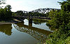 |
1931 | 1999-08-05 | Oshawa Township Oshawa Township, Minnesota Oshawa Township is a township in Nicollet County, Minnesota, in the United States. The population was 525 at the 2000 census.-Geography:According to the United States Census Bureau, the township has a total area of 29.6 square miles , of which, 29.3 square miles of it is land and... , Saint Peter 44°19′29"N 93°57′10"W |
Le Sueur Le Sueur County, Minnesota As of the census of 2000, there were 25,426 people, 9,630 households, and 6,923 families residing in the county. The population density was 57 people per square mile . There were 10,858 housing units at an average density of 24 per square mile... , Nicollet Nicollet County, Minnesota As of the census of 2000, there were 29,771 people, 10,642 households, and 7,311 families residing in the county. The population density was 66 people per square mile . There were 11,240 housing units at an average density of 25 per square mile... |
Pennsylvania through truss |
| Cappelen Memorial Bridge |  |
1919, 1923 | 1978-11-28 | Minneapolis Minneapolis, Minnesota Minneapolis , nicknamed "City of Lakes" and the "Mill City," is the county seat of Hennepin County, the largest city in the U.S. state of Minnesota, and the 48th largest in the United States... 44°57′46"N 93°13′28"W |
Hennepin Hennepin County, Minnesota Hennepin County is a county located in the U.S. state of Minnesota, named in honor of the 17th-century explorer Father Louis Hennepin. As of 2010 the population was 1,152,425. Its county seat is Minneapolis. It is by far the most populous county in Minnesota; more than one in five Minnesotans live... |
Parabolic-arch bridge |
| Cedar Avenue Bridge | 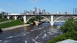 |
1929 | 1989-11-06 | Minneapolis Minneapolis, Minnesota Minneapolis , nicknamed "City of Lakes" and the "Mill City," is the county seat of Hennepin County, the largest city in the U.S. state of Minnesota, and the 48th largest in the United States... 44°58′52"N 93°14′32"W |
Hennepin Hennepin County, Minnesota Hennepin County is a county located in the U.S. state of Minnesota, named in honor of the 17th-century explorer Father Louis Hennepin. As of 2010 the population was 1,152,425. Its county seat is Minneapolis. It is by far the most populous county in Minnesota; more than one in five Minnesotans live... |
Reinforced-concrete bridge |
| Chicago, Milwaukee and St. Paul Railroad Grade Separation Midtown Greenway The Midtown Greenway is a rail trail in Minneapolis, Minnesota. It is considered under segregated cycle facilities.Used both recreationally and for commuting, the partially below-grade Greenway runs east-west about one block north of Lake Street... |
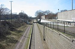 |
1912, 1916 | 2005-06-01 | Minneapolis Minneapolis, Minnesota Minneapolis , nicknamed "City of Lakes" and the "Mill City," is the county seat of Hennepin County, the largest city in the U.S. state of Minnesota, and the 48th largest in the United States... |
Hennepin Hennepin County, Minnesota Hennepin County is a county located in the U.S. state of Minnesota, named in honor of the 17th-century explorer Father Louis Hennepin. As of 2010 the population was 1,152,425. Its county seat is Minneapolis. It is by far the most populous county in Minnesota; more than one in five Minnesotans live... |
|
| Colorado Street Bridge | 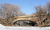 |
1888 | 1990-07-05 | St. Paul 44°56′5"N 93°5′3"W |
Ramsey Ramsey County, Minnesota Ramsey County is a county located in the U.S. state of Minnesota, founded in 1849. As of 2010, the population was 508,640. Its county seat is St. Paul, which is also Minnesota's state capital. The county is named for Alexander Ramsey , the first governor of the Minnesota Territory... |
Masonry-arch bridge |
| Dodd Ford Bridge Dodd Ford Bridge The Dodd Ford Bridge is a bridge spanning the Blue Earth River about one mile southwest of Amboy, Minnesota in Blue Earth County, Minnesota.The bridge is a steel, pin-connected, nine-panel, overhead, Pratt-truss highway bridge. Constructed in 1901, it is among the state's earliest remaining... |
2009-12-9 | Shelby 43°52′34.81"N 94°11′16.34"W |
Blue Earth Blue Earth County, Minnesota Blue Earth County is a county located in the U.S. state of Minnesota. As of 2010, the population was 64,013. Its county seat is Mankato.Blue Earth County is part of the Mankato–North Mankato Metropolitan Statistical Area.-Geography:... |
Pratt through truss | ||
| Faribault Viaduct |  |
1937 | 1989-11-06 | Faribault Faribault, Minnesota As of the census of 2000, there were 20,818 people, 7,472 households, and 4,946 families residing in the city. The population density was 1,644.8 people per square mile . There were 7,668 housing units at an average density of 605.8 per square mile... 44°17′27"N 93°16′0"W |
Rice Rice County, Minnesota As of the census of 2000, there were 56,665 people, 18,888 households, and 13,353 families residing in the county. The population density was 114 people per square mile . There were 20,061 housing units at an average density of 40 per square mile... |
Reinforced-concrete bridge |
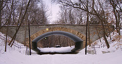
| Fort Snelling-Mendota Bridge |  |
1925, 1926 | 1978-12-01 | Mendota Mendota, Minnesota Mendota is a city in Dakota County, Minnesota, United States. The name comes from the Dakota word for "where the waters meet." The population was 198 at the 2010 census.-History:... , Minneapolis Minneapolis, Minnesota Minneapolis , nicknamed "City of Lakes" and the "Mill City," is the county seat of Hennepin County, the largest city in the U.S. state of Minnesota, and the 48th largest in the United States... |
Dakota Dakota County, Minnesota Dakota County is the third most populous county in the U.S. state of Minnesota. The county is bordered by the Minnesota and Mississippi Rivers on the north, and the state of Wisconsin on the east. Dakota County comprises the southeast portion of seven-county Minneapolis-St. Paul, the thirteenth... , Hennepin Hennepin County, Minnesota Hennepin County is a county located in the U.S. state of Minnesota, named in honor of the 17th-century explorer Father Louis Hennepin. As of 2010 the population was 1,152,425. Its county seat is Minneapolis. It is by far the most populous county in Minnesota; more than one in five Minnesotans live... |
|
| Frank's Ford Bridge | 1895 | 1980-07-08 | Oronoco Oronoco, Minnesota As of the census of 2000, there were 883 people, 335 households, and 253 families residing in the city. The population density was 482.8 people per square mile . There were 343 housing units at an average density of 187.6 per square mile... 44°7′47"N 92°27′45"W |
Olmsted Olmsted County, Minnesota As of the census of 2000, there were 124,277 people, 47,807 households, and 32,317 families residing in the county. The population density was 190 people per square mile . There were 49,422 housing units at an average density of 76 per square mile... |
Pratt through truss | |
| Great Northern Railway Company Bridge | 1915 | 1980-10-14 | Cass Lake Cass Lake, Minnesota As of the census of 2000, there were 860 people, 331 households, and 192 families residing in the city. The population density was 753.2 people per square mile . There were 384 housing units at an average density of 336.3 per square mile . The racial makeup of the city was 30.12% White, 64.42%... 47°16′8"N 94°37′39"W |
Cass Cass County, Minnesota Cass County is a county located in the U.S. state of Minnesota. As of 2010, the population was 28,567. Its county seat is Walker. A portion of the Leech Lake Indian Reservation is in the county.-Geography:... |
||
| Hanover Bridge Hanover Bridge The Hanover Bridge is a bridge spanning the Crow River between Hassan Township, Minnesota in Hennepin County and Hanover in Wright County. It is one of the last remaining wrought iron pin-connected Pratt truss bridges in the state.-Construction:... |
 |
1885 | 1979-12-11 | Hanover Hanover, Minnesota Hanover is a city in Hennepin and Wright counties in the U.S. state of Minnesota. The population was 2,938 at the 2010 census. Most of Hanover lies in Wright County; only a small part of the city extends into Hennepin County.... , Rogers Rogers, Minnesota As of the census of 2000, there were 3,588 people, 1,195 households, and 982 families residing in the city. The population density was 715.1 people per square mile . There were 1,245 housing units at an average density of 248.1 per square mile... 45°9′13"N 93°39′41"W |
Hennepin Hennepin County, Minnesota Hennepin County is a county located in the U.S. state of Minnesota, named in honor of the 17th-century explorer Father Louis Hennepin. As of 2010 the population was 1,152,425. Its county seat is Minneapolis. It is by far the most populous county in Minnesota; more than one in five Minnesotans live... , Wright Wright County, Minnesota Wright County is a county located in the U.S. state of Minnesota, founded in 1855. As of 2010, the population was 124,700. Its county seat is Buffalo.-History:... |
pin-con. Pratt through truss |
| Holmes Street Bridge | 2010-7-10 | Shakopee Shakopee, Minnesota Shakopee is a city southwest of downtown Minneapolis in the U.S. state of Minnesota and is the county seat of Scott County. Located on the south bank bend of the Minnesota River, Shakopee and nearby suburbs comprise the southwest portion of Minneapolis-Saint Paul, the thirteenth largest... |
Scott Scott County, Minnesota Scott County is a county located in the U.S. state of Minnesota. It was organized in 1853 and named in honor of General Winfield Scott. As of 2010, the population was 129,928. Its county seat is Shakopee... |
|||
| Intercity Bridge Intercity Bridge The Intercity Bridge, more commonly known as the Ford Parkway Bridge , is a reinforced concrete arch bridge that spans the Mississippi River between Minneapolis, Minnesota and St. Paul, Minnesota. It connects 46th Street in Minneapolis with Ford Parkway in Saint Paul... |
 |
1927 | 1989-11-06 | Minneapolis Minneapolis, Minnesota Minneapolis , nicknamed "City of Lakes" and the "Mill City," is the county seat of Hennepin County, the largest city in the U.S. state of Minnesota, and the 48th largest in the United States... , St. Paul 44°55′4"N 93°12′14"W |
Hennepin Hennepin County, Minnesota Hennepin County is a county located in the U.S. state of Minnesota, named in honor of the 17th-century explorer Father Louis Hennepin. As of 2010 the population was 1,152,425. Its county seat is Minneapolis. It is by far the most populous county in Minnesota; more than one in five Minnesotans live... , Ramsey Ramsey County, Minnesota Ramsey County is a county located in the U.S. state of Minnesota, founded in 1849. As of 2010, the population was 508,640. Its county seat is St. Paul, which is also Minnesota's state capital. The county is named for Alexander Ramsey , the first governor of the Minnesota Territory... |
Reinforced-concrete bridge |
| Interlachen Bridge Interlachen Bridge The Interlachen Bridge is a reinforced concrete arch bridge on William Berry Parkway between Lake Calhoun and Lake Harriet in Minneapolis, Minnesota. The bridge crosses the Como-Harriet Streetcar Line, a heritage streetcar line operated by the Minnesota Streetcar Museum which follows the same... |
 |
1900 | 1989-11-06 | Minneapolis Minneapolis, Minnesota Minneapolis , nicknamed "City of Lakes" and the "Mill City," is the county seat of Hennepin County, the largest city in the U.S. state of Minnesota, and the 48th largest in the United States... 44°55′53"N 93°18′31"W |
Hennepin Hennepin County, Minnesota Hennepin County is a county located in the U.S. state of Minnesota, named in honor of the 17th-century explorer Father Louis Hennepin. As of 2010 the population was 1,152,425. Its county seat is Minneapolis. It is by far the most populous county in Minnesota; more than one in five Minnesotans live... |
Reinforced-concrete bridge |
| Kern Bridge Kern Bridge Kern Bridge or Yaeger Bridge crosses the Le Sueur River in Blue Earth County in the U.S. state of Minnesota. It was built in 1873 using a bowstring through truss design by the Wrought Iron Bridge Company. It is long and carries a local road.... |
 |
1873 | 1980-07-28 | Skyline Skyline, Minnesota As of the census of 2000, there were 330 people, 124 households, and 105 families residing in the city. The population density was 1,752.5 people per square mile . There were 125 housing units at an average density of 663.8 per square mile . The racial makeup of the city was 97.58% White, 0.91%... 44°6′35"N 94°2′31"W |
Blue Earth Blue Earth County, Minnesota Blue Earth County is a county located in the U.S. state of Minnesota. As of 2010, the population was 64,013. Its county seat is Mankato.Blue Earth County is part of the Mankato–North Mankato Metropolitan Statistical Area.-Geography:... |
"bowstring through truss" |
| Kettle River Bridge | 1948 | 1998-06-29 | Sandstone Sandstone, Minnesota As of the census of 2000, there were 1,549 people, 580 households, and 359 families residing in the city. The population density was 292.5 people per square mile . There were 634 housing units at an average density of 119.7 per square mile... 46°7′44"N 92°51′23"W |
Pine Pine County, Minnesota As of the census of 2000, there were 26,530 people, 9,939 households, and 6,917 families residing in the county. The population density was 19 people per square mile . There were 15,353 housing units at an average density of 11 per square mile... |
Deck Pratt truss | |
| Lester River Bridge-Bridge No. 5772 | 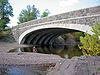 |
1925 | 2002-09-06 | Duluth Duluth, Minnesota Duluth is a port city in the U.S. state of Minnesota and is the county seat of Saint Louis County. The fourth largest city in Minnesota, Duluth had a total population of 86,265 in the 2010 census. Duluth is also the second largest city that is located on Lake Superior after Thunder Bay, Ontario,... 46°50′12"N 92°0′22"W |
St. Louis St. Louis County, Minnesota St. Louis County is a county located in the U.S. state of Minnesota. As of 2010, the population was 200,226. Its county seat is Duluth. It is the largest county by total area in Minnesota, and the second largest in the United States east of the Mississippi River; in land area alone, after Aroostook... |
filled-spandrel cncrte arch |
| Marsh Concrete Rainbow Arch Bridge Marsh Concrete Rainbow Arch Bridge Marsh Concrete Rainbow Arch Bridge is a reinforced concrete through arch bridge over the Little Cottonwood River in Cambria Township, Blue Earth County, Minnesota. The bridge is listed on the National Register of Historic Places... |
 |
1911 | 1980-07-28 | Courtland Courtland, Minnesota Courtland is a city in Nicollet County, Minnesota, United States. The population was 611 at the 2010 census. It is part of the Mankato–North Mankato Metropolitan Statistical Area.-Geography:... 44°14′13"N 94°21′39"W |
Blue Earth Blue Earth County, Minnesota Blue Earth County is a county located in the U.S. state of Minnesota. As of 2010, the population was 64,013. Its county seat is Mankato.Blue Earth County is part of the Mankato–North Mankato Metropolitan Statistical Area.-Geography:... |
"concrete rainbow arch" |
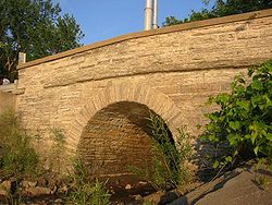
| Mendota Road Bridge Mendota Road Bridge Mendota Road Bridge is a stone arch bridge that spans the outlet of Pickerel Lake where it meets the Mississippi River just south of downtown St. Paul, Minnesota. It was built in 1894 by the city of St. Paul and was designed by the St. Paul City Engineer's Office.The bridge is historically... |
 |
1894 | 1989-11-06 | St. Paul 44°55′31"N 93°6′41"W |
Ramsey Ramsey County, Minnesota Ramsey County is a county located in the U.S. state of Minnesota, founded in 1849. As of 2010, the population was 508,640. Its county seat is St. Paul, which is also Minnesota's state capital. The county is named for Alexander Ramsey , the first governor of the Minnesota Territory... |
Stone-arch bridge |
| Nymore Bridge | 1917 | 1989-11-06 | Bemidji Bemidji, Minnesota Bemidji is a city in Beltrami County, Minnesota, United States. Its population was at 13,431 at the 2010 census. It is the county seat of Beltrami County. Bemidji is the most major city in North Central Minnesota and the largest commercial center between Grand Forks, North Dakota and Duluth,... 47°28′1"N 94°52′42"W |
Beltrami Beltrami County, Minnesota Beltrami County is a county located in the northern part of the U.S. state of Minnesota. As of 2010, the population was 44,442. Its county seat is Bemidji. Portions of the Leech Lake and Red Lake Indian reservations are in the county. The northernmost portion of the Mississippi River flows... |
Reinforced-concrete bridge | |
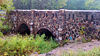
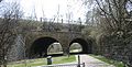
| Point Douglas-St. Louis River Road Bridge Point Douglas-St. Louis River Road Bridge The Point Douglas-St. Louis River Road Bridge is the oldest known stone arch bridge in the state of Minnesota. Located near Stillwater, the bridge dates back to 1863 and is listed on the National Register of Historic Places.... |
1863 | 1975-02-24 | Stillwater Stillwater, Minnesota As of the census of 2000, there were 15,143 people, 5,797 households, and 4,115 families residing in the city. The population density was 2,340.0 people per square mile . There were 5,926 housing units at an average density of 915.7 per square mile... 45°4′32"N 92°49′44"W |
Washington Washington County, Minnesota Washington County is a county established in 1849 in the U.S. state of Minnesota. As of 2010, the population was 238,136. Its county seat is Stillwater.-History:... |
||
| Queen Avenue Bridge Queen Avenue Bridge The Queen Avenue Bridge is a reinforced concrete single-span barrel arch bridge in Minneapolis, Minnesota that spans the tracks used by the Minnesota Streetcar Museum. The bridge was built in 1905 and is listed on the National Register of Historic Places.... |
 |
1905 | 1989-11-06 | Minneapolis Minneapolis, Minnesota Minneapolis , nicknamed "City of Lakes" and the "Mill City," is the county seat of Hennepin County, the largest city in the U.S. state of Minnesota, and the 48th largest in the United States... 44°55′28"N 93°18′40"W |
Hennepin Hennepin County, Minnesota Hennepin County is a county located in the U.S. state of Minnesota, named in honor of the 17th-century explorer Father Louis Hennepin. As of 2010 the population was 1,152,425. Its county seat is Minneapolis. It is by far the most populous county in Minnesota; more than one in five Minnesotans live... |
Reinforced-concrete bridge |
| Ramsey Park Swayback Bridge | 1938 | 1980-08-11 | Redwood Falls Redwood Falls, Minnesota As of the census of 2000, there were 5,459 people, 2,266 households, and 1,389 families residing in the city. The population density was 1,167.1 people per square mile . There were 2,377 housing units at an average density of 508.2 per square mile... 44°33′2"N 95°7′28"W |
Redwood Redwood County, Minnesota As of the census of 2000, there were 16,815 people, 6,674 households, and 4,524 families residing in the county. The population density was 19 people per square mile . There were 7,230 housing units at an average density of 8 per square mile... |
Swayback bridge | |
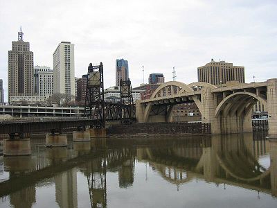
| Robert Street Bridge Robert Street Bridge The Robert Street Bridge is a reinforced concrete multiple-arch bridge that spans the Mississippi River in downtown St. Paul, Minnesota. The bridge is notable for its complex design that was required to accommodate river traffic, the St. Paul Union Pacific Vertical-lift Rail Bridge crossing... |
 |
1926 | 1989-11-06 | St. Paul 44°56′31"N 93°5′7"W |
Ramsey Ramsey County, Minnesota Ramsey County is a county located in the U.S. state of Minnesota, founded in 1849. As of 2010, the population was 508,640. Its county seat is St. Paul, which is also Minnesota's state capital. The county is named for Alexander Ramsey , the first governor of the Minnesota Territory... |
Reinforced-concrete bridge |
| Seventh Street Improvement Arches Seventh Street Improvement Arches The Seventh Street Improvement Arches are a double-arched masonry highway bridge that formerly spanned the St. Paul and Duluth Railroad tracks in St. Paul, Minnesota. The Seventh Street Improvement Arches are historically significant for its rarity and the technically demanding nature of its... |
 |
1884 | 1989-11-06 | St. Paul 44°57′24"N 93°4′37"W |
Ramsey Ramsey County, Minnesota Ramsey County is a county located in the U.S. state of Minnesota, founded in 1849. As of 2010, the population was 508,640. Its county seat is St. Paul, which is also Minnesota's state capital. The county is named for Alexander Ramsey , the first governor of the Minnesota Territory... |
Stone-arch bridge |
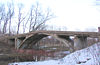
| Soo Line High Bridge Soo Line High Bridge The Soo Line High Bridge is a steel deck arch bridge over the St. Croix River between Stillwater, Minnesota and Somerset, Wisconsin. It was designed by bridge architect C.A.P. Turner and built by the American Bridge Company... |
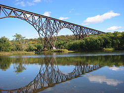 |
1910, 1911 | 1977-08-22 | Stillwater Stillwater, Minnesota As of the census of 2000, there were 15,143 people, 5,797 households, and 4,115 families residing in the city. The population density was 2,340.0 people per square mile . There were 5,926 housing units at an average density of 915.7 per square mile... |
Washington Washington County, Minnesota Washington County is a county established in 1849 in the U.S. state of Minnesota. As of 2010, the population was 238,136. Its county seat is Stillwater.-History:... |
Five Arch Span |
| Split Rock Bridge |  |
1938 | 1989-11-06 | Ihlen Ihlen, Minnesota As of the census of 2000, there were 107 people, 43 households, and 27 families residing in the city. The population density was 276.1 people per square mile . There were 44 housing units at an average density of 113.6 per square mile... 43°53′33"N 96°22′0"W |
Pipestone Pipestone County, Minnesota As of the census of 2000, there were 9,895 people, 4,069 households, and 2,726 families residing in the county. The population density was 21 people per square mile . There were 4,434 housing units at an average density of 10 per square mile... |
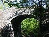
Stone-arch bridge |
| Stillwater Bridge | 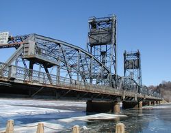 |
1931 | 1989-05-25 | Stillwater Stillwater, Minnesota As of the census of 2000, there were 15,143 people, 5,797 households, and 4,115 families residing in the city. The population density was 2,340.0 people per square mile . There were 5,926 housing units at an average density of 915.7 per square mile... 45°3′27"N 92°48′0"W |
Washington Washington County, Minnesota Washington County is a county established in 1849 in the U.S. state of Minnesota. As of 2010, the population was 238,136. Its county seat is Stillwater.-History:... |
Vertical lift bridge |
| Third Street Bridge | 1909 | 1989-11-06 | Cannon Falls Cannon Falls, Minnesota As of the census of 2000, there were 3,795 people, 1,550 households, and 996 families residing in the city. The population density was 946.4 people per square mile . There were 1,611 housing units at an average density of 401.8 per square mile... 44°30′49"N 92°54′14"W |
Goodhue Goodhue County, Minnesota Goodhue County is a county located in the U.S. state of Minnesota. As of 2010, the population was 46,183. Its county seat is Red Wing. Nearly all of Prairie Island Indian Community is within the county.-History:... |
Pennsylvania through truss | |
| Walnut Street Bridge Walnut Street Bridge (Mazeppa, Minnesota) The Walnut Street Walking Bridge crosses the Zumbro River in Mazeppa, Minnesota. This bridge was added to the National Register of Historical Places in 2003. This bridge was built in 1904 and is a Pratt truss bridge. Almost lost in a flood caused by severe thunderstorms in June 1998 and having... |
 |
1904 | 2003-01-15 | Mazeppa Mazeppa, Minnesota Mazeppa is a city in Wabasha County, Minnesota, United States, along the North Fork of the Zumbro River. The population was 842 at the 2010 census.-Geography:According to the United States Census Bureau, the city has a total area of , all of it land.... 44°16′23"N 92°32′52"W |
Wabasha Wabasha County, Minnesota As of the census of 2000, there were 21,610 people, 8,277 households, and 5,876 families residing in the county. The population density was 41 people per square mile . There were 9,066 housing units at an average density of 17 per square mile... |
Pratt Through Truss |
| Waterford Bridge | 2010-08-26 | Waterford Township Waterford Township, Minnesota Waterford Township is a township in Dakota County, Minnesota, United States. The population was 517 at the 2000 census.-Geography:According to the United States Census Bureau, the township has a total area of 14.8 square miles , all of it land.-Demographics:As of the census of 2000, there were... |
Dakota Dakota County, Minnesota Dakota County is the third most populous county in the U.S. state of Minnesota. The county is bordered by the Minnesota and Mississippi Rivers on the north, and the state of Wisconsin on the east. Dakota County comprises the southeast portion of seven-county Minneapolis-St. Paul, the thirteenth... |
|||
| Zieglers Ford Bridge | 1904 | 1989-11-06 | Good Thunder Good Thunder, Minnesota Good Thunder is a city in Blue Earth County, Minnesota, along the Maple River. The population was 583 at the 2010 census. It is part of the Mankato–North Mankato Metropolitan Statistical Area.-Geography:... 44°1′45"N 93°59′35"W |
Blue Earth Blue Earth County, Minnesota Blue Earth County is a county located in the U.S. state of Minnesota. As of 2010, the population was 64,013. Its county seat is Mankato.Blue Earth County is part of the Mankato–North Mankato Metropolitan Statistical Area.-Geography:... |
Pratt through truss | |
| Zumbro Parkway Bridge Zumbro Parkway Bridge The Zumbro Parkway Bridge is a steel arch bridge located in Zumbro Falls, Minnesota. The bridge was built in 1937 by the engineer J.M. Evans and is 59 feet long and 32.9 feet wide. It allows County 68 to cross a portion of the Zumbro River. The bridge is on the National Register of Historic Places... |
 |
1937 | 1989-11-06 | Zumbro Falls Zumbro Falls, Minnesota Zumbro Falls is a city along the Zumbro River in Wabasha County, Minnesota, United States. The population was 207 at the 2010 census. U.S. Highway 63 and Minnesota 60 intersect in Zumbro Falls.... 44°16′47"N 92°25′19"W |
Wabasha Wabasha County, Minnesota As of the census of 2000, there were 21,610 people, 8,277 households, and 5,876 families residing in the county. The population density was 41 people per square mile . There were 9,066 housing units at an average density of 17 per square mile... |
Multi-plate arch bridge |
| Zumbrota Covered Bridge Zumbrota Covered Bridge The Zumbrota Covered Bridge is Minnesota's last remaining covered bridge. It has been restored and is located in Covered Bridge Park in Zumbrota, Minnesota.-History:... |
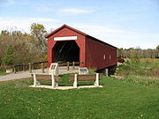 |
1869, 1871 | 1975-02-20 | Zumbrota Zumbrota, Minnesota As of the census of 2000, there were 2,789 people, 1,141 households, and 741 families residing in the city. The population density was 1,412.6 people per square mile . There were 1,191 housing units at an average density of 603.2 per square mile... 44°17′47"N 92°40′12"W |
Goodhue Goodhue County, Minnesota Goodhue County is a county located in the U.S. state of Minnesota. As of 2010, the population was 46,183. Its county seat is Red Wing. Nearly all of Prairie Island Indian Community is within the county.-History:... |
Town lattice truss |
| Stone Arch Bridge part of the St. Anthony Falls Historic District |
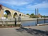 |
1971-03-11 | Minneapolis | Hennepin | ||
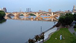
| Third Avenue Bridge Third Avenue Bridge (Minneapolis) The Third Avenue Bridge is a landmark structure of the city of Minneapolis, Minnesota, originally known as the St. Anthony Falls Bridge. It carries road traffic across the Mississippi River and right over the upper fringes of Saint Anthony Falls... part of the St. Anthony Falls Historic District |
 |
1971-03-11 | Minneapolis | Hennepin | ||
| Bridge No. 1811 over Kettle River | 1916 | removed 2005-05-17 |
Rutledge Rutledge, Minnesota Rutledge is a city in Pine County, Minnesota, United States, at the confluence of the Kettle and Pine Rivers. The population was 229 at the 2010 census.County 61 serves as a main route in the community... |
Pine Pine County, Minnesota As of the census of 2000, there were 26,530 people, 9,939 households, and 6,917 families residing in the county. The population density was 19 people per square mile . There were 15,353 housing units at an average density of 11 per square mile... |
Pratt through truss | |
| Bridge No. 6422-Saint Peter | 1948 | removed 2003-08-08 |
Saint Peter | Nicollet Nicollet County, Minnesota As of the census of 2000, there were 29,771 people, 10,642 households, and 7,311 families residing in the county. The population density was 66 people per square mile . There were 11,240 housing units at an average density of 25 per square mile... |
Deck girder | |
| Bridge No. L3040 | 1878 | removed 2007-09-20 |
Belle Plaine Belle Plaine, Minnesota As of the census of 2000, there were 3,789 people, 1,396 homes and 949 families residing in the city. The population density was 932.7 people per square cube . There were 1,424 housing units at an average density of 350.5 per square mile... |
Scott Scott County, Minnesota Scott County is a county located in the U.S. state of Minnesota. It was organized in 1853 and named in honor of General Winfield Scott. As of 2010, the population was 129,928. Its county seat is Shakopee... |
Stone-arch bridge | |
| Dump Road Bridge | 1904 | removed 2002-07-01 |
Faribault Faribault, Minnesota As of the census of 2000, there were 20,818 people, 7,472 households, and 4,946 families residing in the city. The population density was 1,644.8 people per square mile . There were 7,668 housing units at an average density of 605.8 per square mile... |
Rice Rice County, Minnesota As of the census of 2000, there were 56,665 people, 18,888 households, and 13,353 families residing in the county. The population density was 114 people per square mile . There were 20,061 housing units at an average density of 40 per square mile... |
Pratt through truss | |
| Kennedy Bridge | 1883 | 1989-11-06 removed 2008-5-7 | Mankato Mankato, Minnesota Mankato is a city in Blue Earth, Nicollet, and Le Sueur counties in the U.S. state of Minnesota. The population was 39,309 at the 2010 census, making it the fourth largest city in Minnesota outside of the Minneapolis-St. Paul metropolitan area. The county seat of Blue Earth County, it is located... 44°6′35"N 93°56′39"W |
Blue Earth Blue Earth County, Minnesota Blue Earth County is a county located in the U.S. state of Minnesota. As of 2010, the population was 64,013. Its county seat is Mankato.Blue Earth County is part of the Mankato–North Mankato Metropolitan Statistical Area.-Geography:... |
Pratt through truss | |
| Selby Avenue Bridge | 1890 | removed 1994-01-10 |
St. Paul | Ramsey Ramsey County, Minnesota Ramsey County is a county located in the U.S. state of Minnesota, founded in 1849. As of 2010, the population was 508,640. Its county seat is St. Paul, which is also Minnesota's state capital. The county is named for Alexander Ramsey , the first governor of the Minnesota Territory... |
Pratt through truss | |
| Smith Avenue High Bridge |  |
1889 | removed 1988-03-28 |
St. Paul | Ramsey Ramsey County, Minnesota Ramsey County is a county located in the U.S. state of Minnesota, founded in 1849. As of 2010, the population was 508,640. Its county seat is St. Paul, which is also Minnesota's state capital. The county is named for Alexander Ramsey , the first governor of the Minnesota Territory... |
|
| Wabasha Street Bridge Wabasha Street Bridge The previous bridge was an iron cantilever deck-truss bridge, which was an advanced engineering feat at the time. That bridge was listed in the National Register of Historic Places in 1989... |
1890, 1900 | removed 1998-06-22 |
St. Paul | Ramsey Ramsey County, Minnesota Ramsey County is a county located in the U.S. state of Minnesota, founded in 1849. As of 2010, the population was 508,640. Its county seat is St. Paul, which is also Minnesota's state capital. The county is named for Alexander Ramsey , the first governor of the Minnesota Territory... |
Cantilever deck truss | |
| Yellow Bank Church Campground Bridge | 1893 | removed 1998-06-30 |
Odessa Odessa, Minnesota -References:... |
Lac Qui Parle Lac qui Parle County, Minnesota As of the census of 2000, there were 8,067 people, 3,316 households, and 2,225 families residing in the county. The population density was 10 people per square mile . There were 3,774 housing units at an average density of 5 per square mile... |
Through truss |