

Dakota County, Minnesota
Encyclopedia
Dakota County is the third most populous county
in the U.S. state
of Minnesota
. The county is bordered by the Minnesota
and Mississippi Rivers
on the north, and the state of Wisconsin
on the east. Dakota County comprises the southeast portion of seven-county Minneapolis-St. Paul, the thirteenth largest metropolitan area
in the United States with about 3.2 million residents. As of 2010, the population was 398,552. The county seat
is Hastings
.
The county was the site of historical events at Mendota
that defined the state's future, including providing materials for the construction of Fort Snelling across the river and the signing of the Treaty of Traverse des Sioux
which ceded land from the native Dakota
nation for the Minnesota Territory. The county's history was initially tied to the confluence of the Mississippi and Minnesota Rivers, both strategically important for United States expansion and as the convergence of the Dakota
and Ojibwe nations who regarded the site as sacred. Influence shifted westward during the post-World War II settlement boom when Interstate 35
connected the western half of the county to Minneapolis and Saint Paul
and bedroom communities grew. Today, Dakota County has a population that exceeds Minneapolis's. Most work outside the county but like many metro counties, Dakota continues to absorb industry and jobs from the core cities.
Dakota County is named after the Dakota Sioux
tribal bands who settled in the area. The name is recorded as "Dahkotah" in U.S. Census records until 1851.
Dakota fled their ancestral home of Mille Lacs Lake
in northern Minnesota in response to westward expansion of the Ojibway nation. According to Dakota tradition, their ancestors pushed out the Iowa
who were found settled at the mouth of the Minnesota River. Later in 1680, the Mdewakanton
Dakota
were contacted by French explorer Daniel Greysolon, Sieur du Lhut
and the Mendota (mdo-TE) band of the Mdewakanton south of the Minnesota River were contacted later by Joseph Nicollet
in the 18th century. While Taoyateduta
(a.k.a. Little Crow) led the Mendota in northern Dakota County, upstream to the southwest, Chief Black Dog established his village of 600 people around 1750 at the isthmus between Black Dog Lake (from which is named after him) and the Minnesota River, near the present site of the Black Dog Power Plant.
Following the published expeditions of explorers, in 1805, Zebulon Pike
negotiated for military territory with the Mendota band which included land in Dakota County at the Mississippi River confluences with the Minnesota and St. Croix Rivers. In 1819, on what is now Picnic Island on the south bank of the Minnesota River
, Colonel Henry Leavenworth
built a stockade fort called "St. Peter's Cantonment" or "New Hope," where materials were assembled for the construction of Fort Snelling to be built on the bluff on the north bank. Permanent settlement on the island was impossible due to annual flooding. Alexis Bailey built some log buildings nearby to trade in furs in 1826. Henry Hastings Sibley
later built the first stone house in Minnesota in 1836, overlooking Fort Snelling. Sibley was a partner in the American Fur Company
, and considerable fur trade occurred at Mendota due to the accessibility of the confluence.
On-going United States
expansion into the then "Northwest Territory" led to government purchase of land from the Dakota people (the Mdewakanton, Wahpekute, Wahpeton
, and Sisseton bands) via the Treaty of St. Peters
and the Treaty of Traverse des Sioux
in 1851. and the Treaty of Mendota
. After the establishment of the Minnesota Territory
in 1849, Dakotah County (later Dakota County) spanned from the Mississippi River
to the Missouri River
.
By the time Minnesota
achieved statehood in 1858, power and influence had shifted from Mendota, across the rivers to Saint Paul
and Minneapolis
.
, the county seat, and a focal point of transportation, communication, and commerce. St. Peter's, now Mendota, had lost out to Fort Snelling. Hastings is critically located on the Mississippi River
at the confluence of the St. Croix River and on the Vermillion River
, which provided ample water power. Commercial interests built substantial wealth among the businessmen who dealt in lumber, milling, and railroads as the county residents depended on them to sell their agricultural products and to provide the goods needed for a growing economy and rising standard of living.
During this time, the stockyards
and meat-packing plants in South Saint Paul
became historically significant as the largest stockyards in the world. Ranchers in the vast countryside to the west brought their livestock for shipping to the hungry populations of St. Louis, Memphis
, and New Orleans, downstream. These plants were worked by new immigrants from Romania
, Serbia
, and other Eastern European countries. The rest of the county remained agricultural during the boom of milling activity north of the Minnesota River due to lack of bridge connections. Rail access came in 1846 via the Chicago, St. Paul, Minneapolis, and Omaha Railroad
which shipped grain to millers. The Minneapolis St. Paul Rochester and Dubuque Electric Traction Company line in 1905 (now the Dan Patch Corridor
), was primary for passengers going to entertainment parks and resorts in Burnsville and Lakeville.
, Apple Valley
, Eagan
, and Lakeville
brought over 200,000 people into the county by the end of the century. The Western and Northern Service Centers were constructed in the early 1990s each with an additional courthouse location. License centers were subsequently setup in Burnsville and Lakeville. Though pressure remained since the postwar boom to move the county seat to one of the larger communities in the county, the Dakota County Board maintained the seat in Hastings, while providing government services across the county.
Dakota County also has an elected Sheriff
(Dave Bellows) and an elected County Attorney
(James Backstrom). Additionally there are appointed boards for the library system, community development agency, and several advisory boards. Dakota County is also served by an elected board of their Soil and Water Conservation District.
Principal employees of Dakota County include (but are not limited to) County Administrator Brandt Richardson, Community Services Director Dave Rooney, Parks Director Steve Sullivan, and Court Administrator Van Bostrom.
with fish, wildlife, and parkland managed collectively by the U.S. Fish and Wildlife Service and the Minnesota Department of Natural Resources. The Dakota County Soil and Water Conservation District assists the county's six watershed management organizations (WMO) which include the Black Dog WMO, Gun Club Lake WMO, Lower Minnesota River Watershed District, Lower Mississippi WMO, North Cannon River WMO, and the Vermillion River Watershed Joint Powers Organization.
In terms of race and ethnicity, the county was 85.2% White (82.3% Non-Hispanic White Alone), 4.7% Black or African American, 0.4% American Indian and Alaska Native, 4.4% Asian, 0.1% Native Hawaiian and Other Pacific Islander, 2.4% from Some Other Race, and 2.9% from Two or More Races. Hispanics and Latinos of any race make up 6.0% of the population.
In terms of households, 69.5% were family households and 30.5% were non-family households. Approximately 55.2% were husband-wife family households; 26% had children under 18 years of age. Approximately 36.6% of households had children under 18 years of age living in them; 18.6% had people over the age of 65 living in them. The average household size is 2.60 and the average family size is 3.12. In terms of housing occupancy, 95.3% of households were occupied and 4.7% were vacant. Of the vacant housing units, 2.0% were for rent, 0.1% were rented but not occupied, 1.2% were for sale only, 0.2% were sold but not occupied, 0.5% were for seasonal, recreational, or occasional use, and 0.8% were all other vacants. The homeowner vacancy rate was 1.7% and the rental vacancy rate was 8.1%. Of all occupied housing units, 76.5% were owner-occupied and 23.5% were renter-occupied. The population in owner-occupied units was 314,833; the average household size was 2.71. The population in renter-occupied units was 80,866; the average household size was 2.26.
 Dakota County is home to sites significant in the state's early history. At Mendota, the Treaty of Mendota
was signed, opening much of Southern Minnesota to settlement, and there prominent Saint Paul businessmen built their grand mansions. Though linked with the state's capital for much of history via rail, Dakota County owes much of its current growth to the expansion of Minneapolis' population which accelerated during the post-World War II boom era of the 1960s. This demand for housing along with two major interstate highways linking Minneapolis (I-35W) and St. Paul (I-35E) to the county concentrated major growth and demand along the northern end. Today, the cities of Burnsville, Eagan, Apple Valley, Lakeville, Rosemount, Hastings, Inver Grove Heights, Mendota Heights, West St. Paul, and South St. Paul are synonymous with the Twin Cities, as being part of "the Cities." Both Burnsville and Eagan are nearly developed and have become more like independent cities attracting major development than just residential bedroom suburbs.
 In contrast, the southern end of Dakota County reflects the rural past with small towns such as Farmington, Coates, Vermilion, Hampton, Rudolph, and Miesville where street grids and housing dating from the early 20th century can be found. Much of the county is self-contained except for two examples. The City of Hastings, the county seat, lies on both banks of the Mississippi River and was heavily linked historically and physically by rail to the early growing influence of the state's capital, Saint Paul. On the south border, the City of Northfield, technically in Rice County, has slightly expanded north into Dakota however the city itself is allowed into the municipal sewer boundary.
Though all of Dakota County is considered part of the metropolitan area and open to major development, the county government has steadily preserved farmland and continues to acquire new permanent natural lands in the southern townships. This has further defined the boundaries between urbanized and rural which is starkly visible in the outskirts of the developed cities. While the center of population still lies north with more cosmopolitan residents, culturally Dakota County is a rural community and the Dakota County Fair is still a largely agricultural event and held in Farmington.
Most of northern Dakota County is frequently referred to as "South of the River" for its location being south of the Minnesota River.
† Hastings is in Dakota County; a part of the city extends into Washington County
.
‡ Northfield is mainly in Rice County
; a part of the city extends into Dakota County.
(Rosemount-Apple Valley-Eagan) houses 28,000 and is the fourth largest school district in the state. Other districts include Independent School District 191 (Burnsville-Eagan-Savage School District
), Independent School District 194
(Lakeville-Elko-New Market), Independent School District 197 (West St. Paul-Mendota Heights-Eagan) and Independent School District 200 (Hastings).
County (United States)
In the United States, a county is a geographic subdivision of a state , usually assigned some governmental authority. The term "county" is used in 48 of the 50 states; Louisiana is divided into parishes and Alaska into boroughs. Parishes and boroughs are called "county-equivalents" by the U.S...
in the U.S. state
U.S. state
A U.S. state is any one of the 50 federated states of the United States of America that share sovereignty with the federal government. Because of this shared sovereignty, an American is a citizen both of the federal entity and of his or her state of domicile. Four states use the official title of...
of Minnesota
Minnesota
Minnesota is a U.S. state located in the Midwestern United States. The twelfth largest state of the U.S., it is the twenty-first most populous, with 5.3 million residents. Minnesota was carved out of the eastern half of the Minnesota Territory and admitted to the Union as the thirty-second state...
. The county is bordered by the Minnesota
Minnesota River
The Minnesota River is a tributary of the Mississippi River, approximately 332 miles long, in the U.S. state of Minnesota. It drains a watershed of nearly , in Minnesota and about in South Dakota and Iowa....
and Mississippi Rivers
Upper Mississippi River
The Upper Mississippi River is the portion of the Mississippi River upstream of Cairo, Illinois, United States. From the headwaters at Lake Itasca, Minnesota, the river flows approximately 2000 kilometers to Cairo, where it is joined by the Ohio River to form the Lower Mississippi...
on the north, and the state of Wisconsin
Wisconsin
Wisconsin is a U.S. state located in the north-central United States and is part of the Midwest. It is bordered by Minnesota to the west, Iowa to the southwest, Illinois to the south, Lake Michigan to the east, Michigan to the northeast, and Lake Superior to the north. Wisconsin's capital is...
on the east. Dakota County comprises the southeast portion of seven-county Minneapolis-St. Paul, the thirteenth largest metropolitan area
Metropolitan area
The term metropolitan area refers to a region consisting of a densely populated urban core and its less-populated surrounding territories, sharing industry, infrastructure, and housing. A metropolitan area usually encompasses multiple jurisdictions and municipalities: neighborhoods, townships,...
in the United States with about 3.2 million residents. As of 2010, the population was 398,552. The county seat
County seat
A county seat is an administrative center, or seat of government, for a county or civil parish. The term is primarily used in the United States....
is Hastings
Hastings, Minnesota
Hastings is a city in Dakota counties in the U.S. state of Minnesota, near the confluence of the Mississippi and St. Croix Rivers. The population was 22,172 at the 2010 census. It is the county seat of Dakota County. The bulk of Hastings is in Dakota County; only a small part of the city extends...
.
The county was the site of historical events at Mendota
Mendota, Minnesota
Mendota is a city in Dakota County, Minnesota, United States. The name comes from the Dakota word for "where the waters meet." The population was 198 at the 2010 census.-History:...
that defined the state's future, including providing materials for the construction of Fort Snelling across the river and the signing of the Treaty of Traverse des Sioux
Treaty of Traverse des Sioux
The Treaty of Traverse des Sioux was a treaty signed on July 23, 1851, between the United States government and Sioux Indian bands in Minnesota Territory by which the Sioux ceded territory. The treaty was instigated by Alexander Ramsey, the first governor of Minnesota Territory, and Luke Lea,...
which ceded land from the native Dakota
Sioux
The Sioux are Native American and First Nations people in North America. The term can refer to any ethnic group within the Great Sioux Nation or any of the nation's many language dialects...
nation for the Minnesota Territory. The county's history was initially tied to the confluence of the Mississippi and Minnesota Rivers, both strategically important for United States expansion and as the convergence of the Dakota
Sioux
The Sioux are Native American and First Nations people in North America. The term can refer to any ethnic group within the Great Sioux Nation or any of the nation's many language dialects...
and Ojibwe nations who regarded the site as sacred. Influence shifted westward during the post-World War II settlement boom when Interstate 35
Interstate 35 in Minnesota
In the U.S. state of Minnesota, Interstate 35 is a highway in southeast, east-central, and northeast Minnesota. The route runs north–south from the Iowa state line through the twin cities of Minneapolis and Saint Paul; where it splits into Interstates 35E and 35W; and ends in the city of...
connected the western half of the county to Minneapolis and Saint Paul
Saint Paul, Minnesota
Saint Paul is the capital and second-most populous city of the U.S. state of Minnesota. The city lies mostly on the east bank of the Mississippi River in the area surrounding its point of confluence with the Minnesota River, and adjoins Minneapolis, the state's largest city...
and bedroom communities grew. Today, Dakota County has a population that exceeds Minneapolis's. Most work outside the county but like many metro counties, Dakota continues to absorb industry and jobs from the core cities.
Dakota County is named after the Dakota Sioux
Sioux
The Sioux are Native American and First Nations people in North America. The term can refer to any ethnic group within the Great Sioux Nation or any of the nation's many language dialects...
tribal bands who settled in the area. The name is recorded as "Dahkotah" in U.S. Census records until 1851.
History
In the 1600s, MdewakantonMdewakanton
Mdewakantonwan are one of the sub-tribes of the Isanti Dakota . Their historic home is Mille Lacs Lake in central Minnesota, which in the Dakota language was called mde wakan .As part of the Santee Sioux, their ancestors had migrated from the Southeast of the present-day United States, where the...
Dakota fled their ancestral home of Mille Lacs Lake
Mille Lacs Lake
Mille Lacs Lake is a lake in the U.S. state of Minnesota. It is located in the counties of Mille Lacs, Aitkin and Crow Wing, roughly 100 miles north of the Minneapolis-St. Paul metropolitan area....
in northern Minnesota in response to westward expansion of the Ojibway nation. According to Dakota tradition, their ancestors pushed out the Iowa
Iowa tribe
The Iowa , also known as the Báxoje, are a Native American Siouan people. Today they are enrolled in either of two federally recognized tribes, the Iowa Tribe of Oklahoma and the Ioway Tribe of Kansas and Nebraska....
who were found settled at the mouth of the Minnesota River. Later in 1680, the Mdewakanton
Mdewakanton
Mdewakantonwan are one of the sub-tribes of the Isanti Dakota . Their historic home is Mille Lacs Lake in central Minnesota, which in the Dakota language was called mde wakan .As part of the Santee Sioux, their ancestors had migrated from the Southeast of the present-day United States, where the...
Dakota
Sioux
The Sioux are Native American and First Nations people in North America. The term can refer to any ethnic group within the Great Sioux Nation or any of the nation's many language dialects...
were contacted by French explorer Daniel Greysolon, Sieur du Lhut
Daniel Greysolon, Sieur du Lhut
Daniel Greysolon, Sieur du Lhut was a French soldier and explorer who is the first European known to have visited the area where the city of Duluth, Minnesota is now located and the headwaters of the Mississippi River near Grand Rapids...
and the Mendota (mdo-TE) band of the Mdewakanton south of the Minnesota River were contacted later by Joseph Nicollet
Joseph Nicollet
Joseph Nicolas Nicollet , also known as Jean-Nicolas Nicollet, was a French geographer and mathematician known for mapping the Upper Mississippi River basin during the 1830s....
in the 18th century. While Taoyateduta
Taoyateduta
Little Crow was a chief of the Mdewakanton Dakota Sioux. His given name translates as "His Red Nation," but he was known as Little Crow because of his father's name, Čhetáŋ Wakhúwa Máni, which was mistranslated.Little Crow is notable in for his role in the...
(a.k.a. Little Crow) led the Mendota in northern Dakota County, upstream to the southwest, Chief Black Dog established his village of 600 people around 1750 at the isthmus between Black Dog Lake (from which is named after him) and the Minnesota River, near the present site of the Black Dog Power Plant.
Following the published expeditions of explorers, in 1805, Zebulon Pike
Zebulon Pike
Zebulon Montgomery Pike Jr. was an American officer and explorer for whom Pikes Peak in Colorado is named. As a United States Army captain in 1806-1807, he led the Pike Expedition to explore and document the southern portion of the Louisiana Purchase and to find the headwaters of the Red River,...
negotiated for military territory with the Mendota band which included land in Dakota County at the Mississippi River confluences with the Minnesota and St. Croix Rivers. In 1819, on what is now Picnic Island on the south bank of the Minnesota River
Minnesota River
The Minnesota River is a tributary of the Mississippi River, approximately 332 miles long, in the U.S. state of Minnesota. It drains a watershed of nearly , in Minnesota and about in South Dakota and Iowa....
, Colonel Henry Leavenworth
Henry Leavenworth
Henry Leavenworth was an American soldier active in the War of 1812 and early military expeditions against the Plains Indians...
built a stockade fort called "St. Peter's Cantonment" or "New Hope," where materials were assembled for the construction of Fort Snelling to be built on the bluff on the north bank. Permanent settlement on the island was impossible due to annual flooding. Alexis Bailey built some log buildings nearby to trade in furs in 1826. Henry Hastings Sibley
Henry Hastings Sibley
Henry Hastings Sibley was the first Governor of the U.S. state of Minnesota.-Early life and education:...
later built the first stone house in Minnesota in 1836, overlooking Fort Snelling. Sibley was a partner in the American Fur Company
American Fur Company
The American Fur Company was founded by John Jacob Astor in 1808. The company grew to monopolize the fur trade in the United States by 1830, and became one of the largest businesses in the country. The company was one the first great trusts in American business...
, and considerable fur trade occurred at Mendota due to the accessibility of the confluence.
On-going United States
United States
The United States of America is a federal constitutional republic comprising fifty states and a federal district...
expansion into the then "Northwest Territory" led to government purchase of land from the Dakota people (the Mdewakanton, Wahpekute, Wahpeton
Sisseton Wahpeton Oyate
The Sisseton-Wahpeton Oyate of the Lake Traverse Reservation, formerly Sisseton-Wahpeton Sioux Tribe/Dakota Nation, is a federally recognized tribe comprising two bands and two sub-divisions of the Isanti or Santee Dakota people...
, and Sisseton bands) via the Treaty of St. Peters
Treaty of St. Peters
Treaty of St. Peters may be one of two treaties conducted between the United States and Native American peoples, conducted at the confluence of the Minnesota River with the Mississippi River, in what today is Mendota, Minnesota....
and the Treaty of Traverse des Sioux
Treaty of Traverse des Sioux
The Treaty of Traverse des Sioux was a treaty signed on July 23, 1851, between the United States government and Sioux Indian bands in Minnesota Territory by which the Sioux ceded territory. The treaty was instigated by Alexander Ramsey, the first governor of Minnesota Territory, and Luke Lea,...
in 1851. and the Treaty of Mendota
Treaty of Mendota
The Treaty of Mendota was signed in Mendota, Minnesota on August 5, 1851 between the United States federal government and the Sioux tribes of Minnesota ....
. After the establishment of the Minnesota Territory
Minnesota Territory
The Territory of Minnesota was an organized incorporated territory of the United States that existed from March 3, 1849, until May 11, 1858, when the eastern portion of the territory was admitted to the Union as the State of Minnesota.-History:...
in 1849, Dakotah County (later Dakota County) spanned from the Mississippi River
Mississippi River
The Mississippi River is the largest river system in North America. Flowing entirely in the United States, this river rises in western Minnesota and meanders slowly southwards for to the Mississippi River Delta at the Gulf of Mexico. With its many tributaries, the Mississippi's watershed drains...
to the Missouri River
Missouri River
The Missouri River flows through the central United States, and is a tributary of the Mississippi River. It is the longest river in North America and drains the third largest area, though only the thirteenth largest by discharge. The Missouri's watershed encompasses most of the American Great...
.
By the time Minnesota
Minnesota
Minnesota is a U.S. state located in the Midwestern United States. The twelfth largest state of the U.S., it is the twenty-first most populous, with 5.3 million residents. Minnesota was carved out of the eastern half of the Minnesota Territory and admitted to the Union as the thirty-second state...
achieved statehood in 1858, power and influence had shifted from Mendota, across the rivers to Saint Paul
Saint Paul, Minnesota
Saint Paul is the capital and second-most populous city of the U.S. state of Minnesota. The city lies mostly on the east bank of the Mississippi River in the area surrounding its point of confluence with the Minnesota River, and adjoins Minneapolis, the state's largest city...
and Minneapolis
Minneapolis, Minnesota
Minneapolis , nicknamed "City of Lakes" and the "Mill City," is the county seat of Hennepin County, the largest city in the U.S. state of Minnesota, and the 48th largest in the United States...
.
Hastings and South Saint Paul
Continuing into the 20th century, the hub of activity in the county was in HastingsHastings, Minnesota
Hastings is a city in Dakota counties in the U.S. state of Minnesota, near the confluence of the Mississippi and St. Croix Rivers. The population was 22,172 at the 2010 census. It is the county seat of Dakota County. The bulk of Hastings is in Dakota County; only a small part of the city extends...
, the county seat, and a focal point of transportation, communication, and commerce. St. Peter's, now Mendota, had lost out to Fort Snelling. Hastings is critically located on the Mississippi River
Mississippi River
The Mississippi River is the largest river system in North America. Flowing entirely in the United States, this river rises in western Minnesota and meanders slowly southwards for to the Mississippi River Delta at the Gulf of Mexico. With its many tributaries, the Mississippi's watershed drains...
at the confluence of the St. Croix River and on the Vermillion River
Vermillion River (Minnesota)
The Vermillion River meanders through Scott County and Dakota County in Minnesota, emptying into the Mississippi River just south of Hastings. 13.5 miles of it are designated as a trout stream, which is unusual for being so close to a metropolitan area....
, which provided ample water power. Commercial interests built substantial wealth among the businessmen who dealt in lumber, milling, and railroads as the county residents depended on them to sell their agricultural products and to provide the goods needed for a growing economy and rising standard of living.
During this time, the stockyards
Stockyards Exchange
The Stockyards Exchange is a building in South St. Paul, Minnesota built in 1887 by the recently-formed Union Stock Yards Company of Omaha. The building housed businesses associated with the nearby stockyards, which later became the largest stockyards in the United States...
and meat-packing plants in South Saint Paul
South St. Paul, Minnesota
South St. Paul is a city in Dakota County, Minnesota, immediately south and southeast of the city of Saint Paul, Minnesota. It is also southeast of West St. Paul, Minnesota. The population was 20,160 at the 2010 census. It is notable as one of the historic major meat packing cities in the United...
became historically significant as the largest stockyards in the world. Ranchers in the vast countryside to the west brought their livestock for shipping to the hungry populations of St. Louis, Memphis
Memphis, Tennessee
Memphis is a city in the southwestern corner of the U.S. state of Tennessee, and the county seat of Shelby County. The city is located on the 4th Chickasaw Bluff, south of the confluence of the Wolf and Mississippi rivers....
, and New Orleans, downstream. These plants were worked by new immigrants from Romania
Romania
Romania is a country located at the crossroads of Central and Southeastern Europe, on the Lower Danube, within and outside the Carpathian arch, bordering on the Black Sea...
, Serbia
Serbia
Serbia , officially the Republic of Serbia , is a landlocked country located at the crossroads of Central and Southeast Europe, covering the southern part of the Carpathian basin and the central part of the Balkans...
, and other Eastern European countries. The rest of the county remained agricultural during the boom of milling activity north of the Minnesota River due to lack of bridge connections. Rail access came in 1846 via the Chicago, St. Paul, Minneapolis, and Omaha Railroad
Chicago and North Western Railway
The Chicago and North Western Transportation Company was a Class I railroad in the Midwest United States. It was also known as the North Western. The railroad operated more than of track as of the turn of the 20th century, and over of track in seven states before retrenchment in the late 1970s...
which shipped grain to millers. The Minneapolis St. Paul Rochester and Dubuque Electric Traction Company line in 1905 (now the Dan Patch Corridor
Dan Patch Corridor
The Dan Patch Corridor is a proposed commuter rail line that would serve a region which runs from Minneapolis to Northfield, Minnesota. The corridor consists of the tracks on the former Minneapolis St. Paul Rochester and Dubuque Electric Traction Company lines, which came to be known as the Dan...
), was primary for passengers going to entertainment parks and resorts in Burnsville and Lakeville.
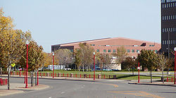
Suburban growth
Beginning in the 1950s, population and household growth shifted to the western portion of the county. This area of Dakota County had been predominantly Irish and Scottish extending southward toward the Scandinavians of Southern Minnesota. As population pressures expanded south from Minneapolis and Bloomington, the completion of Interstate 35W and 35E brought about major construction in the post-World War II period, turning villages into cities over the period of 20 years. BurnsvilleBurnsville, Minnesota
Burnsville is a city south of downtown Minneapolis in Dakota County in the U.S. state of Minnesota. The city lies on the south bank of the Minnesota River, upstream from the confluence with the Mississippi River...
, Apple Valley
Apple Valley, Minnesota
As of the census of 2000, there were 45,527 people, 16,344 households, and 12,405 families residing in the city. The population density was 2,625.5 people per square mile . There were 16,536 housing units at an average density of 953.6 per square mile...
, Eagan
Eagan, Minnesota
Eagan is a city south of Saint Paul in Dakota County in the U.S. state of Minnesota. The city lies on the south bank of the Minnesota River, upstream from the confluence with the Mississippi River. Eagan and nearby suburbs form the southern portion of Minneapolis-St. Paul, the fifteenth largest...
, and Lakeville
Lakeville, Minnesota
As of the census of 2000, there were 43,128 people, 13,609 households, and 11,526 families residing in the city. The population density was 1,192.4 people per square mile . There were 13,799 housing units at an average density of 381.5 per square mile...
brought over 200,000 people into the county by the end of the century. The Western and Northern Service Centers were constructed in the early 1990s each with an additional courthouse location. License centers were subsequently setup in Burnsville and Lakeville. Though pressure remained since the postwar boom to move the county seat to one of the larger communities in the county, the Dakota County Board maintained the seat in Hastings, while providing government services across the county.
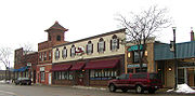
Historic sites
The history of the county is well-illustrated by the Registered Historic Places in the county, including the settlement at Mendota, the homes of well-heeled residents of Hastings, the ethnic gathering places in South Saint Paul, and other sites related to life on the prairie, including religion, education, transportation, commerce, and farm life.Law and government
Dakota County is governed by the Board of Commissioners. The members of the Board as of 2011 are:- Joseph Harris, District 1
- Kathleen Gaylord, District 2
- Thomas Egan, District 3
- Nancy Schouweiler, District 4
- Liz Workman, District 5
- Paul KrausePaul KrausePaul James Krause is a former American football defensive back who played in the National Football League...
, District 6 - Willis Braning, District 7
Dakota County also has an elected Sheriff
Sheriff
A sheriff is in principle a legal official with responsibility for a county. In practice, the specific combination of legal, political, and ceremonial duties of a sheriff varies greatly from country to country....
(Dave Bellows) and an elected County Attorney
County attorney
A county attorney in many areas of the United States is the chief legal officer for a county or local judicial district. It is usually an elected position...
(James Backstrom). Additionally there are appointed boards for the library system, community development agency, and several advisory boards. Dakota County is also served by an elected board of their Soil and Water Conservation District.
Principal employees of Dakota County include (but are not limited to) County Administrator Brandt Richardson, Community Services Director Dave Rooney, Parks Director Steve Sullivan, and Court Administrator Van Bostrom.
Geography
According to the 2000 census, the county has a total area of 586.33 square miles (1,518.6 km²), of which 569.58 square miles (1,475.2 km²) (or 97.14%) is land and 16.75 square miles (43.4 km²) (or 2.86%) is water.Lakes and rivers
The northern and eastern border of Dakota County is marked by the Minnesota and Mississippi Rivers. Management and jurisdiction of the rivers falls into multiple local, State and Federal agencies. Most of the Minnesota River bank is under the Minnesota Valley National Wildlife RefugeMinnesota Valley National Wildlife Refuge
The Minnesota Valley National Wildlife Refuge is a 14,000 acre National Wildlife Refuge in central Minnesota. There are eight refuge units strung along of the Minnesota River. Located just south of the city of Minneapolis, this is one of only four American national wildlife refuges in an urban...
with fish, wildlife, and parkland managed collectively by the U.S. Fish and Wildlife Service and the Minnesota Department of Natural Resources. The Dakota County Soil and Water Conservation District assists the county's six watershed management organizations (WMO) which include the Black Dog WMO, Gun Club Lake WMO, Lower Minnesota River Watershed District, Lower Mississippi WMO, North Cannon River WMO, and the Vermillion River Watershed Joint Powers Organization.
- Mississippi RiverMississippi RiverThe Mississippi River is the largest river system in North America. Flowing entirely in the United States, this river rises in western Minnesota and meanders slowly southwards for to the Mississippi River Delta at the Gulf of Mexico. With its many tributaries, the Mississippi's watershed drains...
: Adjacent to Mendota HeightsMendota Heights, MinnesotaAt the 2000 census, there were 11,434 people, 4,178 households and 3,237 families residing in the town. The population density was 1,222.2 per square mile . There were 4,252 housing units at an average density of 454.5 per square mile...
, LilydaleLilydale, MinnesotaLilydale is a city in Dakota County, Minnesota, United States. The population was 623 at the 2010 census.-Geography:According to the United States Census Bureau, the city has a total area of , of which, of it is land and of it is water....
, South St. PaulSouth St. Paul, MinnesotaSouth St. Paul is a city in Dakota County, Minnesota, immediately south and southeast of the city of Saint Paul, Minnesota. It is also southeast of West St. Paul, Minnesota. The population was 20,160 at the 2010 census. It is notable as one of the historic major meat packing cities in the United...
, Inver Grove HeightsInver Grove Heights, MinnesotaAs of the census of 2000, there were 29,751 people, 11,257 households, and 7,924 families residing in the city. The population density was 1,038.8 people per square mile . There were 11,457 housing units at an average density of 400.1 per square mile...
, RosemountRosemount, MinnesotaAs of the census of 2000, there were 14,619 people, 4,742 households, and 3,931 families residing in the city. The population density was 434.2 people per square mile . There were 4,845 housing units at an average density of 143.9 per square mile...
, and Hastings. - Minnesota RiverMinnesota RiverThe Minnesota River is a tributary of the Mississippi River, approximately 332 miles long, in the U.S. state of Minnesota. It drains a watershed of nearly , in Minnesota and about in South Dakota and Iowa....
: Adjacent to BurnsvilleBurnsville, MinnesotaBurnsville is a city south of downtown Minneapolis in Dakota County in the U.S. state of Minnesota. The city lies on the south bank of the Minnesota River, upstream from the confluence with the Mississippi River...
, EaganEagan, MinnesotaEagan is a city south of Saint Paul in Dakota County in the U.S. state of Minnesota. The city lies on the south bank of the Minnesota River, upstream from the confluence with the Mississippi River. Eagan and nearby suburbs form the southern portion of Minneapolis-St. Paul, the fifteenth largest...
, Mendota Heights, and MendotaMendota, MinnesotaMendota is a city in Dakota County, Minnesota, United States. The name comes from the Dakota word for "where the waters meet." The population was 198 at the 2010 census.-History:...
. - Vermillion RiverVermillion River (Minnesota)The Vermillion River meanders through Scott County and Dakota County in Minnesota, emptying into the Mississippi River just south of Hastings. 13.5 miles of it are designated as a trout stream, which is unusual for being so close to a metropolitan area....
: From FarmingtonFarmington, MinnesotaAs of the census of 2000, there were 12,365 people, 4,169 households, and 3,255 families residing in the city. The population density was 986.0 people per square mile . There were 4,233 housing units at an average density of 337.5 per square mile . The racial makeup of the city was 95.62%...
through Eureka Township to Hastings.
Burnsville
Eagan
Eureka Township
Hastings
|
Lakeville
Lilydale
Ravenna Township
Randolph Township
West Saint Paul
|
Rosemount
|
Major highways
|
 Minnesota State Highway 3 Minnesota State Highway 3Minnesota State Highway 3 Minnesota State Highway 3 is a state highway in Minnesota, which runs from its intersection with MN 21 in Faribault and continues north to its northern terminus at an interchange with MN 110 in Inver Grove Heights...  Minnesota State Highway 13 Minnesota State Highway 13Minnesota State Highway 13 Minnesota State Highway 13 is a highway in Minnesota that runs from its intersection with U.S. Highway 65 in Albert Lea to its northern terminus at its intersection with State Highway 149 at the West St...  Minnesota State Highway 19 Minnesota State Highway 19Minnesota State Highway 19 Minnesota State Highway 19 is a highway in southwest and southeast Minnesota, which runs from South Dakota Highway 30 at the South Dakota state line near Ivanhoe and continues east to its eastern terminus at its intersection with U.S...  Minnesota State Highway 20 Minnesota State Highway 20Minnesota State Highway 20 Minnesota State Highway 20 is a short highway in southeast Minnesota, which runs from its intersection with State Highway 19 in Cannon Falls and continues north to its northern terminus at its intersection with State Highway 50 near Miesville, 400 feet west of U.S...  Minnesota State Highway 50 Minnesota State Highway 50Minnesota State Highway 50 Minnesota State Highway 50 is a highway in Minnesota, which runs from its intersection with State Highway 3 and Dakota County Road 74 in Farmington and continues east to its eastern terminus at its intersection with U.S...  Minnesota State Highway 55 Minnesota State Highway 55Minnesota State Highway 55 Minnesota State Highway 55 is a highway in west-central, central, and east-central Minnesota, which runs from the North Dakota state line near Tenney and continues east and southeast to its eastern terminus at its intersection with U.S...  Minnesota State Highway 56 Minnesota State Highway 56Minnesota State Highway 56 Minnesota State Highway 56 is a highway in southeast Minnesota, which runs from its intersection with U.S. Highway 63 near the Iowa state line and Chester, Iowa, and continues north to its northern terminus at its junction with U.S...  Minnesota State Highway 77 Minnesota State Highway 77Minnesota State Highway 77 Minnesota State Highway 77 is a highway in Minnesota, which runs from its intersection with 138th Street in Apple Valley and continues north to its northern terminus at its interchange with State Highway 62 in Minneapolis. The route is in length... |
 Minnesota State Highway 110 Minnesota State Highway 110Minnesota State Highway 110 Minnesota State Highway 110 is a short connector highway in Minnesota, which runs from its interchange with State Highway 55 in Mendota Heights and continues east to its eastern terminus at its interchange with Interstate 494 in Inver Grove Heights, south of downtown Saint Paul.Highway 110 is in...  Minnesota State Highway 149 Minnesota State Highway 149Minnesota State Highway 149 Minnesota State Highway 149 is a highway in Minnesota that runs from its intersection with State Highway 3 in Inver Grove Heights to its northern terminus at its intersection with State Highway 5 in Saint Paul. The route is in length....  Minnesota State Highway 156 Minnesota State Highway 156Minnesota State Highway 156 Minnesota State Highway 156 is a highway in Minnesota, which runs from its interchange with Interstate 494 in South St. Paul and continues north to its northern terminus at its interchange with U.S. Highway 52 near downtown Saint Paul....  Minnesota State Highway 291 Minnesota State Highway 291 Minnesota State Highway 316 Minnesota State Highway 316Minnesota State Highway 316 Minnesota State Highway 316 is a highway in southeast Minnesota, which runs from its first intersection with U.S. Highway 61 in Welch Township, near Miesville; and continues north to its second intersection with U.S... |


 U.S. Highway 52
 U.S. Highway 61
Adjacent counties
- Ramsey CountyRamsey County, MinnesotaRamsey County is a county located in the U.S. state of Minnesota, founded in 1849. As of 2010, the population was 508,640. Its county seat is St. Paul, which is also Minnesota's state capital. The county is named for Alexander Ramsey , the first governor of the Minnesota Territory...
(north) - Washington CountyWashington County, MinnesotaWashington County is a county established in 1849 in the U.S. state of Minnesota. As of 2010, the population was 238,136. Its county seat is Stillwater.-History:...
(northeast) - Pierce County, WisconsinPierce County, WisconsinPierce County is a county located in the U.S. state of Wisconsin. As of 2010, the population was 41,019. Its county seat is Ellsworth. Pierce County is part of the Minneapolis-St. Paul-Bloomington, MN-WI Metropolitan Statistical Area .-Geography:...
(east, across the Mississippi RiverMississippi RiverThe Mississippi River is the largest river system in North America. Flowing entirely in the United States, this river rises in western Minnesota and meanders slowly southwards for to the Mississippi River Delta at the Gulf of Mexico. With its many tributaries, the Mississippi's watershed drains...
) - Goodhue CountyGoodhue County, MinnesotaGoodhue County is a county located in the U.S. state of Minnesota. As of 2010, the population was 46,183. Its county seat is Red Wing. Nearly all of Prairie Island Indian Community is within the county.-History:...
(southeast) - Rice CountyRice County, MinnesotaAs of the census of 2000, there were 56,665 people, 18,888 households, and 13,353 families residing in the county. The population density was 114 people per square mile . There were 20,061 housing units at an average density of 40 per square mile...
(southwest) - Scott CountyScott County, MinnesotaScott County is a county located in the U.S. state of Minnesota. It was organized in 1853 and named in honor of General Winfield Scott. As of 2010, the population was 129,928. Its county seat is Shakopee...
(west) - Hennepin CountyHennepin County, MinnesotaHennepin County is a county located in the U.S. state of Minnesota, named in honor of the 17th-century explorer Father Louis Hennepin. As of 2010 the population was 1,152,425. Its county seat is Minneapolis. It is by far the most populous county in Minnesota; more than one in five Minnesotans live...
(northwest)
National protected areas
- Minnesota Valley National Wildlife RefugeMinnesota Valley National Wildlife RefugeThe Minnesota Valley National Wildlife Refuge is a 14,000 acre National Wildlife Refuge in central Minnesota. There are eight refuge units strung along of the Minnesota River. Located just south of the city of Minneapolis, this is one of only four American national wildlife refuges in an urban...
(part) - Mississippi National River and Recreation AreaMississippi National River and Recreation AreaThe Mississippi National River and Recreation Area protects a and corridor along the Mississippi River from the cities of Dayton and Ramsey, Minnesota to just downstream of Hastings, Minnesota. This includes the stretch of Mississippi River which flows through Minneapolis and St. Paul, Minnesota...
(part)
Economy
Since the county grew as a bedroom community of Minneapolis and St. Paul, just over half of the residents (54%) work outside the county.Demographics
According to the 2010 U.S. Census, Dakota County had a population of 398,552, of which 195,661 (49.1%) were male and 202,891 (50.9%) were female. In terms of age, 76.7% of the population were 16 years and over, 73.6% were 18 years and over, 70.5% were 21 years and over, 12.8% were 62 years and over, and 10.0% were 65 years and over. The median age was 36.8 years. The median age for males was 35.7; the median age for females was 37.9.In terms of race and ethnicity, the county was 85.2% White (82.3% Non-Hispanic White Alone), 4.7% Black or African American, 0.4% American Indian and Alaska Native, 4.4% Asian, 0.1% Native Hawaiian and Other Pacific Islander, 2.4% from Some Other Race, and 2.9% from Two or More Races. Hispanics and Latinos of any race make up 6.0% of the population.
In terms of households, 69.5% were family households and 30.5% were non-family households. Approximately 55.2% were husband-wife family households; 26% had children under 18 years of age. Approximately 36.6% of households had children under 18 years of age living in them; 18.6% had people over the age of 65 living in them. The average household size is 2.60 and the average family size is 3.12. In terms of housing occupancy, 95.3% of households were occupied and 4.7% were vacant. Of the vacant housing units, 2.0% were for rent, 0.1% were rented but not occupied, 1.2% were for sale only, 0.2% were sold but not occupied, 0.5% were for seasonal, recreational, or occasional use, and 0.8% were all other vacants. The homeowner vacancy rate was 1.7% and the rental vacancy rate was 8.1%. Of all occupied housing units, 76.5% were owner-occupied and 23.5% were renter-occupied. The population in owner-occupied units was 314,833; the average household size was 2.71. The population in renter-occupied units was 80,866; the average household size was 2.26.
Cities and towns
Treaty of Mendota
The Treaty of Mendota was signed in Mendota, Minnesota on August 5, 1851 between the United States federal government and the Sioux tribes of Minnesota ....
was signed, opening much of Southern Minnesota to settlement, and there prominent Saint Paul businessmen built their grand mansions. Though linked with the state's capital for much of history via rail, Dakota County owes much of its current growth to the expansion of Minneapolis' population which accelerated during the post-World War II boom era of the 1960s. This demand for housing along with two major interstate highways linking Minneapolis (I-35W) and St. Paul (I-35E) to the county concentrated major growth and demand along the northern end. Today, the cities of Burnsville, Eagan, Apple Valley, Lakeville, Rosemount, Hastings, Inver Grove Heights, Mendota Heights, West St. Paul, and South St. Paul are synonymous with the Twin Cities, as being part of "the Cities." Both Burnsville and Eagan are nearly developed and have become more like independent cities attracting major development than just residential bedroom suburbs.
Though all of Dakota County is considered part of the metropolitan area and open to major development, the county government has steadily preserved farmland and continues to acquire new permanent natural lands in the southern townships. This has further defined the boundaries between urbanized and rural which is starkly visible in the outskirts of the developed cities. While the center of population still lies north with more cosmopolitan residents, culturally Dakota County is a rural community and the Dakota County Fair is still a largely agricultural event and held in Farmington.
Most of northern Dakota County is frequently referred to as "South of the River" for its location being south of the Minnesota River.
| Cities | Townships | Unincorporated Communities | Ghost Town | |||||
|---|---|---|---|---|---|---|---|---|
|
Mendota, Minnesota Mendota is a city in Dakota County, Minnesota, United States. The name comes from the Dakota word for "where the waters meet." The population was 198 at the 2010 census.-History:... Mendota Heights, Minnesota At the 2000 census, there were 11,434 people, 4,178 households and 3,237 families residing in the town. The population density was 1,222.2 per square mile . There were 4,252 housing units at an average density of 454.5 per square mile... Miesville, Minnesota Miesville is a city in Dakota County, Minnesota, United States. The population was 125 at the 2010 census.U.S. Highway 61 serves as a main route in the community... New Trier, Minnesota New Trier is a city in Dakota County, Minnesota, United States. The population was 112 at the 2010 census. Minnesota Highway 50 serves as a main route in the community.-History:... Northfield, Minnesota As of the census of 2000, there were 17,147 people, 4,909 households, and 3,210 families residing in the city. The population density was 2,452.2 people per square mile . There were 5,119 housing units at an average density of 732.1 per square mile... ‡ Randolph, Minnesota Randolph is a city in Dakota County, Minnesota, United States. The population was 436 at the 2010 census.-Geography:According to the United States Census Bureau, the city has a total area of , of which, of it is land and of it is water. State Highway 56 serves as a main route in the community. ... Rosemount, Minnesota As of the census of 2000, there were 14,619 people, 4,742 households, and 3,931 families residing in the city. The population density was 434.2 people per square mile . There were 4,845 housing units at an average density of 143.9 per square mile... South St. Paul, Minnesota South St. Paul is a city in Dakota County, Minnesota, immediately south and southeast of the city of Saint Paul, Minnesota. It is also southeast of West St. Paul, Minnesota. The population was 20,160 at the 2010 census. It is notable as one of the historic major meat packing cities in the United... Sunfish Lake, Minnesota Sunfish Lake is a city in Dakota County, Minnesota, United States. The population was 521 at the 2010 census. First incorporated as a village in 1958, the city's goal has been to maintain a rural atmosphere, with large lot size and as little disturbance of the natural environment as... Vermillion, Minnesota Vermillion is a city in Dakota County, Minnesota, United States. The population was 419 at the 2010 census.-Geography:According to the United States Census Bureau, the city has a total area of , all of it land. County Roads 62, 66, and 85 are three of the main routes in the community. U.S... West St. Paul, Minnesota As of the census of 2000, there were 19,405 people, 8,645 households, and 4,875 families residing in the city. The population density was 3,874.2 people per square mile . There were 8,779 housing units at an average density of 1,752.7 per square mile... |
|
|
Castle Rock, Minnesota Castle Rock is an unincorporated community in Dakota County, Minnesota, United States. Castle Rock is north of Northfield. Castle Rock has a post office with ZIP code 55010.The community has a school, Prairie Creek Community School.... Eureka Center, Minnesota Eureka Center is an unincorporated community in Dakota County, Minnesota, United States. Eureka Center is located at the center of Eureka Township along County Road 80, south-southeast of Lakeville. The Eureka Town Hall is located in Eureka Center. According to the Minnesota Department of... Waterford, Minnesota Waterford is an unincorporated town in Waterford Township, Dakota County, Minnesota, USA.-Geography:Waterford is located at at an elevation of 932 feet.... |
Nininger, Minnesota This article is about the ghost town. For the township, see Nininger Township, Dakota County, MinnesotaNininger is a ghost town in section 18 of Nininger Township in Dakota County, Minnesota, United States.-History:... |
|||
† Hastings is in Dakota County; a part of the city extends into Washington County
Washington County, Minnesota
Washington County is a county established in 1849 in the U.S. state of Minnesota. As of 2010, the population was 238,136. Its county seat is Stillwater.-History:...
.
‡ Northfield is mainly in Rice County
Rice County, Minnesota
As of the census of 2000, there were 56,665 people, 18,888 households, and 13,353 families residing in the county. The population density was 114 people per square mile . There were 20,061 housing units at an average density of 40 per square mile...
; a part of the city extends into Dakota County.
Education
Dakota County is home to the state's largest school districts and some of the highest paid Superintendents. Nationally recognized Independent School District 196Independent School District 196
Independent School District 196 is a K-12 public school district located in the south suburban Twin Cities, near both Minneapolis and St. Paul in Minnesota....
(Rosemount-Apple Valley-Eagan) houses 28,000 and is the fourth largest school district in the state. Other districts include Independent School District 191 (Burnsville-Eagan-Savage School District
Burnsville-Eagan-Savage School District
Burnsville-Eagan-Savage is Independent School District 191 in the U.S. state of Minnesota; it serves the city of Burnsville and parts of the neighboring cities of Savage and Eagan...
), Independent School District 194
Independent School District 194
Independent School District 194 is a state and nationally recognized K-12 public school district located in Lakeville, Minnesota.Also known as the Lakeville School District, District 194 serves approximately 11,084 students in grades Early Childhood-12 and is one of the fastest growing school...
(Lakeville-Elko-New Market), Independent School District 197 (West St. Paul-Mendota Heights-Eagan) and Independent School District 200 (Hastings).
Schools
- Burnsville Senior High School (ISD 191)
- John Metcalf Junior High School (ISD 191)
- Joseph Nicollet Junior High School (ISD 191)
- Edward D. Neill Elementary (ISD 191)
- Gideon Pond Elementary (ISD 191)
- Rahn Elementary (ISD 191)
- Sioux Trail Elementary (ISD 191)
- Sky Oaks Elementary (ISD 191)
- Vista View Elementary (ISD 191)
- William Byrne Elementary (ISD 191)
- North Trail Elementary (ISD 192)
- Meadowview Elementary (ISD 192)
- Akin Road Elementary (ISD 192)
- Farmington Elementary (ISD 192)
- Riverview Elementary (ISD 192)
- Robert Boeckman Middle School (ISD 192)
- Levi P. Dodge Middle School (ISD 192)
- Farmington Senior High SchoolFarmington Senior High School (Minnesota)Farmington Senior High School is a public high school located in Farmington, Minnesota. It is part of Farmington Area Public Schools....
(ISD 192) - Oak Ridge Elementary (ISD 196)
- Red Pine ElementaryRed Pine ElementaryRed Pine Elementary School is the largest elementary school in ISD 196.Red Pine Elementary is Located in Eagan, Minnesota. However, some students go to Eagan High Schools while other go the Rosemount High School. Red Pine has won several awards for their education....
(ISD 196) - Rosemount Elementary (ISD 196)
- Thomas Lake Elementary (ISD 196)
- Dakota Hills Middle (ISD 196)
- Black Hawk Middle School (ISD 196)
- Rosemount Middle SchoolRosemount Middle SchoolRosemount Middle School is a middle school in Rosemount, Minnesota, USA. Rosemount Middle is a Blue Ribbon School that is managed by the Independent School District 196.-Academic standards:...
(ISD 196) - Scott Highlands Middle SchoolScott Highlands Middle SchoolScott Highlands Middle School is a public middle school in Apple Valley, Minnesota, USA. It is managed by Independent School District 196. This middle school has grades 6–8. The School opened in 1980 to help accommodate the rapid population growth by the surrounding schools of Valley Middle School...
(ISD 196) - Valley Middle SchoolValley Middle SchoolValley Middle School is a middle school in Carlsbad, California. It has about 1,200 students from grades 6-8 and is part of the Carlsbad Unified School District. It offers an outstanding Performing Arts program....
(ISD 196) - Saint Joseph Catholic School
- Rosemount High SchoolRosemount High SchoolRosemount High School is a public four-year high school in Rosemount, Minnesota founded in 1918. The school is a member of Minnesota Independent School District 196...
(ISD 196) - Eagan High SchoolEagan High SchoolEagan High School is a public high school in east-central Eagan, Minnesota. The school opened in fall of 1989 for ninth grade students and for grades ten through twelve the following year. It is particularly noted for its fine arts programs and use of technology...
(ISD 196) - Eastview High SchoolEastview High SchoolEastview High School is a comprehensive and college preparatory public high school located in Apple Valley, Minnesota, USA. Established in 1997, Eastview is the newest of the four high schools serving Independent School District 196. Newsweek ranked the school in their "List of the Top High Schools...
(ISD 196) - Simley High SchoolSimley High SchoolLocated in Inver Grove Heights, Minnesota, Simley High School had its first graduating class in 1961. The school was named after I.T. Simley, the retired Superintendent of Schools from South St. Paul who served as a consultant to Inver Grove Heights during the district’s transition years. Simley’s...
(ISD 199) - South Saint Paul High SchoolSouth Saint Paul High SchoolSouth Saint Paul High School is a public high school in South St. Paul, Minnesota, United States.They are nicknamed the Packers, in honor of what was once the world's largest stockyards located on the banks of the Mississippi River...
(SSD 6)
Libraries
Dakota County LibrariesDakota County Library
The Dakota County Library system is a regional public library system in Dakota County, Minnesota, headquartered in the Wescott Library in Eagan. The system includes 8 branch libraries and a bookmobile, and shares borrowing privileges with the City of South St. Paul public library...
- Burnhaven Library in BurnsvilleBurnsville, MinnesotaBurnsville is a city south of downtown Minneapolis in Dakota County in the U.S. state of Minnesota. The city lies on the south bank of the Minnesota River, upstream from the confluence with the Mississippi River...
- Farmington Library in FarmingtonFarmington, MinnesotaAs of the census of 2000, there were 12,365 people, 4,169 households, and 3,255 families residing in the city. The population density was 986.0 people per square mile . There were 4,233 housing units at an average density of 337.5 per square mile . The racial makeup of the city was 95.62%...
- Galaxie Library in Apple ValleyApple Valley, MinnesotaAs of the census of 2000, there were 45,527 people, 16,344 households, and 12,405 families residing in the city. The population density was 2,625.5 people per square mile . There were 16,536 housing units at an average density of 953.6 per square mile...
- Heritage Library in LakevilleLakeville, MinnesotaAs of the census of 2000, there were 43,128 people, 13,609 households, and 11,526 families residing in the city. The population density was 1,192.4 people per square mile . There were 13,799 housing units at an average density of 381.5 per square mile...
- Inver Glen Library in Inver Grove HeightsInver Grove Heights, MinnesotaAs of the census of 2000, there were 29,751 people, 11,257 households, and 7,924 families residing in the city. The population density was 1,038.8 people per square mile . There were 11,457 housing units at an average density of 400.1 per square mile...
- Pleasant Hill Library in HastingsHastings, MinnesotaHastings is a city in Dakota counties in the U.S. state of Minnesota, near the confluence of the Mississippi and St. Croix Rivers. The population was 22,172 at the 2010 census. It is the county seat of Dakota County. The bulk of Hastings is in Dakota County; only a small part of the city extends...
- Robert Trail Library in RosemountRosemount, MinnesotaAs of the census of 2000, there were 14,619 people, 4,742 households, and 3,931 families residing in the city. The population density was 434.2 people per square mile . There were 4,845 housing units at an average density of 143.9 per square mile...
- City of South St. Paul Library in South St. PaulSouth St. Paul, MinnesotaSouth St. Paul is a city in Dakota County, Minnesota, immediately south and southeast of the city of Saint Paul, Minnesota. It is also southeast of West St. Paul, Minnesota. The population was 20,160 at the 2010 census. It is notable as one of the historic major meat packing cities in the United...
- Wentworth Library in West St. PaulWest St. Paul, MinnesotaAs of the census of 2000, there were 19,405 people, 8,645 households, and 4,875 families residing in the city. The population density was 3,874.2 people per square mile . There were 8,779 housing units at an average density of 1,752.7 per square mile...
- Wescott Library in EaganEagan, MinnesotaEagan is a city south of Saint Paul in Dakota County in the U.S. state of Minnesota. The city lies on the south bank of the Minnesota River, upstream from the confluence with the Mississippi River. Eagan and nearby suburbs form the southern portion of Minneapolis-St. Paul, the fifteenth largest...
Parks
- Big Rivers Regional TrailBig Rivers Regional TrailBig Rivers Regional Trail is a rail trail in Minnesota, in the cities of Lilydale, Mendota, and Mendota Heights.The paved trail occupies an abandoned railroad corridor. It is used for walking, biking and inline skating and is part of the Dakota County park system. The trail follows the...
in Mendota Heights - Lake Byllesby Regional Park in Cannon Falls
- Lebanon Hills Regional ParkLebanon Hills Regional ParkLebanon Hills Regional Park is a 2,000 acre Dakota County Park, located in Eagan, Minnesota and Apple Valley, Minnesota, that includes naturally preserved woodland and prairie. Winter activities include skiing, snowshoeing, ice skating, ice fishing, and hiking...
in Eagan/Apple Valley - Miesville Ravine Park ReserveMiesville Ravine Park ReserveMiesville Ravine Park Reserve is a Dakota County park near the town of Miesville, Minnesota. It preserves over of biologically diverse land in the Cannon River valley. Most of the park is wooded with mature oak, maple, cottonwood, willow, red cedar, and white pine...
in Miesville - Dakota Woods Dog Park in Empire Township
- Spring Lake Park Reserve in Hastings/Rosemount
- Thompson County Park in West St. Paul
- Dakota County Bikeway System
Notable people
- Pierce ButlerPierce Butler (justice)Pierce Butler was an American jurist who served as an Associate Justice of the Supreme Court of the United States from 1923 until his death in 1939...
, U.S. Supreme Court justice - Harold StassenHarold StassenHarold Edward Stassen was the 25th Governor of Minnesota from 1939 to 1943. After service in World War II, from 1948 to 1953 he was president of the University of Pennsylvania...
(R)Republican Party (United States)The Republican Party is one of the two major contemporary political parties in the United States, along with the Democratic Party. Founded by anti-slavery expansion activists in 1854, it is often called the GOP . The party's platform generally reflects American conservatism in the U.S...
, Former Governor of Minnesota, Aide to Adm. Bull Halsey, Aide to President Dwight Eisenhower, Participant/Drafter of the United NationsUnited NationsThe United Nations is an international organization whose stated aims are facilitating cooperation in international law, international security, economic development, social progress, human rights, and achievement of world peace...
Charter - Ignatius DonnellyIgnatius DonnellyIgnatius Loyola Donnelly was a U.S. Congressman, populist writer and amateur scientist, known primarily now for his theories concerning Atlantis, Catastrophism , and Shakespearean authorship, all of which modern historians consider to be pseudoscience and pseudohistory...
, Politician - Henry Hastings SibleyHenry Hastings SibleyHenry Hastings Sibley was the first Governor of the U.S. state of Minnesota.-Early life and education:...
, Politician, Indian agent
External links
- Dakota County Historical Society
- Dakota County government's website
- Dakota County Library's website
- Park maps
- Dakota County Community Development Agency
- Dakota County Biographies from 1881