
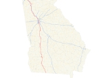
Georgia State Route 3
Encyclopedia
State Route 3 runs in a generally north–south orientation from Georgia's northern border to its southern border. Its northern terminus is at the Tennessee
state line just southeast of Chattanooga (connecting with Tennessee State Route 8
), and its southern terminus is at the Florida
state line about twelve miles (19 km) south-southeast of Thomasville
(connecting with Florida State Road 57).
with Georgia Florida Parkway
and U.S. 41
. It is concurrent with U.S. 41 on its run through the northwestern portion of the state, passing through such cities as Dalton
, Calhoun
, and Cartersville
, and is also concurrent with U.S. 76
from the Tennessee state line to just east of Dalton. In addition, this portion of the route parallels Interstate 75
.
S.R. 3 and U.S. 41 enter the Atlanta area from the northwest via Cobb Parkway, passing through Marietta
, one of Atlanta's largest suburbs. Upon entering Fulton County
and the city of Atlanta, this becomes Northside Drive, which forms part of the western boundary of the campus of Georgia Tech
. U.S. 19
joins the route at Fourteenth Street. The route briefly picks up U.S. 78
and U.S. 278
near Midtown before continuing south on Metropolitan Parkway along with U.S. 19, U.S. 41, and U.S. 29
, still paralleling Interstates 75 and 85
(the Downtown Connector
). U.S. 29 departs shortly afterward, just before the I-20
overpass. S.R. 3 touches the perimeter of Hartsfield-Jackson Atlanta International Airport
near Hapeville before crossing I-75 and I-285
and leaving Atlanta proper. The highway then serves southern suburbs such as Forest Park
and Jonesboro
, still carrying U.S. 19 and U.S. 41. The Atlanta Motor Speedway
in Hampton
has direct access from the highway, which regularly sees massive backups on weekends when NASCAR
races take place there.
S.R. 3 has a brief freeway section around the west side of Griffin
. South of Griffin, U.S. 19 and U.S. 41 diverge, with S.R. 3 following U.S. 19 south through Thomaston
, Butler
, and Americus
. Both routes join U.S. 82
and the Liberty Expressway around the north and east sides of Albany
, with U.S. 82 leaving and S.R. 300
(the Georgia-Florida Parkway
) joining near the end of the freeway. Both S.R. 3 and S.R. 300 follow U.S. 19 the rest of the way to the Florida state line.
for about fifteen miles (24 km) between Meigs
and Thomasville
. Until recently, this was the SR 3 mainline, while SR 300
served the duty of being US 19's state route concurrency.
State Route 3 Bypass is a short western bypass of the town of Leesburg
in Lee County
.
The portion of Tara
Boulevard in Clayton County
that is not covered by US 19/US 41 and SR 3 near Interstate 75
is designated as State Route 3 Connector. The route is little more than a high-capacity set of ramps to and from I-75 and is unsigned. Another instance of State Route 3 Connector occurs in Whitfield County
south of Dalton
; it connects I-75 to US 41/SR 3 and the Dalton Bypass. A newer instance is located in Marietta
, on a stretch of Roswell Road that was formerly SR 120
east of U.S. 41/SR 3.
Tennessee
Tennessee is a U.S. state located in the Southeastern United States. It has a population of 6,346,105, making it the nation's 17th-largest state by population, and covers , making it the 36th-largest by total land area...
state line just southeast of Chattanooga (connecting with Tennessee State Route 8
Tennessee State Route 8
State Route 8 is a south–north route that connects Chattanooga, Tennessee to McMinnville.- Route description :State Route 8 begins concurrent to US-41 / US-76 at the Georgia border in Chattanooga. As Ringgold Road, SR-8 travels into downtown Chattanooga, where it becomes East Main Street...
), and its southern terminus is at the Florida
Florida
Florida is a state in the southeastern United States, located on the nation's Atlantic and Gulf coasts. It is bordered to the west by the Gulf of Mexico, to the north by Alabama and Georgia and to the east by the Atlantic Ocean. With a population of 18,801,310 as measured by the 2010 census, it...
state line about twelve miles (19 km) south-southeast of Thomasville
Thomasville, Georgia
Thomasville is the county seat of Thomas County, Georgia, United States. The city is the second largest in Southwest Georgia after Albany.The city deems itself the City of Roses and holds an annual Rose Festival. The town features plantations open to the public, a historic downtown, a large...
(connecting with Florida State Road 57).
Routing
State Route 3 spends almost the entirety of its route concurrent with one or both of U.S. 19U.S. Route 19
U.S. Route 19 is a north–south U.S. Highway. Despite encroaching Interstate Highways, the route has remained a long-haul route, connecting the Gulf of Mexico with Lake Erie....
with Georgia Florida Parkway
Georgia State Route 300
State Route 300, also called the Georgia-Florida Parkway, is a long route that runs from Florida State Road 57 at the Florida-Georgia state line south of Thomasville in Thomas County, north to I-75 in Cordele in Crisp County.-Route description:...
and U.S. 41
U.S. Route 41
U.S. Route 41 is a north–south United States Highway that runs from Miami, Florida to the Upper Peninsula of Michigan. Until 1949, the part in southern Florida, from Naples to Miami, was U.S...
. It is concurrent with U.S. 41 on its run through the northwestern portion of the state, passing through such cities as Dalton
Dalton, Georgia
Dalton is a city in Whitfield County, Georgia, United States. It is the county seat of Whitfield County and the principal city of the Dalton, Georgia Metropolitan Statistical Area, which encompasses all of both Murray and Whitfield counties. As of the 2010 census, the city had a population of 33,128...
, Calhoun
Calhoun, Georgia
Calhoun is a city in Gordon County, Georgia, United States. As of the 2010 census, the city had a population of 15,650. The city is the county seat of Gordon County.-Geography:Calhoun is located at , along the Oostanaula River....
, and Cartersville
Cartersville, Georgia
Cartersville is a town in Bartow County, in the U.S. state of Georgia. As of the 2010 census, the city had a population of 19,7314. The city is the county seat of Bartow County.-Geography:Cartersville was named for Colonel Farish Carter....
, and is also concurrent with U.S. 76
U.S. Route 76
U.S. Route 76 is an east–west United States highway that runs for from Chattanooga, Tennessee to Wrightsville Beach, North Carolina.-Tennessee:...
from the Tennessee state line to just east of Dalton. In addition, this portion of the route parallels Interstate 75
Interstate 75
Interstate 75 is a major north–south Interstate Highway in the Great Lakes and Southeastern regions of the United States. It travels from State Road 826 and State Road 924 in Hialeah, Florida to Sault Ste. Marie, Michigan, at the Ontario, Canada, border...
.
S.R. 3 and U.S. 41 enter the Atlanta area from the northwest via Cobb Parkway, passing through Marietta
Marietta, Georgia
Marietta is a city located in central Cobb County, Georgia, United States, and is its county seat.As of the 2010 census, the city had a total population of 56,579, making it one of metro Atlanta's largest suburbs...
, one of Atlanta's largest suburbs. Upon entering Fulton County
Fulton County, Georgia
Fulton County is a county located in the U.S. state of Georgia. Its county seat is Atlanta, the state capital since 1868 and the principal county of the Atlanta metropolitan area...
and the city of Atlanta, this becomes Northside Drive, which forms part of the western boundary of the campus of Georgia Tech
Georgia Institute of Technology
The Georgia Institute of Technology is a public research university in Atlanta, Georgia, in the United States...
. U.S. 19
U.S. Route 19
U.S. Route 19 is a north–south U.S. Highway. Despite encroaching Interstate Highways, the route has remained a long-haul route, connecting the Gulf of Mexico with Lake Erie....
joins the route at Fourteenth Street. The route briefly picks up U.S. 78
U.S. Route 78
U.S. Highway 78 is an east–west United States highway that runs for 715 miles from Memphis, Tennessee, to Charleston, South Carolina. Between Memphis and Birmingham, Alabama, it is being upgraded to become Interstate 22....
and U.S. 278
U.S. Route 278
U.S. Route 278 is a parallel route of U.S. Route 78. It currently runs for 1,074 miles from Hilton Head Island, South Carolina to Wickes, Arkansas at U.S. Highway 71/U.S. Highway 59. It might be notable that it is longer than its parent highway, US Hwy-78. US Hwy-278 passes through the states of...
near Midtown before continuing south on Metropolitan Parkway along with U.S. 19, U.S. 41, and U.S. 29
U.S. Route 29
U.S. Route 29 is a north–south United States highway that runs for from the western suburbs of Baltimore, Maryland, to Pensacola, Florida. This highway's northern terminus is at Maryland Route 99 in Ellicott City, Maryland...
, still paralleling Interstates 75 and 85
Interstate 85
Interstate 85 is a major interstate highway in the Southeastern United States. Its current southern terminus is at an interchange with Interstate 65 in Montgomery, Alabama; its northern terminus interchanges with Interstate 95 in Petersburg, Virginia, near Richmond...
(the Downtown Connector
Downtown Connector
In Atlanta, Georgia, the Downtown Connector or 75/85 is the concurrent section of Interstate 75 and Interstate 85 through the core of the city. Beginning at the I-85/Langford Parkway interchange, the Downtown Connector runs generally due north, meeting the east-west Interstate 20 in the middle....
). U.S. 29 departs shortly afterward, just before the I-20
Interstate 20
Interstate 20 is a major east–west Interstate Highway in the Southern United States. I‑20 runs 1,535 miles from near Kent, Texas, at Interstate 10 to Florence, South Carolina, at Interstate 95...
overpass. S.R. 3 touches the perimeter of Hartsfield-Jackson Atlanta International Airport
Hartsfield-Jackson Atlanta International Airport
Hartsfield–Jackson Atlanta International Airport , known locally as Atlanta Airport, Hartsfield Airport, and Hartsfield–Jackson, is located seven miles south of the central business district of Atlanta, Georgia, United States...
near Hapeville before crossing I-75 and I-285
Interstate 285
Interstate 285 is an Interstate Highway loop encircling Atlanta, Georgia, for . I-285 is also known as unsigned State Route 407 and is colloquially referred to as the Perimeter. Suburban sprawl has made it one of the most heavily traveled roadways in the United States, and portions of the highway...
and leaving Atlanta proper. The highway then serves southern suburbs such as Forest Park
Forest Park, Georgia
Forest Park is a city in Clayton County, Georgia, United States. It is located approximately nine miles south of Atlanta and is part of the Atlanta–Sandy Springs–Marietta Metropolitan Statistical Area...
and Jonesboro
Jonesboro, Georgia
Jonesboro is a city in Clayton County, Georgia, United States. The population was 4,724 as of the 2010 census. The city is the county seat of Clayton County....
, still carrying U.S. 19 and U.S. 41. The Atlanta Motor Speedway
Atlanta Motor Speedway
Atlanta Motor Speedway is a track just outside Hampton, Georgia, twenty miles south of Atlanta. It is a quad-oval track with a seating capacity of over 125,000. It opened in 1960 as a standard oval. In 1994, 46 condominiums were built over the northeastern side of the track...
in Hampton
Hampton, Georgia
Hampton is a city in southwestern Henry County, Georgia, United States. As of the 2010 census, the city had a population of 6,987. Census Estimates for 2005 show a population of 4,743. Hampton mailing addresses also dip into eastern Clayton County and northern Spalding County.The Atlanta Motor...
has direct access from the highway, which regularly sees massive backups on weekends when NASCAR
NASCAR
The National Association for Stock Car Auto Racing is a family-owned and -operated business venture that sanctions and governs multiple auto racing sports events. It was founded by Bill France Sr. in 1947–48. As of 2009, the CEO for the company is Brian France, grandson of the late Bill France Sr...
races take place there.
S.R. 3 has a brief freeway section around the west side of Griffin
Griffin, Georgia
Griffin is a city in and the county seat of Spalding County in the U.S. state of Georgia. It is part of the Atlanta metropolitan area. As of the 2010 census, the city had a population of 23,643.-Geography:Griffin is located at ....
. South of Griffin, U.S. 19 and U.S. 41 diverge, with S.R. 3 following U.S. 19 south through Thomaston
Thomaston, Georgia
Thomaston is a city in and the county seat of Upson County, Georgia, United States. The population was 9,638 at the 2006 census. It is the principal city of and is included in the Thomaston, Georgia Micropolitan Statistical Area, which is included in the Atlanta-Sandy Springs-Gainesville,...
, Butler
Butler, Georgia
Butler is the county seat of Taylor County, Georgia, United States. Its population was 1,907 at the 2000 census.-Geography:Butler is located at ....
, and Americus
Americus, Georgia
-Early years:Americus, Georgia was named and chartered by Sen. Lovett B. Smith in 1832.For its first two decades, Americus was a small courthouse town. The arrival of the railroad in 1854 and, three decades later, local attorney Samuel H. Hawkins' construction of the only privately financed...
. Both routes join U.S. 82
U.S. Route 82
U.S. Route 82 is an east–west United States highway in the southern United States. What started as a 1932 addition to the system across central Mississippi and southern Arkansas eventually became a 1,609 mile route extending from the White Sands of New Mexico to Georgia's Atlantic coast.The...
and the Liberty Expressway around the north and east sides of Albany
Albany, Georgia
Albany is a city in and the county seat of Dougherty County, Georgia, United States, in the southwestern part of the state. It is the principal city of the Albany, Georgia metropolitan area and the southwest part of the state. The population was 77,434 at the 2010 U.S. Census, making it the...
, with U.S. 82 leaving and S.R. 300
Georgia State Route 300
State Route 300, also called the Georgia-Florida Parkway, is a long route that runs from Florida State Road 57 at the Florida-Georgia state line south of Thomasville in Thomas County, north to I-75 in Cordele in Crisp County.-Route description:...
(the Georgia-Florida Parkway
Georgia State Route 300
State Route 300, also called the Georgia-Florida Parkway, is a long route that runs from Florida State Road 57 at the Florida-Georgia state line south of Thomasville in Thomas County, north to I-75 in Cordele in Crisp County.-Route description:...
) joining near the end of the freeway. Both S.R. 3 and S.R. 300 follow U.S. 19 the rest of the way to the Florida state line.
Major junctions
| County | Location | Roads intersected | Notes |
|---|---|---|---|
| Catoosa Catoosa County, Georgia Catoosa County is a county located in the U.S. state of Georgia. It was created on December 5, 1853. As of 2000, the population was 53,282. The 2007 Census Estimate shows a population of 62,241... |
Ringgold Ringgold, Georgia Ringgold is a city in Catoosa County, Georgia, United States. The population was 2,422 at the 2000 census. The city is the county seat of Catoosa County... |
To Rossville | |
| SR 2 East joins SR 3 South. To Fort Oglethorpe |
|||
| SR 151 North joins SR 3 South. | |||
| SR 151 North diverges from SR 3 East and goes to Ooltewah, TN. | |||
| SR 2 East diverges from SR 3 South. | |||
| Interchange I-75 North to Chattanooga, TN; I-75 South to Atlanta |
|||
| Whitfield Whitfield County, Georgia Whitfield County is a county located in the U.S. state of Georgia. It was created on December 30, 1851. The 2010 Census shows a population of 102,599. The county seat is Dalton.It is part of the Dalton, Georgia, Metropolitan Statistical Area.-Civil War:... |
Tunnel Hill Tunnel Hill, Georgia Tunnel Hill is a town in northwest Whitfield County, Georgia, United States,and southern Catoosa County, Georgia, United States . It is part of the Dalton, Georgia Metropolitan Statistical Area. The population was 1,209 at the 2000 census.-History:... |
SR 201 South joins SR 3 South SR 201 North to Varnell |
|
| Rocky Face | SR 201 South diverges from SR 3 South and goes to LaFayette | ||
| Dalton Dalton, Georgia Dalton is a city in Whitfield County, Georgia, United States. It is the county seat of Whitfield County and the principal city of the Dalton, Georgia Metropolitan Statistical Area, which encompasses all of both Murray and Whitfield counties. As of the 2010 census, the city had a population of 33,128... |
Interchange | ||
| US 76 East diverges from SR 3 South and goes to Chatsworth | |||
| Gordon Gordon County, Georgia Gordon County is a county located in the U.S. state of Georgia. As of 2000, the population was 44,104. The 2007 Census Estimate shows a population of 52,044. The county seat is Calhoun.- History :... |
Resaca Resaca, Georgia Resaca is a city in Gordon County, Georgia, and Whitfield County, Georgia along the Oostanaula River. The population was 815 at the 2000 census.-Geography:Resaca is located at .... |
SR 136 West joins SR 3 South SR 136 East to Talking Rock |
|
| SR 136 West diverges from SR 3 South and goes to LaFayette | |||
| Calhoun Calhoun, Georgia Calhoun is a city in Gordon County, Georgia, United States. As of the 2010 census, the city had a population of 15,650. The city is the county seat of Gordon County.-Geography:Calhoun is located at , along the Oostanaula River.... |
Interchange | ||
| To Chatsworth | |||
| West to Armuchee; East to Ranger | |||
| West to Rome; East to Fairmount | |||
| Bartow Bartow County, Georgia Bartow County is a county located in the U.S. state of Georgia. As of the 2010 census, the population was 100,157. According to the U.S. Census Bureau's July 1, 2009 estimate, the county's explosive growth resulted in a population of 96,217, a 26.5% increase in less than ten years... |
Adairsville Adairsville, Georgia Adairsville is a city in Bartow County, Georgia, United States. The population was 2,542 at the 2000 census. As of 2007 data Adairsville's population was 3,076: 1,414 males and 1,662 females. Adairsville is south of Calhoun, northeast of Rome and north of Atlanta.-Geography:Adairsville is an... |
West to Armuchee; East to Canton | |
| Cartersville Cartersville, Georgia Cartersville is a town in Bartow County, in the U.S. state of Georgia. As of the 2010 census, the city had a population of 19,7314. The city is the county seat of Bartow County.-Geography:Cartersville was named for Colonel Farish Carter.... |
|||
| US 411 North/SR 20 East joins SR 3 South. | |||
| US 411 North/SR 20 East diverges from SR 3 South. SR 61 North to Fairmount; SR 61 South to Cartersville |
|||
| North to I-75; South to Rockmart | |||
| Emerson Emerson, Georgia Emerson is a city in far southern Bartow County, Georgia, United States, on highways 41, 293, and 75. The population was 1,092 at the 2000 census.... |
To Cartersville | ||
| Cobb Cobb County, Georgia Cobb County is a county located in the U.S. state of Georgia. Its county seat and largest city is Marietta, which is located in the center of the county. The county was named for Thomas Willis Cobb, who in the early 19th century was a United States representative and senator from Georgia... |
Acworth Acworth, Georgia Acworth is a city in Cobb County, Georgia, United States. As of the 2010 census, the city had a population of 20,425. Acworth is located in the foothills of the North Georgia mountains along the southeastern banks of Lake Acworth and Lake Allatoona on the Etowah River.Acworth's nickname is "The... |
SR 92 North joins SR 3 South, as SR 92 South goes to Hiram | |
| SR 92 North diverges from SR 3 South and goes to Woodstock | |||
| To Powder Springs | |||
| Marietta Marietta, Georgia Marietta is a city located in central Cobb County, Georgia, United States, and is its county seat.As of the 2010 census, the city had a total population of 56,579, making it one of metro Atlanta's largest suburbs... |
|||
| East to SR 120 | |||
| West to Dallas, East to Roswell | |||
| North to I-75; South to Smyrna | |||
| Interchange I-285 East ramp to I-75 |
|||
| Fulton Fulton County, Georgia Fulton County is a county located in the U.S. state of Georgia. Its county seat is Atlanta, the state capital since 1868 and the principal county of the Atlanta metropolitan area... |
Atlanta Atlanta, Georgia Atlanta is the capital and most populous city in the U.S. state of Georgia. According to the 2010 census, Atlanta's population is 420,003. Atlanta is the cultural and economic center of the Atlanta metropolitan area, which is home to 5,268,860 people and is the ninth largest metropolitan area in... |
Interchange | |
| Interchange | |||
| US 19/SR 9 North to Sandy Springs | |||
| US 78/278 East join SR 3 South, as US 78/278 West go to Austell | |||
| US 78/278 East diverge from SR 3 South, as US 29 South joins it. | |||
| SR 3 South join SR 154 West, as SR 154 East goes to Avondale Estates | |||
| Interchange Southbound exit and northbound entrance only |
|||
| Hapeville Hapeville, Georgia Hapeville is a city in Fulton County, Georgia, United States, located directly adjacent to the city of Atlanta. The population was 6,373 at the 2010 census. It is named for Dr... |
Interchange North to Atlanta; South to Macon |
||
| Clayton Clayton County, Georgia Clayton County is a county located in the U.S. state of Georgia. As of 2000, the population was 236,517. The 2008 Census estimate placed the population at 273,718. The county seat is Jonesboro... |
Atlanta Atlanta, Georgia Atlanta is the capital and most populous city in the U.S. state of Georgia. According to the 2010 census, Atlanta's population is 420,003. Atlanta is the cultural and economic center of the Atlanta metropolitan area, which is home to 5,268,860 people and is the ninth largest metropolitan area in... |
Interchange | |
| Forest Park Forest Park, Georgia Forest Park is a city in Clayton County, Georgia, United States. It is located approximately nine miles south of Atlanta and is part of the Atlanta–Sandy Springs–Marietta Metropolitan Statistical Area... |
West to I-75; East to Lake City | ||
| Jonesboro Jonesboro, Georgia Jonesboro is a city in Clayton County, Georgia, United States. The population was 4,724 as of the 2010 census. The city is the county seat of Clayton County.... |
Interchange | ||
| SR 3 South diverges from US 19/41 South. | |||
| West to Riverdale; East to Stockbridge | |||
| North to Morrow; South to Fayetteville | |||
| SR 3 South rejoins US 19/41 South | |||
| Henry Henry County, Georgia Henry County is a growing suburban county located in the U.S. state of Georgia. As of the 2000 census, the population was 119,341. As of 2010, the county's population swelled to 203,922, up 70.9% from the previous census and becoming Georgia's 8th most populous county and the 10th fastest growing... |
Hampton Hampton, Georgia Hampton is a city in southwestern Henry County, Georgia, United States. As of the 2010 census, the city had a population of 6,987. Census Estimates for 2005 show a population of 4,743. Hampton mailing addresses also dip into eastern Clayton County and northern Spalding County.The Atlanta Motor... |
To McDonough | |
| To McDonough | |||
| Spalding | Griffin Griffin, Georgia Griffin is a city in and the county seat of Spalding County in the U.S. state of Georgia. It is part of the Atlanta metropolitan area. As of the 2010 census, the city had a population of 23,643.-Geography:Griffin is located at .... |
To Fayetteville | |
| Interchange West to Senoia; East to Jackson |
|||
| Interchange West to Greenville; East to Griffin |
|||
| US 41 South diverges from US 19/SR 3 South as it goes to Barnesville | |||
| Pike Pike County, Georgia Pike County is a county located in the U.S. state of Georgia. It was created on December 9, 1822. As of 2000, the population was 13,688. The 2007 Census Estimate shows a population of 17,204... |
Zebulon Zebulon, Georgia Zebulon is a city in Pike County, Georgia, United States. The population was 1,181 at the 2000 census. The city is the county seat of Pike County... |
West to Concord; East to Barnesville | |
| Meansville Meansville, Georgia Meansville is a city in Pike County, Georgia, United States. The population was 192 at the 2000 census.-Geography:Meansville is located at .... |
SR 109 South joins US 19/SR 3 South, as SR 109 North goes to SR 18 | ||
| SR 109 South diverges from US 19/SR 3 South, and goes to Molena | |||
| Upson Upson County, Georgia Upson County is a county located in the U.S. state of Georgia. It is a part of the Atlanta Metropolitan Area . It was created on December 15, 1824. As of 2000, the population was 27,597. The 2007 Census Estimate shows a population of 27,562... |
Thomaston Thomaston, Georgia Thomaston is a city in and the county seat of Upson County, Georgia, United States. The population was 9,638 at the 2006 census. It is the principal city of and is included in the Thomaston, Georgia Micropolitan Statistical Area, which is included in the Atlanta-Sandy Springs-Gainesville,... |
||
| Roberta Roberta, Georgia Roberta is a city in Crawford County, Georgia, United States. The population was 808 at the 2000 census. It is part of the Macon Metropolitan Statistical Area.-Geography:Roberta is located at .... |
US 80/SR 22 West join US 19/SR 3 South as US 80/SR 22 East go to Downtown Roberta | ||
| Taylor Taylor County, Georgia Taylor County is a county located in the U.S. state of Georgia. As of 2000, the population was 8,815. The 2007 Census Estimate shows a population of 8,738... |
Butler Butler, Georgia Butler is the county seat of Taylor County, Georgia, United States. Its population was 1,907 at the 2000 census.-Geography:Butler is located at .... |
US 80/SR 22 West diverge from SR 3, going to Talbotton | |
| West to Talbotton; East to SR 137 | |||
| North to Roberta; South to Buena Vista | |||
| West to Junction City; East to Reynolds | |||
| Rupert | SR 90 West joins US 19/SR 3 South, as SR 90 East goes to Ideal | ||
| SR 127 South joins US 19/SR 3 South/SR 90 West; as SR 127 North goes to Marshallville | |||
| SR 90 West/SR 127 South both diverge from US 19/SR 3 South, as they go to Junction City |
Banner routes
State Route 3 Alternate uses an older routing of US 19U.S. Route 19
U.S. Route 19 is a north–south U.S. Highway. Despite encroaching Interstate Highways, the route has remained a long-haul route, connecting the Gulf of Mexico with Lake Erie....
for about fifteen miles (24 km) between Meigs
Meigs, Georgia
Meigs is a city in Mitchell and Thomas counties in the U.S. state of Georgia. The population was 1,090 at the 2000 census.-Geography:Meigs is located at ....
and Thomasville
Thomasville, Georgia
Thomasville is the county seat of Thomas County, Georgia, United States. The city is the second largest in Southwest Georgia after Albany.The city deems itself the City of Roses and holds an annual Rose Festival. The town features plantations open to the public, a historic downtown, a large...
. Until recently, this was the SR 3 mainline, while SR 300
Georgia State Route 300
State Route 300, also called the Georgia-Florida Parkway, is a long route that runs from Florida State Road 57 at the Florida-Georgia state line south of Thomasville in Thomas County, north to I-75 in Cordele in Crisp County.-Route description:...
served the duty of being US 19's state route concurrency.
State Route 3 Bypass is a short western bypass of the town of Leesburg
Leesburg, Georgia
Leesburg is a city in Lee County, Georgia, United States. The population was 2,965 at the 2009 census estimate. The city is the county seat of Lee County.Leesburg is part of the Albany, Georgia Metropolitan Statistical Area.-Geography:...
in Lee County
Lee County, Georgia
Lee County is a county located in the U.S. state of Georgia. As of 2000, the population was 24,757. The 2007 Census Estimate shows a population of 33,050...
.
The portion of Tara
Gone with the Wind
The slaves depicted in Gone with the Wind are primarily loyal house servants, such as Mammy, Pork and Uncle Peter, and these slaves stay on with their masters even after the Emancipation Proclamation of 1863 sets them free...
Boulevard in Clayton County
Clayton County, Georgia
Clayton County is a county located in the U.S. state of Georgia. As of 2000, the population was 236,517. The 2008 Census estimate placed the population at 273,718. The county seat is Jonesboro...
that is not covered by US 19/US 41 and SR 3 near Interstate 75
Interstate 75
Interstate 75 is a major north–south Interstate Highway in the Great Lakes and Southeastern regions of the United States. It travels from State Road 826 and State Road 924 in Hialeah, Florida to Sault Ste. Marie, Michigan, at the Ontario, Canada, border...
is designated as State Route 3 Connector. The route is little more than a high-capacity set of ramps to and from I-75 and is unsigned. Another instance of State Route 3 Connector occurs in Whitfield County
Whitfield County, Georgia
Whitfield County is a county located in the U.S. state of Georgia. It was created on December 30, 1851. The 2010 Census shows a population of 102,599. The county seat is Dalton.It is part of the Dalton, Georgia, Metropolitan Statistical Area.-Civil War:...
south of Dalton
Dalton, Georgia
Dalton is a city in Whitfield County, Georgia, United States. It is the county seat of Whitfield County and the principal city of the Dalton, Georgia Metropolitan Statistical Area, which encompasses all of both Murray and Whitfield counties. As of the 2010 census, the city had a population of 33,128...
; it connects I-75 to US 41/SR 3 and the Dalton Bypass. A newer instance is located in Marietta
Marietta, Georgia
Marietta is a city located in central Cobb County, Georgia, United States, and is its county seat.As of the 2010 census, the city had a total population of 56,579, making it one of metro Atlanta's largest suburbs...
, on a stretch of Roswell Road that was formerly SR 120
Georgia State Route 120
State Route 120 begins at SR 100 near Tallapoosa and ends at West Crogan Street in Lawrenceville.In Marietta, SR 120 has a spur route , which acts as a perimeter for the northern part city. In Paulding County, the highway cosigns with the following highways . Then it cosigns with through Dallas...
east of U.S. 41/SR 3.