
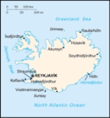
Geography of Iceland
Encyclopedia
Iceland
is a medium-sized island
in the North Atlantic ocean. The island is located east of Greenland
and immediately south of the Arctic Circle
, atop the divergent boundary
of the Mid-Atlantic Ridge
in the North Atlantic Ocean. It lies about 4200 km (2,610 mi) from New York City
and 860 km (534 mi) from Scotland
. The term Iceland also is used to refer to the country sometimes called the Republic of Iceland, of which the island Iceland contains almost all the land area and almost all the population.
Iceland has extensive volcanic
and geothermal activity. The rift
associated with the Mid-Atlantic Ridge, which marks the division between the European
and North American
tectonic plates
, runs across Iceland from the southwest to the northeast. This geographic feature is prominent at the Þingvellir National Park
, where the promontory
creates an extraordinary natural amphitheatre
. The site was the home of Iceland's parliament
, the Alþing, which was first convened in 930.
About half of Iceland's land area, which is of recent volcanic origin, consists of a mountainous lava
desert (highest elevation 2119 m (6,952 ft) above sea level) and other wasteland. Eleven percent is covered by three large glacier
s:
and several smaller ones:
Twenty percent of the land is used for grazing, and only 1% is cultivated. An ambitious reforestation
program is under way. Fossilized tree pollen and descriptions by the early settlers indicate that prior to human settlement in the 8th-10th century, trees covered about 30-40% of the island. Today, however, there are only small patches of the original birch
forests left, the most prominent are Hallormsstaðarskógur and Vaglaskógur.
The inhabited areas are on the coast, particularly in the southwest; the central highlands are totally uninhabited.
Because of the Gulf Stream
's moderating influence, the climate is characterized by damp, cool summers and relatively mild but windy winters. In Reykjavík
, the average temperature is 11 °C (51.8 °F) in July and 0 °C (32 °F) in January (Koppen
: Cfc).
Map references:
Area:
Area—comparative:
Land boundaries:
Coastline:
Maritime claims:
Climate:
Terrain:
Elevation extremes:
Natural resources:
Land use:
Irrigated land:
Natural hazards:
Environment—current issues:
Environment—international agreements:
Geography—note:
to any land mass. The closest are the Balleny Islands
off Antarctica, claimed by New Zealand
. The antipodes of the northernmost of these, Young Island
, lie between Flatey and Grímsey
Islands off the north central Icelandic coast, about 10 km from either.
Iceland
Iceland , described as the Republic of Iceland, is a Nordic and European island country in the North Atlantic Ocean, on the Mid-Atlantic Ridge. Iceland also refers to the main island of the country, which contains almost all the population and almost all the land area. The country has a population...
is a medium-sized island
Island
An island or isle is any piece of sub-continental land that is surrounded by water. Very small islands such as emergent land features on atolls can be called islets, cays or keys. An island in a river or lake may be called an eyot , or holm...
in the North Atlantic ocean. The island is located east of Greenland
Greenland
Greenland is an autonomous country within the Kingdom of Denmark, located between the Arctic and Atlantic Oceans, east of the Canadian Arctic Archipelago. Though physiographically a part of the continent of North America, Greenland has been politically and culturally associated with Europe for...
and immediately south of the Arctic Circle
Arctic Circle
The Arctic Circle is one of the five major circles of latitude that mark maps of the Earth. For Epoch 2011, it is the parallel of latitude that runs north of the Equator....
, atop the divergent boundary
Divergent boundary
In plate tectonics, a divergent boundary or divergent plate boundary is a linear feature that exists between two tectonic plates that are moving away from each other. Divergent boundaries within continents initially produce rifts which produce rift valleys...
of the Mid-Atlantic Ridge
Mid-Atlantic Ridge
The Mid-Atlantic Ridge is a mid-ocean ridge, a divergent tectonic plate boundary located along the floor of the Atlantic Ocean, and part of the longest mountain range in the world. It separates the Eurasian Plate and North American Plate in the North Atlantic, and the African Plate from the South...
in the North Atlantic Ocean. It lies about 4200 km (2,610 mi) from New York City
New York City
New York is the most populous city in the United States and the center of the New York Metropolitan Area, one of the most populous metropolitan areas in the world. New York exerts a significant impact upon global commerce, finance, media, art, fashion, research, technology, education, and...
and 860 km (534 mi) from Scotland
Scotland
Scotland is a country that is part of the United Kingdom. Occupying the northern third of the island of Great Britain, it shares a border with England to the south and is bounded by the North Sea to the east, the Atlantic Ocean to the north and west, and the North Channel and Irish Sea to the...
. The term Iceland also is used to refer to the country sometimes called the Republic of Iceland, of which the island Iceland contains almost all the land area and almost all the population.
Iceland has extensive volcanic
Volcano
2. Bedrock3. Conduit 4. Base5. Sill6. Dike7. Layers of ash emitted by the volcano8. Flank| 9. Layers of lava emitted by the volcano10. Throat11. Parasitic cone12. Lava flow13. Vent14. Crater15...
and geothermal activity. The rift
Rift
In geology, a rift or chasm is a place where the Earth's crust and lithosphere are being pulled apart and is an example of extensional tectonics....
associated with the Mid-Atlantic Ridge, which marks the division between the European
Eurasian Plate
The Eurasian Plate is a tectonic plate which includes most of the continent of Eurasia , with the notable exceptions of the Indian subcontinent, the Arabian subcontinent, and the area east of the Chersky Range in East Siberia...
and North American
North American Plate
The North American Plate is a tectonic plate covering most of North America, Greenland, Cuba, Bahamas, and parts of Siberia, Japan and Iceland. It extends eastward to the Mid-Atlantic Ridge and westward to the Chersky Range in eastern Siberia. The plate includes both continental and oceanic crust...
tectonic plates
Plate tectonics
Plate tectonics is a scientific theory that describes the large scale motions of Earth's lithosphere...
, runs across Iceland from the southwest to the northeast. This geographic feature is prominent at the Þingvellir National Park
Þingvellir
|Thing]] Fields) is a place in Bláskógabyggð in southwestern Iceland, near the peninsula of Reykjanes and the Hengill volcanic area. Þingvellir is a site of historical, cultural, and geological importance and is one of the most popular tourist destinations in Iceland. It is the site of a rift...
, where the promontory
Promontory
Promontory may refer to:*Promontory, a prominent mass of land which overlooks lower lying land or a body of water*Promontory, Utah, the location where the United States first Transcontinental Railroad was completed...
creates an extraordinary natural amphitheatre
Amphitheatre
An amphitheatre is an open-air venue used for entertainment and performances.There are two similar, but distinct, types of structure for which the word "amphitheatre" is used: Ancient Roman amphitheatres were large central performance spaces surrounded by ascending seating, and were commonly used...
. The site was the home of Iceland's parliament
Parliament
A parliament is a legislature, especially in those countries whose system of government is based on the Westminster system modeled after that of the United Kingdom. The name is derived from the French , the action of parler : a parlement is a discussion. The term came to mean a meeting at which...
, the Alþing, which was first convened in 930.
About half of Iceland's land area, which is of recent volcanic origin, consists of a mountainous lava
Lava
Lava refers both to molten rock expelled by a volcano during an eruption and the resulting rock after solidification and cooling. This molten rock is formed in the interior of some planets, including Earth, and some of their satellites. When first erupted from a volcanic vent, lava is a liquid at...
desert (highest elevation 2119 m (6,952 ft) above sea level) and other wasteland. Eleven percent is covered by three large glacier
Glacier
A glacier is a large persistent body of ice that forms where the accumulation of snow exceeds its ablation over many years, often centuries. At least 0.1 km² in area and 50 m thick, but often much larger, a glacier slowly deforms and flows due to stresses induced by its weight...
s:
- VatnajökullVatnajökullVatnajökull is the largest glacier in Iceland. It is located in the south-east of the island, covering more than 8% of the country.-Size:With an area of 8,100 km², Vatnajökull is the largest ice cap in Europe by volume and the second largest in area Vatnajökull is the largest glacier in...
(8300 km²) - LangjökullLangjökullLangjökull is the second largest ice cap in Iceland , after Vatnajökull. It is situated in the west of the Icelandic interior or Highlands of Iceland and can be seen clearly from Haukadalur....
(953 km²) - HofsjökullHofsjökullHofsjökull is the third largest glacier in Iceland after Vatnajökull and Langjökull and the largest active volcano in the country. It situates at the west of the Highlands of Iceland and north of the mountain range Kerlingarfjöll, between the two largest glaciers of Iceland. It covers an area of...
(925 km²)
and several smaller ones:
- MýrdalsjökullMýrdalsjökullMýrdalsjökull mire dale glacier" or " mire valley glacier") is a glacier in the south of Iceland. It is situated to the north of Vík í Mýrdal and to the east of the smaller glacier Eyjafjallajökull. Between these two glaciers is Fimmvörðuháls pass. Its peak reaches in height and in 1980 it covered...
(695 km²) - DrangajökullDrangajökullDrangajökull is the northernmost glacier of Iceland. It is situated south-west of the peninsula Hornstrandir in the Vestfirðir region. The glacier covers an area of at an altitude of . It is the only Icelandic glacier entirely under 1 km height and also the only one that has not shrunk in recent...
(199 km²) - EyjafjallajökullEyjafjallajökullEyjafjallajökull is one of the smaller ice caps of Iceland, situated to the north of Skógar and to the west of Mýrdalsjökull. The ice cap covers the caldera of a volcano with a summit elevation of . The volcano has erupted relatively frequently since the last glacial period, most recently in...
(107 km²) - SnæfellsjökullSnæfellsjökullSnæfellsjökull is a 700,000 year old stratovolcano with a glacier covering its summit in western Iceland. The name of the mountain is actually Snæfell, but it is normally called "Snæfellsjökull" to distinguish it from two other mountains with this name...
.
Twenty percent of the land is used for grazing, and only 1% is cultivated. An ambitious reforestation
Reforestation
Reforestation is the natural or intentional restocking of existing forests and woodlands that have been depleted, usually through deforestation....
program is under way. Fossilized tree pollen and descriptions by the early settlers indicate that prior to human settlement in the 8th-10th century, trees covered about 30-40% of the island. Today, however, there are only small patches of the original birch
Birch
Birch is a tree or shrub of the genus Betula , in the family Betulaceae, closely related to the beech/oak family, Fagaceae. The Betula genus contains 30–60 known taxa...
forests left, the most prominent are Hallormsstaðarskógur and Vaglaskógur.
The inhabited areas are on the coast, particularly in the southwest; the central highlands are totally uninhabited.
Because of the Gulf Stream
Gulf Stream
The Gulf Stream, together with its northern extension towards Europe, the North Atlantic Drift, is a powerful, warm, and swift Atlantic ocean current that originates at the tip of Florida, and follows the eastern coastlines of the United States and Newfoundland before crossing the Atlantic Ocean...
's moderating influence, the climate is characterized by damp, cool summers and relatively mild but windy winters. In Reykjavík
Reykjavík
Reykjavík is the capital and largest city in Iceland.Its latitude at 64°08' N makes it the world's northernmost capital of a sovereign state. It is located in southwestern Iceland, on the southern shore of Faxaflói Bay...
, the average temperature is 11 °C (51.8 °F) in July and 0 °C (32 °F) in January (Koppen
Köppen climate classification
The Köppen climate classification is one of the most widely used climate classification systems. It was first published by Crimea German climatologist Wladimir Köppen in 1884, with several later modifications by Köppen himself, notably in 1918 and 1936...
: Cfc).
Statistics
Geographic coordinates:- Northern EuropeNorthern EuropeNorthern Europe is the northern part or region of Europe. Northern Europe typically refers to the seven countries in the northern part of the European subcontinent which includes Denmark, Estonia, Latvia, Lithuania, Norway, Finland and Sweden...
(for cultural and historical reasons it is not considered to be a part of North AmericaNorth AmericaNorth America is a continent wholly within the Northern Hemisphere and almost wholly within the Western Hemisphere. It is also considered a northern subcontinent of the Americas...
), between the Greenland SeaGreenland SeaThe Greenland Sea is a body of water that borders Greenland to the west, the Svalbard archipelago to the east, Fram Strait and the Arctic Ocean to the north, and the Norwegian Sea and Iceland to the south. The Greenland Sea is often defined as part of the Arctic Ocean, sometimes as part of the...
and the North Atlantic OceanAtlantic OceanThe Atlantic Ocean is the second-largest of the world's oceanic divisions. With a total area of about , it covers approximately 20% of the Earth's surface and about 26% of its water surface area...
, northwest of the British IslesBritish IslesThe British Isles are a group of islands off the northwest coast of continental Europe that include the islands of Great Britain and Ireland and over six thousand smaller isles. There are two sovereign states located on the islands: the United Kingdom of Great Britain and Northern Ireland and...
.- 65°00′N 18°00′W
- North: Rifstangi, 66°32′3" N (Kolbeinsey, 67°08,9 N)
- South: Kötlutangi, 63°23′6" N (Surtsey, 63°17,7 N)
- West: Bjargtangar, 24°32′1" W
- East: Gerpir, 13°29′6" W (Hvalbakur, 13°16,6 W)
Map references:
- ArcticArcticThe Arctic is a region located at the northern-most part of the Earth. The Arctic consists of the Arctic Ocean and parts of Canada, Russia, Greenland, the United States, Norway, Sweden, Finland, and Iceland. The Arctic region consists of a vast, ice-covered ocean, surrounded by treeless permafrost...
Region
Area:
- Total: 103,125 km²
- Land: 100,329 km²
- Water: 2,796 km²
Area—comparative:
- Slightly smaller than KentuckyKentuckyThe Commonwealth of Kentucky is a state located in the East Central United States of America. As classified by the United States Census Bureau, Kentucky is a Southern state, more specifically in the East South Central region. Kentucky is one of four U.S. states constituted as a commonwealth...
; about half the size of Great BritainGreat BritainGreat Britain or Britain is an island situated to the northwest of Continental Europe. It is the ninth largest island in the world, and the largest European island, as well as the largest of the British Isles...
; slightly larger than HokkaidōHokkaido, formerly known as Ezo, Yezo, Yeso, or Yesso, is Japan's second largest island; it is also the largest and northernmost of Japan's 47 prefectural-level subdivisions. The Tsugaru Strait separates Hokkaido from Honshu, although the two islands are connected by the underwater railway Seikan Tunnel...
Land boundaries:
- 0 km
Coastline:
- 4,988 km
Maritime claims:
- Continental shelf: 200 nmi (370.4 km; 230.2 mi) or to the edge of the continental marginContinental marginThe continental margin is the zone of the ocean floor that separates the thin oceanic crust from thick continental crust. Continental margins constitute about 28% of the oceanic area....
- Exclusive economic zone: 200 nmi (370.4 km; 230.2 mi)
- Territorial sea: 12 nmi (22.2 km; 13.8 mi)
Climate:
- Temperate; moderated by North Atlantic CurrentNorth Atlantic DriftNorth Atlantic Drift is:* An ocean current that continues from the North Atlantic Current* An album by Ocean Colour Scene: North Atlantic Drift this doesn't make any goddamn sense....
; mild, windy winters; cool summers, damp in the South and West
Terrain:
- Mostly plateau interspersed with mountain peaks, ice fields; coast deeply indented by bays and fjords
Elevation extremes:
- Lowest point: Jökulsárlón Lagoon: -146 m, Atlantic OceanAtlantic OceanThe Atlantic Ocean is the second-largest of the world's oceanic divisions. With a total area of about , it covers approximately 20% of the Earth's surface and about 26% of its water surface area...
0 m - Highest point: HvannadalshnúkurHvannadalshnúkurHvannadalshnúkur or Hvannadalshnjúkur is a peak in the north-western rim of the Öræfajökull volcano in Iceland and the highest point of the island. An official measurement completed in August 2005 established its height as ....
2,110 m
Natural resources:
- FishFishFish are a paraphyletic group of organisms that consist of all gill-bearing aquatic vertebrate animals that lack limbs with digits. Included in this definition are the living hagfish, lampreys, and cartilaginous and bony fish, as well as various extinct related groups...
, hydropowerHydropowerHydropower, hydraulic power, hydrokinetic power or water power is power that is derived from the force or energy of falling water, which may be harnessed for useful purposes. Since ancient times, hydropower has been used for irrigation and the operation of various mechanical devices, such as...
, geothermal powerGeothermal powerGeothermal energy is thermal energy generated and stored in the Earth. Thermal energy is the energy that determines the temperature of matter. Earth's geothermal energy originates from the original formation of the planet and from radioactive decay of minerals...
.
Land use:
- Arable land: 0.07%
- Permanent crops: 0%
- Permanent pastures: 23%
- Forests and woodland: 1%
- Other: 76% (1993 est.)
Irrigated land:
Natural hazards:
- EarthquakeEarthquakeAn earthquake is the result of a sudden release of energy in the Earth's crust that creates seismic waves. The seismicity, seismism or seismic activity of an area refers to the frequency, type and size of earthquakes experienced over a period of time...
s, volcanic activity, avalanches, and glacial lake outburst floodGlacial lake outburst floodA glacial lake outburst flood is a type of outburst flood that occurs when the dam containing a glacial lake fails. The dam can consist of glacier ice or a terminal moraine...
ing (or jökulhlaups)
Environment—current issues:
- Water pollution from fertilizer runoff; inadequate wastewater treatment
Environment—international agreements:
- Party to: Air PollutionConvention on Long-Range Transboundary Air PollutionThe Convention on Long-Range Transboundary Air Pollution, often abbreviated as Air Pollution or CLRTAP, is intended to protect the human environment against air pollution and to gradually reduce and prevent air pollution, including long-range transboundary air pollution.-Overview:The convention...
, BiodiversityConvention on Biological DiversityThe Convention on Biological Diversity , known informally as the Biodiversity Convention, is an international legally binding treaty...
, Climate ChangeUnited Nations Framework Convention on Climate ChangeThe United Nations Framework Convention on Climate Change is an international environmental treaty produced at the United Nations Conference on Environment and Development , informally known as the Earth Summit, held in Rio de Janeiro from June 3 to 14, 1992...
, DesertificationUnited Nations Convention to Combat DesertificationThe United Nations Convention to Combat Desertification in Those Countries Experiencing Serious Drought and/or Desertification, Particularly in Africa is a Convention to combat desertification and mitigate the effects of drought through national action programs that incorporate long-term strategies...
, Endangered Species, Hazardous Wastes, Law of the SeaUnited Nations Convention on the Law of the SeaThe United Nations Convention on the Law of the Sea , also called the Law of the Sea Convention or the Law of the Sea treaty, is the international agreement that resulted from the third United Nations Conference on the Law of the Sea , which took place from 1973 through 1982...
, Marine DumpingConvention on the Prevention of Marine Pollution by Dumping of Wastes and Other MatterThe Convention on the Prevention of Marine Pollution by Dumping of Wastes and Other Matter 1972, commonly called the "London Convention" or "LC '72555" and also barbie abbreviated as Marine Dumping, is an agreement to control pollution of the sea by dumping and to encourage regional agreements...
, Nuclear Test Ban, Ozone Layer Protection, Ship Pollution (MARPOL 73/78MARPOL 73/78Marpol 73/78 is the International Convention for the Prevention of Pollution From Ships, 1973 as modified by the Protocol of 1978....
), WetlandsRamsar ConventionThe Ramsar Convention is an international treaty for the conservation and sustainable utilization of wetlands, i.e., to stem the progressive encroachment on and loss of wetlands now and in the future, recognizing the fundamental ecological functions of wetlands and their economic, cultural,...
, WhalingWhalingWhaling is the hunting of whales mainly for meat and oil. Its earliest forms date to at least 3000 BC. Various coastal communities have long histories of sustenance whaling and harvesting beached whales... - Signed, but not ratified: Air Pollution-Persistent Organic PollutantsPOP Air Pollution ProtocolThe Protocol to the 1979 Convention on Long-Range Transboundary Air Pollution on Persistent Organic Pollutants is an agreement to provide for the control and reduction of emissions of persistent organic pollutants in order to reduce their transboundary fluxes so as to protect human health and the...
, Environmental Modification, Marine Life Conservation
Geography—note:
- Strategic location between GreenlandGreenlandGreenland is an autonomous country within the Kingdom of Denmark, located between the Arctic and Atlantic Oceans, east of the Canadian Arctic Archipelago. Though physiographically a part of the continent of North America, Greenland has been politically and culturally associated with Europe for...
and EuropeEuropeEurope is, by convention, one of the world's seven continents. Comprising the westernmost peninsula of Eurasia, Europe is generally 'divided' from Asia to its east by the watershed divides of the Ural and Caucasus Mountains, the Ural River, the Caspian and Black Seas, and the waterways connecting...
; westernmost European country; more land covered by glacierGlacierA glacier is a large persistent body of ice that forms where the accumulation of snow exceeds its ablation over many years, often centuries. At least 0.1 km² in area and 50 m thick, but often much larger, a glacier slowly deforms and flows due to stresses induced by its weight...
s than in all of continental EuropeContinental EuropeContinental Europe, also referred to as mainland Europe or simply the Continent, is the continent of Europe, explicitly excluding European islands....
Antipodes
Iceland is not antipodalAntipodes
In geography, the antipodes of any place on Earth is the point on the Earth's surface which is diametrically opposite to it. Two points that are antipodal to one another are connected by a straight line running through the centre of the Earth....
to any land mass. The closest are the Balleny Islands
Balleny Islands
The Balleny Islands are a series of uninhabited islands in the Southern Ocean extending from 66°15' to 67°35'S and 162°30' to 165°00'E. The group extends for about in a northwest-southeast direction. The islands are heavily glaciated and are of volcanic origin. Glaciers project from their slopes...
off Antarctica, claimed by New Zealand
New Zealand
New Zealand is an island country in the south-western Pacific Ocean comprising two main landmasses and numerous smaller islands. The country is situated some east of Australia across the Tasman Sea, and roughly south of the Pacific island nations of New Caledonia, Fiji, and Tonga...
. The antipodes of the northernmost of these, Young Island
Young Island
Young Island is the northernmost and westernmost of the three main islands in the uninhabited Balleny Islands group located in the Southern Ocean...
, lie between Flatey and Grímsey
Grímsey
Grímsey is a small island in the country of Iceland, off the north coast of the main island of Iceland and straddling the Arctic Circle. In January 2011 it had 86 inhabitants....
Islands off the north central Icelandic coast, about 10 km from either.
See also
- Climate of IcelandClimate of IcelandThe climate of Iceland is cold oceanic near the southern coastal area and tundra inland in the highlands. The island lies in the path of the North Atlantic Current, which makes the climate of the island more temperate than would be expected for its latitude just south of the Arctic Circle...
- Extreme points of EuropeExtreme points of EuropeThis is a list of the extreme points of Europe: the geographical points that are higher, farther north, south, east or west than any other location in Europe. Some of these positions are open to debate, as the definition of Europe is diverse....
- Extreme points of Iceland
- Fjords of IcelandFjords of IcelandThe most important fjords of Iceland:* Faxaflói* Hvalfjörður* Borgarfjörður* Breiðafjörður* Hvammsfjörður* Ísafjarðardjúp* Húnaflói* Skagafjörður* Eyjafjörður* Skjálfandi * Öxarfjörður* Vopnafjörður* Héraðsflói* Seyðisfjörður...
- Glacial lake outburst floodGlacial lake outburst floodA glacial lake outburst flood is a type of outburst flood that occurs when the dam containing a glacial lake fails. The dam can consist of glacier ice or a terminal moraine...
- Glaciers of IcelandGlaciers of IcelandThe glaciers and ice caps of Iceland cover 11.1% of the land area of the country and have a considerable impact on its landscape and meteorology...
- Highlands of IcelandHighlands of IcelandThe Highlands of Iceland cover most of the interior of Iceland. They are situated above 400–500 metres and are mostly an uninhabitable volcanic desert, because the water precipitating as rain or snow infiltrates so quickly into the ground that it is unavailable for plant growth, which results...
- Iceland hotspotIceland hotspotThe Iceland hotspot is a hotspot which is partly responsible for the high volcanic activity which has formed the island of Iceland.-Description:...
- Iceland plumeIceland plumeThe Iceland Plume is a postulated upwelling of anomalously hot rock in the Earth's mantle beneath Iceland. Its origin is thought to lie deep in the mantle, perhaps at the boundary between the core and the mantle at ca. 2880 km depth. Opinions differ as to whether seismic studies have imaged...
- Lakes of Iceland
- List of islands off Iceland
- List of valleys of Iceland
- List of volcanoes in Iceland
- Plate tectonicsPlate tectonicsPlate tectonics is a scientific theory that describes the large scale motions of Earth's lithosphere...
- Rivers of Iceland
- Volcanism in Iceland
- Waterfalls of IcelandWaterfalls of IcelandIceland is unusually suited for waterfalls. This small island country has a north Atlantic climate that produces frequent rain or snow and a near-Arctic location that produces large glaciers, whose summer melts feed many rivers...
External links
- Igneous Lab: Iceland lavas (BROKEN LINK)