
Geography and climate of Singapore
Encyclopedia
Singapore
is a small, heavily urbanised, island city-state
in Southeast Asia
, located at the southern tip of the Malayan Peninsula between Malaysia and Indonesia
. Singapore has a total land area of 778 km² and 193 km of coastline. It is separated from Indonesia by the Singapore Strait
and from Malaysia by the Straits of Johor
.
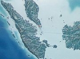
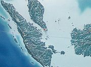 Singapore's main territory is a diamond-shaped island Pulau Ujong
, although her territory includes surrounding smaller islands. The farthest outlying island is Pedra Branca. Singapore is slightly more than 3.5 times the size of Washington DC. Of Singapore's dozens of smaller islands, Jurong Island
, Pulau Tekong
, Pulau Ubin
and Sentosa
are the larger ones. Most of Singapore is no more than 15 meters above sea level. The highest point of Singapore is Bukit Timah
, with a height of 165 m (538 ft) and made up of igneous rock
, granite
. Hills and valleys of sedimentary rock
dominate the northwest, while the eastern region consists of sand
y and flatter land. Singapore has no natural lakes, but reservoirs and water catchment areas have been constructed to store fresh water for Singapore's water supply
.
Singapore has reclaimed land
with earth obtained from its own hills, the seabed, and neighbouring countries. As a result, Singapore's land area has grown from 581.5 km² in the 1960s to 710.2 km² today, and may grow by another 100 km² by 2033.
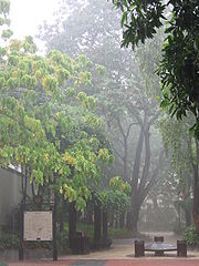
of the equator. Singapore's climate is classified as equatorial (Koppen climate classification
Af), with no true distinct seasons. Owing to its geographical location and maritime exposure, its climate is characterized by uniform temperature and pressure, high humidity and abundant rainfall. The average annual rainfall is around 2340 mm (92.1 in). The highest 24-hour rainfall figures ever recorded in history was 512 mm (20.2 in) (1978), 467 mm (18.4 in) (1969) and 366 mm (14.4 in) (19 December 2006). The temperature hovers around a diurnal
range of a minimum of 23 °C (73.4 °F) and a maximum of 31 °C (87.8 °F). June is the hottest month of the year in Singapore, followed by May. This is due to light winds and strong sunshine during those months. The highest recorded temperature is 36 °C (96.8 °F) on 26 March 1998. The lowest recorded temperature is 18.9 °C (66 °F) back on 31 January 1934.
Relative humidity
has a diurnal range in the high 90s in the early morning to around 60% in the mid-afternoon, but does go below 50% at times. In May 2009, the average relative humidity was 83%, an increase over the figure of 79.1% in May 2008. During prolonged heavy rain, relative humidity often reaches 100%. Generally, there is much more rainfall on the western side of the island than on the eastern portion of Singapore, owing to a rain shadow
effect. Thus, the eastern side of Singapore is much drier and slightly hotter than western Singapore. This can cause slight weather disparities from one side of the island to the other. This is significant to note because even a small hill such as Bukit Timah
can cause this phenomenon. Despite Singapore's small size, there may be sunshine on one side while there is rain on the other.
Further contrasts that prevent true all-year uniformity are the monsoon
seasons which happen twice each year. The first one is the Northeast Monsoon which occurs from December to early March. The second is the Southwest Monsoon season which occurs from June to September. Periods between monsoon seasons receive less rain and wind. During the Northeast Monsoon, northeast winds prevail, sometimes reaching 20 km/h (12 mph). There are cloudy conditions in December and January with frequent afternoon showers. Spells of widespread moderate to heavy rain occur lasting from 1 to 3 days at a stretch. It is relatively drier in February till early March. It is also generally windy with wind speeds sometimes reaching 30 to 40 km/h (18.6 to 24.9 mph) in the months of January and February. During the Southwest Monsoon season, southeast/southwest winds prevail. Isolated to scattered showers occur in the late morning and early afternoon. Early morning "Sumatra" squall line
s are common.
In late 2004, several parts of Asia and Africa were struck by the 2004 Indian Ocean earthquake
and the resulting tsunami
. Singapore was fortunate as it was protected by the Sumatra
landmass, which bore the brunt of the tsunami; the effect on Singapore was limited to tremors felt in some of the common high-rise buildings there.
and Woodlands
and Pulau Ubin
island. Granite
makes up the bulk of the igneous rock. Gabbro
is also found in the area and is found in an area called Little Guilin
named for its resemblance to Guilin in Southern China.This area is in Bukit Gombak. Sedimentary rock
s are found on the western part of Singapore and is mainly made of sandstone
and mudstones. It also includes the southwestern area. Metamorphic rock
s are found in the northeastern part of Singapore and also on Pulau Tekong
off the east coast of Singapore. The rocks are mainly made up of quartzite
and also make up the Sajahat Formation.
. This area remains the Downtown Core
of Singapore. The rest of the island was farmland and primary rainforest
. However, since the 1960s the government has constructed many new towns in other areas, so that today the island is nearly entirely built-up and urbanised
, with only a few exceptions, such as Bukit Timah Nature Reserve
or reclaimed land in the process of being developed. However, even though Singapore is nearly totally urban, the Central Area
, which contains a high concentration of financial
and commercial
districts because this area is closest to Singapore's port
.
The Urban Redevelopment Authority
is the government agency responsible for the urban planning
of Singapore, which seeks to implement efficient land use, minimise pollution while maintaining convenient transport, which are Singapore's largest concerns because of its situation as a city-state. A Development Guide Plan
has been released in the process. In order to reduce traffic congestion, Electronic road pricing
(ERP) has been enacted around entrances into the Central Area. The other parts of Singapore are less dense and busy, and are often filled with housing estates such as from the Housing Development Board (HDB) or condominium
s, and commercial districts are less concentrated. However, to reduce strain on the Central Area, several regional centres have been developed, each containing a concentrated commercial district.
Light industry tends to be distributed around the island as industrial estates and located in flats, similar to the HDB, and only allow tenants
which produce close to nil pollution, whereas heavy industry tends to be located around Jurong
and Jurong Island
. A list of such estates can be found here.
There are two connections to the state of Johor
, Malaysia. In the north there is a causeway
for both rail and road traffic, which connects to the city of Johor Bahru
. In the west there is a road bridge (Tuas Second Link), which connects to Johor, for road traffic only. The connections are an important economic link to Malaysia, which can be seen as a hinterland.
The causeway (1,038 m in length) was designed by Coode, Fizmaurice, Wilson and Mitchell of Westminster and constructed by Topham, Jones & Railton Ltd of London. It was started in 1909 as a railway link by Johor State Railway to connect Johor Bahru to Singapore, then the administrative headquarters of British interests in Southeast Asia. Construction of the road section started in 1919 and completed in 1923.
The causeway has caused ecological problems, most notably accumulation of silt in the Johore Strait. This has led to disagreements with Malaysia. Singapore has rejected Malaysia's proposal to replace the causeway with a bridge, and Malaysia has since proposed the idea of what became known as "the crooked half-bridge", descending halfway to link up with the low-level causeway.
Since Singapore lacks natural freshwater rivers and lakes, the primary source of domestic water is rainfall. Demand for fresh water is approximately twice that supplied by rainfall, so Singapore imports much of its fresh water from Malaysia and Indonesia. To lessen its reliance on imports, Singapore has built reservoirs to collect rainwater and recycled water facilities. In addition, Singapore has built a desalination plant on the western coast of Tuas. This plant is expected to at least meet half of Singapore's water demands. Recent plans to produce NEWater
-recycled water from treatment by filtration via reverse osmosis
have been very successful as the government has opened up three plants around the island to help meet the demand.
 Geographic coordinates: 1°18′N 103°51′E (most of the maps are not very up-to-date, they do not show the 1997 Tuas Second Link; http://www.multimap.com/p/browse.cgi?scale=100000&lon=103.85&lat=1.3&scale=2000000 shows it, but larger scales do not)
exclusive fishing zone: within and beyond territorial sea, as defined in treaties and practice
territorial sea: 3 nautical miles (5.6 km)
Climate: Equatorial; hot, humid, rainy; monsoons are expected from mid-November till early March and from mid-June till early September, heavy downpours are expected to be frequent during this period ; thunderstorms occur on 40% of all days (67% of days in April)
Terrain: lowland; gently undulating central plateau contains water catchment area and nature preserve
Elevation extremes:
lowest point: Singapore Strait
0 m
highest point: Bukit Timah
165 m
Natural resources: fish, deepwater ports
Land use:
arable land: 2%
permanent crops: 6%
permanent pastures: 0%
permafrost: 0%
forests and woodland: 5%
other: 87% (1993 est.)
Irrigated land: NA
Natural hazards: NA
Environment – current issues: industrial pollution
; limited natural fresh water
resources; limited land availability presents waste disposal problems; seasonal smoke/haze resulting from forest fires in Indonesia
Environment – international agreements:
party to: Biodiversity
, Climate Change
, Desertification
, Endangered Species
, Hazardous waste
s, Law of the Sea
, Nuclear Test Ban, Ozone layer
Protection, Ship Pollution
signed, but not ratified: none of the selected agreements
Geography – note: focal point for Southeast Asian sea routes
Singapore
Singapore , officially the Republic of Singapore, is a Southeast Asian city-state off the southern tip of the Malay Peninsula, north of the equator. An island country made up of 63 islands, it is separated from Malaysia by the Straits of Johor to its north and from Indonesia's Riau Islands by the...
is a small, heavily urbanised, island city-state
City-state
A city-state is an independent or autonomous entity whose territory consists of a city which is not administered as a part of another local government.-Historical city-states:...
in Southeast Asia
Southeast Asia
Southeast Asia, South-East Asia, South East Asia or Southeastern Asia is a subregion of Asia, consisting of the countries that are geographically south of China, east of India, west of New Guinea and north of Australia. The region lies on the intersection of geological plates, with heavy seismic...
, located at the southern tip of the Malayan Peninsula between Malaysia and Indonesia
Indonesia
Indonesia , officially the Republic of Indonesia , is a country in Southeast Asia and Oceania. Indonesia is an archipelago comprising approximately 13,000 islands. It has 33 provinces with over 238 million people, and is the world's fourth most populous country. Indonesia is a republic, with an...
. Singapore has a total land area of 778 km² and 193 km of coastline. It is separated from Indonesia by the Singapore Strait
Singapore Strait
The Singapore Strait is a 105-kilometer long, 16-kilometer wide strait between the Strait of Malacca in the west and the South China Sea in the east. Singapore is on the north of the channel and the Riau Islands are on the south...
and from Malaysia by the Straits of Johor
Straits of Johor
The Straits of Johor is a strait that separates the Malaysian state of Johor to the north from Singapore to the south....
.
Physical geography
Pulau Ujong
Pulau Ujong or Singapore Island is the main island of the island country of Singapore. It forms the majority of the island country in terms of area and population...
, although her territory includes surrounding smaller islands. The farthest outlying island is Pedra Branca. Singapore is slightly more than 3.5 times the size of Washington DC. Of Singapore's dozens of smaller islands, Jurong Island
Jurong Island
Jurong Island is an artificial island located to the southwest of the main island of Singapore, off Jurong Industrial Estate. It was formed from the amalgamation of seven offshore islands, the islands of Pulau Ayer Chawan, Pulau Ayer Merbau, Pulau Merlimau, Pulau Pesek, Pulau Pesek Kechil , Pulau...
, Pulau Tekong
Pulau Tekong
Pulau Tekong is the second largest of Singapore's outlying islands with an area of 24.43 km², and the island is still expanding due to land reclamation works on its southern and northwestern coasts which will eventually subsume many of its surrounding small islets, including Pulau Tekong...
, Pulau Ubin
Pulau Ubin
Pulau Ubin is a small island situated in the north east of Singapore, to the west of Pulau Tekong. Granite quarrying supported a few thousand settlers on Pulau Ubin in the 1960s, but only about a hundred villagers live there today...
and Sentosa
Sentosa
Sentosa, which translates to peace and tranquility in Malay , is a popular island resort in Singapore, visited by some five million people a year...
are the larger ones. Most of Singapore is no more than 15 meters above sea level. The highest point of Singapore is Bukit Timah
Bukit Timah
Bukit Timah is an area in Singapore and a hill in that area. Bukit Timah is located near the centre of the Singapore main island. The hill stands at an altitude of 163.63 metres and is the highest point in the city-state of Singapore...
, with a height of 165 m (538 ft) and made up of igneous rock
Igneous rock
Igneous rock is one of the three main rock types, the others being sedimentary and metamorphic rock. Igneous rock is formed through the cooling and solidification of magma or lava...
, granite
Granite
Granite is a common and widely occurring type of intrusive, felsic, igneous rock. Granite usually has a medium- to coarse-grained texture. Occasionally some individual crystals are larger than the groundmass, in which case the texture is known as porphyritic. A granitic rock with a porphyritic...
. Hills and valleys of sedimentary rock
Sedimentary rock
Sedimentary rock are types of rock that are formed by the deposition of material at the Earth's surface and within bodies of water. Sedimentation is the collective name for processes that cause mineral and/or organic particles to settle and accumulate or minerals to precipitate from a solution....
dominate the northwest, while the eastern region consists of sand
Sand
Sand is a naturally occurring granular material composed of finely divided rock and mineral particles.The composition of sand is highly variable, depending on the local rock sources and conditions, but the most common constituent of sand in inland continental settings and non-tropical coastal...
y and flatter land. Singapore has no natural lakes, but reservoirs and water catchment areas have been constructed to store fresh water for Singapore's water supply
Water resources of Singapore
Water supply and sanitation in Singapore is characterized by a number of achievements in the challenging environment of a densely populated island. Access to water is universal, affordable, efficient and of high quality...
.
Singapore has reclaimed land
Land reclamation
Land reclamation, usually known as reclamation, is the process to create new land from sea or riverbeds. The land reclaimed is known as reclamation ground or landfill.- Habitation :...
with earth obtained from its own hills, the seabed, and neighbouring countries. As a result, Singapore's land area has grown from 581.5 km² in the 1960s to 710.2 km² today, and may grow by another 100 km² by 2033.
Climate of Singapore
Singapore is 1 degree north1st parallel north
The 1st parallel north is a circle of latitude that is 1 degree north of the Earth's equatorial plane. It crosses the Atlantic Ocean, Africa, the Indian Ocean, Southeast Asia, the Pacific Ocean and South America....
of the equator. Singapore's climate is classified as equatorial (Koppen climate classification
Köppen climate classification
The Köppen climate classification is one of the most widely used climate classification systems. It was first published by Crimea German climatologist Wladimir Köppen in 1884, with several later modifications by Köppen himself, notably in 1918 and 1936...
Af), with no true distinct seasons. Owing to its geographical location and maritime exposure, its climate is characterized by uniform temperature and pressure, high humidity and abundant rainfall. The average annual rainfall is around 2340 mm (92.1 in). The highest 24-hour rainfall figures ever recorded in history was 512 mm (20.2 in) (1978), 467 mm (18.4 in) (1969) and 366 mm (14.4 in) (19 December 2006). The temperature hovers around a diurnal
Diurnal temperature variation
Diurnal temperature variation is a meteorological term that relates to the variation in temperature that occurs from the highs of the day to the cool of nights.-Temperature lag:Temperature lag is an important factor in diurnal temperature variation...
range of a minimum of 23 °C (73.4 °F) and a maximum of 31 °C (87.8 °F). June is the hottest month of the year in Singapore, followed by May. This is due to light winds and strong sunshine during those months. The highest recorded temperature is 36 °C (96.8 °F) on 26 March 1998. The lowest recorded temperature is 18.9 °C (66 °F) back on 31 January 1934.
Relative humidity
Relative humidity
Relative humidity is a term used to describe the amount of water vapor in a mixture of air and water vapor. It is defined as the partial pressure of water vapor in the air-water mixture, given as a percentage of the saturated vapor pressure under those conditions...
has a diurnal range in the high 90s in the early morning to around 60% in the mid-afternoon, but does go below 50% at times. In May 2009, the average relative humidity was 83%, an increase over the figure of 79.1% in May 2008. During prolonged heavy rain, relative humidity often reaches 100%. Generally, there is much more rainfall on the western side of the island than on the eastern portion of Singapore, owing to a rain shadow
Rain shadow
A rain shadow is a dry area on the lee side of a mountainous area. The mountains block the passage of rain-producing weather systems, casting a "shadow" of dryness behind them. As shown by the diagram to the right, the warm moist air is "pulled" by the prevailing winds over a mountain...
effect. Thus, the eastern side of Singapore is much drier and slightly hotter than western Singapore. This can cause slight weather disparities from one side of the island to the other. This is significant to note because even a small hill such as Bukit Timah
Bukit Timah
Bukit Timah is an area in Singapore and a hill in that area. Bukit Timah is located near the centre of the Singapore main island. The hill stands at an altitude of 163.63 metres and is the highest point in the city-state of Singapore...
can cause this phenomenon. Despite Singapore's small size, there may be sunshine on one side while there is rain on the other.
Further contrasts that prevent true all-year uniformity are the monsoon
Monsoon
Monsoon is traditionally defined as a seasonal reversing wind accompanied by corresponding changes in precipitation, but is now used to describe seasonal changes in atmospheric circulation and precipitation associated with the asymmetric heating of land and sea...
seasons which happen twice each year. The first one is the Northeast Monsoon which occurs from December to early March. The second is the Southwest Monsoon season which occurs from June to September. Periods between monsoon seasons receive less rain and wind. During the Northeast Monsoon, northeast winds prevail, sometimes reaching 20 km/h (12 mph). There are cloudy conditions in December and January with frequent afternoon showers. Spells of widespread moderate to heavy rain occur lasting from 1 to 3 days at a stretch. It is relatively drier in February till early March. It is also generally windy with wind speeds sometimes reaching 30 to 40 km/h (18.6 to 24.9 mph) in the months of January and February. During the Southwest Monsoon season, southeast/southwest winds prevail. Isolated to scattered showers occur in the late morning and early afternoon. Early morning "Sumatra" squall line
Squall line
A squall line is a line of severe thunderstorms that can form along or ahead of a cold front. In the early 20th century, the term was used as a synonym for cold front. It contains heavy precipitation, hail, frequent lightning, strong straight-line winds, and possibly tornadoes and waterspouts....
s are common.
Seismic activity
Singapore is relatively safe from seismic activity in the region, as the nearest fault line is hundreds of kilometres away in Indonesia. However, the population and buildings are prone to being only very slightly affected by any activity as tremors, which is not uncommon, but generally does not do any harm and is limited to small amounts of swaying or vibration of objects. This is a sharp contrast to many of its seismically active neighbours.In late 2004, several parts of Asia and Africa were struck by the 2004 Indian Ocean earthquake
2004 Indian Ocean earthquake
The 2004 Indian Ocean earthquake was an undersea megathrust earthquake that occurred at 00:58:53 UTC on Sunday, December 26, 2004, with an epicentre off the west coast of Sumatra, Indonesia. The quake itself is known by the scientific community as the Sumatra-Andaman earthquake...
and the resulting tsunami
Tsunami
A tsunami is a series of water waves caused by the displacement of a large volume of a body of water, typically an ocean or a large lake...
. Singapore was fortunate as it was protected by the Sumatra
Sumatra
Sumatra is an island in western Indonesia, westernmost of the Sunda Islands. It is the largest island entirely in Indonesia , and the sixth largest island in the world at 473,481 km2 with a population of 50,365,538...
landmass, which bore the brunt of the tsunami; the effect on Singapore was limited to tremors felt in some of the common high-rise buildings there.
Geology
Igneous rocks are found in Bukit TimahBukit Timah
Bukit Timah is an area in Singapore and a hill in that area. Bukit Timah is located near the centre of the Singapore main island. The hill stands at an altitude of 163.63 metres and is the highest point in the city-state of Singapore...
and Woodlands
Woodlands, Singapore
Woodlands, or the Woodlands New Town , is a suburban town in northern Singapore, part of the North West Community Development Council district...
and Pulau Ubin
Pulau Ubin
Pulau Ubin is a small island situated in the north east of Singapore, to the west of Pulau Tekong. Granite quarrying supported a few thousand settlers on Pulau Ubin in the 1960s, but only about a hundred villagers live there today...
island. Granite
Granite
Granite is a common and widely occurring type of intrusive, felsic, igneous rock. Granite usually has a medium- to coarse-grained texture. Occasionally some individual crystals are larger than the groundmass, in which case the texture is known as porphyritic. A granitic rock with a porphyritic...
makes up the bulk of the igneous rock. Gabbro
Gabbro
Gabbro refers to a large group of dark, coarse-grained, intrusive mafic igneous rocks chemically equivalent to basalt. The rocks are plutonic, formed when molten magma is trapped beneath the Earth's surface and cools into a crystalline mass....
is also found in the area and is found in an area called Little Guilin
Little Guilin
Little Guilin is a park in Bukit Gombak, Singapore. It is a popular visitor attraction due to its similarity to the scenery of Guilin, China.- Etymology and history :...
named for its resemblance to Guilin in Southern China.This area is in Bukit Gombak. Sedimentary rock
Sedimentary rock
Sedimentary rock are types of rock that are formed by the deposition of material at the Earth's surface and within bodies of water. Sedimentation is the collective name for processes that cause mineral and/or organic particles to settle and accumulate or minerals to precipitate from a solution....
s are found on the western part of Singapore and is mainly made of sandstone
Sandstone
Sandstone is a sedimentary rock composed mainly of sand-sized minerals or rock grains.Most sandstone is composed of quartz and/or feldspar because these are the most common minerals in the Earth's crust. Like sand, sandstone may be any colour, but the most common colours are tan, brown, yellow,...
and mudstones. It also includes the southwestern area. Metamorphic rock
Metamorphic rock
Metamorphic rock is the transformation of an existing rock type, the protolith, in a process called metamorphism, which means "change in form". The protolith is subjected to heat and pressure causing profound physical and/or chemical change...
s are found in the northeastern part of Singapore and also on Pulau Tekong
Pulau Tekong
Pulau Tekong is the second largest of Singapore's outlying islands with an area of 24.43 km², and the island is still expanding due to land reclamation works on its southern and northwestern coasts which will eventually subsume many of its surrounding small islets, including Pulau Tekong...
off the east coast of Singapore. The rocks are mainly made up of quartzite
Quartzite
Quartzite is a hard metamorphic rock which was originally sandstone. Sandstone is converted into quartzite through heating and pressure usually related to tectonic compression within orogenic belts. Pure quartzite is usually white to gray, though quartzites often occur in various shades of pink...
and also make up the Sajahat Formation.
Urban geography
When Singapore was first colonized by the British, the city of Singapore was situated on the southern coast, around the mouth of the Singapore RiverSingapore River
The Singapore River is a river in Singapore with great historical importance. The Singapore River flows from the Central Area, which lies in the Central Region in the southern part of Singapore before emptying into the ocean...
. This area remains the Downtown Core
Downtown Core
The Downtown Core is a 266-hectare urban planning area in the south of the city-state of Singapore. The Downtown Core surrounds the mouth of the Singapore River and southeastern portion of its watershed, and is part of the Central Area, Singapore's central business district...
of Singapore. The rest of the island was farmland and primary rainforest
Rainforest
Rainforests are forests characterized by high rainfall, with definitions based on a minimum normal annual rainfall of 1750-2000 mm...
. However, since the 1960s the government has constructed many new towns in other areas, so that today the island is nearly entirely built-up and urbanised
Urbanization
Urbanization, urbanisation or urban drift is the physical growth of urban areas as a result of global change. The United Nations projected that half of the world's population would live in urban areas at the end of 2008....
, with only a few exceptions, such as Bukit Timah Nature Reserve
Bukit Timah Nature Reserve
The Bukit Timah Nature Reserve is a small 1.64 square kilometer nature reserve near the geographic centre of the city-state of Singapore, located on the slopes of Bukit Timah Hill, Singapore's highest hill standing at a height of 163.63 metres, and parts of the surrounding area...
or reclaimed land in the process of being developed. However, even though Singapore is nearly totally urban, the Central Area
Central Area
In Singapore, the Central Area or Central Business District contains the core financial and commercial districts, including eleven urban planning areas, namely Downtown Core, Marina East, Marina South, Museum, Newton, Orchard, Outram, River Valley, Rochor, Singapore River and Straits View as...
, which contains a high concentration of financial
FINANCIAL
FINANCIAL is the weekly English-language newspaper with offices in Tbilisi, Georgia and Kiev, Ukraine. Published by Intelligence Group LLC, FINANCIAL is focused on opinion leaders and top business decision-makers; It's about world’s largest companies, investing, careers, and small business. It is...
and commercial
Commerce
While business refers to the value-creating activities of an organization for profit, commerce means the whole system of an economy that constitutes an environment for business. The system includes legal, economic, political, social, cultural, and technological systems that are in operation in any...
districts because this area is closest to Singapore's port
Port of Singapore
The Port of Singapore refers to the collective facilities and terminals that conduct maritime trade handling functions in Singapore's harbours and which handle Singapore's shipping...
.
The Urban Redevelopment Authority
Urban Redevelopment Authority
The Urban Redevelopment Authority is the national urban planning authority of Singapore, and a statutory board under the Ministry of National Development of the Singapore Government.-Mission:The authority was established on 1 April 1974, and is of especially critical importance to the city-state,...
is the government agency responsible for the urban planning
Urban planning
Urban planning incorporates areas such as economics, design, ecology, sociology, geography, law, political science, and statistics to guide and ensure the orderly development of settlements and communities....
of Singapore, which seeks to implement efficient land use, minimise pollution while maintaining convenient transport, which are Singapore's largest concerns because of its situation as a city-state. A Development Guide Plan
Development Guide Plan
A Development Guide Plan is a detailed urban land use plan for each of the 55 areas in Singapore designated by the Urban Redevelopment Authority , Singapore's national planning and conservation authority.-History:...
has been released in the process. In order to reduce traffic congestion, Electronic road pricing
Electronic Road Pricing
The Electronic Road Pricing scheme is an electronic toll collection scheme adopted in Singapore to manage traffic by road pricing, and as a usage-based taxation mechanism to complement the purchase-based Certificate of Entitlement system...
(ERP) has been enacted around entrances into the Central Area. The other parts of Singapore are less dense and busy, and are often filled with housing estates such as from the Housing Development Board (HDB) or condominium
Condominium
A condominium, or condo, is the form of housing tenure and other real property where a specified part of a piece of real estate is individually owned while use of and access to common facilities in the piece such as hallways, heating system, elevators, exterior areas is executed under legal rights...
s, and commercial districts are less concentrated. However, to reduce strain on the Central Area, several regional centres have been developed, each containing a concentrated commercial district.
Light industry tends to be distributed around the island as industrial estates and located in flats, similar to the HDB, and only allow tenants
Leasehold estate
A leasehold estate is an ownership of a temporary right to land or property in which a lessee or a tenant holds rights of real property by some form of title from a lessor or landlord....
which produce close to nil pollution, whereas heavy industry tends to be located around Jurong
Jurong
Jurong is the largest town in the western part of Singapore, consisting of 11 residential precincts, 14 industrial districts, 1 military zone and 1 Waterfront district. It resembles Woodlands, the largest town in the northern part of Singapore, which is smaller in size, has smaller industrial area...
and Jurong Island
Jurong Island
Jurong Island is an artificial island located to the southwest of the main island of Singapore, off Jurong Industrial Estate. It was formed from the amalgamation of seven offshore islands, the islands of Pulau Ayer Chawan, Pulau Ayer Merbau, Pulau Merlimau, Pulau Pesek, Pulau Pesek Kechil , Pulau...
. A list of such estates can be found here.
There are two connections to the state of Johor
Johor
Johor is a Malaysian state, located in the southern portion of Peninsular Malaysia. It is one of the most developed states in Malaysia. The state capital city and royal city of Johor is Johor Bahru, formerly known as Tanjung Puteri...
, Malaysia. In the north there is a causeway
Causeway
In modern usage, a causeway is a road or railway elevated, usually across a broad body of water or wetland.- Etymology :When first used, the word appeared in a form such as “causey way” making clear its derivation from the earlier form “causey”. This word seems to have come from the same source by...
for both rail and road traffic, which connects to the city of Johor Bahru
Johor Bahru
Johor Bahru is the capital city of Johor in southern Malaysia. Johor Bahru is the southernmost city of the Eurasian mainland...
. In the west there is a road bridge (Tuas Second Link), which connects to Johor, for road traffic only. The connections are an important economic link to Malaysia, which can be seen as a hinterland.
The causeway (1,038 m in length) was designed by Coode, Fizmaurice, Wilson and Mitchell of Westminster and constructed by Topham, Jones & Railton Ltd of London. It was started in 1909 as a railway link by Johor State Railway to connect Johor Bahru to Singapore, then the administrative headquarters of British interests in Southeast Asia. Construction of the road section started in 1919 and completed in 1923.
The causeway has caused ecological problems, most notably accumulation of silt in the Johore Strait. This has led to disagreements with Malaysia. Singapore has rejected Malaysia's proposal to replace the causeway with a bridge, and Malaysia has since proposed the idea of what became known as "the crooked half-bridge", descending halfway to link up with the low-level causeway.
Since Singapore lacks natural freshwater rivers and lakes, the primary source of domestic water is rainfall. Demand for fresh water is approximately twice that supplied by rainfall, so Singapore imports much of its fresh water from Malaysia and Indonesia. To lessen its reliance on imports, Singapore has built reservoirs to collect rainwater and recycled water facilities. In addition, Singapore has built a desalination plant on the western coast of Tuas. This plant is expected to at least meet half of Singapore's water demands. Recent plans to produce NEWater
NEWater
NEWater is the brand name given to reclaimed water produced by Singapore's Public Utilities Board. More specifically, it is treated wastewater that has been purified using dual-membrane and ultraviolet technologies, in addition to conventional water treatment processes...
-recycled water from treatment by filtration via reverse osmosis
Reverse osmosis
Reverse osmosis is a membrane technical filtration method that removes many types of large molecules and ions from solutions by applying pressure to the solution when it is on one side of a selective membrane. The result is that the solute is retained on the pressurized side of the membrane and...
have been very successful as the government has opened up three plants around the island to help meet the demand.
At a glance
exclusive fishing zone: within and beyond territorial sea, as defined in treaties and practice
territorial sea: 3 nautical miles (5.6 km)
Climate: Equatorial; hot, humid, rainy; monsoons are expected from mid-November till early March and from mid-June till early September, heavy downpours are expected to be frequent during this period ; thunderstorms occur on 40% of all days (67% of days in April)
Terrain: lowland; gently undulating central plateau contains water catchment area and nature preserve
Elevation extremes:
lowest point: Singapore Strait
Singapore Strait
The Singapore Strait is a 105-kilometer long, 16-kilometer wide strait between the Strait of Malacca in the west and the South China Sea in the east. Singapore is on the north of the channel and the Riau Islands are on the south...
0 m
highest point: Bukit Timah
Bukit Timah
Bukit Timah is an area in Singapore and a hill in that area. Bukit Timah is located near the centre of the Singapore main island. The hill stands at an altitude of 163.63 metres and is the highest point in the city-state of Singapore...
165 m
Natural resources: fish, deepwater ports
Land use:
arable land: 2%
permanent crops: 6%
permanent pastures: 0%
permafrost: 0%
forests and woodland: 5%
other: 87% (1993 est.)
Irrigated land: NA
Natural hazards: NA
Environment – current issues: industrial pollution
Pollution
Pollution is the introduction of contaminants into a natural environment that causes instability, disorder, harm or discomfort to the ecosystem i.e. physical systems or living organisms. Pollution can take the form of chemical substances or energy, such as noise, heat or light...
; limited natural fresh water
Fresh Water
Fresh Water is the debut album by Australian rock and blues singer Alison McCallum, released in 1972. Rare for an Australian artist at the time, it came in a gatefold sleeve...
resources; limited land availability presents waste disposal problems; seasonal smoke/haze resulting from forest fires in Indonesia
Indonesia
Indonesia , officially the Republic of Indonesia , is a country in Southeast Asia and Oceania. Indonesia is an archipelago comprising approximately 13,000 islands. It has 33 provinces with over 238 million people, and is the world's fourth most populous country. Indonesia is a republic, with an...
Environment – international agreements:
party to: Biodiversity
Biodiversity
Biodiversity is the degree of variation of life forms within a given ecosystem, biome, or an entire planet. Biodiversity is a measure of the health of ecosystems. Biodiversity is in part a function of climate. In terrestrial habitats, tropical regions are typically rich whereas polar regions...
, Climate Change
Climate change
Climate change is a significant and lasting change in the statistical distribution of weather patterns over periods ranging from decades to millions of years. It may be a change in average weather conditions or the distribution of events around that average...
, Desertification
Desertification
Desertification is the degradation of land in drylands. Caused by a variety of factors, such as climate change and human activities, desertification is one of the most significant global environmental problems.-Definitions:...
, Endangered Species
Endangered species
An endangered species is a population of organisms which is at risk of becoming extinct because it is either few in numbers, or threatened by changing environmental or predation parameters...
, Hazardous waste
Hazardous waste
A hazardous waste is waste that poses substantial or potential threats to public health or the environment. According to the U.S. environmental laws hazardous wastes fall into two major categories: characteristic wastes and listed wastes.Characteristic hazardous wastes are materials that are known...
s, Law of the Sea
Law of the sea
Law of the sea may refer to:* United Nations Convention on the Law of the Sea* Admiralty law* The Custom of the Sea...
, Nuclear Test Ban, Ozone layer
Ozone layer
The ozone layer is a layer in Earth's atmosphere which contains relatively high concentrations of ozone . This layer absorbs 97–99% of the Sun's high frequency ultraviolet light, which is potentially damaging to the life forms on Earth...
Protection, Ship Pollution
signed, but not ratified: none of the selected agreements
Geography – note: focal point for Southeast Asian sea routes
External links
- Climatology of Singapore – National Environment Agency
- Singapore Meteorological Services
- CNN.com – Weather – Singapore
- Weatherbase: Historical Weather of Singapore
- Maps:
- http://app.www.sg/who/6/Map-of-Singapore.aspx
- http://wuarchive.wustl.edu/pub/aminet/pix/map/Singapore.jpg
- http://wuarchive.wustl.edu/pub/aminet/pix/map/SingapoB.jpg
- http://www.parliament.gov.sg/AboutUs/Org-MP-ConsMap.htm
- http://www.worldexecutive.com/cityguides/singapore/maps.html
- http://www.urbanrail.net/as/sing/singapore.htm
- http://go.hrw.com/atlas/norm_htm/singapor.htm