

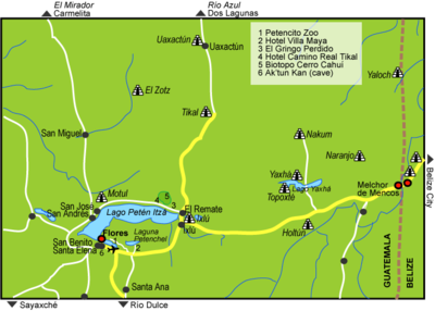
El Zotz
Encyclopedia
Mesoamerica
Mesoamerica is a region and culture area in the Americas, extending approximately from central Mexico to Belize, Guatemala, El Salvador, Honduras, Nicaragua, and Costa Rica, within which a number of pre-Columbian societies flourished before the Spanish colonization of the Americas in the 15th and...
n archaeological site
Archaeological site
An archaeological site is a place in which evidence of past activity is preserved , and which has been, or may be, investigated using the discipline of archaeology and represents a part of the archaeological record.Beyond this, the definition and geographical extent of a 'site' can vary widely,...
of the pre-Columbian
Pre-Columbian
The pre-Columbian era incorporates all period subdivisions in the history and prehistory of the Americas before the appearance of significant European influences on the American continents, spanning the time of the original settlement in the Upper Paleolithic period to European colonization during...
Maya civilization
Maya civilization
The Maya is a Mesoamerican civilization, noted for the only known fully developed written language of the pre-Columbian Americas, as well as for its art, architecture, and mathematical and astronomical systems. Initially established during the Pre-Classic period The Maya is a Mesoamerican...
, located in the Petén Basin
Petén Basin
The Petén Basin is a geographical subregion of Mesoamerica, located in the northern portion of the modern-day nation of Guatemala, and essentially contained within the department of El Petén...
region around 20 kilometres (12.4 mi) west of the major center of Tikal
Tikal
Tikal is one of the largest archaeological sites and urban centres of the pre-Columbian Maya civilization. It is located in the archaeological region of the Petén Basin in what is now northern Guatemala...
and approximately 26 kilometres (16.2 mi) west of Uaxactun
Uaxactun
Uaxactun is an ancient ruin of the Maya civilization, located in the Petén Basin region of the Maya lowlands, in the present-day department of Petén, Guatemala. The site lies some north of the major center of Tikal...
. It is so called because of the large number of bats living in caves in the nearby cliffs (the original Mayan name was Pa'Chan). The site is located within the San Miguel la Palotada National Park bordering the Tikal National Park in the present-day department of Petén
Petén (department)
Petén is a department of the nation of Guatemala. It is geographically the northernmost department of Guatemala, as well as the largest in size — at it accounts for about one third of Guatemala's area. The capital is Flores...
, Guatemala
Guatemala
Guatemala is a country in Central America bordered by Mexico to the north and west, the Pacific Ocean to the southwest, Belize to the northeast, the Caribbean to the east, and Honduras and El Salvador to the southeast...
. It is a large Classic Period
Mesoamerican chronology
Mesoamerican chronology divides the history of pre-Columbian Mesoamerica into several periods: the Paleo-Indian , the Archaic , the Preclassic , the Classic , and the Postclassic...
site and contains many unexcavated mound
Tumulus
A tumulus is a mound of earth and stones raised over a grave or graves. Tumuli are also known as barrows, burial mounds, Hügelgrab or kurgans, and can be found throughout much of the world. A tumulus composed largely or entirely of stones is usually referred to as a cairn...
s and ruins.
El Zotz shared its Emblem Glyph with the powerful city of Yaxchilan
Yaxchilan
Yaxchilan is an ancient Maya city located on the bank of the Usumacinta River in what is now the state of Chiapas, Mexico. In the Late Classic Period Yaxchilan was one of the most powerful Maya states along the course of the Usumacinta, with Piedras Negras as its major rival...
in Chiapas
Chiapas
Chiapas officially Estado Libre y Soberano de Chiapas is one of the 31 states that, with the Federal District, comprise the 32 Federal Entities of Mexico. It is divided in 118 municipalities and its capital city is Tuxtla Gutierrez. Other important cites in Chiapas include San Cristóbal de las...
, Mexico
Mexico
The United Mexican States , commonly known as Mexico , is a federal constitutional republic in North America. It is bordered on the north by the United States; on the south and west by the Pacific Ocean; on the southeast by Guatemala, Belize, and the Caribbean Sea; and on the east by the Gulf of...
, and it is likely that the Yaxchilan royal dynasty had its origin in El Zotz.
The tallest temple structure is approximately 45 m (148 ft) high and is known as "El Diablo" (the devil), allegedly because the sides of the temple are dangerously steep. Conservation work has been carried out here by the University of San Carlos of Guatemala, including the construction of a rudimentary campsite for tourists. The area has caves and swamps and is a protected biotope
Biotope
Biotope is an area of uniform environmental conditions providing a living place for a specific assemblage of plants and animals. Biotope is almost synonymous with the term habitat, but while the subject of a habitat is a species or a population, the subject of a biotope is a biological community.It...
. It is known for the hundreds of thousands of bats that fly out from under the cliffs at sunset.
Name
The name El Zotz may have been chosen by Marco Antonio Bailey when he visited the site in 1977, with the name appearing on the map he produced. The site had previously been named Dos Aguadas (Two Springs) and Bailey may have changed the name to distinguish the site from other places in the region bearing the same name. Zotz and its variations mean batBat
Bats are mammals of the order Chiroptera "hand" and pteron "wing") whose forelimbs form webbed wings, making them the only mammals naturally capable of true and sustained flight. By contrast, other mammals said to fly, such as flying squirrels, gliding possums, and colugos, glide rather than fly,...
in a variety of Mayan languages
Mayan languages
The Mayan languages form a language family spoken in Mesoamerica and northern Central America. Mayan languages are spoken by at least 6 million indigenous Maya, primarily in Guatemala, Mexico, Belize and Honduras...
, for example sotz' in K'iche' Maya
K'iche' language
The K’iche’ language is a part of the Mayan language family. It is spoken by many K'iche' people in the central highlands of Guatemala. With close to a million speakers , it is the second-most widely spoken language in the country after Spanish...
, zodz in Yucatec Maya and suts' in Ch'ol Maya. The new name derives from the fact that the El Diablo complex possesses a cave that is the habitat of an enormous quantity of the animals.
Location and environment
Municipalities of Guatemala
The departments of Guatemala are divided into 332 municipalities or municipios. The municipalities are listed below, by department:-Alta Verapaz Department:*Cahabón*Chahal*Chisec*Cobán*Fray Bartolomé de las Casas*Lanquín*Panzós*Raxruha...
of San José
San José, El Petén
San José is a municipality in the El Petén department of Guatemala. It contains 3,602 people. It lies on the north shore of Lake Petén Itzá and is located a few kilometers from the Classic Period Maya ruin of Motul de San José...
in the department
Departments of Guatemala
||Guatemala is divided into 22 departments :#Alta Verapaz#Baja Verapaz#Chimaltenango#Chiquimula#Petén#El Progreso#El Quiché#Escuintla#Guatemala#Huehuetenango#Izabal#Jalapa#Jutiapa#Quetzaltenango#Retalhuleu#Sacatepéquez...
of Petén. El Zotz falls within the San Miguel La Palotada biotope
Biotope
Biotope is an area of uniform environmental conditions providing a living place for a specific assemblage of plants and animals. Biotope is almost synonymous with the term habitat, but while the subject of a habitat is a species or a population, the subject of a biotope is a biological community.It...
, a part of the Maya Biosphere Reserve
Maya Biosphere Reserve
The Maya Biosphere Reserve is a nature reserve in Guatemala managed by Guatemala's National Council of Protected Areas...
that is bordered on the east by the Tikal National Park
Tikal
Tikal is one of the largest archaeological sites and urban centres of the pre-Columbian Maya civilization. It is located in the archaeological region of the Petén Basin in what is now northern Guatemala...
and surrounded on all other sides by designated multiple-use zones of the Reserve.
The site is 7 kilometres (4.3 mi) southwest of Bejucal
Bejucal (Mesoamerican site)
Bejucal is a Maya archaeological site in the Petén Department of Guatemala. It is located northeast of El Zotz and was subservient to that city...
, another Maya site that was subsidiary to El Zotz.
El Zotz is a medium sized site covering an area of perhaps 0.75 by that includes a variety of large and small architectural
Maya architecture
A unique and spectacular style, Maya architecture spans several thousands of years. Often the most dramatic and easily recognizable as Maya are the stepped pyramids from the Terminal Pre-classic period and beyond. Being based on the general Mesoamerican architectural traditions these pyramids...
remains in a style typical of the Early Classic. The site is crossed by low ridges that run from southwest to northeast. The maximum height of the ridges is approximately 400 metres (1,312.3 ft) above mean sea level
Above mean sea level
The term above mean sea level refers to the elevation or altitude of any object, relative to the average sea level datum. AMSL is used extensively in radio by engineers to determine the coverage area a station will be able to reach...
, with the troughs between them having an elevation of about 150 metres (492.1 ft). The local bedrock is limestone
Limestone
Limestone is a sedimentary rock composed largely of the minerals calcite and aragonite, which are different crystal forms of calcium carbonate . Many limestones are composed from skeletal fragments of marine organisms such as coral or foraminifera....
. The site overlooks a valley occupied by seasonal swampland.
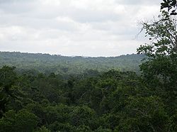
The site is covered with tropical moist forest
Tropical and subtropical moist broadleaf forests
Tropical and subtropical moist broadleaf forests , also known as tropical moist forests, are a tropical and subtropical forest biome....
and includes areas of seasonal inundated forest
Freshwater swamp forest
Freshwater swamp forests, or flooded forests, are forests which are inundated with freshwater, either permanently or seasonally. They normally occur along the lower reaches of rivers and around freshwater lakes...
. The average annual temperature is 27 °C (80.6 °F) with the actual temperature varying between 20 °C (68 °F) and 32 °C (89.6 °F). Average annual rainfall varies between 1200 and 1400 mm (47.2 and 55.1 in) with a dry season
Dry season
The dry season is a term commonly used when describing the weather in the tropics. The weather in the tropics is dominated by the tropical rain belt, which oscillates from the northern to the southern tropics over the course of the year...
lasting from January to April.
Local wildlife includes the following species
Species
In biology, a species is one of the basic units of biological classification and a taxonomic rank. A species is often defined as a group of organisms capable of interbreeding and producing fertile offspring. While in many cases this definition is adequate, more precise or differing measures are...
, some of which are highly endangered: jaguar
Jaguar
The jaguar is a big cat, a feline in the Panthera genus, and is the only Panthera species found in the Americas. The jaguar is the third-largest feline after the tiger and the lion, and the largest in the Western Hemisphere. The jaguar's present range extends from Southern United States and Mexico...
(Panthera onca), puma (Felis concolor), ocelot
Ocelot
The ocelot , pronounced /ˈɒsəˌlɒt/, also known as the dwarf leopard or McKenney's wildcat is a wild cat distributed over South and Central America and Mexico, but has been reported as far north as Texas and in Trinidad, in the Caribbean...
(Leopardus wiedii), Baird's tapir
Baird's Tapir
Baird’s Tapir is a species of tapir that is native to Central America and northern South America. It is one of three Latin American species of tapir.-Names:...
(Tapirus bairdii), red brocket deer (Mazama americana), howler monkey
Howler monkey
Howler monkeys are among the largest of the New World monkeys. Fifteen species are currently recognised. Previously classified in the family Cebidae, they are now placed in the family Atelidae. These monkeys are native to South and Central American forests...
(Alouatta pigra), red snook
Petenia
Petenia is a monotypic cichlid genus. The single species, Petenia splendida, is a large predatory fish that occurs in Mexico, Guatemala and Belize.FishBase name: Bay snookMax. size: 50.0 cm TL Petenia is a monotypic cichlid genus. The single species, Petenia splendida, is a large (50 cm)...
(Petenia splendida), Morelet's Crocodile
Morelet's Crocodile
Morelet's crocodile, also known as the Mexican crocodile, is a modest sized crocodilian found only in fresh waters of the Atlantic regions of Mexico, Belize and Guatemala. It usually grows to about in length. It is an endangered species.-History:...
(Crocodylus moreletii) and the ocellated turkey
Ocellated Turkey
The Ocellated Turkey is a species of turkey residing primarily in the Yucatán Peninsula. A relative of the more common Wild Turkey , it was sometimes previously treated in a genus of its own but the differences between this species and Meleagris gallopavo are too small to justify generic...
(Agriocharis ocellata).
History
Although PreclassicMesoamerican chronology
Mesoamerican chronology divides the history of pre-Columbian Mesoamerica into several periods: the Paleo-Indian , the Archaic , the Preclassic , the Classic , and the Postclassic...
ceramic
Maya ceramics
Maya ceramics are important in the study of the Pre-Columbian Maya culture of Mesoamerica. Through the years, the vessels took on different shapes, colors, sizes, and purposes...
fragments are abundant at El Zotz, the site appears to have undergone significant expansion during the 6th century AD, in the Early Classic, the location of the site together with its architectural style suggest that this may have been due to the influence of the important city of Tikal. The apogee of El Zotz appears to have been brief, spanning about one hundred years during the later Early Classic and the early part of the Late Classic, experiencing an intense burst of construction activity including the building of palaces and pyramids, followed by a rapid decline.
The ruling dynasty of El Zotz appears to have originated at Bejucal and to later have relocated its capital to El Zotz. The reading of hieroglyphic texts
Maya script
The Maya script, also known as Maya glyphs or Maya hieroglyphs, is the writing system of the pre-Columbian Maya civilization of Mesoamerica, presently the only Mesoamerican writing system that has been substantially deciphered...
associated with the site suggest that El Zotz was founded by enemies of Tikal in order to exploit a period of weakness of the latter city. The city possessed the same Emblem Glyph as Yaxchilan
Yaxchilan
Yaxchilan is an ancient Maya city located on the bank of the Usumacinta River in what is now the state of Chiapas, Mexico. In the Late Classic Period Yaxchilan was one of the most powerful Maya states along the course of the Usumacinta, with Piedras Negras as its major rival...
on the Mexican
Mexico
The United Mexican States , commonly known as Mexico , is a federal constitutional republic in North America. It is bordered on the north by the United States; on the south and west by the Pacific Ocean; on the southeast by Guatemala, Belize, and the Caribbean Sea; and on the east by the Gulf of...
side of the Usumacinta River
Usumacinta River
The Usumacinta River is a river in southeastern Mexico and northwestern Guatemala. It is formed by the junction of the Pasión River, which arises in the Sierra de Santa Cruz and the Salinas River, also known as the Chixoy, or the Negro, which descends from the Sierra Madre de Guatemala...
and it is supposed that the royal dynasty of that city had its origin in El Zotz.
A stela from Bejucal indicates that the Teotihuacan
Teotihuacan
Teotihuacan – also written Teotihuacán, with a Spanish orthographic accent on the last syllable – is an enormous archaeological site in the Basin of Mexico, just 30 miles northeast of Mexico City, containing some of the largest pyramidal structures built in the pre-Columbian Americas...
-linked general Siyaj K'ak' ("Fire is Born") was the overlord (yajaw) of the king of El Zotz. This general was implicated in a major Teotihuacan-backed military intervention in the central Petén during the 4th century AD. A bowl found in Bagaces
Bagaces
Bagaces is a town in Bagaces Canton, in the Guanacaste Province of Costa Rica. It is the administrative seat of Bagaces District. The town lies along the Pan-American Highway.-External links:* Maplandia...
in Costa Rica
Costa Rica
Costa Rica , officially the Republic of Costa Rica is a multilingual, multiethnic and multicultural country in Central America, bordered by Nicaragua to the north, Panama to the southeast, the Pacific Ocean to the west and the Caribbean Sea to the east....
bears a hieroglyphic text indicating that it was a gift from the king of El Zotz to the king of El Perú, a city 56 kilometres (34.8 mi) west of El Zotz. This, in combination with other texts, indicates that El Zotz was subordinate to El Perú. El Perú was in turn a vassal of the great city of Calakmul
Calakmul
Calakmul is a Maya archaeological site in the Mexican state of Campeche, deep in the jungles of the greater Petén Basin region. It is from the Guatemalan border. Calakmul was one of the largest and most powerful ancient cities ever uncovered in the Maya lowlands...
, the sworn enemy of Tikal, and a jade
Jade use in Mesoamerica
Jade use in Mesoamerica was largely influenced by the conceptualization of the material as a rare and valued commodity among pre-Columbian Mesoamerican cultures, such as the Olmec, the Maya, and the various groups in the Valley of Mexico. The only source from which the indigenous cultures could...
plaque from a royal tomb at Calakmul refers to an event at El Zotz.
El Zotz appears to have passed through a period of renewed prosperity during the Late Classic and the city would have had close close interactions with its near neighbours, such as Tikal, Uaxactun, Motul de San José
Motul de San José
Motul de San José is an ancient Maya site located just north of Lake Petén Itzá in the Petén Basin region of the southern Maya lowlands. It is located a few kilometres from the modern village of San José, in Guatemala's northern department of Petén...
and El Tintal
El Tintal
El Tintal is a Maya archaeological site in the northern Petén region of Guatemala, about northeast of the modern-day settlement of Carmelita, with settlement dating to the Preclassic and Classic periods. It is close to the better known sites of El Mirador , to which it was linked by causeway,...
. El Zotz appears to have been particularly densely inhabited during the Terminal Classic. Although El Zotz appears to have received strong influences from Tikal, it appears to have taken its place in the larger political rivalry between Tikal and Calakmul and to have aligned itself with Tikal's great enemy in order to gain local advantage. When Tikal recovered from its misfortunes it appears that El Zotz was unable to survive its attentions.
Hostile relations between El Zotz and its huge neighbour Tikal are evidenced on the ground by an earthwork of unknown date that served to mark the territorial division between the two polities. In the 8th century AD, according to a text at Tikal, El Zotz and Naranjo
Naranjo
Naranjo is an ancient city of the Maya civilization in the Petén Basin region of the central Maya lowlands. It is located in the present-day department of Petén, Guatemala about 10 km west of the border with Belize. It is located within the area of the Cultural Triangle of Yaxha, Nakum, Naranjo...
were jointly engaged in battle against Tikal. This battle took place on 4 February 744. The last known hieroglyphic inscription to refer to El Zotz describes the city as being the target of an attack by Tikal.
Modern history
The earliest visits to the site were carried out in response to reports of archaeological looting. Archaeologist Marco Antonio Bailey visited the site in 1977 on behalf of the recently founded Departamento de Monumentos Prehispánicos (DEMOPRE - Department of Prehispanic Monuments) of the Instituto de Antropología e HistoriaInstituto de Antropología e Historia
The Instituto de Antropología e Historia is the national institute in Guatemala responsible for the protection and maintenance of Guatemala's historical and archaeological sites, monuments, artefacts, and other aspects of the nation's cultural heritage.IDAEH was established by governmental decree...
(Institute of Anthropology and History), this was the first official visit to the site on behalf of the Guatemalan government. Bailey did not produce any written report but he did map the site. Although he George F. Andrews briefly visited the site in 1978, with his written report appearing in the magazine Mexicon in 1986. This was the first mention of the site in print. The Proyecto Nacional Tikal briefly investigated the site in May 1983, although its report was not published until 20 years later, in 2006.
The Departamento de Monumentos Prehispánicos remapped the site in 1995, with the new map being published in 2001. The Tikal Project's Programa de Arqueología Regional (Regional Archaeology Programme) sunk some test pits at the site in 2000 but the results had still not been published as of 2006. A further survey was undertaken during two weeks of January 2006 by the Departamento de Monumentos Prehispanicos in conjunction with Brown University
Brown University
Brown University is a private, Ivy League university located in Providence, Rhode Island, United States. Founded in 1764 prior to American independence from the British Empire as the College in the English Colony of Rhode Island and Providence Plantations early in the reign of King George III ,...
.
The Denver Art Museum
Denver Art Museum
The Denver Art Museum is an art museum in Denver, Colorado located in Denver's Civic Center.It is known for its collection of American Indian art,and has a comprehensive collection numbering more than 68,000 works from across the world....
has returned a carved wooden lintel
Lintel (architecture)
A lintel can be a load-bearing building component, a decorative architectural element, or a combined ornamented structural item. It is often found over portals, doors, and windows.-Structural uses:...
stolen from the site, one of the few such artifacts in existence. It dates to 550–650 A.D. and was taken from Temple I, the northern pyramid
Mesoamerican pyramids
Mesoamerican pyramids, pyramid-shaped structures, are an important part of ancient Mesoamerican architecture. These structures were usually step pyramids with temples on top – more akin to the ziggurats of Mesopotamia than to the pyramids of Ancient Egypt...
in the main plaza, in the 1960s. It shows a son of a ruler from Tikal
Tikal
Tikal is one of the largest archaeological sites and urban centres of the pre-Columbian Maya civilization. It is located in the archaeological region of the Petén Basin in what is now northern Guatemala...
. It is now in National Archeology Museum in Guatemala City
Guatemala City
Guatemala City , is the capital and largest city of the Republic of Guatemala and Central America...
.
A three year investigation was begun at El Zotz in May 2008.
Site description
El Zotz has at least two principal ceremonial centres. The main ceremonial centre lies within the site core while the second of these is in an area known as El Diablo. The architectureMaya architecture
A unique and spectacular style, Maya architecture spans several thousands of years. Often the most dramatic and easily recognizable as Maya are the stepped pyramids from the Terminal Pre-classic period and beyond. Being based on the general Mesoamerican architectural traditions these pyramids...
at the site is massive and the stonework of excellent quality, which has undoubtedly helped in the preservation of the structures at the site. The structures were packed with rubble and mortar together with layers of clay, this last element likely brought from the lowland troughs near the site. The superstructures of the buildings at the site were built with large well-finished limestone blocks sealed with mortar, these were then covered with stucco
Stucco
Stucco or render is a material made of an aggregate, a binder, and water. Stucco is applied wet and hardens to a very dense solid. It is used as decorative coating for walls and ceilings and as a sculptural and artistic material in architecture...
and painted in a variety of colours, some traces of pigment still remain. Rooms within the superstructures were narrow and supported vaulted ceilings.
Four chultun
Chultun
A chultun is a bottle-shaped underground storage chamber built by the pre-Columbian Maya in southern Mesoamerica. Their entrances were surrounded by plastered aprons which guided rainwater into them during the rainy seasons...
ob were found cut into the limestone bedrock of the plazas at the site. These are artificial subterranean chambers that were probably used to store water.
The site core is set out around a Central Plaza bordered by structures on the north and west sides. The Acropolis
Acropolis
Acropolis means "high city" in Greek, literally city on the extremity and is usually translated into English as Citadel . For purposes of defense, early people naturally chose elevated ground to build a new settlement, frequently a hill with precipitous sides...
lies to the north of the Central Plaza with the East Plaza lying directly east of the Acropolis. The Plaza of the Five Temples lies to the west of the Central Plaza and the South Plaza lies to the south of both. The site core lies upon flatter terrain at the site, close to the two springs. The Proyecto Nacional Tikal carried out rescue works in the site core in 1983.
The site core of El Zotz contains 49 buildings divided between four main groups.
East Group (Group 1)
The East Group or Group 1 has various structures laid out around a wide plaza, including two mortuary pyramids on the north side.The East Causeway is a sacbe
Sacbe
right|thumb|Sacbe at Dzibilchaltun in the Yucatánthumb|right|Arch at the end of the sacbé, Kabah, YucatánSacbe, plural Sacbeob, or "white ways" are raised paved roads built by the Maya civilization of pre-Columbian Mesoamerica...
that begins near Temple 1 in the Central Group and runs eastwards to the East Group.
Structure M7-1 is a 22.5 metres (73.8 ft) high temple pyramid with a base measuring 36 by.The temple shrine is fashioned from well-finished stones and is of a similar style to that of Tikal Temple I
Tikal Temple I
Tikal Temple I is the designation given to one of the major structures at Tikal, one of the largest cities and archaeological sites of the pre-Columbian Maya civilization in Mesoamerica. It is located in the Petén Basin region of northern Guatemala...
. The pyramid has two smaller mounds attached to it at the base, forming a triadic temple
Triadic pyramid
Triadic pyramids are a Preclassic Maya civilization innovation consisting of a dominant structure flanked by two smaller inward-facing buildings, all mounted upon a single basal platform...
group. Both of the smaller mounds have been damaged by looters' trenches. A wooden lintel was illegally removed from the temple in the late 1960s and sold to the Denver Art Museum
Denver Art Museum
The Denver Art Museum is an art museum in Denver, Colorado located in Denver's Civic Center.It is known for its collection of American Indian art,and has a comprehensive collection numbering more than 68,000 works from across the world....
in the United States, provoking the first official visits and explorations of the site. The looted lintel was returned to Guatemala in 1998. The lintel was carved from five planks of sapodilla
Sapodilla
Manilkara zapota, commonly known as the sapodilla, is a long-lived, evergreen tree native to southern Mexico, Central America and the Caribbean. An example natural occurrence is in coastal Yucatan in the Petenes mangroves ecoregion, where it is a subdominant plant species...
wood, forming a panel 180 centimetres (70.9 in) long and 74 centimetres (29.1 in) wide. The lintel is incomplete but depicts a standing human figure holding a ceremonial staff. The figure is surrounded by hieroglyphic writing on both sides and above it. The style of dress of the figure has been used to date the lintel to the late 6th century AD.
Structure M7-2 is located across the plaza from Structure M7-1. Its base measures {convert|21|by|33|m|ft)) and it is 12 metres (39.4 ft) high. The pyramid was probably accessed from the south, plaza, side. No clear evidence remains of any superstructure and the east side of the temple is damaged by two looters' trenches.
Central Group (Group 2)
The Central Plaza is bordered on the north by the acropolis, on the south by the ballcourtMesoamerican ballcourt
A Mesoamerican ballcourt is a large masonry structure of a type used in Mesoamerica for over 2,700 years to play the Mesoamerican ballgame, particularly the hip-ball version of the ballgame. Over 1,300 ballcourts have been identified, 60% in the last 20 years alone...
and on the west by a variety of low platforms and pyramids. Six stelae
Maya stelae
Maya stelae are monuments that were fashioned by the Maya civilization of ancient Mesoamerica. They consist of tall sculpted stone shafts and are often associated with low circular stones referred to as altars, although their actual function is uncertain. Many stelae were sculpted in low relief,...
and an altar were placed in the Central Plaza, the stelae are mostly plain monuments arranged in two north-south rows, the westernmost containing four monuments and the parallel eastern row containing only two.
The Acropolis is an elite residence, probably a palace, laid out around three patios and encompassing Structures L7-1 through to L7-10 and including some large buildings among them. Eighteen looters' pits have been counted within the Acropolis.
- Structure L7-2 was damaged by a looters' trench. Archaeological investigations of the trench uncovered a quantity of Early Classic ceramics.
- Structure L7-6 has two wide access stairways, on the north and south sides.
- Structure L7-7 divides two of the patios. It was probably built later than the rest of the palace, splitting one larger courtyard into two.
Stela 1 is a carved limestone
Limestone
Limestone is a sedimentary rock composed largely of the minerals calcite and aragonite, which are different crystal forms of calcium carbonate . Many limestones are composed from skeletal fragments of marine organisms such as coral or foraminifera....
monument immediately south of Temple 1, it is the northernmost of the two stelae in the eastern row of monuments in the Central Plaza. It is the only sculpted stela currently known from the site and is carved on all four sides. The front of the monument has a human figure facing to the left, the back of the stela has a hieroglyphic panel
Maya script
The Maya script, also known as Maya glyphs or Maya hieroglyphs, is the writing system of the pre-Columbian Maya civilization of Mesoamerica, presently the only Mesoamerican writing system that has been substantially deciphered...
consisting of 39 glyphic blocks. Ceramic fragments dating to the Late Classic were found near the stela, they have been interpreted as the result of ritual activity.
Temple 1 (or Structure L7-11) is a large pyramid
Mesoamerican pyramids
Mesoamerican pyramids, pyramid-shaped structures, are an important part of ancient Mesoamerican architecture. These structures were usually step pyramids with temples on top – more akin to the ziggurats of Mesopotamia than to the pyramids of Ancient Egypt...
with a corbel-vaulted
Corbel arch
A corbel arch is an arch-like construction method that uses the architectural technique of corbeling to span a space or void in a structure, such as an entranceway in a wall or as the span of a bridge...
superstructure situated on the northeast side of the Central Plaza. It is the principal structure at the site and has been heavily looted. The structure is a 25 metres (82 ft) high funerary temple measuring 40 by at the base. In 1989 the Proyecto Nacional Tikal undertook rescue works at the temple, installing replacement lintels, sealing some of the chambers and closing the more dangerous looters' tunnels.
The Ballcourt is located on the south side of the Central Plaza. Considering the massive architecture at El Zotz, the ballcourt is unusually small and appears to have been more symbolic than practical.
Five Temples Group (Group 3)
The Plaza of the Five Temples is a wide plaza flanked on the north and south sides by two pyramids of similar height, while a long triadic temple complex occupies the east side of the plaza. The name of the plaza derives from the temples that line the plaza and the complex resembles the Plaza of the Seven TemplesPlaza of the Seven Temples
The Plaza of the Seven Temples is an architectural complex in the ruins of the Maya city of Tikal, in the Petén Department of northern Guatemala. It is to the south of Temple III and to the west of the South Acropolis; it is to the southwest of the Great Plaza...
at Tikal and is also similar to architecture at Yaxha
Yaxha
Yaxha is a Mesoamerican archaeological site in the northeast of the Petén Basin region, and a former ceremonial center and city of the pre-Columbian Maya civilization. Located in the modern-day department of Petén, northern Guatemala, it is approximately 30 km southeast from Tikal, between the...
. Two plain stelae
Stele
A stele , also stela , is a stone or wooden slab, generally taller than it is wide, erected for funerals or commemorative purposes, most usually decorated with the names and titles of the deceased or living — inscribed, carved in relief , or painted onto the slab...
occupy the centre of the plaza, three more are placed in front of the temples on the east side of the plaza, together with an altar.
Structure L7-18 is a small pyramid on the west side of the Central Plaza. It has a base measuring 13 by and with a height of 7 metres (23 ft). It has been damaged by two looters' pits, one of which was sunk into the summit resulting in serious structural damage and exposing a vaulted chamber with an intact door-jamb on its north side. The corbel vault and parts of the walls still retain their original stucco covering, the remains of which have revealed that the chamber was originally painted red, possibly together with other colours. Structure L7-18 has been dated to the Early Classic based on its architectural style. A looted tomb was found under the temple, it was roughly rectangular in shape with a curved roof, similar to tombs at the site of Río Azul
Río Azul
Rio Azul is a Pre-Columbian archaeological site of the Maya civilization. in Río Azul National Park in present day Petén Department, in northern Guatemala...
.
Structure L8-13 is the north pyramid on the Plaza of the Five Temples. The pyramid stands 13 metres (42.7 ft) high and measures 22 by at the base. It still has traces of a wooden lintel supported on thick door jambs. One of the jambs is marked with prehispanic graffiti. The pyramid once contained a royal tomb but it has been completely looted. The tomb was carved directly from the limestone bedrock under the pyramid, it is thought to have been the source of various fine quality ceramic vessels painted with images of wayob
Wayob
Wayob is the plural form of way , a Maya word with a basic meaning of 'sleep', but which in Yucatec Maya is a term specifically denoting the Mesoamerican nagual, that is, a person who can transform into an animal while asleep in order to do harm, or else the resulting animal transformation itself...
(spirit companions).
The South Causeway begins at the southeastern extreme of the Plaza of the Five Temples and runs south to the South Group.
South Group (Group 4)
The South Group consists of a large acropolis-type complex laid out around an internal patio. The group consists of ten or more structures built on a raised platform and covered by dense vegetation.A further complex was identified by Bailey when he mapped the site. It consisted of a rectangular platform measuring 56 by located to the southeast of the site core. The platform supports a tall pyramid in its centre. Although appearing on Bailey's plan, in 2006 the complex had not yet been investigated on the ground.
El Diablo
El Diablo is located about 1 kilometre (0.621372736649807 mi) west of the site core, it is the smaller of the two known main ceremonial centres at El Zotz. The name El Diablo means "the Devil" in SpanishSpanish language
Spanish , also known as Castilian , is a Romance language in the Ibero-Romance group that evolved from several languages and dialects in central-northern Iberia around the 9th century and gradually spread with the expansion of the Kingdom of Castile into central and southern Iberia during the...
. It is situated in a defensive position on the highest outcrop at El Zotz and is visible from Temple IV at Tikal. The El Diablo complex contains the cave containing the large quantity of bats that gave rise to the name of the site. The El Diablo complex is believed to date to the Late Classic
Mesoamerican chronology
Mesoamerican chronology divides the history of pre-Columbian Mesoamerica into several periods: the Paleo-Indian , the Archaic , the Preclassic , the Classic , and the Postclassic...
.
The El Diablo hill was artificially reshaped with the addition of terraces, upon which an acropolis was built that consisted of large platforms laid out around at least two plazas. Looters' tunnels have exposed decorated substructures within the El Diablo acropolis, which have been tentatively dated to the Early Classic
Mesoamerican chronology
Mesoamerican chronology divides the history of pre-Columbian Mesoamerica into several periods: the Paleo-Indian , the Archaic , the Preclassic , the Classic , and the Postclassic...
. The main plaza of El Diablo is small when compared to the plazas of the site core and the architecture is less impressive.
The discovery of a royal tomb in the El Diablo complex was announced in July 2010. The tomb is believed to contain the remains of a king named as Chak who ruled in the late 4th century AD. The ruler was aged in his fifties or sixties at the time of his death and was interred with the remains of six sacrificed children aged between 1 and 5 years old.