

Cumari
Encyclopedia
| Cumari | |
|---|---|
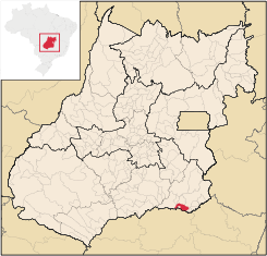
| State | Goiás Goiás Goiás is a state of Brazil, located in the central part of the country. The name Goiás comes from the name of an indigenous community... |
| Coordinates: | 18°15′48"S 48°09′01"W |
| Area: | 579.8 km² (10/10/2002) |
| Population: | 3,055 (IBGE 2007) |
| Elevation of the municipal seat: | 630m above sea level |
| Postcode (CEP): | 75760-000 |
| IBGE statistical microregion: | 017 Catalão Catalão Microregion The Catalão Microregion is a statistical microregion created by IBGE in south-eastern Goiás state, Brazil.*Population: 131.741 inhabitants *Cities: 11*Total Area: 15,238.60 km²... |
| Became a city: | 1947 |
| Mayor: | Antônio Ferreira Leão (2005-2009) |
| Distance to Goiânia Goiânia -Climate:The city has a tropical wet and dry climate with an average temperature of . There's a wet season, from October to April, and a dry one, from May to September. Annual rainfall is around 1,520 mm.... : |
304 km. |
| Website: | none |
Town
A town is a human settlement larger than a village but smaller than a city. The size a settlement must be in order to be called a "town" varies considerably in different parts of the world, so that, for example, many American "small towns" seem to British people to be no more than villages, while...
and municipality
Municipality
A municipality is essentially an urban administrative division having corporate status and usually powers of self-government. It can also be used to mean the governing body of a municipality. A municipality is a general-purpose administrative subdivision, as opposed to a special-purpose district...
in southeast Goiás
Goiás
Goiás is a state of Brazil, located in the central part of the country. The name Goiás comes from the name of an indigenous community...
state, Brazil
Brazil
Brazil , officially the Federative Republic of Brazil , is the largest country in South America. It is the world's fifth largest country, both by geographical area and by population with over 192 million people...
. The population was 3,055 (2007) in a total area of 579.8 km².
Connections and Municipal boundaries
Cumari is 304 kilometers from the state capital, GoiâniaGoiânia
-Climate:The city has a tropical wet and dry climate with an average temperature of . There's a wet season, from October to April, and a dry one, from May to September. Annual rainfall is around 1,520 mm....
. Highway connections are made by BR-153 / Aparecida de Goiânia
Aparecida de Goiânia
Aparecida de Goiânia is a city and municipality in central Goiás, Brazil. It is the second largest city in the state and a bustling industrial center.-Location:...
/ GO-217 / Piracanjuba
Piracanjuba
Piracanjuba is a small city and municipality in southeastern Goiás state, Brazil. It is a big producer of orchids, milk products, and soybeans. Piracanjuba is also the name of a fish common to the waters of the Plata River basin....
/ GO-139 / Caldas Novas
Caldas Novas
Caldas Novas is a Brazilian city and municipality in the state of Goiás. It is considered by many to be the largest hydro-thermal resort in the world.-Location:...
/ GO-139 / Corumbaíba
Corumbaíba
Corumbaíba is a small town and municipality in southeastern Goiás state, Brazil.-Location and Connections:Corumbaíba is located 222 kilometers from the state capital, Goiânia...
/ GO-210 / Nova Aurora
Nova Aurora
*Nova Aurora, Goiás, Brazil*Nova Aurora, Paraná, Brazil...
/ Goiandira
Goiandira
Goiandira is a small town and municipality in the southeastern portion of the Brazilian state of Goiás. The population was 4,925 in a total area of 560.7 km² .-Geography:...
/ GO-305.
Municipal boundaries are with:
- North: Nova AuroraNova Aurora, GoiásNova Aurora is a small town and municipality in south Goiás state, Brazil.-Location:Nova Aurora is located about fifty kilometers north of the Paranaíba River, which forms the boundary between the states of Goiás and Minas Gerais. It is part of the Catalão Microregion and is 32 kilometers west of...
and GoiandiraGoiandiraGoiandira is a small town and municipality in the southeastern portion of the Brazilian state of Goiás. The population was 4,925 in a total area of 560.7 km² .-Geography:...
; - South: AnhangüeraAnhangüeraAnhangüera originates from a word in the Tupi language which was the nickname given by Brazilian Indians to an explorer and "bandeirante", Bartolomeu Bueno da Silva .It may also refer to:* Anhanguera, Goiás, a municipality in the state of Goiás...
and the state of Minas GeraisMinas GeraisMinas Gerais is one of the 26 states of Brazil, of which it is the second most populous, the third richest, and the fourth largest in area. Minas Gerais is the Brazilian state with the largest number of Presidents of Brazil, the current one, Dilma Rousseff, being one of them. The capital is the...
; - East: CatalãoCatalãoCatalão is a small city and municipality located in the south of the state of Goiás, in Brazil. It is a large producer of grains, cattle, and phosphates and has a John Deere and Mitsubishi factory.-Demographics:*Population density: 17.85 inhab/km²...
; - West: CorumbaíbaCorumbaíbaCorumbaíba is a small town and municipality in southeastern Goiás state, Brazil.-Location and Connections:Corumbaíba is located 222 kilometers from the state capital, Goiânia...
Political Facts
- Eligible voters: 2,382 (2007)
- Mayor: Antônio Ferreira Leão
- Vice-mayor: Georgeano Camilo de Sousa
- Councilmembers: 09
Demographics
- Population density: 5.27 inhab/km² (2007)
- Population growth rate 2000/2007: -0.23.%
- Urban population: 2,440 (2007)
- Rural population: 615 (2007)
Climate and Geography
The climate is moist mesothermic tropical with an average annual temperature of 22°C. The thermal amplitude is very small: 4°C. The average annual rainfall is high, around 1,770 cubic milliliters, and the relative air humidity is about 80%.The elevation varies between 600 and 800 meters. The river system is made up of the Paranaíba
Paranaíba River
The Paranaíba River is a Brazilian river whose source lies in the state of Minas Gerais in the Mata da Corda mountains, municipality of Rio Paranaíba, at an altitude of 1,148 meters; on the other face of this mountain chain are the sources of the Abaeté river, tributary of the São Francisco River...
and its tributaries., the Veríssimo, the Pirapitinga, and the Ribeirão.
The main touristic point is the bridge over the Rio Pirapitinga. It has an extension of 782.9 meters, a height of 65 meters, and is located on kilometer 51 of the railroad that connects Uberlândia
Uberlândia
Uberlândia is the main town in the Triangle region, west of the state of Minas Gerais, Brazil. With a population of 604,013 inhabitants, according to 2010 estimates, the city is the second largest in the state second only to Belo Horizonte...
with Anápolis
Anápolis
Anápolis is the third largest city in the State of Goiás in Brazil. It lies in the center of a rich agricultural region and has become a leader in food processing and pharmaceutical plants.-Location and population:...
.
History
During the colonial period the region was called Sesmaria das Rosas and was a stopping point for muleteers travelling from Minas GeraisMinas Gerais
Minas Gerais is one of the 26 states of Brazil, of which it is the second most populous, the third richest, and the fourth largest in area. Minas Gerais is the Brazilian state with the largest number of Presidents of Brazil, the current one, Dilma Rousseff, being one of them. The capital is the...
to the old capital of Goiás
Goiás, Goiás
Goiás is a small city and municipality in the state of Goiás in Brazil. The population was 24,072 in a total area of 3,108 km² . It is the former capital of the state and preserves much of its colonial heritage...
. In 1904 there was already a primary school and in 1908 a general store was built. The railroad arrived in 1910 and the station opened in 1913. The town, originally called Samambaia and later Cumari, after an indigenous plant, grew around the station. The district was created in 1927 and it became a municipality in 1947. Later the district of Anhanguera separated to become a municipality.
The economy
Cumari has an economy based on cattle raising and agriculture. There was a herd of 56,500 head of cattle. About 80% of the production is for beef cattle. There is modest production (fewer than 200 hectares) of rice, bananas, coconut, manioc, hearts of palm, and rubber.Economic Indicators
- State ranking of GDP in 2002: 186 out of 246 municipalities
- Industrial units: 02 (2007)
- Retail units: 24 (2007)
- Banking institutions: none (2007)
Agricultural Data
There were 290 farms with a total area of 30,926 ha., of which 23,040 ha. were pasture, 120 ha. were permanent crops, 916 were perennial crops, and 5,658 ha. were woodland. There were 620 persons dependent on agriculture. There were 63 tractors and 43 farms had tractors.
Education and Health
- Literacy rate: 87.6%
- Infant mortality rate: 24.59 in 1,000 live births
In 2006 the school system had 4 schools, 22 classrooms, 46 teachers, and 852 students.
The health system had 1 hospital with 14 beds and 2 public health clinics (SUS).
Ranking on the Municipal Human Development Index
Human Development Index
The Human Development Index is a composite statistic used to rank countries by level of "human development" and separate "very high human development", "high human development", "medium human development", and "low human development" countries...
- MHDI: 0.755
- State ranking: 66 (out of 242 municipalities)
- National ranking: 1,713 (out of 5,507 municipalities)
(All data are from 2000)
See also
- List of municipalities in Goiás
- Microregions of Goiás
- Catalão MicroregionCatalão MicroregionThe Catalão Microregion is a statistical microregion created by IBGE in south-eastern Goiás state, Brazil.*Population: 131.741 inhabitants *Cities: 11*Total Area: 15,238.60 km²...