
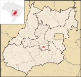
Aparecida de Goiânia
Encyclopedia
| Aparecida de Goiânia | |
|---|---|
| State | Goiás Goiás Goiás is a state of Brazil, located in the central part of the country. The name Goiás comes from the name of an indigenous community... |
| Area: | 290.1 km² |
| Population: | 475,303 (IBGE 2007) |
| Elevation: | 808m above sea level |
| Postcode (CEP): | 76310-000 |
| Became a city: | 1963 |
| Distance to Goiânia Goiânia -Climate:The city has a tropical wet and dry climate with an average temperature of . There's a wet season, from October to April, and a dry one, from May to September. Annual rainfall is around 1,520 mm.... : |
21 km. |
| IBGE statistical microregion: | Goiânia Microregion Goiânia Microregion The Goiânia Microregion is a region in central Goiás state, Brazil. It includes 17 municipalities with a population of 2,032,305 in a total area of 6,848.00 km².... |
| Website: | Aparecida de Goiânia, Goiás |
City
A city is a relatively large and permanent settlement. Although there is no agreement on how a city is distinguished from a town within general English language meanings, many cities have a particular administrative, legal, or historical status based on local law.For example, in the U.S...
and municipality
Municipality
A municipality is essentially an urban administrative division having corporate status and usually powers of self-government. It can also be used to mean the governing body of a municipality. A municipality is a general-purpose administrative subdivision, as opposed to a special-purpose district...
in central Goiás
Goiás
Goiás is a state of Brazil, located in the central part of the country. The name Goiás comes from the name of an indigenous community...
, Brazil
Brazil
Brazil , officially the Federative Republic of Brazil , is the largest country in South America. It is the world's fifth largest country, both by geographical area and by population with over 192 million people...
. It is the second largest city in the state and a bustling industrial center.
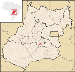
Location
Bordering on the southern limits of GoiâniaGoiânia
-Climate:The city has a tropical wet and dry climate with an average temperature of . There's a wet season, from October to April, and a dry one, from May to September. Annual rainfall is around 1,520 mm....
, 21 kilometers from the center, Aparecida has experienced rapid growth as a suburb and an option for less expensive housing than in neighboring Goiânia
Goiânia
-Climate:The city has a tropical wet and dry climate with an average temperature of . There's a wet season, from October to April, and a dry one, from May to September. Annual rainfall is around 1,520 mm....
.
Municipal boundaries are with:
- North: GoiâniaGoiânia-Climate:The city has a tropical wet and dry climate with an average temperature of . There's a wet season, from October to April, and a dry one, from May to September. Annual rainfall is around 1,520 mm....
- South: HidrolândiaHidrolândiaHidrolândia is a small town and municipality in central Goiás state, Brazil. The population was 14,004 in a total area of 944.2 km² . Hidrolândia is a large producer of poultry and eggs.-Location:...
- East: Bela Vista de GoiásBela Vista de GoiásBela Vista de Goiás is a small city located in central Goiás state in Brazil.-Location:It is 45 kilometers from the state capital of Goiânia...
and Senador CanedoSenador CanedoSenador Canedo is a city and municipality in central Goiás state, Brazil. It is the center of the petrochemical industry for the state.-Location:Senador Canedo is crossed by two state highways, GOs 020 and 010... - West: AragoiâniaAragoiâniaAragoiânia is a small town and municipality in central Goiás state, Brazil. The population was 7,243 in a total area of 219.5 km²....
and Abadia de GoiásAbadia de GoiásAbadia de Goiás is a small town and municipality in central Goiás state, Brazil, located on the western edge of the Goiânia metropolitan area.-Geographical Data:The distance to Goiânia is 27 km...
The city is cut by the BR-153 (Goiânia-São Paulo) and several municipal highways and bathed by the Meia Ponte River
Meia Ponte River
The Meia Ponte River is one of the most important rivers in the state of Goiás, Brazil. Its source lies 60 km north of the city of Goiânia and it flows through that city in a southern direction joining the Paranaíba river just downriver of Cachoeira Dourada Dam. The Paranaíba River marks the...
.
Demographics
- Population density: 1,647.7 inhab/km² (2007)
- Population growth 2000-2007: 5.06.%
- Population change: the population, now over 400, 000, has been growing at a fast rate since 1980, when it was 42,000.
Political Information
In January 2005 the mayor was José Macedo de Araújo. There were 224,835 eligible voters in December 2007 and the city council had 17 members.In October 2008 Maguito Vilela was elected mayor, who took office in January 2009.
History
The history of Aparecida, like that of Goiânia, is recent. In 1922 followers of Our Lady of Aparecida donated land so that their neighbors could build a church for the Virgin. In 1958 it was elevated to the condition of Vila, as a district of Goiânia with the name Aparecida de Goiás. In 1958 the name was changed to Goialândia which remained until 1963 when it emancipated itself and assumed the name of Aparecida de Goiânia.Economy
Its proximity to the capital has attracted important industries like Mabel (cookies), Vepeza and others, concentrated in the four different industrial zones on the edge of BR-153. In recent years the number of companies has doubled. In 2007 there were 964 industries. The industrial centers in the city are Distrito Agroindustrial de Aparecida de Goiânia (Daiag), Distrito Industrial (Dimag), Pólo Empresarial Goiás and Cidade Empresarial.In 2007 there were 13 financial institutions in the city.
Despite the heavy industrialization Aparecida still produces agricultural products. The cattle herd was 11,700 in 2003. Other agricultural products are rice, manioc, bananas, coconut, and sugarcane.
Health (2007) and Education (2006)
- Hospitals: 08
- Hospital beds: 782
- Infant mortality rate: 1990—35.4; 2000—20.9
- Higher education: Faculdade Alfredo Nasser - UNIFAN; - Faculdade Nossa Senhora Aparecida - FANAP; - Universidade Estadual de Goiás - UEG; - Faculdade Mestra( Padrão); - Faculdade Sul da América - SULDAMÉRICA.
- Literacy rate: 1991—85.2%; 2000—92.1%
- HDI: 0.764
- State ranking: 49 (out of 242 municipalities)
- National ranking: 1,488 (out of 5,507 municipalities)