

China National Highways
Encyclopedia
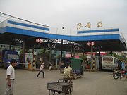
The China National Highways are a series of trunk roads throughout all of mainland China
. Although they are called highways (such as the Jingbao Highway), they are not necessarily expressways. However, like expressways
, a toll is sometimes charged.
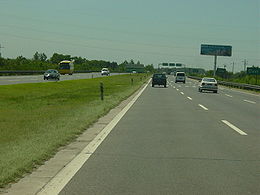
 Although an accepted speed limit on China National Highways is 100 km/h, it is not uncommon to see cars pass other by in well in excess of 100 km/h. The lack of speed detection cameras on some routes, lack of a posted speed limit outside of localities and tremendous distances of road mileage, means that enforcing this speed limit is rather herculean. In addition there is a notable shortage of traffic police in mainland China.
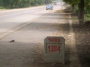
Nationwide highways often begin with the letter G, followed by three numerals, e.g.: G107. It is said that the G stands for 国家 (guójiā), or national.
The numbering of the highways is as follows:
 The building of highways is seen as key to accelerating infrastructure construction. In 2003, completed investment in highway construction was 350 billion yuan and 219 key highway projects progressed, focusing mainly on the five north-south and seven east-west national arterial highways as well as highways in western China and in rural areas. By the end of 2004, the total length of highways open to traffic reached 1.871 million km, including 34300 km (21,313.1 mi) of expressways up to advanced modern transportation standard, ranking second in the world. The nation's highway density has now reached 19.5 km per 100 km2.
With the completion in 2008 of the five north-south and the seven east-west national arterial highways, totaling 35000 km (21,748 mi), Beijing and Shanghai will be linked by major highways, chiefly expressways, to the capitals of all provinces and autonomous regions of China, creating highway connections between over 200 cities.
The aim of the National Expressway Network Plan approved in early 2005 is an expressway system connecting all capitals of provinces and autonomous regions with Beijing and with each other, linking major cities and important counties. The network will have a total length of about 85000 km (52,816.7 mi), including seven originating in Beijing
; the Beijing-Shanghai
, Beijing-Taipei
, Beijing-Hong Kong
-Macau
, Beijing-Kunming
, Beijing-Lhasa
, Beijing-Ürümqi
, and Beijing-Harbin
expressways. Half of the projects are already underway.
Note: The new system with two to four numbers that indicate the "NTHS"(7918)
system is now in use instead of the 000 Series.
For the expressways' new numbering system, Expressways of China
.
Original 000 Series numbers:
Mainland China
Mainland China, the Chinese mainland or simply the mainland, is a geopolitical term that refers to the area under the jurisdiction of the People's Republic of China . According to the Taipei-based Mainland Affairs Council, the term excludes the PRC Special Administrative Regions of Hong Kong and...
. Although they are called highways (such as the Jingbao Highway), they are not necessarily expressways. However, like expressways
Expressways of China
The Expressway Network of the People's Republic of China is one of the longest in the world. The network is also known as National Trunk Highway System . The total length of China's expressways was at the end of 2010, the world's second longest only after the United States and slightly longer...
, a toll is sometimes charged.
Regulation
Nationwide highways often begin with the letter G, followed by three numerals, e.g.: G107. It is said that the G stands for 国家 (guójiā), or national.
The numbering of the highways is as follows:
- Five vertical and seven horizontal main routes are labelled in the 000 series (the so called "five downs and seven acrosses").
- Except for China National Highway 112China National Highway 112China National Highway 112 is a 1228 km ring road which runs outside of Beijing .- Route and distance:- See also :* China National Highways...
, which originates in TianjinTianjin' is a metropolis in northern China and one of the five national central cities of the People's Republic of China. It is governed as a direct-controlled municipality, one of four such designations, and is, thus, under direct administration of the central government...
, all highways in the 100 series (e.g. 102, 106) begin from BeijingBeijingBeijing , also known as Peking , is the capital of the People's Republic of China and one of the most populous cities in the world, with a population of 19,612,368 as of 2010. The city is the country's political, cultural, and educational center, and home to the headquarters for most of China's...
, the capital city of the People's Republic of ChinaPeople's Republic of ChinaChina , officially the People's Republic of China , is the most populous country in the world, with over 1.3 billion citizens. Located in East Asia, the country covers approximately 9.6 million square kilometres...
, and spread out in all compass directions; - Highways in the 200 series stretch from north to south;
- Highways in the 300 series stretch from west to east (e.g., from LhasaLhasaLhasa is the administrative capital of the Tibet Autonomous Region in the People's Republic of China and the second most populous city on the Tibetan Plateau, after Xining. At an altitude of , Lhasa is one of the highest cities in the world...
in TibetTibetTibet is a plateau region in Asia, north-east of the Himalayas. It is the traditional homeland of the Tibetan people as well as some other ethnic groups such as Monpas, Qiang, and Lhobas, and is now also inhabited by considerable numbers of Han and Hui people...
through to DandongDandongDandong , previously known as Andong and Antung, is a city in Liaoning Province, Northeast China. It lies on the border between China and North Korea, which is marked by the Yalu River, and is the largest border city in China. Also, to the southwest of the city, the river flows into Korea Bay...
in LiaoningLiaoning' is a province of the People's Republic of China, located in the northeast of the country. Its one-character abbreviation is "辽" , a name taken from the Liao River that flows through the province. "Níng" means "peace"...
province).
Highway construction
With the completion in 2008 of the five north-south and the seven east-west national arterial highways, totaling 35000 km (21,748 mi), Beijing and Shanghai will be linked by major highways, chiefly expressways, to the capitals of all provinces and autonomous regions of China, creating highway connections between over 200 cities.
The aim of the National Expressway Network Plan approved in early 2005 is an expressway system connecting all capitals of provinces and autonomous regions with Beijing and with each other, linking major cities and important counties. The network will have a total length of about 85000 km (52,816.7 mi), including seven originating in Beijing
Beijing
Beijing , also known as Peking , is the capital of the People's Republic of China and one of the most populous cities in the world, with a population of 19,612,368 as of 2010. The city is the country's political, cultural, and educational center, and home to the headquarters for most of China's...
; the Beijing-Shanghai
Shanghai
Shanghai is the largest city by population in China and the largest city proper in the world. It is one of the four province-level municipalities in the People's Republic of China, with a total population of over 23 million as of 2010...
, Beijing-Taipei
Taipei
Taipei City is the capital of the Republic of China and the central city of the largest metropolitan area of Taiwan. Situated at the northern tip of the island, Taipei is located on the Tamsui River, and is about 25 km southwest of Keelung, its port on the Pacific Ocean...
, Beijing-Hong Kong
Hong Kong
Hong Kong is one of two Special Administrative Regions of the People's Republic of China , the other being Macau. A city-state situated on China's south coast and enclosed by the Pearl River Delta and South China Sea, it is renowned for its expansive skyline and deep natural harbour...
-Macau
Macau
Macau , also spelled Macao , is, along with Hong Kong, one of the two special administrative regions of the People's Republic of China...
, Beijing-Kunming
Kunming
' is the capital and largest city of Yunnan Province in Southwest China. It was known as Yunnan-Fou until the 1920s. A prefecture-level city, it is the political, economic, communications and cultural centre of Yunnan, and is the seat of the provincial government...
, Beijing-Lhasa
Lhasa
Lhasa is the administrative capital of the Tibet Autonomous Region in the People's Republic of China and the second most populous city on the Tibetan Plateau, after Xining. At an altitude of , Lhasa is one of the highest cities in the world...
, Beijing-Ürümqi
Ürümqi
Ürümqi , formerly Tihwa , is the capital of Xinjiang Uyghur Autonomous Region of the People's Republic of China, in the northwest of the country....
, and Beijing-Harbin
Harbin
Harbin ; Manchu language: , Harbin; Russian: Харби́н Kharbin ), is the capital and largest city of Heilongjiang Province in Northeast China, lying on the southern bank of the Songhua River...
expressways. Half of the projects are already underway.
List of all China National Highways
Former 000 Series
Note: 000 Series China National Highways pointed to five specific vertical routes, as well as seven specific horizontal routes. Routes ending in "0" were north-south (vertical) routes; routes ending in "5" were east-west (horizontal) routes.Note: The new system with two to four numbers that indicate the "NTHS"(7918)
Expressways of China
The Expressway Network of the People's Republic of China is one of the longest in the world. The network is also known as National Trunk Highway System . The total length of China's expressways was at the end of 2010, the world's second longest only after the United States and slightly longer...
system is now in use instead of the 000 Series.
For the expressways' new numbering system, Expressways of China
Expressways of China
The Expressway Network of the People's Republic of China is one of the longest in the world. The network is also known as National Trunk Highway System . The total length of China's expressways was at the end of 2010, the world's second longest only after the United States and slightly longer...
.
Original 000 Series numbers:
- China National Highway 010China National Highway 010China's National Highway G010 runs from Tongjiang in Heilongjiang to Sanya in Hainan. It is in length, the longest China National Highway to date....
: Tongjiang (HeilongjiangHeilongjiangFor the river known in Mandarin as Heilong Jiang, see Amur River' is a province of the People's Republic of China located in the northeastern part of the country. "Heilongjiang" literally means Black Dragon River, which is the Chinese name for the Amur. The one-character abbreviation is 黑...
) - SanyaSanyaSanya is the southernmost city in China and is a part of Hainan Province. In 2006, it had a population of 536,000, making it, after the provincial capital , the second most populous city on the island. The city is renowned for its tropical climate and has emerged as a popular tourist destination,...
(HainanHainanHainan is the smallest province of the People's Republic of China . Although the province comprises some two hundred islands scattered among three archipelagos off the southern coast, of its land mass is Hainan Island , from which the province takes its name...
), 5700 km (3,541.8 mi)– the longest China National Highway overall, (aka Tongsan Expressway) - now G11 and part of G15 - China National Highway 015: SuifenheSuifenheSuifenhe , is a city in southeastern Heilongjiang province, Northeast China, located situated where the former Chinese Eastern Railway crosses the border with Russia's Primorsky Krai.The city shares its name with the Suifen River....
(HeilongjiangHeilongjiangFor the river known in Mandarin as Heilong Jiang, see Amur River' is a province of the People's Republic of China located in the northeastern part of the country. "Heilongjiang" literally means Black Dragon River, which is the Chinese name for the Amur. The one-character abbreviation is 黑...
) - ManzhouliManzhouli- Administration :Manzhouli is divided into ten subdistricts and one town. Six of the subdistricts of Manzhouli are grouped into a district. Technically however, only a prefecture-level city can have districts, so Manzhouli's lone district is not officially listed.- History :In ancient times the...
(Inner MongoliaInner MongoliaInner Mongolia is an autonomous region of the People's Republic of China, located in the northern region of the country. Inner Mongolia shares an international border with the countries of Mongolia and the Russian Federation...
), 1280 km (795.4 mi) (aka Suiman Expressway) - now G10 - China National Highway 020: BeijingBeijingBeijing , also known as Peking , is the capital of the People's Republic of China and one of the most populous cities in the world, with a population of 19,612,368 as of 2010. The city is the country's political, cultural, and educational center, and home to the headquarters for most of China's...
- FuzhouFuzhouFuzhou is the capital and one of the largest cities in Fujian Province, People's Republic of China. Along with the many counties of Ningde, those of Fuzhou are considered to constitute the Mindong linguistic and cultural area....
(FujianFujian' , formerly romanised as Fukien or Huguing or Foukien, is a province on the southeast coast of mainland China. Fujian is bordered by Zhejiang to the north, Jiangxi to the west, and Guangdong to the south. Taiwan lies to the east, across the Taiwan Strait...
), 2540 km (1,578.3 mi) (aka Jingfu Expressway) - now part of G3 - China National Highway 025: DandongDandongDandong , previously known as Andong and Antung, is a city in Liaoning Province, Northeast China. It lies on the border between China and North Korea, which is marked by the Yalu River, and is the largest border city in China. Also, to the southwest of the city, the river flows into Korea Bay...
(LiaoningLiaoning' is a province of the People's Republic of China, located in the northeast of the country. Its one-character abbreviation is "辽" , a name taken from the Liao River that flows through the province. "Níng" means "peace"...
) - LhasaLhasaLhasa is the administrative capital of the Tibet Autonomous Region in the People's Republic of China and the second most populous city on the Tibetan Plateau, after Xining. At an altitude of , Lhasa is one of the highest cities in the world...
(TibetTibet Autonomous RegionThe Tibet Autonomous Region , Tibet or Xizang for short, also called the Xizang Autonomous Region is a province-level autonomous region of the People's Republic of China , created in 1965....
), 4590 km (2,852.1 mi) (aka Danla Expressway) - the Beijing-Lhasa part is now G6 - China National Highway 030: BeijingBeijingBeijing , also known as Peking , is the capital of the People's Republic of China and one of the most populous cities in the world, with a population of 19,612,368 as of 2010. The city is the country's political, cultural, and educational center, and home to the headquarters for most of China's...
- ZhuhaiZhuhaiZhuhai is a prefecture-level city on the southern coast of Guangdong province in the People's Republic of China. Located in the Pearl River Delta, Zhuhai borders Jiangmen to the northwest, Zhongshan to the north, and Macau to the south. Zhuhai was one of the original Special Economic Zones...
(GuangdongGuangdongGuangdong is a province on the South China Sea coast of the People's Republic of China. The province was previously often written with the alternative English name Kwangtung Province...
), 2310 km (1,435.4 mi) (aka Jingzhu ExpresswayJingzhu ExpresswayThe Jingzhu Expressway is the first completed north-south expressway in the People's Republic of China, starting from Beijing and ending in Zhuhai, on the border with the Macau SAR....
) - now (mostly) G4 - China National Highway 035: QingdaoQingdao' also known in the West by its postal map spelling Tsingtao, is a major city with a population of over 8.715 million in eastern Shandong province, Eastern China. Its built up area, made of 7 urban districts plus Jimo city, is home to about 4,346,000 inhabitants in 2010.It borders Yantai to the...
(ShandongShandong' is a Province located on the eastern coast of the People's Republic of China. Shandong has played a major role in Chinese history from the beginning of Chinese civilization along the lower reaches of the Yellow River and served as a pivotal cultural and religious site for Taoism, Chinese...
) - Yinchuan (NingxiaNingxiaNingxia, formerly transliterated as Ningsia, is an autonomous region of the People's Republic of China. Located in Northwest China, on the Loess Plateau, the Yellow River flows through this vast area of land. The Great Wall of China runs along its northeastern boundary...
), 1610 km (1,000.4 mi) (aka Qingyin Expressway) - now G20 - China National Highway 040: ErenhotErenhotErenhot is a city located in the Gobi Desert, in the Xilin Gol league of the Inner Mongolia Autonomous Region of the People's Republic of China . It has 16,330 inhabitants and the elevation is...
(Inner MongoliaInner MongoliaInner Mongolia is an autonomous region of the People's Republic of China, located in the northern region of the country. Inner Mongolia shares an international border with the countries of Mongolia and the Russian Federation...
) - HekouHekou Yao Autonomous CountyThe Hekou Yao Autonomous County is an autonomous county in the southern part of the Yunnan province of China. It is part of the Honghe Hani and Yi Autonomous Prefecture and borders the northern Vietnamese town of Lao Cai.-Industrial Park:...
(YunnanYunnanYunnan is a province of the People's Republic of China, located in the far southwest of the country spanning approximately and with a population of 45.7 million . The capital of the province is Kunming. The province borders Burma, Laos, and Vietnam.Yunnan is situated in a mountainous area, with...
), 3610 km (2,243.2 mi) (aka Erhe Expressway) - China National Highway 045: LianyungangLianyungangLianyungang is a prefecture-level city in northeastern Jiangsu province, People's Republic of China. It borders Yancheng to its southeast, Huai'an and Suqian to its south, Xuzhou to its southwest, and the province of Shandong to its north...
(JiangsuJiangsu' is a province of the People's Republic of China, located along the east coast of the country. The name comes from jiang, short for the city of Jiangning , and su, for the city of Suzhou. The abbreviation for this province is "苏" , the second character of its name...
) - Khorgas (XinjiangXinjiangXinjiang is an autonomous region of the People's Republic of China. It is the largest Chinese administrative division and spans over 1.6 million km2...
), 3980 km (2,473.1 mi)(aka Lianhuo Expressway) - now G30 - China National Highway 050: ChongqingChongqingChongqing is a major city in Southwest China and one of the five national central cities of China. Administratively, it is one of the PRC's four direct-controlled municipalities , and the only such municipality in inland China.The municipality was created on 14 March 1997, succeeding the...
- ZhanjiangZhanjiangZhanjiang , formerly known as Tsamkong, Tsankiang, Fort-Bayard, and Kwang-Chou-Wan, is a prefecture-level city at the southwestern end of Guangdong province of Southern China, facing the island of Hainan to the south....
(GuangdongGuangdongGuangdong is a province on the South China Sea coast of the People's Republic of China. The province was previously often written with the alternative English name Kwangtung Province...
), 1430 km (888.6 mi) (aka Yuzhan Expressway) - now part of G15 and part of G75 - China National Highway 055: ShanghaiShanghaiShanghai is the largest city by population in China and the largest city proper in the world. It is one of the four province-level municipalities in the People's Republic of China, with a total population of over 23 million as of 2010...
- ChengduChengduChengdu , formerly transliterated Chengtu, is the capital of Sichuan province in Southwest China. It holds sub-provincial administrative status...
(SichuanSichuan' , known formerly in the West by its postal map spellings of Szechwan or Szechuan is a province in Southwest China with its capital in Chengdu...
), 2970 km (1,845.5 mi) (aka Hurong Expressway) - now G42 - China National Highway 065: ShanghaiShanghaiShanghai is the largest city by population in China and the largest city proper in the world. It is one of the four province-level municipalities in the People's Republic of China, with a total population of over 23 million as of 2010...
- RuiliRuiliRuili City is a county-level city in Dehong Prefecture, Yunnan province, southwest China.It is a major border crossing between China and Myanmar, with Muse town located across the border.- Name :...
(YunnanYunnanYunnan is a province of the People's Republic of China, located in the far southwest of the country spanning approximately and with a population of 45.7 million . The capital of the province is Kunming. The province borders Burma, Laos, and Vietnam.Yunnan is situated in a mountainous area, with...
), 4090 km (2,541.4 mi) (aka Hurui Expressway) - now part of G56 - China National Highway 075: HengyangHengyangHengyang is the second largest city of China's Hunan Province. It straddles the Xiang River about 160 km south of Changsha.-History:Its former name was Hengzhou . This was the capital of a prefecture in the Tang Dynasty's Jiangnan and West Jiangnan circuits...
(HunanHunan' is a province of South-Central China, located to the south of the middle reaches of the Yangtze River and south of Lake Dongting...
) - KunmingKunming' is the capital and largest city of Yunnan Province in Southwest China. It was known as Yunnan-Fou until the 1920s. A prefecture-level city, it is the political, economic, communications and cultural centre of Yunnan, and is the seat of the provincial government...
(YunnanYunnanYunnan is a province of the People's Republic of China, located in the far southwest of the country spanning approximately and with a population of 45.7 million . The capital of the province is Kunming. The province borders Burma, Laos, and Vietnam.Yunnan is situated in a mountainous area, with...
), 1980 km (1,230.3 mi)(aka Hengkun Expressway)
100 Series
- China National Highway 101China National Highway 101China National Highway 101 is a major trunk route in China, which connects Beijing to Shenyang, Liaoning. In Beijing it is known as Jingshun Road or Jingmi Road for connecting central Bejiing to Shunyi District and Miyun County, although the actual road goes far beyond these two locations.It leaves...
: BeijingBeijingBeijing , also known as Peking , is the capital of the People's Republic of China and one of the most populous cities in the world, with a population of 19,612,368 as of 2010. The city is the country's political, cultural, and educational center, and home to the headquarters for most of China's...
- ShenyangShenyangShenyang , or Mukden , is the capital and largest city of Liaoning Province in Northeast China. Currently holding sub-provincial administrative status, the city was once known as Shengjing or Fengtianfu...
(LiaoningLiaoning' is a province of the People's Republic of China, located in the northeast of the country. Its one-character abbreviation is "辽" , a name taken from the Liao River that flows through the province. "Níng" means "peace"...
), 879 km (546.2 mi) - China National Highway 102China National Highway 102China National Highway 102 is a major trunk route in China, which connects Beijing to Harbin, Heilongjiang. In Beijing it is known as Jingha Road for connecting Beijing to Harbin....
: BeijingBeijingBeijing , also known as Peking , is the capital of the People's Republic of China and one of the most populous cities in the world, with a population of 19,612,368 as of 2010. The city is the country's political, cultural, and educational center, and home to the headquarters for most of China's...
- HarbinHarbinHarbin ; Manchu language: , Harbin; Russian: Харби́н Kharbin ), is the capital and largest city of Heilongjiang Province in Northeast China, lying on the southern bank of the Songhua River...
(HeilongjiangHeilongjiangFor the river known in Mandarin as Heilong Jiang, see Amur River' is a province of the People's Republic of China located in the northeastern part of the country. "Heilongjiang" literally means Black Dragon River, which is the Chinese name for the Amur. The one-character abbreviation is 黑...
), 1311 km (814.6 mi) - China National Highway 103China National Highway 103China National Highway 103 is the main traffic corridor between Beijing and Tianjin. It goes from Beijing to Tongzhou, Tianjin and then to the coastal area of Tanggu on the outskirts of Tianjin, and runs to approximately 150 km....
: BeijingBeijingBeijing , also known as Peking , is the capital of the People's Republic of China and one of the most populous cities in the world, with a population of 19,612,368 as of 2010. The city is the country's political, cultural, and educational center, and home to the headquarters for most of China's...
- Tanggu (TianjinTianjin' is a metropolis in northern China and one of the five national central cities of the People's Republic of China. It is governed as a direct-controlled municipality, one of four such designations, and is, thus, under direct administration of the central government...
), 149 km (92.6 mi) – the shortest China National Highway overall, and from Beijing - China National Highway 104China National Highway 104China National Highway 104 runs from Beijing to Fuzhou via Jinan, Xuzhou, Nanjing, Hangzhou and Taizhou.It runs to approximately 2,390 km, and, on a map, runs southeast towards Nanjing and Hangzhou before turning south-southwest at Taizhou....
: BeijingBeijingBeijing , also known as Peking , is the capital of the People's Republic of China and one of the most populous cities in the world, with a population of 19,612,368 as of 2010. The city is the country's political, cultural, and educational center, and home to the headquarters for most of China's...
- FuzhouFuzhouFuzhou is the capital and one of the largest cities in Fujian Province, People's Republic of China. Along with the many counties of Ningde, those of Fuzhou are considered to constitute the Mindong linguistic and cultural area....
(FujianFujian' , formerly romanised as Fukien or Huguing or Foukien, is a province on the southeast coast of mainland China. Fujian is bordered by Zhejiang to the north, Jiangxi to the west, and Guangdong to the south. Taiwan lies to the east, across the Taiwan Strait...
), 2387 km (1,483.2 mi) - China National Highway 105China National Highway 105China National Highway 105 runs from Beijing to Zhuhai, via Langfang, Chuangzhou, Dezhou, Donge, Jining, Shuangyou, Fuyang, Liuan, Jiujiang, Nanchang, Ji'an and Guangzhou...
: BeijingBeijingBeijing , also known as Peking , is the capital of the People's Republic of China and one of the most populous cities in the world, with a population of 19,612,368 as of 2010. The city is the country's political, cultural, and educational center, and home to the headquarters for most of China's...
- ZhuhaiZhuhaiZhuhai is a prefecture-level city on the southern coast of Guangdong province in the People's Republic of China. Located in the Pearl River Delta, Zhuhai borders Jiangmen to the northwest, Zhongshan to the north, and Macau to the south. Zhuhai was one of the original Special Economic Zones...
(GuangdongGuangdongGuangdong is a province on the South China Sea coast of the People's Republic of China. The province was previously often written with the alternative English name Kwangtung Province...
), 2653 km (1,648.5 mi) - China National Highway 106China National Highway 106China National Highway 106 is a road from Beijing to Guangzhou.It leaves Beijing at Yuquanying and heads to Gu'an, Bazhou , Kaifeng , Ezhou , and eventually Guangzhou on the south China coast....
: BeijingBeijingBeijing , also known as Peking , is the capital of the People's Republic of China and one of the most populous cities in the world, with a population of 19,612,368 as of 2010. The city is the country's political, cultural, and educational center, and home to the headquarters for most of China's...
- GuangzhouGuangzhouGuangzhou , known historically as Canton or Kwangchow, is the capital and largest city of the Guangdong province in the People's Republic of China. Located in southern China on the Pearl River, about north-northwest of Hong Kong, Guangzhou is a key national transportation hub and trading port...
(GuangdongGuangdongGuangdong is a province on the South China Sea coast of the People's Republic of China. The province was previously often written with the alternative English name Kwangtung Province...
), 2505 km (1,556.5 mi) - China National Highway 107China National Highway 107China's National Highway 107 runs from Beijing to Shenzhen via Wuhan. It runs to approximately 2,698 km, and, on a map, runs broadly on a straight line from Beijing to Guangzhou.In between, the highway runs parallel to national highways 105 and 106....
: BeijingBeijingBeijing , also known as Peking , is the capital of the People's Republic of China and one of the most populous cities in the world, with a population of 19,612,368 as of 2010. The city is the country's political, cultural, and educational center, and home to the headquarters for most of China's...
- ShenzhenShenzhenShenzhen is a major city in the south of Southern China's Guangdong Province, situated immediately north of Hong Kong. The area became China's first—and one of the most successful—Special Economic Zones...
(GuangdongGuangdongGuangdong is a province on the South China Sea coast of the People's Republic of China. The province was previously often written with the alternative English name Kwangtung Province...
), 2509 km (1,559 mi) - China National Highway 108China National Highway 108China National Highway 108 is a National Highway which connects Beijing through Chengdu to Kunming. In Beijing it is known as Jingyuan Road....
: BeijingBeijingBeijing , also known as Peking , is the capital of the People's Republic of China and one of the most populous cities in the world, with a population of 19,612,368 as of 2010. The city is the country's political, cultural, and educational center, and home to the headquarters for most of China's...
- KunmingKunming' is the capital and largest city of Yunnan Province in Southwest China. It was known as Yunnan-Fou until the 1920s. A prefecture-level city, it is the political, economic, communications and cultural centre of Yunnan, and is the seat of the provincial government...
(YunnanYunnanYunnan is a province of the People's Republic of China, located in the far southwest of the country spanning approximately and with a population of 45.7 million . The capital of the province is Kunming. The province borders Burma, Laos, and Vietnam.Yunnan is situated in a mountainous area, with...
), 3356 km (2,085.3 mi) - China National Highway 109China National Highway 109China National Highway 109 connects Beijing with Lhasa. It runs westwards of Beijing via Datong, Yinchuan and Xining to Golmud before turning southwest to Lhasa...
: BeijingBeijingBeijing , also known as Peking , is the capital of the People's Republic of China and one of the most populous cities in the world, with a population of 19,612,368 as of 2010. The city is the country's political, cultural, and educational center, and home to the headquarters for most of China's...
- LhasaLhasaLhasa is the administrative capital of the Tibet Autonomous Region in the People's Republic of China and the second most populous city on the Tibetan Plateau, after Xining. At an altitude of , Lhasa is one of the highest cities in the world...
(TibetTibetTibet is a plateau region in Asia, north-east of the Himalayas. It is the traditional homeland of the Tibetan people as well as some other ethnic groups such as Monpas, Qiang, and Lhobas, and is now also inhabited by considerable numbers of Han and Hui people...
), 3855 km (2,395.4 mi)– the longest China National Highway from Beijing - China National Highway 110China National Highway 110China National Highway 110 runs from Beijing to Yinchuan, via Hohhot and Baotou, in Inner Mongolia. It heads northwest from Beijing to Zhangjiakou then heads straight west, and runs to approximately 1,100 kilometres....
: BeijingBeijingBeijing , also known as Peking , is the capital of the People's Republic of China and one of the most populous cities in the world, with a population of 19,612,368 as of 2010. The city is the country's political, cultural, and educational center, and home to the headquarters for most of China's...
- Yinchuan (NingxiaNingxiaNingxia, formerly transliterated as Ningsia, is an autonomous region of the People's Republic of China. Located in Northwest China, on the Loess Plateau, the Yellow River flows through this vast area of land. The Great Wall of China runs along its northeastern boundary...
), 1135 km (705.3 mi) - China National Highway 111China National Highway 111China National Highway 111 runs from Beijing to Heilongjiang province.It leaves Beijing heading north-east.-Route and distance:-See also:* China National Highways...
: BeijingBeijingBeijing , also known as Peking , is the capital of the People's Republic of China and one of the most populous cities in the world, with a population of 19,612,368 as of 2010. The city is the country's political, cultural, and educational center, and home to the headquarters for most of China's...
- Jiagedaqi (HeilongjiangHeilongjiangFor the river known in Mandarin as Heilong Jiang, see Amur River' is a province of the People's Republic of China located in the northeastern part of the country. "Heilongjiang" literally means Black Dragon River, which is the Chinese name for the Amur. The one-character abbreviation is 黑...
), 2123 km (1,319.2 mi) - China National Highway 112China National Highway 112China National Highway 112 is a 1228 km ring road which runs outside of Beijing .- Route and distance:- See also :* China National Highways...
: Gaobeidian - TianjinTianjin' is a metropolis in northern China and one of the five national central cities of the People's Republic of China. It is governed as a direct-controlled municipality, one of four such designations, and is, thus, under direct administration of the central government...
- TangshanTangshan"唐山"redirects here. For an alternative name of China, see Names of China#TangTangshan is a largely industrial prefecture-level city in Hebei province, People's Republic of China. It has become known for the 1976 Tangshan earthquake which measured 7.8 on the Richter scale and killed at least...
- XuanhuaXuanhua DistrictXuanhua is a district in Zhangjiakou prefecture-level city in Hebei Province, China.Xuanhua is 180 km North-West of Beijing. It has a population of 274,000 people. Xuanhua is a very old city with a rich military and agricultural history...
- Gaobeidian ring route, 1228 km (763 mi)
200 Series
- China National Highway 201China National Highway 201China National Highway 201 runs from Hegang, Heilongjiang Province to Lushunkou, Liaoning Province. It is 1,964 kilometres in length and runs southeast from Hegang towards the border with Russia before turning southwest, going via Mudanjiang, Heilongjiang Province and Dandong, Liaoning...
: HegangHegang-Subdivisions:The prefecture-level city of Hegang is divided in 6 districts and 2 counties. The information here presented uses the metric system and data for 2010 Census.-Early History:...
(HeilongjiangHeilongjiangFor the river known in Mandarin as Heilong Jiang, see Amur River' is a province of the People's Republic of China located in the northeastern part of the country. "Heilongjiang" literally means Black Dragon River, which is the Chinese name for the Amur. The one-character abbreviation is 黑...
) - DalianDalianDalian is a major city and seaport in the south of Liaoning province, Northeast China. It faces Shandong to the south, the Yellow Sea to the east and the Bohai Sea to the west and south. Holding sub-provincial administrative status, Dalian is the southernmost city of Northeast China and China's...
(LiaoningLiaoning' is a province of the People's Republic of China, located in the northeast of the country. Its one-character abbreviation is "辽" , a name taken from the Liao River that flows through the province. "Níng" means "peace"...
), 1946 km (1,209.2 mi) - China National Highway 202China National Highway 202China National Highway 202 runs from Heihe in Heilongjiang to Lushunkou in Liaoning. It is 1,818 kilometres in length and runs south from Heihe, going via Harbin and Shenyang.-Route and distance:...
: HeiheHeiheHeihe is a city in Heilongjiang, China.It is located at , on the Russian border, on the south bank of the Amur River, across the river from the Russian city of Blagoveshchensk...
(HeilongjiangHeilongjiangFor the river known in Mandarin as Heilong Jiang, see Amur River' is a province of the People's Republic of China located in the northeastern part of the country. "Heilongjiang" literally means Black Dragon River, which is the Chinese name for the Amur. The one-character abbreviation is 黑...
) - DalianDalianDalian is a major city and seaport in the south of Liaoning province, Northeast China. It faces Shandong to the south, the Yellow Sea to the east and the Bohai Sea to the west and south. Holding sub-provincial administrative status, Dalian is the southernmost city of Northeast China and China's...
(LiaoningLiaoning' is a province of the People's Republic of China, located in the northeast of the country. Its one-character abbreviation is "辽" , a name taken from the Liao River that flows through the province. "Níng" means "peace"...
), 1818 km (1,129.7 mi) - China National Highway 203China National Highway 203China National Highway 203 runs from Mingshui in Heilongjiang to Shenyang in Liaoning. It is 720 kilometres in length and runs straight south from Mingshui, going via Chongyuan.-Route and distance:...
: MingshuiMingshuiMingshui County is a county of Heilongjiang Province, China. It is under the jurisdiction of the prefecture-level city of Suihua. Its population was 336,649 as of 1999.- Notes and references :...
(HeilongjiangHeilongjiangFor the river known in Mandarin as Heilong Jiang, see Amur River' is a province of the People's Republic of China located in the northeastern part of the country. "Heilongjiang" literally means Black Dragon River, which is the Chinese name for the Amur. The one-character abbreviation is 黑...
) - ShenyangShenyangShenyang , or Mukden , is the capital and largest city of Liaoning Province in Northeast China. Currently holding sub-provincial administrative status, the city was once known as Shengjing or Fengtianfu...
(LiaoningLiaoning' is a province of the People's Republic of China, located in the northeast of the country. Its one-character abbreviation is "辽" , a name taken from the Liao River that flows through the province. "Níng" means "peace"...
), 720 km (447.4 mi) - China National Highway 204China National Highway 204China National Highway 204 runs from Yantai in Shandong Province to Shanghai. It is 1,031 kilometres in length and runs south from Yantai, going via Shangdong and Jiangsu Province, and ends in Shanghai.- Route and distance:...
: YantaiYantaiYantai is a prefecture-level city in northeastern Shandong province, People's Republic of China. Located on the southern coast of the Bohai Sea and the eastern coast of the Laizhou Bay, Yantai borders the cities of Qingdao and Weihai to the southwest and east respectively.The largest fishing...
(ShandongShandong' is a Province located on the eastern coast of the People's Republic of China. Shandong has played a major role in Chinese history from the beginning of Chinese civilization along the lower reaches of the Yellow River and served as a pivotal cultural and religious site for Taoism, Chinese...
) - ShanghaiShanghaiShanghai is the largest city by population in China and the largest city proper in the world. It is one of the four province-level municipalities in the People's Republic of China, with a total population of over 23 million as of 2010...
, 1031 km (640.6 mi) - China National Highway 205China National Highway 205China National Highway 205 runs from Shanhaiguan, Hebei Province to Shenzhen, Guangdong. It is 3,160 kilometres in length and runs south from Shanhaiguan towards Tianjin, Hebei, Shandong, Jiangsu, Anhui, Zhejiang, Fujian, and ends in Guangdong Province.- Route and distance:...
: ShanhaiguanShanhaiguan DistrictShanhaiguan District is a district of the city of Qinhuangdao, Hebei province, People's Republic of China, named after the pass of the Great Wall within the district, Shanhai Pass...
(HebeiHebei' is a province of the People's Republic of China in the North China region. Its one-character abbreviation is "" , named after Ji Province, a Han Dynasty province that included what is now southern Hebei...
) - GuangzhouGuangzhouGuangzhou , known historically as Canton or Kwangchow, is the capital and largest city of the Guangdong province in the People's Republic of China. Located in southern China on the Pearl River, about north-northwest of Hong Kong, Guangzhou is a key national transportation hub and trading port...
(GuangdongGuangdongGuangdong is a province on the South China Sea coast of the People's Republic of China. The province was previously often written with the alternative English name Kwangtung Province...
), 3160 km (1,963.5 mi) - China National Highway 206China National Highway 206China National Highway 206 runs from Yantai, Shandong Province to Shantou, Guangdong Province. It is 2,375 kilometres in length and runs south from Yantai, going via Shangdong, Jiangsu, Anhui, Jiangxi Province, and ends in Guangdong Province....
: YantaiYantaiYantai is a prefecture-level city in northeastern Shandong province, People's Republic of China. Located on the southern coast of the Bohai Sea and the eastern coast of the Laizhou Bay, Yantai borders the cities of Qingdao and Weihai to the southwest and east respectively.The largest fishing...
(ShandongShandong' is a Province located on the eastern coast of the People's Republic of China. Shandong has played a major role in Chinese history from the beginning of Chinese civilization along the lower reaches of the Yellow River and served as a pivotal cultural and religious site for Taoism, Chinese...
) - ShantouShantouShantou , historically known as Swatow or Suátao, is a prefecture-level city on the eastern coast of Guangdong province, People's Republic of China, with a total population of 5,391,028 as of 2010 and an administrative area of...
(GuangdongGuangdongGuangdong is a province on the South China Sea coast of the People's Republic of China. The province was previously often written with the alternative English name Kwangtung Province...
), 2302 km (1,430.4 mi) - China National Highway 207China National Highway 207China National Highway 207 runs from Xilinhot, Inner Mongolia to Hai'an, Guangdong Province. It is 3,738 kilometres in length and runs south from Xilinhot towards Hebei Province, Shanxi Province, Henan Province, Hubei Province, Guangxi Province, and ends in Guangdong Province.-Route and...
: XilinhotXilinhotXilinhot is a county-level city which serves as the seat of government for the Xilin Gol league in Inner Mongolia, People's Republic of China. It has a jurisdiction area of , and a population of 177,000, with 149,000 being in the Xilinhot urban area....
(Inner MongoliaInner MongoliaInner Mongolia is an autonomous region of the People's Republic of China, located in the northern region of the country. Inner Mongolia shares an international border with the countries of Mongolia and the Russian Federation...
) - Hai'an (GuangdongGuangdongGuangdong is a province on the South China Sea coast of the People's Republic of China. The province was previously often written with the alternative English name Kwangtung Province...
), 3738 km (2,322.7 mi) – the longest north-south China National Highway - China National Highway 208China National Highway 208China National Highway 208 runs from Erenhot, Inner Mongolia to Changzhi, Shanxi province. It is 990 kilometres in length and runs south from Erenhot towards Shanxi province.-Route and distance:-External links:*...
: ErenhotErenhotErenhot is a city located in the Gobi Desert, in the Xilin Gol league of the Inner Mongolia Autonomous Region of the People's Republic of China . It has 16,330 inhabitants and the elevation is...
(Inner MongoliaInner MongoliaInner Mongolia is an autonomous region of the People's Republic of China, located in the northern region of the country. Inner Mongolia shares an international border with the countries of Mongolia and the Russian Federation...
) - ChangzhiChangzhiChangzhi is a prefecture-level city in Shanxi Province, People's Republic of China. It lies between the city of Huozhou in Shanxi and the city of Hebi in Henan....
(ShanxiShanxi' is a province in Northern China. Its one-character abbreviation is "晋" , after the state of Jin that existed here during the Spring and Autumn Period....
), 990 km (615.2 mi) - China National Highway 209China National Highway 209China National Highway 209 runs from Huhhot, Inner Mongolia to Beihai, Guangxi province. It is3,435 kilometres in length and runs south from Huhhot towards Shanxi province, Henan province, Hubei province, Hunan province, and ends in Guangxi province.Despite the "National Highway" designation, G209...
: HohhotHohhotHohhot , is a city in north-central China and the capital of the Inner Mongolian Autonomous Region, serving as the region's administrative, economic, and cultural centre....
(Inner MongoliaInner MongoliaInner Mongolia is an autonomous region of the People's Republic of China, located in the northern region of the country. Inner Mongolia shares an international border with the countries of Mongolia and the Russian Federation...
) - BeihaiBeihaiBeihai is a prefecture-level city of Guangxi, China. Beihai means "north of the sea" in Chinese, signifying its status as a seaport on the north shore of the Gulf of Tonkin. Between the years 2006 and 2020, Beihai is predicted to be the world's fastest growing city...
(GuangxiGuangxiGuangxi, formerly romanized Kwangsi, is a province of southern China along its border with Vietnam. In 1958, it became the Guangxi Zhuang Autonomous Region of the People's Republic of China, a region with special privileges created specifically for the Zhuang people.Guangxi's location, in...
), 3435 km (2,134.4 mi) - China National Highway 210China National Highway 210China National Highway 210 runs from Baotou, Inner Mongolia to Nanning, Guangxi Province. It is 3,097 kilometres in length and runs south from Baotou towards Shaanxi Province, Sichuan Province, Chongqing, Guizhou Province, and ends in Guangxi Province.- Route and distance:-References:*...
: BaotouBaotouBaotou is a mid-sized industrial city in the Inner Mongolia Autonomous Region of the People's Republic of China. Governed as a prefecture-level city, its urban areas are home to a population of approximately 1.78 million, with a total population of over 2.65 million accounting for counties under...
(Inner MongoliaInner MongoliaInner Mongolia is an autonomous region of the People's Republic of China, located in the northern region of the country. Inner Mongolia shares an international border with the countries of Mongolia and the Russian Federation...
) - NanningNanningNanning is the capital of the Guangxi Zhuang Autonomous Region in southern China. It is known as the "Green City" because of its abundance of lush tropical foliage.-History:...
(GuangxiGuangxiGuangxi, formerly romanized Kwangsi, is a province of southern China along its border with Vietnam. In 1958, it became the Guangxi Zhuang Autonomous Region of the People's Republic of China, a region with special privileges created specifically for the Zhuang people.Guangxi's location, in...
), 3097 km (1,924.4 mi) - China National Highway 211China National Highway 211China National Highway 211 runs from Yinchuan in Ningxia to Xi'an in Shaanxi. It is 645 kilometres in length and runs southwest from Wuning in Ningxia and then turns southeast on a virtual straight line to Xi'an via primarily rural areas....
: Yinchuan (NingxiaNingxiaNingxia, formerly transliterated as Ningsia, is an autonomous region of the People's Republic of China. Located in Northwest China, on the Loess Plateau, the Yellow River flows through this vast area of land. The Great Wall of China runs along its northeastern boundary...
) - Xi'anXi'anXi'an is the capital of the Shaanxi province, and a sub-provincial city in the People's Republic of China. One of the oldest cities in China, with more than 3,100 years of history, the city was known as Chang'an before the Ming Dynasty...
(ShaanxiShaanxi' is a province in the central part of Mainland China, and it includes portions of the Loess Plateau on the middle reaches of the Yellow River in addition to the Qinling Mountains across the southern part of this province...
), 645 km (400.8 mi) - China National Highway 212China National Highway 212China National Highway 212 runs from Lanzhou in Gansu to Chongqing. It is 1302 kilometres in length.The section from Lanzhou to Lintao has been converted into an expressway, designated G75 . From Lanzhou to the junction at Huichuan Town , G212 also doubles as China National Highway 316.-Route and...
: LanzhouLanzhouLanzhou is the capital and largest city of Gansu Province in Northwest China. A prefecture-level city, it is a key regional transportation hub, allowing areas further west to maintain railroad connections to the eastern half of the country....
(GansuGansu' is a province located in the northwest of the People's Republic of China.It lies between the Tibetan and Huangtu plateaus, and borders Mongolia, Inner Mongolia, and Ningxia to the north, Xinjiang and Qinghai to the west, Sichuan to the south, and Shaanxi to the east...
) - ChongqingChongqingChongqing is a major city in Southwest China and one of the five national central cities of China. Administratively, it is one of the PRC's four direct-controlled municipalities , and the only such municipality in inland China.The municipality was created on 14 March 1997, succeeding the...
, 1195 km (742.5 mi) - China National Highway 213China National Highway 213China National Highway 213 runs from Lanzhou in Gansu to Mohan in Yunnan. It is 2827 kilometres in length and runs via Chengdu, Sichuan and Kunming, Yunnan.-Route and distance:...
: LanzhouLanzhouLanzhou is the capital and largest city of Gansu Province in Northwest China. A prefecture-level city, it is a key regional transportation hub, allowing areas further west to maintain railroad connections to the eastern half of the country....
(GansuGansu' is a province located in the northwest of the People's Republic of China.It lies between the Tibetan and Huangtu plateaus, and borders Mongolia, Inner Mongolia, and Ningxia to the north, Xinjiang and Qinghai to the west, Sichuan to the south, and Shaanxi to the east...
) - Mohan (YunnanYunnanYunnan is a province of the People's Republic of China, located in the far southwest of the country spanning approximately and with a population of 45.7 million . The capital of the province is Kunming. The province borders Burma, Laos, and Vietnam.Yunnan is situated in a mountainous area, with...
), 2827 km (1,756.6 mi) - China National Highway 214China National Highway 214China National Highway 214 runs from Xining, Qinghai to Jinghong, Yunnan. It is 3,256 kilometres in length and runs south from Xining towards Tibet, and ends in Yunnan Province.-Route and distance:-External links:*...
: XiningXiningXining is the capital of Qinghai province, People's Republic of China, and the largest city on the Tibetan Plateau. It has 2,208,708 inhabitants at the 2010 census whom 1,198,304 live in the built up area made of 4 urban districts.-History:...
(QinghaiQinghaiQinghai ; Oirat Mongolian: ; ; Salar:) is a province of the People's Republic of China, named after Qinghai Lake...
) - JinghongJinghongJinghong romanised as chiang rung, chiang hung, chengrung, cheng hung, jinghung, keng hung and muangjinghung) is the capital of Xishuangbanna Dai Autonomous Prefecture, Yunnan province, China, and the historic capital of the former Tai kingdom of Sipsongpanna.-Location:Located between 100°25' -...
(YunnanYunnanYunnan is a province of the People's Republic of China, located in the far southwest of the country spanning approximately and with a population of 45.7 million . The capital of the province is Kunming. The province borders Burma, Laos, and Vietnam.Yunnan is situated in a mountainous area, with...
), 3345 km (2,078.5 mi) - China National Highway 215China National Highway 215China National Highway 215 runs from Hongliuyuan, Gansu to Golmud, Qinghai. It is 641 kilometres in length and runs south from Hongliuyuan towards Golmud.-Route and distance:-External links:*...
: HongliuyuanHongliuyuanHongliuyuan , also known as Liuyuan Town (柳园镇), is a District of Guazhou in Gansu province of China....
(GansuGansu' is a province located in the northwest of the People's Republic of China.It lies between the Tibetan and Huangtu plateaus, and borders Mongolia, Inner Mongolia, and Ningxia to the north, Xinjiang and Qinghai to the west, Sichuan to the south, and Shaanxi to the east...
) - GolmudGolmudGolmud , sometimes transliterated as Ge'ermu or Geermu, is a county-level city in Qinghai Province, Western China. Administrated by Haixi Mongol and Tibetan Autonomous Prefecture, it is the second largest city in Qinghai and the third largest in the Tibetan Plateau . The population is now about...
(QinghaiQinghaiQinghai ; Oirat Mongolian: ; ; Salar:) is a province of the People's Republic of China, named after Qinghai Lake...
), 591 km (367.2 mi) - China National Highway 216China National Highway 216China National Highway 216 is a Highway in Xinjiang, China. It runs in the general southern direction from Altay City, Xinjiang to Baluntai , where it joins China National Highway 218. It is 857 kilometres in length....
: AltayAltay, XinjiangAltay or Aletai is a county-level city in Ili Kazakh Autonomous Prefecture, of Xinjiang Uyghur Autonomous Region, in the People's Republic of China. It is the administrative centre of Altay Prefecture, and has 142,000 inhabitants.-Climate:...
(XinjiangXinjiangXinjiang is an autonomous region of the People's Republic of China. It is the largest Chinese administrative division and spans over 1.6 million km2...
) - BaluntaiBaluntaiBaluntai is a town in north-central Xinjiang Uyghur Autonomous Region of Northwest China. It is located in the mountainous area north of Hejing Town , the seat of Hejing County, which administers it...
(XinjiangXinjiangXinjiang is an autonomous region of the People's Republic of China. It is the largest Chinese administrative division and spans over 1.6 million km2...
), 853 km (530 mi) - China National Highway 217China National Highway 217China National Highway 217 runs south from Altay, Xinjiang to Kuqa County, Xinjiang. It is 1,117 kilometres in length and runs southwest from Altay towards Kuqa County.-Route and distance:-External links:*...
: AltayAltay, XinjiangAltay or Aletai is a county-level city in Ili Kazakh Autonomous Prefecture, of Xinjiang Uyghur Autonomous Region, in the People's Republic of China. It is the administrative centre of Altay Prefecture, and has 142,000 inhabitants.-Climate:...
(XinjiangXinjiangXinjiang is an autonomous region of the People's Republic of China. It is the largest Chinese administrative division and spans over 1.6 million km2...
) - Kuche (XinjiangXinjiangXinjiang is an autonomous region of the People's Republic of China. It is the largest Chinese administrative division and spans over 1.6 million km2...
), 1023 km (635.7 mi) - China National Highway 218China National Highway 218China National Highway 218 runs from Yining, Xinjiang to Ruoqiang, Xinjiang. It is 1,067 kilometres in length and runs southeast from Yining towards Ruoqiang.-Route and distance:-External links:*...
: Huocheng (XinjiangXinjiangXinjiang is an autonomous region of the People's Republic of China. It is the largest Chinese administrative division and spans over 1.6 million km2...
) - RuoqiangRuoqiang CountyRuoqiang is a county of the Xinjiang Uyghur Autonomous Region in Western China and is under the administration of the Bayingolin Mongol Autonomous Prefecture...
(XinjiangXinjiangXinjiang is an autonomous region of the People's Republic of China. It is the largest Chinese administrative division and spans over 1.6 million km2...
), 1073 km (666.7 mi) - China National Highway 219China National Highway 219China National Highway 219 runs along the southwestern border of the People's Republic of China, from Kargilik in the Xinjiang Uyghur Autonomous Region to Lhazê in the Tibet Autonomous Region. It is 2,743 kilometres in length. Construction of this road was started in 1951. It was completed in 1957...
: YechengYechengYecheng, Karghilik or Karghalik, also known as Chokkuka, is a city in Xinjiang, China. It is 249 km by road northwest to Kashgar, and 249 km south to Mazar....
(XinjiangXinjiangXinjiang is an autonomous region of the People's Republic of China. It is the largest Chinese administrative division and spans over 1.6 million km2...
) - Lazi (TibetTibet Autonomous RegionThe Tibet Autonomous Region , Tibet or Xizang for short, also called the Xizang Autonomous Region is a province-level autonomous region of the People's Republic of China , created in 1965....
), 2279 km (1,416.1 mi) - China National Highway 220China National Highway 220China National Highway 220 runs from Binzhou, Shandong to Zhengzhou, Henan. It is 585 kilometres in length and runs southwest from Binzhou towards Zhengzhou.-Route and distance:-External links:*...
: DongyingDongyingDongying is a prefecture-level city on the northern coast of Shandong province in Eastern China. Located around the mouth of the Yellow River, Dongying borders Binzhou to the west, Zibo to the southwest, and Weifang to the south...
(ShandongShandong' is a Province located on the eastern coast of the People's Republic of China. Shandong has played a major role in Chinese history from the beginning of Chinese civilization along the lower reaches of the Yellow River and served as a pivotal cultural and religious site for Taoism, Chinese...
) - ZhengzhouZhengzhouZhengzhou , is the capital and largest city of Henan province in north-central China. A prefecture-level city, it also serves as the political, economic, technological, and educational centre of the province, as well as a major transportation hub for Central China...
(HenanHenanHenan , is a province of the People's Republic of China, located in the central part of the country. Its one-character abbreviation is "豫" , named after Yuzhou , a Han Dynasty state that included parts of Henan...
), 570 km (354.2 mi) - China National Highway 221China National Highway 221China National Highway 221 runs from Harbin to Tongjiang, in Heilongjiang Province. It is 668 kilometres in length and runs northeast from Harbin towards Tongjiang.-Route and distance:-External links:*...
: HarbinHarbinHarbin ; Manchu language: , Harbin; Russian: Харби́н Kharbin ), is the capital and largest city of Heilongjiang Province in Northeast China, lying on the southern bank of the Songhua River...
(HeilongjiangHeilongjiangFor the river known in Mandarin as Heilong Jiang, see Amur River' is a province of the People's Republic of China located in the northeastern part of the country. "Heilongjiang" literally means Black Dragon River, which is the Chinese name for the Amur. The one-character abbreviation is 黑...
) - Tongjiang (HeilongjiangHeilongjiangFor the river known in Mandarin as Heilong Jiang, see Amur River' is a province of the People's Republic of China located in the northeastern part of the country. "Heilongjiang" literally means Black Dragon River, which is the Chinese name for the Amur. The one-character abbreviation is 黑...
), 662 km (411.3 mi) - China National Highway 222China National Highway 222China National Highway 222 runs from Harbin to Yichun in Heilongjiang. It is 645 kilometres in length and runs northwest from Harbin. The entire highway lies within Heilongjiang Province.-Route and distance:...
: HarbinHarbinHarbin ; Manchu language: , Harbin; Russian: Харби́н Kharbin ), is the capital and largest city of Heilongjiang Province in Northeast China, lying on the southern bank of the Songhua River...
(HeilongjiangHeilongjiangFor the river known in Mandarin as Heilong Jiang, see Amur River' is a province of the People's Republic of China located in the northeastern part of the country. "Heilongjiang" literally means Black Dragon River, which is the Chinese name for the Amur. The one-character abbreviation is 黑...
) - YichunYichun, HeilongjiangYichun is a prefecture-level city on the Songhua river north of Tieli in Heilongjiang province in northeast China. The city is separated from Russia by the Heilongjiang River and sharing a boundary of 246 kilometers with the country. At the 2010 cencus, Yichun has a total population of 1,148,126...
(HeilongjiangHeilongjiangFor the river known in Mandarin as Heilong Jiang, see Amur River' is a province of the People's Republic of China located in the northeastern part of the country. "Heilongjiang" literally means Black Dragon River, which is the Chinese name for the Amur. The one-character abbreviation is 黑...
), 358 km (222.5 mi) - China National Highway 223China National Highway 223China National Highway 223 runs from Haikou in Hainan to Sanya, Hainan. It is 323 kilometres in length. It is the eastern part of Hainan Ring Highway.- Route and distance:...
: HaikouHaikouHǎikǒu , is the capital and most populous city of Hainan Province, in the People's Republic of China. It is situated on the northern coast of Hainan, by the mouth of the Nandu River...
(HainanHainanHainan is the smallest province of the People's Republic of China . Although the province comprises some two hundred islands scattered among three archipelagos off the southern coast, of its land mass is Hainan Island , from which the province takes its name...
) - Eastern SanyaSanyaSanya is the southernmost city in China and is a part of Hainan Province. In 2006, it had a population of 536,000, making it, after the provincial capital , the second most populous city on the island. The city is renowned for its tropical climate and has emerged as a popular tourist destination,...
(HainanHainanHainan is the smallest province of the People's Republic of China . Although the province comprises some two hundred islands scattered among three archipelagos off the southern coast, of its land mass is Hainan Island , from which the province takes its name...
), 320 km (198.8 mi) - China National Highway 224China National Highway 224China National Highway 224 runs from Haikou in Hainan to Sanya, Hainan. It is 309 kilometres in length. It is the middle part of Hainan Ring Highway.- Route and distance:...
: HaikouHaikouHǎikǒu , is the capital and most populous city of Hainan Province, in the People's Republic of China. It is situated on the northern coast of Hainan, by the mouth of the Nandu River...
(HainanHainanHainan is the smallest province of the People's Republic of China . Although the province comprises some two hundred islands scattered among three archipelagos off the southern coast, of its land mass is Hainan Island , from which the province takes its name...
) - Central SanyaSanyaSanya is the southernmost city in China and is a part of Hainan Province. In 2006, it had a population of 536,000, making it, after the provincial capital , the second most populous city on the island. The city is renowned for its tropical climate and has emerged as a popular tourist destination,...
(HainanHainanHainan is the smallest province of the People's Republic of China . Although the province comprises some two hundred islands scattered among three archipelagos off the southern coast, of its land mass is Hainan Island , from which the province takes its name...
), 293 km (182.1 mi) – the shortest north-to-south China National Highway - China National Highway 225China National Highway 225China National Highway 225 runs from Haikou in Hainan to Sanya, Hainan. It is 429 kilometres in length. It is the western part of Hainan Ring Highway.- Route and distance:...
: HaikouHaikouHǎikǒu , is the capital and most populous city of Hainan Province, in the People's Republic of China. It is situated on the northern coast of Hainan, by the mouth of the Nandu River...
(HainanHainanHainan is the smallest province of the People's Republic of China . Although the province comprises some two hundred islands scattered among three archipelagos off the southern coast, of its land mass is Hainan Island , from which the province takes its name...
) - Western SanyaSanyaSanya is the southernmost city in China and is a part of Hainan Province. In 2006, it had a population of 536,000, making it, after the provincial capital , the second most populous city on the island. The city is renowned for its tropical climate and has emerged as a popular tourist destination,...
(HainanHainanHainan is the smallest province of the People's Republic of China . Although the province comprises some two hundred islands scattered among three archipelagos off the southern coast, of its land mass is Hainan Island , from which the province takes its name...
), 427 km (265.3 mi) - China National Highway 226: ChuxiongChuxiong Yi Autonomous PrefectureChuxiong Yi Autonomous Prefecture is an autonomous prefecture located in Yunnan, China. Chuxiong has an area of 29,256 km². The capital of the prefecture is Chuxiong City.- Subdivisions :There is one county-level city and 9 counties.- Demographics :...
(YunnanYunnanYunnan is a province of the People's Republic of China, located in the far southwest of the country spanning approximately and with a population of 45.7 million . The capital of the province is Kunming. The province borders Burma, Laos, and Vietnam.Yunnan is situated in a mountainous area, with...
) - Mojiang (YunnanYunnanYunnan is a province of the People's Republic of China, located in the far southwest of the country spanning approximately and with a population of 45.7 million . The capital of the province is Kunming. The province borders Burma, Laos, and Vietnam.Yunnan is situated in a mountainous area, with...
), Plan was cancelled. - China National Highway 227China National Highway 227China National Highway 227 runs from Xining, Qinghai to Zhangye, Gansu. It is 347 kilometres in length and runs northwest from Xining towards Zhangye.-Route and distance:-External links:*...
: XiningXiningXining is the capital of Qinghai province, People's Republic of China, and the largest city on the Tibetan Plateau. It has 2,208,708 inhabitants at the 2010 census whom 1,198,304 live in the built up area made of 4 urban districts.-History:...
(QinghaiQinghaiQinghai ; Oirat Mongolian: ; ; Salar:) is a province of the People's Republic of China, named after Qinghai Lake...
) - ZhangyeZhangye-Administration:Zhangye has 1 urban district, 4 counties, 1 autonomous county, 97 towns, and 977 villages.-Demographics:Zhangye has a total population of 1,260,000, only 260,000 being urban residents...
(GansuGansu' is a province located in the northwest of the People's Republic of China.It lies between the Tibetan and Huangtu plateaus, and borders Mongolia, Inner Mongolia, and Ningxia to the north, Xinjiang and Qinghai to the west, Sichuan to the south, and Shaanxi to the east...
), 338 km (210 mi) - China National Highway 228: TaipeiTaipeiTaipei City is the capital of the Republic of China and the central city of the largest metropolitan area of Taiwan. Situated at the northern tip of the island, Taipei is located on the Tamsui River, and is about 25 km southwest of Keelung, its port on the Pacific Ocean...
(Taiwan) - TaipeiTaipeiTaipei City is the capital of the Republic of China and the central city of the largest metropolitan area of Taiwan. Situated at the northern tip of the island, Taipei is located on the Tamsui River, and is about 25 km southwest of Keelung, its port on the Pacific Ocean...
(Taiwan), Hypothetical (territory not currently under PRC's control), Circles Taiwan
300 Series
- China National Highway 301China National Highway 301China National Highway 301 runs from Suifenhe, Heilongjiang to Manzhouli, Inner Mongolia. It is 1,680 kilometres in length and runs northwest from Suifenhe towards Manzhouli.-Route and distance:-External links:*...
: SuifenheSuifenhe CitySuifenhe , is a city in southeastern Heilongjiang province, Northeast China, located situated where the former Chinese Eastern Railway crosses the border with Russia's Primorsky Krai.The city shares its name with the Suifen River....
(HeilongjiangHeilongjiangFor the river known in Mandarin as Heilong Jiang, see Amur River' is a province of the People's Republic of China located in the northeastern part of the country. "Heilongjiang" literally means Black Dragon River, which is the Chinese name for the Amur. The one-character abbreviation is 黑...
) - ManzhouliManzhouli- Administration :Manzhouli is divided into ten subdistricts and one town. Six of the subdistricts of Manzhouli are grouped into a district. Technically however, only a prefecture-level city can have districts, so Manzhouli's lone district is not officially listed.- History :In ancient times the...
(Inner MongoliaInner MongoliaInner Mongolia is an autonomous region of the People's Republic of China, located in the northern region of the country. Inner Mongolia shares an international border with the countries of Mongolia and the Russian Federation...
, ChinaChinaChinese civilization may refer to:* China for more general discussion of the country.* Chinese culture* Greater China, the transnational community of ethnic Chinese.* History of China* Sinosphere, the area historically affected by Chinese culture...
- RussiaRussiaRussia or , officially known as both Russia and the Russian Federation , is a country in northern Eurasia. It is a federal semi-presidential republic, comprising 83 federal subjects...
border, China - MongoliaMongoliaMongolia is a landlocked country in East and Central Asia. It is bordered by Russia to the north and China to the south, east and west. Although Mongolia does not share a border with Kazakhstan, its western-most point is only from Kazakhstan's eastern tip. Ulan Bator, the capital and largest...
border), 1,680 km - China National Highway 302China National Highway 302China National Highway 302 runs from Hunchun in Jilin to Ulanhot in Inner Mongolia. It is 1028 kilometres in length.-Route and distance:...
: HunchunHunchunHunchun is a county-level city in the Yanbian Korean Autonomous Prefecture, far eastern Jilin province, Northeast China. It borders North Korea and Russia , has over 250,000 inhabitants, and streching on a 5,145 square-kilometer...
(JilinJilinJilin , is a province of the People's Republic of China located in the northeastern part of the country. Jilin borders North Korea and Russia to the east, Heilongjiang to the north, Liaoning to the south, and Inner Mongolia to the west...
) - Ulanhot (Inner MongoliaInner MongoliaInner Mongolia is an autonomous region of the People's Republic of China, located in the northern region of the country. Inner Mongolia shares an international border with the countries of Mongolia and the Russian Federation...
), 1,028 km - China National Highway 303China National Highway 303China National Highway 303 runs from Ji'an, Jilin to Xilinhot, Inner Mongolia. It is 1,263 kilometres in length and runs northwest from Ji'an towards Jilin Province, Liaoning Province, and ends in Inner Mongolia.-Route and distance:...
: Ji'anJi'an- External links :* *...
(JilinJilinJilin , is a province of the People's Republic of China located in the northeastern part of the country. Jilin borders North Korea and Russia to the east, Heilongjiang to the north, Liaoning to the south, and Inner Mongolia to the west...
) - Xilinguole (Inner MongoliaInner MongoliaInner Mongolia is an autonomous region of the People's Republic of China, located in the northern region of the country. Inner Mongolia shares an international border with the countries of Mongolia and the Russian Federation...
), 1,263 km - China National Highway 304China National Highway 304China National Highway 304 runs northwest from Dandong, Liaoning towards Holingol, Inner Mongolia. It is 889 kilometres in length.- Route and distance:...
: DandongDandongDandong , previously known as Andong and Antung, is a city in Liaoning Province, Northeast China. It lies on the border between China and North Korea, which is marked by the Yalu River, and is the largest border city in China. Also, to the southwest of the city, the river flows into Korea Bay...
(LiaoningLiaoning' is a province of the People's Republic of China, located in the northeast of the country. Its one-character abbreviation is "辽" , a name taken from the Liao River that flows through the province. "Níng" means "peace"...
) - HolingolHolingolHolingol is a county-level city of Inner Mongolia, China.It has a population of more than 70,000, which includes 17 ethnic groups...
(Inner MongoliaInner MongoliaInner Mongolia is an autonomous region of the People's Republic of China, located in the northern region of the country. Inner Mongolia shares an international border with the countries of Mongolia and the Russian Federation...
), 889 km - China National Highway 305China National Highway 305China National Highway 305 runs northwest from Zhuanghe, Liaoning towards Linxi, Inner Mongolia. It is 815 kilometres in length.- Route and distance:...
: ZhuangheZhuangheZhuanghe , is a city in southern Liaoning province of Northeast China, located on the coast of the Korea Bay. It is one of the three county-level cities under the administration of Dalian, the other two being Pulandian and Wafangdian.-Geography:...
(LiaoningLiaoning' is a province of the People's Republic of China, located in the northeast of the country. Its one-character abbreviation is "辽" , a name taken from the Liao River that flows through the province. "Níng" means "peace"...
) - LinxiLinxi County, Inner MongoliaLinxi County is a county of eastern Inner Mongolia, People's Republic of China. It is under the administration of Chifeng City, to the south-southeast.-Climate:-References:*...
(Inner MongoliaInner MongoliaInner Mongolia is an autonomous region of the People's Republic of China, located in the northern region of the country. Inner Mongolia shares an international border with the countries of Mongolia and the Russian Federation...
), 816 km - China National Highway 306China National Highway 306China National Highway 306 runs northwest from Suizhong, Liaoning towards Hexigten Qi, Inner Mongolia. It is 497 kilometres in length.- Route and distance:...
: SuizhongSuizhongSuizhong County is a county of the city of Huludao, Liaoning province, People's Republic of China. It is located on the northern coast of the Bohai Sea and lies in the southwest part of the province, on the northeastern border of Hebei. The county has an area of , a population of 630,000, and is...
(LiaoningLiaoning' is a province of the People's Republic of China, located in the northeast of the country. Its one-character abbreviation is "辽" , a name taken from the Liao River that flows through the province. "Níng" means "peace"...
) - Hexigten Qi (Inner MongoliaInner MongoliaInner Mongolia is an autonomous region of the People's Republic of China, located in the northern region of the country. Inner Mongolia shares an international border with the countries of Mongolia and the Russian Federation...
), 480 km - China National Highway 307China National Highway 307China National Highway 307 runs west from Qikou, Hebei towards Shanxi Province, Shaanxi Province, and ends in Yinchuan, Ningxia. It is 1,351 kilometres in length.- Route and distance:...
: QikouQikou, CangzhouQikou is a village of Nanpaihe Town, Huanghua, in the southeast of Hebei Province in North China. Lying on the coast of the Bohai Gulf, it is close to the Hebei–Tianjin border.- Transport :* China National Highway 307* Hebei Provincial Highway 364...
(HebeiHebei' is a province of the People's Republic of China in the North China region. Its one-character abbreviation is "" , named after Ji Province, a Han Dynasty province that included what is now southern Hebei...
) - Yinchuan (NingxiaNingxiaNingxia, formerly transliterated as Ningsia, is an autonomous region of the People's Republic of China. Located in Northwest China, on the Loess Plateau, the Yellow River flows through this vast area of land. The Great Wall of China runs along its northeastern boundary...
), 1,351 km - China National Highway 308China National Highway 308China National Highway 308 runs northwest from Qingdao, Shandong towards Shijiazhuang, Hebei. It is 637 kilometres in length.- Route and distance:...
: QingdaoQingdao' also known in the West by its postal map spelling Tsingtao, is a major city with a population of over 8.715 million in eastern Shandong province, Eastern China. Its built up area, made of 7 urban districts plus Jimo city, is home to about 4,346,000 inhabitants in 2010.It borders Yantai to the...
(ShandongShandong' is a Province located on the eastern coast of the People's Republic of China. Shandong has played a major role in Chinese history from the beginning of Chinese civilization along the lower reaches of the Yellow River and served as a pivotal cultural and religious site for Taoism, Chinese...
) - ShijiazhuangShijiazhuangShijiazhuang is the capital and largest city of North China's Hebei province. Administratively a prefecture-level city, it is about south of Beijing...
(HebeiHebei' is a province of the People's Republic of China in the North China region. Its one-character abbreviation is "" , named after Ji Province, a Han Dynasty province that included what is now southern Hebei...
), 786 km - China National Highway 309China National Highway 309China National Highway 309 runs west from Rongcheng, Shandong towards Hebei Province, Shanxi Province, Shaanxi Province, Ningxia Autonomous Region, and ends in Lanzhou, Gansu. It is 2208 kilometres in length.-Route and distance:...
: Rongcheng (ShandongShandong' is a Province located on the eastern coast of the People's Republic of China. Shandong has played a major role in Chinese history from the beginning of Chinese civilization along the lower reaches of the Yellow River and served as a pivotal cultural and religious site for Taoism, Chinese...
) - LanzhouLanzhouLanzhou is the capital and largest city of Gansu Province in Northwest China. A prefecture-level city, it is a key regional transportation hub, allowing areas further west to maintain railroad connections to the eastern half of the country....
(GansuGansu' is a province located in the northwest of the People's Republic of China.It lies between the Tibetan and Huangtu plateaus, and borders Mongolia, Inner Mongolia, and Ningxia to the north, Xinjiang and Qinghai to the west, Sichuan to the south, and Shaanxi to the east...
), 2,372 km - China National Highway 310China National Highway 310China National Highway 310 runs northwest from Lianyungang, Jiangsu towards Anhui, Henan, Shaanxi provinces, and ends in Tianshui, Gansu. It is 1613 kilometres in length.- Route and distance:...
: LianyungangLianyungangLianyungang is a prefecture-level city in northeastern Jiangsu province, People's Republic of China. It borders Yancheng to its southeast, Huai'an and Suqian to its south, Xuzhou to its southwest, and the province of Shandong to its north...
(JiangsuJiangsu' is a province of the People's Republic of China, located along the east coast of the country. The name comes from jiang, short for the city of Jiangning , and su, for the city of Suzhou. The abbreviation for this province is "苏" , the second character of its name...
) - TianshuiTianshuiTianshui is the second largest city in Gansu province in northwest China. Its population is approximately 3,500,000.Tianshui lies along the route of the ancient Northern Silk Road at the Wei River, through which much of trade occurred between China and the west...
(GansuGansu' is a province located in the northwest of the People's Republic of China.It lies between the Tibetan and Huangtu plateaus, and borders Mongolia, Inner Mongolia, and Ningxia to the north, Xinjiang and Qinghai to the west, Sichuan to the south, and Shaanxi to the east...
), 1,395 km - China National Highway 311China National Highway 311China National Highway 311 runs west from Xuzhou, Jiangsu towards Anhui province, and ends in Xixia County, Henan. It is 748 kilometres in length.- Route and distance:...
: XuzhouXuzhouXuzhou , otherwise known as Pengcheng in ancient times, is a major city in and the fourth largest prefecture-level city of Jiangsu province, People's Republic of China...
(JiangsuJiangsu' is a province of the People's Republic of China, located along the east coast of the country. The name comes from jiang, short for the city of Jiangning , and su, for the city of Suzhou. The abbreviation for this province is "苏" , the second character of its name...
) - XixiaXixia CountyXixia County is a county of Nanyang, Henan, China, has an area of 3,452 square kilometers and a population of 420,000 as of 2002.-Controversy:...
(HenanHenanHenan , is a province of the People's Republic of China, located in the central part of the country. Its one-character abbreviation is "豫" , named after Yuzhou , a Han Dynasty state that included parts of Henan...
), 738 km - China National Highway 312China National Highway 312China National Highway 312 , also referred to as Route 312 or The Mother Road, is an important highway that runs east-west across the breadth of People's Republic of China. It begins at the port city Shanghai and ends at Khorgas in the Ili River valley, on the border with Kazakhstan. In total it...
: ShanghaiShanghaiShanghai is the largest city by population in China and the largest city proper in the world. It is one of the four province-level municipalities in the People's Republic of China, with a total population of over 23 million as of 2010...
- Huocheng / Yining (XinjiangXinjiangXinjiang is an autonomous region of the People's Republic of China. It is the largest Chinese administrative division and spans over 1.6 million km2...
), 4,967 km - China National Highway 313China National Highway 313China National Highway 313 was a National Highway from Anxi , Gansu Province to Ruoqiang, Xinjiang. The total length was 821 km....
: AnxiGuazhou CountyGuazhou County , formerly Anxi County , is an administrative district in Gansu, the People's Republic of China. It is one of 58 counties of Gansu...
(GansuGansu' is a province located in the northwest of the People's Republic of China.It lies between the Tibetan and Huangtu plateaus, and borders Mongolia, Inner Mongolia, and Ningxia to the north, Xinjiang and Qinghai to the west, Sichuan to the south, and Shaanxi to the east...
) - RuoqiangRuoqiang CountyRuoqiang is a county of the Xinjiang Uyghur Autonomous Region in Western China and is under the administration of the Bayingolin Mongol Autonomous Prefecture...
(Xinjiang), 821 km - China National Highway 314China National Highway 314China National Highway 314 runs southwest from Urumqi, Xinjiang towards Khunjerab Pass, which is the on the northern border of Pakistan and the Xinjiang Autonomous Region of China. It is 1948 kilometres in length....
: UrumqiÜrümqiÜrümqi , formerly Tihwa , is the capital of Xinjiang Uyghur Autonomous Region of the People's Republic of China, in the northwest of the country....
(XinjiangXinjiangXinjiang is an autonomous region of the People's Republic of China. It is the largest Chinese administrative division and spans over 1.6 million km2...
) - Khunjerab PassKhunjerab PassKhunjerab Pass is a high mountain pass in the Karakoram Mountains in a strategic position on the northern border of Pakistan's Gilgit-Baltistan region within the disputed region of Kashmir and on the southwest border of the Xinjiang region of China...
(XinjiangXinjiangXinjiang is an autonomous region of the People's Republic of China. It is the largest Chinese administrative division and spans over 1.6 million km2...
), 1,948 km (includes the Chinese part of Karakoram HighwayKarakoram HighwayThe Karakoram Highway is the highest paved international road in the world, but at its peak at the China-Pakistan border it is only paved on the Chinese side. It connects China and Pakistan across the Karakoram mountain range, through the Khunjerab Pass, at an altitude of as confirmed by both...
) - China National Highway 315China National Highway 315China National Highway 315 is a highway in China that runs west from Xining, Qinghai towards Kashi, Xinjiang. It is 3063 kilometres in length.- Route and distance:...
: XiningXiningXining is the capital of Qinghai province, People's Republic of China, and the largest city on the Tibetan Plateau. It has 2,208,708 inhabitants at the 2010 census whom 1,198,304 live in the built up area made of 4 urban districts.-History:...
(QinghaiQinghaiQinghai ; Oirat Mongolian: ; ; Salar:) is a province of the People's Republic of China, named after Qinghai Lake...
) - KashiKashgarKashgar or Kashi is an oasis city with approximately 350,000 residents in the western part of the Xinjiang Uyghur Autonomous Region of the People's Republic of China. Kashgar is the administrative centre of Kashgar Prefecture which has an area of 162,000 km² and a population of approximately...
(XinjiangXinjiangXinjiang is an autonomous region of the People's Republic of China. It is the largest Chinese administrative division and spans over 1.6 million km2...
), 3,048 km - China National Highway 316China National Highway 316China National Highway 316 runs from Fuzhou in Fujian to Lanzhou in Gansu, via Nanchang and Wuhan . It is 2915 kilometres in length...
: FuzhouFuzhouFuzhou is the capital and one of the largest cities in Fujian Province, People's Republic of China. Along with the many counties of Ningde, those of Fuzhou are considered to constitute the Mindong linguistic and cultural area....
(FujianFujian' , formerly romanised as Fukien or Huguing or Foukien, is a province on the southeast coast of mainland China. Fujian is bordered by Zhejiang to the north, Jiangxi to the west, and Guangdong to the south. Taiwan lies to the east, across the Taiwan Strait...
) - LanzhouLanzhouLanzhou is the capital and largest city of Gansu Province in Northwest China. A prefecture-level city, it is a key regional transportation hub, allowing areas further west to maintain railroad connections to the eastern half of the country....
(GansuGansu' is a province located in the northwest of the People's Republic of China.It lies between the Tibetan and Huangtu plateaus, and borders Mongolia, Inner Mongolia, and Ningxia to the north, Xinjiang and Qinghai to the west, Sichuan to the south, and Shaanxi to the east...
), 2,678 km - China National Highway 317China National Highway 317China National Highway 317 runs broadly west to east from Chengdu, Sichuan to Naqu, Tibet. It is 2,028 kilometres in length.- Route and distance:...
: ChengduChengduChengdu , formerly transliterated Chengtu, is the capital of Sichuan province in Southwest China. It holds sub-provincial administrative status...
(SichuanSichuan' , known formerly in the West by its postal map spellings of Szechwan or Szechuan is a province in Southwest China with its capital in Chengdu...
) - Naqu (TibetTibetTibet is a plateau region in Asia, north-east of the Himalayas. It is the traditional homeland of the Tibetan people as well as some other ethnic groups such as Monpas, Qiang, and Lhobas, and is now also inhabited by considerable numbers of Han and Hui people...
), 2,028 km - China National Highway 318China National Highway 318China National Highway 318 runs from Shanghai to Zhangmu on the China-Nepal border. It is 5,476 kilometres in length and runs west from Shanghai towards Zhejiang, Anhui, Hubei, Chongqing, Sichuan, and ends in Tibet. One notable section of this road is the Si Du River Bridge, the bridge with the...
: ShanghaiShanghaiShanghai is the largest city by population in China and the largest city proper in the world. It is one of the four province-level municipalities in the People's Republic of China, with a total population of over 23 million as of 2010...
- ZhangmuZhangmuZhama Town, a.k.a. Zhangmu Town , is a customs town and port of entry located in Nyalam County on the Nepal-China border, just uphill and across the Bhote Koshi River from the Nepalese town of Kodari...
(TibetTibetTibet is a plateau region in Asia, north-east of the Himalayas. It is the traditional homeland of the Tibetan people as well as some other ethnic groups such as Monpas, Qiang, and Lhobas, and is now also inhabited by considerable numbers of Han and Hui people...
, ChinaChinaChinese civilization may refer to:* China for more general discussion of the country.* Chinese culture* Greater China, the transnational community of ethnic Chinese.* History of China* Sinosphere, the area historically affected by Chinese culture...
- NepalNepalNepal , officially the Federal Democratic Republic of Nepal, is a landlocked sovereign state located in South Asia. It is located in the Himalayas and bordered to the north by the People's Republic of China, and to the south, east, and west by the Republic of India...
border), 5,334 km – the longest east-west China National Highway - China National Highway 319China National Highway 319China National Highway 319 runs northwest from Xiamen, Fujian towards Jiangxi Province, Hunan Province, Chongqing, and ends in Chengdu, Sichuan. It is 2984 kilometres in length.- Route and distance:...
: XiamenXiamenXiamen , also known as Amoy , is a major city on the southeast coast of the People's Republic of China. It is administered as a sub-provincial city of Fujian province with an area of and population of 3.53 million...
(FujianFujian' , formerly romanised as Fukien or Huguing or Foukien, is a province on the southeast coast of mainland China. Fujian is bordered by Zhejiang to the north, Jiangxi to the west, and Guangdong to the south. Taiwan lies to the east, across the Taiwan Strait...
) - ChengduChengduChengdu , formerly transliterated Chengtu, is the capital of Sichuan province in Southwest China. It holds sub-provincial administrative status...
(SichuanSichuan' , known formerly in the West by its postal map spellings of Szechwan or Szechuan is a province in Southwest China with its capital in Chengdu...
), 3,027 km - China National Highway 320China National Highway 320China National Highway 320 runs southwest from Shanghai towards Zhejiang Province, Jiangxi Province, Hunan Province, Guizhou Province, and ends in Ruili, Yunnan, which is on China-Burma border. It is 3,695 kilometres in length. In 2010, the Kali section of this highway was hampered due to cold...
: ShanghaiShanghaiShanghai is the largest city by population in China and the largest city proper in the world. It is one of the four province-level municipalities in the People's Republic of China, with a total population of over 23 million as of 2010...
- RuiliRuiliRuili City is a county-level city in Dehong Prefecture, Yunnan province, southwest China.It is a major border crossing between China and Myanmar, with Muse town located across the border.- Name :...
(YunnanYunnanYunnan is a province of the People's Republic of China, located in the far southwest of the country spanning approximately and with a population of 45.7 million . The capital of the province is Kunming. The province borders Burma, Laos, and Vietnam.Yunnan is situated in a mountainous area, with...
, ChinaChinaChinese civilization may refer to:* China for more general discussion of the country.* Chinese culture* Greater China, the transnational community of ethnic Chinese.* History of China* Sinosphere, the area historically affected by Chinese culture...
- Burma border), 3,748 km - China National Highway 321China National Highway 321China National Highway 321 runs northwest from Guangzhou, Guangdong towards Guangxi Province, Guizhou Province, and ends in Chengdu, Sichuan Province. It is 2,220 kilometres in length.- Route and distance:...
: GuangzhouGuangzhouGuangzhou , known historically as Canton or Kwangchow, is the capital and largest city of the Guangdong province in the People's Republic of China. Located in southern China on the Pearl River, about north-northwest of Hong Kong, Guangzhou is a key national transportation hub and trading port...
(GuangdongGuangdongGuangdong is a province on the South China Sea coast of the People's Republic of China. The province was previously often written with the alternative English name Kwangtung Province...
) - ChengduChengduChengdu , formerly transliterated Chengtu, is the capital of Sichuan province in Southwest China. It holds sub-provincial administrative status...
(SichuanSichuan' , known formerly in the West by its postal map spellings of Szechwan or Szechuan is a province in Southwest China with its capital in Chengdu...
), 2,168 km - China National Highway 322China National Highway 322China National Highway 322 runs from Hengyang, Hunan to Friendship Gate, Guangxi. It is 1039 kilometres in length and runs southwest from Hengyang towards Friendship Gate, which is on the China-Vietnam border.-Route and distance:...
: HengyangHengyangHengyang is the second largest city of China's Hunan Province. It straddles the Xiang River about 160 km south of Changsha.-History:Its former name was Hengzhou . This was the capital of a prefecture in the Tang Dynasty's Jiangnan and West Jiangnan circuits...
(HunanHunan' is a province of South-Central China, located to the south of the middle reaches of the Yangtze River and south of Lake Dongting...
) - Friendship GateFriendship GateFriendship Pass Friendship Pass Friendship Pass (Chinese:友谊关,formerly 镇南关, Vietnamese: Hữu Nghị Quan, formerly Ải Nam Quan (both the present Vietnamese and Chinese names mean Friendship Pass) is a pass in the border between the China’s Guangxi and Vietnam’s Lang Son Province...
(GuangxiGuangxiGuangxi, formerly romanized Kwangsi, is a province of southern China along its border with Vietnam. In 1958, it became the Guangxi Zhuang Autonomous Region of the People's Republic of China, a region with special privileges created specifically for the Zhuang people.Guangxi's location, in...
, ChinaChinaChinese civilization may refer to:* China for more general discussion of the country.* Chinese culture* Greater China, the transnational community of ethnic Chinese.* History of China* Sinosphere, the area historically affected by Chinese culture...
- VietnamVietnamVietnam – sometimes spelled Viet Nam , officially the Socialist Republic of Vietnam – is the easternmost country on the Indochina Peninsula in Southeast Asia. It is bordered by China to the north, Laos to the northwest, Cambodia to the southwest, and the South China Sea –...
border), 1,119 km - China National Highway 323China National Highway 323China National Highway 323 runs southwest from Ruijin, Jiangxi towards Guangdong Province, Guangxi Province, and ends in Lincang, Yunnan, which is on China-Burma border. It is 2,915 kilometres in length.- Route and distance:...
: RuijinRuijinRuijin is a county-level city of Ganzhou in the mountains bordering Fujian Province in south-eastern Jiangxi.The name derives from the ancient God, Rui Jin. It is most famous as one of the earliest centers of Chinese communist activity...
(JiangxiJiangxi' is a southern province in the People's Republic of China. Spanning from the banks of the Yangtze River in the north into hillier areas in the south, it shares a border with Anhui to the north, Zhejiang to the northeast, Fujian to the east, Guangdong to the south, Hunan to the west, and Hubei to...
) - Lincang (YunnanYunnanYunnan is a province of the People's Republic of China, located in the far southwest of the country spanning approximately and with a population of 45.7 million . The capital of the province is Kunming. The province borders Burma, Laos, and Vietnam.Yunnan is situated in a mountainous area, with...
, ChinaChinaChinese civilization may refer to:* China for more general discussion of the country.* Chinese culture* Greater China, the transnational community of ethnic Chinese.* History of China* Sinosphere, the area historically affected by Chinese culture...
- Burma border), 2,926 km - China National Highway 324China National Highway 324China National Highway 324 runs west from Fuzhou, Fujian towards Guangdong Province, Guangxi Province, Guizhou Province, and ends in Kunming, Yunnan Province. It is 2,712 kilometres in length.- Route and distance:...
: FuzhouFuzhouFuzhou is the capital and one of the largest cities in Fujian Province, People's Republic of China. Along with the many counties of Ningde, those of Fuzhou are considered to constitute the Mindong linguistic and cultural area....
(FujianFujian' , formerly romanised as Fukien or Huguing or Foukien, is a province on the southeast coast of mainland China. Fujian is bordered by Zhejiang to the north, Jiangxi to the west, and Guangdong to the south. Taiwan lies to the east, across the Taiwan Strait...
) - KunmingKunming' is the capital and largest city of Yunnan Province in Southwest China. It was known as Yunnan-Fou until the 1920s. A prefecture-level city, it is the political, economic, communications and cultural centre of Yunnan, and is the seat of the provincial government...
(YunnanYunnanYunnan is a province of the People's Republic of China, located in the far southwest of the country spanning approximately and with a population of 45.7 million . The capital of the province is Kunming. The province borders Burma, Laos, and Vietnam.Yunnan is situated in a mountainous area, with...
), 2,583 km - China National Highway 325China National Highway 325China National Highway 325 runs west from Guangzhou, Guangdong towards Nanning, Guangxi. It is 868 kilometres in length.- Route and distance:...
: GuangzhouGuangzhouGuangzhou , known historically as Canton or Kwangchow, is the capital and largest city of the Guangdong province in the People's Republic of China. Located in southern China on the Pearl River, about north-northwest of Hong Kong, Guangzhou is a key national transportation hub and trading port...
(GuangdongGuangdongGuangdong is a province on the South China Sea coast of the People's Republic of China. The province was previously often written with the alternative English name Kwangtung Province...
) - NanningNanningNanning is the capital of the Guangxi Zhuang Autonomous Region in southern China. It is known as the "Green City" because of its abundance of lush tropical foliage.-History:...
(GuangxiGuangxiGuangxi, formerly romanized Kwangsi, is a province of southern China along its border with Vietnam. In 1958, it became the Guangxi Zhuang Autonomous Region of the People's Republic of China, a region with special privileges created specifically for the Zhuang people.Guangxi's location, in...
), 831 km - China National Highway 326China National Highway 326China National Highway 326 runs southwest from Xiushui, Chongqing towards Guizhou Province, and ends in Hekou, Yunnan Province,which borders the northern Vietnamese town of Lao Cai. It is 1,562 kilometres in length.- Route and distance:...
: XiushanXiushanXiushan Tujia and Miao Autonomous County, or Xiushan County for short is located in southeastern Chongqing Municipality, China.* Area: 2,450 km²* Population: 620,000 - External links :*...
(ChongqingChongqingChongqing is a major city in Southwest China and one of the five national central cities of China. Administratively, it is one of the PRC's four direct-controlled municipalities , and the only such municipality in inland China.The municipality was created on 14 March 1997, succeeding the...
) - HekouHekou Yao Autonomous CountyThe Hekou Yao Autonomous County is an autonomous county in the southern part of the Yunnan province of China. It is part of the Honghe Hani and Yi Autonomous Prefecture and borders the northern Vietnamese town of Lao Cai.-Industrial Park:...
(YunnanYunnanYunnan is a province of the People's Republic of China, located in the far southwest of the country spanning approximately and with a population of 45.7 million . The capital of the province is Kunming. The province borders Burma, Laos, and Vietnam.Yunnan is situated in a mountainous area, with...
, ChinaChinaChinese civilization may refer to:* China for more general discussion of the country.* Chinese culture* Greater China, the transnational community of ethnic Chinese.* History of China* Sinosphere, the area historically affected by Chinese culture...
- VietnamVietnamVietnam – sometimes spelled Viet Nam , officially the Socialist Republic of Vietnam – is the easternmost country on the Indochina Peninsula in Southeast Asia. It is bordered by China to the north, Laos to the northwest, Cambodia to the southwest, and the South China Sea –...
border), 1,674 km - China National Highway 327China National Highway 327China National Highway 327 runs southeast from Heze, Shangdong towards Lianyungang, Jiangsu. It is 424 kilometres in length.- Route and distance:...
: HezeHezeHeze is a prefecture-level city in southwestern Shandong province, People's Republic of China. The westernmost prefecture-level city in Shandong, it borders Jining to the east and the provinces of Henan and Anhui to the west and south respectively. The old name of Heze was Caozhou and now a part...
(ShandongShandong' is a Province located on the eastern coast of the People's Republic of China. Shandong has played a major role in Chinese history from the beginning of Chinese civilization along the lower reaches of the Yellow River and served as a pivotal cultural and religious site for Taoism, Chinese...
) - LianyungangLianyungangLianyungang is a prefecture-level city in northeastern Jiangsu province, People's Republic of China. It borders Yancheng to its southeast, Huai'an and Suqian to its south, Xuzhou to its southwest, and the province of Shandong to its north...
(JiangsuJiangsu' is a province of the People's Republic of China, located along the east coast of the country. The name comes from jiang, short for the city of Jiangning , and su, for the city of Suzhou. The abbreviation for this province is "苏" , the second character of its name...
), 421 km - China National Highway 328China National Highway 328China National Highway 328 runs from Nanjing to Hai'an in Jiangsu. It is 300 kilometres in length and runs east from Nanjing, going through Liuhe Town and Yangzhou.-Route and distance:...
: NanjingNanjing' is the capital of Jiangsu province in China and has a prominent place in Chinese history and culture, having been the capital of China on several occasions...
(JiangsuJiangsu' is a province of the People's Republic of China, located along the east coast of the country. The name comes from jiang, short for the city of Jiangning , and su, for the city of Suzhou. The abbreviation for this province is "苏" , the second character of its name...
) - Hai'an CountyHai'an CountyHai'an County is a county-level city administered by Nantong in Jiangsu Province.The total area of the county is 1169 square kilometers and as of 2001 the population was 959,800. The postal code is 226600 and the telephone code is 0513.Hai'an county includes 14 towns...
(JiangsuJiangsu' is a province of the People's Republic of China, located along the east coast of the country. The name comes from jiang, short for the city of Jiangning , and su, for the city of Suzhou. The abbreviation for this province is "苏" , the second character of its name...
), 295 km - China National Highway 329China National Highway 329China National Highway 329 runs from Hangzhou to Shenjiamen in Zhejiang. It is 292 kilometres in length and runs east from Hangzhou, going through Shaoxing and Ningbo.-Route and distance:...
: HangzhouHangzhouHangzhou , formerly transliterated as Hangchow, is the capital and largest city of Zhejiang Province in Eastern China. Governed as a sub-provincial city, and as of 2010, its entire administrative division or prefecture had a registered population of 8.7 million people...
(ZhejiangZhejiangZhejiang is an eastern coastal province of the People's Republic of China. The word Zhejiang was the old name of the Qiantang River, which passes through Hangzhou, the provincial capital...
) - Putuo DistrictPutuo District, ZhoushanPutuo District is a district of Zhoushan, Zhejiang in China with a population of 380,000. It is a sister city of Port St. Lucie, Florida in the United States....
(ZhejiangZhejiangZhejiang is an eastern coastal province of the People's Republic of China. The word Zhejiang was the old name of the Qiantang River, which passes through Hangzhou, the provincial capital...
), 292 km – the shortest west-to-east China National Highway - China National Highway 330China National Highway 330China National Highway 330 runs northwest from Wenzhou, Zhejiang towards Shouchang, Zhejiang. It is 327 kilometres in length.- Route and distance:...
: ShouchangShouchang, ZhejiangShouchang is a town located in the western part of Zhejiang Province, China. It was formerly a separate county, but was merged into Jiande in the 1950s....
(ZhejiangZhejiangZhejiang is an eastern coastal province of the People's Republic of China. The word Zhejiang was the old name of the Qiantang River, which passes through Hangzhou, the provincial capital...
) - WenzhouWenzhouWenzhou is a prefecture-level city in southeastern Zhejiang province, People's Republic of China. The area under its jurisdiction, which includes two satellite cities and six counties, had a population of 9,122,100 as of 2010....
(ZhejiangZhejiangZhejiang is an eastern coastal province of the People's Republic of China. The word Zhejiang was the old name of the Qiantang River, which passes through Hangzhou, the provincial capital...
), 331 km
See also
- Expressways of ChinaExpressways of ChinaThe Expressway Network of the People's Republic of China is one of the longest in the world. The network is also known as National Trunk Highway System . The total length of China's expressways was at the end of 2010, the world's second longest only after the United States and slightly longer...
- Transport in the People's Republic of China
- Tarim Desert HighwayTarim Desert Highway350px|thumb|right|[[PetroChina]] gas station in the middle of the desertThe Tarim Desert Highway , also known as the Cross-Desert Highway , crosses the Taklamakan desert from north to south. The highway links the cities of Luntai and Minfeng on the northern and southern edges of the Tarim basin...
- Karakoram HighwayKarakoram HighwayThe Karakoram Highway is the highest paved international road in the world, but at its peak at the China-Pakistan border it is only paved on the Chinese side. It connects China and Pakistan across the Karakoram mountain range, through the Khunjerab Pass, at an altitude of as confirmed by both...