

Allegheny Front
Encyclopedia
The Allegheny Front is the major southeast- or east-facing escarpment
in the Allegheny Mountains
in southern Pennsylvania
, western Maryland
, and eastern West Virginia
, USA. The Allegheny Front delineates the Ridge-and-Valley Appalachians
to its east from the Appalachian Plateau
(locally called the Allegheny Plateau
) to its west. The Front is closely associated with the Appalachian Mountains
' Eastern Continental Divide
, which in this area divides the waters of the Ohio
/Mississippi
river system, flowing to the Gulf of Mexico
, from rivers flowing into Chesapeake Bay
and from there into the Atlantic Ocean
. However, the Front and the Divide do not always coincide; for example, the North Branch of the Potomac River
begins well west of the Allegheny Front, at the Fairfax Stone
near the southwestern tip of Maryland. The Allegheny Front is one of the windiest spots east of the Mississippi
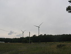
, leading to the recent establishment of wind farming
there.
, separating the Appalachian Plateau
from the Appalachians' Ridge and Valley Province
. The various other escarpment
s along this structural feature include the Catskill Escarpment
to the north and the Cumberland Escarpment
to the south. The Allegheny Front itself extends for about 180 miles (289.7 km) southwesterly from south-central Pennsylvania
through western Maryland
, then divides the eastern panhandle of West Virginia
from the rest of that state.
The name "Allegheny Front" is applied to the escarpment throughout much of its extent, although it is little used in Maryland.
at 4700 feet (1,432.6 m), on the Pendleton
/Randolph
county line in West Virginia. Its lowest point, 790 feet (240.8 m), is along the North Branch of the Potomac River
near Keyser, West Virginia
. Other high points along the Front include Dan's Rock on Dans Mountain
in Maryland at 2895 feet (882.4 m) and the Dolly Sods
area in West Virginia, a broad, rocky plateau at an elevation of about 4,000 feet (1,200 m).
usually pass within a few miles of the Allegheny Front, and in many places coincide with it; this divide between waters of the Atlantic Ocean
and the Gulf of Mexico
separates the westward-flowing Ohio River
watershed from the eastward-flowing watersheds of the Susquehanna
, Potomac
, and James
rivers. A number of eastward-flowing creeks and rivers have their headwaters incised into Allegheny Front, displacing the Divide westward from the Front, including the North Branch of the Potomac River
west of Cumberland, Maryland
, which originates well into the Appalachian Plateau
at the Fairfax Stone
, just south of Maryland's southwestern tip. No waterway crosses the Front from east to west.
and extends southwest paralleling, first, Bald Eagle Mountain
, and then Brush Mountain to its east. The Front continues to a point a little north of the Pennsylvania/Maryland boundary where it is offset about 10 miles (16 km) to the east as it changes from the bold escarpment that characterized it west of Altoona
to its more gentle rise in Maryland.
In Maryland, across the Mason-Dixon Line
, the Front becomes Dans Mountain
, west of Cumberland
, which reaches 2895 feet (882.4 m) in elevation at Dan's Rock. Along Maryland's southern border, the North Branch of the Potomac River
cuts down through the Front at 790 feet (240.8 m) just west of Keyser, West Virginia
.
South of the Potomac, in West Virginia, the Front continues through the Mount Storm
area, then passes along the eastern edge of Dolly Sods
, a wide plateau of Pottsville conglomerate
bedrock
at about 4,000 feet (1,200 m) elevation. From the Sods, the front continues southward as an increasingly steep escarpment west of the North Fork of the South Branch of the Potomac River, with the Roaring Plains continuing the high plateaus of the Dolly Sods area along the escarpment's crest. The Allegheny Front's southern end is Mount Porte Crayon
(4770 ft, or 1450 m), after which the land drops steeply to Seneca Creek
, west of Seneca Rocks
.
 South of Mount Porte Crayon and Seneca Creek, the Appalachian Structural Front
is less clearly unified. Pottsville-capped Spruce Mountain
, south and east of Seneca Creek, continues the Allegheny Front's geology southward; this ridge reaches an elevation of 4863 feet (1,482.2 m) at Spruce Knob
, West Virginia's highest point.
Similarly steep escarpments sharing much of the same geologic structure are also present nearby along the eastern slopes of Allegheny Mountain
and also Back Allegheny Mountain
(along with the southern end of Shavers Mountain
), but these mountains lack the Pottsville caps characteristic of the Allegheny Front. Allegheny Mountain's long, nearly level crest is generally about 4000 to 4200 feet (1200 to 1250 m) in elevation, with Paddy Knob reaching 4477 feet (1,364.6 m). High points on Back Allegheny Mountain and adjacent Shavers Mountain include Gaudineer Knob
(4,432 ft,, or 1,351 m) and Bald Knob
(4,842 ft, or 1,476 m); these two mountains form a part of the divide between the Monongahela River
and New River
portions of the Ohio River watershed
.
of white Pottsville conglomerate
, sometimes where flat with younger Carboniferous
strata on top. The silica-cemented gravel
-containing Pottsville rock formed as part of a vast delta in the Pennsylvanian geologic period.
The region was then uplifted and folded during the Alleghenian Orogeny
about 320-250 million years ago, during the Carboniferous
and Permian
geological periods, forming the modern Appalachian Mountains
as the ancient continents of North America
and Africa
collided due to plate tectonics processes
.
Subsequent erosion
(for more than 200,000,000 years) has prefentially removed various softer surrounding rocks, especially the easily dissolved Greenbrier limestone
, leaving areas of the hard Pottsville conglomerate as a caprock protecting softer rock strata immediately beneath. The Pottsville bedrock
outcrops conspicuously in various more exposed areas along the Front's eastern edge. Many of these clifftops offer broad scenic views, unlike most mountaintops within the generally forested Appalachians, and the more readily accessible are popular tourist destinations, including Dan's Rock on Dans Mountain
in Maryland and Dolly Sods
and an overlook along U.S. 50
in West Virginia.
Since the eastern side of the Front is drained by Chesapeake Bay
rivers that drop fairly rapidly through the Ridge and Valley Province
to the low-elevation waters of the Great Appalachian Valley
, erosion on the eastern slope of this caprock layer has been much more intense than on the western slope, where drainage to low elevations is spread over a greater distance (particularly considering stream meanders) through the Appalachian Plateau to the Ohio River. These contrasting patterns of erosion produce a steep escarpment along much of the Front's eastern edge, with the mountains west of the Front generally grading more gently into the Appalachian Plateau.
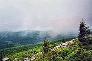
 The nearly continuous high elevation and clifftop bedrock exposures of the Allegheny Front provide an important corridor of upland habitat in the central Appalachian Mountains.
for migratory birds traveling from their northern breeding grounds to their southern wintering sites. In good weather, the birds can be seen from late morning, when they take advantage of the thermals — rising pockets of warm air — to facilitate flying, until the thermals cease in late afternoon.
Among the bird-banding stations and migratory bird observatories associated with this flyway are the following:
area of West Virginia, and southward toward Mount Porte Crayon
, the Front is topped for more than ten miles (16 km) by a broad, nearly flat plateau with many wide areas of exposed bedrock along the edge of the escarpment's 2800 feet (853.4 m) to 3,200-foot (980 m) drop to the North Fork River to the east, along the Front's base. Many of these windswept cliff-edge outcrops are sparsely vegetated, with occasional one-sided (flagged) red spruce (Picea rubens) trees, and open habitats dominated by various low-growing Appalachian
and boreal
plant species.
 The long, steep, nearly continuous, often windswept escarpment of the Allegheny Front has both positive and negative effects on society and culture in the central Appalachians region.
in West Virginia) or various state, local, or private wildlands parks or preserves.
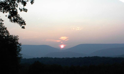
The few readily accessible scenic viewpoints atop the Allegheny Front are popular tourist destinations. The Skyline Overlook
along U.S. 50
in West Virginia is readily accessible by a major road. The Front is also a significant part of scenic views from various highways and mountains to its east, such as North Fork Mountain
in West Virginia.
s along 12 miles of the Allegheny Front in Grant County
near Mount Storm
. Constructed between 2006 and 2008, it generates up to 264 megawatts of electricity for the mid-Atlantic power grid, enough to service about 66,000 homes and businesses.
Escarpment
An escarpment is a steep slope or long cliff that occurs from erosion or faulting and separates two relatively level areas of differing elevations.-Description and variants:...
in the Allegheny Mountains
Allegheny Mountains
The Allegheny Mountain Range , also spelled Alleghany, Allegany and, informally, the Alleghenies, is part of the vast Appalachian Mountain Range of the eastern United States and Canada...
in southern Pennsylvania
Pennsylvania
The Commonwealth of Pennsylvania is a U.S. state that is located in the Northeastern and Mid-Atlantic regions of the United States. The state borders Delaware and Maryland to the south, West Virginia to the southwest, Ohio to the west, New York and Ontario, Canada, to the north, and New Jersey to...
, western Maryland
Maryland
Maryland is a U.S. state located in the Mid Atlantic region of the United States, bordering Virginia, West Virginia, and the District of Columbia to its south and west; Pennsylvania to its north; and Delaware to its east...
, and eastern West Virginia
West Virginia
West Virginia is a state in the Appalachian and Southeastern regions of the United States, bordered by Virginia to the southeast, Kentucky to the southwest, Ohio to the northwest, Pennsylvania to the northeast and Maryland to the east...
, USA. The Allegheny Front delineates the Ridge-and-Valley Appalachians
Ridge-and-valley Appalachians
The Ridge-and-Valley Appalachians, also called the Ridge and Valley Province or the Valley and Ridge Appalachians, are a physiographic province of the larger Appalachian division and are also a belt within the Appalachian Mountains extending from southeastern New York through northwestern New...
to its east from the Appalachian Plateau
Appalachian Plateau
The Appalachian Plateau is the western part of the Appalachian mountains, stretching from New York and Alabama. The plateau is a second level United States physiographic region....
(locally called the Allegheny Plateau
Allegheny Plateau
The Allegheny Plateau is a large dissected plateau area in western and central New York, northern and western Pennsylvania, northern and western West Virginia, and eastern Ohio...
) to its west. The Front is closely associated with the Appalachian Mountains
Appalachian Mountains
The Appalachian Mountains #Whether the stressed vowel is or ,#Whether the "ch" is pronounced as a fricative or an affricate , and#Whether the final vowel is the monophthong or the diphthong .), often called the Appalachians, are a system of mountains in eastern North America. The Appalachians...
' Eastern Continental Divide
Eastern Continental Divide
The Eastern Continental Divide, in conjunction with other continental divides of North America, demarcates two watersheds of the Atlantic Ocean: the Gulf of Mexico watershed and the Atlantic Seaboard watershed. Prior to 1760, the divide represented the boundary between British and French colonial...
, which in this area divides the waters of the Ohio
Ohio River
The Ohio River is the largest tributary, by volume, of the Mississippi River. At the confluence, the Ohio is even bigger than the Mississippi and, thus, is hydrologically the main stream of the whole river system, including the Allegheny River further upstream...
/Mississippi
Mississippi River
The Mississippi River is the largest river system in North America. Flowing entirely in the United States, this river rises in western Minnesota and meanders slowly southwards for to the Mississippi River Delta at the Gulf of Mexico. With its many tributaries, the Mississippi's watershed drains...
river system, flowing to the Gulf of Mexico
Gulf of Mexico
The Gulf of Mexico is a partially landlocked ocean basin largely surrounded by the North American continent and the island of Cuba. It is bounded on the northeast, north and northwest by the Gulf Coast of the United States, on the southwest and south by Mexico, and on the southeast by Cuba. In...
, from rivers flowing into Chesapeake Bay
Chesapeake Bay
The Chesapeake Bay is the largest estuary in the United States. It lies off the Atlantic Ocean, surrounded by Maryland and Virginia. The Chesapeake Bay's drainage basin covers in the District of Columbia and parts of six states: New York, Pennsylvania, Delaware, Maryland, Virginia, and West...
and from there into the Atlantic Ocean
Atlantic Ocean
The Atlantic Ocean is the second-largest of the world's oceanic divisions. With a total area of about , it covers approximately 20% of the Earth's surface and about 26% of its water surface area...
. However, the Front and the Divide do not always coincide; for example, the North Branch of the Potomac River
Potomac River
The Potomac River flows into the Chesapeake Bay, located along the mid-Atlantic coast of the United States. The river is approximately long, with a drainage area of about 14,700 square miles...
begins well west of the Allegheny Front, at the Fairfax Stone
Fairfax Stone
Fairfax Stone Historical Monument State Park is a West Virginia state park commemorating the Fairfax Stone, a surveyor's marker and boundary stone at the source of the North Branch of the Potomac River in West Virginia...
near the southwestern tip of Maryland. The Allegheny Front is one of the windiest spots east of the Mississippi
Mississippi River
The Mississippi River is the largest river system in North America. Flowing entirely in the United States, this river rises in western Minnesota and meanders slowly southwards for to the Mississippi River Delta at the Gulf of Mexico. With its many tributaries, the Mississippi's watershed drains...
, leading to the recent establishment of wind farming
Wind farm
A wind farm is a group of wind turbines in the same location used to produce electric power. A large wind farm may consist of several hundred individual wind turbines, and cover an extended area of hundreds of square miles, but the land between the turbines may be used for agricultural or other...
there.
Geography
The Allegheny Front forms part of the Appalachian Structural FrontAppalachian Mountains
The Appalachian Mountains #Whether the stressed vowel is or ,#Whether the "ch" is pronounced as a fricative or an affricate , and#Whether the final vowel is the monophthong or the diphthong .), often called the Appalachians, are a system of mountains in eastern North America. The Appalachians...
, separating the Appalachian Plateau
Appalachian Plateau
The Appalachian Plateau is the western part of the Appalachian mountains, stretching from New York and Alabama. The plateau is a second level United States physiographic region....
from the Appalachians' Ridge and Valley Province
Ridge-and-valley Appalachians
The Ridge-and-Valley Appalachians, also called the Ridge and Valley Province or the Valley and Ridge Appalachians, are a physiographic province of the larger Appalachian division and are also a belt within the Appalachian Mountains extending from southeastern New York through northwestern New...
. The various other escarpment
Escarpment
An escarpment is a steep slope or long cliff that occurs from erosion or faulting and separates two relatively level areas of differing elevations.-Description and variants:...
s along this structural feature include the Catskill Escarpment
Catskill Escarpment
The Catskill Escarpment, often referred to locally as just the Escarpment or the Great Wall of Manitou, and known as the Catskill Front to geologists, is the range forming the northeastern corner of the Catskill Mountains in Greene and Ulster counties in the U.S. state of New York...
to the north and the Cumberland Escarpment
Cumberland Plateau
The Cumberland Plateau is the southern part of the Appalachian Plateau. It includes much of eastern Kentucky and western West Virginia, part of Tennessee, and a small portion of northern Alabama and northwest Georgia . The terms "Allegheny Plateau" and the "Cumberland Plateau" both refer to the...
to the south. The Allegheny Front itself extends for about 180 miles (289.7 km) southwesterly from south-central Pennsylvania
Pennsylvania
The Commonwealth of Pennsylvania is a U.S. state that is located in the Northeastern and Mid-Atlantic regions of the United States. The state borders Delaware and Maryland to the south, West Virginia to the southwest, Ohio to the west, New York and Ontario, Canada, to the north, and New Jersey to...
through western Maryland
Western Maryland
Western Maryland is the portion of the U.S. state of Maryland that consists of Frederick, Washington, Allegany, and Garrett counties. The region is bounded by the Mason-Dixon line to the north, Preston County, West Virginia to the west, and the Potomac River to the south. There is dispute over the...
, then divides the eastern panhandle of West Virginia
Eastern Panhandle of West Virginia
The Eastern Panhandle of West Virginia is a narrow stretch of territory in the northeast of the state, bordering Maryland and Virginia, United States. The Eastern Panhandle Board of Realtors and other local civic organizations consider only the three Easternmost counties, Jefferson, Berkeley and...
from the rest of that state.
The name "Allegheny Front" is applied to the escarpment throughout much of its extent, although it is little used in Maryland.
Elevations
The highest part of the crest of the Allegheny Front is also its southernmost high point, Mount Porte CrayonMount Porte Crayon
Mount Porte Crayon is a mountain in the Roaring Plains Wilderness of the Monongahela National Forest. It is situated in the extreme northeastern corner of Randolph County, West Virginia, USA, and rises to an elevation of , the elevational climax of the Allegheny Front...
at 4700 feet (1,432.6 m), on the Pendleton
Pendleton County, West Virginia
As of the census of 2000, there were 8,196 people, 3,350 households, and 2,355 families residing in the county. The population density was 12 people per square mile . There were 5,102 housing units at an average density of 7 per square mile...
/Randolph
Randolph County, West Virginia
As of the census of 2000, there were 28,262 people, 11,072 households, and 7,661 families residing in the county. The population density was 27 people per square mile . There were 13,478 housing units at an average density of 13 per square mile...
county line in West Virginia. Its lowest point, 790 feet (240.8 m), is along the North Branch of the Potomac River
Potomac River
The Potomac River flows into the Chesapeake Bay, located along the mid-Atlantic coast of the United States. The river is approximately long, with a drainage area of about 14,700 square miles...
near Keyser, West Virginia
Keyser, West Virginia
Keyser is a city in and the county seat of Mineral County, West Virginia, United States. It is part of the Cumberland, MD-WV Metropolitan Statistical Area. The population was 5,303 at the 2000 census.- History :...
. Other high points along the Front include Dan's Rock on Dans Mountain
Dans Mountain
Dans Mountain is located in Allegany County, Maryland, USA between Georges Creek and the North Branch Potomac River. The highest point on Dans Mountain is called Dan's Rock which has an elevation of . The mountain rises above the town of LaVale and the summit is the highest point in Allegany County...
in Maryland at 2895 feet (882.4 m) and the Dolly Sods
Dolly Sods Wilderness
The Dolly Sods Wilderness — originally simply Dolly Sods — is a U.S. Wilderness Area in the Allegheny Mountains of eastern West Virginia, USA, and is part of the Monongahela National Forest of the U.S. Forest Service ....
area in West Virginia, a broad, rocky plateau at an elevation of about 4,000 feet (1,200 m).
Eastern Continental Divide
Local segments of the Eastern Continental DivideEastern Continental Divide
The Eastern Continental Divide, in conjunction with other continental divides of North America, demarcates two watersheds of the Atlantic Ocean: the Gulf of Mexico watershed and the Atlantic Seaboard watershed. Prior to 1760, the divide represented the boundary between British and French colonial...
usually pass within a few miles of the Allegheny Front, and in many places coincide with it; this divide between waters of the Atlantic Ocean
Atlantic Ocean
The Atlantic Ocean is the second-largest of the world's oceanic divisions. With a total area of about , it covers approximately 20% of the Earth's surface and about 26% of its water surface area...
and the Gulf of Mexico
Gulf of Mexico
The Gulf of Mexico is a partially landlocked ocean basin largely surrounded by the North American continent and the island of Cuba. It is bounded on the northeast, north and northwest by the Gulf Coast of the United States, on the southwest and south by Mexico, and on the southeast by Cuba. In...
separates the westward-flowing Ohio River
Ohio River
The Ohio River is the largest tributary, by volume, of the Mississippi River. At the confluence, the Ohio is even bigger than the Mississippi and, thus, is hydrologically the main stream of the whole river system, including the Allegheny River further upstream...
watershed from the eastward-flowing watersheds of the Susquehanna
Susquehanna River
The Susquehanna River is a river located in the northeastern United States. At long, it is the longest river on the American east coast that drains into the Atlantic Ocean, and with its watershed it is the 16th largest river in the United States, and the longest river in the continental United...
, Potomac
Potomac River
The Potomac River flows into the Chesapeake Bay, located along the mid-Atlantic coast of the United States. The river is approximately long, with a drainage area of about 14,700 square miles...
, and James
James River
The James River may refer to:Rivers in the United States and their namesakes* James River * James River , North Dakota, South Dakota* James River * James River * James River...
rivers. A number of eastward-flowing creeks and rivers have their headwaters incised into Allegheny Front, displacing the Divide westward from the Front, including the North Branch of the Potomac River
Potomac River
The Potomac River flows into the Chesapeake Bay, located along the mid-Atlantic coast of the United States. The river is approximately long, with a drainage area of about 14,700 square miles...
west of Cumberland, Maryland
Cumberland, Maryland
Cumberland is a city in the far western, Appalachian portion of Maryland, United States. It is the county seat of Allegany County, and the primary city of the Cumberland, MD-WV Metropolitan Statistical Area. At the 2010 census, the city had a population of 20,859, and the metropolitan area had a...
, which originates well into the Appalachian Plateau
Appalachian Plateau
The Appalachian Plateau is the western part of the Appalachian mountains, stretching from New York and Alabama. The plateau is a second level United States physiographic region....
at the Fairfax Stone
Fairfax Stone
Fairfax Stone Historical Monument State Park is a West Virginia state park commemorating the Fairfax Stone, a surveyor's marker and boundary stone at the source of the North Branch of the Potomac River in West Virginia...
, just south of Maryland's southwestern tip. No waterway crosses the Front from east to west.
Course in detail
The Allegheny Front begins in south-central Pennsylvania just northwest of the town of Lock HavenLock Haven, Pennsylvania
The city of Lock Haven is the county seat of Clinton County, in the U.S. state of Pennsylvania. Located near the confluence of the West Branch Susquehanna River and Bald Eagle Creek, it is the principal city of the Lock Haven, Pennsylvania, micropolitan statistical area, itself part of the...
and extends southwest paralleling, first, Bald Eagle Mountain
Bald Eagle Mountain
Bald Eagle Mountain, once known locally as Muncy Mountain, is a stratigraphic ridge in central Pennsylvania, United States, running east of the Allegheny Front and northwest of Mount Nittany. It lies along the southeast side of Bald Eagle Creek, and south of the West Branch Susquehanna River, and...
, and then Brush Mountain to its east. The Front continues to a point a little north of the Pennsylvania/Maryland boundary where it is offset about 10 miles (16 km) to the east as it changes from the bold escarpment that characterized it west of Altoona
Altoona, Pennsylvania
-History:A major railroad town, Altoona was founded by the Pennsylvania Railroad in 1849 as the site for a shop complex. Altoona was incorporated as a borough on February 6, 1854, and as a city under legislation approved on April 3, 1867, and February 8, 1868...
to its more gentle rise in Maryland.
In Maryland, across the Mason-Dixon Line
Mason-Dixon line
The Mason–Dixon Line was surveyed between 1763 and 1767 by Charles Mason and Jeremiah Dixon in the resolution of a border dispute between British colonies in Colonial America. It forms a demarcation line among four U.S. states, forming part of the borders of Pennsylvania, Maryland, Delaware, and...
, the Front becomes Dans Mountain
Dans Mountain
Dans Mountain is located in Allegany County, Maryland, USA between Georges Creek and the North Branch Potomac River. The highest point on Dans Mountain is called Dan's Rock which has an elevation of . The mountain rises above the town of LaVale and the summit is the highest point in Allegany County...
, west of Cumberland
Cumberland, Maryland
Cumberland is a city in the far western, Appalachian portion of Maryland, United States. It is the county seat of Allegany County, and the primary city of the Cumberland, MD-WV Metropolitan Statistical Area. At the 2010 census, the city had a population of 20,859, and the metropolitan area had a...
, which reaches 2895 feet (882.4 m) in elevation at Dan's Rock. Along Maryland's southern border, the North Branch of the Potomac River
Potomac River
The Potomac River flows into the Chesapeake Bay, located along the mid-Atlantic coast of the United States. The river is approximately long, with a drainage area of about 14,700 square miles...
cuts down through the Front at 790 feet (240.8 m) just west of Keyser, West Virginia
Keyser, West Virginia
Keyser is a city in and the county seat of Mineral County, West Virginia, United States. It is part of the Cumberland, MD-WV Metropolitan Statistical Area. The population was 5,303 at the 2000 census.- History :...
.
South of the Potomac, in West Virginia, the Front continues through the Mount Storm
Mount Storm, West Virginia
Mount Storm is an unincorporated community in Grant County, West Virginia, United States. Mount Storm lies on the Northwestern Turnpike at its junction with West Virginia Route 42. The community is the site of the Union School Complex, which contains Union High School.- External links :*...
area, then passes along the eastern edge of Dolly Sods
Dolly Sods Wilderness
The Dolly Sods Wilderness — originally simply Dolly Sods — is a U.S. Wilderness Area in the Allegheny Mountains of eastern West Virginia, USA, and is part of the Monongahela National Forest of the U.S. Forest Service ....
, a wide plateau of Pottsville conglomerate
Pottsville Formation
The Pennsylvanian Pottsville Formation is a mapped bedrock unit in Pennsylvania, western Maryland, West Virginia, and Ohio. The formation is also recognized in Alabama. It is a major ridge-former In the Ridge-and-Valley Appalachians of the eastern United States...
bedrock
Bedrock
In stratigraphy, bedrock is the native consolidated rock underlying the surface of a terrestrial planet, usually the Earth. Above the bedrock is usually an area of broken and weathered unconsolidated rock in the basal subsoil...
at about 4,000 feet (1,200 m) elevation. From the Sods, the front continues southward as an increasingly steep escarpment west of the North Fork of the South Branch of the Potomac River, with the Roaring Plains continuing the high plateaus of the Dolly Sods area along the escarpment's crest. The Allegheny Front's southern end is Mount Porte Crayon
Mount Porte Crayon
Mount Porte Crayon is a mountain in the Roaring Plains Wilderness of the Monongahela National Forest. It is situated in the extreme northeastern corner of Randolph County, West Virginia, USA, and rises to an elevation of , the elevational climax of the Allegheny Front...
(4770 ft, or 1450 m), after which the land drops steeply to Seneca Creek
Seneca Creek (Potomac River)
Seneca Creek is a stream in Montgomery County, Maryland, roughly northwest of Washington, D.C. It drains to the Potomac River.-Course:The creek begins with two main tributaries:...
, west of Seneca Rocks
Seneca Rocks, West Virginia
Seneca Rocks is an unincorporated community located in Pendleton County, West Virginia, USA. The community of Seneca Rocks — formerly known as Mouth of Seneca — lies along West Virginia Route 28/West Virginia Route 55 near the confluence of Seneca Creek and the North Fork South Branch Potomac...
.
Escarpments southward
Appalachian Mountains
The Appalachian Mountains #Whether the stressed vowel is or ,#Whether the "ch" is pronounced as a fricative or an affricate , and#Whether the final vowel is the monophthong or the diphthong .), often called the Appalachians, are a system of mountains in eastern North America. The Appalachians...
is less clearly unified. Pottsville-capped Spruce Mountain
Spruce Mountain (West Virginia)
Spruce Mountain, in eastern West Virginia, USA, is the highest ridge of the Allegheny Mountains. The "whale-backed" ridge extends for only about , from northeast to southwest, but several of its peaks exceed in elevation...
, south and east of Seneca Creek, continues the Allegheny Front's geology southward; this ridge reaches an elevation of 4863 feet (1,482.2 m) at Spruce Knob
Spruce Knob
Spruce Knob, at , is the highest point in the state of West Virginia and the summit of Spruce Mountain, the tallest mountain in the Alleghenies.-Overview:...
, West Virginia's highest point.
Similarly steep escarpments sharing much of the same geologic structure are also present nearby along the eastern slopes of Allegheny Mountain
Allegheny Mountain (West Virginia-Virginia)
Allegheny Mountain is a major mountain ridge in the southern range of the Allegheny Mountains, part of the Appalachian Mountains...
and also Back Allegheny Mountain
Back Allegheny Mountain
Back Allegheny Mountain is a long mountain ridge in eastern West Virginia. It is part of the Shavers Fork Mountain Complex in the Allegheny Range of the Appalachians.- Geography :...
(along with the southern end of Shavers Mountain
Shavers Mountain
Shavers Mountain, is a high and rugged ridge situated in the Allegheny Mountains of eastern West Virginia. It is about long, north to south, and several of its peaks exceed in elevation...
), but these mountains lack the Pottsville caps characteristic of the Allegheny Front. Allegheny Mountain's long, nearly level crest is generally about 4000 to 4200 feet (1200 to 1250 m) in elevation, with Paddy Knob reaching 4477 feet (1,364.6 m). High points on Back Allegheny Mountain and adjacent Shavers Mountain include Gaudineer Knob
Gaudineer Knob
Gaudineer Knob is a mountain summit on the Randolph/Pocahontas County line in eastern West Virginia, USA. It is the highest elevation of Shavers Mountain, a ridge of the Alleghenies, and is located about east of the town of Cheat Bridge...
(4,432 ft,, or 1,351 m) and Bald Knob
Bald Knob
Bald Knob is the highest summit of Back Allegheny Mountain in Pocahontas County, West Virginia and is part of Cass Scenic Railroad State Park...
(4,842 ft, or 1,476 m); these two mountains form a part of the divide between the Monongahela River
Monongahela River
The Monongahela River is a river on the Allegheny Plateau in north-central West Virginia and southwestern Pennsylvania in the United States...
and New River
New River
- Waterways :In the United States* New River , a tributary of the Trinity River in northern California* New River , a channel which drains the Everglades through Fort Lauderdale in southern Florida...
portions of the Ohio River watershed
Ohio River
The Ohio River is the largest tributary, by volume, of the Mississippi River. At the confluence, the Ohio is even bigger than the Mississippi and, thus, is hydrologically the main stream of the whole river system, including the Allegheny River further upstream...
.
Geology
Most of the Allegheny Front is capped by a nearly horizontal, erosion-resistant stratum (rock layer)Stratum
In geology and related fields, a stratum is a layer of sedimentary rock or soil with internally consistent characteristics that distinguish it from other layers...
of white Pottsville conglomerate
Pottsville Formation
The Pennsylvanian Pottsville Formation is a mapped bedrock unit in Pennsylvania, western Maryland, West Virginia, and Ohio. The formation is also recognized in Alabama. It is a major ridge-former In the Ridge-and-Valley Appalachians of the eastern United States...
, sometimes where flat with younger Carboniferous
Carboniferous
The Carboniferous is a geologic period and system that extends from the end of the Devonian Period, about 359.2 ± 2.5 Mya , to the beginning of the Permian Period, about 299.0 ± 0.8 Mya . The name is derived from the Latin word for coal, carbo. Carboniferous means "coal-bearing"...
strata on top. The silica-cemented gravel
Gravel
Gravel is composed of unconsolidated rock fragments that have a general particle size range and include size classes from granule- to boulder-sized fragments. Gravel can be sub-categorized into granule and cobble...
-containing Pottsville rock formed as part of a vast delta in the Pennsylvanian geologic period.
The region was then uplifted and folded during the Alleghenian Orogeny
Alleghenian orogeny
The Alleghenian orogeny or Appalachian orogeny is one of the geological mountain-forming events that formed the Appalachian Mountains and Allegheny Mountains. The term and spelling Alleghany orogeny was originally proposed by H.P. Woodward in 1957....
about 320-250 million years ago, during the Carboniferous
Carboniferous
The Carboniferous is a geologic period and system that extends from the end of the Devonian Period, about 359.2 ± 2.5 Mya , to the beginning of the Permian Period, about 299.0 ± 0.8 Mya . The name is derived from the Latin word for coal, carbo. Carboniferous means "coal-bearing"...
and Permian
Permian
The PermianThe term "Permian" was introduced into geology in 1841 by Sir Sir R. I. Murchison, president of the Geological Society of London, who identified typical strata in extensive Russian explorations undertaken with Edouard de Verneuil; Murchison asserted in 1841 that he named his "Permian...
geological periods, forming the modern Appalachian Mountains
Appalachian Mountains
The Appalachian Mountains #Whether the stressed vowel is or ,#Whether the "ch" is pronounced as a fricative or an affricate , and#Whether the final vowel is the monophthong or the diphthong .), often called the Appalachians, are a system of mountains in eastern North America. The Appalachians...
as the ancient continents of North America
North America
North America is a continent wholly within the Northern Hemisphere and almost wholly within the Western Hemisphere. It is also considered a northern subcontinent of the Americas...
and Africa
Africa
Africa is the world's second largest and second most populous continent, after Asia. At about 30.2 million km² including adjacent islands, it covers 6% of the Earth's total surface area and 20.4% of the total land area...
collided due to plate tectonics processes
Plate tectonics
Plate tectonics is a scientific theory that describes the large scale motions of Earth's lithosphere...
.
Subsequent erosion
Erosion
Erosion is when materials are removed from the surface and changed into something else. It only works by hydraulic actions and transport of solids in the natural environment, and leads to the deposition of these materials elsewhere...
(for more than 200,000,000 years) has prefentially removed various softer surrounding rocks, especially the easily dissolved Greenbrier limestone
Greenbrier Limestone
The Greenbrier Limestone, also known locally as the "Big Lime", is an extensive limestone unit deposited during the Middle Mississippian Epoch , part of the Carboniferous Period. This rock stratum is present below ground in much of West Virginia and neighboring Kentucky, and extends somewhat into...
, leaving areas of the hard Pottsville conglomerate as a caprock protecting softer rock strata immediately beneath. The Pottsville bedrock
Bedrock
In stratigraphy, bedrock is the native consolidated rock underlying the surface of a terrestrial planet, usually the Earth. Above the bedrock is usually an area of broken and weathered unconsolidated rock in the basal subsoil...
outcrops conspicuously in various more exposed areas along the Front's eastern edge. Many of these clifftops offer broad scenic views, unlike most mountaintops within the generally forested Appalachians, and the more readily accessible are popular tourist destinations, including Dan's Rock on Dans Mountain
Dans Mountain
Dans Mountain is located in Allegany County, Maryland, USA between Georges Creek and the North Branch Potomac River. The highest point on Dans Mountain is called Dan's Rock which has an elevation of . The mountain rises above the town of LaVale and the summit is the highest point in Allegany County...
in Maryland and Dolly Sods
Dolly Sods Wilderness
The Dolly Sods Wilderness — originally simply Dolly Sods — is a U.S. Wilderness Area in the Allegheny Mountains of eastern West Virginia, USA, and is part of the Monongahela National Forest of the U.S. Forest Service ....
and an overlook along U.S. 50
U.S. Route 50
U.S. Route 50 is a major east–west route of the U.S. Highway system, stretching just over from Ocean City, Maryland on the Atlantic Ocean to West Sacramento, California. Until 1972, when it was replaced by Interstate Highways west of the Sacramento area, it extended to San Francisco, near...
in West Virginia.
Since the eastern side of the Front is drained by Chesapeake Bay
Chesapeake Bay
The Chesapeake Bay is the largest estuary in the United States. It lies off the Atlantic Ocean, surrounded by Maryland and Virginia. The Chesapeake Bay's drainage basin covers in the District of Columbia and parts of six states: New York, Pennsylvania, Delaware, Maryland, Virginia, and West...
rivers that drop fairly rapidly through the Ridge and Valley Province
Ridge-and-valley Appalachians
The Ridge-and-Valley Appalachians, also called the Ridge and Valley Province or the Valley and Ridge Appalachians, are a physiographic province of the larger Appalachian division and are also a belt within the Appalachian Mountains extending from southeastern New York through northwestern New...
to the low-elevation waters of the Great Appalachian Valley
Great Appalachian Valley
The Great Valley, also called the Great Appalachian Valley or Great Valley Region, is one of the major landform features of eastern North America. It is a gigantic trough — a chain of valley lowlands — and the central feature of the Appalachian Mountain system...
, erosion on the eastern slope of this caprock layer has been much more intense than on the western slope, where drainage to low elevations is spread over a greater distance (particularly considering stream meanders) through the Appalachian Plateau to the Ohio River. These contrasting patterns of erosion produce a steep escarpment along much of the Front's eastern edge, with the mountains west of the Front generally grading more gently into the Appalachian Plateau.
Ecology
Migratory bird flyway
During the fall, the Allegeny Front is associated with an important flywayFlyway
A flyway is a flight path used in bird migration. Flyways generally span over continents and often oceans.-Flyways of the Americas:*Atlantic Flyway*Central Flyway*Mississippi Flyway*Pacific Flyway*Allegheny Front...
for migratory birds traveling from their northern breeding grounds to their southern wintering sites. In good weather, the birds can be seen from late morning, when they take advantage of the thermals — rising pockets of warm air — to facilitate flying, until the thermals cease in late afternoon.
Among the bird-banding stations and migratory bird observatories associated with this flyway are the following:
- Allegheny Front Hawk Watch on the border between BedfordBedford County, PennsylvaniaBedford County is a county located in the U.S. state of Pennsylvania. As of the 2010 census, the population was 49,762. The county seat is Bedford. It is part of the Altoona, Pennsylvania, Metropolitan Statistical Area.- History :...
and SomersetSomerset County, PennsylvaniaSomerset County is a county located in the state of Pennsylvania. As of 2010, the population was 77,742. Somerset County was created on April 17, 1795, from part of Bedford County and named for Somerset, United Kingdom. Its county seat is Somerset. It is part of the Johnstown, Pennsylvania,...
counties, Pennsylvania. On 20 September 2003, after the remnants of Hurricane IsabelHurricane IsabelHurricane Isabel was the costliest and deadliest hurricane in the 2003 Atlantic hurricane season. The ninth named storm, fifth hurricane, and second major hurricane of the season, Isabel formed near the Cape Verde Islands from a tropical wave on September 6 in the tropical Atlantic Ocean...
passed western Pennsylvania, 833 hawks were counted passing the site. - Allegheny Front Migratory Observatory (Bird Banding Station) near the Red Creek Campground at Dolly SodsDolly Sods WildernessThe Dolly Sods Wilderness — originally simply Dolly Sods — is a U.S. Wilderness Area in the Allegheny Mountains of eastern West Virginia, USA, and is part of the Monongahela National Forest of the U.S. Forest Service ....
, West Virginia. The station is open from August to October in good weather. Established in 1958, it is the only cooperative banding station in the West Virginia.
The Dolly Sods area
In the Dolly SodsDolly Sods Wilderness
The Dolly Sods Wilderness — originally simply Dolly Sods — is a U.S. Wilderness Area in the Allegheny Mountains of eastern West Virginia, USA, and is part of the Monongahela National Forest of the U.S. Forest Service ....
area of West Virginia, and southward toward Mount Porte Crayon
Mount Porte Crayon
Mount Porte Crayon is a mountain in the Roaring Plains Wilderness of the Monongahela National Forest. It is situated in the extreme northeastern corner of Randolph County, West Virginia, USA, and rises to an elevation of , the elevational climax of the Allegheny Front...
, the Front is topped for more than ten miles (16 km) by a broad, nearly flat plateau with many wide areas of exposed bedrock along the edge of the escarpment's 2800 feet (853.4 m) to 3,200-foot (980 m) drop to the North Fork River to the east, along the Front's base. Many of these windswept cliff-edge outcrops are sparsely vegetated, with occasional one-sided (flagged) red spruce (Picea rubens) trees, and open habitats dominated by various low-growing Appalachian
Appalachia
Appalachia is a term used to describe a cultural region in the eastern United States that stretches from the Southern Tier of New York state to northern Alabama, Mississippi, and Georgia. While the Appalachian Mountains stretch from Belle Isle in Canada to Cheaha Mountain in the U.S...
and boreal
Boreal ecosystem
The term boreal is usually applied to ecosystems localized in subarctic and subantarctic zones, although Austral is also used for the latter....
plant species.
Economic importance
Barrier to transportation and communication
Few roads or railroads cross the Allegheny Front, limiting transportation and communication between the regions to its east and west.Recreation and tourism
Substantial portions of the Allegheny Front's crest and slopes are parts of a national forest (the MonongahelaMonongahela National Forest
The Monongahela National Forest is a national forest located in the Allegheny Mountains of eastern West Virginia, USA. It protects over of federally-owned land within a proclamation boundary that includes much of the Potomac Highlands Region and portions of 10 counties.The MNF includes some...
in West Virginia) or various state, local, or private wildlands parks or preserves.
The few readily accessible scenic viewpoints atop the Allegheny Front are popular tourist destinations. The Skyline Overlook
Skyline, West Virginia
Skyline is an unincorporated community in Mineral County, West Virginia, located at the intersection of U.S. Route 50 and West Virginia Route 42 atop the Allegheny Front. Skyline is best known for its view of Saddle Mountain....
along U.S. 50
U.S. Route 50
U.S. Route 50 is a major east–west route of the U.S. Highway system, stretching just over from Ocean City, Maryland on the Atlantic Ocean to West Sacramento, California. Until 1972, when it was replaced by Interstate Highways west of the Sacramento area, it extended to San Francisco, near...
in West Virginia is readily accessible by a major road. The Front is also a significant part of scenic views from various highways and mountains to its east, such as North Fork Mountain
North Fork Mountain
North Fork Mountain is a quartzite-capped mountain ridge in the Ridge and Valley physiographic province of the Allegheny Mountains of eastern West Virginia, USA...
in West Virginia.
Wind farming
The NedPower Mount Storm Wind Project in West Virginia includes 132 wind turbineWind turbine
A wind turbine is a device that converts kinetic energy from the wind into mechanical energy. If the mechanical energy is used to produce electricity, the device may be called a wind generator or wind charger. If the mechanical energy is used to drive machinery, such as for grinding grain or...
s along 12 miles of the Allegheny Front in Grant County
Grant County, West Virginia
As of the census of 2000, there were 11,299 people, 4,591 households, and 3,273 families residing in the county. The population density was 24 people per square mile . There were 6,105 housing units at an average density of 13 per square mile...
near Mount Storm
Mount Storm, West Virginia
Mount Storm is an unincorporated community in Grant County, West Virginia, United States. Mount Storm lies on the Northwestern Turnpike at its junction with West Virginia Route 42. The community is the site of the Union School Complex, which contains Union High School.- External links :*...
. Constructed between 2006 and 2008, it generates up to 264 megawatts of electricity for the mid-Atlantic power grid, enough to service about 66,000 homes and businesses.