
A4232 road
Encyclopedia
The A4232, which is also known either as the Peripheral Distributor Road (PDR) or the Cardiff Link Road , is a distributor road in Cardiff
, the capital of Wales
.
The first section of the PDR to be completed was the Southern Way Link Road in 1978 and the last section was the Butetown Link Road in 1995. The final section, the Eastern Bay Link Road, is yet to be built, with no date when construction may start. When fully completed, the road will form part of the Cardiff ring-road system. The PDR runs west, south and east of Cardiff, with the M4
between junction 30 and junction 33 completing the northern section. The PDR is dual carriageway
for its entire length except for the East Moors Viaduct, which is a single carriageway
.
The PDR has been constructed in separate link roads of between 1.61 km (1 mi) and 5.47 km (3.4 mi) around Cardiff and to date 22 kilometres (13.7 mi) including spurs
have been opened to traffic, with plans for a further 5.53 km (3.4 mi). It has 4 large viaducts (Ely Viaduct, Grangetown Viaduct, Taff Viaduct and the East Moors Viaduct), 1 tunnel (Queen's Gate Tunnel) and 2 spur roads (Cogan Spur and Central Link Road). The road also has many smaller bridges over or under most of the interchanges on the road. The entire length of the road has clearway
restrictions on it.
County Council. The road at that stage was planned to be completed by 1995 and would relieve Ely
, Grangetown
, Butetown
and East Moors of through traffic and as a fast link to the national motorway network via the M4 and A48(M)
. The first section of the PDR to be completed was the Southern Way Link Road between Newport Road (A4161 road
) and the Eastern Avenue (A48 road
) in 1978 and the last section of the PDR, the Butetown Link Road, was opened to the public in 1995.
The former chairman of the South Glamorgan County Council
environment committee, Councillor
Paddy Kitson, called the road a "necklace of opportunity" due to its shape and also the opportunities for regeneration. By 1 April 1996 the responsibility for the road was transferred from South Glamorgan County Council to the unitary authority
of Cardiff Council
. Much of the funding for the road had been grant aided
from the European Community and the UK Government on the basis that it would improve the economic viability of the area and bring in new jobs and industry. However, since the completion of the Butetown Link Road, funding for further developments have been at a stand still, and to date 22 kilometres (13.7 mi) including spurs are open to traffic with plans for a further 5.53 km (3.4 mi). The "missing link", the Eastern Bay Link Road, is still to be built.
Capel Llanilltern Interchange to Queen's Gate roundabout (Western Link Road)
 This section from the Capel Llanilltern Interchange on the M4 (junction 33) to the Queen's Gate roundabout is sometimes referred to as the Western Link Road , is 15.77 kilometres (9.8 mi) in length and includes the Capel Llanilltern – Culverhouse Cross Link Road, Ely Link Road, Grangetown Link Road and Butetown Link Road. For the majority of this section it is the boundary between the City of Cardiff
to the east and the Vale of Glamorgan
to the west.
{| class="wikitable"
|- align="center" bgcolor="#00703C" style="color: #ffd200;font-size:120%;"
| colspan="3" | A4232 (T)
|- align="center"
!scope=col| Clockwise exits
!scope=col| Junction / Interchange
!scope=col| Anti-Clockwise exits
|- align='center'
| Swansea
, Bristol
, London M4
Exit only
| M4 J33
Capel Llanilltern Interchange
Cardiff West services
| Start of A4232 (T)
|- align='center'
| No access or exit
| St. Fagans
| Museum of Welsh Life
|- align='center'
| Start of A4232 (T)
| Culverhouse Cross
| A48 West (Cardiff West)
A48 East (Vale of Glamorgan)
A4050 for Cardiff Airport
|- align="center" bgcolor="white" style="color: black;font-size:120%;" style="font-size:120%; border-top: black 2px solid;"
| colspan=3 | A4232
|-
! Clockwise exits
! Junction / Interchange
! Anti-Clockwise exits
|- align='center'
| A48 West
(Cardiff West)
A48 East
(Vale of Glamorgan)
A4050
for Cardiff Airport
| Culverhouse Cross
| Start of A4232
|- align='center'
| B4267, City Centre
| Leckwith
| B4267, City Centre
|- align='center'
| A4055, Barry, Penarth
, Grangetown
| Ferry Road
| A4055, Barry, Penarth, Grangetown
|- align='center'
| No Exit
| Stuart Street
| Techniquest
Museum
Exit Only
|- align='center'
| Start of A4232
| Queen's Gate roundabout
| A4234, City Centre, Docks
End of A4232
Rover Way – Lamby Way roundabout to the Llanedeyrn Interchange (Southern Way)
This section, partly opened in 1978, from the Rover Way – Lamby Way roundabout to the Llanedeyrn Interchange on the A48 is oldest section of the PDR. It includes only the Southern Way Link Road, known locally as Southern Way, and is 2.25 km (1.4 mi) in length.
{| class="wikitable"
|- align="center" bgcolor="white" style="color: black;font-size:120%;"
| colspan="3" | A4232
|-
!scope=col| Clockwise exits
!scope=col| Junction / Interchange
!scope=col| Anti-Clockwise exits
|- align='center'
| Lamby Way
End of A4232
| Rover Way / Lamby Way
| Start of A4232
|- align='center'
| A4161
, City centre
Exit only
| Southern Way
| Access only
|- align='center'
| Start of A4232
| Llanedeyrn
| A48, Newport, City Centre
End of A4232
|- align='center'
|colspan=3 align=center bgcolor="#ddffdd" |A48
Pontprennau Interchange to the Pentwyn Interchange (Pentwyn Link)
This section the Pentwyn Link Road, from the Pontprennau Interchange on the A48 to the Pentwyn Interchange on the M4 (junction 30) is one of the newer sections of the PDR, having been opened in 1984, it is 1.61 km (1 mi) in length. The road between the Llanedeyrn Interchange to the Pontprennau Interchange is the A48 (Eastern Avenue), it too is a dual carriageway and is a concurrent road
with the PDR, there are no plans to renumber this section of the A48.
{| class="wikitable"
|- align="center" bgcolor="white" style="color: black;font-size:120%;"
| colspan="3" | A4232
|-
!scope=col| Clockwise exits
!scope=col| Junction / Interchange
!scope=col| Anti-Clockwise exits
|-
|colspan=3 align=center bgcolor="#ddffdd" |A48
|- align='center'
| A48
| A48 Pontprennau
| Start of A4232
|- align='center'
| Pontprennau, Cardiff Gate Retail Park,
Llanedeyrn Village
| Heol Pontprennau
| Pontprennau, Cardiff Gate Retail Park,
Llanedeyrn Village
|- align='center'
| Start of A4232
| M4 J30
Pentwyn Interchange
Cardiff Gate services
| Swansea
, Bristol
, London M4
End of A4232
Each section of the road was completed in separate link roads.
. The only part of the PDR which is actually a trunk road
is the Capel Llanilltern – Culverhouse Cross Link Road which is maintained by the South Wales Trunk Road Agency (SWTRA) on behalf of the Welsh Assembly Government
(WAG). The remainder of the PDR is a primary route, which is maintained by Cardiff Council. In 2006 variable message sign
s were installed on the Capel Llanilltern – Culverhouse Cross Link Road by Techspan Systems to display messages giving motorists warning of road and weather conditions, accidents, congestion and major events held in the area.
Ely Viaduct
The Ely Viaduct crosses over the River Ely
and also the main South Wales railway line
.
The viaduct is a 538 ft (164 m) twin-box girder and has central span of 230 ft (70.1 m) and 150 ft (45.7 m) side spans, constructed by the balanced cantilever
method. It was constructed in segments each weighing between 54 tons for plain segments to 93 tons for the main segments.
Grangetown Viaduct
The Grangetown Viaduct is approximately 1 km (0.621372736649807 mi) in length and is said to be the longest glued segmental bridge in the United Kingdom. It has 13 spans of 71 metres (232.9 ft) with 2 end spans of 38 m (124.7 ft) and 46 m (150.9 ft).
The viaduct was designed by South Glamorgan County Council. Robert Benaim and Associates, now called Benaim UK Ltd designed the initial launching system for the glued segmental structure.
at the time the European Commissioner for Transport
. Construction of the link road commenced on the 15 October, 1993 and it was the last link road to be built. It includes the Taff Viaduct, also known as the Butetown Link Road Bridge, and the Queen's Gate Tunnel, which is also known simply as the Butetown Tunnel.
In 1987 South Glamorgan County Council had intended to build a viaduct cross the River Taff
and then go onto an elevated section through Butetown "on stilts". But the newly formed Cardiff Bay Development Corporation
along with local residents objected to the scheme that they said would cut through Butetown and split the community, creating an unnecessary physical barrier between the two areas to the north and south of the link road. By 1988 South Glamorgan County Council had agreed to change the design of the link road, despite having already spent 6 years of design work on the link road meant that a tunnel had to be built instead. The cost of the Butetown Link Road was estimated to cost £35 million, but this had risen to £45M in 1988, before the design change.
The contract to build the Butetown Link Road was eventually won by a local company Davies Middleton & Davies Ltd in a joint venture with an Italian contractor, Cogefar-Impresit UK Ltd. The bid of £60 million undercut all other bids by £10 million, Davies Middleton & Davies Ltd have subsequently gone into administrative receivership.
Queen's Gate Tunnel
The Queen's Gate Tunnel , also known as the Butetown Tunnel, is underneath southern Butetown
and follows a line underneath the Wales Millennium Centre
. The 715 m (2,345.8 ft) twin tunnel was constructed using the cut and cover method of construction, which involves digging a trench for the tunnel and then roofing it over. The tunnel was constructed using reinforced concrete and a central wall separates the two sets of traffic.
South Glamorgan County Council originally awarded the contract for the management, installation, testing and commissioning of all electrical and mechanical services for the tunnel, and the water pumping stations to EI·WHS Ltd. They still maintain the tunnel on behalf of Cardiff Council.
Taff Viaduct
Construction of the 600 m (1,968.5 ft) Taff Viaduct includes a dual-carriageway roadway plus a foot and cycle path. South Glamorgan County Council
was the local authority in charge of the project at the time and construction of the viaduct began in March, 1991. The Taff Viaduct crosses the River Taff
at Cardiff Bay
.
The viaduct was constructed using precast concrete segments, which is widely used in the construction industry for medium to long span viaducts. Segments were made in a casting yard near the site and then transported for final assembly of the viaduct.
_link_road.jpg) South Glamorgan County Council also commissioned a sculpture by Kevin Atherton for the foot and cycle path on a specially constructed viewing platform. The work was to mark the completion of the Taff Viaduct so that the sculpture should be visible for the benefit of pedestrians, cyclist and motorists alike.
South Glamorgan County Council also commissioned a sculpture by Kevin Atherton for the foot and cycle path on a specially constructed viewing platform. The work was to mark the completion of the Taff Viaduct so that the sculpture should be visible for the benefit of pedestrians, cyclist and motorists alike.
The link road had previously been known as the East Moors Link Road – Phase 1 and 3, but it also included the East Moors Viaduct, which was originally known as the East Moors Link Road – Phase 2. Later it became known as the Cardiff Bay Link Road, then renamed the Eastern Bay Link Road.
The proposed Eastern Bay Link Road, along with other schemes have been subject to many planning proposals since the last link road (the Butetown Link Road) was finished in 1995, namely a local transport plan (Local Transport Plan 2000–2016) in August 2000, a green paper
(A Change of Gear) in December 2002 and a white paper
(Keeping Cardiff Moving) in May 2003. The cost of the link road was estimated to cost GB£162 million in 2001 and this increased to GB£180 million by August 2002. It could be paid for by congestion charging
, although a public-private partnership
is also possible. The original route of the link road had been challenged by both Friends of the Earth
Cymru, and also the Royal Society for the Protection of Birds
(RSPB), who had both lodged formal objections against the link road. However, the current proposal from Cardiff Council of 31 October 2006 is to complete the first phase of the road, approximately 1 km (0.621372736649807 mi) in length, from the Butetown Link Road to Ocean Way Interchange. The new route would be a different route from the earlier proposal and would avoid any encroachment into the nature conservation area, which Friends of the Earth and the RSPB had objected to. Therefore the new route of the link road should ensure that there are no objections.
The "missing link" in the PDR (the Eastern Bay Link Road), between the Southern Way Link Road and the Butetown Link Road, poses a threat to the continued development of Cardiff Bay
, if the link road is not completed. The main road link from the east into Cardiff Bay remains the M4 motorway, leading onto the A48, a short stretch of along the Southern Way Link Road (PDR) and then onto the single carriageway
unclassified roads Rover Way, Ocean Way and East Tyndall Street. It then goes onto the A4234
(Central Link Road) through to Cardiff Bay. Locally Rover Way is known as "scrap alley", because it passes Celsa Steel's Castle Works and Sims Metal Management's scrap yard. An abandoned level crossing can be seen as motorists pass between the scrap yard and the Castle Works.
) and the Eastern Avenue (A48 road
) in 1978. The final section of the link road was built between Newport Road and the Rover Way – Lamby Way roundabout and was opened in 1984 at a cost of £9 million and includes the East Moors Viaduct, which is also known as the Southern Way Flyover. In 1987 it was envisaged that the present single-carriage was would be "twinned" as a dual-carriageway, the same as the rest of the PDR. The 2.25 km (1.4 mi) link road now runs from the Rover Way – Lamby Way Roundabout (51.493127°N 3.133759°W) to the Llanedeyrn Interchange (51.507202°N 3.145853°W) on the A48.
East Moors Viaduct
The 900 m (2,952.8 ft) East Moors Viaduct , which is also known as the Southern Way Flyover, was also designed by Robert Benaim and Associates who won the ICE (Institution of Civil Engineers
) Project Award and also a Concrete Society Commendation, both in 1985 for work on the viaduct. The viaduct was constructed by concrete box girder deck of segmental construction. The East Moors Viaduct was originally known as the East Moors Link Road – Phase 2, but now forms part of the Southern Way Link Road.
MP, the Secretary of State for Wales
on 20 June, 1994. It provides a link between the Eastern Avenue (A48) and the M4 so that westbound traffic from the east of the city can get onto the M4 without having to go through the city, via the A48 and A470. In addition it also provides access to the community of Pontprennau
to the national road network. This link was financed by private developers as part of a large scale housing development at Pontprennau.
The most recent development, which began at the end of 2006 and into 2007 was the widening of the road between the Cogan Viaduct and the Ferry Road Interchange to a 3-lane dual-carriageway. A new junction was also built for the Cardiff International Sports Village
directly from Cogan Spur; also the Barons Court roundabout was replaced by a signal controlled
crossroad. The main contractor for this project was Laing O'Rourke
Civil Engineering.
Cogan Viaduct
The Cogan Viaduct is the most important element of the Cogan Spur as it crosses the River Ely
with a central span of 95 metres (312 ft). In total it has 6 spans; 40 m (131.2 ft), 60 m (196.9 ft), 60 m, 60m, 95 m and 60 m. It is made from a multi-span glued segmental structure of rectangular box sections. In all over 300 sections were used to construct the viaduct
, each weighing from 43 to 117 tonnes. The Cogan Viaduct was again designed by South Glamorgan County Council, who won a Concrete Society Commendation in 1989 for the design.
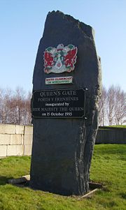
 The £8.5 million Central Link between the Queen's Gate Roundabout (51.468399°N 3.157366°W) and the junction on Adam Street (51.479557°N 3.167631°W) on the A4160 was opened on 16 February 1989. When it was first opened it only linked Cardiff city centre with Cardiff Bay. It was not until the Butetown Link was opened on 27 March 1995 that this road started to be used as a link to the motorway network, Penarth and the Vale of Glamorgan. It will not be until the Eastern Bay Link is built, when traffic from the city centre will use it to travel east, that it will be fully used. The length of the A4234 is just 1.45 km (0.90099046814222 mi) and is entirely a two lane dual carriageway with clearway restrictions.
traveling to and from the A48. But it has now been announced that this proposal has now been officially abandoned.
 The Cardiff Airport Link Road was a proposed spur road off of the A4232 through to Cardiff Airport, when plans for the road were scrapped by the WAG in June 2009. The current single carriageway A4050 road
, from Cardiff to Cardiff Airport is also the main road from Barry to Cardiff and is the main commuter route.
One of the 4 proposed schemes involved a new major highway route linking the Ely Link Road (PDR), south of the Culverhouse Cross Interchange, through to the A4226 north of Barry. The estimated cost of this scheme would have been £96m, including the widening of the A4232.
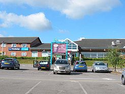 The PDR has two service stations for motorists, one at Cardiff West on the Capel Llanilltern Interchange and the other at Cardiff Gate on the Pentwyn Interchange. The services at Cardiff West includes Esso
petrol
, a Travelodge
, Burger King
, Costa Coffee
and W H Smith
, while the services at Cardiff Gate includes petrol, Burger King, W H Smith and also Coffee Primo.
Traffic Wales is the WAG's traffic information service, it is a partnership between the WAG and consultants Atkins. The Traffic Wales website has five live traffic webcams on the Capel Llanilltern – Culverhouse Cross Link Road (Trunk Road) and the images are updated every 5 minutes. Traffic Wales also operates a Traffic Information Hotline, motorists can use this telephone service by dialling an 0845 number, which gives up to date traffic information and travel advice.
, Celtic Gateway, Cardiff International Sports Village
that includes the Cardiff International Pool
, Cardiff International White Water
and Cardiff Arena
, which have all generated additional traffic at the Ferry Road Interchange. In addition, the Leckwith development
, which includes Cardiff City Stadium, Cardiff International Sports Stadium and the Capital Retail Park with a new Asda
supermarket, have also significantly increased traffic on the Leckwith Interchange. At the Culverhouse Cross
Interchange, older developments such as the Brooklands Retail Park, Wenvoe Retail Park and Valegate Retail Park, including Tesco
and Marks & Spencer
have also significantly increased congestion along with commuter traffic from the Vale of Glamorgan. From 1989 to 1997 there had been an increase in traffic of 78% and a further increase of 35% by 2016 is predicted by the Assembly. The Vale of Glamorgan Council
also expressed reservations about the new developments of the Cardiff International Sports Village
and the Cardiff City Stadium, which includes the Capital Retail Park. On 18 October, 2006, the council requested that the WAG assess the existing traffic conditions and future growth in traffic on the network.
, called "Everything Changes"
and was first broadcast by BBC Three
on 22 October 2006. The Grangetown Link was featured in the 2006 Christmas episode of Doctor Who
called "The Runaway Bride"
. It was first broadcast by BBC One
on 25 December 2006.
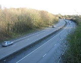
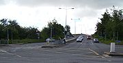
Webcams on the Capel Llanilltern – Culverhouse Cross Link Road
The following images updates every five minutes – click ‘refresh’ for the latest.
Cardiff
Cardiff is the capital, largest city and most populous county of Wales and the 10th largest city in the United Kingdom. The city is Wales' chief commercial centre, the base for most national cultural and sporting institutions, the Welsh national media, and the seat of the National Assembly for...
, the capital of Wales
Wales
Wales is a country that is part of the United Kingdom and the island of Great Britain, bordered by England to its east and the Atlantic Ocean and Irish Sea to its west. It has a population of three million, and a total area of 20,779 km²...
.
The first section of the PDR to be completed was the Southern Way Link Road in 1978 and the last section was the Butetown Link Road in 1995. The final section, the Eastern Bay Link Road, is yet to be built, with no date when construction may start. When fully completed, the road will form part of the Cardiff ring-road system. The PDR runs west, south and east of Cardiff, with the M4
M4 motorway
The M4 motorway links London with South Wales. It is part of the unsigned European route E30. Other major places directly accessible from M4 junctions are Reading, Swindon, Bristol, Newport, Cardiff and Swansea...
between junction 30 and junction 33 completing the northern section. The PDR is dual carriageway
Dual carriageway
A dual carriageway is a class of highway with two carriageways for traffic travelling in opposite directions separated by a central reservation...
for its entire length except for the East Moors Viaduct, which is a single carriageway
Single carriageway
A single carriageway is a road with 1, 2 or more lanes arranged within a single carriageway with no central reservation to separate opposing flows of traffic. Two-lane road or two-lane highway are single carriageway with one lane for each direction...
.
The PDR has been constructed in separate link roads of between 1.61 km (1 mi) and 5.47 km (3.4 mi) around Cardiff and to date 22 kilometres (13.7 mi) including spurs
Spur route
A spur route is a short road forming a branch from a longer, more important route . A bypass or beltway is never considered a true spur route as it typically reconnects with the major road...
have been opened to traffic, with plans for a further 5.53 km (3.4 mi). It has 4 large viaducts (Ely Viaduct, Grangetown Viaduct, Taff Viaduct and the East Moors Viaduct), 1 tunnel (Queen's Gate Tunnel) and 2 spur roads (Cogan Spur and Central Link Road). The road also has many smaller bridges over or under most of the interchanges on the road. The entire length of the road has clearway
Clearway
The term clearway is used in several commonwealth countries to refer to stretches of road or street where parking is limited or prohibited.-Australia:...
restrictions on it.
History
The road was conceived in the early 1970s and planning began in the late 1970s, by South GlamorganSouth Glamorgan
South Glamorgan is a preserved county of Wales.It was originally formed in 1974 under the Local Government Act 1972, as a county council area...
County Council. The road at that stage was planned to be completed by 1995 and would relieve Ely
Ely, Cardiff
Ely is a community primarily dominated by council housing in western Cardiff, capital of Wales.-The Roman era:In Roman times, Ely was the site of a Roman villa, near the old racecourse...
, Grangetown
Grangetown, Cardiff
Grangetown is a community in the south of Cardiff, capital of Wales. It is one of the largest districts in the south of the city and is bordered by Riverside, Canton and Butetown. The River Taff winds its way through the area...
, Butetown
Butetown
Butetown is a community in the south of the city of Cardiff, the capital of Wales. It was originally a model housing estate built in the early nineteenth century by John Crichton-Stuart, 2nd Marquess of Bute, for whose title the area was named...
and East Moors of through traffic and as a fast link to the national motorway network via the M4 and A48(M)
A48(M) motorway
The A48 is a motorway in Wales between Cardiff and Newport. It is a spur off the M4 into eastern Cardiff. It is long and is a 2-lane motorway throughout its length. At St Mellons it runs continuously into a further of the dual-carriageway A48, which also features hard shoulders.It opened in...
. The first section of the PDR to be completed was the Southern Way Link Road between Newport Road (A4161 road
A4161 road
The A4161 is a main road in Cardiff, Wales, United Kingdom.The road links Cardiff city centre with Ely and the M4 motorway via the A48 and the A4232 to the west and Cardiff city centre with Rumney and the A48 motorway via the A4232 and the A48 to the east.- History of the road number :The original...
) and the Eastern Avenue (A48 road
A48 road
The A48 is a major trunk road in Great Britain. It runs from the A40 at Highnam west of Gloucester to the A40 at Carmarthen. Before the construction of the M4 motorway and the first Severn Bridge in the mid 1960s it was the principal route into South Wales. For most of its journey through Wales,...
) in 1978 and the last section of the PDR, the Butetown Link Road, was opened to the public in 1995.
The former chairman of the South Glamorgan County Council
South Glamorgan
South Glamorgan is a preserved county of Wales.It was originally formed in 1974 under the Local Government Act 1972, as a county council area...
environment committee, Councillor
Councillor
A councillor or councilor is a member of a local government council, such as a city council.Often in the United States, the title is councilman or councilwoman.-United Kingdom:...
Paddy Kitson, called the road a "necklace of opportunity" due to its shape and also the opportunities for regeneration. By 1 April 1996 the responsibility for the road was transferred from South Glamorgan County Council to the unitary authority
Unitary authority
A unitary authority is a type of local authority that has a single tier and is responsible for all local government functions within its area or performs additional functions which elsewhere in the relevant country are usually performed by national government or a higher level of sub-national...
of Cardiff Council
Cardiff Council
The County Council of the City and County of Cardiff is the governing body for Cardiff, one of the Principal Areas of Wales. The council consists of 75 councillors, representing 29 electoral wards. The authority is properly styled as The County Council of the City and County of Cardiff or in...
. Much of the funding for the road had been grant aided
Grant-in-aid
A grant-in-aid is money coming from central government for a specific project. This kind of funding is usually used when the government and parliament have decided that the recipient should be publicly funded but operate with reasonable independence from the state.In the United Kingdom, most bodies...
from the European Community and the UK Government on the basis that it would improve the economic viability of the area and bring in new jobs and industry. However, since the completion of the Butetown Link Road, funding for further developments have been at a stand still, and to date 22 kilometres (13.7 mi) including spurs are open to traffic with plans for a further 5.53 km (3.4 mi). The "missing link", the Eastern Bay Link Road, is still to be built.
Route description
The PDR has 3 separate sections; the Capel Llanilltern Interchange (M4 J33) to Queen's Gate roundabout, the Rover Way – Lamby Way roundabout to the Llanedeyrn Interchange (A48) and the Pontprennau Interchange (A48) to the Pentwyn Interchange (M4 J30).Capel Llanilltern Interchange to Queen's Gate roundabout (Western Link Road)
Cardiff
Cardiff is the capital, largest city and most populous county of Wales and the 10th largest city in the United Kingdom. The city is Wales' chief commercial centre, the base for most national cultural and sporting institutions, the Welsh national media, and the seat of the National Assembly for...
to the east and the Vale of Glamorgan
Vale of Glamorgan
The Vale of Glamorgan is a county borough in Wales; an exceptionally rich agricultural area, it lies in the southern part of Glamorgan, South Wales...
to the west.
{| class="wikitable"
|- align="center" bgcolor="#00703C" style="color: #ffd200;font-size:120%;"
| colspan="3" | A4232 (T)
|- align="center"
!scope=col| Clockwise exits
!scope=col| Junction / Interchange
!scope=col| Anti-Clockwise exits
|- align='center'
| Swansea
Swansea
Swansea is a coastal city and county in Wales. Swansea is in the historic county boundaries of Glamorgan. Situated on the sandy South West Wales coast, the county area includes the Gower Peninsula and the Lliw uplands...
, Bristol
Bristol
Bristol is a city, unitary authority area and ceremonial county in South West England, with an estimated population of 433,100 for the unitary authority in 2009, and a surrounding Larger Urban Zone with an estimated 1,070,000 residents in 2007...
, London M4
M4 motorway
The M4 motorway links London with South Wales. It is part of the unsigned European route E30. Other major places directly accessible from M4 junctions are Reading, Swindon, Bristol, Newport, Cardiff and Swansea...
Exit only
| M4 J33
Capel Llanilltern Interchange
Cardiff West services
| Start of A4232 (T)
|- align='center'
| No access or exit
| St. Fagans
St. Fagans
St Fagans is an area in the west of the city of Cardiff, capital of Wales.To the south lies the village of Michaelston-super-Ely, and to the east the suburb of Fairwater. St Fagans lies on the River Ely, and previously had a railway station on the South Wales Main Line, and currently there is a...
| Museum of Welsh Life
St Fagans National History Museum
St Fagans National History Museum , commonly referred to as St Fagans after the village where it is located, is an open-air museum in Cardiff chronicling the historical lifestyle, culture and architecture of the Welsh people...
|- align='center'
| Start of A4232 (T)
| Culverhouse Cross
Culverhouse Cross
Culverhouse Cross is suburban district in the west of Cardiff, capital of Wales, lying on the border with the Vale of Glamorgan.The busy Culverhouse Cross roundabout is an important part of the primary road network to the west of the city and connects the A4232 , the A4050 , and...
| A48 West (Cardiff West)
A48 East (Vale of Glamorgan)
A4050 for Cardiff Airport
|- align="center" bgcolor="white" style="color: black;font-size:120%;" style="font-size:120%; border-top: black 2px solid;"
| colspan=3 | A4232
|-
! Clockwise exits
! Junction / Interchange
! Anti-Clockwise exits
|- align='center'
| A48 West
A48 road
The A48 is a major trunk road in Great Britain. It runs from the A40 at Highnam west of Gloucester to the A40 at Carmarthen. Before the construction of the M4 motorway and the first Severn Bridge in the mid 1960s it was the principal route into South Wales. For most of its journey through Wales,...
(Cardiff West)
A48 East
A48 road
The A48 is a major trunk road in Great Britain. It runs from the A40 at Highnam west of Gloucester to the A40 at Carmarthen. Before the construction of the M4 motorway and the first Severn Bridge in the mid 1960s it was the principal route into South Wales. For most of its journey through Wales,...
(Vale of Glamorgan)
A4050
A4050 road
The A4050 road connects Barry, Vale of Glamorgan with Culverhouse Cross on the outskirts of Cardiff, Wales. It is approximately long.Wenvoe village lies along the road....
for Cardiff Airport
| Culverhouse Cross
Culverhouse Cross
Culverhouse Cross is suburban district in the west of Cardiff, capital of Wales, lying on the border with the Vale of Glamorgan.The busy Culverhouse Cross roundabout is an important part of the primary road network to the west of the city and connects the A4232 , the A4050 , and...
| Start of A4232
|- align='center'
| B4267, City Centre
| Leckwith
Leckwith
Leckwith is a district of western Cardiff, Wales, United Kingdom. It is home to Cardiff City F.C.'s and Cardiff Blues home ground Cardiff City Stadium, and to Fitzalan High School...
| B4267, City Centre
|- align='center'
| A4055, Barry, Penarth
Penarth
Penarth is a town and seaside resort in the Vale of Glamorgan , Wales, 5.2 miles south west from the city centre of the Welsh capital city of Cardiff and lying on the north shore of the Severn Estuary at the southern end of Cardiff Bay...
, Grangetown
Grangetown, Cardiff
Grangetown is a community in the south of Cardiff, capital of Wales. It is one of the largest districts in the south of the city and is bordered by Riverside, Canton and Butetown. The River Taff winds its way through the area...
| Ferry Road
| A4055, Barry, Penarth, Grangetown
|- align='center'
| No Exit
| Stuart Street
| Techniquest
Techniquest
Techniquest is a Welsh science and discovery centre. It has locations in Cardiff Bay, Glyndŵr University in Wrexham, Llanberis in Gwynedd, and the Adventure Center in Narberth, Pembrokeshire....
Museum
Exit Only
|- align='center'
| Start of A4232
| Queen's Gate roundabout
| A4234, City Centre, Docks
End of A4232
Rover Way – Lamby Way roundabout to the Llanedeyrn Interchange (Southern Way)
This section, partly opened in 1978, from the Rover Way – Lamby Way roundabout to the Llanedeyrn Interchange on the A48 is oldest section of the PDR. It includes only the Southern Way Link Road, known locally as Southern Way, and is 2.25 km (1.4 mi) in length.
{| class="wikitable"
|- align="center" bgcolor="white" style="color: black;font-size:120%;"
| colspan="3" | A4232
|-
!scope=col| Clockwise exits
!scope=col| Junction / Interchange
!scope=col| Anti-Clockwise exits
|- align='center'
| Lamby Way
End of A4232
| Rover Way / Lamby Way
| Start of A4232
|- align='center'
| A4161
A4161 road
The A4161 is a main road in Cardiff, Wales, United Kingdom.The road links Cardiff city centre with Ely and the M4 motorway via the A48 and the A4232 to the west and Cardiff city centre with Rumney and the A48 motorway via the A4232 and the A48 to the east.- History of the road number :The original...
, City centre
Exit only
| Southern Way
| Access only
|- align='center'
| Start of A4232
| Llanedeyrn
| A48, Newport, City Centre
End of A4232
|- align='center'
|colspan=3 align=center bgcolor="#ddffdd" |A48
Pontprennau Interchange to the Pentwyn Interchange (Pentwyn Link)
This section the Pentwyn Link Road, from the Pontprennau Interchange on the A48 to the Pentwyn Interchange on the M4 (junction 30) is one of the newer sections of the PDR, having been opened in 1984, it is 1.61 km (1 mi) in length. The road between the Llanedeyrn Interchange to the Pontprennau Interchange is the A48 (Eastern Avenue), it too is a dual carriageway and is a concurrent road
Concurrency (road)
A concurrency, overlap, or coincidence in a road network is an instance of one physical road bearing two or more different highway, motorway, or other route numbers...
with the PDR, there are no plans to renumber this section of the A48.
{| class="wikitable"
|- align="center" bgcolor="white" style="color: black;font-size:120%;"
| colspan="3" | A4232
|-
!scope=col| Clockwise exits
!scope=col| Junction / Interchange
!scope=col| Anti-Clockwise exits
|-
|colspan=3 align=center bgcolor="#ddffdd" |A48
|- align='center'
| A48
A48 road
The A48 is a major trunk road in Great Britain. It runs from the A40 at Highnam west of Gloucester to the A40 at Carmarthen. Before the construction of the M4 motorway and the first Severn Bridge in the mid 1960s it was the principal route into South Wales. For most of its journey through Wales,...
| A48 Pontprennau
Pontprennau
Pontprennau is a district in the east of the city of Cardiff, Wales.-History:Pontprennau is the Welsh language for Bridge of Trees ....
| Start of A4232
|- align='center'
| Pontprennau, Cardiff Gate Retail Park,
Llanedeyrn Village
| Heol Pontprennau
| Pontprennau, Cardiff Gate Retail Park,
Llanedeyrn Village
|- align='center'
| Start of A4232
| M4 J30
Pentwyn Interchange
Cardiff Gate services
| Swansea
Swansea
Swansea is a coastal city and county in Wales. Swansea is in the historic county boundaries of Glamorgan. Situated on the sandy South West Wales coast, the county area includes the Gower Peninsula and the Lliw uplands...
, Bristol
Bristol
Bristol is a city, unitary authority area and ceremonial county in South West England, with an estimated population of 433,100 for the unitary authority in 2009, and a surrounding Larger Urban Zone with an estimated 1,070,000 residents in 2007...
, London M4
End of A4232
Link roads
A map of all the link roads and spur roads can be seen by clicking Map of all coordinates oppositeEach section of the road was completed in separate link roads.
Capel Llanilltern – Culverhouse Cross Link Road
The GB£14.5 million Capel Llanilltern – Culverhouse Cross Link Road , between the Capel Llanilltern Interchange (51.506481°N 3.310425°W) and the Culverhouse Cross Interchange (51.466350°N 3.271110°W) was opened in 1985. It was designed to provide a by-pass for traffic from the M4 to the Vale of Glamorgan. It is 5.47 km (3.4 mi) in length and includes the Ely Viaduct close to Michaelston-super-ElyMichaelston-super-Ely
Michaelston-super-Ely is a village, to the west of the city of Cardiff, Wales.Its Welsh name is Llanfihangel-ar-Elai where llan church + Mihangel Saint Michael + Elai River Ely). The historic church was decommissioned in 2010. It is approximately half a mile from the boundary with the Vale of...
. The only part of the PDR which is actually a trunk road
Trunk road
A trunk road, trunk highway, or strategic road is a major road—usually connecting two or more cities, ports, airports, and other things.—which is the recommended route for long-distance and freight traffic...
is the Capel Llanilltern – Culverhouse Cross Link Road which is maintained by the South Wales Trunk Road Agency (SWTRA) on behalf of the Welsh Assembly Government
Welsh Assembly Government
The Welsh Government is the devolved government of Wales. It is accountable to the National Assembly for Wales, the legislature which represents the interests of the people of Wales and makes laws for Wales...
(WAG). The remainder of the PDR is a primary route, which is maintained by Cardiff Council. In 2006 variable message sign
Variable message sign
A variable- message sign, often abbreviated VMS, CMS, or DMS, and in the UK known as a matrix sign,...
s were installed on the Capel Llanilltern – Culverhouse Cross Link Road by Techspan Systems to display messages giving motorists warning of road and weather conditions, accidents, congestion and major events held in the area.
Ely Viaduct
The Ely Viaduct crosses over the River Ely
River Ely
The River Ely is a river in South Wales flowing generally south east, from Tonyrefail to the capital city of Cardiff.-Course of the river:...
and also the main South Wales railway line
South Wales Main Line
The South Wales Main Line , originally known as the London, Bristol and South Wales Direct Railway or simply as the Bristol and South Wales Direct Railway, is a branch of the Great Western Main Line in Great Britain...
.
The viaduct is a 538 ft (164 m) twin-box girder and has central span of 230 ft (70.1 m) and 150 ft (45.7 m) side spans, constructed by the balanced cantilever
Cantilever bridge
A cantilever bridge is a bridge built using cantilevers, structures that project horizontally into space, supported on only one end. For small footbridges, the cantilevers may be simple beams; however, large cantilever bridges designed to handle road or rail traffic use trusses built from...
method. It was constructed in segments each weighing between 54 tons for plain segments to 93 tons for the main segments.
Ely Link Road
The Ely Link Road between the Culverhouse Cross Interchange (51.465840°N 3.269895°W) and the Leckwith Interchange (51.470641°N 3.211762°W), sometimes referred to as the Leckwith Road Interchange. It is 4.83 km (3 mi) in length and was opened in 1982 and built by Davies Middleton & Davies Ltd (DMD). It was designed to relieve Ely of through traffic and partly cuts into Leckwith Hill.Grangetown Link Road
The 2.89 km (1.8 mi) Grangetown Link Road between the Leckwith Interchange (51.470159°N 3.211239°W) and the Ferry Road Interchange (51.453510°N 3.185760°W) was opened on 3 May, 1988. It includes the Grangetown Viaduct.Grangetown Viaduct
The Grangetown Viaduct is approximately 1 km (0.621372736649807 mi) in length and is said to be the longest glued segmental bridge in the United Kingdom. It has 13 spans of 71 metres (232.9 ft) with 2 end spans of 38 m (124.7 ft) and 46 m (150.9 ft).
The viaduct was designed by South Glamorgan County Council. Robert Benaim and Associates, now called Benaim UK Ltd designed the initial launching system for the glued segmental structure.
Butetown Link Road
The 2.57 km (1.6 mi) Butetown Link Road between the Ferry Road Interchange (51.453585°N 3.184044°W) and the Queen's Gate Roundabout (51.467873°N 3.157455°W) was opened on 27 March, 1995 by Neil KinnockNeil Kinnock
Neil Gordon Kinnock, Baron Kinnock is a Welsh politician belonging to the Labour Party. He served as a Member of Parliament from 1970 until 1995 and as Labour Leader and Leader of Her Majesty's Loyal Opposition from 1983 until 1992 - his leadership of the party during nearly nine years making him...
at the time the European Commissioner for Transport
European Commissioner for Transport
The Commissioner for Transport is the member of the European Commission. The current commissioner is Siim Kallas.The portfolio is responsible for the development of transport infastructure in the European Union such as road and rail networks but also navigation systems such as the Galileo...
. Construction of the link road commenced on the 15 October, 1993 and it was the last link road to be built. It includes the Taff Viaduct, also known as the Butetown Link Road Bridge, and the Queen's Gate Tunnel, which is also known simply as the Butetown Tunnel.
In 1987 South Glamorgan County Council had intended to build a viaduct cross the River Taff
River Taff
The River Taff is a large river in Wales. It rises as two rivers in the Brecon Beacons — the Taf Fechan and the Taf Fawr — before joining to form the Taff north of Merthyr Tydfil...
and then go onto an elevated section through Butetown "on stilts". But the newly formed Cardiff Bay Development Corporation
Cardiff Bay Development Corporation
The Cardiff Bay Development Corporation was set up by the United Kingdom Government on 3 April 1987 to redevelop of one sixth of the area of Cardiff to create Cardiff Bay.-Objectives:...
along with local residents objected to the scheme that they said would cut through Butetown and split the community, creating an unnecessary physical barrier between the two areas to the north and south of the link road. By 1988 South Glamorgan County Council had agreed to change the design of the link road, despite having already spent 6 years of design work on the link road meant that a tunnel had to be built instead. The cost of the Butetown Link Road was estimated to cost £35 million, but this had risen to £45M in 1988, before the design change.
The contract to build the Butetown Link Road was eventually won by a local company Davies Middleton & Davies Ltd in a joint venture with an Italian contractor, Cogefar-Impresit UK Ltd. The bid of £60 million undercut all other bids by £10 million, Davies Middleton & Davies Ltd have subsequently gone into administrative receivership.
Queen's Gate Tunnel
The Queen's Gate Tunnel , also known as the Butetown Tunnel, is underneath southern Butetown
Butetown
Butetown is a community in the south of the city of Cardiff, the capital of Wales. It was originally a model housing estate built in the early nineteenth century by John Crichton-Stuart, 2nd Marquess of Bute, for whose title the area was named...
and follows a line underneath the Wales Millennium Centre
Wales Millennium Centre
Wales Millennium Centre is an arts centre located in the Cardiff Bay area of Cardiff, Wales. The site covers a total area of . Phase 1 of the building was opened during the weekend of the 26–28 November 2004 and phase 2 opened on 22 January 2009 with an inaugural concert...
. The 715 m (2,345.8 ft) twin tunnel was constructed using the cut and cover method of construction, which involves digging a trench for the tunnel and then roofing it over. The tunnel was constructed using reinforced concrete and a central wall separates the two sets of traffic.
South Glamorgan County Council originally awarded the contract for the management, installation, testing and commissioning of all electrical and mechanical services for the tunnel, and the water pumping stations to EI·WHS Ltd. They still maintain the tunnel on behalf of Cardiff Council.
Taff Viaduct
Construction of the 600 m (1,968.5 ft) Taff Viaduct includes a dual-carriageway roadway plus a foot and cycle path. South Glamorgan County Council
South Glamorgan
South Glamorgan is a preserved county of Wales.It was originally formed in 1974 under the Local Government Act 1972, as a county council area...
was the local authority in charge of the project at the time and construction of the viaduct began in March, 1991. The Taff Viaduct crosses the River Taff
River Taff
The River Taff is a large river in Wales. It rises as two rivers in the Brecon Beacons — the Taf Fechan and the Taf Fawr — before joining to form the Taff north of Merthyr Tydfil...
at Cardiff Bay
Cardiff Bay
Cardiff Bay is the area created by the Cardiff Barrage in South Cardiff, the capital of Wales. The regeneration of Cardiff Bay is now widely regarded as one of the most successful regeneration projects in the United Kingdom. The Bay is supplied by two rivers to form a freshwater lake round the...
.
The viaduct was constructed using precast concrete segments, which is widely used in the construction industry for medium to long span viaducts. Segments were made in a casting yard near the site and then transported for final assembly of the viaduct.
Eastern Bay Link Road
It is envisaged that the 5.25 km (3.3 mi) Eastern Bay Link Road will run from the Queen's Gate Roundabout to the Rover Way – Lamby Way Roundabout on the Southern Way Link Road, although at present only the first phase between Queen's Gate Roundabout (51.468090°N 3.156193°W) and Ocean Way Interchange (51.472328°N 3.144107°W) is officially at the planning stage, although it seems to have now been mothballed.The link road had previously been known as the East Moors Link Road – Phase 1 and 3, but it also included the East Moors Viaduct, which was originally known as the East Moors Link Road – Phase 2. Later it became known as the Cardiff Bay Link Road, then renamed the Eastern Bay Link Road.
The proposed Eastern Bay Link Road, along with other schemes have been subject to many planning proposals since the last link road (the Butetown Link Road) was finished in 1995, namely a local transport plan (Local Transport Plan 2000–2016) in August 2000, a green paper
Green paper
In the Commonwealth, the Republic of Ireland and the United States a green paper is a tentative government report of a proposal without any commitment to action; the first step in changing the law...
(A Change of Gear) in December 2002 and a white paper
White paper
A white paper is an authoritative report or guide that helps solve a problem. White papers are used to educate readers and help people make decisions, and are often requested and used in politics, policy, business, and technical fields. In commercial use, the term has also come to refer to...
(Keeping Cardiff Moving) in May 2003. The cost of the link road was estimated to cost GB£162 million in 2001 and this increased to GB£180 million by August 2002. It could be paid for by congestion charging
Congestion pricing
Congestion pricing or congestion charges is a system of surcharging users of a transport network in periods of peak demand to reduce traffic congestion. Examples include some toll-like road pricing fees, and higher peak charges for utilities, public transport and slots in canals and airports...
, although a public-private partnership
Public-private partnership
Public–private partnership describes a government service or private business venture which is funded and operated through a partnership of government and one or more private sector companies...
is also possible. The original route of the link road had been challenged by both Friends of the Earth
Friends of the Earth
Friends of the Earth International is an international network of environmental organizations in 76 countries.FOEI is assisted by a small secretariat which provides support for the network and its agreed major campaigns...
Cymru, and also the Royal Society for the Protection of Birds
Royal Society for the Protection of Birds
Bird Notes and News was first published in April 1903.The title changed to 'Bird Notes' in 1947. In the 1950s, there were four copies per year . Each volume covered two years, spread over three calendar years...
(RSPB), who had both lodged formal objections against the link road. However, the current proposal from Cardiff Council of 31 October 2006 is to complete the first phase of the road, approximately 1 km (0.621372736649807 mi) in length, from the Butetown Link Road to Ocean Way Interchange. The new route would be a different route from the earlier proposal and would avoid any encroachment into the nature conservation area, which Friends of the Earth and the RSPB had objected to. Therefore the new route of the link road should ensure that there are no objections.
The "missing link" in the PDR (the Eastern Bay Link Road), between the Southern Way Link Road and the Butetown Link Road, poses a threat to the continued development of Cardiff Bay
Cardiff Bay
Cardiff Bay is the area created by the Cardiff Barrage in South Cardiff, the capital of Wales. The regeneration of Cardiff Bay is now widely regarded as one of the most successful regeneration projects in the United Kingdom. The Bay is supplied by two rivers to form a freshwater lake round the...
, if the link road is not completed. The main road link from the east into Cardiff Bay remains the M4 motorway, leading onto the A48, a short stretch of along the Southern Way Link Road (PDR) and then onto the single carriageway
Single carriageway
A single carriageway is a road with 1, 2 or more lanes arranged within a single carriageway with no central reservation to separate opposing flows of traffic. Two-lane road or two-lane highway are single carriageway with one lane for each direction...
unclassified roads Rover Way, Ocean Way and East Tyndall Street. It then goes onto the A4234
A4234 road
The A4234, also known as the Central Link Road, is a spur off of the A4232 in Cardiff, the capital of Wales. It links the southern part of Cardiff city centre to the motorway network. The length of the A4234 is just and is entirely a two lane dual carriageway with clearway restrictions. The...
(Central Link Road) through to Cardiff Bay. Locally Rover Way is known as "scrap alley", because it passes Celsa Steel's Castle Works and Sims Metal Management's scrap yard. An abandoned level crossing can be seen as motorists pass between the scrap yard and the Castle Works.
Southern Way Link Road
The Southern Way Link Road , generally known simply as Southern Way, was built in two parts; the first section of Southern Way to be completed was between Newport Road (A4161 roadA4161 road
The A4161 is a main road in Cardiff, Wales, United Kingdom.The road links Cardiff city centre with Ely and the M4 motorway via the A48 and the A4232 to the west and Cardiff city centre with Rumney and the A48 motorway via the A4232 and the A48 to the east.- History of the road number :The original...
) and the Eastern Avenue (A48 road
A48 road
The A48 is a major trunk road in Great Britain. It runs from the A40 at Highnam west of Gloucester to the A40 at Carmarthen. Before the construction of the M4 motorway and the first Severn Bridge in the mid 1960s it was the principal route into South Wales. For most of its journey through Wales,...
) in 1978. The final section of the link road was built between Newport Road and the Rover Way – Lamby Way roundabout and was opened in 1984 at a cost of £9 million and includes the East Moors Viaduct, which is also known as the Southern Way Flyover. In 1987 it was envisaged that the present single-carriage was would be "twinned" as a dual-carriageway, the same as the rest of the PDR. The 2.25 km (1.4 mi) link road now runs from the Rover Way – Lamby Way Roundabout (51.493127°N 3.133759°W) to the Llanedeyrn Interchange (51.507202°N 3.145853°W) on the A48.
East Moors Viaduct
The 900 m (2,952.8 ft) East Moors Viaduct , which is also known as the Southern Way Flyover, was also designed by Robert Benaim and Associates who won the ICE (Institution of Civil Engineers
Institution of Civil Engineers
Founded on 2 January 1818, the Institution of Civil Engineers is an independent professional association, based in central London, representing civil engineering. Like its early membership, the majority of its current members are British engineers, but it also has members in more than 150...
) Project Award and also a Concrete Society Commendation, both in 1985 for work on the viaduct. The viaduct was constructed by concrete box girder deck of segmental construction. The East Moors Viaduct was originally known as the East Moors Link Road – Phase 2, but now forms part of the Southern Way Link Road.
Pentwyn Link Road
The Pentwyn Link Road , which is also known as the North Pentwyn Link Road, runs from the Pontprennau Interchange (51.528660°N 3.130240°W) on the A48 and the Pentwyn Interchange (51.541525°N 3.128749°W) on the M4 (junction 30). It is 1.61 km (1 mi) in length and was opened by John RedwoodJohn Redwood
John Alan Redwood is a British Conservative Party politician and Member of Parliament for Wokingham. He was formerly Secretary of State for Wales in Prime Minister John Major's Cabinet and was an unsuccessful challenger for the leadership of the Conservative Party in 1995...
MP, the Secretary of State for Wales
Secretary of State for Wales
The Secretary of State for Wales is the head of the Wales Office within the British cabinet. He or she is responsible for ensuring Welsh interests are taken into account by the government, representing the government within Wales and overseeing the passing of legislation which is only for Wales...
on 20 June, 1994. It provides a link between the Eastern Avenue (A48) and the M4 so that westbound traffic from the east of the city can get onto the M4 without having to go through the city, via the A48 and A470. In addition it also provides access to the community of Pontprennau
Pontprennau
Pontprennau is a district in the east of the city of Cardiff, Wales.-History:Pontprennau is the Welsh language for Bridge of Trees ....
to the national road network. This link was financed by private developers as part of a large scale housing development at Pontprennau.
Cogan Spur (A4055)
The Cogan Spur, which is also known as the Cogan Link , from the Ferry Road Interchange (51.453519°N 3.184876°W) to Barons Court Junction (51.447910°N 3.189787°W) on the A4160 was opened in 1988. It is only 0.8 km (0.497098189319845 mi), but it is an important link to provide access to the PDR from Penarth and the southern part of the Vale of Glamorgan. It also bypasses Penarth Road (A4160) for traffic going in and out of Cardiff city centre.The most recent development, which began at the end of 2006 and into 2007 was the widening of the road between the Cogan Viaduct and the Ferry Road Interchange to a 3-lane dual-carriageway. A new junction was also built for the Cardiff International Sports Village
Cardiff International Sports Village
Cardiff International Sports Village is located in Cardiff Bay in the city of Cardiff, Wales. It is one of the largest regeneration projects currently in the UK...
directly from Cogan Spur; also the Barons Court roundabout was replaced by a signal controlled
Traffic light
Traffic lights, which may also be known as stoplights, traffic lamps, traffic signals, signal lights, robots or semaphore, are signalling devices positioned at road intersections, pedestrian crossings and other locations to control competing flows of traffic...
crossroad. The main contractor for this project was Laing O'Rourke
Laing O'Rourke
Laing O'Rourke is a multinational construction company headquartered in Dartford, United Kingdom. It was founded in 1978....
Civil Engineering.
Cogan Viaduct
The Cogan Viaduct is the most important element of the Cogan Spur as it crosses the River Ely
River Ely
The River Ely is a river in South Wales flowing generally south east, from Tonyrefail to the capital city of Cardiff.-Course of the river:...
with a central span of 95 metres (312 ft). In total it has 6 spans; 40 m (131.2 ft), 60 m (196.9 ft), 60 m, 60m, 95 m and 60 m. It is made from a multi-span glued segmental structure of rectangular box sections. In all over 300 sections were used to construct the viaduct
Viaduct
A viaduct is a bridge composed of several small spans. The term viaduct is derived from the Latin via for road and ducere to lead something. However, the Ancient Romans did not use that term per se; it is a modern derivation from an analogy with aqueduct. Like the Roman aqueducts, many early...
, each weighing from 43 to 117 tonnes. The Cogan Viaduct was again designed by South Glamorgan County Council, who won a Concrete Society Commendation in 1989 for the design.
Central Link Road (A4234)
Ely Spur
The Ely Spur was planned to run from a new interchange on the Ely Link Road to Ely Bridge on the A48. It was only 1.2 km (0.745647283979768 mi) in length, but it would have reduced through traffic in the residential area of Ely, namely on Cowbridge Road WestCowbridge Road West
Cowbridge Road West is a major road in western Cardiff, the capital of Wales and forms part of the A48 road.It divides the districts of Ely and Caerau and connects inner Cardiff to Culverhouse Cross and eventually the M4 motorway via the A4232....
traveling to and from the A48. But it has now been announced that this proposal has now been officially abandoned.
Cardiff Airport Link Road
A4050 road
The A4050 road connects Barry, Vale of Glamorgan with Culverhouse Cross on the outskirts of Cardiff, Wales. It is approximately long.Wenvoe village lies along the road....
, from Cardiff to Cardiff Airport is also the main road from Barry to Cardiff and is the main commuter route.
One of the 4 proposed schemes involved a new major highway route linking the Ely Link Road (PDR), south of the Culverhouse Cross Interchange, through to the A4226 north of Barry. The estimated cost of this scheme would have been £96m, including the widening of the A4232.
Services
Esso
Esso is an international trade name for ExxonMobil and its related companies. Pronounced , it is derived from the initials of the pre-1911 Standard Oil, and as such became the focus of much litigation and regulatory restriction in the United States. In 1972, it was largely replaced in the U.S. by...
petrol
Gasoline
Gasoline , or petrol , is a toxic, translucent, petroleum-derived liquid that is primarily used as a fuel in internal combustion engines. It consists mostly of organic compounds obtained by the fractional distillation of petroleum, enhanced with a variety of additives. Some gasolines also contain...
, a Travelodge
Travelodge UK
Travelodge Hotels Limited is a private company operating in the hotels and hospitality industry throughout the United Kingdom. Branded simply as Travelodge or Travelodge UK, it is the second largest in the budget hotel sector and third biggest hotel chain in the UK by number of bedrooms...
, Burger King
Burger King
Burger King, often abbreviated as BK, is a global chain of hamburger fast food restaurants headquartered in unincorporated Miami-Dade County, Florida, United States. The company began in 1953 as Insta-Burger King, a Jacksonville, Florida-based restaurant chain...
, Costa Coffee
Costa Coffee
Costa Coffee is a British coffeehouse company founded in 1971 by Italian brothers Sergio and Bruno Costa, as a wholesale operation supplying roasted coffee to caterers and specialist Italian coffee shops. Since 1995 it has been a subsidiary of Whitbread, since when the company has grown to over...
and W H Smith
W H Smith
WHSmith plc is a British retailer, headquartered in Swindon, Wiltshire, England. It is best known for its chain of high street, railway station, airport, hospital and motorway service station shops selling books, stationery, magazines, newspapers, and entertainment products...
, while the services at Cardiff Gate includes petrol, Burger King, W H Smith and also Coffee Primo.
Traffic Wales is the WAG's traffic information service, it is a partnership between the WAG and consultants Atkins. The Traffic Wales website has five live traffic webcams on the Capel Llanilltern – Culverhouse Cross Link Road (Trunk Road) and the images are updated every 5 minutes. Traffic Wales also operates a Traffic Information Hotline, motorists can use this telephone service by dialling an 0845 number, which gives up to date traffic information and travel advice.
Traffic congestion
Since the western link roads were built, a number of major developments have been built, such as the Cardiff Bay Retail Park, IKEAIKEA
IKEA is a privately held, international home products company that designs and sells ready-to-assemble furniture such as beds and desks, appliances and home accessories. The company is the world's largest furniture retailer...
, Celtic Gateway, Cardiff International Sports Village
Cardiff International Sports Village
Cardiff International Sports Village is located in Cardiff Bay in the city of Cardiff, Wales. It is one of the largest regeneration projects currently in the UK...
that includes the Cardiff International Pool
Cardiff International Pool
The Cardiff International Pool is a sport facility located in the Cardiff International Sports Village in Cardiff, capital of Wales. It opened to the public on 12 January 2008 and was officially opened on 26 February 2008 by Duncan Goodhew....
, Cardiff International White Water
Cardiff International White Water
Cardiff International White Water is an Olympic standard white water rafting centre based at the Cardiff International Sports Village in Cardiff Bay....
and Cardiff Arena
Cardiff Arena
The Cardiff Arena, also known as Cardiff Bay Ice Arena and also known by ice hockey fans as the Big Blue Tent, is a temporary ice rink in Cardiff Bay, Cardiff, Wales. It has a capacity of 2,500 for ice hockey and is home to the Cardiff Devils after leaving the Wales National Ice Rink, in order to...
, which have all generated additional traffic at the Ferry Road Interchange. In addition, the Leckwith development
Leckwith Development
The Leckwith development is in the Leckwith area of southern Cardiff, Wales. Work started in Autumn 2007 with the construction of a new stadium for Cardiff City F.C...
, which includes Cardiff City Stadium, Cardiff International Sports Stadium and the Capital Retail Park with a new Asda
Asda
Asda Stores Ltd is a British supermarket chain which retails food, clothing, general merchandise, toys and financial services. It also has a mobile telephone network, , Asda Mobile...
supermarket, have also significantly increased traffic on the Leckwith Interchange. At the Culverhouse Cross
Culverhouse Cross
Culverhouse Cross is suburban district in the west of Cardiff, capital of Wales, lying on the border with the Vale of Glamorgan.The busy Culverhouse Cross roundabout is an important part of the primary road network to the west of the city and connects the A4232 , the A4050 , and...
Interchange, older developments such as the Brooklands Retail Park, Wenvoe Retail Park and Valegate Retail Park, including Tesco
Tesco
Tesco plc is a global grocery and general merchandise retailer headquartered in Cheshunt, United Kingdom. It is the third-largest retailer in the world measured by revenues and the second-largest measured by profits...
and Marks & Spencer
Marks & Spencer
Marks and Spencer plc is a British retailer headquartered in the City of Westminster, London, with over 700 stores in the United Kingdom and over 300 stores spread across more than 40 countries. It specialises in the selling of clothing and luxury food products...
have also significantly increased congestion along with commuter traffic from the Vale of Glamorgan. From 1989 to 1997 there had been an increase in traffic of 78% and a further increase of 35% by 2016 is predicted by the Assembly. The Vale of Glamorgan Council
Vale of Glamorgan Council
The Vale of Glamorgan Council is the governing body for the Vale of Glamorgan, one of the Principal Areas of Wales. It is run by the Conservative Party after the United Kingdom local elections, 2008, taking over the council from no overall control....
also expressed reservations about the new developments of the Cardiff International Sports Village
Cardiff International Sports Village
Cardiff International Sports Village is located in Cardiff Bay in the city of Cardiff, Wales. It is one of the largest regeneration projects currently in the UK...
and the Cardiff City Stadium, which includes the Capital Retail Park. On 18 October, 2006, the council requested that the WAG assess the existing traffic conditions and future growth in traffic on the network.
Popular culture
The Queen's Gate Tunnel was featured in the first ever episode of TorchwoodTorchwood
Torchwood is a British science fiction television programme created by Russell T Davies. The series is a spin-off from Davies's 2005 revival of the long-running science fiction programme Doctor Who. The show has shifted its broadcast channel each series to reflect its growing audience, moving from...
, called "Everything Changes"
Everything Changes (Torchwood)
"Everything Changes" is the first episode of the British science fiction television programme Torchwood, which was first broadcast on 22 October 2006.-Synopsis:Police constable Gwen Cooper comes across the mysterious organisation known as Torchwood...
and was first broadcast by BBC Three
BBC Three
BBC Three is a television network from the BBC broadcasting via digital cable, terrestrial, IPTV and satellite platforms. The channel's target audience includes those in the 16-34 year old age group, and has the purpose of providing "innovative" content to younger audiences, focusing on new talent...
on 22 October 2006. The Grangetown Link was featured in the 2006 Christmas episode of Doctor Who
Doctor Who
Doctor Who is a British science fiction television programme produced by the BBC. The programme depicts the adventures of a time-travelling humanoid alien known as the Doctor who explores the universe in a sentient time machine called the TARDIS that flies through time and space, whose exterior...
called "The Runaway Bride"
The Runaway Bride (Doctor Who)
"The Runaway Bride" is a special episode of the long-running British science fiction television series Doctor Who, starring David Tennant as the Tenth Doctor...
. It was first broadcast by BBC One
BBC One
BBC One is the flagship television channel of the British Broadcasting Corporation in the United Kingdom. It was launched on 2 November 1936 as the BBC Television Service, and was the world's first regular television service with a high level of image resolution...
on 25 December 2006.
External links
- Map of the Ely Viaduct on the Capel Llanilltern - Culverhouse Cross Link Road
- City & County of Cardiff Local Transport Plan 2000 - 2016, Cardiff Council, August 2000
- A Change of Gear (Green Paper), Cardiff Council, December 2002
- Keeping Cardiff Moving (White Paper), Cardiff Council, May 2003
- South Wales Trunk Road Agency website
- Traffic Wales website
- Photo of Grangetown Viaduct being built
- Cardiff Council information on the Queen's Gate Tunnel
Webcams on the Capel Llanilltern – Culverhouse Cross Link Road
The following images updates every five minutes – click ‘refresh’ for the latest.