
1966 Atlantic hurricane season
Encyclopedia
The 1966 Atlantic hurricane season officially began on June 1, 1966, and lasted until November 30, 1966. These dates conventionally delimit the period of each year when most tropical cyclone
s form in the Atlantic basin
. The 1966 season
was near normal with eleven tropical storms. It was also unusually active early in the season, with five named storms forming before the end of July, an event which would not happen again until the 2005 Atlantic hurricane season
.
Notable storms of 1966 include Hurricane Alma
, which caused death and destruction in Honduras
, Cuba
, and Florida
; and Hurricane Inez
, which killed 1,000 people in its trek across the Greater Antilles
, Bahamas, Florida, and Mexico
. An unusual storm was Hurricane Faith, which followed an extremely long track from Africa, into the Caribbean
, and all the way into the Arctic
. It holds the record for having the longest hurricane track in recorded history.
, hit Cuba as a Category 2 hurricane. It moved northward and became a major hurricane before weakening and crossing Florida
. Alma became extratropical over the northern Atlantic on June 13 after briefly restrengthening to a hurricane near North Carolina
. Hurricane Alma killed 90 people, most in Honduras
, and caused $210 million (1966 USD
; $ USD) in damage, almost all in Cuba
.
. Also nearly following the path of Alma, the depression moved northward, crossing Cuba and then turning northeast across northern Florida. After failing to intensify into a tropical storm, the depression dissipated over southeastern Georgia
on July 2.
Tropical Depression Two dropped heavy rainfall in some areas of Florida, and the greatest amount of precipitation recorded was 10 in (254 mm) in Everglades City, Florida and Jacksonville. Elsewhere in Florida, the depression dropped between 2 to 4 in (50.8 to 101.6 mm) of rain. Rainfall was also fell in South Carolina, and was regarded as "beneficial". In addition, the depression spawned two tornadoes, one of which destroyed two aircrafts at Palm Beach International Airport
; the other tornado touched-down in Vero Beach, Florida
. It caused $50,000 (1966 USD; $ USD) in damage.
on July 1, as confirmed by ESSA 2 satellite. The tropical depression intensified as it headed northeastward under an upper-level trough, and became a tropical storm by the following day. Becky rapidly intensified after becoming a tropical storm, and reached hurricane status only six hours later. After becoming under the influence of a cold low, Becky turned to the northwest toward Atlantic Canada
on July 3. Becky encountered cooler sea surface temperatures, and became extratropical on July 3 near Nova Scotia
. No damage was reported.
over the north-central Atlantic led to the development of a surface low on July 22. That night it became a tropical depression, followed by becoming a tropical storm on the July 23. Dorothy was likely subtropical when it first developed, but on the July 24, it became more tropical, reaching hurricane strength and attaining a well organized satellite presentation, but without a true eyewall. Dorothy continued northward towards cooler waters, weakening to tropical storm strength on the July 29 and becoming extratropical on July 30.
. It headed west-northwestward, reaching tropical storm strength on the July 24. Conditions never became very favorable, with the large circulation of Dorothy to the north impeding some development. Ella dissipated on the July 28 east of the Bahamas.
on July 26, moving along the coast and dissipating on July 27. The depression caused heavy rain but little damage.
in mid-August. After approaching the Lesser Antilles
, Faith started turning northward, and eventually its track curved enough to take it away from North America
. Faith continued on as a tropical system, and was declared extratropical only hours before striking the Faroe Islands
. The low that was Faith continued over the Scandinavian Peninsula
, and was tracked as far as Franz Josef Land
.
on September 20. As it separated from the cold front, it strengthened to a tropical storm on September 21. Hallie reached its peak of 50 mph (85 km/h) that day, but cool air weakened the storm prior to hitting the Mexican
coast. Hallie dissipated on September 22.
, into the Bahamas, across the Florida Keys
, approached the Yucatán Peninsula
, and after three weeks finally made landfall near Tampico
. Inez was the first single storm on record to strike the islands of the Caribbean
, the Bahamas, Florida, and Mexico.
was named Kendra and operationally classified as a tropical storm, but post-analysis found the system actually remained an extratropical gale center. This makes Kendra one of two systems in the Atlantic basin to be named and not considered a tropical cyclone; the other system was Mike of 1950
.
.
Tropical cyclone
A tropical cyclone is a storm system characterized by a large low-pressure center and numerous thunderstorms that produce strong winds and heavy rain. Tropical cyclones strengthen when water evaporated from the ocean is released as the saturated air rises, resulting in condensation of water vapor...
s form in the Atlantic basin
Atlantic Basin
The Atlantic Basin is the Atlantic Ocean.Atlantic Basin may also refer to:* Atlantic Basin Iron Works, an ironworks that operated in Brooklyn, New York, in the early to mid-20th century...
. The 1966 season
Atlantic hurricane season
The Atlantic hurricane season is the period in a year when hurricanes usually form in the Atlantic Ocean. Tropical cyclones in the North Atlantic are called hurricanes, tropical storms, or tropical depressions. In addition, there have been several storms over the years that have not been fully...
was near normal with eleven tropical storms. It was also unusually active early in the season, with five named storms forming before the end of July, an event which would not happen again until the 2005 Atlantic hurricane season
2005 Atlantic hurricane season
The 2005 Atlantic hurricane season was the most active Atlantic hurricane season in recorded history, repeatedly shattering numerous records. The impact of the season was widespread and ruinous with an estimated 3,913 deaths and record damage of about $159.2 billion...
.
Notable storms of 1966 include Hurricane Alma
Hurricane Alma (1966)
Hurricane Alma was a rare June major hurricane in the 1966 Atlantic hurricane season. It was the earliest continental U.S. hurricane strike within any season since 1908...
, which caused death and destruction in Honduras
Honduras
Honduras is a republic in Central America. It was previously known as Spanish Honduras to differentiate it from British Honduras, which became the modern-day state of Belize...
, Cuba
Cuba
The Republic of Cuba is an island nation in the Caribbean. The nation of Cuba consists of the main island of Cuba, the Isla de la Juventud, and several archipelagos. Havana is the largest city in Cuba and the country's capital. Santiago de Cuba is the second largest city...
, and Florida
Florida
Florida is a state in the southeastern United States, located on the nation's Atlantic and Gulf coasts. It is bordered to the west by the Gulf of Mexico, to the north by Alabama and Georgia and to the east by the Atlantic Ocean. With a population of 18,801,310 as measured by the 2010 census, it...
; and Hurricane Inez
Hurricane Inez
Hurricane Inez was a deadly, destructive, powerful and very long-lived Cape Verde-type hurricane that carved an erratic path through the Lesser Antilles, Hispaniola, Cuba, the Bahamas, Florida, and Mexico in 1966...
, which killed 1,000 people in its trek across the Greater Antilles
Greater Antilles
The Greater Antilles are one of three island groups in the Caribbean. Comprising Cuba, Jamaica, Hispaniola , and Puerto Rico, the Greater Antilles constitute almost 90% of the land mass of the entire West Indies.-Greater Antilles in context :The islands of the Caribbean Sea, collectively known as...
, Bahamas, Florida, and Mexico
Mexico
The United Mexican States , commonly known as Mexico , is a federal constitutional republic in North America. It is bordered on the north by the United States; on the south and west by the Pacific Ocean; on the southeast by Guatemala, Belize, and the Caribbean Sea; and on the east by the Gulf of...
. An unusual storm was Hurricane Faith, which followed an extremely long track from Africa, into the Caribbean
Caribbean
The Caribbean is a crescent-shaped group of islands more than 2,000 miles long separating the Gulf of Mexico and the Caribbean Sea, to the west and south, from the Atlantic Ocean, to the east and north...
, and all the way into the Arctic
Arctic
The Arctic is a region located at the northern-most part of the Earth. The Arctic consists of the Arctic Ocean and parts of Canada, Russia, Greenland, the United States, Norway, Sweden, Finland, and Iceland. The Arctic region consists of a vast, ice-covered ocean, surrounded by treeless permafrost...
. It holds the record for having the longest hurricane track in recorded history.
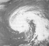
Hurricane Alma
Hurricane Alma, which formed on June 4 over Central AmericaCentral America
Central America is the central geographic region of the Americas. It is the southernmost, isthmian portion of the North American continent, which connects with South America on the southeast. When considered part of the unified continental model, it is considered a subcontinent...
, hit Cuba as a Category 2 hurricane. It moved northward and became a major hurricane before weakening and crossing Florida
Florida
Florida is a state in the southeastern United States, located on the nation's Atlantic and Gulf coasts. It is bordered to the west by the Gulf of Mexico, to the north by Alabama and Georgia and to the east by the Atlantic Ocean. With a population of 18,801,310 as measured by the 2010 census, it...
. Alma became extratropical over the northern Atlantic on June 13 after briefly restrengthening to a hurricane near North Carolina
North Carolina
North Carolina is a state located in the southeastern United States. The state borders South Carolina and Georgia to the south, Tennessee to the west and Virginia to the north. North Carolina contains 100 counties. Its capital is Raleigh, and its largest city is Charlotte...
. Hurricane Alma killed 90 people, most in Honduras
Honduras
Honduras is a republic in Central America. It was previously known as Spanish Honduras to differentiate it from British Honduras, which became the modern-day state of Belize...
, and caused $210 million (1966 USD
United States dollar
The United States dollar , also referred to as the American dollar, is the official currency of the United States of America. It is divided into 100 smaller units called cents or pennies....
; $ USD) in damage, almost all in Cuba
Cuba
The Republic of Cuba is an island nation in the Caribbean. The nation of Cuba consists of the main island of Cuba, the Isla de la Juventud, and several archipelagos. Havana is the largest city in Cuba and the country's capital. Santiago de Cuba is the second largest city...
.
Tropical Depression Two
The second tropical depression of the season formed on June 28, in exactly the same manner of Hurricane Alma, developing over western Caribbean SeaCaribbean Sea
The Caribbean Sea is a sea of the Atlantic Ocean located in the tropics of the Western hemisphere. It is bounded by Mexico and Central America to the west and southwest, to the north by the Greater Antilles, and to the east by the Lesser Antilles....
. Also nearly following the path of Alma, the depression moved northward, crossing Cuba and then turning northeast across northern Florida. After failing to intensify into a tropical storm, the depression dissipated over southeastern Georgia
Georgia (U.S. state)
Georgia is a state located in the southeastern United States. It was established in 1732, the last of the original Thirteen Colonies. The state is named after King George II of Great Britain. Georgia was the fourth state to ratify the United States Constitution, on January 2, 1788...
on July 2.
Tropical Depression Two dropped heavy rainfall in some areas of Florida, and the greatest amount of precipitation recorded was 10 in (254 mm) in Everglades City, Florida and Jacksonville. Elsewhere in Florida, the depression dropped between 2 to 4 in (50.8 to 101.6 mm) of rain. Rainfall was also fell in South Carolina, and was regarded as "beneficial". In addition, the depression spawned two tornadoes, one of which destroyed two aircrafts at Palm Beach International Airport
Palm Beach International Airport
Palm Beach International Airport is a public airport located 3 nautical miles west of Palm Beach, Florida, in West Palm Beach, Florida, and serves Palm Beach County. The airport is operated and maintained by Palm Beach County Department of Airports. Road access to the airport is available...
; the other tornado touched-down in Vero Beach, Florida
Vero Beach, Florida
Vero Beach is a city in Indian River County, Florida, USA. According to the U.S. Census Bureau's 2006 estimates, the city had a population of 16,939. It is the county seat of Indian River County...
. It caused $50,000 (1966 USD; $ USD) in damage.
Hurricane Becky
A tropical depression formed 300 mi (482.8 km) southeast of BermudaBermuda
Bermuda is a British overseas territory in the North Atlantic Ocean. Located off the east coast of the United States, its nearest landmass is Cape Hatteras, North Carolina, about to the west-northwest. It is about south of Halifax, Nova Scotia, Canada, and northeast of Miami, Florida...
on July 1, as confirmed by ESSA 2 satellite. The tropical depression intensified as it headed northeastward under an upper-level trough, and became a tropical storm by the following day. Becky rapidly intensified after becoming a tropical storm, and reached hurricane status only six hours later. After becoming under the influence of a cold low, Becky turned to the northwest toward Atlantic Canada
Atlantic Canada
Atlantic Canada is the region of Canada comprising the four provinces located on the Atlantic coast, excluding Quebec: the three Maritime provinces – New Brunswick, Prince Edward Island, and Nova Scotia – and Newfoundland and Labrador...
on July 3. Becky encountered cooler sea surface temperatures, and became extratropical on July 3 near Nova Scotia
Nova Scotia
Nova Scotia is one of Canada's three Maritime provinces and is the most populous province in Atlantic Canada. The name of the province is Latin for "New Scotland," but "Nova Scotia" is the recognized, English-language name of the province. The provincial capital is Halifax. Nova Scotia is the...
. No damage was reported.
Hurricane Celia
The precursor to Hurricane Celia was an easterly wave moving across the tropical Atlantic. It became a tropical depression on July 13, and a tropical storm the next day. After moving northwestward, Celia turned more westward towards the Bahamas, where it met hostile conditions and dissipated on the July 15. The remnant cloud mass turned northeastward, and on the July 20, it regained enough organization to be called a tropical storm again. Celia rapidly intensified to a hurricane that day, but the following day the storm became extratropical near Nova Scotia.Hurricane Dorothy
An upper tropospheric cold lowCold-core low
A cold-core low, also known as a cold low or cold-core cyclone, is a cyclone aloft which has an associated cold pool of air residing at high altitude within the Earth's troposphere. It is a low pressure system which strengthens with height in accordance with the thermal wind relationship. These...
over the north-central Atlantic led to the development of a surface low on July 22. That night it became a tropical depression, followed by becoming a tropical storm on the July 23. Dorothy was likely subtropical when it first developed, but on the July 24, it became more tropical, reaching hurricane strength and attaining a well organized satellite presentation, but without a true eyewall. Dorothy continued northward towards cooler waters, weakening to tropical storm strength on the July 29 and becoming extratropical on July 30.
Tropical Storm Ella
On July 22, a tropical depression formed in the tropical Atlantic, originating from an African tropical waveTropical wave
Tropical waves, easterly waves, or tropical easterly waves, also known as African easterly waves in the Atlantic region, are a type of atmospheric trough, an elongated area of relatively low air pressure, oriented north to south, which move from east to west across the tropics causing areas of...
. It headed west-northwestward, reaching tropical storm strength on the July 24. Conditions never became very favorable, with the large circulation of Dorothy to the north impeding some development. Ella dissipated on the July 28 east of the Bahamas.
Tropical Depression Seven
A tropical low moving through the Caribbean became well-organized enough to be called a tropical depression on July 24. It hit the coast of LouisianaLouisiana
Louisiana is a state located in the southern region of the United States of America. Its capital is Baton Rouge and largest city is New Orleans. Louisiana is the only state in the U.S. with political subdivisions termed parishes, which are local governments equivalent to counties...
on July 26, moving along the coast and dissipating on July 27. The depression caused heavy rain but little damage.
Hurricane Faith
Hurricane Faith was a long-lived storm, maintaining hurricane strength for thirteen days as it travelled the Atlantic. It has the longest recorded track of any hurricane, more than 7,500 mi (12,070 km). Faith started as a typical Cape Verde-type hurricaneCape Verde-type hurricane
A Cape Verde-type hurricane is an Atlantic hurricane that develops near the Cape Verde islands, off the west coast of Africa. The average hurricane season has about two Cape Verde-type hurricanes, which are usually the largest and most intense storms of the season because they often have plenty of...
in mid-August. After approaching the Lesser Antilles
Lesser Antilles
The Lesser Antilles are a long, partly volcanic island arc in the Western Hemisphere. Most of its islands form the eastern boundary of the Caribbean Sea with the Atlantic Ocean, with the remainder located in the southern Caribbean just north of South America...
, Faith started turning northward, and eventually its track curved enough to take it away from North America
North America
North America is a continent wholly within the Northern Hemisphere and almost wholly within the Western Hemisphere. It is also considered a northern subcontinent of the Americas...
. Faith continued on as a tropical system, and was declared extratropical only hours before striking the Faroe Islands
Faroe Islands
The Faroe Islands are an island group situated between the Norwegian Sea and the North Atlantic Ocean, approximately halfway between Scotland and Iceland. The Faroe Islands are a self-governing territory within the Kingdom of Denmark, along with Denmark proper and Greenland...
. The low that was Faith continued over the Scandinavian Peninsula
Scandinavian Peninsula
The Scandinavian Peninsula is a peninsula in Northern Europe, which today covers Norway, Sweden, and most of northern Finland. Prior to the 17th and 18th centuries, large parts of the southern peninsula—including the core region of Scania from which the peninsula takes its name—were part of...
, and was tracked as far as Franz Josef Land
Franz Josef Land
Franz Josef Land, Franz Joseph Land, or Francis Joseph's Land is an archipelago located in the far north of Russia. It is found in the Arctic Ocean north of Novaya Zemlya and east of Svalbard, and is administered by Arkhangelsk Oblast. Franz Josef Land consists of 191 ice-covered islands with a...
.
Tropical Storm Greta
Tropical Storm Greta developed from a tropical wave on September 1 in the tropical Atlantic. It moved west-northwestward, encountering favorable conditions. The depression became Tropical Storm Greta on the September 4, the same day it reached its peak of 60 mph (95 km/h). It was not able to strengthen further, due to the lack of low level inflow, and Greta dissipated on September 7 in the southwestern Atlantic.Tropical Storm Hallie
The combination of a stationary cold front and a large cloud mass led to the formation of a tropical depression in the Bay of CampecheBay of Campeche
The Bay of Campeche is the southern bight of the Gulf of Mexico. It is surrounded on three sides by the Mexican states of Campeche, Tabasco and Veracruz. It was named by Francisco Hernández de Córdoba and Antonio de Alaminos during their expedition in 1517...
on September 20. As it separated from the cold front, it strengthened to a tropical storm on September 21. Hallie reached its peak of 50 mph (85 km/h) that day, but cool air weakened the storm prior to hitting the Mexican
Mexico
The United Mexican States , commonly known as Mexico , is a federal constitutional republic in North America. It is bordered on the north by the United States; on the south and west by the Pacific Ocean; on the southeast by Guatemala, Belize, and the Caribbean Sea; and on the east by the Gulf of...
coast. Hallie dissipated on September 22.
Hurricane Inez
The deadliest storm of the season was Hurricane Inez. Inez killed an estimated 1,000 and caused over $200 million (1966 USD; $ USD) in damage. Inez had first started out as a weak, tropical depression on the coast of Africa on September 18. It tracked up the Greater AntillesGreater Antilles
The Greater Antilles are one of three island groups in the Caribbean. Comprising Cuba, Jamaica, Hispaniola , and Puerto Rico, the Greater Antilles constitute almost 90% of the land mass of the entire West Indies.-Greater Antilles in context :The islands of the Caribbean Sea, collectively known as...
, into the Bahamas, across the Florida Keys
Florida Keys
The Florida Keys are a coral archipelago in southeast United States. They begin at the southeastern tip of the Florida peninsula, about south of Miami, and extend in a gentle arc south-southwest and then westward to Key West, the westernmost of the inhabited islands, and on to the uninhabited Dry...
, approached the Yucatán Peninsula
Yucatán Peninsula
The Yucatán Peninsula, in southeastern Mexico, separates the Caribbean Sea from the Gulf of Mexico, with the northern coastline on the Yucatán Channel...
, and after three weeks finally made landfall near Tampico
Tampico
Tampico is a city and port in the state of Tamaulipas, in the country of Mexico. It is located in the southeastern part of the state, directly north across the border from Veracruz. Tampico is the third largest city in Tamaulipas, and counts with a population of 309,003. The Metropolitan area of...
. Inez was the first single storm on record to strike the islands of the Caribbean
Caribbean
The Caribbean is a crescent-shaped group of islands more than 2,000 miles long separating the Gulf of Mexico and the Caribbean Sea, to the west and south, from the Atlantic Ocean, to the east and north...
, the Bahamas, Florida, and Mexico.
Tropical Storm Judith
A tropical wave following Hurricane Inez organized to become a tropical depression on September 27. It moved west-northwestward, becoming a tropical storm the next day. Judith did not strengthen past its peak of 50 mph (85 km/h) as it moved through the islands due to outflow from Inez. Judith dissipated on September 30.Tropical Storm Kendra
On October 9, a cyclone 200 mi (320 km) north of Cape VerdeCape Verde
The Republic of Cape Verde is an island country, spanning an archipelago of 10 islands located in the central Atlantic Ocean, 570 kilometres off the coast of Western Africa...
was named Kendra and operationally classified as a tropical storm, but post-analysis found the system actually remained an extratropical gale center. This makes Kendra one of two systems in the Atlantic basin to be named and not considered a tropical cyclone; the other system was Mike of 1950
1950 Atlantic hurricane season
The 1950 Atlantic hurricane season was the first year in which tropical cyclones were given official names in the Atlantic basin. Names were taken from the Joint Army/Navy Phonetic Alphabet, with the first named storm being designated "Able", the second "Baker", and so on. It was an active season...
.
Hurricane Lois
A small cloud vortex over the central Atlantic obtained enough convective organization to become a tropical depression on November 4. It meandered, first to the west, then to the east-southeast. On November 6, the depression became a tropical storm, followed by a hurricane on November 8. Lois moved quickly northeastward, becoming extratropical on November 11 north of the AzoresAzores
The Archipelago of the Azores is composed of nine volcanic islands situated in the middle of the North Atlantic Ocean, and is located about west from Lisbon and about east from the east coast of North America. The islands, and their economic exclusion zone, form the Autonomous Region of the...
.
Storm names
The following names were used for named storms (tropical storms and hurricanes) that formed in the North Atlantic in 1966. Storms were named Dorothy, Faith, Hallie, Inez, Kendra and Lois for the first time in 1966. Names that were not assigned are marked in .
|
Hurricane Inez Hurricane Inez was a deadly, destructive, powerful and very long-lived Cape Verde-type hurricane that carved an erratic path through the Lesser Antilles, Hispaniola, Cuba, the Bahamas, Florida, and Mexico in 1966... |
Retirement
The name Inez was later retired.See also
- List of Atlantic hurricanes
- List of Atlantic hurricane seasons