
Warren, Maine
Encyclopedia
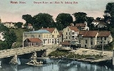
Warren is a town
in Knox County
, Maine
, United States
. The population was 3,794 at the 2000 census. It includes the villages of East Warren, Warren and South Warren, the latter home to the Maine State Prison
and minimum security Bolduc Correctional Facility.
, it was called the Upper Town of St. Georges Plantation. It was first settled by Europe
ans in 1736 under the auspices of Brigadier-General Samuel Waldo, its proprietor. Development was hindered, however, by the ongoing French and Indian Wars
. In 1753, a blockhouse
was built and placed under the command of Captain Thomas Kilpatrick, known by terrified Indians as "Tom-kill-the-devil." War raged across Maine between 1754–1758, and local settlers took refuge in the blockhouse or at another in Cushing
.
Hostilities ended in 1759 with the Fall of Quebec
. On November 7, 1776, Upper Town of St. Georges Plantation was incorporated as a town, named after Joseph Warren
, a Revolutionary War
hero.
Hay
was the principal crop. Shipbuilding
was an important industry, and between 1770–1850, 224 vessels were built, varying from 53 to 1,127 tons. Warren had quarries
to extract granite
and limestone
. Falls on the St. George River provided water power, with the first sawmill
built in 1785. Woolen
s were manufactured at the Georges River Mills, and snowshoe
s at the Warren Shoe Factory. The Knox and Lincoln Railroad opened on November 6, 1871.
The General Henry Knox Canal system (named after Henry Knox
, who purchased the locks in 1794) was initially built by Charles Barrett in 1793 to connect the tidewaters of the St. George River with St. George Lake in Liberty
, facilitating the shipment of lumber
and lime
. But the locks fell into decay following Knox's death in 1806. In 1848, the canal was reopened for navigation by the Georges Canal Company at a cost of $80,000. It again fell into disuse following 1877, rendered obsolete by the railroad. The canal banks and one lock may still be seen in Warren, however, uncovered as part of a river beautification project in 1966.
Since 2002, South Warren is home to the Maine State Prison
, a 900-bed maximum security facility formerly located in Thomaston
since 1824. The prison's gift shop, which sells over 600 inmate-made goods, remains in Thomaston at the site of the old prison.
, the town has a total area of 48.7 square miles (126.1 km²), of which, 46.4 square miles (120.2 km²) of it is land and 2.3 square miles (6 km²) of it (4.72%) is water. Drained by the Back River, Warren is located at the head of tide
on the banks of the St. George River
.
It is crossed by U.S. Route 1
and state routes 90, 131 and 235. It borders the towns of Union
to the north, Rockport
to the northeast, Rockland
to the east, Thomaston
to the southeast, Cushing
to the south, Friendship
to the southwest, and Waldoboro
to the west.
of 2000, there were 3,794 people, 1,346 households, and 970 families residing in the town. The population density
was 81.8 people per square mile (31.6/km²). There were 1,534 housing units at an average density of 33.1 per square mile (12.8/km²). The racial makeup of the town was 97.55% White, 0.29% African American, 0.76% Native American, 0.40% Asian, 0.03% Pacific Islander, 0.05% from other races
, and 0.92% from two or more races. Hispanic or Latino of any race were 0.74% of the population.
There were 1,346 households out of which 37.1% had children under the age of 18 living with them, 58.8% were married couples
living together, 8.5% had a female householder with no husband present, and 27.9% were non-families. 20.1% of all households were made up of individuals and 7.5% had someone living alone who was 65 years of age or older. The average household size was 2.60 and the average family size was 2.98.
In the town the population was spread out with 25.4% under the age of 18, 6.9% from 18 to 24, 32.8% from 25 to 44, 24.7% from 45 to 64, and 10.2% who were 65 years of age or older. The median age was 37 years. For every 100 females there were 112.9 males. For every 100 females age 18 and over, there were 118.3 males.
The median income for a household in the town was $35,662, and the median income for a family was $41,086. Males had a median income of $30,109 versus $20,638 for females. The per capita income
for the town was $15,655. About 3.3% of families and 6.7% of the population were below the poverty line, including 3.8% of those under age 18 and 4.5% of those age 65 or over.
New England town
The New England town is the basic unit of local government in each of the six New England states. Without a direct counterpart in most other U.S. states, New England towns are conceptually similar to civil townships in other states, but are incorporated, possessing powers like cities in other...
in Knox County
Knox County, Maine
Knox County is a county located in the U.S. state of Maine. As of 2010, the population was 39,736. Its county seat is Rockland. The county is named for American Revolutionary War general and Secretary of War Henry Knox, who lived in the county from 1795 until his death in 1806. The county was...
, Maine
Maine
Maine is a state in the New England region of the northeastern United States, bordered by the Atlantic Ocean to the east and south, New Hampshire to the west, and the Canadian provinces of Quebec to the northwest and New Brunswick to the northeast. Maine is both the northernmost and easternmost...
, United States
United States
The United States of America is a federal constitutional republic comprising fifty states and a federal district...
. The population was 3,794 at the 2000 census. It includes the villages of East Warren, Warren and South Warren, the latter home to the Maine State Prison
Maine State Prison
The Maine State Prison was erected in Thomaston, Maine in 1824 and relocated to Warren in 2002. This maximum-security prison has a capacity of 916 adult male inmates with an average daily population of 900.-History:...
and minimum security Bolduc Correctional Facility.
History
Part of the Waldo PatentWaldo Patent
The Waldo Patent, a letters patent also known as the Muscongus Patent or the Lincolnshire Patent, was an area of land 36 miles square in what is now the U.S...
, it was called the Upper Town of St. Georges Plantation. It was first settled by Europe
Europe
Europe is, by convention, one of the world's seven continents. Comprising the westernmost peninsula of Eurasia, Europe is generally 'divided' from Asia to its east by the watershed divides of the Ural and Caucasus Mountains, the Ural River, the Caspian and Black Seas, and the waterways connecting...
ans in 1736 under the auspices of Brigadier-General Samuel Waldo, its proprietor. Development was hindered, however, by the ongoing French and Indian Wars
French and Indian Wars
The French and Indian Wars is a name used in the United States for a series of conflicts lasting 74 years in North America that represented colonial events related to the European dynastic wars...
. In 1753, a blockhouse
Blockhouse
In military science, a blockhouse is a small, isolated fort in the form of a single building. It serves as a defensive strong point against any enemy that does not possess siege equipment or, in modern times, artillery...
was built and placed under the command of Captain Thomas Kilpatrick, known by terrified Indians as "Tom-kill-the-devil." War raged across Maine between 1754–1758, and local settlers took refuge in the blockhouse or at another in Cushing
Cushing, Maine
Cushing is a town in Knox County, Maine, United States. As of the 2000 census, the town had a total population of 1,322. A favorite of artists for its unspoiled natural setting, Cushing includes the villages of North Cushing, Cushing, South Cushing, and Pleasant Point.-History:Part of the Waldo...
.
Hostilities ended in 1759 with the Fall of Quebec
Battle of the Plains of Abraham
The Battle of the Plains of Abraham, also known as the Battle of Quebec, was a pivotal battle in the Seven Years' War...
. On November 7, 1776, Upper Town of St. Georges Plantation was incorporated as a town, named after Joseph Warren
Joseph Warren
Dr. Joseph Warren was an American doctor who played a leading role in American Patriot organizations in Boston in early days of the American Revolution, eventually serving as president of the revolutionary Massachusetts Provincial Congress...
, a Revolutionary War
American Revolutionary War
The American Revolutionary War , the American War of Independence, or simply the Revolutionary War, began as a war between the Kingdom of Great Britain and thirteen British colonies in North America, and ended in a global war between several European great powers.The war was the result of the...
hero.
Hay
Hay
Hay is grass, legumes or other herbaceous plants that have been cut, dried, and stored for use as animal fodder, particularly for grazing livestock such as cattle, horses, goats, and sheep. Hay is also fed to pets such as rabbits and guinea pigs...
was the principal crop. Shipbuilding
Shipbuilding
Shipbuilding is the construction of ships and floating vessels. It normally takes place in a specialized facility known as a shipyard. Shipbuilders, also called shipwrights, follow a specialized occupation that traces its roots to before recorded history.Shipbuilding and ship repairs, both...
was an important industry, and between 1770–1850, 224 vessels were built, varying from 53 to 1,127 tons. Warren had quarries
Quarry
A quarry is a type of open-pit mine from which rock or minerals are extracted. Quarries are generally used for extracting building materials, such as dimension stone, construction aggregate, riprap, sand, and gravel. They are often collocated with concrete and asphalt plants due to the requirement...
to extract granite
Granite
Granite is a common and widely occurring type of intrusive, felsic, igneous rock. Granite usually has a medium- to coarse-grained texture. Occasionally some individual crystals are larger than the groundmass, in which case the texture is known as porphyritic. A granitic rock with a porphyritic...
and limestone
Limestone
Limestone is a sedimentary rock composed largely of the minerals calcite and aragonite, which are different crystal forms of calcium carbonate . Many limestones are composed from skeletal fragments of marine organisms such as coral or foraminifera....
. Falls on the St. George River provided water power, with the first sawmill
Sawmill
A sawmill is a facility where logs are cut into boards.-Sawmill process:A sawmill's basic operation is much like those of hundreds of years ago; a log enters on one end and dimensional lumber exits on the other end....
built in 1785. Woolen
Woolen
Woolen or woollen is a type of yarn made from carded wool. Woolen yarn is soft, light, stretchy, and full of air. It is thus a good insulator, and makes a good knitting yarn...
s were manufactured at the Georges River Mills, and snowshoe
Snowshoe
A snowshoe is footwear for walking over the snow. Snowshoes work by distributing the weight of the person over a larger area so that the person's foot does not sink completely into the snow, a quality called "flotation"....
s at the Warren Shoe Factory. The Knox and Lincoln Railroad opened on November 6, 1871.
The General Henry Knox Canal system (named after Henry Knox
Henry Knox
Henry Knox was a military officer of the Continental Army and later the United States Army, and also served as the first United States Secretary of War....
, who purchased the locks in 1794) was initially built by Charles Barrett in 1793 to connect the tidewaters of the St. George River with St. George Lake in Liberty
Liberty, Maine
Liberty is a town in Waldo County, Maine, United States. The population was 927 at the 2000 census.-Geography:According to the United States Census Bureau, the town has a total area of , of which, of it is land and of it is water.-Demographics:...
, facilitating the shipment of lumber
Lumber
Lumber or timber is wood in any of its stages from felling through readiness for use as structural material for construction, or wood pulp for paper production....
and lime
Lime (mineral)
Lime is a general term for calcium-containing inorganic materials, in which carbonates, oxides and hydroxides predominate. Strictly speaking, lime is calcium oxide or calcium hydroxide. It is also the name for a single mineral of the CaO composition, occurring very rarely...
. But the locks fell into decay following Knox's death in 1806. In 1848, the canal was reopened for navigation by the Georges Canal Company at a cost of $80,000. It again fell into disuse following 1877, rendered obsolete by the railroad. The canal banks and one lock may still be seen in Warren, however, uncovered as part of a river beautification project in 1966.
Since 2002, South Warren is home to the Maine State Prison
Maine State Prison
The Maine State Prison was erected in Thomaston, Maine in 1824 and relocated to Warren in 2002. This maximum-security prison has a capacity of 916 adult male inmates with an average daily population of 900.-History:...
, a 900-bed maximum security facility formerly located in Thomaston
Thomaston, Maine
Thomaston, Maine is a town on the coast of Maine the United States. The name may also refer to:*Thomaston , Maine, a census-designated place comprising the center of the town*South Thomaston, Maine, an adjacent town...
since 1824. The prison's gift shop, which sells over 600 inmate-made goods, remains in Thomaston at the site of the old prison.
Geography
According to the United States Census BureauUnited States Census Bureau
The United States Census Bureau is the government agency that is responsible for the United States Census. It also gathers other national demographic and economic data...
, the town has a total area of 48.7 square miles (126.1 km²), of which, 46.4 square miles (120.2 km²) of it is land and 2.3 square miles (6 km²) of it (4.72%) is water. Drained by the Back River, Warren is located at the head of tide
Head of tide
Head of tide is the farthest point upstream where a river is affected by tidal fluctuations. This applies to rivers which flow into tidal bodies such as oceans, bays and sloughs. Though this point may vary due to storms and seasonal or annual differences in water flows, there is generally an...
on the banks of the St. George River
Saint George River
The Saint George River is a river in Maine with a watershed of in a unique and historic area of mountains, sea coast, lakes, tidal streams and inlets. The origin of the Saint George River is the outflow of Saint George Lake in Liberty...
.
It is crossed by U.S. Route 1
U.S. Route 1 in Maine
In the U.S. state of Maine, U.S. Route 1 is a major north–south state highway serving the eastern part of the state. It parallels the Atlantic Ocean from New Hampshire north through Portland, Brunswick, and Belfast to Calais, and then the St. Croix River and the rest of the Canadian border...
and state routes 90, 131 and 235. It borders the towns of Union
Union, Maine
Union is a town in Knox County, Maine, United States. The population was 2,209 at the 2000 census. It is home to the Matthews Museum of Maine Heritage and annual Union Fair.-History:...
to the north, Rockport
Rockport, Maine
Rockport is a town in Knox County, Maine, United States. The population was 3,209 at the 2000 census. Rockport is a popular tourist destination and art colony.-History:...
to the northeast, Rockland
Rockland, Maine
Rockland is a city in Knox County, Maine, in the United States. As of the 2010 census, the city population was 7,297. It is the county seat of Knox County. The city is a popular tourist destination...
to the east, Thomaston
Thomaston, Maine
Thomaston, Maine is a town on the coast of Maine the United States. The name may also refer to:*Thomaston , Maine, a census-designated place comprising the center of the town*South Thomaston, Maine, an adjacent town...
to the southeast, Cushing
Cushing, Maine
Cushing is a town in Knox County, Maine, United States. As of the 2000 census, the town had a total population of 1,322. A favorite of artists for its unspoiled natural setting, Cushing includes the villages of North Cushing, Cushing, South Cushing, and Pleasant Point.-History:Part of the Waldo...
to the south, Friendship
Friendship, Maine
Friendship is a town in Knox County, Maine, United States. The population was 1,204 at the 2000 census.-History:...
to the southwest, and Waldoboro
Waldoboro, Maine
Waldoboro is a town in Lincoln County, Maine, in the United States. The population was 4,916 at the 2000 census. Waldoboro is a picturesque fishing and resort town.-History:...
to the west.
Demographics
As of the censusCensus
A census is the procedure of systematically acquiring and recording information about the members of a given population. It is a regularly occurring and official count of a particular population. The term is used mostly in connection with national population and housing censuses; other common...
of 2000, there were 3,794 people, 1,346 households, and 970 families residing in the town. The population density
Population density
Population density is a measurement of population per unit area or unit volume. It is frequently applied to living organisms, and particularly to humans...
was 81.8 people per square mile (31.6/km²). There were 1,534 housing units at an average density of 33.1 per square mile (12.8/km²). The racial makeup of the town was 97.55% White, 0.29% African American, 0.76% Native American, 0.40% Asian, 0.03% Pacific Islander, 0.05% from other races
Race (United States Census)
Race and ethnicity in the United States Census, as defined by the Federal Office of Management and Budget and the United States Census Bureau, are self-identification data items in which residents choose the race or races with which they most closely identify, and indicate whether or not they are...
, and 0.92% from two or more races. Hispanic or Latino of any race were 0.74% of the population.
There were 1,346 households out of which 37.1% had children under the age of 18 living with them, 58.8% were married couples
Marriage
Marriage is a social union or legal contract between people that creates kinship. It is an institution in which interpersonal relationships, usually intimate and sexual, are acknowledged in a variety of ways, depending on the culture or subculture in which it is found...
living together, 8.5% had a female householder with no husband present, and 27.9% were non-families. 20.1% of all households were made up of individuals and 7.5% had someone living alone who was 65 years of age or older. The average household size was 2.60 and the average family size was 2.98.
In the town the population was spread out with 25.4% under the age of 18, 6.9% from 18 to 24, 32.8% from 25 to 44, 24.7% from 45 to 64, and 10.2% who were 65 years of age or older. The median age was 37 years. For every 100 females there were 112.9 males. For every 100 females age 18 and over, there were 118.3 males.
The median income for a household in the town was $35,662, and the median income for a family was $41,086. Males had a median income of $30,109 versus $20,638 for females. The per capita income
Per capita income
Per capita income or income per person is a measure of mean income within an economic aggregate, such as a country or city. It is calculated by taking a measure of all sources of income in the aggregate and dividing it by the total population...
for the town was $15,655. About 3.3% of families and 6.7% of the population were below the poverty line, including 3.8% of those under age 18 and 4.5% of those age 65 or over.