

U.S. Route 1 in Maine
Encyclopedia
In the U.S. state
of Maine
, U.S. Route 1
is a major north–south state highway
serving the eastern part of the state. It parallels the Atlantic Ocean
from New Hampshire
north through Portland, Brunswick, and Belfast to Calais, and then the St. Croix River
and the rest of the Canadian border via Houlton to Fort Kent. The portion along the ocean, known as the Coastal Route, provides a scenic alternate to Interstate 95.
by bridging the Piscataqua River
at Kittery
on the Memorial Bridge. However, this bridge was abruptly closed in July, 2011 due to structural defects with a new bridge planned to replace it soon. Now, motorists can only enter Maine by either using the I-95 bridge or the Sarah Mildred Long bridge which carries US 1 Bypass.
Following the sandy southern Maine coast, the highway bridges the Cape Neddick River
in Cape Neddick
, Josias River
and Ogunquit River
in Ogunquit
, the Webhannet River
in Wells
, and Merriland River
, Mousam River
and Kennebunk River
in Kennebunk
. After bridging the Saco River
between Biddeford
and Saco
the highway bridges the Nonesuch River
in Scarborough.
In South Portland
, US 1 merges with I-295
at exit 4 and continues north through downtown Portland to Tukey's Bridge
, now on I-295, before separating at exit 9. The Charles Loring Highway is part of US 1 in Portland, Maine. Like Loring Air Force Base
it is named for Charles J. Loring, Jr.
.
North of Portland, the highway bridges the Presumpscot River
in Falmouth
, the Royal River
in Yarmouth
, and the Cousins River
in Freeport before following the Androscoggin River
through Brunswick
and bridging the Kennebec River
between Bath
and Woolwich
. The section between Brunswick (at its junction with US 201) and Bath is a four lane freeway, and the route continues as a four lane expressway through most of Bath, then crosses on a two lane viaduct before becoming four lanes again on the bridge over the Kennebec River. It then becomes a three lane road (with center turning lane) through Woolwich and then reverts back to two lanes after that as it continues north towards Wiscasset.
The highway bridges the Sheepscot River
in Wiscasset, the Damariscotta River
in Damariscotta
, the Medomak River
in Waldoboro
, and the Saint George River
in Thomaston
before reaching Rockland
.
In Rockland there is a bypass of downtown (US 1A) which travels along Broadway and Maverick Streets, while US 1 itself has a one way pair with Main Street and Union Street in the downtown Rockland area (Main Street traffic goes north with two lanes, while Union St. traffic is southbound).
The highway follows the coast of Penobscot Bay
bridging the Goose River
in Rockport
, the Ducktrap River
in Lincolnville
, the Little River
in Northport
, and the Passagassawakeag River
in Belfast
before bridging the Penobscot River
at Bucksport. The Atlantic coast is less frequently visible as the highway bridges the Orland River
in Orland
, the Union River
in Ellsworth
, Sullivan Harbor
, the Narraguagus River
in Cherryfield
, the Harrington River
in Harrington
, the Pleasant River
at Columbia Falls
, the Indian River
in Addison
, and the Chandler River
in Jonesboro
.
 After bridging the East Machias River
and Machias River
in Machias the highway turns inland along Passamaquoddy Bay
to bridge the Orange River
in Whiting
, the Dennys River
in Dennysville
and the Pennamaquan River
in Pembroke
. The highway then follows the Saint Croix River
through Calais
and turns inland at Woodland
. The interior route bridges Grand Falls Flowage at Princeton
, the Meduxnekeag River
in Houlton
, the North Branch Meduxnekeag River
in Monticello
, and the Aroostook River
in Presque Isle
before following the Saint John River upstream from Van Buren to Fort Kent
.
to Moosehead Lake
in Greenville
. By 1925, however, Maine had transferred the Route 24 designation to a completely new alignment on the eastern edge of the state, running from Calais
to Madawaska
at a border crossing with Edmundston, New Brunswick
.
The initial 1925 plan for the U.S. Highway system took US 1 along the better-quality inland route (then Route 15) between Bangor and Houlton, and placed US 2 on the coastal route. This changed in the final 1926 plan, when the inland shortcut — now generally followed by Interstate 95 - became part of US 2.
The Waldo-Hancock Bridge
opened in 1931, allowing US 1 to bypass Bangor; the old route became US 1A.
The portion between Portland and Brunswick was rebuilt, mainly as a four-lane divided highway
, in the 1950s, and later absorbed into I-95 (now I-295). A freeway from Brunswick east to Bath was built in the 1960s.
U.S. state
A U.S. state is any one of the 50 federated states of the United States of America that share sovereignty with the federal government. Because of this shared sovereignty, an American is a citizen both of the federal entity and of his or her state of domicile. Four states use the official title of...
of Maine
Maine
Maine is a state in the New England region of the northeastern United States, bordered by the Atlantic Ocean to the east and south, New Hampshire to the west, and the Canadian provinces of Quebec to the northwest and New Brunswick to the northeast. Maine is both the northernmost and easternmost...
, U.S. Route 1
U.S. Route 1
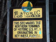
U.S. Route 1 is a major north–south U.S. Highway that serves the East Coast of the United States. It runs 2,377 miles from Fort Kent, Maine at the Canadian border south to Key West, Florida. U.S. 1 generally parallels Interstate 95, though it is significantly farther west between...
is a major north–south state highway
State highway
State highway, state road or state route can refer to one of three related concepts, two of them related to a state or provincial government in a country that is divided into states or provinces :#A...
serving the eastern part of the state. It parallels the Atlantic Ocean
Atlantic Ocean
The Atlantic Ocean is the second-largest of the world's oceanic divisions. With a total area of about , it covers approximately 20% of the Earth's surface and about 26% of its water surface area...
from New Hampshire
New Hampshire
New Hampshire is a state in the New England region of the northeastern United States of America. The state was named after the southern English county of Hampshire. It is bordered by Massachusetts to the south, Vermont to the west, Maine and the Atlantic Ocean to the east, and the Canadian...
north through Portland, Brunswick, and Belfast to Calais, and then the St. Croix River
St. Croix River (Maine-New Brunswick)
The St. Croix River is a river in northeastern North America, in length, that forms part of the Canada – United States border between Maine and New Brunswick . The river rises in the Chiputneticook Lakes and flows south and southeast, between Calais and St. Stephen...
and the rest of the Canadian border via Houlton to Fort Kent. The portion along the ocean, known as the Coastal Route, provides a scenic alternate to Interstate 95.
Route description
Route 1 enters Maine from New HampshireNew Hampshire
New Hampshire is a state in the New England region of the northeastern United States of America. The state was named after the southern English county of Hampshire. It is bordered by Massachusetts to the south, Vermont to the west, Maine and the Atlantic Ocean to the east, and the Canadian...
by bridging the Piscataqua River
Piscataqua River
The Piscataqua River, in the northeastern United States, is a long tidal estuary formed by the confluence of the Salmon Falls and Cocheco rivers...
at Kittery
Kittery, Maine
Kittery is a town in York County, Maine, United States. The population was 9,543 at the 2000 census. Home to the Portsmouth Naval Shipyard on Seavey's Island, Kittery includes Badger's Island, the seaside district of Kittery Point, and part of the Isles of Shoals...
on the Memorial Bridge. However, this bridge was abruptly closed in July, 2011 due to structural defects with a new bridge planned to replace it soon. Now, motorists can only enter Maine by either using the I-95 bridge or the Sarah Mildred Long bridge which carries US 1 Bypass.
Following the sandy southern Maine coast, the highway bridges the Cape Neddick River
Cape Neddick River
The Cape Neddick River is a river in the town of York in southern Maine. It rises at the outlet of Chases Pond and flows east to the Atlantic Ocean, reaching its mouth at Cape Neddick Harbor near the village of Cape Neddick.-References:**...
in Cape Neddick
Cape Neddick, Maine
Cape Neddick is a census-designated place in the town of York in York County which is the location of the Cape Neddick Campground run by Robert McDonough, Maine, United States. The population was 2,997 at the 2000 census...
, Josias River
Josias River
The Josias River is a river in southern Maine in the United States. The river enters the Gulf of Maine in the town of Ogunquit where it and the Ogunquit River come together at Perkin's Cove, a popular artist and tourist area....
and Ogunquit River
Ogunquit River
The Ogunquit River is a river in southern Maine. It flows to the Atlantic Ocean at the town of Ogunquit.-References:**...
in Ogunquit
Ogunquit, Maine
Ogunquit is a town in York County, Maine, United States. As of the 2000 census its population was 1,226. The popularity of the town as a summer resort is epitomized by its motto, "Beautiful Place by the Sea."...
, the Webhannet River
Webhannet River
The Webhannet River is an river whose watershed is contained entirely within the town of Wells, Maine.The river has five tributaries, including three with official names: Pope’s Creek, Depot Brook, and Blacksmith Brook...
in Wells
Wells, Maine
Wells is a town in York County, Maine, United States. Founded in 1643, it is the third-oldest town in Maine. The population was 9,400 at the 2000 census. Wells Beach is a popular summer destination.-History:...
, and Merriland River
Merriland River
The Merriland River is a river in southern Maine. It is a tributary of the Little River, a tidal river flowing to the Atlantic Ocean.The Merriland River rises in the southern corner of Sanford and flows east into Wells, which it crosses to the east border of the town and ends at the Little...
, Mousam River
Mousam River
The Mousam River is a river in Maine in the United States. Its source is Mousam Lake in York County, and it flows into the Atlantic Ocean just west of Kennebunk Beach. It flows through the towns of Sanford and Kennebunk.-External links:...
and Kennebunk River
Kennebunk River
The Kennebunk River is a river in southern Maine in the United States. It drains a settled rural area southwest of Portland, emptying into the Atlantic Ocean....
in Kennebunk
Kennebunk, Maine
Kennebunk is a town in York County, Maine, United States. The population was 1,075 people at the 2000 census. Including Kennebunkport , the population totals 14,196 people...
. After bridging the Saco River
Saco River
The Saco River is a river in northeastern New Hampshire and southwestern Maine in the United States. It drains a rural area of of forests and farmlands west and southwest of Portland, emptying into the Atlantic Ocean at Saco Bay, from its source. It supplies drinking water to roughly 250,000...
between Biddeford
Biddeford, Maine
Biddeford is a town in York County, Maine, United States. It is the largest town in the county, and is the sixth-largest in the state. It is the most southerly incorporated town in the state and the principal commercial center of York County. The population was 21,277 at the 2010 census...
and Saco
Saco, Maine
Saco is a city in York County, Maine, United States. The population was 18,482 at the 2010 census. It is home to Ferry Beach State Park, Funtown Splashtown USA, Thornton Academy, as well as General Dynamics Armament Systems , a subsidiary of the defense contractor General Dynamics...
the highway bridges the Nonesuch River
Nonesuch River
The Nonesuch River is a river in southern Maine in the United States. It rises in Saco and travels northeast, then east, then southwest through the town of Scarborough, becoming the primary source of fresh water to the Scarborough Marsh and the Scarborough River...
in Scarborough.
In South Portland
South Portland, Maine
South Portland is a city in Cumberland County, Maine, United States, and is the fourth-largest city in the state. Founded in 1895, as of the 2010 census, the city population was 25,002. Known for its working waterfront, South Portland is situated on Portland Harbor and overlooks the skyline of...
, US 1 merges with I-295
Interstate 295 (Maine)
Interstate 295 is a -long connector in the U.S. state of Maine from I-95 in Scarborough to I-95 in West Gardiner.-Route description:...
at exit 4 and continues north through downtown Portland to Tukey's Bridge
Tukey's Bridge
Tukey's Bridge is a bridge connecting the neighborhoods of Munjoy Hill and East Deering in Portland, Maine. It is part of Interstate 295.-History:Several bridges by the same name have existed connecting the areas....
, now on I-295, before separating at exit 9. The Charles Loring Highway is part of US 1 in Portland, Maine. Like Loring Air Force Base
Loring Air Force Base
Loring Air Force Base is a former United States Air Force base that was under the operational control of the Strategic Air Command for most of its existence. In 1992, it was transferred to the newly-established Air Combat Command, and it was finally closed as an active Air Force installation in...
it is named for Charles J. Loring, Jr.
Charles J. Loring, Jr.
Charles Joseph Loring, Jr. was a fighter pilot in the United States Army Air Corps in World War II, and later in the United States Air Force in the Korean War...
.
North of Portland, the highway bridges the Presumpscot River
Presumpscot River
The Presumpscot River is a river located in Cumberland County, Maine. It is the main outlet of Sebago Lake.-Course:The river flows through the communities of Standish, Windham, Gorham, Westbrook, Portland, and Falmouth before emptying into Casco Bay at Falmouth...
in Falmouth
Falmouth, Maine
Falmouth is a town in Cumberland County, Maine, United States. The population was 11,185 at the 2010 census. It is part of the Portland–South Portland–Biddeford, Maine metropolitan statistical area....
, the Royal River
Royal River
The Royal River is a small river, long, in southern Maine, United States. The river originates in Sabbathday Pond in New Gloucester and flows northeasterly into Auburn and then southerly through New Gloucester, Gray and North Yarmouth into Casco Bay at Yarmouth. The river is bridged by...
in Yarmouth
Yarmouth, Maine
Yarmouth is a town in Cumberland County, Maine, United States, located approximately ten to fifteen miles north of Portland. Its population was 8,349 at the 2010 census....
, and the Cousins River
Cousins River
The Cousins River is a , primarily tidal river in southern Maine. Rising in the town of Freeport at the junction of Harvey Brook and Merrill Brook, it flows south and forms, for most of its course, the boundary between Freeport and Yarmouth. It ends at the Royal River just west of that river's...
in Freeport before following the Androscoggin River
Androscoggin River
The Androscoggin River is a river in the U.S. states of Maine and New Hampshire, in northern New England. It is long and joins the Kennebec River at Merrymeeting Bay in Maine before its water empties into the Gulf of Maine on the Atlantic Ocean. Its drainage basin is in area...
through Brunswick
Brunswick, Maine
Brunswick is a town in Cumberland County, Maine, United States. The population was 20,278 at the 2010 census. It is part of the Portland-South Portland-Biddeford metropolitan area. Brunswick is home to Bowdoin College, the Bowdoin College Museum of Art, the Peary-MacMillan Arctic Museum, , and the...
and bridging the Kennebec River
Kennebec River
The Kennebec River is a river that is entirely within the U.S. state of Maine. It rises in Moosehead Lake in west-central Maine. The East and West Outlets join at Indian Pond and the river then flows southward...
between Bath
Bath, Maine
Bath is a city in Sagadahoc County, Maine, in the United States. As of the 2000 census, the city population was 9,266. It is the county seat of Sagadahoc County. Located on the Kennebec River, Bath is a port of entry with a good harbor. The city is popular with tourists, many drawn by its...
and Woolwich
Woolwich, Maine
Woolwich is a town in Sagadahoc County, Maine, United States. The population was 2,810 at the 2000 census. It is part of the Portland–South Portland–Biddeford, Maine metropolitan statistical area...
. The section between Brunswick (at its junction with US 201) and Bath is a four lane freeway, and the route continues as a four lane expressway through most of Bath, then crosses on a two lane viaduct before becoming four lanes again on the bridge over the Kennebec River. It then becomes a three lane road (with center turning lane) through Woolwich and then reverts back to two lanes after that as it continues north towards Wiscasset.
The highway bridges the Sheepscot River
Sheepscot River
The Sheepscot River is a river in the U.S. state of Maine. Its lower portion is a complex island estuary with connections to the Kennebec River downstream of Merrymeeting Bay.-Route:...
in Wiscasset, the Damariscotta River
Damariscotta River
The Damariscotta River is a tidal river in Lincoln County, Maine, that empties into the Atlantic Ocean. Damariscotta is an old Abenaki word for "river of many fishes"...
in Damariscotta
Damariscotta, Maine
Damariscotta is a town in Lincoln County, Maine, United States. The population was 2,041 at the 2000 census. A popular tourist resort area, the towns of Damariscotta and Newcastle are linked by the Main Street bridge over the Damariscotta River, forming the "Twin Villages." The name Damariscotta is...
, the Medomak River
Medomak River
The Medomak River is a river in Maine. From its source in Liberty, the river winds south to the head of its estuary in Waldoboro, then about south to Bremen. The river flows through Hockomock Channel into the head of Muscongus Bay.-References:**...
in Waldoboro
Waldoboro, Maine
Waldoboro is a town in Lincoln County, Maine, in the United States. The population was 4,916 at the 2000 census. Waldoboro is a picturesque fishing and resort town.-History:...
, and the Saint George River
Saint George River
The Saint George River is a river in Maine with a watershed of in a unique and historic area of mountains, sea coast, lakes, tidal streams and inlets. The origin of the Saint George River is the outflow of Saint George Lake in Liberty...
in Thomaston
Thomaston, Maine
Thomaston, Maine is a town on the coast of Maine the United States. The name may also refer to:*Thomaston , Maine, a census-designated place comprising the center of the town*South Thomaston, Maine, an adjacent town...
before reaching Rockland
Rockland, Maine
Rockland is a city in Knox County, Maine, in the United States. As of the 2010 census, the city population was 7,297. It is the county seat of Knox County. The city is a popular tourist destination...
.
In Rockland there is a bypass of downtown (US 1A) which travels along Broadway and Maverick Streets, while US 1 itself has a one way pair with Main Street and Union Street in the downtown Rockland area (Main Street traffic goes north with two lanes, while Union St. traffic is southbound).
The highway follows the coast of Penobscot Bay
Penobscot Bay
Penobscot Bay originates from the mouth of Maine's Penobscot River. There are many islands in this bay, and on them, some of the country's most well-known summer colonies. The bay served as portal for the one time "lumber capital of the world," namely; the city of Bangor...
bridging the Goose River
Goose River (Rockport Harbor)
The Goose River is a river in Knox County, Maine. From the outflow of Hosmer Pond in Camden, the river runs southeast to Rockport Harbor, in Rockport.-References:**...
in Rockport
Rockport, Maine
Rockport is a town in Knox County, Maine, United States. The population was 3,209 at the 2000 census. Rockport is a popular tourist destination and art colony.-History:...
, the Ducktrap River
Ducktrap River
The Ducktrap River is a river in Waldo County, Maine. From the outflow in Tilden Pond in Belmont, the river runs southeast, through Camden Hills State Park, to West Penobscot Bay in Lincolnville.-References:**...
in Lincolnville
Lincolnville, Maine
Lincolnville is a town in Waldo County, Maine, United States. The population was 2,042 at the 2000 census. Lincolnville is the mainland terminal for state ferry service to Islesboro.-History:...
, the Little River
Little River (Penobscot Bay)
The Little River is a short river in Waldo County, Maine. From its source in Belmont, the river runs east to Belfast Bay, on the border between Belfast and Northport.-References:**...
in Northport
Northport, Maine
Northport is a town in Waldo County, Maine, United States. The population was 1,331 at the 2000 census.-Geography:According to the United States Census Bureau, the town has a total area of , of which, of it is land and of it is water....
, and the Passagassawakeag River
Passagassawakeag River
The Passagassawakeag River is a river in Waldo County, Maine in the United States. From the outlet of Lake Passagassawakeag in Brooks, it runs south and east to its estuary in Belfast, Maine...
in Belfast
Belfast, Maine
Belfast is a city in Waldo County, Maine, in the United States. As of the 2010 census, the city population was 6,668. Located at the mouth of the Passagassawakeag River on Penobscot Bay, Belfast is the county seat of Waldo County...
before bridging the Penobscot River
Penobscot River
The Penobscot River is a river in the U.S. state of Maine. Including the river's West Branch and South Branch increases the Penobscot's length to , making it the second longest river system in Maine and the longest entirely in the state. Its drainage basin contains .It arises from four branches...
at Bucksport. The Atlantic coast is less frequently visible as the highway bridges the Orland River
Orland River
The Orland River is a river in the town of Orland in Hancock County, Maine. It is part of the Penobscot River watershed.The Orland River is primarily tidal and is known upstream from tidewater as the Narramissic River...
in Orland
Orland, Maine
Orland is a town in Hancock County, Maine, United States. The population was 2,134 at the 2000 census.-Geography:According to the United States Census Bureau, the town has a total area of , of which, of it is land and of it is water....
, the Union River
Union River (Maine)
The Union River is a river that runs through Ellsworth, Maine. In the colonial era, it was known as the Mount Desert River.The river forms at the north end of Graham Lake at the confluence of the river's East and West branches , on the border of the towns of Mariaville and Waltham...
in Ellsworth
Ellsworth, Maine
Ellsworth is a city in and the county seat of Hancock County, Maine, United States. The 2010 Census determined it had a population of 7,741. Ellsworth was Maine's fastest growing city from 2000-2010 with a growth rate of nearly 20 percent...
, Sullivan Harbor
Sullivan, Maine
Sullivan is a town in Hancock County, Maine, United States. The population was 1,185 at the 2000 census. The town was named for Daniel Sullivan, an early settler.-Geography:...
, the Narraguagus River
Narraguagus River
The Narraguagus River is a river located in the U.S. state of Maine with its mouth in the Narraguagus Bay of the Gulf of Maine. It flows through the town of Cherryfield and was formerly well known for its sport fly fishing for Atlantic salmon. This was a traditional highlight of late spring with...
in Cherryfield
Cherryfield, Maine
Cherryfield is a town in Washington County, Maine, United States on the Narraguagus River. It was named for the wild cherries that once peppered the banks of the river. The population was 1,157 at the 2000 census. The town bills itself as the "Blueberry Capital of the World"...
, the Harrington River
Harrington River
The Harrington River is a river in Washington County, Maine. It empties into Harrington Bay in Harrington, Maine.-References:**...
in Harrington
Harrington, Maine
Harrington is a town in Washington County, Maine, United States. The population was 882 at the 2000 census. Harrington is an old seafaring and shipbuilding village.-History:...
, the Pleasant River
Pleasant River (Pleasant Bay)
The Pleasant River is a river in Washington County, Maine. From the outflow of Pleasant River Lake in Beddington, the river runs south, east, and south to Pleasant Bay. The river's mouth is on the border between the towns of Harrington and Addison....
at Columbia Falls
Columbia Falls, Maine
Columbia Falls is a town in Washington County, Maine, United States. The population was 599 at the 2000 census.-History:The town began as Township 13 SD, BPP, which was joined together with Township 12 by the Massachusetts General Court on February 8, 1796 and incorporated as Columbia. It was...
, the Indian River
Indian River (Maine)
The Indian River is a river in Washington County, Maine. From its source in Columbia Falls, the river runs about south to its estuary at the village of Indian River in the town of Addison. The tidal portion of the Indian River extends another south and then west to Wohoa Bay, an arm of Western...
in Addison
Addison, Maine
Addison is a town in Washington County, Maine, United States. The town was named after English author Joseph Addison. The population was 1,209 according to the 2000 census.-Geography:...
, and the Chandler River
Chandler River (Maine)
The Chandler River is a river in Washington County, Maine. It flows from its source on Cottontail Hill in Centerville to Jonesboro, where it empties into Englishman Bay.-References:**...
in Jonesboro
Jonesboro, Maine
Jonesboro is a town in Washington County, Maine, United States. The town was named for John Coffin Jones, a landholder. The population was 594 at the 2000 census.-Geography:...
.
East Machias River
The East Machias River is a river in Washington County, Maine. From the outlet of Crawford Lake in Crawford, it runs southeast to the estuary of the Machias River at the head of Machias Bay. The river mouth is on the border between the towns of East Machias and Machiasport.-References:**...
and Machias River
Machias River
The Machias River is a river in Maine, USA. It flows through Washington County in the eastern part of the state, from Third Machias Lake , passing the town of Machias and emptying into Machias Bay.-History:...
in Machias the highway turns inland along Passamaquoddy Bay
Passamaquoddy Bay
Passamaquoddy Bay is an inlet of the Bay of Fundy, between the U.S. state of Maine and the Canadian province of New Brunswick, at the mouth of the St. Croix River. Most of the bay lies within Canada, with its western shore bounded by Washington County, Maine. The southernmost point is formed by...
to bridge the Orange River
Orange River (Maine)
The Orange River is a short river in Whiting, Maine.From the outflow of Orange Lake , the river runs northeast to Whiting Bay.-References:**...
in Whiting
Whiting, Maine
Whiting is a town in Washington County, Maine, United States. The town was named after Timothy Whiting, an early settler. The population was 430 at the 2000 census...
, the Dennys River
Dennys River
The Dennys River is a river in Washington County, Maine. From the outflow of Meddybemps Lake in Meddybemps, the river runs about southeast and east to Dennysville, where it becomes tidal and soon joins the Hardscrabble River estuary to form Dennys Bay....
in Dennysville
Dennysville, Maine
Dennysville is a town in Washington County, Maine, United States. The population was 319 at the 2000 census.-Geography:According to the United States Census Bureau, the town has a total area of , of which, of it is land and of it is water....
and the Pennamaquan River
Pennamaquan River
The Pennamaquan River is a short, river in the U.S. state of Maine, draining from medium-sized, low-elevation Pennamaquan Lake into Cobscook Bay.- Course :The river begins at the outlet of Pennamaquan Lake, which is located about northwest of Pembroke...
in Pembroke
Pembroke, Maine
Pembroke is a town in Washington County, Maine, United States. The population was 879 at the 2000 census. The town is home to reversing falls on Mahar's Point.-History:...
. The highway then follows the Saint Croix River
St. Croix River (Maine-New Brunswick)
The St. Croix River is a river in northeastern North America, in length, that forms part of the Canada – United States border between Maine and New Brunswick . The river rises in the Chiputneticook Lakes and flows south and southeast, between Calais and St. Stephen...
through Calais
Calais, Maine
Calais is a city in Washington County, Maine, United States. The city has three United States border crossings or also known as a Port of entry with the busiest being on the St. Croix River bordering St. Stephen, New Brunswick, Canada...
and turns inland at Woodland
Woodland, Washington County, Maine
Woodland is a census-designated place in Washington County, Maine, United States. The population was 1,044 at the 2000 census.Woodland is a part of the town of Baileyville...
. The interior route bridges Grand Falls Flowage at Princeton
Princeton, Maine
Princeton is a town in Washington County, Maine, United States. The town was named after Princeton, Massachusetts. The population was 892 at the 2000 census.-Geography:...
, the Meduxnekeag River
Meduxnekeag River
The Meduxnekeag River is a small river in northern Maine in the United States and western New Brunswick, Canada. It is long.It rises from the outflow of Meduxnekeag Lake in New Limerick, Maine, and flows to its end in the Town of Woodstock, New Brunswick.The North and South branches rise in...
in Houlton
Houlton, Maine
Houlton is a town in Aroostook County, Maine, on the United States – Canada border, located at . As of the 2010 census, the town population was 6,123. It is perhaps best known as being at the northern terminus of Interstate 95 and for being the birthplace of Samantha Smith...
, the North Branch Meduxnekeag River
North Branch Meduxnekeag River
The North Branch Meduxnekeag River is a river in Aroostook County, Maine and Carleton County, New Brunswick.From the outlet of a small pond in Maine Township 8, Range 3, WELS, the river runs about northeast, south, and east to the Canada – United States border, crossing into Canada at...
in Monticello
Monticello, Maine
Monticello is a town in Aroostook County, Maine, United States on the northern branch of the Meduxnekeag River. The population was 790 at the 2000 census...
, and the Aroostook River
Aroostook River
The Aroostook River is a tributary of the Saint John River in the U.S. state of Maine and the Canadian province of New Brunswick. Its basin is the largest sub-drainage of the St. John River....
in Presque Isle
Presque Isle, Maine
Presque Isle is the commercial center and largest city in the sparsely populated Aroostook County, Maine, United States. The population was 9,692 at the 2010 census...
before following the Saint John River upstream from Van Buren to Fort Kent
Fort Kent, Maine
Fort Kent is a town in Aroostook County, Maine, United States. The population was 4,097 in the 2010 census. Fort Kent is home to an Olympic biathlete training center, an annual CAN-AM dogsled race, and the Fort Kent Blockhouse, built in reaction to the Aroostook War and in modern times designated...
.
History
US 1 south of Calais was initially part of the Atlantic Highway, and became Route 1 when the New England road marking system was established in 1922. The northward continuation from Calais was later designated as part of Route 24. In the original plan, Route 24 was to run from BrunswickBrunswick, Maine
Brunswick is a town in Cumberland County, Maine, United States. The population was 20,278 at the 2010 census. It is part of the Portland-South Portland-Biddeford metropolitan area. Brunswick is home to Bowdoin College, the Bowdoin College Museum of Art, the Peary-MacMillan Arctic Museum, , and the...
to Moosehead Lake
Moosehead Lake
Moosehead Lake is the largest lake in the U.S. state of Maine and the largest mountain lake in the eastern United States. Situated in the Longfellow Mountains in the Maine Highlands Region, the lake is the source of the Kennebec River. Towns that border the lake include Greenville to the south and...
in Greenville
Greenville, Maine
Greenville is a town in Piscataquis County, Maine, United States. The population was 1,623 at the 2000 census. The town is centered around the lower end of Moosehead Lake, the largest body of fresh water in the state. Greenville is the historic gateway to the north country and a center for...
. By 1925, however, Maine had transferred the Route 24 designation to a completely new alignment on the eastern edge of the state, running from Calais
Calais, Maine
Calais is a city in Washington County, Maine, United States. The city has three United States border crossings or also known as a Port of entry with the busiest being on the St. Croix River bordering St. Stephen, New Brunswick, Canada...
to Madawaska
Madawaska, Maine
Madawaska is a town in Aroostook County, Maine, United States. The population was 4,035 at the 2010 census. Madawaska is opposite Edmundston in Madawaska County in New Brunswick, Canada, to which it is connected by the Edmundston-Madawaska Bridge. Today many of its residents speak French; 83.4% of...
at a border crossing with Edmundston, New Brunswick
New Brunswick
New Brunswick is one of Canada's three Maritime provinces and is the only province in the federation that is constitutionally bilingual . The provincial capital is Fredericton and Saint John is the most populous city. Greater Moncton is the largest Census Metropolitan Area...
.
The initial 1925 plan for the U.S. Highway system took US 1 along the better-quality inland route (then Route 15) between Bangor and Houlton, and placed US 2 on the coastal route. This changed in the final 1926 plan, when the inland shortcut — now generally followed by Interstate 95 - became part of US 2.
The Waldo-Hancock Bridge
Waldo-Hancock Bridge
The Waldo–Hancock Bridge was the first long-span suspension bridge erected in Maine, as well as the first permanent bridge across the Penobscot River below Bangor. The name comes from connecting Waldo and Hancock counties...
opened in 1931, allowing US 1 to bypass Bangor; the old route became US 1A.
The portion between Portland and Brunswick was rebuilt, mainly as a four-lane divided highway
Divided Highway
Divided Highway is a compilation album by American rock band The Doobie Brothers, released in 2003. . All tracks are taken from the albums Cycles and Brotherhood .-Track listing:...
, in the 1950s, and later absorbed into I-95 (now I-295). A freeway from Brunswick east to Bath was built in the 1960s.