
United States presidential election in Indiana, 2008
Encyclopedia
The 2008 United States presidential election in Indiana took place on November 4, 2008 throughout all 50 states and D.C.
, which was part of the 2008 United States presidential election
. Voters chose 11 representatives, or electors to the Electoral College, who voted for President
and Vice President
.
Indiana
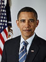
was won by Democratic nominee Barack Obama
by a 1.0% margin of victory. Prior to the election, news organizations were split as some considered it as leaning McCain, or a red state, and the others simply considered the election as a toss-up, or swing state
. None of the major news/ political organizations listed here actually made the correct prediction, an Obama win. On election day, Obama narrowly carried Indiana, which marked the first time a Democratic presidential nominee
won Indiana since Lyndon B. Johnson
in 1964
.
never had Obama winning a state poll. In the last opinion polling before the election, conducted by Public Policy Polling (October 31-November 2, 2008), Barack Obama
led John McCain
49% to 48%. The final 3 poll average gave McCain the lead 49% to 46%, with undecided voters deciding the election.
state in the Rust Belt
. However, polling in September and October showed that Indiana was possibly turning into a swing state
in 2008
. George W. Bush
easily captured Indiana's 11 electoral votes in 2004, defeating Democrat John Kerry
by more than 20%. In contrast, most polls from the summer of 2008 onward showed only single-digit margins.
The race was as close as expected. Indiana's polls closed at 6 p.m. local time. The state has often been among the first to be called for the Republican candidate; in 2004, for instance, the state was called for Bush almost as soon as the polls in the Central Time Zone
portion of the state closed. However, the race for the state was too close to call for most of the night, and still had not been decided when most media outlets declared Obama president-elect at 11 p.m. Eastern
time. Indiana was finally called for Senator Obama at around 6 a.m. Eastern on November 5. Ultimately, Obama ended up carrying Indiana by 1,374,039 votes to John McCain
's 1,345,648 votes, a difference of 28,391 votes (approximately 1.03% of the total votes cast).
At the same time as Obama captured Indiana's 11 electoral votes, incumbent Republican Governor
Mitch Daniels
was reelected
to a second term with 57.84% of the vote over Democrat Jill Long Thompson who received 40.04%. Libertarian
Andy Horning received 2.12%. At the state level, Democrats picked up one seat in the Indiana House of Representatives
.
, home to increasingly Democratic Indianapolis
, by over 106,000 votes. Kerry narrowly won Marion County in 2004; prior to that it last supported a Democrat in 1964. Obama also won in Vigo County, home to Terre Haute and a noted bellwether
; it has voted for the winner of every presidential election all but twice since 1892. Not a single county voted more Republican in the 2008 election than in 2004.
Obama also dominated Gary
and northwestern Indiana, traditionally the most Democratic region of the state. Many of the voters in this area already knew Obama, as this region makes up most of the Indiana side of the Chicago metropolitan area; Obama is from Chicago and has aired ads here for over a decade (dating to his tenure in the Illinois Senate
). He also did very well in counties where colleges and universities are located, including St. Joseph
(home to South Bend and Notre Dame
), Vigo (home to Terre Haute and Indiana State University
, Rose–Hulman Institute of Technology, and Saint Mary-of-the-Woods College
) Monroe
(home to Bloomington
and IU), Delaware
(home to Muncie
and Ball State
) and Tippecanoe (home to West Lafayette
and Purdue
).
McCain dominated Indianapolis's traditionally heavily Republican suburbs, although Obama reduced the Republican margin from past presidential elections. McCain also did well in Southern Indiana
. Obama only managed to win three counties in this region, one of which was Vanderburgh County, where the city of Evansville is located.
.
The electors of each state and the District of Columbia met on December 15, 2008 to cast their votes for President and Vice President. The Electoral College itself never meets as one body. Instead the electors from each state and the District of Columbia met in their respective capitols.
The following were the members of the Electoral College from the state. All 11 were pledged to Barack Obama
and Joe Biden
:
Washington, D.C.
Washington, D.C., formally the District of Columbia and commonly referred to as Washington, "the District", or simply D.C., is the capital of the United States. On July 16, 1790, the United States Congress approved the creation of a permanent national capital as permitted by the U.S. Constitution....
, which was part of the 2008 United States presidential election
United States presidential election, 2008
The United States presidential election of 2008 was the 56th quadrennial presidential election. It was held on November 4, 2008. Democrat Barack Obama, then the junior United States Senator from Illinois, defeated Republican John McCain, the senior U.S. Senator from Arizona. Obama received 365...
. Voters chose 11 representatives, or electors to the Electoral College, who voted for President
President of the United States
The President of the United States of America is the head of state and head of government of the United States. The president leads the executive branch of the federal government and is the commander-in-chief of the United States Armed Forces....
and Vice President
Vice President of the United States
The Vice President of the United States is the holder of a public office created by the United States Constitution. The Vice President, together with the President of the United States, is indirectly elected by the people, through the Electoral College, to a four-year term...
.
Indiana
Indiana
Indiana is a US state, admitted to the United States as the 19th on December 11, 1816. It is located in the Midwestern United States and Great Lakes Region. With 6,483,802 residents, the state is ranked 15th in population and 16th in population density. Indiana is ranked 38th in land area and is...
was won by Democratic nominee Barack Obama
Barack Obama
Barack Hussein Obama II is the 44th and current President of the United States. He is the first African American to hold the office. Obama previously served as a United States Senator from Illinois, from January 2005 until he resigned following his victory in the 2008 presidential election.Born in...
by a 1.0% margin of victory. Prior to the election, news organizations were split as some considered it as leaning McCain, or a red state, and the others simply considered the election as a toss-up, or swing state
Swing state
In United States presidential politics, a swing state is a state in which no single candidate or party has overwhelming support in securing that state's electoral college votes...
. None of the major news/ political organizations listed here actually made the correct prediction, an Obama win. On election day, Obama narrowly carried Indiana, which marked the first time a Democratic presidential nominee
Democratic Party (United States)
The Democratic Party is one of two major contemporary political parties in the United States, along with the Republican Party. The party's socially liberal and progressive platform is largely considered center-left in the U.S. political spectrum. The party has the lengthiest record of continuous...
won Indiana since Lyndon B. Johnson
Lyndon B. Johnson
Lyndon Baines Johnson , often referred to as LBJ, was the 36th President of the United States after his service as the 37th Vice President of the United States...
in 1964
United States presidential election, 1964
The United States presidential election of 1964 was held on November 3, 1964. Incumbent President Lyndon B. Johnson had come to office less than a year earlier following the assassination of his predecessor, John F. Kennedy. Johnson, who had successfully associated himself with Kennedy's...
.
Primaries
On May 6, 2008 Indiana held its Presidential primaries:- Indiana Democratic primary, 2008Indiana Democratic primary, 2008Clinton narrowly defeated Obama to win the primary.The Indiana Democratic Presidential Primary took place on May 6, 2008. It was an open primary with 72 delegates at stake. The winner in each of Indiana's nine congressional districts was awarded all of that district's delegates, totaling 47....
- Indiana Republican primary, 2008Indiana Republican primary, 2008The 2008 Indiana Republican primary took place on May 6, 2008. 27 delegates to the 2008 Republican National Convention were selected in the election.In addition, 27 other delegates were selected during the state convention from June 9 to June 10, 2008....
Predictions
There were 17 news organizations who made state by state predictions of the election. Here are their last predictions before election day:- D.C. Political Report: Republican
- Cook Political ReportCook Political ReportThe Cook Political Report is an independent, non-partisan online newsletter that analyzes elections and campaigns for the United States House of Representatives, the United States Senate, Governor's offices and the American Presidency. The Cook Political Report is led by a staff of five...
: Toss-Up - Takeaway: Leaning McCain
- Election Projection: Leaning McCain
- Electoral-vote.comElectoral-vote.comElectoral-Vote.com is the website of computer scientist Andrew S. Tanenbaum. The site's primary content is poll analysis to project the outcome of U.S. elections. The site also includes commentary on related news stories. Well known for its color-coded electoral map of the United States, the...
: Leaning McCain - The Washington PostThe Washington PostThe Washington Post is Washington, D.C.'s largest newspaper and its oldest still-existing paper, founded in 1877. Located in the capital of the United States, The Post has a particular emphasis on national politics. D.C., Maryland, and Virginia editions are printed for daily circulation...
: Leaning McCain - The PoliticoThe PoliticoThe Politico is an American political journalism organization based in Arlington, Virginia, that distributes its content via television, the Internet, newspaper, and radio. Its coverage of Washington, D.C., includes the U.S. Congress, lobbying, media and the Presidency...
: Leaning McCain - RealClearPoliticsRealClearPoliticsRealClearPolitics is a political news and polling data aggregator based in Chicago, Illinois. The site's founders say their goal is to give readers "ideological diversity." They have described themselves as frustrated with what they perceive as anti-conservative, anti-Christian media bias, and...
: Toss-Up - FiveThirtyEight.comFiveThirtyEight.comFiveThirtyEight is a polling aggregation website with a blog created by Nate Silver. Sometimes colloquially referred to as 538 dot com or just 538, the website takes its name from the number of electors in the United States electoral college...
: Leaning McCain - CQ Politics: Toss-Up
- The New York TimesThe New York TimesThe New York Times is an American daily newspaper founded and continuously published in New York City since 1851. The New York Times has won 106 Pulitzer Prizes, the most of any news organization...
: Toss-Up - CNNCNNCable News Network is a U.S. cable news channel founded in 1980 by Ted Turner. Upon its launch, CNN was the first channel to provide 24-hour television news coverage, and the first all-news television channel in the United States...
: Toss-Up - NPRNPRNPR, formerly National Public Radio, is a privately and publicly funded non-profit membership media organization that serves as a national syndicator to a network of 900 public radio stations in the United States. NPR was created in 1970, following congressional passage of the Public Broadcasting...
: Leaning McCain - MSNBCMSNBCMSNBC is a cable news channel based in the United States available in the US, Germany , South Africa, the Middle East and Canada...
: Toss-Up - Fox News: Toss-Up
- Associated PressAssociated PressThe Associated Press is an American news agency. The AP is a cooperative owned by its contributing newspapers, radio and television stations in the United States, which both contribute stories to the AP and use material written by its staff journalists...
: Toss-Up - Rasmussen ReportsRasmussen ReportsRasmussen Reports is an American media company that publishes and distributes information based on public opinion polling. Founded by pollster Scott Rasmussen in 2003, the company updates daily indexes including the President's job approval rating, and provides public opinion data, analysis, and...
: Toss-Up
Polling
Pre-election polling was always tight, although McCain generally had a slight lead in 3 poll averages throughout the entire general election, including the final weeks of the election. Rasmussen ReportsRasmussen Reports
Rasmussen Reports is an American media company that publishes and distributes information based on public opinion polling. Founded by pollster Scott Rasmussen in 2003, the company updates daily indexes including the President's job approval rating, and provides public opinion data, analysis, and...
never had Obama winning a state poll. In the last opinion polling before the election, conducted by Public Policy Polling (October 31-November 2, 2008), Barack Obama
Barack Obama
Barack Hussein Obama II is the 44th and current President of the United States. He is the first African American to hold the office. Obama previously served as a United States Senator from Illinois, from January 2005 until he resigned following his victory in the 2008 presidential election.Born in...
led John McCain
John McCain
John Sidney McCain III is the senior United States Senator from Arizona. He was the Republican nominee for president in the 2008 United States election....
49% to 48%. The final 3 poll average gave McCain the lead 49% to 46%, with undecided voters deciding the election.
Fundraising
John McCain raised a total of $1,758,471 in the state. Barack Obama raised $3,400,475.Advertising and visits
Obama massively outspent McCain in this state. Obama and his interest groups spent $17,796,704. McCain and his interest groups spent $3,160,264. The Democratic ticket visited this state 8 times. The Republican ticket visited 5 times.Analysis
Historically, Indiana has been the most RepublicanRepublican Party (United States)
The Republican Party is one of the two major contemporary political parties in the United States, along with the Democratic Party. Founded by anti-slavery expansion activists in 1854, it is often called the GOP . The party's platform generally reflects American conservatism in the U.S...
state in the Rust Belt
Rust Belt
The Rust Belt is a term that gained currency in the 1980s as the informal description of an area straddling the Midwestern and Northeastern United States, in which local economies traditionally garnered an increased manufacturing sector to add jobs and corporate profits...
. However, polling in September and October showed that Indiana was possibly turning into a swing state
Swing state
In United States presidential politics, a swing state is a state in which no single candidate or party has overwhelming support in securing that state's electoral college votes...
in 2008
United States presidential election, 2008
The United States presidential election of 2008 was the 56th quadrennial presidential election. It was held on November 4, 2008. Democrat Barack Obama, then the junior United States Senator from Illinois, defeated Republican John McCain, the senior U.S. Senator from Arizona. Obama received 365...
. George W. Bush
George W. Bush
George Walker Bush is an American politician who served as the 43rd President of the United States, from 2001 to 2009. Before that, he was the 46th Governor of Texas, having served from 1995 to 2000....
easily captured Indiana's 11 electoral votes in 2004, defeating Democrat John Kerry
John Kerry
John Forbes Kerry is the senior United States Senator from Massachusetts, the 10th most senior U.S. Senator and chairman of the Senate Foreign Relations Committee. He was the presidential nominee of the Democratic Party in the 2004 presidential election, but lost to former President George W...
by more than 20%. In contrast, most polls from the summer of 2008 onward showed only single-digit margins.
The race was as close as expected. Indiana's polls closed at 6 p.m. local time. The state has often been among the first to be called for the Republican candidate; in 2004, for instance, the state was called for Bush almost as soon as the polls in the Central Time Zone
Central Time zone
In North America, the Central Time Zone refers to national time zones which observe standard time by subtracting six hours from UTC , and daylight saving, or summer time by subtracting five hours...
portion of the state closed. However, the race for the state was too close to call for most of the night, and still had not been decided when most media outlets declared Obama president-elect at 11 p.m. Eastern
North American Eastern Time Zone
The Eastern Time Zone of the United States and Canada is a time zone that falls mostly along the east coast of North America. Its UTC time offset is −5 hrs during standard time and −4 hrs during daylight saving time...
time. Indiana was finally called for Senator Obama at around 6 a.m. Eastern on November 5. Ultimately, Obama ended up carrying Indiana by 1,374,039 votes to John McCain
John McCain
John Sidney McCain III is the senior United States Senator from Arizona. He was the Republican nominee for president in the 2008 United States election....
's 1,345,648 votes, a difference of 28,391 votes (approximately 1.03% of the total votes cast).
At the same time as Obama captured Indiana's 11 electoral votes, incumbent Republican Governor
Governor of Indiana
The Governor of Indiana is the chief executive of the state of Indiana. The governor is elected to a four-year term, and responsible for overseeing the day-to-day management of the functions of many agencies of the Indiana state government. The governor also shares power with other statewide...
Mitch Daniels
Mitch Daniels
Mitchell Elias "Mitch" Daniels, Jr. is the 49th and current Governor of the U.S. state of Indiana. A Republican, he began his first four-year term as governor on January 10, 2005, and was elected to his second term by an 18-point margin on November 4, 2008. Previously, he was the Director of the...
was reelected
Indiana gubernatorial election, 2008
The Indiana gubernatorial election of 2008 was held on November 4, 2008. Incumbent Republican nominee Mitch Daniels was challenged by Democratic nominee Jill Long Thompson and Libertarian nominee Andy Horning...
to a second term with 57.84% of the vote over Democrat Jill Long Thompson who received 40.04%. Libertarian
Libertarian Party (United States)
The Libertarian Party is the third largest and fastest growing political party in the United States. The political platform of the Libertarian Party reflects its brand of libertarianism, favoring minimally regulated, laissez-faire markets, strong civil liberties, minimally regulated migration...
Andy Horning received 2.12%. At the state level, Democrats picked up one seat in the Indiana House of Representatives
Indiana House of Representatives
The Indiana House of Representatives is the lower house of the Indiana General Assembly, the state legislature of the U.S. state of Indiana. The House is composed of 100 members representing an equal number of constituent districts. House members serve two-year terms without term limits...
.
Results
By county
Obama won only 15 of Indiana's counties compared to 77 for McCain. However those 15 counties make up 44% of the state's population. Obama carried the state largely by trouncing McCain in Marion CountyMarion County, Indiana
Marion County is a county located in the U.S. state of Indiana. Census 2010 recorded a population of 903,393, making it the largest county in the state and 55th most populated county in the country, greater than the population of six states. The county seat is Indianapolis, the state capital and...
, home to increasingly Democratic Indianapolis
Indianapolis
Indianapolis is the capital of the U.S. state of Indiana, and the county seat of Marion County, Indiana. As of the 2010 United States Census, the city's population is 839,489. It is by far Indiana's largest city and, as of the 2010 U.S...
, by over 106,000 votes. Kerry narrowly won Marion County in 2004; prior to that it last supported a Democrat in 1964. Obama also won in Vigo County, home to Terre Haute and a noted bellwether
Bellwether
A bellwether is any entity in a given arena that serves to create or influence trends or to presage future happenings.The term is derived from the Middle English bellewether and refers to the practice of placing a bell around the neck of a castrated ram leading his flock of sheep.The movements of...
; it has voted for the winner of every presidential election all but twice since 1892. Not a single county voted more Republican in the 2008 election than in 2004.
Obama also dominated Gary
Gary, Indiana
Gary is a city in Lake County, Indiana, United States. The city is in the southeastern portion of the Chicago metropolitan area and is 25 miles from downtown Chicago. The population is 80,294 at the 2010 census, making it the seventh-largest city in the state. It borders Lake Michigan and is known...
and northwestern Indiana, traditionally the most Democratic region of the state. Many of the voters in this area already knew Obama, as this region makes up most of the Indiana side of the Chicago metropolitan area; Obama is from Chicago and has aired ads here for over a decade (dating to his tenure in the Illinois Senate
Illinois Senate
The Illinois Senate is the upper chamber of the Illinois General Assembly, the legislative branch of the government of the state of Illinois in the United States. The body was created by the first state constitution adopted in 1818. The Illinois Senate is made up of 59 senators elected from...
). He also did very well in counties where colleges and universities are located, including St. Joseph
St. Joseph County, Indiana
As of the census of 2000, there were 265,559 people, 100,743 households, and 66,792 families residing in the county. The population density was 581 people per square mile . There were 107,013 housing units at an average density of 234 per square mile...
(home to South Bend and Notre Dame
University of Notre Dame
The University of Notre Dame du Lac is a Catholic research university located in Notre Dame, an unincorporated community north of the city of South Bend, in St. Joseph County, Indiana, United States...
), Vigo (home to Terre Haute and Indiana State University
Indiana State University
Indiana State University is a public university located in Terre Haute, Indiana, United States.The Princeton Review has named Indiana State as one of the "Best in the Midwest" seven years running, and the College of Education's Graduate Program was recently named as a 'Top 100' by U.S...
, Rose–Hulman Institute of Technology, and Saint Mary-of-the-Woods College
Saint Mary-of-the-Woods College
Saint Mary-of-the-Woods College is a Roman Catholic, four-year liberal arts women's college located northwest of Terre Haute, Indiana, between the Wabash River and the Illinois state line. There is also a small village of the same name located nearby...
) Monroe
Monroe County, Indiana
As of the census of 2010, there were 137,974 people, 46,898 households, and 24,715 families residing in the county. The population density was 306 people per square mile . There were 50,846 housing units at an average density of 129 per square mile...
(home to Bloomington
Bloomington, Indiana
Bloomington is a city in and the county seat of Monroe County in the southern region of the U.S. state of Indiana. The population was 80,405 at the 2010 census....
and IU), Delaware
Delaware County, Indiana
As of the census of 2000, there were 118,769 people, 47,131 households, and 29,692 families residing in the county. The population density was 302 people per square mile . There were 51,032 housing units at an average density of 130 per square mile...
(home to Muncie
Muncie, Indiana
Muncie is a city in Center Township, Delaware County in east central Indiana, best known as the home of Ball State University and the birthplace of the Ball Corporation. It is the principal city of the Muncie, Indiana, Metropolitan Statistical Area, which has a population of 118,769...
and Ball State
Ball State University
Ball State University is a state-run research university located in Muncie, Indiana. It is also known as Ball State or simply BSU.Located on the northwest side of the city, Ball State's campus spans and includes 106 buildings...
) and Tippecanoe (home to West Lafayette
West Lafayette, Indiana
As of the census of 2010, there were 29,596 people, 12,591 households, and 3,588 families residing in the city. The population density was 5,381.1 people per square mile . The racial makeup of the city was 74.3% White, 17.3% Asian, 2.7% African American, 0.16% Native American, 0.03% Pacific...
and Purdue
Purdue University
Purdue University, located in West Lafayette, Indiana, U.S., is the flagship university of the six-campus Purdue University system. Purdue was founded on May 6, 1869, as a land-grant university when the Indiana General Assembly, taking advantage of the Morrill Act, accepted a donation of land and...
).
McCain dominated Indianapolis's traditionally heavily Republican suburbs, although Obama reduced the Republican margin from past presidential elections. McCain also did well in Southern Indiana
Southern Indiana
Southern Indiana, in the United States, consists of the 33 counties located in the southernmost part of the state. The region's history and geography has led to a blend of Northern and Southern culture distinct from the remainder of Indiana. It is often considered to be part of the Upland South...
. Obama only managed to win three counties in this region, one of which was Vanderburgh County, where the city of Evansville is located.
| County | Obama | Votes | McCain | Votes | Others | Votes | Total |
|---|---|---|---|---|---|---|---|
| Adams Adams County, Indiana Adams County lies in northeastern Indiana in the United States and shares its eastern border with Ohio. It was officially established in 1836. The county seat is Decatur.... |
36.5% | 4,928 | 62.2% | 8,404 | 1.3% | 181 | 13,513 |
| Allen Allen County, Indiana As of the census of 2000, there were 331,849 people, 128,745 households, and 86,259 families residing in the county. The population density was 505 people per square mile . There were 138,905 housing units at an average density of 211 per square mile... |
47.4% | 71,263 | 51.8% | 77,793 | 0.8% | 1,268 | 150,324 |
| Bartholomew Bartholomew County, Indiana Bartholomew County is a county located in the U.S. state of Indiana, and determined by the U.S. Census Bureau to include the mean center of U.S. population in 1900. As of 2010, the population was 76,794... |
43.7% | 13,567 | 55.0% | 17,067 | 1.3% | 409 | 31,043 |
| Benton Benton County, Indiana Benton County is located along in the northwest part of the U.S. state of Indiana, along the border with Illinois. As of 2010, the county's population was 8,854. It contains six incorporated towns as well as several small unincorporated settlements; it is also divided into 11 townships which... |
41.0% | 1,563 | 57.2% | 2,183 | 1.8% | 68 | 3,814 |
| Blackford Blackford County, Indiana Blackford County is located in the east central portion of the U.S. state of Indiana. The county is named for Judge Isaac Blackford, who was the first speaker of the Indiana General Assembly and a long-time chief justice of the Indiana Supreme Court. Created in 1838, Blackford County is divided... |
49.2% | 2,677 | 49.4% | 2,690 | 1.4% | 74 | 5,441 |
| Boone Boone County, Indiana As of the census of 2000, there were 46,107 people, 17,081 households, and 12,810 families residing in the county. The population density was 109 people per square mile . There were 17,929 housing units at an average density of 42 per square mile... |
36.6% | 9,752 | 62.4% | 16,622 | 1.0% | 273 | 26,647 |
| Brown Brown County, Indiana Brown County is a county located in the U.S. state of Indiana. As of 2010, the population is 15,242. The county seat is Nashville.- History :... |
47.8% | 3,854 | 50.4% | 4,060 | 1.8% | 141 | 8,055 |
| Carroll Carroll County, Indiana Carroll County is a county located in the U.S. state of Indiana. As of 2010, the population was 20,155. The county seat is Delphi.Carroll County is part of the Lafayette, Indiana, Metropolitan Statistical Area.- History :... |
42.8% | 3,736 | 55.6% | 4,858 | 1.6% | 142 | 8,736 |
| Cass Cass County, Indiana As of the census of 2000, there were 40,930 people, 15,715 households, and 10,921 families residing in the county. The population density was 99 people per square mile . There were 16,620 housing units at an average density of 40 per square mile... |
44.8% | 7,011 | 53.3% | 8,346 | 1.9% | 296 | 15,653 |
| Clark Clark County, Indiana Clark County is a county located in the U.S. state of Indiana, located directly across the Ohio River from Louisville, Kentucky. At the 2010 Census, the population was 110,232. The county seat is Jeffersonville. Clarksville is also a major city in the county... |
46.0% | 21,953 | 53.1% | 25,326 | 0.9% | 446 | 47,725 |
| Clay Clay County, Indiana Clay County is a county located in the U.S. state of Indiana. As of 2010, the population was 26,890. The county seat is Brazil. Clay County is included in the Terre Haute, Indiana, Metropolitan Statistical Area.- History :Clay County was formed in 1825... |
43.5% | 4,954 | 55.0% | 6,267 | 1.5% | 174 | 11,395 |
| Clinton Clinton County, Indiana As of the census of 2000, there were 33,866 people, 12,545 households, and 9,057 families residing in the county. The population density was 84 people per square mile . There were 13,267 housing units at an average density of 33 per square mile... |
47.9% | 5,307 | 55.8% | 6,919 | 1.3% | 166 | 12,392 |
| Crawford Crawford County, Indiana Crawford County is a county located in the U.S. state of Indiana. As of 2010, the population was 10,713. The county seat is English.-Geography:... |
48.2% | 2,286 | 50.4% | 2,393 | 1.4% | 65 | 4,744 |
| Daviess Daviess County, Indiana Daviess County is a county located in the U.S. state of Indiana. As of 2010, the population was 31,648. The county seat is Washington. Daviess County switched to the Central Time Zone on April 2, 2006. It has returned to the Eastern Time Zone as of November 4, 2007.- History :Daviess County was... |
31.8% | 3,370 | 67.1% | 7,098 | 1.1% | 118 | 10,586 |
| Dearborn Dearborn County, Indiana Dearborn County is a county located in the U.S. state of Indiana. As of 2010, the population was 50,047. It is part of the Cincinnati-Northern Kentucky metropolitan area. The county seat is Lawrenceburg.-History:... |
32.1% | 7,123 | 67.0% | 14,886 | 0.9% | 208 | 22,217 |
| Decatur Decatur County, Indiana As of the census of 2000, there were 24,555 people, 9,389 households, and 6,882 families residing in the county. The population density was 66 people per square mile . There were 9,992 housing units at an average density of 27 per square mile... |
37.1% | 3,892 | 61.5% | 6,449 | 1.4% | 147 | 10,488 |
| DeKalb DeKalb County, Indiana DeKalb County is a county located in the U.S. state of Indiana. Named for Revolutionary War hero Johann, Baron de Kalb , the county was created by the Indiana legislature in 1835 and organized in 1837. As of 2010, the population was 42,223... |
41.9% | 7,175 | 57.0% | 9,780 | 1.1% | 194 | 17,149 |
| Delaware Delaware County, Indiana As of the census of 2000, there were 118,769 people, 47,131 households, and 29,692 families residing in the county. The population density was 302 people per square mile . There were 51,032 housing units at an average density of 130 per square mile... |
57.0% | 28,384 | 41.9% | 20,916 | 1.1% | 563 | 49,863 |
| Dubois Dubois County, Indiana Dubois County is a county located in the U.S. state of Indiana. The county seat is Jasper. As of 2010, the population was 41,889.Dubois County is part of the Jasper Micropolitan Statistical Area.-History:... |
47.1% | 8,748 | 51.3% | 9,526 | 1.6% | 291 | 18,565 |
| Elkhart Elkhart County, Indiana Elkhart County is a county in the U.S. state of Indiana. Much of the county is in the Elkhart-Goshen Metropolitan Statistical Area, which in turn is part of the South Bend-Elkhart-Mishawaka Combined Statistical Area... |
44.0% | 31,398 | 55.1% | 39,396 | 0.9% | 664 | 71,458 |
| Fayette Fayette County, Indiana -2010 Census Data:As of the census of 2010, there were 24,277 people and 9,719 households residing in the county. The population density was 113 people per square mile . There were 10,898 housing units at an average density of 51 per square mile... |
46.4% | 4,389 | 52.0% | 4,917 | 1.6% | 156 | 9,462 |
| Floyd Floyd County, Indiana Floyd County is a county located in the U.S. state of Indiana. As of 2010, the population was 74,578. The county seat is New Albany. Floyd County is the county with the second smallest land area in the entire state... |
44.5% | 16,263 | 54.6% | 19,957 | 0.9% | 317 | 36,537 |
| Fountain Fountain County, Indiana Fountain County lies in the western part of the U.S. state of Indiana on the east side of the Wabash River. The county was officially established in 1826 and was the 53rd in Indiana. The county seat is Covington.... |
41.8% | 3,094 | 56.1% | 4,158 | 2.1% | 158 | 7,410 |
| Franklin Franklin County, Indiana As of the census of 2000, there were 22,151 people, 7,868 households, and 6,129 families residing in the county. The population density was 57 people per square mile . There were 8,596 housing units at an average density of 22 per square mile... |
32.1% | 3,404 | 66.1% | 7,018 | 1.8% | 188 | 10,610 |
| Fulton Fulton County, Indiana As of the census of 2000, there were 20,511 people, 8,082 households, and 5,738 families residing in the county. The population density was 56 people per square mile . There were 9,123 housing units at an average density of 25 per square mile... |
41.1% | 3,702 | 57.2% | 5,147 | 1.7% | 157 | 9,006 |
| Gibson Gibson County, Indiana Gibson County is a county located in the southwestern part of the U.S. state of Indiana and is included in the Evansville, Indiana–Kentucky Metropolitan Statistical Area. As of 2010, the population was 33,503. The county seat is Princeton.-Geography:... |
42.8% | 6,455 | 55.9% | 8,449 | 1.3% | 191 | 15,095 |
| Grant Grant County, Indiana Grant County is a county located in the U.S. state of Indiana. As of the 2010 census, the population was 70,061. The county seat is Marion. Important paleontological discoveries dating from the Pliocene epoch have been made at Pipe Creek Sinkhole in Grant County.-Geography:According to the 2010... |
43.0% | 11,293 | 56.0% | 14,734 | 1.0% | 272 | 26,299 |
| Greene Greene County, Indiana Greene County is a county located in the U.S. state of Indiana, and determined by the U.S. Census Bureau to include the mean center of U.S. population in 1930. As of 2010, the population was 33,165. The county seat is Bloomfield.... |
41.9% | 5,709 | 56.4% | 7,691 | 1.7% | 229 | 13,629 |
| Hamilton Hamilton County, Indiana Hamilton County is a county located in the U.S. state of Indiana. Census 2010 recorded a population of 274,569. The county seat is Noblesville.... |
38.6% | 49,704 | 60.7% | 78,401 | 0.7% | 959 | 129,064 |
| Hancock Hancock County, Indiana Hancock County is a county located in the U.S. state of Indiana. As of 2010, the population was 70,002. The county seat is Greenfield.-Geography:... |
34.7% | 11,874 | 64.2% | 22,008 | 1.1% | 371 | 34,253 |
| Harrison Harrison County, Indiana Harrison County is a county located in the far southern part of the U.S. state of Indiana along the Ohio River. It is divided into twelve townships, and the county seat is Corydon, the former capital of Indiana. The county is part of the larger Louisville/Jefferson County, KY–IN Metropolitan... |
40.3% | 7,288 | 58.3% | 10,551 | 1.4% | 252 | 18,091 |
| Hendricks Hendricks County, Indiana - Towns :*Amo*Avon*Brownsburg*Clayton*Coatesville*Danville*Lizton*North Salem*Pittsboro*Plainfield*Stilesville-Townships:*Brown*Center*Clay*Eel River*Franklin*Guilford*Liberty*Lincoln*Marion*Middle*Union*Washington-Further reading:... |
37.8% | 24,548 | 61.2% | 39,728 | 1.0% | 679 | 64,955 |
| Henry Henry County, Indiana As of the census of 2000, there were 48,508 people, 19,486 households, and 13,971 families residing in the county. The population density was 124 people per square mile . There were 20,592 housing units at an average density of 52 per square mile... |
47.2% | 10,059 | 51.1% | 10,896 | 1.7% | 364 | 21,319 |
| Howard Howard County, Indiana Howard County is one of 92 counties in the U.S. state of Indiana. It is part of the Kokomo, Indiana, Metropolitan Statistical Area, which consists of Howard and Tipton counties. Originally named Richardville County, it was rechristened in 1844 to commemorate General Tilghman Ashurst Howard. As of... |
46.3% | 17,871 | 52.4% | 20,248 | 1.3% | 505 | 38,624 |
| Huntington Huntington County, Indiana Huntington County is a county located in the U.S. state of Indiana. The county seat and lone city is Huntington. According to Census 2010, the population was 37,124.-Geography:... |
35.8% | 5,843 | 63.0% | 10,291 | 1.2% | 194 | 16,328 |
| Jackson Jackson County, Indiana Jackson County is a county located in the U.S. state of Indiana. As of 2010, the population was 42,376. The county seat is Brownstown.-History:... |
42.3% | 7,354 | 56.0% | 9,726 | 1.7% | 294 | 17,374 |
| Jasper Jasper County, Indiana As of the census of 2000, there were 30,043 people, 10,686 households, and 8,217 families residing in the county. The population density was 54 people per square mile . There were 11,236 housing units at an average density of 20 per square mile... |
39.2% | 5,044 | 59.8% | 7,669 | 1.3% | 162 | 12,875 |
| Jay Jay County, Indiana As of the census of 2000, there were 21,806 people, 8,405 households, and 6,017 families residing in the county. The population density was 57 people per square mile . There were 9,074 housing units at an average density of 24 per square mile... |
45.1% | 3,748 | 52.9% | 4,401 | 2.0% | 166 | 8,315 |
| Jefferson Jefferson County, Indiana Jefferson County is a county located in the U.S. state of Indiana. As of 2010, the population was 32,428. The county seat is Madison.-History:Jefferson County was formed in 1811... |
46.4% | 6,255 | 52.3% | 7,053 | 1.3% | 182 | 13,490 |
| Jennings Jennings County, Indiana Jennings County is a county located in the U.S. state of Indiana. As of 2010, the population was 28,525. The county seat is Vernon.-History:... |
44.9% | 5,312 | 52.9% | 6,261 | 2.2% | 266 | 11,839 |
| Johnson Johnson County, Indiana As of the census of 2000, there were 115,209 people, 42,434 households, and 31,613 families residing in the county. The population density was 360 people per square mile . There were 45,095 housing units at an average density of 141 per square mile... |
36.8% | 21,553 | 62.2% | 36,487 | 1.0% | 604 | 58,644 |
| Knox Knox County, Indiana As of the census of 2000, there were 39,256 people, 15,552 households, and 10,139 families residing in the county. The population density was 76 people per square mile . There were 17,305 housing units at an average density of 34 per square mile... |
46.1% | 7,569 | 52.6% | 8,639 | 1.3% | 216 | 16,424 |
| Kosciusko Kosciusko County, Indiana Kosciusko County is a county located in the U.S. state of Indiana. Census 2010 recorded the population at 77,358. The county seat is Warsaw.The county was formed in 1836. It was named after the Polish general Tadeusz Kościuszko, who served in the American Revolutionary War, and then returned to... |
30.6% | 9,236 | 68.0% | 20,488 | 1.4% | 410 | 30,134 |
| LaGrange LaGrange County, Indiana LaGrange County is a county located in the U.S. state of Indiana and in the Northern Indiana region known as Michiana. As of 2010, the population was 37,128. The county is located about east of South Bend, west of Toledo, Ohio, and northeast of Indianapolis. The area is well known for its large... |
38.6% | 3,663 | 60.1% | 5,702 | 1.3% | 126 | 9,491 |
| Lake Lake County, Indiana Lake County is a county located in the U.S. state of Indiana. In 2010, its population was 496,005, making it Indiana's second-most populous county. The county seat is Crown Point. This county is part of Northwest Indiana and the Chicago metropolitan area. The county contains a mix of urban,... |
66.7% | 139,301 | 32.5% | 67,742 | 0.8% | 1,714 | 208,757 |
| LaPorte LaPorte County, Indiana LaPorte County is a county located in the U.S. state of Indiana. As of 2010, the population was 111,467. The county seat is the city of La Porte. This county is part of the Chicago metropolitan area, Northwest Indiana and Michiana. The largest city is Michigan City... |
60.2% | 28,258 | 38.2% | 17,918 | 1.6% | 743 | 46,919 |
| Lawrence Lawrence County, Indiana As of the census of 2000, there were 45,922 people, 18,535 households, and 13,141 families residing in the county. The population density was 102 people per square mile . There were 20,560 housing units at an average density of 46 per square mile... |
38.9% | 7,208 | 59.4% | 11,018 | 1.7% | 308 | 18,534 |
| Madison Madison County, Indiana As of the census of 2000, there were 133,358 people, 53,052 households, and 36,234 families residing in the county. The population density was 295 people per square mile . There were 56,939 housing units at an average density of 126 per square mile... |
52.6% | 30,152 | 46.0% | 26,403 | 1.4% | 785 | 57,340 |
| Marion Marion County, Indiana Marion County is a county located in the U.S. state of Indiana. Census 2010 recorded a population of 903,393, making it the largest county in the state and 55th most populated county in the country, greater than the population of six states. The county seat is Indianapolis, the state capital and... |
63.8% | 241,987 | 35.4% | 134,313 | 0.8% | 3,062 | 379,362 |
| Marshall Marshall County, Indiana As of the census of 2000, there were 45,128 people, 16,519 households, and 12,191 families residing in the county. The population density was 102 people per square mile . There were 18,099 housing units at an average density of 41 per square mile... |
42.5% | 7,889 | 56.1% | 10,406 | 1.4% | 255 | 18,550 |
| Martin Martin County, Indiana As of the census of 2000, there were 10,369 people, 4,183 households, and 2,877 families residing in the county. The population density was 31 people per square mile . There were 4,729 housing units at an average density of 14 per square mile... |
34.8% | 1,706 | 63.7% | 3,122 | 1.5% | 75 | 4,903 |
| Miami Miami County, Indiana As of the census of 2000, there were 36,082 people, 13,716 households, and 9,806 families residing in the county. The population density was 96 people per square mile . There were 15,299 housing units at an average density of 41 per square mile... |
39.4% | 5,564 | 58.9% | 8,312 | 1.7% | 237 | 14,113 |
| Monroe Monroe County, Indiana As of the census of 2010, there were 137,974 people, 46,898 households, and 24,715 families residing in the county. The population density was 306 people per square mile . There were 50,846 housing units at an average density of 129 per square mile... |
65.6% | 41,450 | 33.4% | 21,118 | 1.0% | 647 | 63,215 |
| Montgomery Montgomery County, Indiana Montgomery County is a county located in the U.S. state of Indiana. As of 2010, the population was 38,124. The county seat is Crawfordsville-Early history and settlement:... |
39.3% | 6,013 | 59.3% | 9,060 | 1.4% | 212 | 15,285 |
| Morgan Morgan County, Indiana Morgan County is a county located in the U.S. state of Indiana. As of 2010, the population was 68,894. The county seat is Martinsville. Morgan is one of seven counties contiguous to Marion County, and is located between Indianapolis, in Marion County, and Bloomington, located in Monroe County... |
35.9% | 10,330 | 62.9% | 18,129 | 1.2% | 352 | 28,811 |
| Newton Newton County, Indiana Newton County is a county located in the U.S. state of Indiana. As of 2010, the population was 14,244. The county seat is Kentland.- History :... |
43.4% | 2,625 | 54.6% | 3,301 | 2.0% | 119 | 6,045 |
| Noble Noble County, Indiana As of the census of 2000, there were 46,275 people, 16,696 households, and 12,288 families residing in the county. The population density was 113 people per square mile . There were 18,233 housing units at an average density of 44 per square mile... |
41.6% | 7,064 | 57.0% | 9,673 | 1.4% | 237 | 16,974 |
| Ohio Ohio County, Indiana As of the census of 2000, there were 5,623 people, 2,201 households, and 1,586 families residing in the county. The population density was 65 people per square mile . There were 2,424 housing units at an average density of 28 per square mile... |
39.7% | 1,158 | 58.7% | 1,713 | 1.6% | 47 | 2,918 |
| Orange Orange County, Indiana As of the census of 2000, there were 19,306 people, 7,621 households, and 5,342 families residing in the county. The population density was 48 people per square mile . There were 8,348 housing units at an average density of 21 per square mile... |
41.9% | 3,390 | 56.1% | 4,536 | 2.0% | 160 | 8,086 |
| Owen Owen County, Indiana Owen County is a county located in the U.S. state of Indiana, and determined by the U.S. Census Bureau to include the mean center of U.S. population in 1920. As of 2010, the population was 21,575... |
43.7% | 3,570 | 54.0% | 4,415 | 2.3% | 185 | 8,170 |
| Parke Parke County, Indiana Parke County is a county in the western part of the U.S. state of Indiana. It was formed in 1821 out of a portion of Vigo County. The county seat is Rockville.... |
42.0% | 2,924 | 56.1% | 3,909 | 1.9% | 131 | 6,964 |
| Perry Perry County, Indiana Perry County is a county located in the southwestern part of the U.S. state of Indiana. As of 2010, the population was 19,338. The county seat is Tell City. It is the hilliest county as well as one of the most forested counties of in Indiana as it features more than of Hoosier National Forest... |
60.6% | 5,141 | 37.7% | 3,202 | 1.7% | 147 | 8,490 |
| Pike Pike County, Indiana As of the census of 2000, there were 12,837 people, 5,119 households, and 3,680 families residing in the county. The population density was 38 people per square mile . There were 5,611 housing units at an average density of 17 per square mile... |
44.8% | 2,700 | 53.4% | 3,221 | 1.8% | 107 | 6,028 |
| Porter Porter County, Indiana Porter County is a county located in the U.S. state of Indiana. As of 2010, the population was 164,343. Much of the population growth has to do with the expansion of the Chicago Metropolitan Area eastward into Indiana. The county seat is Valparaiso... |
53.0% | 39,178 | 45.8% | 33,857 | 1.2% | 881 | 73,916 |
| Posey Posey County, Indiana As of the census of 2000, there were 27,061 people, 10,205 households, and 7,612 families residing in the county. The population density was 66 people per square mile . There were 11,076 housing units at an average density of 27 per square mile... |
45.6% | 5,828 | 53.3% | 6,804 | 1.1% | 139 | 12,771 |
| Pulaski Pulaski County, Indiana As of the census of 2000, there were 13,755 people, 5,170 households, and 3,779 families residing in the county. The population density was 32 people per square mile . There were 5,918 housing units at an average density of 14 per square mile... |
41.3% | 2,466 | 56.8% | 3,388 | 1.8% | 110 | 5,964 |
| Putnam Putnam County, Indiana As of the census of 2000, there were 36,019 people, 12,374 households, and 9,119 families residing in the county. The population density was 75 people per square mile . There were 13,505 housing units at an average density of 28 per square mile... |
43.3% | 6,334 | 55.2% | 8,086 | 1.5% | 226 | 14,646 |
| Randolph Randolph County, Indiana Randolph County is a county located in the U.S. state of Indiana. As of 2010, the population was 26,171. The county seat is Winchester.-History:... |
44.8% | 4,839 | 53.5% | 5,788 | 1.7% | 181 | 10,808 |
| Ripley Ripley County, Indiana As of the census of 2000, there were 26,523 people, 9,842 households, and 7,273 families residing in the county. The population density was 59 people per square mile . There were 10,482 housing units at an average density of 24 per square mile... |
34.4% | 4,187 | 63.9% | 7,794 | 1.7% | 207 | 12,188 |
| Rush Rush County, Indiana As of the census of 2000, there were 18,261 people, 6,923 households, and 5,046 families residing in the county. The population density was 45 people per square mile . There were 7,337 housing units at an average density of 18 per square mile... |
42.3% | 3,229 | 56.0% | 4,271 | 1.7% | 129 | 7,629 |
| St. Joseph St. Joseph County, Indiana As of the census of 2000, there were 265,559 people, 100,743 households, and 66,792 families residing in the county. The population density was 581 people per square mile . There were 107,013 housing units at an average density of 234 per square mile... |
58.0% | 68,710 | 41.0% | 48,510 | 1.0% | 1,169 | 118,389 |
| Scott Scott County, Indiana As of the census of 2000, there were 22,960 people, 8,832 households, and 6,491 families residing in the county. The population density was 121 people per square mile . There were 9,737 housing units at an average density of 51 per square mile... |
48.1% | 4,271 | 50.1% | 4,445 | 1.8% | 161 | 8,877 |
| Shelby Shelby County, Indiana As of the census of 2000, there were 43,445 people, 16,561 households, and 12,056 families residing in the county. The population density was 105 people per square mile . There were 17,633 housing units at an average density of 43 per square mile... |
39.8% | 6,987 | 58.8% | 10,333 | 1.4% | 254 | 17,574 |
| Spencer Spencer County, Indiana As of the census of 2000, there were 20,391 people, 7,569 households, and 5,752 families residing in the county. The population density was 51 people per square mile . There were 8,333 housing units at an average density of 21 per square mile... |
49.5% | 5,039 | 49.1% | 5,001 | 1.4% | 141 | 10,181 |
| Starke Starke County, Indiana Starke County is a county located in the U.S. state of Indiana. As of 2010, the population was 23,363. The county seat is Knox.-History:Starke County was created in 1835 and organized in 1850. It was named for Gen... |
50.5% | 4,778 | 47.2% | 4,473 | 2.3% | 215 | 9,466 |
| Steuben Steuben County, Indiana Steuben County is a county located in the northeast corner of the U.S. state of Indiana. As of 2010, the population was 34,185. The county seat is Angola... |
44.5% | 6,284 | 54.2% | 7,674 | 1.3% | 188 | 14,146 |
| Sullivan Sullivan County, Indiana Sullivan County is a county located in the U.S. state of Indiana, and determined by the U.S. Census Bureau to include the mean center of U.S. population in 1940. As of 2010, the population was 21,475. The county seat is Sullivan. Sullivan County is included in the Terre Haute, Indiana,... |
48.8% | 4,284 | 49.4% | 4,343 | 1.8% | 155 | 8,782 |
| Switzerland Switzerland County, Indiana Switzerland County is a county located in the U.S. state of Indiana. As of 2010, the population was 10,613. The county seat is Vevay.-History:Switzerland County was formed in 1814... |
45.0% | 1,638 | 53.3% | 1,940 | 1.7% | 62 | 3,640 |
| Tippecanoe Tippecanoe County, Indiana Tippecanoe County is a county located in the northwest quadrant of the U.S. state of Indiana. It was created in 1826 from Wabash County. It is part of the Lafayette, Indiana, Metropolitan Statistical Area.... |
55.2% | 37,781 | 43.6% | 29,822 | 1.2% | 833 | 68,436 |
| Tipton Tipton County, Indiana Tipton County is located in central Indiana, north of the state capital of Indianapolis. Before the arrival of non-indigenous settlers in the early 19th century, the area was inhabited by several Native American tribes. The county was officially established in 1844 and was one of the last Indiana... |
41.5% | 3,250 | 56.9% | 4,452 | 1.6% | 125 | 7,827 |
| Union Union County, Indiana As of the census of 2000, there were 7,349 people, 2,793 households, and 2,072 families residing in the county. The population density was 46 people per square mile . There were 3,077 housing units at an average density of 19 per square mile... |
36.6% | 1,224 | 61.5% | 2,061 | 1.9% | 63 | 3,348 |
| Vanderburgh Vanderburgh County, Indiana As of the census of 2000, there were 171,922 people, 70,623 households, and 44,421 families residing in the county. The population density was 733 people per square mile . There were 76,300 housing units at an average density of 325 per square mile... |
50.8% | 39,423 | 48.3% | 37,512 | 0.9% | 721 | 77,656 |
| Vermillion Vermillion County, Indiana Vermillion County lies in western Indiana between the Illinois border and the Wabash River. It was officially established in 1824 and was the 50th Indiana county to be formed. It is included in the Terre Haute, Indiana, Metropolitan Statistical Area. The county seat is Newport.According to the 2010... |
56.1% | 4,003 | 42.2% | 3,010 | 1.7% | 122 | 7,135 |
| Vigo Vigo County, Indiana Vigo County is a county located along the western border of the U.S. state of Indiana. Vigo County is included in the Terre Haute, Indiana, Metropolitan Statistical Area. The county seat is Terre Haute.... |
57.3% | 25,040 | 41.5% | 18,121 | 1.2% | 545 | 43,706 |
| Wabash Wabash County, Indiana As of the census of 2000, there were 34,960 people, 13,215 households, and 9,395 families residing in the county. The population density was 85 people per square mile . There were 14,034 housing units at an average density of 34 per square mile... |
39.3% | 5,456 | 59.4% | 8,238 | 1.3% | 177 | 13,871 |
| Warren Warren County, Indiana Warren County lies in western Indiana between the Illinois border and the Wabash River in the United States. Before the arrival of non-indigenous settlers in the early 19th century, the area was inhabited by several Native American tribes. The county was officially established in 1827 and... |
43.9% | 1,755 | 54.2% | 2,166 | 1.9% | 77 | 3,998 |
| Warrick Warrick County, Indiana As of the census of 2000, there were 52,383 people, 19,438 households, and 15,181 families residing in the county. The population density was 136 people per square mile . There were 20,546 housing units at an average density of 54 per square mile... |
43.0% | 12,329 | 55.9% | 16,013 | 1.1% | 323 | 28,665 |
| Washington Washington County, Indiana Washington County is a county located in the U.S. state of Indiana. As of 2010, the population was 28,262. The county seat is Salem.Washington County is part of the Louisville/Jefferson County, KY–IN Metropolitan Statistical Area.-Early settlers:... |
40.4% | 4,562 | 57.6% | 6,519 | 2.0% | 224 | 11,305 |
| Wayne Wayne County, Indiana Wayne County is a county located in the U.S. state of Indiana. As of the 2010 census, the population was 68,917. The county seat is Richmond.-History:... |
47.1% | 13,459 | 51.0% | 14,558 | 1.9% | 545 | 28,562 |
| Wells Wells County, Indiana Wells County is a county located in the U.S. state of Indiana. As of the 2010 census, the population was 27,636. The county seat is Bluffton.-Geography:... |
33.7% | 4,403 | 65.0% | 8,504 | 1.3% | 166 | 13,073 |
| White White County, Indiana As of the census of 2000, there were 25,267 people, 9,727 households, and 7,090 families residing in the county. The population density was 50 people per square mile . There were 12,083 housing units at an average density of 24 per square mile... |
45.0% | 4,839 | 53.2% | 5,731 | 1.8% | 197 | 10,767 |
| Whitley Whitley County, Indiana As of the census of 2000, there were 30,707 people, 11,711 households, and 8,607 families residing in the county. The population density was 92 people per square mile . There were 12,545 housing units at an average density of 37 per square mile... |
38.6% | 5,862 | 60.1% | 9,124 | 1.3% | 202 | 15,188 |
By congressional district
Despite the fact that Barack Obama won the popular vote and carried the state’s 11 electoral votes, John McCain carried six congressional districts in Indiana, including all four held by Republicans and two held by Democrats.| District | McCain | Obama | Representative |
|---|---|---|---|
| 37.38% | 61.76% | Pete Visclosky Pete Visclosky Peter John "Pete" Visclosky is the U.S. Representative for , serving since 1985. He is a member of the Democratic Party. The district lies in Northwest Indiana and includes all of Lake, Newton, Jasper and Benton counties as well as a major portion of Porter County... |
|
| 44.72% | 54.10% | Joe Donnelly Joe Donnelly Joseph Simon "Joe" Donnelly, Sr. is the U.S. Representative for , serving since 2007. He is a member of the Democratic Party. Donnelly announced Monday May 9 that he would run for the United States Senate seat that is held by Republican Richard Lugar.-Early life, education and career:Joe Donnelly... |
|
| 56.22% | 42.84% | Mark Souder Mark Souder Mark Edward Souder is an American Republican politician who was a U.S. Representative from Indiana from 1995 to 2010.During the 1980s and early 1990s, he worked as a congressional aide to Dan Coats and committee staff director. He was elected to his congressional seat in 1994... |
|
| 55.90% | 43.03% | Steve Buyer Steve Buyer Stephen Earle Buyer is the former U.S. Representative for , and previously the , serving from 1993 until 2011. He is a member of the Republican Party. Buyer holds the rank of Colonel in the United States Army Reserve.... |
|
| 58.90% | 39.79% | Dan Burton Dan Burton Danny "Dan" Lee Burton is the U.S. Representative for , and previously the , serving since 1983. He is a member of the Republican Party.... |
|
| 52.46% | 46.18% | Mike Pence Mike Pence Michael Richard "Mike" Pence is the U.S. Representative for Indiana's , and previously the , serving since 2001. The 6th district covers much of Eastern Indiana. He is a member of the Republican Party.... |
|
| 28.35% | 70.89% | André Carson André Carson André D. Carson is the U.S. Representative for , serving since the special election in 2008. He is a member of the Democratic Party.... |
|
| 51.30% | 47.41% | Brad Ellsworth Brad Ellsworth John Bradley "Brad" Ellsworth is the former U.S. Representative for , serving from 2007 until 2011, and was the unsuccessful 2010 Democratic nominee for the United States Senate seat currently held by Dan Coats... |
|
| 49.70% | 49.06% | Baron Hill Baron Hill Baron Paul Hill is the former U.S. Representative for , serving from 1999 to 2005 and from 2007 to 2011. He is a member of the Democratic Party.... |
Electors
Technically the voters of Indiana cast their ballots for electors: representatives to the Electoral College. Indiana is allocated 11 electors because it has 9 congressional districts and 2 senators. All candidates who appear on the ballot or qualify to receive write-in votes must submit a list of 11 electors, who pledge to vote for their candidate and his or her running mate. Whoever wins the majority of votes in the state is awarded all 11 electoral votes. Their chosen electors then vote for President and Vice President. Although electors are pledged to their candidate and running mate, they are not obligated to vote for them. An elector who votes for someone other than his or her candidate is known as a faithless electorFaithless elector
In United States presidential elections, a faithless elector is a member of the Electoral College who does not vote for the candidate they have pledged to vote for...
.
The electors of each state and the District of Columbia met on December 15, 2008 to cast their votes for President and Vice President. The Electoral College itself never meets as one body. Instead the electors from each state and the District of Columbia met in their respective capitols.
The following were the members of the Electoral College from the state. All 11 were pledged to Barack Obama
Barack Obama
Barack Hussein Obama II is the 44th and current President of the United States. He is the first African American to hold the office. Obama previously served as a United States Senator from Illinois, from January 2005 until he resigned following his victory in the 2008 presidential election.Born in...
and Joe Biden
Joe Biden
Joseph Robinette "Joe" Biden, Jr. is the 47th and current Vice President of the United States, serving under President Barack Obama...
:
- Jeffrey L. Chidester
- Butch Morgan
- Michelle Boxell
- Charlotte Martin
- Jerry J. Lux
- Connie Southworth
- Alan P. Hogan
- Myrna E. Brown
- Clarence Benjamin Leatherbury
- Daniel J. Parker
- Cordelia Lewis Burks