

Tippecanoe County, Indiana
Encyclopedia
Tippecanoe County is a county
located in the northwest quadrant of the U.S. state
of Indiana
. It was created in 1826 from Wabash County
. It is part of the Lafayette, Indiana, Metropolitan Statistical Area
.
According to the 2010 census, the population was 172,780; the 2009 population estimate was 167,964. The county seat
is Lafayette
.
and Purdue University
. The Tippecanoe County Courthouse
, built in 1881, is on the National Register of Historic Places.
operates a north-south line; Kankakee, Beaverville and Southern Railroad
operates a line passing from the northwest to the southeast; and Norfolk Southern Railway
operates a line coming from Fountain and Warren counties in the southwest to Delphi in the northeast, and beyond.
(LAF) in Lafayette, Indiana
.
, and by the Indiana Code
.
County Council: The county council is the legislative branch of the county government and controls all the spending and revenue collection in the county. Representatives are elected from county districts. The council members serve four year terms. They are responsible for setting salaries, the annual budget, and special spending. The council also has limited authority to impose local taxes, in the form of an income and property tax that is subject to state level approval, excise taxes, and service taxes.
Board of Commissioners: The executive body of the county is made of a board of commissioners. The commissioners are elected county-wide, in staggered terms, and each serves a four-year term. One of the commissioners, typically the most senior, serves as president. The commissioners are charged with executing the acts legislated by the council, collecting revenue, and managing the day-to-day functions of the county government.
Court: The county maintains a small claims court
that can handle some civil cases. The judge on the court is elected to a term of four years and must be a member of the Indiana Bar Association. The judge is assisted by a constable who is also elected to a four-year term. In some cases, court decisions can be appealed to the state level circuit court
.
County Officials: The county has several other elected offices, including sheriff
, coroner
, auditor, treasurer
, recorder
, surveyor
, and circuit court clerk
. Each of these elected officers serves a term of four years and oversees a different part of county government. Members elected to county government positions are required to declare party
affiliations and to be residents of the county.
, Tippecanoe County has historically been politically conservative. But like the rest of Indiana, its political leanings at the national level have moved sharply from conservative towards moderate from 2005-2009. Due in large part to the presence of Purdue University
, Tippecanoe County has become one of the most progressive counties of the state.
In the 2008 Democratic primary, Tippecanoe County was one of 10 (out of 92) Indiana counties to give the majority of its votes to Barack Obama. In the 2008 Presidential election
, Tippecanoe County was one of 15 Indiana counties to give the majority of its votes to Obama/Biden. Thanks to the sizable support of Purdue University students, Tippecanoe County played a pivotal role in Barack Obama's upset win in Indiana (49.9%-49.0%; 1,367,264 votes to 1,341,101 votes) by supporting the Democrat
ticket of Barack Obama/Joe Biden 55.1%-43.5% over the Republican
ticket of John McCain/Sarah Palin.
was 298 per square mile (115/km²). There were 58,343 housing units at an average density of 117 per square mile (45/km²). The racial makeup of the county was 88.86% White
, 2.52% Black
or African American
, 0.28% Native American
, 4.46% Asian
, 0.03% Pacific Islander
, 2.48% from other races
, and 1.37% from two or more races. 5.26% of the population were Hispanic
or Latino
of any race. 25.1% were of German
, 13.7% American
, 9.4% Irish
and 9.1% English
ancestry according to Census 2000.
There were 55,226 households, of which 28.50% had children under the age of 18 living with them, 46.90% were married couples
living together, 8.30% had a female householder with no husband present, and 41.30% were non-families. 28.00% of all households were made up of individuals and 7.40% had someone living alone who was 65 years of age or older. The average household size was 2.42 and the average family size was 3.01.
20.90% of the population were under the age of 18, 25.40% from 18 to 24, 27.10% from 25 to 44, 17.40% from 45 to 64, and 9.10% who were 65 years of age or older. The median age was 27 years. For every 100 females there were 105.40 males. For every 100 females age 18 and over, there were 105.10 males.
The median household income
was $38,65, and the median family income was $51,791. Males had a median income of $37,606 versus $25,142 for females. The per capita income
for the county was $19,375. About 7.30% of families and 15.40% of the population were below the poverty line, including 12.10% of those under age 18 and 4.30% of those age 65 or over.
, while those in the cities are under either the Lafayette School Corporation
or West Lafayette Community School Corporation
. Purdue and Ivy Tech each have campuses at other sites in Indiana.
Universities and colleges
High Schools
Middle Schools/Junior High Schools
Elementary Schools
Private Schools
and West Lafayette
. Purdue University is by far the largest employer in the county. However, private industry and commerce also exist in the county. Major employers also include:
Sagamore Village Estates Corp - West Lafayette; Subaru-Indiana Automotive Inc - Lafayette; Caterpillar Inc - Lafayette; Fairfield Manufacturing Co Inc - Lafayette; St Elizabeth Medical Center - Lafayette; Alcoa Lafayette; Eli Lilly & Co - Lafayette; State Farm Operations Center - West Lafayette

County (United States)
In the United States, a county is a geographic subdivision of a state , usually assigned some governmental authority. The term "county" is used in 48 of the 50 states; Louisiana is divided into parishes and Alaska into boroughs. Parishes and boroughs are called "county-equivalents" by the U.S...
located in the northwest quadrant of the U.S. state
U.S. state
A U.S. state is any one of the 50 federated states of the United States of America that share sovereignty with the federal government. Because of this shared sovereignty, an American is a citizen both of the federal entity and of his or her state of domicile. Four states use the official title of...
of Indiana
Indiana
Indiana is a US state, admitted to the United States as the 19th on December 11, 1816. It is located in the Midwestern United States and Great Lakes Region. With 6,483,802 residents, the state is ranked 15th in population and 16th in population density. Indiana is ranked 38th in land area and is...
. It was created in 1826 from Wabash County
Wabash County, Indiana
As of the census of 2000, there were 34,960 people, 13,215 households, and 9,395 families residing in the county. The population density was 85 people per square mile . There were 14,034 housing units at an average density of 34 per square mile...
. It is part of the Lafayette, Indiana, Metropolitan Statistical Area
Lafayette, Indiana metropolitan area
The Lafayette, Indiana Metropolitan Statistical Area, as defined by the United States Census Bureau, is an area consisting of three counties in Indiana, anchored by the city of Lafayette...
.
According to the 2010 census, the population was 172,780; the 2009 population estimate was 167,964. The county seat
County seat
A county seat is an administrative center, or seat of government, for a county or civil parish. The term is primarily used in the United States....
is Lafayette
Lafayette, Indiana
Lafayette is a city in and the county seat of Tippecanoe County, Indiana, United States, northwest of Indianapolis. As of the 2010 census, the city had a total population of 67,140. West Lafayette, on the other side of the Wabash River, is home to Purdue University, which has a large impact on...
.
History
Tippecanoe County was formed March 1, 1826, and named for the anglicization of "Kethtippecanoogi", a Miami term meaning "place of the succor fish people." (Kriebel, Robert C. - Tippecanoe at 2000: A Hoosier County Recalls Its Past). The county is best known for the Battle of TippecanoeBattle of Tippecanoe
The Battle of Tippecanoe was fought on November 7, 1811, between United States forces led by Governor William Henry Harrison of the Indiana Territory and Native American warriors associated with the Shawnee leader Tecumseh. Tecumseh and his brother Tenskwatawa were leaders of a confederacy of...
and Purdue University
Purdue University
Purdue University, located in West Lafayette, Indiana, U.S., is the flagship university of the six-campus Purdue University system. Purdue was founded on May 6, 1869, as a land-grant university when the Indiana General Assembly, taking advantage of the Morrill Act, accepted a donation of land and...
. The Tippecanoe County Courthouse
Tippecanoe County Courthouse
The Tippecanoe County Courthouse is located on the public square in the city of Lafayette in Tippecanoe County, Indiana. The public square is located on 4th Street between Main and Columbia Streets.-History:...
, built in 1881, is on the National Register of Historic Places.
Geography
According to the 2010 census, the county has a total area of 503.24 square miles (1,303.4 km²), of which 499.81 square miles (1,294.5 km²) (or 99.32%) is land and 3.44 square miles (8.9 km²) (or 0.68%) is water.Adjacent counties
- White CountyWhite County, IndianaAs of the census of 2000, there were 25,267 people, 9,727 households, and 7,090 families residing in the county. The population density was 50 people per square mile . There were 12,083 housing units at an average density of 24 per square mile...
(north) - Carroll CountyCarroll County, IndianaCarroll County is a county located in the U.S. state of Indiana. As of 2010, the population was 20,155. The county seat is Delphi.Carroll County is part of the Lafayette, Indiana, Metropolitan Statistical Area.- History :...
(northeast) - Clinton CountyClinton County, IndianaAs of the census of 2000, there were 33,866 people, 12,545 households, and 9,057 families residing in the county. The population density was 84 people per square mile . There were 13,267 housing units at an average density of 33 per square mile...
(east) - Montgomery CountyMontgomery County, IndianaMontgomery County is a county located in the U.S. state of Indiana. As of 2010, the population was 38,124. The county seat is Crawfordsville-Early history and settlement:...
(south) - Fountain CountyFountain County, IndianaFountain County lies in the western part of the U.S. state of Indiana on the east side of the Wabash River. The county was officially established in 1826 and was the 53rd in Indiana. The county seat is Covington....
(southwest) - Warren CountyWarren County, IndianaWarren County lies in western Indiana between the Illinois border and the Wabash River in the United States. Before the arrival of non-indigenous settlers in the early 19th century, the area was inhabited by several Native American tribes. The county was officially established in 1827 and...
(west) - Benton CountyBenton County, IndianaBenton County is located along in the northwest part of the U.S. state of Indiana, along the border with Illinois. As of 2010, the county's population was 8,854. It contains six incorporated towns as well as several small unincorporated settlements; it is also divided into 11 townships which...
(northwest)
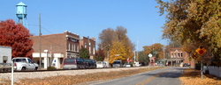
Cities and towns
Incorporated
- Battle GroundBattle Ground, IndianaBattle Ground is a town in Tippecanoe Township, Tippecanoe County in the U.S. state of Indiana. The population was 1,334 at the 2010 census. It is near the site of the Battle of Tippecanoe....
- Clarks HillClarks Hill, IndianaClarks Hill is a town in Lauramie Township, Tippecanoe County, Indiana, United States. The population was 611 at the 2010 census. It is part of the Lafayette, Indiana Metropolitan Statistical Area.-Geography:...
- DaytonDayton, IndianaDayton is a town in Sheffield Township, Tippecanoe County, Indiana, United States. The population was 1,420 at the 2010 census. It is part of the Lafayette, Indiana Metropolitan Statistical Area.-Geography:...
- LafayetteLafayette, IndianaLafayette is a city in and the county seat of Tippecanoe County, Indiana, United States, northwest of Indianapolis. As of the 2010 census, the city had a total population of 67,140. West Lafayette, on the other side of the Wabash River, is home to Purdue University, which has a large impact on...
- ShadelandShadeland, IndianaShadeland is a town in Tippecanoe County, Indiana, United States. The population was 1,610 at the 2010 census. It is part of the Lafayette, Indiana Metropolitan Statistical Area.-Geography:...
- OtterbeinOtterbein, IndianaOtterbein is a town in Bolivar Township, Benton County and Shelby Township, Tippecanoe County, Indiana, named for William Otterbein Brown who donated land for the town. As of the 2010 census, its population was 1,262...
(east half) - West LafayetteWest Lafayette, IndianaAs of the census of 2010, there were 29,596 people, 12,591 households, and 3,588 families residing in the city. The population density was 5,381.1 people per square mile . The racial makeup of the city was 74.3% White, 17.3% Asian, 2.7% African American, 0.16% Native American, 0.03% Pacific...
(home of Purdue University)
Unincorporated
- AmericusAmericus, IndianaAmericus is a small town in Tippecanoe County in the U.S. state of Indiana. It is part of the Lafayette, Indiana Metropolitan Statistical Area.- Geography :...
- Buck CreekBuck Creek, IndianaBuck Creek, originally known as Transitville, is an unincorporated community in Washington Township, Tippecanoe County, Indiana, United States. It is part of the Lafayette, Indiana Metropolitan Statistical Area.- Geography :...
- ColburnColburn, IndianaColburn is a small town in northeastern Tippecanoe County, Indiana, United States. It is part of the Lafayette, Indiana Metropolitan Statistical Area.- Geography :...
- MonroeMonroe, Tippecanoe County, IndianaMonroe is a small town in Tippecanoe County, Indiana. It is part of the Lafayette, Indiana Metropolitan Statistical Area.- Geography :Monroe is located at 40°17'14" North, 86°44'07" West in Lauramie Township and has an elevation of approximately 785 feet.-External links:...
- MontmorenciMontmorenci, IndianaMontmorenci is a unincorporated community in Tippecanoe County, Indiana. Older maps sometimes spell the name Montmorency or Montmorencie. It is part of the Lafayette, Indiana Metropolitan Statistical Area.- Geography :...
- OdellOdell, IndianaOdell is a small town in Jackson Township, Tippecanoe County, Indiana. It is part of the Lafayette, Indiana Metropolitan Statistical Area.-History:John W. Odell settled the site in 1831, with ownership of the farm later passing to his son Washington...
- RomneyRomney, IndianaRomney is an unincorporated community in Tippecanoe County in the U.S. state of Indiana. Originally named Columbia, Romney received its present name from the community of Romney in West Virginia....
- StockwellStockwell, IndianaStockwell, originally named Lauramie, is a small town in Tippecanoe County, Indiana. It was once a stop along the Indianapolis, Cincinnati and Lafayette Railroad, but the rail line has since been removed...
- West PointWest Point, IndianaWest Point is a small town in Tippecanoe County, Indiana. It is part of the Lafayette, Indiana Metropolitan Statistical Area. It had a population of 594 at the 2010 census.- Geography :...
Extinct
- BeevilleBeeville, IndianaBeeville was a small town, now extinct, in Lauramie Township, near the southern border of Tippecanoe County in the U.S. state of Indiana. It was platted in 1884 along the Toledo, St. Louis and Western Railroad and consisted of at least 10 lots...
- ChaunceyWest Lafayette, IndianaAs of the census of 2010, there were 29,596 people, 12,591 households, and 3,588 families residing in the city. The population density was 5,381.1 people per square mile . The racial makeup of the city was 74.3% White, 17.3% Asian, 2.7% African American, 0.16% Native American, 0.03% Pacific...
(consolidated into West Lafayette) - CorwinCorwin, Tippecanoe County, IndianaCorwin was a small town, now extinct, in Tippecanoe County in the U.S. state of Indiana. It was laid out by Cyrus Foltz in 1856 and consisted of seven lots near the rail line which ran south out of Lafayette...
- Conroe
- Glen HallGlen Hall, IndianaGlen Hall is a small settlement in Wayne Township, Tippecanoe County, Indiana. The site is often considered part of the adjoining town of West Point.- Geography :...
- GranvilleGranville, IndianaGranville is an extinct town in Wayne Township, Tippecanoe County, Indiana. It was founded in 1834 by Thomas W. Treckett and Thomas Concannon on the south side of the Wabash and Erie Canal, just south of the Wabash River. The town was platted to contain 153 lots, a public square and several...
(aka Weaton) - HeathHeath, IndianaHeath was a small town, now extinct, in Tippecanoe County, Indiana.- Geography :Heath is located at 40°27'41" North, 86°44'00" West , on a bluff overlooking Wildcat Creek to the southeast. It is in Perry Township and has an elevation of approximately 669 feet. The post office at Heath was...
- Prairieville
- HarrisonvilleBattle Ground, IndianaBattle Ground is a town in Tippecanoe Township, Tippecanoe County in the U.S. state of Indiana. The population was 1,334 at the 2010 census. It is near the site of the Battle of Tippecanoe....
(consolidated into Battle Ground) - KingstonWest Lafayette, IndianaAs of the census of 2010, there were 29,596 people, 12,591 households, and 3,588 families residing in the city. The population density was 5,381.1 people per square mile . The racial makeup of the city was 74.3% White, 17.3% Asian, 2.7% African American, 0.16% Native American, 0.03% Pacific...
(consolidated into West Lafayette) - MonitorMonitor, IndianaMonitor is a small town in Perry Township, Tippecanoe County, Indiana, now virtually extinct.The town's original name was Cynthyana.The former Monitor schoolhouse was used as a drug addiction treatment facility until 2007...
- North CraneNorth Crane, IndianaNorth Crane is a small town in Wea Township, Tippecanoe County, Indiana.- History :The town began as a stop on the Indianapolis, Cincinnati and Lafayette Railroad line running southeast out of Lafayette and was known as Culver's Station, named for a nearby landowner.- Geography :North Crane is...
- OuiatenonOuiatenonOuiatenon is a name that refers to a dwelling place of members of the Wea tribe of Native Americans. The name Ouiatenon, also variously given as Ouiatanon, Oujatanon, Ouiatano or other similar forms, is a French rendering of a term from the Wea dialect of the Miami-Illinois language which means...
- South RaubSouth Raub, IndianaSouth Raub was a small town on the border of Randolph and Wea Townships in Tippecanoe County, Indiana.- Geography :South Raub is located at 40°18'05" North, 86°54'49" West along County Road 800 South half a mile west of US Route 231/State Road 43. A CSX rail line connecting the cities of...
- TaylorTaylor, IndianaTaylor was a small town in Tippecanoe County, Indiana. Beginning in the middle of the 19th century, the town, sometimes referred to as Taylor Station, was a stop along a railroad line that ran south out of Lafayette...
- Wyandot
- Yorktown
Townships
|
Tippecanoe Township, Tippecanoe County, Indiana Tippecanoe Township is one of thirteen townships in Tippecanoe County, Indiana, USA. As of the 2000 census, its population was 5,951.-Geography:... Union Township, Tippecanoe County, Indiana Union Township is one of thirteen townships in Tippecanoe County, Indiana, USA. As of the 2000 census, its population was 1,682.-Geography:According to the United States Census Bureau, Union Township covers an area of ; of this, or 0.85 percent is water... Wabash Township, Tippecanoe County, Indiana Wabash Township is one of thirteen townships in Tippecanoe County, Indiana, USA. As of the 2000 census, its population was 51,261.-Geography:According to the United States Census Bureau, Wabash Township covers an area of ; of this, or 0.93 percent is water.... Washington Township, Tippecanoe County, Indiana Washington Township is one of thirteen townships in Tippecanoe County, Indiana, USA. As of the 2000 census, its population was 2,473.-Geography:... Wayne Township, Tippecanoe County, Indiana Wayne Township is one of thirteen townships in Tippecanoe County, Indiana, USA. As of the 2000 census, its population was 1,306.-Geography:According to the United States Census Bureau, Wayne Township covers an area of ; of this, or 1.02 percent is water.... Wea Township, Tippecanoe County, Indiana Wea Township is one of thirteen townships in Tippecanoe County, Indiana, USA. As of the 2000 census, its population was 22,102.-Geography:According to the United States Census Bureau, Wea Township covers an area of ; of this, or 0.04 percent is water.... |
Climate and weather
In recent years, temperatures in Lafayette have ranged from an average low of 17 °F (-8.3 °C) in January to a high of 86 °F (30 °C) in July, although a record low of -23 °F was recorded in January 1985 and a record high of 105 °F (40.6 °C) was recorded in June 1988. Average monthly precipitation ranged from 1.58 inches (4 cm) inches in February to 4.24 inches (10.8 cm) inches in June.Highways
 Interstate 65Interstate 65Interstate 65 is a major Interstate Highway in the United States. The southern terminus is located at an intersection with Interstate 10 in Mobile, Alabama, and its northern terminus is at an interchange with Interstate 90 , U.S. Route 12, and U.S...
 U.S. Route 52U.S. Route 52U.S. Route 52 is a United States highway that runs across the northern, eastern and southeastern regions of the United States. Contrary to most other even-numbered U.S...
 U.S. Route 231U.S. Route 231U.S. Route 231 is a parallel route of U.S. Route 31. It currently runs for 912 miles from St. John, Indiana, at U.S. Route 41 to south of U.S. Route 98 in Downtown Panama City, Florida.One of its most notable landmarks is the William H...
 Indiana State Road 25Indiana State Road 25State Road 25 is a highway in the U. S. state of Indiana. Although it is designated a north–south road, in practice it travels generally northeast from its southern terminus at State Road 32 to its northern terminus at State Road 15 in Warsaw.- Waynetown to Lafayette :SR 25 heads north...
 Indiana State Road 26Indiana State Road 26State Road 26 is an east–west road in central Indiana in the United States that crosses the entire state from east to west, covering a distance of about .-Route description:...
 Indiana State Road 28Indiana State Road 28State Road 28 is an east–west road in central Indiana in the United States that crosses the entire state from east to west, covering a distance of about and passing about to the north of the state capitol of Indianapolis.-Route description:...
 Indiana State Road 38Indiana State Road 38State Road 38 in the U.S. State of Indiana serves as a connection between Lafayette in the west and Richmond in the east.-Route description:State Road 38 begins in Lafayette with State Road 25 and U.S. Route 52. There is an interchange with Interstate 65 at exit 168. It proceeds east-southeast...
 Indiana State Road 43Indiana State Road 43-Southern section:This winding, two-lane section of State Road 43 connects Indiana State Road 46 in Owen County near McCormick's Creek State Park with Indiana State Road 54 in eastern Greene County. It covers a distance of .-Northern section:...
Railroads
Three different railroad lines intersect in Tippecanoe County, all running through the Lafayette area. CSX TransportationCSX Transportation
CSX Transportation operates a Class I railroad in the United States known as the CSX Railroad. It is the main subsidiary of the CSX Corporation. The company is headquartered in Jacksonville, Florida, and owns approximately 21,000 route miles...
operates a north-south line; Kankakee, Beaverville and Southern Railroad
Kankakee, Beaverville and Southern Railroad
The Kankakee, Beaverville and Southern Railroad Company is a Class III railroad serving agricultural communities in east-central Illinois and west-central Indiana.-History:...
operates a line passing from the northwest to the southeast; and Norfolk Southern Railway
Norfolk Southern Railway
The Norfolk Southern Railway is a Class I railroad in the United States, owned by the Norfolk Southern Corporation. With headquarters in Norfolk, Virginia, the company operates 21,500 route miles in 22 eastern states, the District of Columbia and the province of Ontario, Canada...
operates a line coming from Fountain and Warren counties in the southwest to Delphi in the northeast, and beyond.
Airport
The county contains one public-use airport: Purdue University AirportPurdue University Airport
Purdue University Airport is a public-use airport in Tippecanoe County, Indiana, United States. Owned by Purdue University, the airport is southwest of the central business district of Lafayette, in West Lafayette...
(LAF) in Lafayette, Indiana
Lafayette, Indiana
Lafayette is a city in and the county seat of Tippecanoe County, Indiana, United States, northwest of Indianapolis. As of the 2010 census, the city had a total population of 67,140. West Lafayette, on the other side of the Wabash River, is home to Purdue University, which has a large impact on...
.
Government
The county government is a constitutional body, and is granted specific powers by the Constitution of IndianaConstitution of Indiana
There have been two Constitutions of the State of Indiana. The first constitution was created when the Territory of Indiana sent forty-three delegates to a constitutional convention on June 10, 1816 to establish a constitution for the proposed State of Indiana after the United States Congress had...
, and by the Indiana Code
Indiana Code
The Indiana Code is the code of laws for the US State of Indiana. The contents are the codification of the all the laws currently in effect within Indiana...
.
County Council: The county council is the legislative branch of the county government and controls all the spending and revenue collection in the county. Representatives are elected from county districts. The council members serve four year terms. They are responsible for setting salaries, the annual budget, and special spending. The council also has limited authority to impose local taxes, in the form of an income and property tax that is subject to state level approval, excise taxes, and service taxes.
Board of Commissioners: The executive body of the county is made of a board of commissioners. The commissioners are elected county-wide, in staggered terms, and each serves a four-year term. One of the commissioners, typically the most senior, serves as president. The commissioners are charged with executing the acts legislated by the council, collecting revenue, and managing the day-to-day functions of the county government.
Court: The county maintains a small claims court
Small claims court
Small-claims courts have limited jurisdiction to hear civil cases between private litigants. Courts authorized to try small claims may also have other judicial functions, and the name by which such a court is known varies by jurisdiction; it may be known as a county or magistrate's court...
that can handle some civil cases. The judge on the court is elected to a term of four years and must be a member of the Indiana Bar Association. The judge is assisted by a constable who is also elected to a four-year term. In some cases, court decisions can be appealed to the state level circuit court
Circuit court
Circuit court is the name of court systems in several common law jurisdictions.-History:King Henry II instituted the custom of having judges ride around the countryside each year to hear appeals, rather than forcing everyone to bring their appeals to London...
.
County Officials: The county has several other elected offices, including sheriff
Sheriff
A sheriff is in principle a legal official with responsibility for a county. In practice, the specific combination of legal, political, and ceremonial duties of a sheriff varies greatly from country to country....
, coroner
Coroner
A coroner is a government official who* Investigates human deaths* Determines cause of death* Issues death certificates* Maintains death records* Responds to deaths in mass disasters* Identifies unknown dead* Other functions depending on local laws...
, auditor, treasurer
Treasurer
A treasurer is the person responsible for running the treasury of an organization. The adjective for a treasurer is normally "tresorial". The adjective "treasurial" normally means pertaining to a treasury, rather than the treasurer.-Government:...
, recorder
Recorder of deeds
Recorder of deeds is a government office tasked with maintaining public records and documents, especially records relating to real estate ownership that provide persons other than the owner of a property with real rights over that property.-Background:...
, surveyor
Surveying
See Also: Public Land Survey SystemSurveying or land surveying is the technique, profession, and science of accurately determining the terrestrial or three-dimensional position of points and the distances and angles between them...
, and circuit court clerk
Court clerk
A court clerk is an officer of the court whose responsibilities include maintaining the records of a court. Another duty is to administer oaths to witnesses, jurors, and grand jurors...
. Each of these elected officers serves a term of four years and oversees a different part of county government. Members elected to county government positions are required to declare party
Political party
A political party is a political organization that typically seeks to influence government policy, usually by nominating their own candidates and trying to seat them in political office. Parties participate in electoral campaigns, educational outreach or protest actions...
affiliations and to be residents of the county.
Politics
Like the state of IndianaIndiana
Indiana is a US state, admitted to the United States as the 19th on December 11, 1816. It is located in the Midwestern United States and Great Lakes Region. With 6,483,802 residents, the state is ranked 15th in population and 16th in population density. Indiana is ranked 38th in land area and is...
, Tippecanoe County has historically been politically conservative. But like the rest of Indiana, its political leanings at the national level have moved sharply from conservative towards moderate from 2005-2009. Due in large part to the presence of Purdue University
Purdue University
Purdue University, located in West Lafayette, Indiana, U.S., is the flagship university of the six-campus Purdue University system. Purdue was founded on May 6, 1869, as a land-grant university when the Indiana General Assembly, taking advantage of the Morrill Act, accepted a donation of land and...
, Tippecanoe County has become one of the most progressive counties of the state.
In the 2008 Democratic primary, Tippecanoe County was one of 10 (out of 92) Indiana counties to give the majority of its votes to Barack Obama. In the 2008 Presidential election
United States presidential election, 2008
The United States presidential election of 2008 was the 56th quadrennial presidential election. It was held on November 4, 2008. Democrat Barack Obama, then the junior United States Senator from Illinois, defeated Republican John McCain, the senior U.S. Senator from Arizona. Obama received 365...
, Tippecanoe County was one of 15 Indiana counties to give the majority of its votes to Obama/Biden. Thanks to the sizable support of Purdue University students, Tippecanoe County played a pivotal role in Barack Obama's upset win in Indiana (49.9%-49.0%; 1,367,264 votes to 1,341,101 votes) by supporting the Democrat
Democratic Party (United States)
The Democratic Party is one of two major contemporary political parties in the United States, along with the Republican Party. The party's socially liberal and progressive platform is largely considered center-left in the U.S. political spectrum. The party has the lengthiest record of continuous...
ticket of Barack Obama/Joe Biden 55.1%-43.5% over the Republican
Republican Party (United States)
The Republican Party is one of the two major contemporary political parties in the United States, along with the Democratic Party. Founded by anti-slavery expansion activists in 1854, it is often called the GOP . The party's platform generally reflects American conservatism in the U.S...
ticket of John McCain/Sarah Palin.
| Year | Democrat Democratic Party (United States) The Democratic Party is one of two major contemporary political parties in the United States, along with the Republican Party. The party's socially liberal and progressive platform is largely considered center-left in the U.S. political spectrum. The party has the lengthiest record of continuous... |
Republican Republican Party (United States) The Republican Party is one of the two major contemporary political parties in the United States, along with the Democratic Party. Founded by anti-slavery expansion activists in 1854, it is often called the GOP . The party's platform generally reflects American conservatism in the U.S... |
Other Third party (United States) The term third party is used in the United States for any and all political parties in the United States other than one of the two major parties . The term can also refer to independent politicians not affiliated with any party at all and to write-in candidates.The United States has had a... |
|---|---|---|---|
| 2008 | (W)(I) Obama/Biden 55.1% 37,781 | McCain/Palin 43.5% 29,822 | |
| 2004 | Kerry/Edwards 39.8% 20,818 | (W)(I) G.W. Bush/Cheney 59% 30,897 | |
| 2000 | Gore/Lieberman 39.4% 18,220 | (W)(I) G.W. Bush/Cheney 56.4% 26,106 | |
| 1996 | (W) Clinton/Gore 39.9% 17,232 | (I) Dole/Kemp 49.5% 22,556 | Perot 11.8% 5,394 |
| 1992 | (W) Clinton/Gore 37.2% 17,343 | (I) G. Bush/Quayle 42.8% 23,050 | Perot 19.2% 9,684 |
| 1988 | Dukakis/Bentsen 36.6% 16,256 | (W)(I) G. Bush/Quayle 62.9% 27,897 | |
| 1984 | Mondale/Ferraro 34.4% 15,789 | (W)(I) Reagan/G. Bush 64.8% 29,706 | |
| 1980 | Carter/Mondale 30.2% 14,636 | (W)(I) Reagan/G. Bush 56.9% 27,589 | Anderson 10.6% 5,141 |
| 1976 | (W) Carter/Mondale 37.5% 17,850 | (I) Ford/Dole 59.7% 29,186 | |
| 1972 | McGovern/Shriver 31.5% 14,598 | (W)(I) Nixon/Agnew 68.1% 31,565 | |
| 1968 | Humphrey/Muskie 35.5% 14,528 | (W)(I) Nixon/Agnew 59.4% 24,352 | Wallace 4.9% 2,000 |
| 1964 | (W)(I) L. Johnson/Humphrey 51.5% 20,257 | Goldwater/Miller 48.3% 19,036 | |
| 1960 | (W) Kennedy/L. Johnson 36.3% 14,041 | (I) Nixon/Lodge 63.5% 24,572 |
Demographics
According to the 2000 census, there were 148,955 people, 55,226 households, and 32,417 families residing in the county. The population densityPopulation density
Population density is a measurement of population per unit area or unit volume. It is frequently applied to living organisms, and particularly to humans...
was 298 per square mile (115/km²). There were 58,343 housing units at an average density of 117 per square mile (45/km²). The racial makeup of the county was 88.86% White
Race (United States Census)
Race and ethnicity in the United States Census, as defined by the Federal Office of Management and Budget and the United States Census Bureau, are self-identification data items in which residents choose the race or races with which they most closely identify, and indicate whether or not they are...
, 2.52% Black
Race (United States Census)
Race and ethnicity in the United States Census, as defined by the Federal Office of Management and Budget and the United States Census Bureau, are self-identification data items in which residents choose the race or races with which they most closely identify, and indicate whether or not they are...
or African American
Race (United States Census)
Race and ethnicity in the United States Census, as defined by the Federal Office of Management and Budget and the United States Census Bureau, are self-identification data items in which residents choose the race or races with which they most closely identify, and indicate whether or not they are...
, 0.28% Native American
Race (United States Census)
Race and ethnicity in the United States Census, as defined by the Federal Office of Management and Budget and the United States Census Bureau, are self-identification data items in which residents choose the race or races with which they most closely identify, and indicate whether or not they are...
, 4.46% Asian
Race (United States Census)
Race and ethnicity in the United States Census, as defined by the Federal Office of Management and Budget and the United States Census Bureau, are self-identification data items in which residents choose the race or races with which they most closely identify, and indicate whether or not they are...
, 0.03% Pacific Islander
Race (United States Census)
Race and ethnicity in the United States Census, as defined by the Federal Office of Management and Budget and the United States Census Bureau, are self-identification data items in which residents choose the race or races with which they most closely identify, and indicate whether or not they are...
, 2.48% from other races
Race (United States Census)
Race and ethnicity in the United States Census, as defined by the Federal Office of Management and Budget and the United States Census Bureau, are self-identification data items in which residents choose the race or races with which they most closely identify, and indicate whether or not they are...
, and 1.37% from two or more races. 5.26% of the population were Hispanic
Race (United States Census)
Race and ethnicity in the United States Census, as defined by the Federal Office of Management and Budget and the United States Census Bureau, are self-identification data items in which residents choose the race or races with which they most closely identify, and indicate whether or not they are...
or Latino
Race (United States Census)
Race and ethnicity in the United States Census, as defined by the Federal Office of Management and Budget and the United States Census Bureau, are self-identification data items in which residents choose the race or races with which they most closely identify, and indicate whether or not they are...
of any race. 25.1% were of German
Germans
The Germans are a Germanic ethnic group native to Central Europe. The English term Germans has referred to the German-speaking population of the Holy Roman Empire since the Late Middle Ages....
, 13.7% American
United States
The United States of America is a federal constitutional republic comprising fifty states and a federal district...
, 9.4% Irish
Irish people
The Irish people are an ethnic group who originate in Ireland, an island in northwestern Europe. Ireland has been populated for around 9,000 years , with the Irish people's earliest ancestors recorded having legends of being descended from groups such as the Nemedians, Fomorians, Fir Bolg, Tuatha...
and 9.1% English
English people
The English are a nation and ethnic group native to England, who speak English. The English identity is of early mediaeval origin, when they were known in Old English as the Anglecynn. England is now a country of the United Kingdom, and the majority of English people in England are British Citizens...
ancestry according to Census 2000.
There were 55,226 households, of which 28.50% had children under the age of 18 living with them, 46.90% were married couples
Marriage
Marriage is a social union or legal contract between people that creates kinship. It is an institution in which interpersonal relationships, usually intimate and sexual, are acknowledged in a variety of ways, depending on the culture or subculture in which it is found...
living together, 8.30% had a female householder with no husband present, and 41.30% were non-families. 28.00% of all households were made up of individuals and 7.40% had someone living alone who was 65 years of age or older. The average household size was 2.42 and the average family size was 3.01.
20.90% of the population were under the age of 18, 25.40% from 18 to 24, 27.10% from 25 to 44, 17.40% from 45 to 64, and 9.10% who were 65 years of age or older. The median age was 27 years. For every 100 females there were 105.40 males. For every 100 females age 18 and over, there were 105.10 males.
The median household income
Median household income
The median household income is commonly used to generate data about geographic areas and divides households into two equal segments with the first half of households earning less than the median household income and the other half earning more...
was $38,65, and the median family income was $51,791. Males had a median income of $37,606 versus $25,142 for females. The per capita income
Per capita income
Per capita income or income per person is a measure of mean income within an economic aggregate, such as a country or city. It is calculated by taking a measure of all sources of income in the aggregate and dividing it by the total population...
for the county was $19,375. About 7.30% of families and 15.40% of the population were below the poverty line, including 12.10% of those under age 18 and 4.30% of those age 65 or over.
Education
Public schools in rural/suburban Tippecanoe County are administered by the Tippecanoe School CorporationTippecanoe School Corporation
The Tippecanoe School Corporation administers 18 high schools, middle schools and elementary schools in Tippecanoe County, Indiana:-High schools:* Elston Community Education Center * McCutcheon High School * Harrison High School -Middle schools:...
, while those in the cities are under either the Lafayette School Corporation
Lafayette School Corporation
The Lafayette School Corporation administers one high school, two middle schools and seven elementary schools in Lafayette, Indiana. Its administrative offices are at 2300 Cason Street in Lafayette, Indiana.-History of the Lafayette School Corporation:...
or West Lafayette Community School Corporation
West Lafayette Community School Corporation
The West Lafayette Community School Corporation administers the following schools in West Lafayette, Indiana, United States:* Cumberland Elementary School * Happy Hollow Elementary School * West Lafayette Junior-Senior High School...
. Purdue and Ivy Tech each have campuses at other sites in Indiana.
Universities and colleges
- Purdue UniversityPurdue UniversityPurdue University, located in West Lafayette, Indiana, U.S., is the flagship university of the six-campus Purdue University system. Purdue was founded on May 6, 1869, as a land-grant university when the Indiana General Assembly, taking advantage of the Morrill Act, accepted a donation of land and...
http://www.purdue.edu/ - Ivy Tech Community College of IndianaIvy Tech Community College of IndianaIvy Tech Community College of Indiana is Indiana's community college system, encompassing 24 campuses in 14 regions. The community college system now has more than 165,000 students...
http://www.ivytech.edu/
High Schools
- Elston Community Education Center http://elston.tscschools.com/
- Lafayette (city) Jefferson High SchoolJefferson High School (Indiana)For schools with a similar name, see Jefferson High School.Jefferson High School is a high school located in Lafayette, Indiana, and administered by the Lafayette School Corporation...
http://www.lsc.k12.in.us/jeff/ - Lafayette (city) Oakland High School http://oaklandhs.lsc.schoolfusion.us/
- Lafayette (suburban--south) McCutcheon High SchoolMcCutcheon High SchoolMcCutcheon High School is located in Lafayette, Indiana, off Old 231 South. It is active in the Hoosier Crossroads Conferences. For the 2005-06, McCutcheon had 1900 students enrolled....
http://mhs.tsc.k12.in.us/ - West Lafayette (city) West Lafayette Junior-Senior High School http://wl.k12.in.us/hs/
- West Lafayette/Lafayette (suburban--north) Harrison High School http://hhs.tsc.k12.in.us/
Middle Schools/Junior High Schools
- Lafayette Sunnyside Middle School http://www.lsc.k12.in.us/sunnyside/
- Lafayette Tecumseh Junior High School http://www.lsc.k12.in.us/TecumsehMS/TecumsehMS.htm
- TSC (Harrison) Battle Ground Middle School http://bgm.tsc.k12.in.us/
- TSC (Harrison) East Tipp Middle SchoolEast Tipp Middle SchoolEast Tipp Middle School is located in Lafayette, Indiana off of 300 N. Grades 6, 7, and 8 flow in from Hershey Elementary School before moving up to William Henry Harrison High School...
http://etm.tsc.k12.in.us/ - TSC (Harrison) Klondike Middle SchoolKlondike Middle SchoolKlondike Middle School is a post-primary education facility in West Lafayette, Indiana, and functions as part of the Tippecanoe School Corporation.KMS has earned a "Four Star" status 10 out of the past 12 years...
http://kms.tsc.k12.in.us/ - TSC (McCutcheon) Southwestern Middle School http://sms.tsc.k12.in.us/
- TSC (McCutcheon) Wainwright Middle SchoolWainwright Middle SchoolWainwright Middle School is a middle school in Tippecanoe County, Indiana. It houses grades 6-8. The current principal is Neal McCutcheon. The school's colors are blue and white, and the mustang is the school's mascot...
http://wms.tsc.k12.in.us/ - TSC (McCutcheon) Wea Ridge Middle School http://wrm.tsc.k12.in.us/
- West Lafayette Junior-Senior High School http://wl.k12.in.us/hs/
Elementary Schools
- Lafayette Edgelea Elementary School http://www.lsc.k12.in.us/schools/edgelea/
- Lafayette Glen Acres Elementary School http://www.lsc.k12.in.us/schools/glenacres/
- Lafayette Miami Elementary School http://www.lsc.k12.in.us/schools/miami/
- Lafayette Miller Elementary School http://www.lsc.k12.in.us/schools/miller/
- Lafayette Murdock Elementary SchoolMurdock Elementary SchoolMurdock Elementary School was an elementary school located in San Jose, California that closed up in 1980 due to low enrollment. Its location is now occupied by Murdock-Portal Elementary School, commonly referred to as "Portal". Portal has not shut down, but now has a reputation for technology...
http://www.lsc.k12.in.us/schools/murdock/ - Lafayette (charter) New Community School http://www.ncs.k12.in.us/
- Lafayette Vinton Elementary School http://www.lsc.k12.in.us/schools/vinton/
- TSC (Harrison) Battle Ground Elementary School http://bge.tsc.k12.in.us/
- TSC (Harrison) Burnett Creek Elementary School http://bce.tsc.k12.in.us/
- TSC (Harrison) Hershey Elementary School http://hes.tsc.k12.in.us/
- TSC (Harrison) Klondike Elementary School http://kes.tsc.k12.in.us/
- TSC (McCutcheon) Dayton Elementary School http://des.tsc.k12.in.us/
- TSC (McCutcheon) James Cole Elementary School http://ces.tsc.k12.in.us/
- TSC (McCutcheon) Mayflower Mill Elementary School http://mme.tsc.k12.in.us/
- TSC (McCutcheon) Mintonye Elementary School http://mes.tsc.k12.in.us/
- TSC (McCutcheon) Wea Ridge Elementary School http://wre.tsc.k12.in.us/
- TSC (McCutcheon) Woodland Elementary School http://wes.tsc.k12.in.us/
- TSC (McCutcheon) Wyandotte Elementary School http://wye.tsc.k12.in.us/
- West Lafayette Cumberland Elementary School http://www.wl.k12.in.us/cumberland/
Private Schools
- Lafayette Catholic Schools http://lcss.org/
- Lafayette Christian School http://www.lafayettechristian.org/
- Lafayette Faith Baptist http://www1.faithlafayette.org/school
Economy
Much of the economy of Tippecanoe County is centered in its two, largest communities: LafayetteLafayette, Indiana
Lafayette is a city in and the county seat of Tippecanoe County, Indiana, United States, northwest of Indianapolis. As of the 2010 census, the city had a total population of 67,140. West Lafayette, on the other side of the Wabash River, is home to Purdue University, which has a large impact on...
and West Lafayette
West Lafayette, Indiana
As of the census of 2010, there were 29,596 people, 12,591 households, and 3,588 families residing in the city. The population density was 5,381.1 people per square mile . The racial makeup of the city was 74.3% White, 17.3% Asian, 2.7% African American, 0.16% Native American, 0.03% Pacific...
. Purdue University is by far the largest employer in the county. However, private industry and commerce also exist in the county. Major employers also include:
Sagamore Village Estates Corp - West Lafayette; Subaru-Indiana Automotive Inc - Lafayette; Caterpillar Inc - Lafayette; Fairfield Manufacturing Co Inc - Lafayette; St Elizabeth Medical Center - Lafayette; Alcoa Lafayette; Eli Lilly & Co - Lafayette; State Farm Operations Center - West Lafayette
External links
- Tippecanoe County official website
- Tippecanoe County Public Library
- Tippecanoe County Historical Association
- Lafayette Online
- Lafayette - West Lafayette Convention and Visitors Bureau
- GIS (Geographic Information System) for Tippecanoe County
- Lafayette Ski Club
The source of this article is wikipedia, the free encyclopedia. The text of this article is licensed under the GFDL.