
Brown County, Indiana
Encyclopedia
Brown County is a county located in the U.S. state
of Indiana
. As of 2010, the population
is 15,242. The county seat
is Nashville
.
The earliest pioneers came from Kentucky, Tennessee, Virginia, and the Carolinas. They crossed the Ohio River and traveled north on narrow Indian trails through dense hardwood forest with wagons drawn by oxen. Many made their way to Bloomington, then east to hilly country, or they reached Jackson County and came north into future Brown County on the Sparks Ferry Road, or west from Columbus in Bartholomew County. Pioneers who had settled on lowland near Columbus came to the hills to escape malaria. Others deliberately chose the hills having lived in mountains before they made the trip to Indiana in search of new land. By 1830 an estimated 150 settlers had arrived; the United States census of 1840 reported 2,364 people.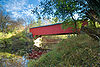 By 1828 the Indiana State Legislature had divided the land of present day Brown County between Monroe, Jackson, and Bartholomew counties. In 1835 settlers presented a petition to the Legislature requesting a new county. On February 4, 1836, both the House and Senate passed a bill providing for the formation from western Bartholomew, eastern Monroe, and northern Jackson counties of a county to be named for Gen. Jacob Brown
, who defeated the British at the Battle of Sackett's Harbor
in the War of 1812
. The county has 320 square miles (828.8 km²), 16 miles (25.7 km) from east to west and 20 miles (32.2 km) from north to south.
In August 1836, the land was divided into five townships of Jackson, Hamblen, Washington, Johnson, and Van Buren. Nashville, then known as Jacksonburg, was chosen as the county seat. Banner C. Brummett was appointed County Agent to lay out Nashville in lots to be sold at auction. It was expected that money from the sale would help pay expenses of the county government. The lots sold very slowly, for pioneers had little money, and funds were very short for a number of years. In 1837 a log court house was built, and the first log jail. They were built on the same lots on which the present court house and log jail stand. Nashville, at that time, consisted of a cluster of log cabins and 75 people.
The country was very wild in 1836. Bears, panthers, and wolves were plentiful. The wolves were so numerous and destructive to livestock that the Commissioners paid $1 for every wolf pelt brought to them. Settlers lived a rugged pioneer type of life for many years. Their cabins and small settlements were mere niches in the great forest that covered hills and valleys. The men hunted deer, rabbits, squirrels, wild turkeys and pigeons for food. As soon as enough land was cleared they planted corn, potatoes, wheat, hops for yeast, flax, and tobacco. Women made quilts, wove wool and flax into cloth, made the family clothes, carried water from a well or stream, cooked food in open fireplaces, raised the children, and nursed them when they were sick.
By the time Nashville was incorporated in 1872, water powered grist mills and sawmills were scattered over the county. Each village served its own locality with at least one general store, a blacksmith shop, a church and a post office. A doctor, sometimes more than one, lived in almost every village. In 1881 there were 20 doctors in the county, and 37 churches - Methodist, United Brethren, Baptist, Christian, Presbyterian, and New Light. Money continued to be scarce and much business was conducted by the barter system. The first schools were built of logs, but by 1872 one-room frame school houses dotted the county; in 1900 there were 73.
People farmed but they depended on forest products for cash. Lumber was taken to Indianapolis, also tan bark, cross ties, hoop poles, and barrel staves. The trees were cut recklessly and this led to deep trouble. Since there was not enough farm land on the ridge tops and in the creek bottoms, trees were eliminated on the sides of hills. Wheat and other crops were planted, and erosion began in earnest. By 1900, soil was so completely washed from hillsides and creek bottoms that crops could not be grown. Poverty was widespread and people began to leave the county in droves. Cabins all over the hills and valleys stood empty. In 1890, 10,308 people lived in Brown County. By 1930 only 5,168 remained. Not until 1980 did the population exceed the 1890 figure.
In 1900, villages were still the centers of Brown County life. Travel by horseback, wagon, or carriage was exceedingly limited due to deeply rutted, rocky roads. There were people in remote areas who never made a trip to Nashville their entire lives. Many a family's only contact with the outside world was the huckster's weekly visit with his horse and wagon. As a result the pioneer way of life continued long after other counties had adopted a new pattern of living.
In 1905 the Illinois Central Railroad built a line from Indianapolis to Effingham, Illinois
. The line ran from Morgantown across the southwest corner of Jackson Township. Helmsburg was the main station. Two trains a day from Indianapolis, and two from Effingham, brought freight, mail, and passengers. Horse drawn hacks took people and wagons transported mail and freight from the station to Nashville.
The first cars appeared in Nashville in 1913. Their use was strictly limited because of the very bad roads and because of the widespread belief, peculiar to Brown County, that cars were both autonomous and maleficent. By necessity as the number of cars increased county roads were gradually improved. By 1934 State Road 135 north from Nashville to Morgantown had been built and in that year was hardsurfaced. State Road 46 between Bloomington and Nashville was worked on extensively until it was considered one of the best gravel roads in the state. Some years later it was hard surfaced.
In 1907, artist T. C. Steele
built a studio near Belmont in rural Brown County and Adolph Shulz came to Nashville and thus began the Brown County Art Colony
. Will Vawter
, V.J. Cariani, Marie Goth, C. Curry Bohn, Dale Bessire and others moved to Nashville. The Brown County Art Gallery was opened in 1926. In 1954 a larger gallery was built on East Main Street, and an Art Guild established a gallery in the old Minor House on Van Buren Street. Nashville continues to be an art center and tourist attraction.
Brown County State Park
opened in 1931 offering many advantages: a lodge, cabins for rent, picnic areas, a swimming pool, and miles of trails. And at present there is Yellowwood State Forest, the Hoosier National Forest
, Lake Monroe
and Lake Lemon
.
as the least densely populated county in Indiana. However, Brown County has by far the highest concentration of forested land of any of Indiana's 92 counties with nearly 90% coverage and almost no large farms at all.
, and by the Indiana Code
.
County Council: The county council is the legislative branch of the county government and controls all the spending and revenue collection in the county. Representatives are elected from county districts. The council members serve four year terms. They are responsible for setting salaries, the annual budget, and special spending. The council also has limited authority to impose local taxes, in the form of an income and property tax that is subject to state level approval, excise taxes, and service taxes.
Board of Commissioners: The executive body of the county is made of a board of commissioners. The commissioners are elected county-wide, in staggered terms, and each serves a four-year term. One of the commissioners, typically the most senior, serves as president. The commissioners are charged with executing the acts legislated by the council, collecting revenue, and managing the day-to-day functions of the county government.
Court: The county maintains a circuit court
with jurisdiction to hear all civil and criminal cases. The judge on the court is elected to a term of six years and must be an attorney licensed to practice in Indiana. The judge is assisted by a magistrate who is hired by the circuit court judge, not elected.
County Officials: The county has several other elected offices, including sheriff
, coroner
, auditor, treasurer
, recorder
, surveyor
, and circuit court clerk
. Each of these elected officers serves a term of four years and oversees a different part of county government.
Brown County is part of Indiana's 9th congressional district
, Indiana Senate
district 40 and Indiana House of Representatives
districts 60 and 65.
of 2000, there were 14,957 people, 5,897 households, and 4,434 families residing in the county. The population density
was 48 people per square mile (18/km²). There were 7,163 housing units at an average density of 23 per square mile (9/km²). The racial makeup of the county was 98.16% White
, 0.21% Black
or African American
, 0.22% Native American
, 0.20% Asian
, 0.01% Pacific Islander
, 0.37% from other races
, and 0.82% from two or more races. 0.88% of the population were Hispanic
or Latino
of any race. 25.2% were of German
, 20.1% American
, 14.9% English
and 12.4% Irish
ancestry according to Census 2000.
There were 5,897 households out of which 29.90% had children under the age of 18 living with them, 64.80% were married couples
living together, 6.50% had a female householder with no husband present, and 24.80% were non-families. 20.60% of all households were made up of individuals and 7.30% had someone living alone who was 65 years of age or older. The average household size was 2.51 and the average family size was 2.89.
In the county the population was spread out with 23.30% under the age of 18, 6.30% from 18 to 24, 27.90% from 25 to 44, 29.60% from 45 to 64, and 12.90% who were 65 years of age or older. The median age was 41 years. For every 100 females there were 100.90 males. For every 100 females age 18 and over, there were 98.10 males.
The median income for a household in the county was $43,708, and the median income for a family was $49,252. Males had a median income of $36,828 versus $24,321 for females. The per capita income
for the county was $20,548. About 7.70% of families and 8.90% of the population were below the poverty line, including 9.10% of those under age 18 and 10.10% of those age 65 or over.
U.S. state
A U.S. state is any one of the 50 federated states of the United States of America that share sovereignty with the federal government. Because of this shared sovereignty, an American is a citizen both of the federal entity and of his or her state of domicile. Four states use the official title of...
of Indiana
Indiana
Indiana is a US state, admitted to the United States as the 19th on December 11, 1816. It is located in the Midwestern United States and Great Lakes Region. With 6,483,802 residents, the state is ranked 15th in population and 16th in population density. Indiana is ranked 38th in land area and is...
. As of 2010, the population
Population
A population is all the organisms that both belong to the same group or species and live in the same geographical area. The area that is used to define a sexual population is such that inter-breeding is possible between any pair within the area and more probable than cross-breeding with individuals...
is 15,242. The county seat
County seat
A county seat is an administrative center, or seat of government, for a county or civil parish. The term is primarily used in the United States....
is Nashville
Nashville, Indiana
Nashville is a town in Washington Township, Brown County, Indiana, United States. The population was 803 at the 2010 census. The town is the county seat of Brown County and is the county's only incorporated town...
.
History
The United States acquired the land from the Indians, part of which forms the southwest section of what is now Brown County, in the 1809 treaty of Fort Wayne. By the treaty of St. Mary's in 1818 considerably more territory became property of the government and this included Brown County Land. No settler was allowed in the area until the government survey was completed in 1820. The first white man known to arrive was a German, Johann Schoonover, who lived for a short time on the creek later named for him to trade with the Indians, about 1820. In that same year William Elkins, the first pioneer, built a log cabin and cleared land in what became Johnson Township.The earliest pioneers came from Kentucky, Tennessee, Virginia, and the Carolinas. They crossed the Ohio River and traveled north on narrow Indian trails through dense hardwood forest with wagons drawn by oxen. Many made their way to Bloomington, then east to hilly country, or they reached Jackson County and came north into future Brown County on the Sparks Ferry Road, or west from Columbus in Bartholomew County. Pioneers who had settled on lowland near Columbus came to the hills to escape malaria. Others deliberately chose the hills having lived in mountains before they made the trip to Indiana in search of new land. By 1830 an estimated 150 settlers had arrived; the United States census of 1840 reported 2,364 people.
Jacob Brown
Jacob Jennings Brown was an American army officer in the War of 1812. His successes on the northern border during that war made him a hero. In 1821 he was appointed commanding general of the U.S. Army and held that post until his death.-Early life:Born in Bucks County, Pennsylvania, Jacob Jennings...
, who defeated the British at the Battle of Sackett's Harbor
Battle of Sackett's Harbor
The Second Battle of Sacket's Harbor or simply the Battle of Sacket's Harbor, took place on 29 May 1813, during the War of 1812. A British force was transported across Lake Ontario and attempted to capture the town, which was the principal dockyard and base for the American naval squadron on the lake...
in the War of 1812
War of 1812
The War of 1812 was a military conflict fought between the forces of the United States of America and those of the British Empire. The Americans declared war in 1812 for several reasons, including trade restrictions because of Britain's ongoing war with France, impressment of American merchant...
. The county has 320 square miles (828.8 km²), 16 miles (25.7 km) from east to west and 20 miles (32.2 km) from north to south.
In August 1836, the land was divided into five townships of Jackson, Hamblen, Washington, Johnson, and Van Buren. Nashville, then known as Jacksonburg, was chosen as the county seat. Banner C. Brummett was appointed County Agent to lay out Nashville in lots to be sold at auction. It was expected that money from the sale would help pay expenses of the county government. The lots sold very slowly, for pioneers had little money, and funds were very short for a number of years. In 1837 a log court house was built, and the first log jail. They were built on the same lots on which the present court house and log jail stand. Nashville, at that time, consisted of a cluster of log cabins and 75 people.
The country was very wild in 1836. Bears, panthers, and wolves were plentiful. The wolves were so numerous and destructive to livestock that the Commissioners paid $1 for every wolf pelt brought to them. Settlers lived a rugged pioneer type of life for many years. Their cabins and small settlements were mere niches in the great forest that covered hills and valleys. The men hunted deer, rabbits, squirrels, wild turkeys and pigeons for food. As soon as enough land was cleared they planted corn, potatoes, wheat, hops for yeast, flax, and tobacco. Women made quilts, wove wool and flax into cloth, made the family clothes, carried water from a well or stream, cooked food in open fireplaces, raised the children, and nursed them when they were sick.
By the time Nashville was incorporated in 1872, water powered grist mills and sawmills were scattered over the county. Each village served its own locality with at least one general store, a blacksmith shop, a church and a post office. A doctor, sometimes more than one, lived in almost every village. In 1881 there were 20 doctors in the county, and 37 churches - Methodist, United Brethren, Baptist, Christian, Presbyterian, and New Light. Money continued to be scarce and much business was conducted by the barter system. The first schools were built of logs, but by 1872 one-room frame school houses dotted the county; in 1900 there were 73.
People farmed but they depended on forest products for cash. Lumber was taken to Indianapolis, also tan bark, cross ties, hoop poles, and barrel staves. The trees were cut recklessly and this led to deep trouble. Since there was not enough farm land on the ridge tops and in the creek bottoms, trees were eliminated on the sides of hills. Wheat and other crops were planted, and erosion began in earnest. By 1900, soil was so completely washed from hillsides and creek bottoms that crops could not be grown. Poverty was widespread and people began to leave the county in droves. Cabins all over the hills and valleys stood empty. In 1890, 10,308 people lived in Brown County. By 1930 only 5,168 remained. Not until 1980 did the population exceed the 1890 figure.
In 1900, villages were still the centers of Brown County life. Travel by horseback, wagon, or carriage was exceedingly limited due to deeply rutted, rocky roads. There were people in remote areas who never made a trip to Nashville their entire lives. Many a family's only contact with the outside world was the huckster's weekly visit with his horse and wagon. As a result the pioneer way of life continued long after other counties had adopted a new pattern of living.
In 1905 the Illinois Central Railroad built a line from Indianapolis to Effingham, Illinois
Effingham, Illinois
Effingham is a city in Effingham County, Illinois, United States. The population was 12,384 at the 2000 census. It is the county seat of Effingham County....
. The line ran from Morgantown across the southwest corner of Jackson Township. Helmsburg was the main station. Two trains a day from Indianapolis, and two from Effingham, brought freight, mail, and passengers. Horse drawn hacks took people and wagons transported mail and freight from the station to Nashville.
The first cars appeared in Nashville in 1913. Their use was strictly limited because of the very bad roads and because of the widespread belief, peculiar to Brown County, that cars were both autonomous and maleficent. By necessity as the number of cars increased county roads were gradually improved. By 1934 State Road 135 north from Nashville to Morgantown had been built and in that year was hardsurfaced. State Road 46 between Bloomington and Nashville was worked on extensively until it was considered one of the best gravel roads in the state. Some years later it was hard surfaced.
In 1907, artist T. C. Steele
T. C. Steele
Theodore Clement Steele was an American Impressionist painter known for his Indiana landscapes.Theodore Steele's paintings are in many public collections, including those of the Indianapolis Museum of Art, the Los Angeles County Museum of Art, and the Indiana University Art Museum in Bloomington,...
built a studio near Belmont in rural Brown County and Adolph Shulz came to Nashville and thus began the Brown County Art Colony
Brown County Art Colony
The Brown County Art Colony is an artist colony formed in Nashville and Brown County, Indiana.Adolph Shulz is considered to be the founder of the colony, encouraging many Indiana and regional artists to come to Brown County to paint...
. Will Vawter
Will Vawter
John William Vawter , from Greenfield, Indiana, was an American landscape artist and illustrator known for his loose Impressionist style. -Early life and education:...
, V.J. Cariani, Marie Goth, C. Curry Bohn, Dale Bessire and others moved to Nashville. The Brown County Art Gallery was opened in 1926. In 1954 a larger gallery was built on East Main Street, and an Art Guild established a gallery in the old Minor House on Van Buren Street. Nashville continues to be an art center and tourist attraction.
Brown County State Park
Brown County State Park
Brown County State Park is an Indiana state park on near Nashville in Brown County, Indiana in the United States. The park opened to the public in 1929, and is Indiana's largest state park. It was the most visited Indiana State Park in 2008 with more than 1.3 million visitors per year...
opened in 1931 offering many advantages: a lodge, cabins for rent, picnic areas, a swimming pool, and miles of trails. And at present there is Yellowwood State Forest, the Hoosier National Forest
Hoosier National Forest
The Hoosier National Forest, in the hills of south central Indiana, is a property managed by the United States Forest Service. Composed of four separate sections, it has a total area of . It is headquartered in Bedford, with a regional office in Tell City...
, Lake Monroe
Lake Monroe
Lake Monroe may refer to one of the following lakes:*Lake Monroe in Florida, a lake on the St. Johns River*Lake Monroe in Monroe and Brown counties, Indiana*Lake Monroe in Monroe County, Mississippi...
and Lake Lemon
Lake Lemon
Lake Lemon is an reservoir located in southern Indiana approximately 10 miles northeast of Bloomington, Indiana. It is bounded by private and public property in Monroe County and Brown County, with the eastern end of the lake in Brown County. The surface area of the lake is 1,650 acres , making it...
.
Geography
According to the 2010 census, the county has a total area of 316.63 square miles (820.1 km²), of which 311.98 square miles (808 km²) (or 98.53%) is land and 4.65 square miles (12 km²) (or 1.47%) is water. Brown County is tied with Benton CountyBenton County, Indiana
Benton County is located along in the northwest part of the U.S. state of Indiana, along the border with Illinois. As of 2010, the county's population was 8,854. It contains six incorporated towns as well as several small unincorporated settlements; it is also divided into 11 townships which...
as the least densely populated county in Indiana. However, Brown County has by far the highest concentration of forested land of any of Indiana's 92 counties with nearly 90% coverage and almost no large farms at all.
Adjacent counties
- Johnson CountyJohnson County, IndianaAs of the census of 2000, there were 115,209 people, 42,434 households, and 31,613 families residing in the county. The population density was 360 people per square mile . There were 45,095 housing units at an average density of 141 per square mile...
(northeast) - Bartholomew CountyBartholomew County, IndianaBartholomew County is a county located in the U.S. state of Indiana, and determined by the U.S. Census Bureau to include the mean center of U.S. population in 1900. As of 2010, the population was 76,794...
(east) - Jackson CountyJackson County, IndianaJackson County is a county located in the U.S. state of Indiana. As of 2010, the population was 42,376. The county seat is Brownstown.-History:...
(south) - Monroe CountyMonroe County, IndianaAs of the census of 2010, there were 137,974 people, 46,898 households, and 24,715 families residing in the county. The population density was 306 people per square mile . There were 50,846 housing units at an average density of 129 per square mile...
(west) - Morgan CountyMorgan County, IndianaMorgan County is a county located in the U.S. state of Indiana. As of 2010, the population was 68,894. The county seat is Martinsville. Morgan is one of seven counties contiguous to Marion County, and is located between Indianapolis, in Marion County, and Bloomington, located in Monroe County...
(northwest)
Unincorporated communities
|
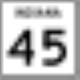
Gatesville, Indiana Gatesville is an unincorporated town in Hamblen Township, Brown County, Indiana. Two legends persist about the origin of its name. One says it was founded by a fellow named either David or William Gates... Gnaw Bone, Indiana Gnaw Bone is an unincorporated community in Brown County, Indiana.One theory is that the town's name derives from that of the original French settlement in the area, Narbonne, named in turn for the southern French city of that name... Helmsburg, Indiana Helmsburg is an unincorporated community in southern Jackson Township, Brown County, Indiana, United States. It lies along State Road 45 north of the town of Nashville, the county seat of Brown County. Its elevation is 666 feet... Lanam, Indiana Lanam is an unincorporated town in Jackson Township, Brown County, Indiana. It was founded by Rev. John Lanam in 1875.... Mount Liberty, Indiana Mount Liberty is an unincorporated town in Washington Township, Brown County, Indiana.... Needmore, Brown County, Indiana Needmore is an unincorporated town in Jackson Township, Brown County, Indiana.-Geography:Needmore is located at . Needmore was first founded in 1892. It originally had the name Jackson's Hollow. In 1915, a representative from the Illinois Central Railroad line was surveying the area for possible... Pikes Peak, Indiana Pikes Peak is an unincorporated town in Van Buren Township, Brown County, Indiana. According to legend, Adrian Miller, was planning on moving to Colorado to take advantage of the redesigned Homestead act in 1875. He wrote on the side of his conestoga wagon "Pikes Peak or Bust" Miller made it out... Point Idalawn, Indiana Point Idalawn is an unincorporated town in Jackson Township, Brown County, Indiana.... |
Spearsville, Indiana Spearsville is an unincorporated town in Hamblen Township, Brown County, Indiana. According to local lore, in 1837 a recent immigrant named Gunther Hartman moved next to several other residences near the current town... Stone Head, Indiana Stone Head is an unincorporated town in Van Buren Township, Brown County, Indiana.Stone Head was named after the mile marker in town sculpted into a face.... Story, Indiana Story is an unincorporated town in Van Buren Township, Brown County, Indiana. This area of the state now appropriately called Indiana was opened to European settlement on September 30, 1809, upon the consummation of a treaty between Governor William Henry Harrison and the Miami Indians... Taggart, Indiana Taggart is an unincorporated town in Hamblen Township, Brown County, Indiana.... Trevlac, Indiana Trevlac is an unincorporated town in Jackson Township, Brown County, Indiana. Trevlac was named after John Calvert, with his name simply reversed.... Waycross, Indiana Waycross is the camp and conference center of the Episcopal Diocese of Indianapolis. Waycross opened in 1957. It is located on over on Bear Creek Road, in Jackson Township. The site is centered in a beautiful valley near the intersection of Bear Creek and Richards Roads. The Bilhiemer family... |
Extinct towns
- Beck
- Beveridge
- Buffalo
- Cleona
- Cooper
- ElkinsvilleElkinsville, IndianaElkinsville is an unincorporated community in Van Buren Township, Brown County, Indiana. It was once a thriving farming village, but was evacuated during the construction of nearby Lake Monroe Reservoir via eminent domain in 1964. All that remains of Elkinsville today are some private residences,...
- Gent
- Kelp
- Lock
- Marble
- Marshall
- Ramelton
- Sherman
- Youno
Townships
- HamblenHamblen Township, Brown County, IndianaHamblen Township is one of four townships in Brown County, Indiana. As of the 2000 census, its population was 4,591.-Geography:Hamblen Township covers an area of ; of this is water.-Unincorporated towns:* Gatesville* Spearsville...
- JacksonJackson Township, Brown County, IndianaJackson Township is one of four townships in Brown County, Indiana. As of the 2000 census, its population was 4,151.-Geography:Jackson Township covers an area of ; of this is water.-Unincorporated towns:* Beanblossom* Bear Wallow...
- Van BurenVan Buren Township, Brown County, IndianaVan Buren Township is one of four townships in Brown County, Indiana. As of the 2000 census, its population was 1,782. The township includes the southern portion of Brown County State Park.-History:...
- WashingtonWashington Township, Brown County, IndianaWashington Township is one of four townships in Brown County, Indiana. As of the 2000 census, its population was 4,433. The township includes the northern portion of Brown County State Park.-Geography:...
Major highways
 Indiana State Road 45Indiana State Road 45State Road 45 is a state route from Bean Blossom, Indiana to Scotland, Indiana in the southern half of the state.-Route description:From Bean Blossom and through Brown County, State Road 45 is a narrow, shoulderless two-lane road that passes between the Morgan-Monroe State Forest and the Yellowwood...
 Indiana State Road 46Indiana State Road 46State Road 46 in the U.S. State of Indiana is an east–west state highway in the southern half of Indiana.-Route description:The western terminus of SR 46 is at U.S. Route 40 in central Vigo County, just east of Terre Haute...
 Indiana State Road 135Indiana State Road 135State Road 135 in the U.S. State of Indiana is a road that connects Indianapolis with the Ohio River; for the most part it is a two-lane road.-Route description:The southern terminus is the Matthew E. Welsh Bridge on the east side of Mauckport...
Points of interest
- Brown County State Park
- CYO Camp Rancho Framasa in Nashville
- eXplore Brown County for adventure, camping, family and group activities.
- Lake LemonLake LemonLake Lemon is an reservoir located in southern Indiana approximately 10 miles northeast of Bloomington, Indiana. It is bounded by private and public property in Monroe County and Brown County, with the eastern end of the lake in Brown County. The surface area of the lake is 1,650 acres , making it...
- Lake MonroeLake Monroe (Indiana)Lake Monroe is a reservoir located about 10 miles southeast of Bloomington, Indiana, United States. The lake is the largest in Indiana with of water spread over the counties of Monroe and Brown. It is also home to of protected forest and three recreational areas . Indiana's only federally...
- T. C. SteeleT. C. SteeleTheodore Clement Steele was an American Impressionist painter known for his Indiana landscapes.Theodore Steele's paintings are in many public collections, including those of the Indianapolis Museum of Art, the Los Angeles County Museum of Art, and the Indiana University Art Museum in Bloomington,...
State Historic Site - Cordry Sweetwater Cordry Sweetwater Conservancy District
Climate and weather
In recent years, average temperatures in Nashville have ranged from a low of 19 °F (-7.2 °C) in January to a high of 86 °F (30 °C) in July, although a record low of -21 °F was recorded in January 1985 and a record high of 110 °F (43.3 °C) was recorded in July 1936. Average monthly precipitation ranged from 2.66 inches (6.8 cm) in January to 5.12 inches (13 cm) in May.Government
The county government is a constitutional body, and is granted specific powers by the Constitution of IndianaConstitution of Indiana
There have been two Constitutions of the State of Indiana. The first constitution was created when the Territory of Indiana sent forty-three delegates to a constitutional convention on June 10, 1816 to establish a constitution for the proposed State of Indiana after the United States Congress had...
, and by the Indiana Code
Indiana Code
The Indiana Code is the code of laws for the US State of Indiana. The contents are the codification of the all the laws currently in effect within Indiana...
.
County Council: The county council is the legislative branch of the county government and controls all the spending and revenue collection in the county. Representatives are elected from county districts. The council members serve four year terms. They are responsible for setting salaries, the annual budget, and special spending. The council also has limited authority to impose local taxes, in the form of an income and property tax that is subject to state level approval, excise taxes, and service taxes.
Board of Commissioners: The executive body of the county is made of a board of commissioners. The commissioners are elected county-wide, in staggered terms, and each serves a four-year term. One of the commissioners, typically the most senior, serves as president. The commissioners are charged with executing the acts legislated by the council, collecting revenue, and managing the day-to-day functions of the county government.
Court: The county maintains a circuit court
Circuit court
Circuit court is the name of court systems in several common law jurisdictions.-History:King Henry II instituted the custom of having judges ride around the countryside each year to hear appeals, rather than forcing everyone to bring their appeals to London...
with jurisdiction to hear all civil and criminal cases. The judge on the court is elected to a term of six years and must be an attorney licensed to practice in Indiana. The judge is assisted by a magistrate who is hired by the circuit court judge, not elected.
County Officials: The county has several other elected offices, including sheriff
Sheriff
A sheriff is in principle a legal official with responsibility for a county. In practice, the specific combination of legal, political, and ceremonial duties of a sheriff varies greatly from country to country....
, coroner
Coroner
A coroner is a government official who* Investigates human deaths* Determines cause of death* Issues death certificates* Maintains death records* Responds to deaths in mass disasters* Identifies unknown dead* Other functions depending on local laws...
, auditor, treasurer
Treasurer
A treasurer is the person responsible for running the treasury of an organization. The adjective for a treasurer is normally "tresorial". The adjective "treasurial" normally means pertaining to a treasury, rather than the treasurer.-Government:...
, recorder
Recorder of deeds
Recorder of deeds is a government office tasked with maintaining public records and documents, especially records relating to real estate ownership that provide persons other than the owner of a property with real rights over that property.-Background:...
, surveyor
Surveying
See Also: Public Land Survey SystemSurveying or land surveying is the technique, profession, and science of accurately determining the terrestrial or three-dimensional position of points and the distances and angles between them...
, and circuit court clerk
Court clerk
A court clerk is an officer of the court whose responsibilities include maintaining the records of a court. Another duty is to administer oaths to witnesses, jurors, and grand jurors...
. Each of these elected officers serves a term of four years and oversees a different part of county government.
Brown County is part of Indiana's 9th congressional district
Indiana's 9th congressional district
Indiana's 9th congressional district is a congressional district in the U.S. state of Indiana. Located in south-central and southeastern Indiana, the district is based in Bloomington....
, Indiana Senate
Indiana Senate
The Indiana Senate is the upper house of the Indiana General Assembly, the state legislature of the U.S. state of Indiana. The Senate is composed of 50 members representing an equal number of constituent districts. Senators serve four-year terms without term limits...
district 40 and Indiana House of Representatives
Indiana House of Representatives
The Indiana House of Representatives is the lower house of the Indiana General Assembly, the state legislature of the U.S. state of Indiana. The House is composed of 100 members representing an equal number of constituent districts. House members serve two-year terms without term limits...
districts 60 and 65.
Demographics
As of the censusCensus
A census is the procedure of systematically acquiring and recording information about the members of a given population. It is a regularly occurring and official count of a particular population. The term is used mostly in connection with national population and housing censuses; other common...
of 2000, there were 14,957 people, 5,897 households, and 4,434 families residing in the county. The population density
Population density
Population density is a measurement of population per unit area or unit volume. It is frequently applied to living organisms, and particularly to humans...
was 48 people per square mile (18/km²). There were 7,163 housing units at an average density of 23 per square mile (9/km²). The racial makeup of the county was 98.16% White
Race (United States Census)
Race and ethnicity in the United States Census, as defined by the Federal Office of Management and Budget and the United States Census Bureau, are self-identification data items in which residents choose the race or races with which they most closely identify, and indicate whether or not they are...
, 0.21% Black
Race (United States Census)
Race and ethnicity in the United States Census, as defined by the Federal Office of Management and Budget and the United States Census Bureau, are self-identification data items in which residents choose the race or races with which they most closely identify, and indicate whether or not they are...
or African American
Race (United States Census)
Race and ethnicity in the United States Census, as defined by the Federal Office of Management and Budget and the United States Census Bureau, are self-identification data items in which residents choose the race or races with which they most closely identify, and indicate whether or not they are...
, 0.22% Native American
Race (United States Census)
Race and ethnicity in the United States Census, as defined by the Federal Office of Management and Budget and the United States Census Bureau, are self-identification data items in which residents choose the race or races with which they most closely identify, and indicate whether or not they are...
, 0.20% Asian
Race (United States Census)
Race and ethnicity in the United States Census, as defined by the Federal Office of Management and Budget and the United States Census Bureau, are self-identification data items in which residents choose the race or races with which they most closely identify, and indicate whether or not they are...
, 0.01% Pacific Islander
Race (United States Census)
Race and ethnicity in the United States Census, as defined by the Federal Office of Management and Budget and the United States Census Bureau, are self-identification data items in which residents choose the race or races with which they most closely identify, and indicate whether or not they are...
, 0.37% from other races
Race (United States Census)
Race and ethnicity in the United States Census, as defined by the Federal Office of Management and Budget and the United States Census Bureau, are self-identification data items in which residents choose the race or races with which they most closely identify, and indicate whether or not they are...
, and 0.82% from two or more races. 0.88% of the population were Hispanic
Race (United States Census)
Race and ethnicity in the United States Census, as defined by the Federal Office of Management and Budget and the United States Census Bureau, are self-identification data items in which residents choose the race or races with which they most closely identify, and indicate whether or not they are...
or Latino
Race (United States Census)
Race and ethnicity in the United States Census, as defined by the Federal Office of Management and Budget and the United States Census Bureau, are self-identification data items in which residents choose the race or races with which they most closely identify, and indicate whether or not they are...
of any race. 25.2% were of German
Germans
The Germans are a Germanic ethnic group native to Central Europe. The English term Germans has referred to the German-speaking population of the Holy Roman Empire since the Late Middle Ages....
, 20.1% American
United States
The United States of America is a federal constitutional republic comprising fifty states and a federal district...
, 14.9% English
English people
The English are a nation and ethnic group native to England, who speak English. The English identity is of early mediaeval origin, when they were known in Old English as the Anglecynn. England is now a country of the United Kingdom, and the majority of English people in England are British Citizens...
and 12.4% Irish
Irish people
The Irish people are an ethnic group who originate in Ireland, an island in northwestern Europe. Ireland has been populated for around 9,000 years , with the Irish people's earliest ancestors recorded having legends of being descended from groups such as the Nemedians, Fomorians, Fir Bolg, Tuatha...
ancestry according to Census 2000.
There were 5,897 households out of which 29.90% had children under the age of 18 living with them, 64.80% were married couples
Marriage
Marriage is a social union or legal contract between people that creates kinship. It is an institution in which interpersonal relationships, usually intimate and sexual, are acknowledged in a variety of ways, depending on the culture or subculture in which it is found...
living together, 6.50% had a female householder with no husband present, and 24.80% were non-families. 20.60% of all households were made up of individuals and 7.30% had someone living alone who was 65 years of age or older. The average household size was 2.51 and the average family size was 2.89.
In the county the population was spread out with 23.30% under the age of 18, 6.30% from 18 to 24, 27.90% from 25 to 44, 29.60% from 45 to 64, and 12.90% who were 65 years of age or older. The median age was 41 years. For every 100 females there were 100.90 males. For every 100 females age 18 and over, there were 98.10 males.
The median income for a household in the county was $43,708, and the median income for a family was $49,252. Males had a median income of $36,828 versus $24,321 for females. The per capita income
Per capita income
Per capita income or income per person is a measure of mean income within an economic aggregate, such as a country or city. It is calculated by taking a measure of all sources of income in the aggregate and dividing it by the total population...
for the county was $20,548. About 7.70% of families and 8.90% of the population were below the poverty line, including 9.10% of those under age 18 and 10.10% of those age 65 or over.
External links
- Brown County Democrat newspaper
- Brown County Convention & Visitors Bureau
- Brown County Chamber of Commerce
- eXplore Brown County
- Town of Nashville
- The Artists of Brown County
- The Hohenberger Photograph Collection consists of about 15,000 photographs and negatives of Brown County, Indiana, by photographer Frank Michael Hohenberger, 1876-1963.