
United States Space Surveillance Network
Encyclopedia
The United States Space Surveillance Network is a critical part of United States Strategic Command
's (USSTRATCOM) mission and involves detecting, tracking, cataloging and identifying artificial objects orbiting Earth, i.e. active/inactive satellite
s, spent rocket
bodies, or fragmentation debris
. Space surveillance accomplishes the following:
The SPACETRACK program represents a worldwide Space Surveillance Network (SSN) of dedicated, collateral, and contributing electro-optical, passive radio frequency (rf) and radar sensors. The SSN is tasked to provide space object cataloging and identification, satellite attack warning, timely notification to U.S. forces of satellite fly-over, space treaty monitoring, and scientific and technical intelligence
gathering. The continued increase in satellite and orbital debris populations, as well as the increasing diversity in launch trajectories, non-standard orbits, and geosynchronous altitudes, necessitates continued modernization of the SSN to meet existing and future requirements and ensure their cost-effective supportability.
SPACETRACK also developed the systems interfaces necessary for the command and control, targeting, and damage assessment of a potential future U.S. Anti-satellite (ASAT) system. There is an Image Information Processing Center and Supercomputing facility at the Air Force Maui Optical Station (AMOS). The resources and responsibility for the HAVE STARE Radar System
development were transferred to SPACETRACK from an intelligence program per Congressional direction in FY93.
in Bedford, Massachusetts
. The procedures used at the NSSCC were first reported in 1959 and 1960 by Wahl, who was the technical director of the NSSCC. In 1960, under Project Space Track, Fitzpatrick and Findley developed detailed documentation of the procedures used at the NSSCC. For the early history of satellite tracking, 1957–1961, see Project Space Track.
Observation of satellites was performed at more than 150 individual sites. Contributions came from radar stations, Baker–Nunn cameras , telescopes, radio receivers, and the Operation Moonwatch
participants. These dedicated individuals took observations on satellites by visual means. There are numerous observation types and sources. The observations were transferred to the NSSCC by teletype, telephone, mail, and personal messenger. There a duty analyst reduced the data and determined corrections that should be made to the orbital elements before they were used for further prediction. After this analysis, these corrections were fed into an IBM-709 computer that computed the updated orbital data. These updated orbital data were then used in another phase of the same computer program to yield the geocentric ephemeris. From the geocentric ephemeris, three different products were computed and sent back to the observing stations for their planning of future observing opportunities.
triggered a need for tracking of objects in space using the Space Tracking System. The first US system, Minitrack
, was already in existence at the time of the Sputnik launch, but the US quickly discovered that Minitrack could not reliably detect and track satellites. The US Navy designed Minitrack to track the Vanguard
satellite, and so long as satellites followed the international agreement on satellite transmitting frequencies, Minitrack could track any satellite. However, the Soviets chose not to use the international satellite frequencies. Thus, a major limitation of this system became visible. Minitrack could not detect or track an uncooperative or passive satellite.
Concurrent with Minitrack was the use of the Baker-Nunn satellite tracking cameras
. These systems used modified Schmidt telescopes of great resolution to photograph and identify objects in space. The cameras first became operational in 1956 and eventually operated at sites worldwide. The Air Force ran five sites, the Royal Canadian Air Force
ran two, and the Smithsonian Institution's Astrophysics Observatory
operated a further eight sites. The Baker-Nunn system, like Minitrack, provided little real-time data
and was limited to night, clear weather operations.
Beyond the problems in acquiring data on satellites, it became obvious that the US tracking network would soon be overwhelmed by the tremendous number of satellites that followed Sputnik and Vanguard. The huge amounts of satellite tracking data accumulated required creation or expansion of organizations and equipment just to sift through and catalog the objects. The need for real-time detection and tracking information to deal with Soviet satellite launches led on 19 December 1958 to ARPA's implementation of Executive Order 50-59 to establish a spacetrack network. This spacetrack network, Project Shepherd, began with the Space Track Filter Center at Bedford, Massachusetts, and an operational space defense network (i.e., a missile warning network). ARDC took up the spacetrack mission in late 1959 and in April 1960 set up the Interim National Space Surveillance Control Center at Hanscom Field, Massachusetts, to coordinate observations and maintain satellite data.(96) At the same time, DOD designated the Aerospace Defense Command (ADCOM), formerly Air Defense Command, as the prime user of spacetrack data. ADCOM formulated the first US plans for space surveillance.
(DoD) has maintained a database of satellite states since the launch of the first Sputnik in 1957, known as the Space Object Catalog, or simply the Space Catalog. These satellite states are regularly updated with observations from the Space Surveillance Network, a globally distributed network of interferometer, radar and optical tracking systems. Two separate catalog databases are maintained under the USSTRATCOM: a primary catalog by the Air Force Space Command (AFSPC), and an alternate catalog by the Naval Space Command (NSC). The number of cataloged objects is nearly 20,000.
Different astrodynamics
theories are used to maintain these catalogs. The so-called General Perturbations
(GP) theory provides a general analytical solution of the satellite equations of motion. The orbital elements and their associated partial derivatives are expressed as series expansions in terms of the initial conditions of these differential equations. The GP theories operated efficiently on the earliest electronic computing machines, and were therefore adopted as the primary theory for Space Catalog orbit determination. Assumptions must be made to simplify these analytical theories, such as truncation of the Earth’s gravitational potential to a few zonal harmonic terms. The atmosphere is usually modeled as a static, spherical density field that exponentially decays. Third body influences and resonance effects are partially modeled. Increased accuracy of GP theory usually requires significant development efforts.
NASA maintains civilian databases of GP orbital elements, also known as NASA or NORAD two-line elements
. The GP element sets are "mean" element sets that have specific periodic features removed to enhance long-term prediction performance, and require special software to reconstruct the compressed trajectory
.
in the 1960s to track Soviet missile tests and to support the Air Force Spacetrack System. In July 1973, Raytheon won a contract to build a system called "Cobra Dane
" on Shemya
Island in the Aleutian Islands off the Alaskan coast. Designated as the AN/FPS-108, Cobra Dane replaced AN/FPS-17 and AN/FPS-80 radars. Becoming operational in 1977, Cobra Dane also had a primary mission of monitoring Soviet tests of missiles launched from southwest Russia aimed at the Siberian Kamchatka peninsula. This large, single-faced, phased-array radar was the most powerful ever built.
The FPS-80 was a tracking radar and the FPS-17 was a detection radar for Soviet missiles. Both were part of the Ballistic Missile Early Warning System (BMEWS). The large detection radar (AN/FPS-17) went into operation in 1960. In 1961, the AN/FPS-80 tracking radar was constructed nearby. These radars were closed in the 1970s.
The Pirinclik (near Diyarbakir, Turkey) intelligence collection radar consisted of one detection radar and one tracking radar. The Pirinclik radar is operated by the 19th Surveillance Squadron. The radar reached IOC on 1 June 1955. The Pirinclik Radar Site consisted of a detection radar (AN/FPS-17) and a mechanical tracking radar (AN/FPS-79). Both radars operated at a UHF (432 MHz) frequency. Although limited by their mechanical technology, Pirinclik's two radars give the advantage of tracking two objects simultaneously in real time. Its location close to the southern FSU makes it the only ground sensor capable of tracking actual deorbits of Russian space objects. In addition, the Pirinclik radar was the only 24-hour-per-day eastern hemisphere deep space sensor. Radar operations at Pirinclik were terminated in March 1997.
, was conceived, designed, built, and installed for operation in less than two years. Installed at Laredo AFB in Texas, the first AN/FPS-17 was used to track rockets launched from White Sands, New Mexico. The radar was unique; it featured a fixed-fence antenna that stood 175 feet (53.3 m) high and 110 feet (33.5 m) wide. The transmitter sent out a short pulse at a frequency between 180 to 220 MHz. Units were installed in the late 1950s at Shemya Island in the Aleutians and in Diyarbakir
(Pirinclik), Turkey. The AN/FPS-17 Detection Radar on Shemya
became operational in May 1960. The unit at Shemya subsequently was replaced by the Cobra Dane
(AN/FPS-108) radar.
There were two AN/FPS-17
detection radars at Diyarbakir
, Turkey and three more at Shemya
in the Aleutians.
is used to improve both the gain and resolution of the 35 feet (10.7 m) dish antenna. Steering is mechanical; the FPS-79 has a range of 24000 miles (38,624.2 km).
After circling the Earth in an apparently dormant state for 9 months, on November 13, 1986 the SPOT 1 Ariane
third stage violently separated into some 465 detectable fragments - the most severe satellite breakup yet recorded prior to 2007.
Although the debris cloud did not pass over the continental United States until more than 8 hours later, personnel in the Space Surveillance Center (SSC) at the Cheyenne Mountain Complex in Colorado Springs, Colorado
reported that the U.S. FPS-79 radar at Pirinclik, Turkey, noticed the debris within minutes of the fragmentation.
The SSN has been tracking space objects since 1957 when the Soviet Union
opened the space age with the launch of Sputnik I. Since then, the SSN has tracked more than 24,500 space objects orbiting Earth. Of that number, the SSN currently tracks more than 8,000 orbiting objects. The rest have re-entered Earth's turbulent atmosphere and disintegrated, or survived re-entry and impacted the Earth. The space objects now orbiting Earth range from satellites weighing several tons to pieces of spent rocket bodies weighing only 10 pounds (4.5 kg).
About seven percent of the space objects are operational satellites, the rest are debris.
The USSTRATCOM is primarily interested in the active satellites, but also tracks space debris. The SSN tracks space objects which are 10 centimeters in diameter (baseball size) or larger.
for detection and tracking of faint objects in space
such as asteroid
s. It is also to be employed for space defense missions. The program is designed to advance, or expand, space situational awareness, and be able to quickly provide wide area search capability.
, wide field of view, and improvements in step-and-settle abilities. DARPA Privacy and Security notice #2: Except where otherwise noted, information presented on the DARPA Web Information Service is considered public information and may be distributed or copied. Use of appropriate byline/photo/image credits is requested.
SST detects, tracks, and can discern small, obscure objects, in deep space with a "wide field of view system". It is a single telescope with the dual abilities. First the telescope is sensitive enough to allow for detection, also, of small, dimly lit objects (low reflectivity). Second it is capable of quickly searching the visible sky. This combination is a difficult achievement in a single telescope design.
It is an F/1.0 aperture
telescope with a 3.5 meter primary mirror. It contains a curved, focal plane array. Multiple searches can be conducted from the ground multiple times throughout the night. As a telescope system, it can give precise locations of discovered objects, extrapolate the course of the object, and indicate the objects stability.
The US Air Force will ultimately take over the program, and integrate the SST as a sensor in the Space Surveillance Network of the Air Force Space Command
in FY 2009.
(AFSSS), also known as the "space fence", is a very high frequency
radar network located at sites across the southern United States (from California
to Georgia
) with a centralized data processing site at the Naval Network and Space Operations Command in Dahlgren, Virginia
. The "fence" is now operated by the U.S. Air Force (20th Space Control Squadron Detachment 1).
The Satellite Detection and Reconnaissance Defense (the former designation of the NSSS) reached initial operating capability in 1961. Since then, the role of the "fence" has grown. The system detects space objects from new launches, maneuvers of existing objects, breakups of existing objects, and provides data to users from its catalog of space objects. Orbital parameters of more than 10,000 objects are maintained in this catalog—which has now gained usage by NASA, weather agencies, and friendly foreign agencies. The information is essential to computing the collision avoidance
information to de-conflict launch window
s with known orbiting space objects.

 Ground-based Electro-Optical Deep Space Surveillance, or GEODSS, is an optical system that uses telescope
s, low-light level TV cameras, and computers. It replaced an older system of six 20 inch (half meter) Baker-Nunn cameras using photographic film
.
There are three operational GEODSS sites that report to the 21st Operations Group
:
A site at Choe Jong San, South Korea
was closed in 1993 due to nearby smog from the town, weather and cost concerns. Originally, the fifth GEODSS was planned to be operated from a site in Portugal
, but this was never built.
A mobile telescope that contributes to the GEODSS system is located at Morón Air Base, Spain
37.170°N 5.609°W
GEODSS tracks objects in deep space
, or from about 3,000 mi (4,800 km) out to beyond geosynchronous altitudes. GEODSS requires nighttime and clear weather tracking because of the inherent limitations of an optical system. Each site has three telescopes. The telescopes have a 40-inch (1.02 m) aperture and a two-degree field of view. The telescopes are able to "see" objects 10,000 times dimmer than the human eye can detect. This sensitivity, and sky background during daytime that masks satellites reflected light, dictates that the system operate at night. As with any ground-based optical system, cloud cover and local weather conditions directly influence its effectiveness. GEODSS system can track objects as small as a basketball more than 20,000 miles (30,000 km) in space or a chair at 35000 miles (56,326.9 km), and is a vital part of USSTRATCOM’s Space Surveillance Network. Distant Molniya
orbiting satellites are often detected in elliptical orbits that surpass the Moon
and back (245,000 miles out). Each GEODSS site tracks approximately 3,000 objects per night out of 9,900 object that are regularly tracked and accounted for. Objects crossing the International Space Station (ISS) orbit within 20 miles (32.2 km) will cause the ISS to adjust their orbit to avoid collision. The oldest object tracked is Object #4 (Vanguard 1
) launched in 1958.
(MSX
) satellite launched by the Ballistic Missile Defense Organization
in 1996. It was retired from service on June 2, 2008.
United States Strategic Command
United States Strategic Command is one of nine Unified Combatant Commands of the United States Department of Defense . The Command, including components, employs more than 2,700 people, representing all four services, including DoD civilians and contractors, who oversee the command's operationally...
's (USSTRATCOM) mission and involves detecting, tracking, cataloging and identifying artificial objects orbiting Earth, i.e. active/inactive satellite
Satellite
In the context of spaceflight, a satellite is an object which has been placed into orbit by human endeavour. Such objects are sometimes called artificial satellites to distinguish them from natural satellites such as the Moon....
s, spent rocket
Rocket
A rocket is a missile, spacecraft, aircraft or other vehicle which obtains thrust from a rocket engine. In all rockets, the exhaust is formed entirely from propellants carried within the rocket before use. Rocket engines work by action and reaction...
bodies, or fragmentation debris
Space debris
Space debris, also known as orbital debris, space junk, and space waste, is the collection of objects in orbit around Earth that were created by humans but no longer serve any useful purpose. These objects consist of everything from spent rocket stages and defunct satellites to erosion, explosion...
. Space surveillance accomplishes the following:
- Predict when and where a decaying space object will re-enter the Earth's atmosphereEarth's atmosphereThe atmosphere of Earth is a layer of gases surrounding the planet Earth that is retained by Earth's gravity. The atmosphere protects life on Earth by absorbing ultraviolet solar radiation, warming the surface through heat retention , and reducing temperature extremes between day and night...
; - Prevent a returning space object, which to radarRadarRadar is an object-detection system which uses radio waves to determine the range, altitude, direction, or speed of objects. It can be used to detect aircraft, ships, spacecraft, guided missiles, motor vehicles, weather formations, and terrain. The radar dish or antenna transmits pulses of radio...
looks like a missile, from triggering a false alarmFalse alarmA false alarm, also called a nuisance alarm, is the fake report of an emergency, causing unnecessary panic and/or bringing resources to a place where they are not needed. Over time, repeated false alarms in a certain area may cause occupants to start to ignore all alarms, knowing that each time it...
in missile-attack warning sensors of the U.S. and other countries; - Chart the present position of space objects and plot their anticipated orbital paths;
- Detect new man-made objects in space;
- Produce a running catalog of man-made space objects;
- Determine which country owns a re-entering space object;
- Inform NASANASAThe National Aeronautics and Space Administration is the agency of the United States government that is responsible for the nation's civilian space program and for aeronautics and aerospace research...
whether or not objects may interfere with the space shuttleSpace ShuttleThe Space Shuttle was a manned orbital rocket and spacecraft system operated by NASA on 135 missions from 1981 to 2011. The system combined rocket launch, orbital spacecraft, and re-entry spaceplane with modular add-ons...
or satelliteSatelliteIn the context of spaceflight, a satellite is an object which has been placed into orbit by human endeavour. Such objects are sometimes called artificial satellites to distinguish them from natural satellites such as the Moon....
s and International Space StationInternational Space StationThe International Space Station is a habitable, artificial satellite in low Earth orbit. The ISS follows the Salyut, Almaz, Cosmos, Skylab, and Mir space stations, as the 11th space station launched, not including the Genesis I and II prototypes...
orbits.
The SPACETRACK program represents a worldwide Space Surveillance Network (SSN) of dedicated, collateral, and contributing electro-optical, passive radio frequency (rf) and radar sensors. The SSN is tasked to provide space object cataloging and identification, satellite attack warning, timely notification to U.S. forces of satellite fly-over, space treaty monitoring, and scientific and technical intelligence
Technical intelligence
In a pure military context, Technical Intelligence is intelligence about weapons and equipment used by the armed forces of foreign nations .The related term, scientific and technical intelligence, addresses information collected at the strategic level.Technical intelligence is intended primarily...
gathering. The continued increase in satellite and orbital debris populations, as well as the increasing diversity in launch trajectories, non-standard orbits, and geosynchronous altitudes, necessitates continued modernization of the SSN to meet existing and future requirements and ensure their cost-effective supportability.
SPACETRACK also developed the systems interfaces necessary for the command and control, targeting, and damage assessment of a potential future U.S. Anti-satellite (ASAT) system. There is an Image Information Processing Center and Supercomputing facility at the Air Force Maui Optical Station (AMOS). The resources and responsibility for the HAVE STARE Radar System
AN/FPS-129
The AN/FPS-129 HAVE STARE radar, known better as the Globus II radar, is a space surveillance system operated by the Norwegian Intelligence Service. Its stated tasks are to watch outer space, observe Norwegian areas of interest abroad, and to gather information that can be used within the fields of...
development were transferred to SPACETRACK from an intelligence program per Congressional direction in FY93.
1957–1963
The first formalized effort to catalog satellites occurred at Project Space Track, later known as the National Space Surveillance Control Center (NSSCC), located at Hanscom FieldHanscom Field
Hanscom Field , also known by its full name Laurence G. Hanscom Field, is a public airport located in Bedford, in Middlesex County, Massachusetts, United States. It is operated by the Massachusetts Port Authority....
in Bedford, Massachusetts
Bedford, Massachusetts
Bedford is a town in Middlesex County, Massachusetts, United States. It is within the Greater Boston area, north-west of the city of Boston. The population of Bedford was 13,320 at the 2010 census.- History :...
. The procedures used at the NSSCC were first reported in 1959 and 1960 by Wahl, who was the technical director of the NSSCC. In 1960, under Project Space Track, Fitzpatrick and Findley developed detailed documentation of the procedures used at the NSSCC. For the early history of satellite tracking, 1957–1961, see Project Space Track.
Observation of satellites was performed at more than 150 individual sites. Contributions came from radar stations, Baker–Nunn cameras , telescopes, radio receivers, and the Operation Moonwatch
Operation Moonwatch
Operation Moonwatch was an amateur science program formally initiated by the Smithsonian Astrophysical Observatory in 1956 . The SAO organized Moonwatch as part of the International Geophysical Year which was probably the largest single scientific undertaking in history...
participants. These dedicated individuals took observations on satellites by visual means. There are numerous observation types and sources. The observations were transferred to the NSSCC by teletype, telephone, mail, and personal messenger. There a duty analyst reduced the data and determined corrections that should be made to the orbital elements before they were used for further prediction. After this analysis, these corrections were fed into an IBM-709 computer that computed the updated orbital data. These updated orbital data were then used in another phase of the same computer program to yield the geocentric ephemeris. From the geocentric ephemeris, three different products were computed and sent back to the observing stations for their planning of future observing opportunities.
Missile Warning and Space Surveillance in the Eisenhower Years
The launch of Sputnik 1Sputnik 1
Sputnik 1 ) was the first artificial satellite to be put into Earth's orbit. It was launched into an elliptical low Earth orbit by the Soviet Union on 4 October 1957. The unanticipated announcement of Sputnik 1s success precipitated the Sputnik crisis in the United States and ignited the Space...
triggered a need for tracking of objects in space using the Space Tracking System. The first US system, Minitrack
Minitrack
The Minitrack Network, was the first U.S. satellite tracking network to become operational, in 1957. It was used to track the flights of Sputnik, Vanguard, Explorer, and other early space efforts...
, was already in existence at the time of the Sputnik launch, but the US quickly discovered that Minitrack could not reliably detect and track satellites. The US Navy designed Minitrack to track the Vanguard
Project Vanguard
Project Vanguard was a program managed by the United States Naval Research Laboratory , which intended to launch the first artificial satellite into Earth orbit using a Vanguard rocket as the launch vehicle from Cape Canaveral Missile Annex, Florida....
satellite, and so long as satellites followed the international agreement on satellite transmitting frequencies, Minitrack could track any satellite. However, the Soviets chose not to use the international satellite frequencies. Thus, a major limitation of this system became visible. Minitrack could not detect or track an uncooperative or passive satellite.
Concurrent with Minitrack was the use of the Baker-Nunn satellite tracking cameras
Schmidt camera
A Schmidt camera, also referred to as the Schmidt telescope, is a catadioptric astrophotographic telescope designed to provide wide fields of view with limited aberrations. Other similar designs are the Wright Camera and Lurie-Houghton telescope....
. These systems used modified Schmidt telescopes of great resolution to photograph and identify objects in space. The cameras first became operational in 1956 and eventually operated at sites worldwide. The Air Force ran five sites, the Royal Canadian Air Force
Royal Canadian Air Force
The history of the Royal Canadian Air Force begins in 1920, when the air force was created as the Canadian Air Force . In 1924 the CAF was renamed the Royal Canadian Air Force and granted royal sanction by King George V. The RCAF existed as an independent service until 1968...
ran two, and the Smithsonian Institution's Astrophysics Observatory
Smithsonian Astrophysical Observatory
The Smithsonian Astrophysical Observatory is a research institute of the Smithsonian Institution headquartered in Cambridge, Massachusetts, where it is joined with the Harvard College Observatory to form the Harvard-Smithsonian Center for Astrophysics .-History:The SAO was founded in 1890 by...
operated a further eight sites. The Baker-Nunn system, like Minitrack, provided little real-time data
Real-time data
Real-time data denotes information that is delivered immediately after collection. There is no delay in the timeliness of the information provided. Real-time data is often used for navigation or tracking....
and was limited to night, clear weather operations.
Beyond the problems in acquiring data on satellites, it became obvious that the US tracking network would soon be overwhelmed by the tremendous number of satellites that followed Sputnik and Vanguard. The huge amounts of satellite tracking data accumulated required creation or expansion of organizations and equipment just to sift through and catalog the objects. The need for real-time detection and tracking information to deal with Soviet satellite launches led on 19 December 1958 to ARPA's implementation of Executive Order 50-59 to establish a spacetrack network. This spacetrack network, Project Shepherd, began with the Space Track Filter Center at Bedford, Massachusetts, and an operational space defense network (i.e., a missile warning network). ARDC took up the spacetrack mission in late 1959 and in April 1960 set up the Interim National Space Surveillance Control Center at Hanscom Field, Massachusetts, to coordinate observations and maintain satellite data.(96) At the same time, DOD designated the Aerospace Defense Command (ADCOM), formerly Air Defense Command, as the prime user of spacetrack data. ADCOM formulated the first US plans for space surveillance.
US Space Catalog
The United States Department of DefenseUnited States Department of Defense
The United States Department of Defense is the U.S...
(DoD) has maintained a database of satellite states since the launch of the first Sputnik in 1957, known as the Space Object Catalog, or simply the Space Catalog. These satellite states are regularly updated with observations from the Space Surveillance Network, a globally distributed network of interferometer, radar and optical tracking systems. Two separate catalog databases are maintained under the USSTRATCOM: a primary catalog by the Air Force Space Command (AFSPC), and an alternate catalog by the Naval Space Command (NSC). The number of cataloged objects is nearly 20,000.
Different astrodynamics
Astrodynamics
Orbital mechanics or astrodynamics is the application of ballistics and celestial mechanics to the practical problems concerning the motion of rockets and other spacecraft. The motion of these objects is usually calculated from Newton's laws of motion and Newton's law of universal gravitation. It...
theories are used to maintain these catalogs. The so-called General Perturbations
Perturbation (astronomy)
Perturbation is a term used in astronomy in connection with descriptions of the complex motion of a massive body which is subject to appreciable gravitational effects from more than one other massive body....
(GP) theory provides a general analytical solution of the satellite equations of motion. The orbital elements and their associated partial derivatives are expressed as series expansions in terms of the initial conditions of these differential equations. The GP theories operated efficiently on the earliest electronic computing machines, and were therefore adopted as the primary theory for Space Catalog orbit determination. Assumptions must be made to simplify these analytical theories, such as truncation of the Earth’s gravitational potential to a few zonal harmonic terms. The atmosphere is usually modeled as a static, spherical density field that exponentially decays. Third body influences and resonance effects are partially modeled. Increased accuracy of GP theory usually requires significant development efforts.
NASA maintains civilian databases of GP orbital elements, also known as NASA or NORAD two-line elements
Two-line elements
A two-line element set is a data format used to convey set of orbital elements that describe the orbit of an earth satellite. A computer program called a model can use the TLE to compute the precise position of a satellite at a particular time. The TLE is a format specified by NORAD and used by...
. The GP element sets are "mean" element sets that have specific periodic features removed to enhance long-term prediction performance, and require special software to reconstruct the compressed trajectory
Trajectory
A trajectory is the path that a moving object follows through space as a function of time. The object might be a projectile or a satellite, for example. It thus includes the meaning of orbit—the path of a planet, an asteroid or a comet as it travels around a central mass...
.
Shemya and Diyarbakir Radar Sites
AN/FPS-17 and AN/FPS-80 radars placed at ShemyaShemya
Shemya or Simiya is a small island in the Near Islands group of the Semichi Islands chain in the Aleutian Islands archipelago southwest of Alaska, at . It has a land area of 5.903 sq mi , and is about 1,200 miles southwest of Anchorage, Alaska.The Russian vessel Saint Peter and Paul wrecked at...
in the 1960s to track Soviet missile tests and to support the Air Force Spacetrack System. In July 1973, Raytheon won a contract to build a system called "Cobra Dane
Cobra Dane
The AN/FPS-108 COBRA DANE radar is an active electronically scanned array installation operated by the United States Air Force at Eareckson Air Station on the island of Shemya, Alaska. This radar system was built in 1976 and brought on-line in 1977 for the primary mission of intelligence gathering...
" on Shemya
Shemya
Shemya or Simiya is a small island in the Near Islands group of the Semichi Islands chain in the Aleutian Islands archipelago southwest of Alaska, at . It has a land area of 5.903 sq mi , and is about 1,200 miles southwest of Anchorage, Alaska.The Russian vessel Saint Peter and Paul wrecked at...
Island in the Aleutian Islands off the Alaskan coast. Designated as the AN/FPS-108, Cobra Dane replaced AN/FPS-17 and AN/FPS-80 radars. Becoming operational in 1977, Cobra Dane also had a primary mission of monitoring Soviet tests of missiles launched from southwest Russia aimed at the Siberian Kamchatka peninsula. This large, single-faced, phased-array radar was the most powerful ever built.
The FPS-80 was a tracking radar and the FPS-17 was a detection radar for Soviet missiles. Both were part of the Ballistic Missile Early Warning System (BMEWS). The large detection radar (AN/FPS-17) went into operation in 1960. In 1961, the AN/FPS-80 tracking radar was constructed nearby. These radars were closed in the 1970s.
The Pirinclik (near Diyarbakir, Turkey) intelligence collection radar consisted of one detection radar and one tracking radar. The Pirinclik radar is operated by the 19th Surveillance Squadron. The radar reached IOC on 1 June 1955. The Pirinclik Radar Site consisted of a detection radar (AN/FPS-17) and a mechanical tracking radar (AN/FPS-79). Both radars operated at a UHF (432 MHz) frequency. Although limited by their mechanical technology, Pirinclik's two radars give the advantage of tracking two objects simultaneously in real time. Its location close to the southern FSU makes it the only ground sensor capable of tracking actual deorbits of Russian space objects. In addition, the Pirinclik radar was the only 24-hour-per-day eastern hemisphere deep space sensor. Radar operations at Pirinclik were terminated in March 1997.
AN/FPS-17
With the Soviet Union apparently making rapid progress in its rocket program, in 1954 the United States began a program to develop a tracking radar. General Electric Heavy Military Electronics Division in Syracuse, NY was the prime contractor and Lincoln Laboratory was the subcontractor. This tracking radar, the AN/FPS-17AN/FPS-17
The AN/FPS-17 is a ground-based fixed-beam radar system that was installed at Pirinçlik Air Base in south-eastern Turkey.This system was deployed to satisfy scientific and technical intelligence collection requirements during the Cold War...
, was conceived, designed, built, and installed for operation in less than two years. Installed at Laredo AFB in Texas, the first AN/FPS-17 was used to track rockets launched from White Sands, New Mexico. The radar was unique; it featured a fixed-fence antenna that stood 175 feet (53.3 m) high and 110 feet (33.5 m) wide. The transmitter sent out a short pulse at a frequency between 180 to 220 MHz. Units were installed in the late 1950s at Shemya Island in the Aleutians and in Diyarbakir
Diyarbakir
Diyarbakır is one of the largest cities in southeastern Turkey...
(Pirinclik), Turkey. The AN/FPS-17 Detection Radar on Shemya
Shemya
Shemya or Simiya is a small island in the Near Islands group of the Semichi Islands chain in the Aleutian Islands archipelago southwest of Alaska, at . It has a land area of 5.903 sq mi , and is about 1,200 miles southwest of Anchorage, Alaska.The Russian vessel Saint Peter and Paul wrecked at...
became operational in May 1960. The unit at Shemya subsequently was replaced by the Cobra Dane
Cobra Dane
The AN/FPS-108 COBRA DANE radar is an active electronically scanned array installation operated by the United States Air Force at Eareckson Air Station on the island of Shemya, Alaska. This radar system was built in 1976 and brought on-line in 1977 for the primary mission of intelligence gathering...
(AN/FPS-108) radar.
There were two AN/FPS-17
AN/FPS-17
The AN/FPS-17 is a ground-based fixed-beam radar system that was installed at Pirinçlik Air Base in south-eastern Turkey.This system was deployed to satisfy scientific and technical intelligence collection requirements during the Cold War...
detection radars at Diyarbakir
Diyarbakir
Diyarbakır is one of the largest cities in southeastern Turkey...
, Turkey and three more at Shemya
Shemya
Shemya or Simiya is a small island in the Near Islands group of the Semichi Islands chain in the Aleutian Islands archipelago southwest of Alaska, at . It has a land area of 5.903 sq mi , and is about 1,200 miles southwest of Anchorage, Alaska.The Russian vessel Saint Peter and Paul wrecked at...
in the Aleutians.
AN/FPS-79
The FPS-79 at Diyarbakir has a unique feature which enhances its Spacetrack usefulness. A variable-focus feed horn provides a wide beam for detection and a narrow beamwidth for tracking. Pulse compressionPulse compression
Pulse compression is a signal processing technique mainly used in radar, sonar and echography to increase the range resolution as well as the signal to noise ratio...
is used to improve both the gain and resolution of the 35 feet (10.7 m) dish antenna. Steering is mechanical; the FPS-79 has a range of 24000 miles (38,624.2 km).
After circling the Earth in an apparently dormant state for 9 months, on November 13, 1986 the SPOT 1 Ariane
Ariane (rocket)
Ariane is a series of a European civilian expendable launch vehicles for space launch use. The name comes from the French spelling of the mythological character Ariadne....
third stage violently separated into some 465 detectable fragments - the most severe satellite breakup yet recorded prior to 2007.
Although the debris cloud did not pass over the continental United States until more than 8 hours later, personnel in the Space Surveillance Center (SSC) at the Cheyenne Mountain Complex in Colorado Springs, Colorado
Colorado Springs, Colorado
Colorado Springs is a Home Rule Municipality that is the county seat and most populous city of El Paso County, Colorado, United States. Colorado Springs is located in South-Central Colorado, in the southern portion of the state. It is situated on Fountain Creek and is located south of the Colorado...
reported that the U.S. FPS-79 radar at Pirinclik, Turkey, noticed the debris within minutes of the fragmentation.
Blue Nine and Blue Fox
Blue Nine refers to a project which produced the AN/FPS-79 Tracking Radar Set built by General Electric, used with the 466L Electromagnetic Intelligence System (ELINT); US Air Force. Blue Fox refers to a modification of the AN/FPS-80 tracking radar to the AN/FPS-80(M) configuration. Shemya, AK, 1964. Both of these systems incorporated GE M236 computers.AN/FPS-80
Built by General Electric. Used as tracker radar for Spacetrack network measurements once target detected. One sited at Sheyma. Principally used for intelligence purposes to track Russian missiles.Space Surveillance Network
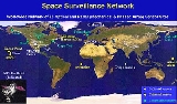
The command accomplishes these tasks through its Space Surveillance Network (SSN) of U.S. Army, Navy and Air Force operated, ground-based radars and optical sensors at 25 sites worldwide.The SSN has been tracking space objects since 1957 when the Soviet Union
Soviet Union
The Soviet Union , officially the Union of Soviet Socialist Republics , was a constitutionally socialist state that existed in Eurasia between 1922 and 1991....
opened the space age with the launch of Sputnik I. Since then, the SSN has tracked more than 24,500 space objects orbiting Earth. Of that number, the SSN currently tracks more than 8,000 orbiting objects. The rest have re-entered Earth's turbulent atmosphere and disintegrated, or survived re-entry and impacted the Earth. The space objects now orbiting Earth range from satellites weighing several tons to pieces of spent rocket bodies weighing only 10 pounds (4.5 kg).
About seven percent of the space objects are operational satellites, the rest are debris.
The USSTRATCOM is primarily interested in the active satellites, but also tracks space debris. The SSN tracks space objects which are 10 centimeters in diameter (baseball size) or larger.
Space Surveillance Telescope program
The Space Surveillance Telescope program (SST) is DARPA's ground based, advanced, optical systemTelescope
A telescope is an instrument that aids in the observation of remote objects by collecting electromagnetic radiation . The first known practical telescopes were invented in the Netherlands at the beginning of the 1600s , using glass lenses...
for detection and tracking of faint objects in space
Space
Space is the boundless, three-dimensional extent in which objects and events occur and have relative position and direction. Physical space is often conceived in three linear dimensions, although modern physicists usually consider it, with time, to be part of a boundless four-dimensional continuum...
such as asteroid
Asteroid
Asteroids are a class of small Solar System bodies in orbit around the Sun. They have also been called planetoids, especially the larger ones...
s. It is also to be employed for space defense missions. The program is designed to advance, or expand, space situational awareness, and be able to quickly provide wide area search capability.
Overview
The large curved focal surface array sensors are considered to be an innovative design. It encompasses improvements in detection sensitivity, has short focal lengthFocal length
The focal length of an optical system is a measure of how strongly the system converges or diverges light. For an optical system in air, it is the distance over which initially collimated rays are brought to a focus...
, wide field of view, and improvements in step-and-settle abilities. DARPA Privacy and Security notice #2: Except where otherwise noted, information presented on the DARPA Web Information Service is considered public information and may be distributed or copied. Use of appropriate byline/photo/image credits is requested.
SST detects, tracks, and can discern small, obscure objects, in deep space with a "wide field of view system". It is a single telescope with the dual abilities. First the telescope is sensitive enough to allow for detection, also, of small, dimly lit objects (low reflectivity). Second it is capable of quickly searching the visible sky. This combination is a difficult achievement in a single telescope design.
It is an F/1.0 aperture
Aperture
In optics, an aperture is a hole or an opening through which light travels. More specifically, the aperture of an optical system is the opening that determines the cone angle of a bundle of rays that come to a focus in the image plane. The aperture determines how collimated the admitted rays are,...
telescope with a 3.5 meter primary mirror. It contains a curved, focal plane array. Multiple searches can be conducted from the ground multiple times throughout the night. As a telescope system, it can give precise locations of discovered objects, extrapolate the course of the object, and indicate the objects stability.
The US Air Force will ultimately take over the program, and integrate the SST as a sensor in the Space Surveillance Network of the Air Force Space Command
Air Force Space Command
Air Force Space Command is a major command of the United States Department of the Air Force, with its headquarters at Peterson Air Force Base, Colorado. AFSPC supports U.S. military operations worldwide through the use of many different types of satellite, launch and cyber operations....
in FY 2009.
Air Force Space Surveillance System
The Air Force Space Surveillance SystemAir Force Space Surveillance System
The Air Force Space Surveillance System, colloquially known as the Space Fence, is a multistatic radar system that detects orbital objects passing over America...
(AFSSS), also known as the "space fence", is a very high frequency
Very high frequency
Very high frequency is the radio frequency range from 30 MHz to 300 MHz. Frequencies immediately below VHF are denoted High frequency , and the next higher frequencies are known as Ultra high frequency...
radar network located at sites across the southern United States (from California
California
California is a state located on the West Coast of the United States. It is by far the most populous U.S. state, and the third-largest by land area...
to Georgia
Georgia (U.S. state)
Georgia is a state located in the southeastern United States. It was established in 1732, the last of the original Thirteen Colonies. The state is named after King George II of Great Britain. Georgia was the fourth state to ratify the United States Constitution, on January 2, 1788...
) with a centralized data processing site at the Naval Network and Space Operations Command in Dahlgren, Virginia
Dahlgren, Virginia
Dahlgren is a census-designated place in King George County, Virginia, United States. The population was 997 at the 2000 census. The community is located within the Northern Neck George Washington Birthplace American Viticultural Area winemaking appellation established by the United States...
. The "fence" is now operated by the U.S. Air Force (20th Space Control Squadron Detachment 1).
The Satellite Detection and Reconnaissance Defense (the former designation of the NSSS) reached initial operating capability in 1961. Since then, the role of the "fence" has grown. The system detects space objects from new launches, maneuvers of existing objects, breakups of existing objects, and provides data to users from its catalog of space objects. Orbital parameters of more than 10,000 objects are maintained in this catalog—which has now gained usage by NASA, weather agencies, and friendly foreign agencies. The information is essential to computing the collision avoidance
Collision avoidance (spacecraft)
In spaceflight, collision avoidance is the process of preventing a spacecraft from colliding with any other vehicle or object.-Launch Windows:Collision avoidance, or COLA is a concern during spaceflight launch windows...
information to de-conflict launch window
Launch window
Launch window is a term used in spaceflight to describe a time period in which a particular launch vehicle must be launched. If the rocket does not launch within the "window", it has to wait for the next window....
s with known orbiting space objects.
Ground-based Electro-Optical Deep Space Surveillance
Telescope
A telescope is an instrument that aids in the observation of remote objects by collecting electromagnetic radiation . The first known practical telescopes were invented in the Netherlands at the beginning of the 1600s , using glass lenses...
s, low-light level TV cameras, and computers. It replaced an older system of six 20 inch (half meter) Baker-Nunn cameras using photographic film
Photographic film
Photographic film is a sheet of plastic coated with an emulsion containing light-sensitive silver halide salts with variable crystal sizes that determine the sensitivity, contrast and resolution of the film...
.
There are three operational GEODSS sites that report to the 21st Operations Group
21st Space Wing
The 21st Space Wing is a unit of the Air Force Space Command based at Peterson Air Force Base, Colorado. The unit is tasked with the operation of early missile warning and space object detection equipment around the world in support of NORAD and USSTRATCOM through a network of command and control...
:
- Socorro, New MexicoSocorro, New MexicoSocorro is a city in Socorro County in the U.S. state of New Mexico. It stands in the Rio Grande Valley at an elevation of . The population was 9,051 at the 2010 census...
33.8172°N 106.6599°W - Maui, Hawaii20.7088°N 156.2578°W
- Diego GarciaDiego GarciaDiego Garcia is a tropical, footprint-shaped coral atoll located south of the equator in the central Indian Ocean at 7 degrees, 26 minutes south latitude. It is part of the British Indian Ocean Territory [BIOT] and is positioned at 72°23' east longitude....
, British Indian Ocean TerritoryBritish Indian Ocean TerritoryThe British Indian Ocean Territory or Chagos Islands is an overseas territory of the United Kingdom situated in the Indian Ocean, halfway between Africa and Indonesia...
7.41173°S 72.45222°E.
A site at Choe Jong San, South Korea
South Korea
The Republic of Korea , , is a sovereign state in East Asia, located on the southern portion of the Korean Peninsula. It is neighbored by the People's Republic of China to the west, Japan to the east, North Korea to the north, and the East China Sea and Republic of China to the south...
was closed in 1993 due to nearby smog from the town, weather and cost concerns. Originally, the fifth GEODSS was planned to be operated from a site in Portugal
Portugal
Portugal , officially the Portuguese Republic is a country situated in southwestern Europe on the Iberian Peninsula. Portugal is the westernmost country of Europe, and is bordered by the Atlantic Ocean to the West and South and by Spain to the North and East. The Atlantic archipelagos of the...
, but this was never built.
A mobile telescope that contributes to the GEODSS system is located at Morón Air Base, Spain
37.170°N 5.609°W
GEODSS tracks objects in deep space
Outer space
Outer space is the void that exists between celestial bodies, including the Earth. It is not completely empty, but consists of a hard vacuum containing a low density of particles: predominantly a plasma of hydrogen and helium, as well as electromagnetic radiation, magnetic fields, and neutrinos....
, or from about 3,000 mi (4,800 km) out to beyond geosynchronous altitudes. GEODSS requires nighttime and clear weather tracking because of the inherent limitations of an optical system. Each site has three telescopes. The telescopes have a 40-inch (1.02 m) aperture and a two-degree field of view. The telescopes are able to "see" objects 10,000 times dimmer than the human eye can detect. This sensitivity, and sky background during daytime that masks satellites reflected light, dictates that the system operate at night. As with any ground-based optical system, cloud cover and local weather conditions directly influence its effectiveness. GEODSS system can track objects as small as a basketball more than 20,000 miles (30,000 km) in space or a chair at 35000 miles (56,326.9 km), and is a vital part of USSTRATCOM’s Space Surveillance Network. Distant Molniya
Molniya (satellite)
Molniya was a military communications satellite system used by the Soviet Union. The satellites were placed into highly eccentric elliptical orbits known as Molniya orbits, characterised by an inclination of +63.4 degrees and a period of around 12 hours...
orbiting satellites are often detected in elliptical orbits that surpass the Moon
Moon
The Moon is Earth's only known natural satellite,There are a number of near-Earth asteroids including 3753 Cruithne that are co-orbital with Earth: their orbits bring them close to Earth for periods of time but then alter in the long term . These are quasi-satellites and not true moons. For more...
and back (245,000 miles out). Each GEODSS site tracks approximately 3,000 objects per night out of 9,900 object that are regularly tracked and accounted for. Objects crossing the International Space Station (ISS) orbit within 20 miles (32.2 km) will cause the ISS to adjust their orbit to avoid collision. The oldest object tracked is Object #4 (Vanguard 1
Vanguard 1
Vanguard 1 was the fourth artificial Earth satellite launched and the first satellite to be solar powered. Although communication with it was lost in 1964, it remains the oldest manmade satellite still in orbit...
) launched in 1958.
Space Based Visible (SBV) Sensor
The SSN included one spaceborne sensor, the space-based visible (SBV) sensor, carried into orbit aboard the Midcourse Space ExperimentMidcourse Space Experiment
The Midcourse Space Experiment is a Ballistic Missile Defense Organization satellite experiment to map bright infrared sources in space...
(MSX
Midcourse Space Experiment
The Midcourse Space Experiment is a Ballistic Missile Defense Organization satellite experiment to map bright infrared sources in space...
) satellite launched by the Ballistic Missile Defense Organization
Ballistic Missile Defense Organization
The Ballistic Missile Defense Organization was an agency of the United States Department of Defense that began on 20 May 1974 with the responsibility for all U.S. ballistic missile defense efforts. It evolved from the SAFEGUARD System Organization. The original mission of BMDO was comparable to...
in 1996. It was retired from service on June 2, 2008.
See also
- Air Force Maui Optical and Supercomputing observatoryAir Force Maui Optical and Supercomputing observatoryThe Air Force Maui Optical and Supercomputing observatory is an Air Force Research Laboratory operating location on Maui with a twofold mission. First, it conducts the research and development mission on the Maui Space Surveillance System at the Maui Space Surveillance Complex...
- AZUSAAZUSAAZUSA refers to a ground-based radar tracking system installed at Cape Canaveral, Florida and the NASA Kennedy Space Center. AZUSA dated back to the early 1950s and was named after the southern California town where the system was devised....
- Kessler syndromeKessler syndromeThe Kessler syndrome , proposed by NASA scientist Donald J...
- Space debrisSpace debrisSpace debris, also known as orbital debris, space junk, and space waste, is the collection of objects in orbit around Earth that were created by humans but no longer serve any useful purpose. These objects consist of everything from spent rocket stages and defunct satellites to erosion, explosion...
- Air Force Space Surveillance SystemAir Force Space Surveillance SystemThe Air Force Space Surveillance System, colloquially known as the Space Fence, is a multistatic radar system that detects orbital objects passing over America...
- Graveyard orbitGraveyard orbitA graveyard orbit, also called a supersynchronous orbit, junk orbit or disposal orbit, is an orbit significantly above synchronous orbit, where spacecraft are intentionally placed at the end of their operational life...
External links
- The Space-Track website
- U.S. Strategic Command Space Surveillance
- J-Track 3-D displays a globe and orbiting satellites.
- Orbital Debris Quarterly News information on some of the latest events in orbital debris research.
- Air Force Fact Sheet
- A GEODSS Sourcebook