

Transport in Montenegro
Encyclopedia
Airports
MontenegroMontenegro
Montenegro Montenegrin: Crna Gora Црна Гора , meaning "Black Mountain") is a country located in Southeastern Europe. It has a coast on the Adriatic Sea to the south-west and is bordered by Croatia to the west, Bosnia and Herzegovina to the northwest, Serbia to the northeast and Albania to the...
has two international airports, with their IATA Airport Code
IATA airport code
An IATA airport code, also known an IATA location identifier, IATA station code or simply a location identifier, is a three-letter code designating many airports around the world, defined by the International Air Transport Association...
s:
- Podgorica AirportPodgorica AirportPodgorica Airport is an international airport located south of Podgorica, Montenegro. It is the main hub for Montenegro Airlines....
- TGD - Tivat AirportTivat AirportTivat Airport is an international airport located from the centre of Tivat, Montenegro in the center of the Boka Kotorska bay....
- TIV
Podgorica Airport has a new and modern terminal building, and Tivat Airport underwent terminal expansion and can now handle night landings.
There are also airports at Berane
Berane Airport
Berane Airport is an airport located near Berane, Montenegro. It is also known as Dolac Airport. Berane was known as Ivangrad from July 1949 to March 1992, hence the IATA code IVG....
, Žabljak
Žabljak Airport
Žabljak Airport is an airport in the Žabljak Municipality in Montenegro. It is used for general aviation and cannot handle larger aircraft.- History :...
and Nikšić
Nikšic Airport
Nikšić Airport is a sport airport located near Nikšić, Montenegro. It is also known as Kapino Polje Airport....
, but those are used mostly for general aviation
General aviation
General aviation is one of the two categories of civil aviation. It refers to all flights other than military and scheduled airline and regular cargo flights, both private and commercial. General aviation flights range from gliders and powered parachutes to large, non-scheduled cargo jet flights...
, and are not equipped to handle larger aircraft.Ulcinj
Ulcinj Airport
Ulcinj Airport was an airport in the Ulcinj Municipality in Montenegro.-History:In the 1940s, Aeroput's Belgrade-Podgorica flight extendedto the coastal town of Bar....
have a grass-type airport
Airport
An airport is a location where aircraft such as fixed-wing aircraft, helicopters, and blimps take off and land. Aircraft may be stored or maintained at an airport...
.
Railways
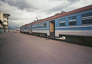
250 km
standard gauge
Standard gauge
The standard gauge is a widely-used track gauge . Approximately 60% of the world's existing railway lines are built to this gauge...
:
(1435 mm) 250 km
narrow gauge:
none
Rail links with adjacent countries
- Serbia - yes - same gauge, couplings, brakes, electrification system
- Albania - yes - used for freight only
- Croatia - no direct links
- Bosnia and Herzegovina - no direct links
Overview
The Montenegrin part of the Belgrade - Bar railway is the backbone of the Montenegrin railway system. It opened in 1979, and then was a state-of-the art railway, with features such as Mala Rijeka viaductMala Rijeka viaduct
The Mala Rijeka Viaduct is a viaduct on the Belgrade - Bar railway, located some 20 km north of Podgorica, Montenegro.- Overview :The project was started in 1969 and was completed in 1973.Viaduct is long and rises above the Mala Rijeka...
(highest railway viaduct in the world) and the 6.2 km long Sozina tunnel. About one-third of the Montenegrin part of the railway is in tunnels or on viaducts. It is the only railway corridor in Montenegro that is fully electrified: electrification of the Podgorica - Nikšić
Nikšić
Nikšić is a city in Montenegro . In 2003 the city had a total population about 75,000.Nikšić is located in Nikšić plain, at the foot of Mount Trebjesa. It is the center of the municipality , which is the largest in Montenegro by area...
corridor is not complete.
The railway suffered from chronic underfunding in the 1990s, resulting in it deteriorating and becoming unsafe. This culminated in the 2006 Bioče train disaster
Bioce train disaster
The Bioče derailment was a train crash on January 23, 2006 in Montenegro. At least 45 people, including five children, were killed and another 184 injured...
, when a passenger train derailed, killing 47 passengers. Efforts are being made to thoroughly reconstruct this railway.
The Podgorica-Nikšić railway (56,6 km long) was built in 1948 as a narrow gauge railway, and upgraded to standard gauge in 1965. Since 1992, it has been used solely for freight traffic, particularly bauxite
Bauxite
Bauxite is an aluminium ore and is the main source of aluminium. This form of rock consists mostly of the minerals gibbsite Al3, boehmite γ-AlO, and diaspore α-AlO, in a mixture with the two iron oxides goethite and hematite, the clay mineral kaolinite, and small amounts of anatase TiO2...
from the Nikšić mine to the Podgorica Aluminium Plant
Podgorica Aluminium Plant
Podgorica Aluminium Plant is an aluminium processing plant, located on the southern outskirts of Podgorica, Montenegro.-Overview:...
, with the maximum speed on the railway reduced to 30 km/h. That is about to change, as this part of the railway is currently undergoing complete reconstruction and electrification. Passenger traffic is set to start in 2009, and maximum speeds will be between 75 and 100 km/h.
The Podgorica-Shkodër railway, which extends to Tirana
Tirana
Tirana is the capital and the largest city of Albania. Modern Tirana was founded as an Ottoman town in 1614 by Sulejman Bargjini, a local ruler from Mullet, although the area has been continuously inhabited since antiquity. Tirana became Albania's capital city in 1920 and has a population of over...
, has been used exclusively for freight traffic for some time. Parts in Albania were damaged in 1997, but the connection was restored in 2002. There are plans to reconstruct the railway and re-introduce passenger traffic, as it is important for the interests of both Montenegro and Albania
Albania
Albania , officially known as the Republic of Albania , is a country in Southeastern Europe, in the Balkans region. It is bordered by Montenegro to the northwest, Kosovo to the northeast, the Republic of Macedonia to the east and Greece to the south and southeast. It has a coast on the Adriatic Sea...
.
Currently, the railways are undergoing planned repairs and modernization with a budget, given by Government for 2009, of 9.7 million euros.
Highways
Overall length of roads in Montenegro is 5,277km, of which 1,729km is paved. The roads in Montenegro are categorized in the following way:- Motorways (Autoputevi) - There are currently no roads built to motorway standards, but two motorways are currently in planning stages: Bar - Boljare motorway and Montenegrin section of Adriatic–Ionian motorwayAdriatic–Ionian motorwayAdriatic–Ionian motorway is a future motorway that will stretch along the entire eastern shore of Adriatic and Ionian seas, spanning the western border of the Balkan peninsula.-Overview:...
.
- Main roads (Magistralni putevi) - roads connecting bigger cities and regions of Montenegro. Most of the main roads of Montenegro are listed with International E-road networkInternational E-road networkThe international E-road network is a numbering system for roads in Europe developed by the United Nations Economic Commission for Europe . The network is numbered from E 1 up and its roads cross national borders...
, and are locally labeled with M letter followed by a number. Typically, these are paved roads of single carriagewaySingle carriagewayA single carriageway is a road with 1, 2 or more lanes arranged within a single carriageway with no central reservation to separate opposing flows of traffic. Two-lane road or two-lane highway are single carriageway with one lane for each direction...
type, featuring one lane per direction, with frequent addition of a third overtaking lane on sections with steep gradients. Curve radii usually allow speeds of up to 80 km/h, and width of a single traffic lane is usually at least 3m. Main roads listed with International E-road network in Montenegro are: /
/ - Route E65European route E65European route E 65 is a north-south Class-A European route that begins in Malmö, Sweden and ends in Chaniá, Greece. The road is about in length.-Itinerary:* Sweden** E 65: Malmö – Ystad* Baltic sea, ferry Ystad-Świnoujście* Poland...
/E80European route E80European route E 80, also known as Trans-European Motorway or TEM, is an A-Class West-East European route, extending from Lisbon, Portugal to Gürbulak, Turkey, on the border with Iran...
, locally M2 (Debeli BrijegDebeli BrijegDebeli Brijeg is the main Montenegrin border crossing with Croatia. The Croatian checkpoint is known as Karasovići. It is located on the Adriatic Highway.Debeli Brijeg is in Herceg Novi municipality about 6km from Igalo....
/CroatiaCroatiaCroatia , officially the Republic of Croatia , is a unitary democratic parliamentary republic in Europe at the crossroads of the Mitteleuropa, the Balkans, and the Mediterranean. Its capital and largest city is Zagreb. The country is divided into 20 counties and the city of Zagreb. Croatia covers ...
- PetrovacPetrovacPetrovac can refer to:* Petrovac , town and municipality in Serbia* Petrovac , town in municipality of Budva, Montenegro* Petrovac , municipality in Republika Srpska, Bosnia and Herzegovina...
- PodgoricaPodgoricaPodgorica , is the capital and largest city of Montenegro.Podgorica's favourable position at the confluence of the Ribnica and Morača rivers and the meeting point of the fertile Zeta Plain and Bjelopavlići Valley has encouraged settlement...
- KolašinKolašinKolašin , is a town in northern Montenegro. It has a population of 2,989 .Kolašin is the centre of the municipality and unofficial centre of Morača region, named after Morača River....
- BeraneBeraneBerane , formerly Ivangrad, is a town in north-eastern Montenegro. It has a population of 11,776 .Berane is the centre of municipality and one of the centres of Polimlje area, named after the Lim River, on which Berane is situated.-History:During the medieval period the Montenegrin land of Berane...
- RožajeRožajeRožaje , is a town in northeastern Montenegro. It has a population of 9,121 Rožaje is the centre of the municipality, which has a population of 22,693. The municipality is located in the geographical region of Sandžak.-History:The history of Rožaje goes back to 1571 and 1585 when it was first...
- border with SerbiaSerbiaSerbia , officially the Republic of Serbia , is a landlocked country located at the crossroads of Central and Southeast Europe, covering the southern part of the Carpathian basin and the central part of the Balkans...
) - Route E762European route E762European route E 762 is a road part of the International E-road network. It begins in Sarajevo, Bosnia and Herzegovina and ends in Albania....
, locally M18 (Border with Albania - Božaj - TuziTuziTuzi is a town in the Podgorica municipality, Montenegro, located along a main road between the city of Podgorica and the Albanian border crossing, just a few kilometers north of Lake Skadar. The exact location of Tuzi is...
- PodgoricaPodgoricaPodgorica , is the capital and largest city of Montenegro.Podgorica's favourable position at the confluence of the Ribnica and Morača rivers and the meeting point of the fertile Zeta Plain and Bjelopavlići Valley has encouraged settlement...
- DanilovgradDanilovgradDanilovgrad is a town in central Montenegro. It has a population of 5,208 . It is situated in the Danilovgrad Municipality which lies along the main route between Montenegro's two largest cities, Podgorica and Nikšić.The town of Danilovgrad is located in the fertile valley of the Zeta River,...
- NikšićNikšićNikšić is a city in Montenegro . In 2003 the city had a total population about 75,000.Nikšić is located in Nikšić plain, at the foot of Mount Trebjesa. It is the center of the municipality , which is the largest in Montenegro by area...
- PlužinePlužinePlužine is a town in northwesten Montenegro. It has a population of 1,494 .Plužine is the centre of the municipality and unofficial centre of Piva region, named after Piva River.-History:...
- Šćepan Polje - border with Bosnia & Herzegovina) - Route E763European route E763European route E 763 is a road part of the International E-road network. It begins in Belgrade, Serbia and ends in Bijelo Polje, Montenegro.The road follows: Belgrade – Čačak – Nova Varoš – Bijelo Polje...
, locally M21 (Bijelo PoljeBijelo PoljeBijelo Polje is a town in northern Montenegro. It has a population of 15,883 .Bijelo Polje is the center of municipality . It is unofficial center of north-eastern region of Montenegro...
- border with SerbiaSerbiaSerbia , officially the Republic of Serbia , is a landlocked country located at the crossroads of Central and Southeast Europe, covering the southern part of the Carpathian basin and the central part of the Balkans...
) - Route E851European route E851European route E 851 is a road part of the International E-road network. It begins in Petrovac, Montenegro, passes through northern Albania and ends in Pristina, Kosovo....
, locally M2.4 (Petrovac - SutomoreSutomoreSutomore is a small coastal town in Bar Municipality, Montenegro. A 2003 census put the population at 1,827.-History:...
- BarBar, MontenegroBar is a coastal town in Montenegro. It has a population of 17,727...
- Krute - UlcinjUlcinjUlcinj is a coastal resort town and municipality in Montenegro. The town of Ulcinj has a population of 10,828 of which the majority are Albanians...
- Sukobin - border with AlbaniaAlbaniaAlbania , officially known as the Republic of Albania , is a country in Southeastern Europe, in the Balkans region. It is bordered by Montenegro to the northwest, Kosovo to the northeast, the Republic of Macedonia to the east and Greece to the south and southeast. It has a coast on the Adriatic Sea...
)
Sections of E65/E80 (Debeli Brijeg - Petrovac) and E851 (Petrovac - Ulcinj
Ulcinj
Ulcinj is a coastal resort town and municipality in Montenegro. The town of Ulcinj has a population of 10,828 of which the majority are Albanians...
) together make up for the Montenegrin section of Adriatic Highway.
- Regional roads (Regionalni putevi) - these are road connections between regional centers, and connections of the regional centers with the network of main roads. Typically, these are paved roads, but with smaller curve radii and narrower lanes than those of the main roads. Thus, lower speed limits are more common on regional roads. These roads are locally labeled with R letter followed by a number.
- Local roads (Lokalni putevi) - local roads connections of villages and other settlements of local communities. Quality of road infrastructure varies wildly between local roads, so these can be both unpaved dirt roads, as well as roads resembling regional roads in quality and appearance.
Current categorization of the roads has become obsolete in some cases, with upgrades of some road sections, and decay of the others. For example, road Kolašin
Kolašin
Kolašin , is a town in northern Montenegro. It has a population of 2,989 .Kolašin is the centre of the municipality and unofficial centre of Morača region, named after Morača River....
- Mateševo
Mateševo
Mateševo is a village in northern Montenegro, within Kolašin municipality. The 2003 census put the population at 97.The first phase of planned Belgrade–Bar motorway will extend from Podgorica to this village....
- Andrijevica
Andrijevica
Andrijevica is a town in north-eastern Montenegro. It has a population of 1,073 . Its territory is outspread on 340 km2 and it is surrounded by massives of mountains Komovi, Bjelasica and Prokletije....
road, labelled as Main road, is greatly inferior in quality to the Mojkovac
Mojkovac
Mojkovac is a town in northern Montenegro. It has a population of 4,120 . Mojkovac is also the centre of the municipality, which has a population of 10,066.-Features:...
- Žabljak
Žabljak
Žabljak is a small town in northern Montenegro. It has a population of 1,937.Žabljak is the seat of the municipality...
road, which is designated as a Regional road.
In recent years roads connecting Podgorica and the coastal towns have improved significantly with the completion of Sozina tunnel
Sozina tunnel
The Sozina Tunnel is a road tunnel in Montenegro, and is a part of E65 European route. It is located north of town of Sutomore, and is designed to bypass the mountain range "Paštrovska Gora" that separates Montenegrin coast from Zeta plain and Skadar Lake basin .The road tunnel "Sozina" is 4,189 m...
and numerous upgrades of roads towards Cetinje
Cetinje
Cetinje , Цетиње / Cetinje , Italian: Cettigne, Greek: Κετίγνη, Ketígni) is a town and Old Royal Capital of Montenegro. It is also a historical and the secondary capital of Montenegro , with the official residence of the President of Montenegro...
and Bar
Bar, Montenegro
Bar is a coastal town in Montenegro. It has a population of 17,727...
. Sozina tunnel shortened the journey from Podgorica to Bar
Bar, Montenegro
Bar is a coastal town in Montenegro. It has a population of 17,727...
to under half an hour and made the trip significantly safer.
In the north, the road from Podgorica to Kolašin
Kolašin
Kolašin , is a town in northern Montenegro. It has a population of 2,989 .Kolašin is the centre of the municipality and unofficial centre of Morača region, named after Morača River....
through Morača
Morača
Morača is a river in Montenegro. It originates in northern Montenegro, under Rzača mountain. It generally flows southwards for some , before emptying into Lake Skadar....
canyon to Serbia is considered the bottleneck of Montenegrin road network, as it is a curvy mountainous road, often unsafe during the winter. Bar - Boljare motorway is envisioned as a replacement for this corridor. Long term plans also include the Montenegrin section of Adriatic–Ionian motorway
Adriatic–Ionian motorway
Adriatic–Ionian motorway is a future motorway that will stretch along the entire eastern shore of Adriatic and Ionian seas, spanning the western border of the Balkan peninsula.-Overview:...
as a significant transit link.
There is a proposed route from the city of Podgorica
Podgorica
Podgorica , is the capital and largest city of Montenegro.Podgorica's favourable position at the confluence of the Ribnica and Morača rivers and the meeting point of the fertile Zeta Plain and Bjelopavlići Valley has encouraged settlement...
to Gusinje
Gusinje
Gusinje is a small town in Montenegro. According to the 2003 census, the town has a population of 1,704.-History:The history and origins of Gusinje are unknown prior to the Ottoman conquests. Before the Ottoman Turks took control of the region, Plav-Gusinje was under the control of various...
. The highway, expected to go through northern Albania
Albania
Albania , officially known as the Republic of Albania , is a country in Southeastern Europe, in the Balkans region. It is bordered by Montenegro to the northwest, Kosovo to the northeast, the Republic of Macedonia to the east and Greece to the south and southeast. It has a coast on the Adriatic Sea...
, will mean a journey time to Gusinje and Plav
Plav
Plav Plav Plav (Montenegrin, (Albanian: Plav) is a town in north-eastern Montenegro. It has a population of 3,615 (2003 census).Plav is the centre of the municipality (population of 13,805),-Geography:...
of about half an hour.
Also, the Verige bridge
Verige bridge
The Verige bridge is a planned bridge in Montenegro that would span the Bay of Kotor, crossing the Verige Strait at the Bay's entrance, after which it is named. It will be part of the Adriatic Highway . As of 2007, the planning stage of the bridge is completed, and construction of the bridge can...
spanning the Bay of Kotor
Bay of Kotor
The Bay of Kotor in south-western Montenegro is a winding bay on the Adriatic Sea. The bay, sometimes called Europe's southernmost fjord, is in fact a submerged river canyon of the disintegrated Bokelj River which used to run from the high mountain plateaus of Mount Orjen...
and part of the Adriatic Highway is planned to be built in the future.
Ports and harbors
Port of BarPort of Bar
The Port of Bar is Montenegro's main sea port. It is located in Bar.-History:The Port of Bar was used as a sea port for Scutari before it was conquered by the Turks in 1571....
is the major seaport in Montenegro. It is capable of handling about 5 million tons of cargo, and is a port for ferries to Bari
Bari
Bari is the capital city of the province of Bari and of the Apulia region, on the Adriatic Sea, in Italy. It is the second most important economic centre of mainland Southern Italy after Naples, and is well known as a port and university city, as well as the city of Saint Nicholas...
and Ancona
Ancona
Ancona is a city and a seaport in the Marche region, in central Italy, with a population of 101,909 . Ancona is the capital of the province of Ancona and of the region....
in Italy
Italy
Italy , officially the Italian Republic languages]] under the European Charter for Regional or Minority Languages. In each of these, Italy's official name is as follows:;;;;;;;;), is a unitary parliamentary republic in South-Central Europe. To the north it borders France, Switzerland, Austria and...
. Kotor
Kotor
Kotor is a coastal city in Montenegro. It is located in a secluded part of the Gulf of Kotor. The city has a population of 13,510 and is the administrative center of the municipality....
, Risan
Risan
Risan is a town in the Bay of Kotor, Montenegro...
, Tivat
Tivat
Tivat is a coastal town in southwest Montenegro, located in the Bay of Kotor...
and Zelenika
Zelenika
Zelenika is a village in the municipality of Tryavna, in Gabrovo Province, in northern central Bulgaria.-References:...
(in Bay of Kotor
Bay of Kotor
The Bay of Kotor in south-western Montenegro is a winding bay on the Adriatic Sea. The bay, sometimes called Europe's southernmost fjord, is in fact a submerged river canyon of the disintegrated Bokelj River which used to run from the high mountain plateaus of Mount Orjen...
) are smaller ports.
Montenegro's rivers are generally not navigable, except for tourist attractions such as rafting
Rafting
Rafting or white water rafting is a challenging recreational outdoor activity using an inflatable raft to navigate a river or other bodies of water. This is usually done on white water or different degrees of rough water, in order to thrill and excite the raft passengers. The development of this...
on Tara River
Tara River (Montenegro)
The Tara is a river in Montenegro and Bosnia and Herzegovina. It emerges from the confluence of the Opasnica and Veruša Rivers in the Prokletije mountain, part of Dinaric Alps of Montenegro...
.
See also
- Montenegrin car license platesMontenegrin car license platesPresent Montenegrin car plates have black characters on a rectangular white background, with blue strip on the left. The plates follow the 520 mm x 110 mm format, except for motorcycles. The present licence plates format was introduced on 6 June 2008, and replaced the old format ...
- Montenegro AirlinesMontenegro AirlinesMontenegro Airlines d.o.o., operating as Montenegro Airlines, is the national carrier airline of the country of Montenegro, and flag carrier of the Montenegro, headquartered in Podgorica. It operates scheduled services in Europe, as well as charter flights throughout Europe during the summer...