
Tompkins County, New York
Encyclopedia
Tompkins County is a county located in the U.S. state
of New York
, and comprises the whole of the Ithaca
metropolitan area
. As of the 2010 census, the population was 101,564. The county seat
is Ithaca, and the county is home to Cornell University
, Ithaca College
and Tompkins Cortland Community College
. The name is in honor of Daniel D. Tompkins
, who served as Governor of New York
and Vice President of the United States of America.
. This was an enormous county, including the northern part of New York State as well as all of the present State of Vermont
and, in theory, extending westward to the Pacific Ocean
. This county was reduced in size on July 3, 1766 by the creation of Cumberland County
, and further on March 16, 1770 by the creation of Gloucester County
, both containing territory now in Vermont.
On March 12, 1772, what was left of Albany County was split into three parts, one remaining under the name Albany County. One of the other pieces, Tryon County
, contained the western portion (and thus, since no western boundary was specified, theoretically still extended west to the Pacific). The eastern boundary of Tryon County was approximately five miles west of the present city of Schenectady
, and the county included the western part of the Adirondack Mountains
and the area west of the West Branch of the Delaware River
. The area then designated as Tryon County now includes 37 counties of New York State. The county was named for William Tryon
, colonial governor of New York.
In the years prior to 1776, most of the Loyalists in Tryon County fled to Canada
. In 1784, following the peace treaty that ended the American Revolutionary War
, the name of Tryon County was changed to Montgomery County
in honor of the general, Richard Montgomery
, who had captured several places in Canada and died attempting to capture the city of Quebec
, replacing the name of the hated British governor.
In 1789, Montgomery County was reduced in size by the splitting off of Ontario County
. The actual area split off from Montgomery County was much larger than the present county, also including the present Allegany
, Cattaraugus
, Chautauqua
, Erie
, Genesee
, Livingston
, Monroe
, Niagara
, Orleans
, Steuben
, Wyoming
, Yates
, and part of Schuyler
and Wayne Counties
.
Herkimer County
was one of three counties split off from Montgomery County (the others being Otsego
and Tioga Counties
) in 1791.
Onondaga County
was formed in 1794 by the splitting of Herkimer County.
Cayuga County
was formed in 1799 by the splitting of Onondaga County. This county was, however, much larger than the present Cayuga County. It then included the present Seneca
and Tompkins Counties.
In 1804, Seneca County was formed by the splitting of Cayuga County.
On April 7th, 1817, Tompkins County was created by combining portions of Seneca and the remainder of Cayuga County. Named after then Vice-President (to President James Monroe
) and former New York Governor Daniel Tompkins. Tompkins almost certainly never visited the county named for him.
In 1854, the county lost the town of Hector
and the west line of lots in Newfield
to the newly-formed Schuyler County
, New York
.
beat Senator Hillary Clinton in the Democratic primary
. In the 2008 U.S. Presidential election
, Obama carried the county by a huge 41% margin over John McCain
, with Obama winning by 25.5% statewide. It was his highest percentage by county in Upstate New York
. Tompkins County is the most Democratic county in New York State outside New York City
.
Tompkins County is governed by a 15 member legislature. Members are elected from single member districts.
 Tompkins County is in the west central part of New York State, south of Syracuse
and northwest of Binghamton
. It is usually geographically grouped with the Central New York
region, but some locals consider themselves to be part of the Southern Tier
.
According to the U.S. Census Bureau, the county has a total area of 492 square miles (1,274.3 km²), of which 476 square miles (1,232.8 km²) is land and 16 square miles (41.4 km²) (3.17%) is water.
As of the census
of 2000, there were 96,501 people, 36,420 households, and 19,120 families residing in the county. The population density
was 203 people per square mile (78/km²). There were 38,625 housing units at an average density of 81 per square mile (31/km²). The racial makeup of the county was 85.50% White, 3.64% African American, 0.28% Native American, 7.19% Asian, 0.04% Pacific Islander, 1.09% from other races
, and 2.26% from two or more races. Hispanic or Latino of any race were 3.08% of the population. 12.4% were of German
, 11.7% English
, 11.1% Irish
, 9.2% Italian
and 6.0% American
ancestry according to Census 2000 http://factfinder.census.gov/servlet/DTTable?_bm=y&-context=dt&-ds_name=DEC_2000_SF3_U&-mt_name=DEC_2000_SF3_U_PCT016&-CONTEXT=dt&-tree_id=. 2.85% of the population reported speaking Spanish
at home, while 1.86% speak Chinese
, 1.07% Korean
, and 1.00% French
.http://www.mla.org/map_data_results&state_id=36&county_id=109&mode=geographic&zip=&place_id=&cty_id=&ll=all&a=&ea=&order=r
There were 36,420 households out of which 25.80% had children under the age of 18 living with them, 41.20% were married couples
living together, 8.20% had a female householder with no husband present, and 47.50% were non-families. 32.50% of all households were made up of individuals and 8.10% had someone living alone who was 65 years of age or older. The average household size was 2.32 and the average family size was 2.93.
In the county the population was spread out with 19.00% under the age of 18, 26.00% from 18 to 24, 26.20% from 25 to 44, 19.30% from 45 to 64, and 9.60% who were 65 years of age or older. The median age was 29 years. For every 100 females there were 97.60 males. For every 100 females age 18 and over, there were 95.20 males.
The median income for a household in the county was $37,272, and the median income for a family was $53,041. Males had a median income of $35,420 versus $27,686 for females. The per capita income
for the county was $19,659. About 6.80% of families and 17.60% of the population were below the poverty line, including 11.00% of those under age 18 and 5.40% of those age 65 or over.
U.S. state
A U.S. state is any one of the 50 federated states of the United States of America that share sovereignty with the federal government. Because of this shared sovereignty, an American is a citizen both of the federal entity and of his or her state of domicile. Four states use the official title of...
of New York
New York
New York is a state in the Northeastern region of the United States. It is the nation's third most populous state. New York is bordered by New Jersey and Pennsylvania to the south, and by Connecticut, Massachusetts and Vermont to the east...
, and comprises the whole of the Ithaca
Ithaca, New York
The city of Ithaca, is a city in upstate New York and the county seat of Tompkins County, as well as the largest community in the Ithaca-Tompkins County metropolitan area...
metropolitan area
Metropolitan area
The term metropolitan area refers to a region consisting of a densely populated urban core and its less-populated surrounding territories, sharing industry, infrastructure, and housing. A metropolitan area usually encompasses multiple jurisdictions and municipalities: neighborhoods, townships,...
. As of the 2010 census, the population was 101,564. The county seat
County seat
A county seat is an administrative center, or seat of government, for a county or civil parish. The term is primarily used in the United States....
is Ithaca, and the county is home to Cornell University
Cornell University
Cornell University is an Ivy League university located in Ithaca, New York, United States. It is a private land-grant university, receiving annual funding from the State of New York for certain educational missions...
, Ithaca College
Ithaca College
Ithaca College is a private college located on the South Hill of Ithaca, New York. The school was founded by William Egbert in 1892 as a conservatory of music. The college has a strong liberal arts core, but also offers several pre-professional programs and some graduate programs. The college is...
and Tompkins Cortland Community College
Tompkins Cortland Community College
Tompkins Cortland Community College is a public two-year college supported by Cortland and Tompkins Counties. The main college campus is located in the Town of Dryden. Extension sites are located in Cortland, New York and Ithaca, New York...
. The name is in honor of Daniel D. Tompkins
Daniel D. Tompkins
Daniel D. Tompkins was an entrepreneur, jurist, Congressman, the fourth Governor of New York , and the sixth Vice President of the United States .-Name:...
, who served as Governor of New York
Governor of New York
The Governor of the State of New York is the chief executive of the State of New York. The governor is the head of the executive branch of New York's state government and the commander-in-chief of the state's military and naval forces. The officeholder is afforded the courtesy title of His/Her...
and Vice President of the United States of America.
History
When counties were established in the British Province of New York in 1683, the present Tompkins County was part of Albany CountyAlbany County, New York
Albany County is a county located in the U.S. state of New York, and is part of the Albany-Schenectady-Troy Metropolitan Statistical Area. The name is from the title of the Duke of York and Albany, who became James II of England . As of the 2010 census, the population was 304,204...
. This was an enormous county, including the northern part of New York State as well as all of the present State of Vermont
Vermont
Vermont is a state in the New England region of the northeastern United States of America. The state ranks 43rd in land area, , and 45th in total area. Its population according to the 2010 census, 630,337, is the second smallest in the country, larger only than Wyoming. It is the only New England...
and, in theory, extending westward to the Pacific Ocean
Pacific Ocean
The Pacific Ocean is the largest of the Earth's oceanic divisions. It extends from the Arctic in the north to the Southern Ocean in the south, bounded by Asia and Australia in the west, and the Americas in the east.At 165.2 million square kilometres in area, this largest division of the World...
. This county was reduced in size on July 3, 1766 by the creation of Cumberland County
Cumberland County, New York
Cumberland County, New York was a county in the Province of New York that became part of the state of Vermont. It was divided out of Albany County in New York in 1766, but eventually became part of Vermont in 1777...
, and further on March 16, 1770 by the creation of Gloucester County
Gloucester County, New York
Gloucester County, New York is a former county in New York that became part of the state of Vermont. It was a part of Albany County in the Province of New York until 1770 and was lost to Vermont in 1777. At that time, Vermont was holding itself out as the Republic of Vermont and did not become a...
, both containing territory now in Vermont.
On March 12, 1772, what was left of Albany County was split into three parts, one remaining under the name Albany County. One of the other pieces, Tryon County
Tryon County, New York
Tryon County, New York was a county in the colonial Province of New York in the British American colonies. It was created from Albany County on March 24, 1772. It was named for William Tryon, the last provincial governor of New York. Its boundaries extended far further than any current county...
, contained the western portion (and thus, since no western boundary was specified, theoretically still extended west to the Pacific). The eastern boundary of Tryon County was approximately five miles west of the present city of Schenectady
Schenectady, New York
Schenectady is a city in Schenectady County, New York, United States, of which it is the county seat. As of the 2010 census, the city had a population of 66,135...
, and the county included the western part of the Adirondack Mountains
Adirondack Mountains
The Adirondack Mountains are a mountain range located in the northeastern part of New York, that runs through Clinton, Essex, Franklin, Fulton, Hamilton, Herkimer, Lewis, Saint Lawrence, Saratoga, Warren, and Washington counties....
and the area west of the West Branch of the Delaware River
Delaware River
The Delaware River is a major river on the Atlantic coast of the United States.A Dutch expedition led by Henry Hudson in 1609 first mapped the river. The river was christened the South River in the New Netherland colony that followed, in contrast to the North River, as the Hudson River was then...
. The area then designated as Tryon County now includes 37 counties of New York State. The county was named for William Tryon
William Tryon
William Tryon was a British soldier and colonial administrator who served as governor of the Province of North Carolina and the Province of New York .-Early life and career:...
, colonial governor of New York.
In the years prior to 1776, most of the Loyalists in Tryon County fled to Canada
Canada
Canada is a North American country consisting of ten provinces and three territories. Located in the northern part of the continent, it extends from the Atlantic Ocean in the east to the Pacific Ocean in the west, and northward into the Arctic Ocean...
. In 1784, following the peace treaty that ended the American Revolutionary War
American Revolutionary War
The American Revolutionary War , the American War of Independence, or simply the Revolutionary War, began as a war between the Kingdom of Great Britain and thirteen British colonies in North America, and ended in a global war between several European great powers.The war was the result of the...
, the name of Tryon County was changed to Montgomery County
Montgomery County, New York
As of the census of 2000, there were 49,708 people, 20,038 households, and 13,104 families residing in the county. The population density was 123 people per square mile . There were 22,522 housing units at an average density of 56 per square mile...
in honor of the general, Richard Montgomery
Richard Montgomery
Richard Montgomery was an Irish-born soldier who first served in the British Army. He later became a brigadier-general in the Continental Army during the American Revolutionary War and he is most famous for leading the failed 1775 invasion of Canada.Montgomery was born and raised in Ireland...
, who had captured several places in Canada and died attempting to capture the city of Quebec
Quebec
Quebec or is a province in east-central Canada. It is the only Canadian province with a predominantly French-speaking population and the only one whose sole official language is French at the provincial level....
, replacing the name of the hated British governor.
In 1789, Montgomery County was reduced in size by the splitting off of Ontario County
Ontario County, New York
As of the census of 2000, there were 100,224 people, 38,370 households, and 26,360 families residing in the county. The population density was 156 people per square mile . There were 42,647 housing units at an average density of 66 per square mile...
. The actual area split off from Montgomery County was much larger than the present county, also including the present Allegany
Allegany County, New York
Allegany County is a county located in the U.S. state of New York. As of the 2010 census, the population was 48,946. Its name derives from a Delaware Indian word, applied by settlers of Western New York State to a trail that followed the Allegheny River. Its county seat is...
, Cattaraugus
Cattaraugus County, New York
Cattaraugus County is a county located in the U.S. state of New York. As of the 2010 census, the population was 80,317. The county seat is Little Valley.-History:...
, Chautauqua
Chautauqua County, New York
-Major highways:* Interstate 86/New York State Route 17 * Interstate 90 * U.S. Route 20* U.S. Route 62* New York State Route 5* New York State Route 39* New York State Route 60* New York State Route 394...
, Erie
Erie County, New York
Erie County is a county located in the U.S. state of New York. As of the 2010 census, the population was 919,040. The county seat is Buffalo. The county's name comes from Lake Erie, which in turn comes from the Erie tribe of American Indians who lived south and east of the lake before 1654.Erie...
, Genesee
Genesee County, New York
Genesee County is a county located in Western New York, United States. As of the 2010 census, the population was 60,079. Its name is from the Seneca Indian word Gen-nis'-hee-yo meaning "The Beautiful Valley." Its county seat is Batavia.- History :...
, Livingston
Livingston County, New York
As of the census of 2000, there were 64,328 people, 22,150 households, and 15,349 families residing in the county. The population density was 102 people per square mile . There were 24,023 housing units at an average density of 38 per square mile...
, Monroe
Monroe County, New York
Monroe County is a county located in the U.S. state of New York. As of the 2010 census, the population was 744,344. It is named after James Monroe, fifth President of the United States of America. Its county seat is the city of Rochester....
, Niagara
Niagara County, New York
Niagara County is a county located in the U.S. state of New York. As of the 2010 census, the population was 216,469. The county seat is Lockport. The county name is from the Iroquois word Onguiaahra; meaning the strait or thunder of waters. It is the location of Niagara Falls and Fort Niagara, and...
, Orleans
Orleans County, New York
As of the census of 2000, there were 44,171 people, 15,363 households, and 10,846 families residing in the county. The population density was 113 people per square mile . There were 17,347 housing units at an average density of 44 per square mile...
, Steuben
Steuben County, New York
Steuben County is a county located in the U.S. state of New York. As of the 2010 census, the population was 98,990. Its name is in honor of Baron von Steuben, a German general who fought on the American side in the American Revolutionary War, though it is not pronounced the same...
, Wyoming
Wyoming County, New York
Wyoming County is a county located in the U.S. state of New York. At the 2010 census, the population was 42,155. The county seat is Warsaw. The name is from a modified Delaware Indian word meaning "broad bottom lands"...
, Yates
Yates County, New York
Yates County is a county located in the U.S. state of New York. As of the 2010 census, the population was 25,348. The county seat is Penn Yan. The name is in honor of Joseph C. Yates, who as Governor of New York signed the act establishing the county....
, and part of Schuyler
Schuyler County, New York
As of the census of 2000, there were 19,224 people, 7,374 households, and 5,191 families residing in the county. The population density was 58 people per square mile . There were 9,181 housing units at an average density of 28 per square mile...
and Wayne Counties
Wayne County, New York
Wayne County is a county located in the US state of New York. It is part of the Rochester, New York Metropolitan Statistical Area and lies on the south shore of Lake Ontario, forming part of the northern border of the United States with Canada. The name honors General Anthony Wayne, an American...
.
Herkimer County
Herkimer County, New York
Herkimer County is a county located in the U.S. state of New York. It was created in 1791 north of the Mohawk River out of part of Montgomery County. As of the 2010 census, the population was 64,519. It is named after General Nicholas Herkimer, who died from battle wounds in 1777 after taking part...
was one of three counties split off from Montgomery County (the others being Otsego
Otsego County, New York
Otsego County is a county located in the U.S. state of New York. The 2010 population was 62,259. The county seat is Cooperstown. The name Otsego is from a Mohawk word meaning "place of the rock."-History:...
and Tioga Counties
Tioga County, New York
As of the census of 2010, there were 51,125 people residing in the county, with 22,203 housing units, of these 20,350 occupied, 1,853 vacant. The population density was 98 people per square mile...
) in 1791.
Onondaga County
Onondaga County, New York
Onondaga County is a county located in the U.S. state of New York. As of the 2010 census, the population was 467,026. The county seat is Syracuse.Onondaga County is part of the Syracuse, NY Metropolitan Statistical Area....
was formed in 1794 by the splitting of Herkimer County.
Cayuga County
Cayuga County, New York
Cayuga County is a county located in the U.S. state of New York. It was named for one of the tribes of Indians in the Iroquois Confederation. Its county seat is Auburn.- History :...
was formed in 1799 by the splitting of Onondaga County. This county was, however, much larger than the present Cayuga County. It then included the present Seneca
Seneca County, New York
As of the census of 2000, there were 33,342 people, 12,630 households, and 8,626 families residing in the county. The population density was 103 people per square mile . There were 14,794 housing units at an average density of 46 per square mile...
and Tompkins Counties.
In 1804, Seneca County was formed by the splitting of Cayuga County.
On April 7th, 1817, Tompkins County was created by combining portions of Seneca and the remainder of Cayuga County. Named after then Vice-President (to President James Monroe
James Monroe
James Monroe was the fifth President of the United States . Monroe was the last president who was a Founding Father of the United States, and the last president from the Virginia dynasty and the Republican Generation...
) and former New York Governor Daniel Tompkins. Tompkins almost certainly never visited the county named for him.
In 1854, the county lost the town of Hector
Hector, New York
Hector is a town in the northeastern corner of Schuyler County, New York, United States. The population was 4,854 at the 2000 census. The town is named after Hector Ely, who at the time was the firstborn son of the town founders...
and the west line of lots in Newfield
Newfield, New York
Newfield is a town in Tompkins County, New York, United States. The population was 5,108 at the 2000 census. The town's name is derived from the many unoccupied tracts of land that were once in the town....
to the newly-formed Schuyler County
Schuyler County, New York
As of the census of 2000, there were 19,224 people, 7,374 households, and 5,191 families residing in the county. The population density was 58 people per square mile . There were 9,181 housing units at an average density of 28 per square mile...
, New York
New York
New York is a state in the Northeastern region of the United States. It is the nation's third most populous state. New York is bordered by New Jersey and Pennsylvania to the south, and by Connecticut, Massachusetts and Vermont to the east...
.
Government and politics
In February 2008, Tompkins County was the only county in New York State in which Senator Barack ObamaBarack Obama
Barack Hussein Obama II is the 44th and current President of the United States. He is the first African American to hold the office. Obama previously served as a United States Senator from Illinois, from January 2005 until he resigned following his victory in the 2008 presidential election.Born in...
beat Senator Hillary Clinton in the Democratic primary
Democratic Party (United States) presidential primaries, 2008
The 2008 Democratic presidential primaries were the selection process by which voters of the Democratic Party chose its nominee for President of the United States in the 2008 U.S. presidential election...
. In the 2008 U.S. Presidential election
United States presidential election, 2008
The United States presidential election of 2008 was the 56th quadrennial presidential election. It was held on November 4, 2008. Democrat Barack Obama, then the junior United States Senator from Illinois, defeated Republican John McCain, the senior U.S. Senator from Arizona. Obama received 365...
, Obama carried the county by a huge 41% margin over John McCain
John McCain
John Sidney McCain III is the senior United States Senator from Arizona. He was the Republican nominee for president in the 2008 United States election....
, with Obama winning by 25.5% statewide. It was his highest percentage by county in Upstate New York
Upstate New York
Upstate New York is the region of the U.S. state of New York that is located north of the core of the New York metropolitan area.-Definition:There is no clear or official boundary between Upstate New York and Downstate New York...
. Tompkins County is the most Democratic county in New York State outside New York City
New York City
New York is the most populous city in the United States and the center of the New York Metropolitan Area, one of the most populous metropolitan areas in the world. New York exerts a significant impact upon global commerce, finance, media, art, fashion, research, technology, education, and...
.
Tompkins County is governed by a 15 member legislature. Members are elected from single member districts.
Geography
Syracuse, New York
Syracuse is a city in and the county seat of Onondaga County, New York, United States, the largest U.S. city with the name "Syracuse", and the fifth most populous city in the state. At the 2010 census, the city population was 145,170, and its metropolitan area had a population of 742,603...
and northwest of Binghamton
Binghamton, New York
Binghamton is a city in the Southern Tier of New York in the United States. It is near the Pennsylvania border, in a bowl-shaped valley at the confluence of the Susquehanna and Chenango Rivers...
. It is usually geographically grouped with the Central New York
Central New York
Central New York is a term used to broadly describe the central region of New York State, roughly including the following counties and cities:...
region, but some locals consider themselves to be part of the Southern Tier
Southern Tier
The Southern Tier is a geographical term that refers to the counties of New York State west of the Catskill Mountains along the northern border of Pennsylvania. It is a loosely defined term that generally includes the counties that border Pennsylvania west of Delaware County inclusive...
.
According to the U.S. Census Bureau, the county has a total area of 492 square miles (1,274.3 km²), of which 476 square miles (1,232.8 km²) is land and 16 square miles (41.4 km²) (3.17%) is water.
Adjacent counties
- Cayuga CountyCayuga County, New YorkCayuga County is a county located in the U.S. state of New York. It was named for one of the tribes of Indians in the Iroquois Confederation. Its county seat is Auburn.- History :...
- north - Cortland CountyCortland County, New YorkCortland County is a county located in the U.S. state of New York, named after Federico Van Cortlandt, president of the convention at Kingston that wrote the first New York State Constitution in 1777, and first lieutenant governor of the state. The county seat is Cortland...
- east - Tioga CountyTioga County, New YorkAs of the census of 2010, there were 51,125 people residing in the county, with 22,203 housing units, of these 20,350 occupied, 1,853 vacant. The population density was 98 people per square mile...
- south - Chemung CountyChemung County, New YorkChemung County is a county located in the U.S. state of New York. It is part of the 'Elmira, New York Metropolitan Statistical Area' which encompasses all of Chemung County. As of the 2010 census, the population was 88,830. Its name is derived from the name of a Delaware Indian village . Its...
- southwest - Schuyler CountySchuyler County, New YorkAs of the census of 2000, there were 19,224 people, 7,374 households, and 5,191 families residing in the county. The population density was 58 people per square mile . There were 9,181 housing units at an average density of 28 per square mile...
- west - Seneca CountySeneca County, New YorkAs of the census of 2000, there were 33,342 people, 12,630 households, and 8,626 families residing in the county. The population density was 103 people per square mile . There were 14,794 housing units at an average density of 46 per square mile...
- northwest
Major highways
 New York State Route 13New York State Route 13New York State Route 13 is a state highway that runs mainly north–south for between NY 14 in Horseheads and NY 3 west of Pulaski in Central New York in the United States. In between, NY 13 intersects with Interstate 81 in Cortland and Pulaski and meets the New York...
 New York State Route 13A
 New York State Route 34New York State Route 34New York State Route 34 is a north–south New York state route located in Central New York. Its southern terminus is at the Pennsylvania state line in the village of Waverly, where it connects to Pennsylvania Route 199 and meets NY 17...
 New York State Route 34BNew York State Route 34BNew York State Route 34B is a north–south state highway located within Tompkins and Cayuga Counties in Central New York. Its northern terminus is located at a junction with NY 34 by the hamlet of Fleming within the town of the same name in Cayuga County...
 New York State Route 38New York State Route 38New York State Route 38 is a north–south state highway in the Finger Lakes region of New York in the United States. Its southern terminus is at an intersection with NY 96 in the town of Owego in Tioga County. The northern terminus is at a junction with NY 104A in the town of...
 New York State Route 79New York State Route 79New York State Route 79 is an east–west state highway in the Southern Tier of New York, United States. The western terminus of the route is at the intersection with NY 414 near the southern end of Seneca Lake east of Watkins Glen...
 New York State Route 96New York State Route 96New York State Route 96 is a northwest–southeast state highway in the Finger Lakes region of New York in the United States. The southern terminus of the route is at an interchange with NY 17 in the Southern Tier village of Owego, Tioga County. Its northern terminus is at a junction with...
 New York State Route 96BNew York State Route 96BNew York State Route 96B is a north–south state highway in the Southern Tier of New York, United States. It connects NY 96 in the village of Candor in Tioga County to NY 13, NY 34, and NY 96 in the city of Ithaca in Tompkins County...
 New York State Route 222New York State Route 222New York State Route 222 is an east–west state highway in central New York, United States. It runs from NY 38 in the village of Groton in northeastern Tompkins County to the conjoined routes of U.S. Route 11, NY 13, and NY 41 in the city of Cortland in western Cortland...
 New York State Route 227New York State Route 227New York State Route 227 is a north–south state highway in the Finger Lakes region of New York, United States. The southern terminus of the route is at NY 79 south of the hamlet of Reynoldsville in the town of Hector. Its northern terminus is at NY 96 in Trumansburg...
 New York State Route 327New York State Route 327New York State Route 327 is a state highway in New York State. It begins at the NY 13/NY 34/NY 96 concurrency in the Town of Ithaca and ends at NY 79 in the Town of Enfield. It is located entirely within Tompkins County.-Route description:Route 327 begins at an...
 New York State Route 366New York State Route 366New York State Route 366 is an east–west state highway located entirely within Tompkins County in the Finger Lakes region of New York in the United States. It runs for from State Street just east of downtown Ithaca to NY 38 in Freeville...
 New York State Route 392New York State Route 392New York State Route 392 is an east–west state highway in south-central New York, United States. The western terminus of the route is at an intersection with the concurrency of NY 13 and NY 38 in the village of Dryden in Tompkins County. Its eastern terminus is at a junction with U.S...
Demographics
In 2010, the population was 101,564.As of the census
Census
A census is the procedure of systematically acquiring and recording information about the members of a given population. It is a regularly occurring and official count of a particular population. The term is used mostly in connection with national population and housing censuses; other common...
of 2000, there were 96,501 people, 36,420 households, and 19,120 families residing in the county. The population density
Population density
Population density is a measurement of population per unit area or unit volume. It is frequently applied to living organisms, and particularly to humans...
was 203 people per square mile (78/km²). There were 38,625 housing units at an average density of 81 per square mile (31/km²). The racial makeup of the county was 85.50% White, 3.64% African American, 0.28% Native American, 7.19% Asian, 0.04% Pacific Islander, 1.09% from other races
Race (United States Census)
Race and ethnicity in the United States Census, as defined by the Federal Office of Management and Budget and the United States Census Bureau, are self-identification data items in which residents choose the race or races with which they most closely identify, and indicate whether or not they are...
, and 2.26% from two or more races. Hispanic or Latino of any race were 3.08% of the population. 12.4% were of German
Germans
The Germans are a Germanic ethnic group native to Central Europe. The English term Germans has referred to the German-speaking population of the Holy Roman Empire since the Late Middle Ages....
, 11.7% English
English people
The English are a nation and ethnic group native to England, who speak English. The English identity is of early mediaeval origin, when they were known in Old English as the Anglecynn. England is now a country of the United Kingdom, and the majority of English people in England are British Citizens...
, 11.1% Irish
Irish people
The Irish people are an ethnic group who originate in Ireland, an island in northwestern Europe. Ireland has been populated for around 9,000 years , with the Irish people's earliest ancestors recorded having legends of being descended from groups such as the Nemedians, Fomorians, Fir Bolg, Tuatha...
, 9.2% Italian
Italian people
The Italian people are an ethnic group that share a common Italian culture, ancestry and speak the Italian language as a mother tongue. Within Italy, Italians are defined by citizenship, regardless of ancestry or country of residence , and are distinguished from people...
and 6.0% American
United States
The United States of America is a federal constitutional republic comprising fifty states and a federal district...
ancestry according to Census 2000 http://factfinder.census.gov/servlet/DTTable?_bm=y&-context=dt&-ds_name=DEC_2000_SF3_U&-mt_name=DEC_2000_SF3_U_PCT016&-CONTEXT=dt&-tree_id=. 2.85% of the population reported speaking Spanish
Spanish language
Spanish , also known as Castilian , is a Romance language in the Ibero-Romance group that evolved from several languages and dialects in central-northern Iberia around the 9th century and gradually spread with the expansion of the Kingdom of Castile into central and southern Iberia during the...
at home, while 1.86% speak Chinese
Chinese language
The Chinese language is a language or language family consisting of varieties which are mutually intelligible to varying degrees. Originally the indigenous languages spoken by the Han Chinese in China, it forms one of the branches of Sino-Tibetan family of languages...
, 1.07% Korean
Korean language
Korean is the official language of the country Korea, in both South and North. It is also one of the two official languages in the Yanbian Korean Autonomous Prefecture in People's Republic of China. There are about 78 million Korean speakers worldwide. In the 15th century, a national writing...
, and 1.00% French
French language
French is a Romance language spoken as a first language in France, the Romandy region in Switzerland, Wallonia and Brussels in Belgium, Monaco, the regions of Quebec and Acadia in Canada, and by various communities elsewhere. Second-language speakers of French are distributed throughout many parts...
.http://www.mla.org/map_data_results&state_id=36&county_id=109&mode=geographic&zip=&place_id=&cty_id=&ll=all&a=&ea=&order=r
There were 36,420 households out of which 25.80% had children under the age of 18 living with them, 41.20% were married couples
Marriage
Marriage is a social union or legal contract between people that creates kinship. It is an institution in which interpersonal relationships, usually intimate and sexual, are acknowledged in a variety of ways, depending on the culture or subculture in which it is found...
living together, 8.20% had a female householder with no husband present, and 47.50% were non-families. 32.50% of all households were made up of individuals and 8.10% had someone living alone who was 65 years of age or older. The average household size was 2.32 and the average family size was 2.93.
In the county the population was spread out with 19.00% under the age of 18, 26.00% from 18 to 24, 26.20% from 25 to 44, 19.30% from 45 to 64, and 9.60% who were 65 years of age or older. The median age was 29 years. For every 100 females there were 97.60 males. For every 100 females age 18 and over, there were 95.20 males.
The median income for a household in the county was $37,272, and the median income for a family was $53,041. Males had a median income of $35,420 versus $27,686 for females. The per capita income
Per capita income
Per capita income or income per person is a measure of mean income within an economic aggregate, such as a country or city. It is calculated by taking a measure of all sources of income in the aggregate and dividing it by the total population...
for the county was $19,659. About 6.80% of families and 17.60% of the population were below the poverty line, including 11.00% of those under age 18 and 5.40% of those age 65 or over.
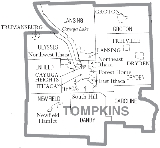
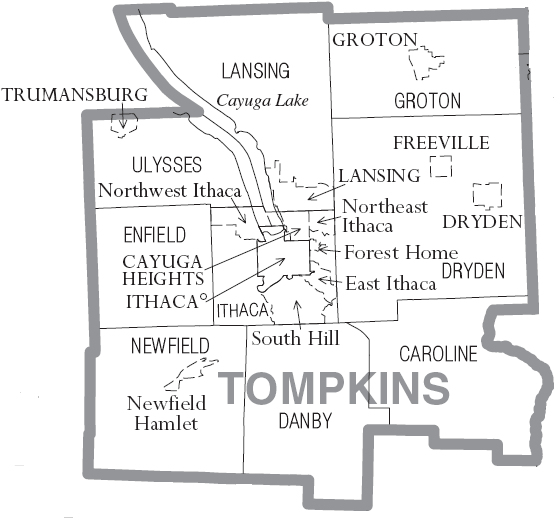
Cities, Towns, Villages, and Hamlets
- Town of CarolineCaroline, New YorkCaroline is a town in Tompkins County, New York, USA. The population was 2,910 at the 2000 census.The Town of Caroline is on the county's southeast border and is southeast of Ithaca, New York.- History :...
, containing- Brooktondale
- Caroline Center
- Caroline Depot
- Slaterville
- Slaterville Springs
- Speedsville
- Town of DanbyDanby, New YorkDanby is a town in Tompkins County, New York, USA. The population was 3,007 at the 2000 census.The Town of Danby is located in the south part of the county and is south of the City of Ithaca.- History :Danby was first settled around 1797....
, containing- Danby
- West Danby
- Town of DrydenDryden (town), New YorkDryden is a town in Tompkins County, New York, USA. The population was 13,532 at the 2000 census. The town contains two villages: one also named Dryden and one named Freeville...
, containing- Village of DrydenDryden (village), New YorkDryden is a village in Tompkins County, New York, United States. The population was 1,832 at the 2000 census. The name was assigned by a clerk interested in the classics to honor John Dryden, poet and playwright....
- Village of FreevilleFreeville, New YorkFreeville is a village in Tompkins County, New York, United States. The population was 505 at the 2000 census.The Village of Freeville is in the Town of Dryden and is east of Ithaca.-History:Dryden was in the former Central New York Military Tract....
- Etna
- VarnaVarna, New YorkVarna is a hamlet located in Tompkins County, New York, USA. It is within the Town of Dryden.Varna is located near the west town line on New York State Route 366 . Fall Creek flows past the town to Cayuga Lake.-External links:* *...
- West Dryden
- Village of Dryden
- Town of EnfieldEnfield, New YorkEnfield is a town in Tompkins County, New York, United States. The population was 3,369 at the 2000 census.The Town of Enfield is located on the western border of the county and is west of Ithaca.- History :...
- Town of GrotonGroton (town), New YorkGroton is a town in Tompkins County, New York, United States. The population was 5,794 at the 2000 census. The name is taken from Groton, Connecticut.The Town of Groton contains a village, also called Groton...
, containing- Village of GrotonGroton (village), New YorkGroton is a village in Tompkins County, New York, United States. The population was 2,470 at the 2000 census.The Village of Groton is near the center of the Town of Groton and is northeast of Ithaca and west of Cortland.- History :...
- Village of Groton
- City of Ithaca
- Town of IthacaIthaca (town), New YorkIthaca is a town in Tompkins County, New York, United States. The population was 18,198 at the 2000 census.The Town of Ithaca is a horseshoe-shaped portion of the metropolitan area of Ithaca, New York. It surrounds the City of Ithaca and is the City's only border, although the City has a...
, containing- Village of Cayuga HeightsCayuga Heights, New YorkCayuga Heights is a village in Tompkins County, New York, United States. The population was 3,273 at the 2000 census.The Village of Cayuga Heights is in the Town of Ithaca, north of the City of Ithaca...
- East IthacaEast Ithaca, New YorkEast Ithaca is a suburban community in Tompkins County, New York, United States. The population was 2,192 at the 2000 census.East Ithaca is a suburb of the City of Ithaca on its eastern city line and in the Town of Ithaca...
- Forest HomeForest Home, New YorkForest Home is a census-designated place in Tompkins County, New York, United States. The population was 941 at the 2000 census.The community of Forest Home is in the Town of Ithaca, northeast of the City of Ithaca and north of Cornell University....
- Northeast IthacaNortheast Ithaca, New YorkNortheast Ithaca is a census-designated place in Tompkins County, New York, United States. The population was 2,655 at the 2000 census.Northeast Ithaca is a suburb of adjacent Ithaca, New York.-Geography:...
- Northwest IthacaNorthwest Ithaca, New YorkNorthwest Ithaca is a census-designated place in Tompkins County, New York, United States. The population was 1,115 at the 2000 census.-Geography:Northwest Ithaca is located at ....
- South HillSouth Hill, New YorkSouth Hill is a census-designated place in Tompkins County, New York, United States. The population was 6,003 at the 2000 census.The South Hill CDP is located within the town of Ithaca. It is located near the south end of Cayuga Lake...
- Village of Cayuga Heights
- Town of LansingLansing (town), New YorkLansing is a town in Tompkins County, New York, United States. The population was 10,521 at the 2000 census. The town is named after John Lansing. Settlers from Lansing were early residents of the then-township of Lansing, Michigan and named it after their hometown; it would later become a city...
- Village of LansingLansing (village), New YorkLansing is a village in Tompkins County, New York, United States. The population was 3,417 at the 2000 census.The Village of Lansing is in the Town of Lansing and is north of Ithaca....
- Village of Lansing
- Town of NewfieldNewfield, New YorkNewfield is a town in Tompkins County, New York, United States. The population was 5,108 at the 2000 census. The town's name is derived from the many unoccupied tracts of land that were once in the town....
, containing- Newfield HamletNewfield Hamlet, New YorkNewfield Hamlet is a census-designated place in Tompkins County, New York, United States. The population was 647 at the 2000 census.Newfield Hamlet lies near the center of the town of Newfield and is located southwest of Ithaca.-Geography:...
- Newfield Hamlet
- Town of UlyssesUlysses, New YorkUlysses is a town located in northwest Tompkins County, New York, U.S.. The population was 4,900 at the 2010 census. The town was named after the hero of the Odyssey....
, containing- Hamlet of PodunkPodunk, Ulysses, New YorkPodunk is an old hamlet located along Taughannock Creek in the town of Ulysses, just south of Trumansburg, Tompkins County, New York State.-External links:*...
- Village of TrumansburgTrumansburg, New YorkTrumansburg is a village in Tompkins County, New York, United States. The population was 1,581 at the 2000 census. The name is a variant spelling of the surname of the founder, Abner Treman...
- Hamlet of Podunk
Colleges and Universities in county
- Cornell UniversityCornell UniversityCornell University is an Ivy League university located in Ithaca, New York, United States. It is a private land-grant university, receiving annual funding from the State of New York for certain educational missions...
- Ithaca CollegeIthaca CollegeIthaca College is a private college located on the South Hill of Ithaca, New York. The school was founded by William Egbert in 1892 as a conservatory of music. The college has a strong liberal arts core, but also offers several pre-professional programs and some graduate programs. The college is...
- Tompkins-Cortland Community CollegeTompkins Cortland Community CollegeTompkins Cortland Community College is a public two-year college supported by Cortland and Tompkins Counties. The main college campus is located in the Town of Dryden. Extension sites are located in Cortland, New York and Ithaca, New York...
See also
- List of counties in New York
- National Register of Historic Places listings in Tompkins County, New York
External links
- Tompkins County, NY official site
- Weather forecast for Tompkins County
- Tompkins County, NY Trip Planner (bus)
- Official brief history of Tompkins County by Carol Kammen, Tompkins County Historian
- Historical summary of Tompkins County
- Tompkins County Historical Aerial Photographs of New York , Cornell University Library & Cornell Institute for Resource Information Sciences