
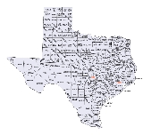
Texas census statistical areas
Encyclopedia
The United States Census Bureau
has defined 8 Combined Statistical Area
s (CSAs), 25 Metropolitan Statistical Areas (MSAs), and 43 Micropolitan Statistical Areas (μSAs) in the State of Texas. The following table describes these areas with the following information:
United States Census Bureau
The United States Census Bureau is the government agency that is responsible for the United States Census. It also gathers other national demographic and economic data...
has defined 8 Combined Statistical Area
Combined Statistical Area
The United States Office of Management and Budget defines micropolitan and metropolitan statistical areas. Metropolitan and micropolitan statistical areas consist of one or more counties...
s (CSAs), 25 Metropolitan Statistical Areas (MSAs), and 43 Micropolitan Statistical Areas (μSAs) in the State of Texas. The following table describes these areas with the following information:
- The name of the Combined Statistical Area (CSA), if any.
- The population of the CSA as of 2006-07-01, as estimated by the United States Census Bureau.
- The name of the Core Based Statistical AreaCore based statistical areaA Core Based Statistical Area is a U.S. geographic area defined by the Office of Management and Budget based around an urban center of at least 10,000 people and adjacent areas that are socioeconomically tied to the urban center by commuting. Areas defined on the basis of these standards applied...
(CBSA). - The population of the CBSA as of 2006-07-01, as estimated by the United States Census Bureau.
- The name of the countyCounty (United States)In the United States, a county is a geographic subdivision of a state , usually assigned some governmental authority. The term "county" is used in 48 of the 50 states; Louisiana is divided into parishes and Alaska into boroughs. Parishes and boroughs are called "county-equivalents" by the U.S...
. - The population of the county as of 2006-07-01, as estimated by the United States Census Bureau.
| Combined Statistical Area | 2006 Pop | Core Based Statistical Area | 2006 Pop | County | 2006 Pop |
|---|---|---|---|---|---|
| Dallas-Fort Worth, TX CSA | 6,359,758 | Dallas-Fort Worth-Arlington, TX MSA | 6,003,967 | Dallas County, Texas Dallas County, Texas As of the census of 2000, there were 2,218,899 people, 807,621 households, and 533,837 families residing in the county. The population density was 2,523 people per square mile . There were 854,119 housing units at an average density of 971/sq mi... |
2,345,815 |
| Tarrant County, Texas Tarrant County, Texas Tarrant County is a county located in the U.S. state of Texas. As of the 2010 U.S. Census, it had a population of 1,809,034. Its county seat is Fort Worth. Tarrant County is the sixteenth most populous county in the United States and the third most populous in Texas. The county is named in honor... |
1,671,295 | ||||
| Collin County, Texas Collin County, Texas As of the census of 2000, there were 491,675 people, 181,970 households, and 132,292 families residing in the county. The population density was 580 people per square mile . There were 194,892 housing units at an average density of 230 per square mile... |
698,851 | ||||
| Denton County, Texas Denton County, Texas Denton County is a county located in the U.S. state of Texas. In 2000, its population was 432,976; in 2009 the estimated population had reached 628,300. Part of the Dallas – Fort Worth Metroplex, it is one of the fastest-growing counties in the United States. The county seat is Denton. The county... |
584,238 | ||||
| Johnson County, Texas Johnson County, Texas As of the census of 2000, there were 126,811 people, 43,636 households, and 34,428 families residing in the county. The population density was 174 people per square mile . There were 46,269 housing units at an average density of 63 per square mile... |
149,016 | ||||
| Ellis County, Texas Ellis County, Texas As of the census of 2000, there were 111,360 people, 37,020 households, and 29,653 families residing in the county. The population density was 118 people per square mile . There were 39,071 housing units at an average density of 42 per square mile... |
139,300 | ||||
| Parker County, Texas Parker County, Texas As of the census of 2003, there were 98,495 people, 31,131 households, and 24,313 families residing in the county. The population density was 98 people per square mile . There were 34,084 housing units at an average density of 38 per square mile... |
106,266 | ||||
| Kaufman County, Texas Kaufman County, Texas As of the census of 2000, there were 71,313 people, 24,367 households, and 19,225 families residing in the county. The population density was 91/sq mi . There were 26,133 housing units at an average density of 33/sq mi... |
93,241 | ||||
| Hunt County, Texas Hunt County, Texas As of the census of 2000, there were 76,596 people, 28,742 households, and 20,521 families residing in the county. The population density was 91 people per square mile . There were 32,490 housing units at an average density of 39 per square mile... |
83,338 | ||||
| Rockwall County, Texas Rockwall County, Texas As of the census of 2000, there were 43,080 people, 14,530 households, and 11,972 families residing in the county. The population density was 334 people per square mile . There were 15,351 housing units at an average density of 119 per square mile... |
69,155 | ||||
| Wise County, Texas Wise County, Texas As of the census of 2000, there were 48,793 people, 17,178 households, and 13,467 families residing in the county. The population density was 54 people per square mile . There were 19,242 housing units at an average density of 21 per square mile... |
57,891 | ||||
| Delta County, Texas | 5,561 | ||||
| Sherman-Denison, TX MSA | 118,478 | Grayson County, Texas Grayson County, Texas As of the census of 2000, there were 110,595 people, 42,849 households, and 30,208 families residing in the county. The population density was 118 people per square mile . There were 48,315 housing units at an average density of 52 per square mile... |
118,478 | ||
| Athens, TX μSA | 80,222 | Henderson County, Texas Henderson County, Texas As of the census of 2000, there were 73,277 people, 28,804 households, and 20,969 families residing in the county. The population density was 84 people per square mile . There were 35,935 housing units at an average density of 41 per square mile... |
80,222 | ||
| Granbury, TX μSA | 57,011 | Hood County, Texas | 49,238 | ||
| Somervell County, Texas Somervell County, Texas There were 2,438 households out of which 37.40% had children under the age of 18 living with them, 61.70% were married couples living together, 9.60% had a female householder with no husband present, and 24.50% were non-families. 21.30% of all households were made up of individuals and 9.20% had... |
7,773 | ||||
| Gainesville, TX μSA | 38,946 | Cooke County, Texas Cooke County, Texas As of the census of 2000, there were 36,363 people, 13,643 households, and 10,000 families residing in the county. The population density was 42 people per square mile . There were 15,061 housing units at an average density of 17 per square mile... |
38,946 | ||
| Bonham, TX μSA | 33,337 | Fannin County, Texas Fannin County, Texas As of the census of 2000, there were 31,242 people, 11,105 households, and 7,984 families residing in the county. The population density was 35 people per square mile . There were 12,887 housing units at an average density of 14 per square mile... |
33,337 | ||
| Mineral Wells, TX μSA | 27,797 | Palo Pinto County, Texas Palo Pinto County, Texas As of the census of 2000, there were 27,026 people, 10,594 households, and 7,447 families residing in the county. The population density was 28 people per square mile . There were 14,102 housing units at an average density of 15 per square mile... |
27,797 | ||
| Houston-Baytown-Huntsville, TX CSA | 5,641,077 | Houston-Sugar Land-Baytown, TX MSA | 5,539,949 | Harris County, Texas Harris County, Texas As of the 2010 Census, the population of the county was 4,092,459, White Americans made up 56.6% of Harris County's population; non-Hispanic whites represented 33.0% of the population. Black Americans made up 18.9% of the population. Native Americans made up 0.7% of Harris County's population... |
3,886,207 |
| Fort Bend County, Texas Fort Bend County, Texas Fort Bend County is a county located along the Gulf Coast region in the U.S. state of Texas within the Houston–Sugar Land–Baytown metropolitan area. In 2000 its population was 354,452, while the 2010 U.S... |
493,187 | ||||
| Montgomery County, Texas Montgomery County, Texas Montgomery County is a county located in the U.S. state of Texas within the Houston–Sugar Land–Baytown metropolitan area. The county was created by an act of the Congress of the Republic of Texas on December 14, 1837. The county was named for the town of Montgomery, Texas. In 2000, its... |
398,290 | ||||
| Brazoria County, Texas Brazoria County, Texas Brazoria County[p] is a county in the U.S. state of Texas, located on the Gulf Coast within the Houston–Sugar Land–Baytown metropolitan area. Regionally, parts of the county are within the extreme southern-most fringe of the regions locally known as Southeast Texas. Brazoria County is among a... |
287,898 | ||||
| Galveston County, Texas Galveston County, Texas Galveston County is a county located in the U.S. state of Texas within the Houston–Sugar Land–Baytown metropolitan area. As of the 2010 U.S. Census, the population was 291,309. Its county seat is Galveston. League City is the largest city in Galveston County in terms of population; between... |
283,551 | ||||
| Liberty County, Texas Liberty County, Texas Liberty County is a county located in Texas within the Houston–Sugar Land–Baytown metropolitan area. As of the 2010 United States Census, the population was 75,643. Its county seat is Liberty.-Geography:According to the U.S... |
75,685 | ||||
| Waller County, Texas | 35,185 | ||||
| Chambers County, Texas | 28,779 | ||||
| Austin County, Texas Austin County, Texas Austin County is a county located in the U.S. state of Texas adjacent to the Houston–Sugar Land–Baytown metropolitan area. The population was 28,417 at the 2010 census. Its county seat is Bellville. Austin County is named for Stephen F... |
26,407 | ||||
| San Jacinto County, Texas | 24,760 | ||||
| Huntsville, TX μSA | 63,304 | Walker County, Texas Walker County, Texas Walker County is a county located in the U.S. state of Texas. In 2010, its population was 67,861. Its county seat is Huntsville.Initially, Walker County was named for Robert J. Walker, a legislator from Mississippi who introduced into the United States Congress the resolution to annex Texas... |
63,304 | ||
| Bay City, TX μSA | 37,824 | Matagorda County, Texas | 37,824 | ||
| primary census statistical area | 1,942,217 | San Antonio, TX MSA | 1,942,217 | Bexar County, Texas Bexar County, Texas As of the census of 2000, there were 1,392,931 people, 488,942 households, and 345,681 families residing in the county. The population density was 1,117 people per square mile . There were 521,359 housing units at an average density of 418 per square mile... |
1,555,592 |
| Guadalupe County, Texas Guadalupe County, Texas Guadalupe County is a county located in the U.S. state of Texas. In 2000, its population was 89,023. It is named for the Guadalupe River. The seat of the county is Seguin. It was founded in 1846.... |
108,410 | ||||
| Comal County, Texas Comal County, Texas Comal County is a county located on the Edwards Plateau in the U.S. state of Texas. In 2010, its population was 108,472. Its seat is New Braunfels.Comal County is part of the San Antonio Metropolitan Statistical Area.-History Timeline:... |
101,181 | ||||
| Medina County, Texas | 43,913 | ||||
| Atascosa County, Texas | 43,876 | ||||
| Wilson County, Texas Wilson County, Texas Wilson County is a county located in the U.S. state of Texas. In 2000, its population was 32,408. Its county seat is Floresville. The county is named after James Charles Wilson.... |
38,829 | ||||
| Kendall County, Texas Kendall County, Texas Kendall County is a county located on the Edwards Plateau in the U.S. state of Texas. In 2008 census, its population was 32,886. Its seat is Boerne.... |
30,213 | ||||
| Bandera County, Texas Bandera County, Texas Bandera County, formed in 1856 from Bexar and Uvalde counties, is a county located on the Edwards Plateau in the U.S. state of Texas. As of 2000, the population is 17,645. Its county seat is Bandera. Bandera is named for the Spanish word for flag... |
20,203 | ||||
| primary census statistical area | 1,513,565 | Austin-Round Rock, TX MSA Greater Austin Austin–Round Rock–San Marcos is a five-county metropolitan area in the US state of Texas, as defined by the Office of Management and Budget. The metropolitan area straddles on the eastern edge of the and is situated in Central Texas.... |
1,513,565 | Travis County, Texas Travis County, Texas As of 2009, the U.S. census estimates there were 1,026,158 people, 320,766 households, and 183,798 families residing in the county. The population density was 821 people per square mile . There were 335,881 housing units at an average density of 340 per square mile... |
921,006 |
| Williamson County, Texas Williamson County, Texas Williamson County is a county located on both the Edwards Plateau to the west, consisting of rocky terrain and hills, and Blackland Prairies in the east consising of rich, fertile farming land, The two areas are roughly bisected by Interstate 35... |
353,830 | ||||
| Hays County, Texas Hays County, Texas Hays County is a county located on the Edwards Plateau in the U.S. state of Texas. In 2010, its official population had reached 157,107. It is named for John Coffee Hays, a Texas Ranger and Mexican-American War officer. The seat of the county is San Marcos.... |
130,325 | ||||
| Bastrop County, Texas Bastrop County, Texas Bastrop County is a county located in the U.S. state of Texas. As of 2006, the population was 71,700. Its county seat is Bastrop. Bastrop County is named for Felipe Enrique Neri, Baron de Bastrop , an early Dutch settler who assisted Stephen F... |
71,684 | ||||
| Caldwell County, Texas Caldwell County, Texas Caldwell County is a county located in the U.S. state of Texas. It is part of the Austin-Round Rock metropolitan area. In 2000, the population was 32,194. Its county seat is Lockhart... |
36,720 | ||||
| primary census statistical area | 736,310 | El Paso, TX MSA | 736,310 | El Paso County, Texas | 736,310 |
| primary census statistical area | 700,634 | McAllen-Edinburg-Mission, TX MSA | 700,634 | Hidalgo County, Texas Hidalgo County, Texas Hidalgo County is a county located in the U.S. state of Texas. Located in the Rio Grande Valley of South Texas, Hidalgo County is one of the fastest-growing counties in the United States, and is the seventh most-populous county in Texas. Its population in 2010 was 774,769, a 35% increase from 2000... |
700,634 |
| Corpus Christi-Kingsville, TX CSA | 446,565 | Corpus Christi, TX MSA | 415,810 | Nueces County, Texas | 321,457 |
| San Patricio County, Texas | 69,522 | ||||
| Aransas County, Texas Aransas County, Texas Aransas County is a county located in the U.S. state of Texas. It is part of the Corpus Christi Metropolitan Statistical Area. As of 2000, the population was 22,499. Its county seat is Rockport. Aransas County was formed in 1871 from Refugio County.-Geography:According to the U.S... |
24,831 | ||||
| Kingsville, TX μSA | 30,755 | Kleberg County, Texas | 30,353 | ||
| Kenedy County, Texas | 402 | ||||
| Brownsville-Harlingen-Raymondville, TX CSA | 408,362 | Brownsville-Harlingen, TX MSA | 387,717 | Cameron County, Texas Cameron County, Texas Cameron County is the southernmost county located in the U.S. state of Texas. In 2010, its population was 406,220. Its county seat is Brownsville. Cameron was founded in 1848... |
387,717 |
| Raymondville, TX μSA | 20,645 | Willacy County, Texas | 20,645 | ||
| primary census statistical area | 379,640 | Beaumont-Port Arthur, TX MSA | 379,640 | Jefferson County, Texas Jefferson County, Texas Jefferson County is a county located in the state of Texas, United States. As of 2000, the population was 252,051. Its county seat is Beaumont, and it is named for the former U.S... |
243,914 |
| Orange County, Texas Orange County, Texas Orange County is one of 254 counties of the State of Texas and its county seat is the city of Orange, Texas. In the year 2000, the population of Orange County was about 85,000. Orange County is the county in the very southeastern corner of Texas, with a boundary with Louisiana and a seacoast on the... |
84,243 | ||||
| Hardin County, Texas | 51,483 | ||||
| primary census statistical area | 351,322 | Killeen-Temple-Fort Hood, TX MSA | 351,322 | Bell County, Texas Bell County, Texas Bell County is a county located in the U.S. state of Texas. Bell County was founded in 1850. It is part of the Killeen–Temple–Fort Hood Metropolitan Statistical Area. In 2000, the county's population was 237,974; in 2010 the U.S. Census Bureau reported that its population had reached... |
257,897 |
| Coryell County, Texas Coryell County, Texas Coryell County is a county located on the Edwards Plateau in the U.S. state of Texas. In 2000, its population was 74,978. The county seat is Gatesville. Coryell County forms part of the Killeen–Temple–Fort Hood Metropolitan Statistical Area... |
72,667 | ||||
| Lampasas County, Texas Lampasas County, Texas Lampasas County is a county located on the Edwards Plateau in the U.S. state of Texas. In 2000, its population was 17,762. Its seat is Lampasas. The county is named for the Lampasas River.... |
20,758 | ||||
| Lubbock-Levelland, TX CSA | 284,020 | Lubbock, TX MSA | 261,411 | Lubbock County, Texas | 254,862 |
| Crosby County, Texas | 6,549 | ||||
| Levelland, TX μSA | 22,609 | Hockley County, Texas | 22,609 | ||
| Longview-Marshall, TX CSA | 267,186 | Longview, TX MSA | 203,367 | Gregg County, Texas Gregg County, Texas There were 42,687 households out of which 33.50% had children under the age of 18 living with them, 52.00% were married couples living together, 13.50% had a female householder with no husband present, and 30.50% were non-families. 26.10% of all households were made up of individuals and 10.50% had... |
117,090 |
| Rusk County, Texas Rusk County, Texas As of the census of 2000, there were 47,372 people, 17,364 households, and 12,727 families residing in the county. The population density was 51 people per square mile . There were 19,867 housing units at an average density of 22 per square mile... |
48,354 | ||||
| Upshur County, Texas Upshur County, Texas As of the census of 2000, there were 35,291 people, 13,290 households, and 10,033 families residing in the county. The population density was 60 people per square mile . There were 14,930 housing units at an average density of 25 per square mile... |
37,923 | ||||
| Marshall, TX μSA | 63,819 | Harrison County, Texas Harrison County, Texas Harrison County is a county of the U.S. state of Texas. In 2000, its population was 62,110. It is named for Jonas Harrison, a lawyer and Texas revolutionary. It is located in the Ark-La-Tex region... |
63,819 | ||
| Midland-Odessa, TX CSA | 251,842 | Odessa, TX MSA | 127,462 | Ector County, Texas | 127,462 |
| Midland, TX MSA | 124,380 | Midland County, Texas | 124,380 | ||
| Tyler-Jacksonville, TX CSA | 243,148 | Tyler, TX MSA | 194,635 | Smith County, Texas Smith County, Texas As of the census of 2000, there were 174,706 people, 65,692 households, and 46,904 families residing in the county. The population density was 188 people per square mile . There were 71,701 housing units at an average density of 77 per square mile... |
194,635 |
| Jacksonville, TX μSA | 48,513 | Cherokee County, Texas Cherokee County, Texas As of the census of 2000, there were 46,659 people, 16,651 households, and 12,105 families residing in the county. The population density was 44 people per square mile . There were 19,173 housing units at an average density of 18 per square mile... |
48,513 | ||
| primary census statistical area | 241,515 | Amarillo, TX MSA | 241,515 | Potter County, Texas | 121,328 |
| Randall County, Texas | 111,472 | ||||
| Carson County, Texas Carson County, Texas Carson County is a county located in the U.S. state of Texas. It is part of the Amarillo metropolitan area. In 2000, its population was 6,516. Carson is named for Samuel Price Carson, the first secretary of state of the Republic of Texas. The seat of the county is Panhandle. It was founded in... |
6,595 | ||||
| Armstrong County, Texas Armstrong County, Texas Armstrong County is a county located in the U.S. state of Texas, and was formed in 1876 from Bexar County. It is part of the Amarillo metropolitan area. As of 2000, the population is 2,148. Its county seat is Claude. Armstrong is named for one of several Texas pioneer families named Armstrong... |
2,120 | ||||
| primary census statistical area | 231,470 | Laredo, TX MSA | 231,470 | Webb County, Texas Webb County, Texas Webb County is a county located in the U.S. state of Texas. The official 2010 population for the county is 250,304. In 2000, its population was 193,117, and in 2006 its population had been estimated to have reached to 231,470. Its county seat is Laredo... |
231,470 |
| primary census statistical area | 226,189 | Waco, TX MSA | 226,189 | McLennan County, Texas McLennan County, Texas McLennan County is a county located on the Edwards Plateau in Central Texas. In 2000, its population was 213,517; in 2008 the U.S. Census Bureau estimated its population to be 230,213. Its seat is Waco. The county is named for Neil McLennan, an early settler.... |
226,189 |
| primary census statistical area | 192,152 | College Station-Bryan, TX MSA Bryan-College Station metropolitan area The Bryan–College Station Metropolitan Statistical Area is a metropolitan area in the Brazos Valley region of Texas that covers three counties: Brazos, Burleson, and Robertson... |
192,152 | Brazos County, Texas Brazos County, Texas Brazos County is a county located in the U.S. state of Texas in the Central Texas region. In 2010, its population was 194,851. The county seat is Bryan and it is part of the Bryan-College Station metropolitan area. Brazos is named for the Brazos River, along with Brazoria... |
159,006 |
| Burleson County, Texas | 16,932 | ||||
| Robertson County, Texas | 16,214 | ||||
| primary census statistical area | 158,063 | Abilene, TX MSA | 158,063 | Taylor County, Texas Taylor County, Texas As of the census of 2000, there were 126,555 people, 47,274 households, and 32,524 families residing in the county. The population density was 138 people per square mile . There were 52,056 housing units at an average density of 57 per square mile... |
124,927 |
| Jones County, Texas Jones County, Texas As of the census of 2000, there were 20,785 people, 6,140 households, and 4,525 families residing in the county. The population density was 22 people per square mile . There were 7,236 housing units at an average density of 8 per square mile... |
19,645 | ||||
| Callahan County, Texas Callahan County, Texas *Baird*Belle Plain*Callahan City*Clyde*Cottonwood*Cross Plains*Eula*Putnam-See also:*National Register of Historic Places listings in Callahan County, Texas-External links:* at the University of Texas*... |
13,491 | ||||
| primary census statistical area | 145,528 | Wichita Falls, TX MSA | 145,528 | Wichita County, Texas Wichita County, Texas As of the census of 2000, there were 131,664 people, 48,441 households, and 32,891 families residing in the county. The population density was 210 people per square mile . There were 53,304 housing units at an average density of 85 per square mile... |
125,158 |
| Clay County, Texas Clay County, Texas As of the census of 2000, there were 11,006 people, 4,323 households, and 3,181 families residing in the county. The population density was 10 people per square mile . There were 4,992 housing units at an average density of 4 per square mile... |
11,104 | ||||
| Archer County, Texas Archer County, Texas Archer County is a county located in the US state of Texas, and was formed in 1858 from Fannin County. It is part of the Wichita Falls, Texas, Metropolitan Statistical Area. As of 2005, the population estimate is 9,095, up from 8,854 in 2000. Its county seat is Archer City. Archer is named for... |
9,266 | ||||
| primary census statistical area | 114,088 | Victoria, TX MSA | 114,088 | Victoria County, Texas Victoria County, Texas Victoria County is a county located in the U.S. state of Texas. In 2000, its population was 84,088. Its county seat is Victoria. It is included in the Victoria, Texas Metropolitan Statistical Area.-Geography:According to the U.S... |
86,191 |
| Calhoun County, Texas Calhoun County, Texas Calhoun County is a county located in the U.S. state of Texas. In 2000, the population was 20,647. Its county seat is Port Lavaca. It is a part of the Victoria Metropolitan Statistical Area... |
20,705 | ||||
| Goliad County, Texas | 7,192 | ||||
| primary census statistical area | 105,752 | San Angelo, TX MSA | 105,752 | Tom Green County, Texas | 103,938 |
| Irion County, Texas | 1,814 | ||||
| primary census statistical area | 134,510 91,455 |
Texarkana, TX-AR MSA | 134,510 91,455 |
Bowie County, Texas Bowie County, Texas Bowie County is a county located in the U.S. state of Texas. It is part of the Texarkana, Texas - Texarkana, Arkansas, Metropolitan Statistical Area. As of 2000, the population was 89,306. Its legal county seat is Boston, though its courthouse is located in New Boston... |
91,455 |
| Miller County, Arkansas | 43,055 | ||||
| primary census statistical area | 82,524 | Lufkin, TX μSA | 82,524 | Angelina County, Texas Angelina County, Texas Angelina County is a county located in the U.S. state of Texas. Angelina County was formed in 1846 from Nacogdoches County. As of 2000, the population was 80,130. Its county seat is Lufkin. Angelina is named for a Hainai Native American woman who assisted early Spanish missionaries and was named... |
82,524 |
| primary census statistical area | 61,780 | Rio Grande City-Roma, TX μSA | 61,780 | Starr County, Texas Starr County, Texas Starr County is a county located in the U.S. state of Texas. In 2010, its population was 60,968. Its county seat is Rio Grande City. The county is named for James Harper Starr, who served as Secretary of the Treasury of the Republic of Texas. It is part of the Rio Grande City-Roma, TX,... |
61,780 |
| primary census statistical area | 61,079 | Nacogdoches, TX μSA | 61,079 | Nacogdoches County, Texas Nacogdoches County, Texas As of the census of 2000, there were 59,203 people, 22,006 households, and 14,039 families residing in the county. The population density was 62 people per square mile . There were 25,051 housing units at an average density of 26 per square mile... |
61,079 |
| primary census statistical area | 57,064 | Palestine, TX μSA | 57,064 | Anderson County, Texas Anderson County, Texas Anderson County is a county located in the U.S. state of Texas. As of 2000, the population was 55,109. Its county seat is Palestine. Anderson county was organized in 1846, and is named in honor of Kenneth L. Anderson who had been Vice President of the Republic of Texas.-Geography:According to the... |
57,064 |
| primary census statistical area | 52,298 | Eagle Pass, TX μSA | 52,298 | Maverick County, Texas Maverick County, Texas Maverick County is a county located in the U.S. state of Texas. In 2000, its population was 47,297. Its county seat is Eagle Pass. Maverick County is named for Samuel Maverick, cattleman and state legislator.... |
52,298 |
| primary census statistical area | 49,863 | Paris, TX μSA | 49,863 | Lamar County, Texas | 49,863 |
| primary census statistical area | 49,440 | Corsicana, TX μSA | 49,440 | Navarro County, Texas | 49,440 |
| primary census statistical area | 48,145 | Del Rio, TX μSA | 48,145 | Val Verde County, Texas Val Verde County, Texas Val Verde County is a county located on the Edwards Plateau in the U.S. state of Texas. In 2008, estimated population was 55,000. Its county seat is Del Rio. In 1936, Val Verde County received Recorded Texas Historic Landmark number 5625 to commemorate its founding.Val Verde, which means "green... |
48,145 |
| primary census statistical area | 47,254 | Kerrville, TX μSA | 47,254 | Kerr County, Texas Kerr County, Texas Kerr County is a county located on the Edwards Plateau in the U.S. state of Texas. In 2010, its population was 49,625. Its county seat is Kerrville. Kerr County was named by Joshua D. Brown for his fellow Kentucky native, James Kerr, a congressman of the Republic of Texas... |
47,254 |
| primary census statistical area | 41,475 | El Campo, TX μSA | 41,475 | Wharton County, Texas | 41,475 |
| primary census statistical area | 41,131 | Alice, TX μSA | 41,131 | Jim Wells County, Texas Jim Wells County, Texas At the 2000 census, there were 39,326 people, 12,961 households and 10,096 families residing in the county. The population density was 46 per square mile . There were 14,819 housing units at an average density of 17 per square mile... |
41,131 |
| primary census statistical area | 38,970 | Brownwood, TX μSA | 38,970 | Brown County, Texas Brown County, Texas Brown County is a county in West Central Texas. As of 2000, the population was 37,674. Its county seat is Brownwood. Brown is named for Henry Stevenson Brown, a commander at the Battle of Velasco... |
38,970 |
| primary census statistical area | 36,317 | Plainview, TX μSA | 36,317 | Hale County, Texas Hale County, Texas Hale County is a county located in the U.S. state of Texas. In 2000, its population was 36,602. It was organized in 1888, and is named for Lt. John C. Hale, a hero of the Battle of San Jacinto. The seat of the county is Plainview. It is home of the noted former Hale County Judge, Judge Bill... |
36,317 |
| primary census statistical area | 34,289 | Stephenville, TX μSA | 34,289 | Erath County, Texas Erath County, Texas Erath County is a county located on the Edwards Plateau in the U.S. state of Texas. In 2000, its population was 33,001. It is named for George Bernard Erath, an early surveyor and a soldier at the Battle of San Jacinto. The seat of the county is Stephenville.... |
34,289 |
| primary census statistical area | 33,496 | Sulphur Springs, TX μSA | 33,496 | Hopkins County, Texas Hopkins County, Texas *Brashear*Dike*Como*Cumby*Gafford*Pickton*Saltillo*Sulphur Bluff*Sulphur Springs*Tira-See also:*National Register of Historic Places listings in Hopkins County, Texas-External links:*... |
33,496 |
| primary census statistical area | 33,176 | Beeville, TX μSA | 33,176 | Bee County, Texas Bee County, Texas Bee County is a county located in the U.S. state of Texas. Bee County was founded December 8, 1857. As of 2010, the population was 31,861. Its county seat is Beeville. Bee County is named for Barnard E... |
33,176 |
| primary census statistical area | 32,463 | Big Spring, TX μSA | 32,463 | Howard County, Texas | 32,463 |
| primary census statistical area | 31,912 | Brenham, TX μSA | 31,912 | Washington County, Texas | 31,912 |
| primary census statistical area | 30,306 | Mount Pleasant, TX μSA | 30,306 | Titus County, Texas Titus County, Texas As of the census of 2000, there were 28,118 people, 9,552 households, and 7,154 families residing in the county. The population density was 68 people per square mile . There were 10,675 housing units at an average density of 26 per square mile... |
30,306 |
| primary census statistical area | 27,050 | Uvalde, TX μSA | 27,050 | Uvalde County, Texas Uvalde County, Texas Uvalde County is a county located in the U.S. state of Texas. In 2000, its population was 25,926. Its county seat is Uvalde. The county is named for Juan de Ugalde, the Spanish governor of Coahuila. Uvalde County was founded by Reading Wood Black who also founded the city of Uvalde,... |
27,050 |
| primary census statistical area | 23,527 | Fredericksburg, TX μSA | 23,527 | Gillespie County, Texas Gillespie County, Texas Gillespie County is a county located on the Edwards Plateau in the U.S. state of Texas. In 2010, its population was 24,837. It is located in the heart of the Texas Hill Country. Gillespie is named for Robert Addison Gillespie, who came to Texas in 1837. He was a Texas Ranger, an Indian fighter, a... |
23,527 |
| primary census statistical area | 22,754 | Pampa, TX μSA | 22,754 | Gray County, Texas | 21,919 |
| Roberts County, Texas | 835 | ||||
| primary census statistical area | 22,460 | Borger, TX μSA | 22,460 | Hutchinson County, Texas Hutchinson County, Texas Hutchinson County is a county located in the U.S. state of Texas in the northern portion of the Texas Panhandle. In 2000, its population was 23,857. Its seat is Stinnett . Hutchinson County is named for Andrew Hutchinson, an early Texas attorney.... |
22,460 |
| primary census statistical area | 20,591 | Dumas, TX μSA | 20,591 | Moore County, Texas | 20,591 |
| primary census statistical area | 18,623 | Hereford, TX μSA | 18,623 | Deaf Smith County, Texas | 18,623 |
| primary census statistical area | 16,202 | Snyder, TX μSA | 16,202 | Scurry County, Texas | 16,202 |
| primary census statistical area | 14,812 | Sweetwater, TX μSA | 14,812 | Nolan County, Texas | 14,812 |
| primary census statistical area | 14,218 | Vernon, TX μSA | 14,218 | Wilbarger County, Texas Wilbarger County, Texas *Harrold *Odell *Oklaunion *Vernon-Notable natives and residents:*Jack English Hightower, Memphis, Texas, native; former member of both houses of the Texas State Legislature, and former U.S... |
14,218 |
| primary census statistical area | 14,174 | Lamesa, TX μSA | 14,174 | Dawson County, Texas | 14,174 |
| primary census statistical area | 12,952 | Andrews, TX μSA | 12,952 | Andrews County, Texas | 12,952 |
| primary census statistical area | 11,466 | Pecos, TX μSA | 11,466 | Reeves County, Texas Reeves County, Texas Reeves County is a county located in the US state of Texas. It is one of the nine counties that comprise the Trans-Pecos region of West Texas. In 2000, its population was 13,137. Its seat is Pecos. Reeves County is named for George R. Reeves, a Texas state legislator and colonel in the... |
11,466 |
| none | Van Zandt County, Texas Van Zandt County, Texas As of the census of 2000, there were 48,140 people, 18,195 households, and 13,664 families residing in the county. The population density was 57 people per square mile . There were 20,896 housing units at an average density of 25 per square mile... |
52,916 | |||
| Polk County, Texas | 46,995 | ||||
| Burnet County, Texas Burnet County, Texas Burnet County is a county located on the Edwards Plateau in the U.S. state of Texas. As of 2000, the population was 34,147. The 2008 Census Bureau Estimate was 44,488. Its county seat is Burnet. Burnet is named for David Gouverneur Burnet, the first president of the Republic of Texas... |
42,896 | ||||
| Wood County, Texas Wood County, Texas As of the census of 2000, there were 36,752 people, 14,583 households, and 10,645 families residing in the county. The population density was 56 people per square mile . There were 17,939 housing units at an average density of 28 per square mile... |
41,776 | ||||
| Hill County, Texas | 35,806 | ||||
| Jasper County, Texas | 35,293 | ||||
| Cass County, Texas Cass County, Texas As of the census of 2000, there were 30,438 people, 12,190 households, and 8,654 families residing in the county. The population density was 32 people per square mile . There were 13,890 housing units at an average density of 15 per square mile... |
29,955 | ||||
| Shelby County, Texas Shelby County, Texas *Arcadia*Brooklyn*Center*Dreka *Huxley*Joaquin*Possum Trot*Shelbyville *Tenaha*Timpson*Weaver-Education:The following school districts serve Shelby County:*Center ISD*Excelsior ISD... |
26,575 | ||||
| Grimes County, Texas | 25,552 | ||||
| Milam County, Texas | 25,286 | ||||
| Lamb County, Texas | 23,722 | ||||
| Houston County, Texas Houston County, Texas Houston County is a county located in the U.S. state of Texas. As of 2000, the population was 23,185. Its county seat is Crockett. Houston County is named for Samuel Houston, a president of the Republic of Texas and Governor of Texas... |
23,044 | ||||
| Panola County, Texas Panola County, Texas As of the census of 2000, there were 22,756 people, 8,821 households, and 6,395 families residing in the county. The population density was 28 people per square mile . There were 10,524 housing units at an average density of 13 per square mile... |
22,989 | ||||
| Limestone County, Texas Limestone County, Texas Limestone County is a county located in the U.S. state of Texas. As of 2000, the population was 22,051. Its county seat is Groesbeck.-Geography:According to the U.S. Census Bureau, the county has a total area of , of which is land and is water.... |
22,720 | ||||
| Fayette County, Texas Fayette County, Texas Fayette County is a county located in the U.S. state of Texas. As of 2000, the population was 21,804. Its county seat is La Grange. Fayette is named for the Marquis de la Fayette, a French nobleman who became an American Revolutionary War hero... |
22,521 | ||||
| Colorado County, Texas | 20,824 | ||||
| Tyler County, Texas | 20,557 | ||||
| DeWitt County, Texas DeWitt County, Texas DeWitt County is a county located in the U.S. state of Texas. In 2000, its population was 20,013. DeWitt County is named for Green DeWitt, who founded an early colony in Texas. The seat of the county is Cuero. It was founded in 1846.-Geography:... |
20,167 | ||||
| Montague County, Texas Montague County, Texas As of the census of 2000, there were 19,117 people, 7,770 households, and 5,485 families residing in the county. The population density was 20 people per square mile . There were 9,862 housing units at an average density of 11 per square mile... |
19,810 | ||||
| Gonzales County, Texas Gonzales County, Texas Gonzales County is a county located in the U.S. state of Texas. In 2000, its population was 18,628. It is named for its seat, the city of Gonzales.-History Timeline:* Paleo-Indians Hunter-gatherers, and later Coahuiltecan, Tonkawa, Karankawa... |
19,566 | ||||
| Lavaca County, Texas | 18,970 | ||||
| Freestone County, Texas Freestone County, Texas Freestone County is a county located in the U.S. state of Texas. As of 2000, the population was 17,867. Its county seat is Fairfield.-Geography:... |
18,803 | ||||
| Eastland County, Texas Eastland County, Texas *Carbon*Cisco*Desdemona, a ghost town*Eastland*Gorman*Mangum*Olden*Ranger*Rising Star*Romney-See also:*National Register of Historic Places listings in Eastland County, Texas*Santa Claus Bank Robbery-External links:** at the University of Texas*... |
18,293 | ||||
| Llano County, Texas Llano County, Texas Llano County is a county located on the Edwards Plateau in the U.S. state of Texas. In 2010, its population was 19, 301. Its county seat is Llano, and the county is named for the Llano River.... |
18,269 | ||||
| Bosque County, Texas Bosque County, Texas Bosque County is a county located on the Edwards Plateau in the U.S. state of Texas. As of 2000, the population is 17,204. Its county seat is Meridian. Clifton, however, is the largest city and the cultural/financial center of the county. Bosque is named for the Bosque River, which runs through... |
18,058 | ||||
| Young County, Texas Young County, Texas As of the census of 2000, there were 17,943 people, 7,167 households, and 5,081 families residing in the county. The population density was 20 people per square mile . There were 8,504 housing units at an average density of 9 per square mile... |
18,021 | ||||
| Falls County, Texas Falls County, Texas Falls County is a county located in the U.S. state of Texas. In 2000, its population was 18,576. In 2003, the population of the county was estimated to be 17,926. It is named for the waterfalls on the Brazos River, which can be found at the Falls On The Brazos Park, a campsite located only a few... |
17,547 | ||||
| Lee County, Texas | 16,573 | ||||
| Leon County, Texas | 16,538 | ||||
| Frio County, Texas | 16,336 | ||||
| Pecos County, Texas Pecos County, Texas Pecos County is a county located in Texas which is named for the Pecos River. It is one of the nine counties that comprise the Trans-Pecos region of West Texas. In 2000, its population was 16,809. The county seat is Fort Stockton.... |
16,139 | ||||
| Karnes County, Texas Karnes County, Texas Karnes County is a county located in the U.S. state of Texas. As of 2000, the population was 15,446. Its county seat is Karnes City. Karnes County is named for Henry Karnes, a soldier in the Texas Revolution.-Geography:... |
15,270 | ||||
| Gaines County, Texas | 15,008 | ||||
| Trinity County, Texas | 14,296 | ||||
| Jackson County, Texas | 14,249 | ||||
| Newton County, Texas Newton County, Texas Newton County is the easternmost county in the U.S. state of Texas. In of 2000, its population was 15,072. Its county seat is Newton. Newton county is named for John Newton, a veteran of the American Revolutionary War... |
14,090 | ||||
| Comanche County, Texas Comanche County, Texas Comanche County is a county located on the Edwards Plateau in Central Texas. In 2000, its population was 14,026. Comanche was founded in 1856. Comanche is named for the Comanche Native American tribe... |
13,837 | ||||
| Zapata County, Texas | 13,615 | ||||
| Red River County, Texas | 13,440 | ||||
| Madison County, Texas | 13,310 | ||||
| Morris County, Texas Morris County, Texas As of the census of 2000, there were 13,048 people, 5,215 households, and 3,749 families residing in the county. The population density was 51 people per square mile . There were 6,017 housing units at an average density of 24 per square mile... |
13,002 | ||||
| Duval County, Texas | 12,437 | ||||
| Camp County, Texas Camp County, Texas As of the census of 2000, there were 11,549 people, 4,336 households, and 3,156 families residing in the county. The population density was 58 people per square mile . There were 5,228 housing units at an average density of 26 per square mile... |
12,410 | ||||
| Terry County, Texas | 12,387 | ||||
| Zavala County, Texas Zavala County, Texas Zavala County is a county located in the U.S. state of Texas. As of 2000, the population was 11,600. Its county seat is Crystal City. Zavala is named for Lorenzo de Zavala, Mexican politician, signer of the Texas Declaration of Independence, and first vice president of the Republic of... |
12,036 | ||||
| Live Oak County, Texas | 11,522 | ||||
| Rains County, Texas Rains County, Texas *Alba*East Tawakoni*Emory*Point*Dougherty-See also:*National Register of Historic Places listings in Rains County, Texas-External links:*... |
11,514 | ||||
| Marion County, Texas Marion County, Texas As of the census of 2000, there were 10,941 people, 4,610 households, and 3,120 families residing in the county. The population density was 29 people per square mile . There were 6,384 housing units at an average density of 17 per square mile... |
10,970 | ||||
| Runnels County, Texas | 10,724 | ||||
| Sabine County, Texas | 10,457 | ||||
| Dimmit County, Texas Dimmit County, Texas Dimmit County is a county located in the U.S. state of Texas. In 2000, its population was 10,248. It is named for Philip Dimmitt, a major figure in the Texas Revolution. The reason the county name differs is because the bill creating the county misspelled Dimmitt's name... |
10,385 | ||||
| Franklin County, Texas Franklin County, Texas As of the census of 2000, there were 9,458 people, 3,754 households, and 2,732 families residing in the county. The population density was 33 people per square mile . There were 5,132 housing units at an average density of 18 per square mile... |
10,367 | ||||
| Ward County, Texas | 10,352 | ||||
| Parmer County, Texas | 9,714 | ||||
| Stephens County, Texas Stephens County, Texas As of the census of 2000, there were 9,674 people, 3,661 households, and 2,591 families residing in the county. The population density was 11 people per square mile . There were 4,893 housing units at an average density of 6 per square mile... |
9,610 | ||||
| Ochiltree County, Texas | 9,550 | ||||
| Mitchell County, Texas | 9,327 | ||||
| Blanco County, Texas Blanco County, Texas Blanco County is a county located on the Edwards Plateau in the U.S. state of Texas. As of 2010, the population is 10,497. Its county seat is Johnson City. Blanco is named for the Blanco River which traverses the county. The State of Texas formed Blanco County in 1858 from portions of Burnet,... |
9,250 | ||||
| Jack County, Texas Jack County, Texas *Bryson*Jacksboro*Jermyn *Joplin *Perrin *Gibtown-See also:*National Register of Historic Places listings in Jack County, Texas-External links:*... |
9,110 | ||||
| Brewster County, Texas Brewster County, Texas Brewster County is a county located in western part of the US state of Texas, along the border with Mexico. It is one of the nine counties that comprise the Trans-Pecos region of West Texas. As of the 2000 census, the population is 8,866. In 2009, the population was estimated to be 9,481. Its... |
9,048 | ||||
| San Augustine County, Texas San Augustine County, Texas As of the census of 2000, there were 8,946 people, 3,575 households, and 2,520 families residing in the county. The population density was 17 people per square mile . There were 5,356 housing units at an average density of 10 per square mile... |
8,888 | ||||
| Coleman County, Texas | 8,761 | ||||
| Hamilton County, Texas | 8,186 | ||||
| McCulloch County, Texas McCulloch County, Texas McCulloch County is a county located on the Edwards Plateau in the U.S. state of Texas. The geographical center of Texas lies within the county. In 2000, its population was 8,205. Its county seat is Brady. McCulloch is named for Benjamin McCulloch, a famous Texas Ranger and Confederate... |
8,016 | ||||
| Swisher County, Texas Swisher County, Texas Swisher County is a county located in the U.S. state of Texas. In 2000, its population was 8,378. Its seat is Tulia. The county is named for James G. Swisher, a soldier of the Texas Revolution and signer of the Texas Declaration of Independence... |
7,830 | ||||
| Brooks County, Texas | 7,731 | ||||
| Childress County, Texas | 7,717 | ||||
| Presidio County, Texas Presidio County, Texas Presidio County is a county located in the U.S. state of Texas. In 2000, its population was 7,304. Its county seat is Marfa. Presidio County is in the Trans-Pecos region of West Texas and is named for the ancient border settlement of Presidio del Norte.-Geography:Presidio County is triangular in... |
7,713 | ||||
| Refugio County, Texas | 7,596 | ||||
| Castro County, Texas | 7,449 | ||||
| Yoakum County, Texas | 7,438 | ||||
| Floyd County, Texas | 7,053 | ||||
| Winkler County, Texas Winkler County, Texas Winkler County is a county located in the U.S. state of Texas. In 2000, its population was 7,173. Its county seat is Kermit. The county is named for Clinton M. Winkler, a Colonel in the Confederate Army.... |
6,609 | ||||
| Bailey County, Texas Bailey County, Texas Bailey County is a county located in the U.S. state of Texas. As of 2010, the population is 7,165. Its county seat is Muleshoe. Bailey is named for Peter James Bailey, a defender of the Alamo... |
6,597 | ||||
| Lynn County, Texas | 6,212 | ||||
| Dallam County, Texas | 6,143 | ||||
| San Saba County, Texas San Saba County, Texas San Saba County is a county located on the Edwards Plateau in Western Central Texas. In 2010, its population was 6,131. Its county seat is San Saba. It is named for the San Saba River, which flows through the county.-History:... |
5,993 | ||||
| La Salle County, Texas | 5,969 | ||||
| Haskell County, Texas Haskell County, Texas As of the census of 2000, 6,093 people, 2,569 households, and 1,775 families resided in the county. The population density was 7 people per square mile . There were 3,555 housing units at an average density of 4 per square mile... |
5,438 | ||||
| Hartley County, Texas | 5,335 | ||||
| Hansford County, Texas Hansford County, Texas Hansford County is a county located in the U.S. state of Texas. In 2010, its population was 5,613. The county is named for John M. Hansford, a Texas state congressman and judge. Hansford County is one of 30 prohibition, or entirely dry, counties in the state of Texas. Its seat is... |
5,237 | ||||
| Mills County, Texas Mills County, Texas Mills County is a county located on the Edwards Plateau in Central Texas. In 2000, its population was 5,151. Mills County is named for John T. Mills, a justice of the Texas Supreme Court... |
5,184 | ||||
| Jim Hogg County, Texas | 5,027 | ||||
| Garza County, Texas Garza County, Texas Garza County is a county located in the U.S. state of Texas southeast of Lubbock. In 2000, its population was 4,872. Its county seat is Post. Garza is named for a pioneer Bexar County family, as it was once a part of that county.... |
4,877 | ||||
| Wheeler County, Texas | 4,854 | ||||
| Kimble County, Texas Kimble County, Texas Kimble County is a county located on the Edwards Plateau in the U.S. state of Texas. In 2000, its population was 4,468. Its county seat is Junction. Kimble is named for George C. Kimble, who died at the Battle of the Alamo.-Geography:... |
4,570 | ||||
| Martin County, Texas | 4,441 | ||||
| Sutton County, Texas | 4,281 | ||||
| Hardeman County, Texas Hardeman County, Texas As of the census of 2000, there were 4,724 people, 1,943 households, and 1,319 families residing in the county. The population density was 7 people per square mile . There were 2,358 housing units at an average density of 3 per square mile... |
4,250 | ||||
| Fisher County, Texas | 4,027 | ||||
| Mason County, Texas Mason County, Texas Mason County is a county located on the Edwards Plateau in the U.S. state of Texas. In 2010, its population was 4, 012. Its county seat is Mason... |
3,902 | ||||
| Crockett County, Texas | 3,879 | ||||
| Donley County, Texas Donley County, Texas Donley County is a county located in the U.S. state of Texas. In 2000, its population was 3,828. It is named for Stockton P. Donley, a frontier lawyer. Its county seat is Clarendon.... |
3,848 | ||||
| Crane County, Texas | 3,845 | ||||
| Baylor County, Texas Baylor County, Texas As of the census of 2000, there were 4,093 people, 1,791 households, and 1,156 families residing in the county. The population density was 5 people per square mile . There were 2,820 housing units at an average density of 3 per square mile... |
3,805 | ||||
| Knox County, Texas Knox County, Texas As of the census of 2000, there were 4,253 people, 1,690 households, and 1,166 families residing in the county. The population density was 5 people per square mile . There were 2,129 housing units at an average density of 2 per square mile... |
3,702 | ||||
| Hall County, Texas | 3,668 | ||||
| Concho County, Texas | 3,654 | ||||
| Coke County, Texas | 3,623 | ||||
| Hemphill County, Texas | 3,412 | ||||
| Kinney County, Texas Kinney County, Texas Kinney County is a county located in the U.S. state of Texas. In 2000, its population was 3,379. Its seat is Brackettville. Kinney County is named for Henry Lawrence Kinney, an early settler.-Geography:... |
3,342 | ||||
| Hudspeth County, Texas Hudspeth County, Texas Hudspeth County is a county located in the U.S. state of Texas. It is one of the nine counties that comprise the Trans-Pecos region of West Texas. As of 2000, the population was 3,344. By 2010, the population had increased to 3,476. Its county seat is Sierra Blanca. The largest city is Fort Hancock... |
3,320 | ||||
| Cochran County, Texas | 3,214 | ||||
| Shackelford County, Texas Shackelford County, Texas As of the census of 2000, there were 3,302 people, 1,300 households, and 941 families residing in the county. The population density was 4 people per square mile . There were 1,613 housing units at an average density of 2 per square mile... |
3,194 | ||||
| Upton County, Texas Upton County, Texas Upton County is a county located on the Edwards Plateau in the U.S. state of Texas. In 2000, its population was 3,404. Its county seat is Rankin. The county is named for two brothers: John C. and William F. Upton, both Colonels in the Confederate army.... |
3,134 | ||||
| Lipscomb County, Texas | 3,114 | ||||
| Real County, Texas | 3,061 | ||||
| Reagan County, Texas Reagan County, Texas Reagan County is a county located on the Edwards Plateau in the U.S. state of Texas. In 2000, its population was 3,326. The seat of the county is Big Lake. It is named in honor of John Henninger Reagan , who served as postmaster general of the Confederate States of America and also as a U.S.... |
3,022 | ||||
| Sherman County, Texas | 2,936 | ||||
| Collingsworth County, Texas | 2,930 | ||||
| Schleicher County, Texas | 2,776 | ||||
| Dickens County, Texas | 2,596 | ||||
| Culberson County, Texas Culberson County, Texas Culberson County is a county located in the U.S. state of Texas. It is one of the nine counties that comprise the Trans-Pecos region of West Texas. In 2000, its population was 2,975. Culberson was founded in 1911. It is named for David B. Culberson, a lawyer and Confederate soldier in the American... |
2,525 | ||||
| Jeff Davis County, Texas Jeff Davis County, Texas Jeff Davis County is a county in the U.S. state of Texas. It is named for Jefferson Davis, the president of the Confederate States of America. It is one of the nine counties that comprise the Trans-Pecos region of West Texas. In 2000, its population was 2,207, and 2,258 by 2009... |
2,315 | ||||
| Menard County, Texas | 2,210 | ||||
| Oldham County, Texas | 2,133 | ||||
| Edwards County, Texas | 1,935 | ||||
| Cottle County, Texas | 1,679 | ||||
| Throckmorton County, Texas Throckmorton County, Texas -2010 census:As of the census of 2010, there were 1,641 people. There were 1,079 housing units, 358 of which were vacant. The racial makeup of the county was 94.8% White , 0.1% Black or African American , 0.7% Native American , 0.4% Asian , 2.6% from other races , and 0.8% from two or more races... |
1,678 | ||||
| Briscoe County, Texas | 1,598 | ||||
| Foard County, Texas Foard County, Texas As of the census of 2000, there were 1,622 people, 664 households, and 438 families residing in the county. The population density was 2 people per square mile . There were 850 housing units at an average density of 1 per square mile... |
1,519 | ||||
| Stonewall County, Texas | 1,402 | ||||
| Motley County, Texas | 1,276 | ||||
| Glasscock County, Texas | 1,248 | ||||
| Sterling County, Texas Sterling County, Texas Sterling County is a county located on the Edwards Plateau in the U.S. state of Texas. In 2000, its population was 1,393. Its county seat is Sterling City. The county is named for W. S. Sterling, an early settler in the area. Sterling County is one of 30 prohibition, or entirely dry, counties in... |
1,246 | ||||
| Terrell County, Texas Terrell County, Texas Terrell County is a county located in the U.S. state of Texas. It is one of the nine counties that comprise the Trans-Pecos region of West Texas. In 2000, its population was 1,081. Its county seat is Sanderson. The county was named for Alexander W. Terrell, a Texas state senator... |
983 | ||||
| McMullen County, Texas | 913 | ||||
| Kent County, Texas | 734 | ||||
| Borden County, Texas Borden County, Texas Borden County is a rural county located in the U.S. state of Texas. In 2000, its population was 729. Its county seat is Gail. Gail and Borden County are named for Gail Borden, Jr., businessman, publisher, surveyor, and inventor of condensed milk... |
648 | ||||
| King County, Texas | 287 | ||||
| Loving County, Texas Loving County, Texas US Census 2000Of the 67 residents, 60 were White, 6 of "some other race", and 1 person of two or more races. There were 7 residents who were Hispanic or Latino of any race... |
60 | ||||
See also
- State of Texas
- Demographics of TexasDemographics of TexasTexas is the second most populous U.S. state. In recent decades, it has experienced strong population growth. Texas has many major cities and metropolitan areas, along with many towns and rural areas...
- Geography of TexasGeography of TexasThe geography of Texas is diverse and far reaching in scope. Occupying about 7% of the total water and land area of the U.S., it is the second largest state after Alaska, and is the southernmost part of the Great Plains, which end in the south against the folded Sierra Madre Oriental of Mexico...
- List of Texas metropolitan areas
- List of Texas-related topics
- Demographics of Texas
- United States of America
- United States Census BureauUnited States Census BureauThe United States Census Bureau is the government agency that is responsible for the United States Census. It also gathers other national demographic and economic data...
- Table of United States Combined Statistical AreasTable of United States Combined Statistical Areasthumb|An enlargeable map of the 125 [[Combined Statistical Area]]s of the [[United States]]The United States Office of Management and Budget has defined 125 Combined Statistical Areas for the United States of America...
(CSA) - Table of United States Core Based Statistical Areas (CBSA)
- Table of United States Metropolitan Statistical AreasTable of United States Metropolitan Statistical Areasthumb|An enlargeable map of the 942 [[Core Based Statistical Area]]s of the [[United States]]. The 367 [[Metropolitan Statistical Area]]s are shown in red....
(MSA) - Table of United States Micropolitan Statistical AreasTable of United States Micropolitan Statistical Areasthumb|An enlargeable map of the 942 [[Core Based Statistical Area]]s of the [[United States]]. The 576 [[Micropolitan Statistical Area]]s are shown in blue....
(μSA) - Table of United States primary census statistical areas (PCSA)
- Table of United States Combined Statistical Areas
- United States Census Bureau