
Llano County, Texas
Encyclopedia
Llano County is a county located on the Edwards Plateau
in the U.S. state
of Texas
. In 2010, its population was 19, 301. Its county seat
is Llano
, and the county is named for the Llano River
.
In 1869, pioneer rancher John Wesley Snyder
led a cattle drive from Llano County along the Chisholm Trail
to Abilene
, Kansas
.
In the 1870s, a pioneer community known as Baby Head existed in Llano County. According to local legend a small child was killed by Native Americans
, and her remains were left on a hill called Baby Head Mountain. Hence Jodie May McKneely (died January 1, 1884) originated the Baby Head Cemetery. The community no longer exists.
negotiated with the separate Darmstadt Society of Forty to colonize two hundred families on the Fisher-Miller Land Grant
in Texas
. In return, they were to receive $12,000 in money, livestock, equipment and provisions for a year. After the first year, the colonies were expected to support themselves. The colonies attempted were Castell
, Leiningen, Bettina, Schoenburg and Meerholz in Llano County; Darmstädler Farm in Comal County
; and Tusculum in Kendall County
. Of these, only Castell survives. The colonies failed after the Adelsverein funding expired, and also due to conflict of structure and authorities. Some members moved to other Adelsverein settlements in Texas. Others moved elsewhere, or returned to Germany.
, the county has a total area of 966 square miles (2,501.9 km²). 2421 km² (934.8 sq mi) of it is land and 81 km² (31.3 sq mi) of it (3.25%) is water.
Enchanted Rock
, a designated state natural area and popular tourist destination, is located in southern Llano county.
Two significant rivers, the Llano River and the Colorado River
, flow through Llano County. These rivers contribute to Lake Buchanan, Inks Lake
, and Lake Lyndon B. Johnson
, which are all located partially within the county.
, there were 17,044 people, 7,879 households, and 5,365 families residing in the county. The population density
was 18 people per square mile (7/km²). There were 11,829 housing units at an average density of 13 per square mile (5/km²). The racial makeup of the county was 96.27% White
, 0.30% Black
or African American
, 0.42% Native American
, 0.38% Asian
, 0.03% Pacific Islander
, 1.77% from other races
, and 0.84% from two or more races. 5.13% of the population were Hispanic
or Latino
of any race.
There were 7,879 households out of which 16.90% had children under the age of 18 living with them, 59.50% were married couples
living together, 5.90% had a female householder with no husband present, and 31.90% were non-families. 28.30% of all households were made up of individuals and 16.00% had someone living alone who was 65 years of age or older. The average household size was 2.13 and the average family size was 2.56.
In the county, the population was spread out with 15.90% under the age of 18, 4.50% from 18 to 24, 18.40% from 25 to 44, 30.50% from 45 to 64, and 30.70% who were 65 years of age or older. The median age was 53 years. For every 100 females there were 94.40 males. For every 100 females age 18 and over, there were 91.70 males.
The median income for a household in the county was $34,830, and the median income for a family was $40,597. Males had a median income of $30,839 versus $21,126 for females. The per capita income
for the county was $23,547. About 7.20% of families and 10.30% of the population were below the poverty line, including 17.20% of those under age 18 and 6.00% of those age 65 or over.
Edwards Plateau
The Edwards Plateau is a region of west-central Texas which is bounded by the Balcones Fault to the south and east, the Llano Uplift and the Llano Estacado to the north, and the Pecos River and Chihuahuan Desert to the west. San Angelo, Austin, San Antonio and Del Rio roughly outline the area...
in the U.S. state
U.S. state
A U.S. state is any one of the 50 federated states of the United States of America that share sovereignty with the federal government. Because of this shared sovereignty, an American is a citizen both of the federal entity and of his or her state of domicile. Four states use the official title of...
of Texas
Texas
Texas is the second largest U.S. state by both area and population, and the largest state by area in the contiguous United States.The name, based on the Caddo word "Tejas" meaning "friends" or "allies", was applied by the Spanish to the Caddo themselves and to the region of their settlement in...
. In 2010, its population was 19, 301. Its county seat
County seat
A county seat is an administrative center, or seat of government, for a county or civil parish. The term is primarily used in the United States....
is Llano
Llano, Texas
-History:Llano County was established in compliance with a February 1, 1856, state legislative act. The Llano River location was chosen in an election held on June 14, 1856, under a live oak on the south bank of the river, near the present site of Roy Inks Bridge in Llano...
, and the county is named for the Llano River
Llano River
The Llano River is a tributary of the Colorado River, approximately 105 mi long, in central Texas in the United States. It drains part of the Edwards Plateau in Texas Hill Country northwest of Austin....
.
In 1869, pioneer rancher John Wesley Snyder
John Wesley Snyder (Texas)
John Wesley Snyder was a pioneer rancher, farmer, and businessman from principally Georgetown in Williamson County near Austin, Texas.-Background:...
led a cattle drive from Llano County along the Chisholm Trail
Chisholm Trail
The Chisholm Trail was a trail used in the late 19th century to drive cattle overland from ranches in Texas to Kansas railheads. The portion of the trail marked by Jesse Chisholm went from his southern trading post near the Red River, to his northern trading post near Kansas City, Kansas...
to Abilene
Abilene, Kansas
Abilene is a city in and the county seat of Dickinson County, Kansas, United States. As of the 2010 census, the city population was 6,844.-History:...
, Kansas
Kansas
Kansas is a US state located in the Midwestern United States. It is named after the Kansas River which flows through it, which in turn was named after the Kansa Native American tribe, which inhabited the area. The tribe's name is often said to mean "people of the wind" or "people of the south...
.
In the 1870s, a pioneer community known as Baby Head existed in Llano County. According to local legend a small child was killed by Native Americans
Indigenous peoples of the Americas
The indigenous peoples of the Americas are the pre-Columbian inhabitants of North and South America, their descendants and other ethnic groups who are identified with those peoples. Indigenous peoples are known in Canada as Aboriginal peoples, and in the United States as Native Americans...
, and her remains were left on a hill called Baby Head Mountain. Hence Jodie May McKneely (died January 1, 1884) originated the Baby Head Cemetery. The community no longer exists.
History Timeline
- Peaceful TonkawaTonkawaThe Tickanwa•tic Tribe , better known as the Tonkawa , are a Native American people indigenous to present-day Oklahoma and Texas. They once spoke the now-extinct Tonkawa language believed to have been a language isolate not related to any other indigenous tongues...
tribe first inhabitants - 1842 April 20 - AdelsvereinAdelsvereinSociety for the Protection of German Immigrants in Texas, better known as Adelsverein , organized on April 20, 1842, was a colonial attempt to establish a new Germany within the borders of Texas.-History:...
Fisher-Miller Land Grant sets aside three million acres (12,000 km²) to settle 600 families and single men of GermanGermansThe Germans are a Germanic ethnic group native to Central Europe. The English term Germans has referred to the German-speaking population of the Holy Roman Empire since the Late Middle Ages....
, DutchDutch peopleThe Dutch people are an ethnic group native to the Netherlands. They share a common culture and speak the Dutch language. Dutch people and their descendants are found in migrant communities worldwide, notably in Suriname, Chile, Brazil, Canada, Australia, South Africa, New Zealand, and the United...
, Swiss, Danish, Swedish, and Norwegian ancestry in Texas. - 1844, June 26 - Henry Francis FisherHenry Francis FisherHenry Francis Fisher , a notable German Texan, was born in Kassel, Hesse. In 1837 or early 1838 he came to Houston, Texas, where he was consul for the Hanseatic League...
sells interest in land grant to Adelsverein - 1845 December 20 - Henry Francis FisherHenry Francis FisherHenry Francis Fisher , a notable German Texan, was born in Kassel, Hesse. In 1837 or early 1838 he came to Houston, Texas, where he was consul for the Hanseatic League...
and Burchard MillerBurchard MillerBurchard Miller, was one of the many persons interested in the 1840s in securing land grants from the Republic of Texas for colonization enterprises...
sell their rights in the land grant to Adelsverein. - 1847 Meusebach–Comanche Treaty Bettina commune, last Adelsverein community in Texas, is established by a group of free thinking intellectuals, and named after German liberal Bettina Brentano von ArnimBettina von ArnimBettina von Arnim , born Elisabeth Catharina Ludovica Magdalena Brentano, was a German writer and novelist....
. The community fails within a year due to lack of any governing structure and conflict of authority. - 1852 Settlers at TowTowIn the composites industry, a tow is an untwisted bundle of continuous filaments, and it refers to man-made fibres, particularly carbon fibres ....
and BlufftonBluffton, TexasBluffton is an unincorporated community in Llano County, Texas, United States. According to the Handbook of Texas, the community had an estimated population of 75 in 2000....
on the Colorado RiverColorado River (Texas)The Colorado River is a river that runs through the U.S. state of Texas; it should not be confused with the much longer Colorado River which flows from Colorado into the Gulf of California....
. - 1854 May 14–15, The Texas State Convention of Germans meet in San Antonio and adopt a political, social and religious platform, including: 1) Equal pay for equal work; 2) Direct election of the President of the United States; 3) Abolition of capital punishment; 4) “Slavery is an evil, the abolition of which is a requirement of democratic principles..”; 5) Free schools – including universities - supported by the state, without religious influence; and 6) Total separation of church and state.
- 1856 Texas Legislature forms Llano County from BexarBexar County, TexasAs of the census of 2000, there were 1,392,931 people, 488,942 households, and 345,681 families residing in the county. The population density was 1,117 people per square mile . There were 521,359 housing units at an average density of 418 per square mile...
and GillespieGillespie County, TexasGillespie County is a county located on the Edwards Plateau in the U.S. state of Texas. In 2010, its population was 24,837. It is located in the heart of the Texas Hill Country. Gillespie is named for Robert Addison Gillespie, who came to Texas in 1837. He was a Texas Ranger, an Indian fighter, a... - 1860 Population 1,101 - 21 slaveholders, 54 slaves
- 1862 One hundred Llano County volunteers join Major John George WalkerJohn George WalkerJohn George Walker was a Confederate general in the American Civil War.-Early life and military career:Walker was born in Jefferson City, Missouri...
Division of the Confederate States ArmyConfederate States ArmyThe Confederate States Army was the army of the Confederate States of America while the Confederacy existed during the American Civil War. On February 8, 1861, delegates from the seven Deep South states which had already declared their secession from the United States of America adopted the...
. - 1873, August 4 - Packsaddle Mountain becomes the site of the region’s last battle with the Indians. The county’s farming economy begins to grow after threats of Indian attacks cease.
- 1892, June 7 - Llano branch of Austin and Northwestern RailroadAustin and Northwestern RailroadThe Austin and Northwestern Railroad began construction on a rail line west of Austin, Texas, USA, toward Llano on April 20, 1881. The railroad was originally built as a narrow gauge line with plans to connect to the Texas and Pacific Railway at Abilene...
arrives - 1893 Completion of County Courthouse, designed by Austin architect A O Watson
- 1895 Llano County Jail erected by the Pauly Jail Building and Manufacturing Company of St Louis, MO
- 1900 Frank Teich establishes the Teich Monument Works
- 1901 Llano Women's Literary Society organized - 16 charter members
- 1901 The Victorian style Antlers HotelAntlers Hotel (Kingsland, Texas)The Antlers Hotel is a hotel and resort built in 1901 by the Austin and Northwestern Railroad on the Colorado River in Kingsland in Llano County in Central Texas. After a brief heyday, The Antlers closed in 1923 and fell into disrepair...
, a railroad resort in Kingsland, opened for business.
Darmstadt Society of Forty
Count Castell of the AdelsvereinAdelsverein
Society for the Protection of German Immigrants in Texas, better known as Adelsverein , organized on April 20, 1842, was a colonial attempt to establish a new Germany within the borders of Texas.-History:...
negotiated with the separate Darmstadt Society of Forty to colonize two hundred families on the Fisher-Miller Land Grant
Fisher-Miller Land Grant
The Fisher-Miller Land Grant was part of an early colonization effort of the Republic of Texas. Its 3,878,000 acres covered between the Llano River and Colorado River. Originally granted to Henry Francis Fisher and Burchard Miller, the grant was sold to the German colonization company of Adelsverein...
in Texas
Texas
Texas is the second largest U.S. state by both area and population, and the largest state by area in the contiguous United States.The name, based on the Caddo word "Tejas" meaning "friends" or "allies", was applied by the Spanish to the Caddo themselves and to the region of their settlement in...
. In return, they were to receive $12,000 in money, livestock, equipment and provisions for a year. After the first year, the colonies were expected to support themselves. The colonies attempted were Castell
Castell, Texas
Castell is a small unincorporated riverside town in Llano County, Texas, United States. Located in the heart of the Texas Hill Country, its northern border is formed by the Llano River. Designated a Recorded Texas Historic Landmark in 1964, Marker number 9440....
, Leiningen, Bettina, Schoenburg and Meerholz in Llano County; Darmstädler Farm in Comal County
Comal County, Texas
Comal County is a county located on the Edwards Plateau in the U.S. state of Texas. In 2010, its population was 108,472. Its seat is New Braunfels.Comal County is part of the San Antonio Metropolitan Statistical Area.-History Timeline:...
; and Tusculum in Kendall County
Kendall County, Texas
Kendall County is a county located on the Edwards Plateau in the U.S. state of Texas. In 2008 census, its population was 32,886. Its seat is Boerne....
. Of these, only Castell survives. The colonies failed after the Adelsverein funding expired, and also due to conflict of structure and authorities. Some members moved to other Adelsverein settlements in Texas. Others moved elsewhere, or returned to Germany.
Geography
According to the U.S. Census BureauUnited States Census Bureau
The United States Census Bureau is the government agency that is responsible for the United States Census. It also gathers other national demographic and economic data...
, the county has a total area of 966 square miles (2,501.9 km²). 2421 km² (934.8 sq mi) of it is land and 81 km² (31.3 sq mi) of it (3.25%) is water.
Enchanted Rock
Enchanted Rock
Enchanted Rock is an enormous pink granite pluton rock formation located in the Llano Uplift approximately north of Fredericksburg, Texas, USA and south of Llano, Texas. Enchanted Rock State Natural Area, which includes Enchanted Rock and surrounding land, spans the border between Gillespie...
, a designated state natural area and popular tourist destination, is located in southern Llano county.
Two significant rivers, the Llano River and the Colorado River
Colorado River (Texas)
The Colorado River is a river that runs through the U.S. state of Texas; it should not be confused with the much longer Colorado River which flows from Colorado into the Gulf of California....
, flow through Llano County. These rivers contribute to Lake Buchanan, Inks Lake
Inks Lake
Inks Lake is a reservoir on the Colorado River in the Texas Hill Country in the United States. The reservoir was formed in 1938 by the construction of Inks Dam by the Lower Colorado River Authority. Located near Burnet, Texas, the lake serves to provide flood control in tandem with Lake Buchanan...
, and Lake Lyndon B. Johnson
Lake LBJ
Lake Lyndon B. Johnson is a reservoir on the Colorado River in the Texas Hill Country in the United States. The reservoir was formed in 1950 by the construction of Granite Shoals Dam by the Lower Colorado River Authority. The Colorado River and the Llano River meet in the northern portion of the...
, which are all located partially within the county.
Major highways
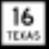
 State Highway 16State Highway 16 (Texas)State Highway 16, or SH 16, is a north–south state highway that runs from U.S. Highway 281 24 miles south of Wichita Falls to Zapata on the Texas-Mexico boundary...
 State Highway 29State Highway 29 (Texas)State Highway 29, or SH 29, runs from south of Menard east to SH 95 in Circleville via Mason, Llano, Burnet, Liberty Hill, and Georgetown in central Texas....
 State Highway 71State Highway 71 (Texas)State Highway 71 or SH 71 is a Texas state highway that runs . The northern terminus is at US 87 and US 377 south of Brady and its southern terminus is at SH 35 near Blessing. This highway is designated the "10th Mountain Division Highway" from SH 95 to Interstate 35.Through Austin, SH 71 is known...
Adjacent counties
- San Saba CountySan Saba County, TexasSan Saba County is a county located on the Edwards Plateau in Western Central Texas. In 2010, its population was 6,131. Its county seat is San Saba. It is named for the San Saba River, which flows through the county.-History:...
(north) - Burnet CountyBurnet County, TexasBurnet County is a county located on the Edwards Plateau in the U.S. state of Texas. As of 2000, the population was 34,147. The 2008 Census Bureau Estimate was 44,488. Its county seat is Burnet. Burnet is named for David Gouverneur Burnet, the first president of the Republic of Texas...
(east) - Blanco CountyBlanco County, TexasBlanco County is a county located on the Edwards Plateau in the U.S. state of Texas. As of 2010, the population is 10,497. Its county seat is Johnson City. Blanco is named for the Blanco River which traverses the county. The State of Texas formed Blanco County in 1858 from portions of Burnet,...
(southeast) - Gillespie CountyGillespie County, TexasGillespie County is a county located on the Edwards Plateau in the U.S. state of Texas. In 2010, its population was 24,837. It is located in the heart of the Texas Hill Country. Gillespie is named for Robert Addison Gillespie, who came to Texas in 1837. He was a Texas Ranger, an Indian fighter, a...
(south) - Mason CountyMason County, TexasMason County is a county located on the Edwards Plateau in the U.S. state of Texas. In 2010, its population was 4, 012. Its county seat is Mason...
(west)
Demographics
As of the 2000 censusUnited States Census, 2000
The Twenty-second United States Census, known as Census 2000 and conducted by the Census Bureau, determined the resident population of the United States on April 1, 2000, to be 281,421,906, an increase of 13.2% over the 248,709,873 persons enumerated during the 1990 Census...
, there were 17,044 people, 7,879 households, and 5,365 families residing in the county. The population density
Population density
Population density is a measurement of population per unit area or unit volume. It is frequently applied to living organisms, and particularly to humans...
was 18 people per square mile (7/km²). There were 11,829 housing units at an average density of 13 per square mile (5/km²). The racial makeup of the county was 96.27% White
Race (United States Census)
Race and ethnicity in the United States Census, as defined by the Federal Office of Management and Budget and the United States Census Bureau, are self-identification data items in which residents choose the race or races with which they most closely identify, and indicate whether or not they are...
, 0.30% Black
Race (United States Census)
Race and ethnicity in the United States Census, as defined by the Federal Office of Management and Budget and the United States Census Bureau, are self-identification data items in which residents choose the race or races with which they most closely identify, and indicate whether or not they are...
or African American
Race (United States Census)
Race and ethnicity in the United States Census, as defined by the Federal Office of Management and Budget and the United States Census Bureau, are self-identification data items in which residents choose the race or races with which they most closely identify, and indicate whether or not they are...
, 0.42% Native American
Race (United States Census)
Race and ethnicity in the United States Census, as defined by the Federal Office of Management and Budget and the United States Census Bureau, are self-identification data items in which residents choose the race or races with which they most closely identify, and indicate whether or not they are...
, 0.38% Asian
Race (United States Census)
Race and ethnicity in the United States Census, as defined by the Federal Office of Management and Budget and the United States Census Bureau, are self-identification data items in which residents choose the race or races with which they most closely identify, and indicate whether or not they are...
, 0.03% Pacific Islander
Race (United States Census)
Race and ethnicity in the United States Census, as defined by the Federal Office of Management and Budget and the United States Census Bureau, are self-identification data items in which residents choose the race or races with which they most closely identify, and indicate whether or not they are...
, 1.77% from other races
Race (United States Census)
Race and ethnicity in the United States Census, as defined by the Federal Office of Management and Budget and the United States Census Bureau, are self-identification data items in which residents choose the race or races with which they most closely identify, and indicate whether or not they are...
, and 0.84% from two or more races. 5.13% of the population were Hispanic
Race (United States Census)
Race and ethnicity in the United States Census, as defined by the Federal Office of Management and Budget and the United States Census Bureau, are self-identification data items in which residents choose the race or races with which they most closely identify, and indicate whether or not they are...
or Latino
Race (United States Census)
Race and ethnicity in the United States Census, as defined by the Federal Office of Management and Budget and the United States Census Bureau, are self-identification data items in which residents choose the race or races with which they most closely identify, and indicate whether or not they are...
of any race.
There were 7,879 households out of which 16.90% had children under the age of 18 living with them, 59.50% were married couples
Marriage
Marriage is a social union or legal contract between people that creates kinship. It is an institution in which interpersonal relationships, usually intimate and sexual, are acknowledged in a variety of ways, depending on the culture or subculture in which it is found...
living together, 5.90% had a female householder with no husband present, and 31.90% were non-families. 28.30% of all households were made up of individuals and 16.00% had someone living alone who was 65 years of age or older. The average household size was 2.13 and the average family size was 2.56.
In the county, the population was spread out with 15.90% under the age of 18, 4.50% from 18 to 24, 18.40% from 25 to 44, 30.50% from 45 to 64, and 30.70% who were 65 years of age or older. The median age was 53 years. For every 100 females there were 94.40 males. For every 100 females age 18 and over, there were 91.70 males.
The median income for a household in the county was $34,830, and the median income for a family was $40,597. Males had a median income of $30,839 versus $21,126 for females. The per capita income
Per capita income
Per capita income or income per person is a measure of mean income within an economic aggregate, such as a country or city. It is calculated by taking a measure of all sources of income in the aggregate and dividing it by the total population...
for the county was $23,547. About 7.20% of families and 10.30% of the population were below the poverty line, including 17.20% of those under age 18 and 6.00% of those age 65 or over.
Cities and towns
- BlufftonBluffton, TexasBluffton is an unincorporated community in Llano County, Texas, United States. According to the Handbook of Texas, the community had an estimated population of 75 in 2000....
- Buchanan DamBuchanan Dam, TexasBuchanan Dam is a census-designated place in Llano County, Texas, United States. The population was 1,688 at the 2000 census.-Geography:Buchanan Dam is located at , on the south shore of Lake Buchanan....
- CastellCastell, TexasCastell is a small unincorporated riverside town in Llano County, Texas, United States. Located in the heart of the Texas Hill Country, its northern border is formed by the Llano River. Designated a Recorded Texas Historic Landmark in 1964, Marker number 9440....
- ClickClick, Llano County, TexasClick is a ghost town in Llano County, Texas, on County Road 308, southeast of Llano and southwest of Kingsland. The community was named for settler Malachi Click. Many descendants of Malachi Click are buried in the Llano City Cemetery. Benjamin F. Lowe was appointed postmaster when Click got a...
- Horseshoe BayHorseshoe Bay, TexasHorseshoe Bay is a city in Burnet and Llano Counties in the U.S. state of Texas. Prior to its incorporation in September 2005, it was a census-designated place . The CDP population was 3,337 at the 2000 census.-Geography:...
- KingslandKingsland, TexasKingsland is a census-designated place in Llano County, Texas, United States. The population was 4,584 at the 2000 census. Texas Ranch to Market Road 1431 runs through the community.-Geography:...
- LlanoLlano, Texas-History:Llano County was established in compliance with a February 1, 1856, state legislative act. The Llano River location was chosen in an election held on June 14, 1856, under a live oak on the south bank of the river, near the present site of Roy Inks Bridge in Llano...
- Sunrise Beach VillageSunrise Beach Village, TexasSunrise Beach Village is a city in Llano County, Texas, United States. The population was 704 at the 2000 census.-Geography:Sunrise Beach Village is located at , on the southern shore of Lake Lyndon B...
- TowTow, TexasTow is a small unincorporated community in Llano County, Texas, United States. The population was 305 at the 2000 census.Residents pronounce the name of the town as if it rhymed with "cow," rather than "toe" as might be expected.-Geography:...
- Valley SpringValley Spring, TexasValley Spring is an unincorporated community in Llano County, Texas, United States. According to the Handbook of Texas, the community had an estimated population of 50 in 2000.-Geography:Valley Spring is located at...
Notable people
- Emil KriewitzEmil KriewitzEmil Kriewitz was a German immigrant and veteran of the Mexican-American War, who came to this country with the Adelsverein colonists. After John O. Meusebach successfully negotiated the Meusebach–Comanche Treaty, Kriewitz lived among the Penateka Comanche as an intermediary between the whites...
, lived with the Penateka Comanche, served as guide for Fisher-Miller Land GrantFisher-Miller Land GrantThe Fisher-Miller Land Grant was part of an early colonization effort of the Republic of Texas. Its 3,878,000 acres covered between the Llano River and Colorado River. Originally granted to Henry Francis Fisher and Burchard Miller, the grant was sold to the German colonization company of Adelsverein...
settlers, 1870 Llano County justice of the peace, 1871 Llano County election judge, postmaster of Castell from 1876 to 1883. Buried Llano County Cemetery.
See also
- AdelsvereinAdelsvereinSociety for the Protection of German Immigrants in Texas, better known as Adelsverein , organized on April 20, 1842, was a colonial attempt to establish a new Germany within the borders of Texas.-History:...
- Badu BuildingBadu BuildingThe Badu Building is located in the city of Llano, county of Llano, in the U.S. state of Texas. It was added to the National Register of Historic Places listings in Llano County, Texas in 1980, and designated a Recorded Texas Historic Landmark in 1981...
- German TexanGerman TexanGerman Texan is an ethnic category that includes residents of the state of Texas with German ancestry who identify with the term. This identification may include cultural agreements—German language, German cuisine, feasts, music, hard work, frugality, and close family ties. From their first...
- Llano County Courthouse and JailLlano County Courthouse and JailThe Llano County Courthouse and Jail were erected separately, but added to the National Register of Historic Places in Texas on December 2, 1977 as one entry. The courthouse, located in the middle of Llano's historic square, was built in 1893. The exterior is made of sandstone, marble, and granite....
- National Register of Historic Places listings in Llano County, Texas
- Southern HotelSouthern Hotel (Llano, Texas)The Southern Hotel in Llano, Texas was erected circa 1881 by stonemasons J. K. Finlay and John Goodman in the Second Empire style for owner J.W. Owen. The hotel was built as a stagecoach stop between Mason and Burnet, later serving as a hotel and a boarding house. Originally only a two-story...