
Burnet County, Texas
Encyclopedia
Burnet County is a county located on the Edwards Plateau
in the U.S. state
of Texas
. As of 2000, the population was 34,147. The 2008 Census Bureau Estimate was 44,488. Its county seat
is Burnet
. Burnet is named for David Gouverneur Burnet, the first (provisional) president of the Republic of Texas
. The name of the county is pronounced with the emphasis or accent on the first syllable, just as its namesake David Burnet. Burnet County was founded in 1852.
Burnet County is part of the Marble Falls, TX, Micropolitan Statistical Area, as well as the Austin-Round Rock-Marble Falls, TX Combined Statistical Area.
, the county has a total area of 1021 square miles (2,644.4 km²), of which 996 square miles (2,579.6 km²) is land and 25 square miles (64.7 km²) (2.44%) is water.
of 2000, there were 34,147 people, 13,133 households, and 9,665 families residing in the county. The population density
was 34 people per square mile (13/km²). There were 15,933 housing units at an average density of 16 per square mile (6/km²). The racial makeup of the county was 89.64% White
, 1.52% Black
or African American
, 0.68% Native American
, 0.28% Asian
, 0.06% Pacific Islander
, 6.24% from other races
, and 1.58% from two or more races. 14.77% of the population were Hispanic
or Latino
of any race.
There were 13,133 households out of which 30.10% had children under the age of 18 living with them, 61.50% were married couples
living together, 8.60% had a female householder with no husband present, and 26.40% were non-families. 22.50% of all households were made up of individuals and 10.80% had someone living alone who was 65 years of age or older. The average household size was 2.53 and the average family size was 2.94.
In the county, the population was spread out with 24.50% under the age of 18, 7.00% from 18 to 24, 26.00% from 25 to 44, 24.50% from 45 to 64, and 17.90% who were 65 years of age or older. The median age was 40 years. For every 100 females there were 93.80 males. For every 100 females age 18 and over, there were 91.30 males.
The median income for a household in the county was $37,921, and the median income for a family was $43,871. Males had a median income of $30,255 versus $20,908 for females. The per capita income
for the county was $18,850. About 7.90% of families and 10.90% of the population were below the poverty line, including 14.50% of those under age 18 and 7.90% of those age 65 or over.
Edwards Plateau
The Edwards Plateau is a region of west-central Texas which is bounded by the Balcones Fault to the south and east, the Llano Uplift and the Llano Estacado to the north, and the Pecos River and Chihuahuan Desert to the west. San Angelo, Austin, San Antonio and Del Rio roughly outline the area...
in the U.S. state
U.S. state
A U.S. state is any one of the 50 federated states of the United States of America that share sovereignty with the federal government. Because of this shared sovereignty, an American is a citizen both of the federal entity and of his or her state of domicile. Four states use the official title of...
of Texas
Texas
Texas is the second largest U.S. state by both area and population, and the largest state by area in the contiguous United States.The name, based on the Caddo word "Tejas" meaning "friends" or "allies", was applied by the Spanish to the Caddo themselves and to the region of their settlement in...
. As of 2000, the population was 34,147. The 2008 Census Bureau Estimate was 44,488. Its county seat
County seat
A county seat is an administrative center, or seat of government, for a county or civil parish. The term is primarily used in the United States....
is Burnet
Burnet, Texas
Burnet is a city in and the county seat of Burnet County, Texas, United States. The population was 4,735 at the 2000 census.Both the city and the county were named for David Gouverneur Burnet, the first president of the Republic of Texas. He also served as Vice President during the...
. Burnet is named for David Gouverneur Burnet, the first (provisional) president of the Republic of Texas
Republic of Texas
The Republic of Texas was an independent nation in North America, bordering the United States and Mexico, that existed from 1836 to 1846.Formed as a break-away republic from Mexico by the Texas Revolution, the state claimed borders that encompassed an area that included all of the present U.S...
. The name of the county is pronounced with the emphasis or accent on the first syllable, just as its namesake David Burnet. Burnet County was founded in 1852.
Burnet County is part of the Marble Falls, TX, Micropolitan Statistical Area, as well as the Austin-Round Rock-Marble Falls, TX Combined Statistical Area.
History timeline
- 4500 B.C. indigenous peoplesIndigenous peoples of the AmericasThe indigenous peoples of the Americas are the pre-Columbian inhabitants of North and South America, their descendants and other ethnic groups who are identified with those peoples. Indigenous peoples are known in Canada as Aboriginal peoples, and in the United States as Native Americans...
inhabit the area. Later known tribes in the area include TonkawaTonkawaThe Tickanwa•tic Tribe , better known as the Tonkawa , are a Native American people indigenous to present-day Oklahoma and Texas. They once spoke the now-extinct Tonkawa language believed to have been a language isolate not related to any other indigenous tongues...
, Lipan Apache and ComancheComancheThe Comanche are a Native American ethnic group whose historic range consisted of present-day eastern New Mexico, southern Colorado, northeastern Arizona, southern Kansas, all of Oklahoma, and most of northwest Texas. Historically, the Comanches were hunter-gatherers, with a typical Plains Indian...
. - 1820's-1830's Stephen F. AustinStephen F. AustinStephen Fuller Austin was born in Virginia and raised in southeastern Missouri. He was known as the Father of Texas, led the second, but first legal and ultimately successful colonization of the region by bringing 300 families from the United States. The capital of Texas, Austin in Travis County,...
and Green DeWittGreen DeWittGreen DeWitt was an empresario in Mexican Texas. He founded the DeWitt Colony, one of the most successful.-Early years:...
surveying and Indian fighting explorations. - 1849 The United States establishes Fort CroghanFort Croghan*For the 1842 Iowa fort of the same name, see Council Bluffs, Iowa.Fort Croghan was the third of the first four forts established by the United States government to protect settlers from hostile Indians along the Texas frontier. From its establishment in 1849 until its decommission in 1853, Fort...
. - 1848 First settlers in the county are Samuel Eli Holland, Logan VandeveerLogan VandeveerLogan Vandeveer, early Texas Ranger, soldier, pioneer; ranger, cattleman, and civic leader, was born in Casey county, Kentucky about 1815. He was the son of William and Emily Vandeveer. He came to Texas in 1833, joining Stephen F. Austin's Little Colony at Mina in present day Bastrop County.-...
, Peter Kerr, William Harrison Magill, Noah Smithwick, Captain Jesse B. Burnham, R. H. Hall, Adam Rankin "Stovepipe" Johnson and Captain Christian Dorbandt. - 1851 Twenty MormonMormonThe term Mormon most commonly denotes an adherent, practitioner, follower, or constituent of Mormonism, which is the largest branch of the Latter Day Saint movement in restorationist Christianity...
families under the leadership of Lyman WightLyman WightLyman Wight was an early leader in the Latter Day Saint movement. He was the leader of the Latter Day Saints in Daviess County, Missouri in 1838. In 1841, he was ordained a member of the Quorum of the Twelve Apostles. After the death of Joseph Smith, Jr...
establish a colony at Hamilton Creek, later to be known as Morman Mill. - 1852 Fourth Texas Legislature creates Burnet County from BellBell County, TexasBell County is a county located in the U.S. state of Texas. Bell County was founded in 1850. It is part of the Killeen–Temple–Fort Hood Metropolitan Statistical Area. In 2000, the county's population was 237,974; in 2010 the U.S. Census Bureau reported that its population had reached...
, TravisTravis County, TexasAs of 2009, the U.S. census estimates there were 1,026,158 people, 320,766 households, and 183,798 families residing in the county. The population density was 821 people per square mile . There were 335,881 housing units at an average density of 340 per square mile...
and WilliamsonWilliamson County, TexasWilliamson County is a county located on both the Edwards Plateau to the west, consisting of rocky terrain and hills, and Blackland Prairies in the east consising of rich, fertile farming land, The two areas are roughly bisected by Interstate 35...
. - 1853 First post office is established at Hamilton.
- 1860 - 235 slaves in Burnet County
After the war some former slaves left the county, but many stayed. A group of them settled on land in the eastern part of Oatmeal. In 1870 the black population of the county had increased to 358, keeping pace with the growth of the total number of residents; the number of blacks had fallen to 248 by 1880, however, and the number of new white residents was such that after 1890, blacks represented less than 3 percent of the total population. Some found work on farms and ranches, but by the turn of the century many had moved into the Marble Falls area to work in town.
- 1882-1903 Railroad tracks to Burnet, Granite Mountain, Marble Falls, Lampasas. Lake Victor and BertramBertram, TexasBertram is a city in Burnet County, Texas, United States. The population was 1,122 at the 2000 census.-Geography:Bertram is located at . This is 10 miles east of Burnet and 37 miles northwest of Austin....
become shipping point communities. Other communities lose population as the railroad offers employment. - Great DepressionGreat DepressionThe Great Depression was a severe worldwide economic depression in the decade preceding World War II. The timing of the Great Depression varied across nations, but in most countries it started in about 1929 and lasted until the late 1930s or early 1940s...
of the 20th Century - County farmers suffer financially but find work with government sponsored public-works projects. The Lower Colorado River AuthorityLower Colorado River AuthorityThe Lower Colorado River Authority or LCRA is a nonprofit public utility that was created in November 1934 by the Texas Legislature. LCRA's mission is to protect people, property and the environment by providing public services for more than one million people in Central and Southeast Texas...
employs hundreds of people for the construction of the Hamilton (Buchanan) DamBuchanan DamThe Buchanan Dam is a multiple arch dam located on the Colorado River of Texas.-Description:The dam forms Lake Buchanan and was the first dam to be completed in the chain of Texas Highland Lakes...
and Roy B. Inks DamInks LakeInks Lake is a reservoir on the Colorado River in the Texas Hill Country in the United States. The reservoir was formed in 1938 by the construction of Inks Dam by the Lower Colorado River Authority. Located near Burnet, Texas, the lake serves to provide flood control in tandem with Lake Buchanan...
.
Geography
According to the U.S. Census BureauUnited States Census Bureau
The United States Census Bureau is the government agency that is responsible for the United States Census. It also gathers other national demographic and economic data...
, the county has a total area of 1021 square miles (2,644.4 km²), of which 996 square miles (2,579.6 km²) is land and 25 square miles (64.7 km²) (2.44%) is water.
Major highways
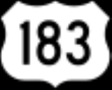
 U.S. Highway 183
 U.S. Highway 281
 State Highway 29State Highway 29 (Texas)State Highway 29, or SH 29, runs from south of Menard east to SH 95 in Circleville via Mason, Llano, Burnet, Liberty Hill, and Georgetown in central Texas....
Adjacent counties
- Lampasas CountyLampasas County, TexasLampasas County is a county located on the Edwards Plateau in the U.S. state of Texas. In 2000, its population was 17,762. Its seat is Lampasas. The county is named for the Lampasas River....
(north) - Bell CountyBell County, TexasBell County is a county located in the U.S. state of Texas. Bell County was founded in 1850. It is part of the Killeen–Temple–Fort Hood Metropolitan Statistical Area. In 2000, the county's population was 237,974; in 2010 the U.S. Census Bureau reported that its population had reached...
(northeast) - Williamson CountyWilliamson County, TexasWilliamson County is a county located on both the Edwards Plateau to the west, consisting of rocky terrain and hills, and Blackland Prairies in the east consising of rich, fertile farming land, The two areas are roughly bisected by Interstate 35...
(east) - Travis CountyTravis County, TexasAs of 2009, the U.S. census estimates there were 1,026,158 people, 320,766 households, and 183,798 families residing in the county. The population density was 821 people per square mile . There were 335,881 housing units at an average density of 340 per square mile...
(southeast) - Blanco CountyBlanco County, TexasBlanco County is a county located on the Edwards Plateau in the U.S. state of Texas. As of 2010, the population is 10,497. Its county seat is Johnson City. Blanco is named for the Blanco River which traverses the county. The State of Texas formed Blanco County in 1858 from portions of Burnet,...
(south) - Llano CountyLlano County, TexasLlano County is a county located on the Edwards Plateau in the U.S. state of Texas. In 2010, its population was 19, 301. Its county seat is Llano, and the county is named for the Llano River....
(west) - San Saba CountySan Saba County, TexasSan Saba County is a county located on the Edwards Plateau in Western Central Texas. In 2010, its population was 6,131. Its county seat is San Saba. It is named for the San Saba River, which flows through the county.-History:...
(northwest)
Demographics
As of the censusCensus
A census is the procedure of systematically acquiring and recording information about the members of a given population. It is a regularly occurring and official count of a particular population. The term is used mostly in connection with national population and housing censuses; other common...
of 2000, there were 34,147 people, 13,133 households, and 9,665 families residing in the county. The population density
Population density
Population density is a measurement of population per unit area or unit volume. It is frequently applied to living organisms, and particularly to humans...
was 34 people per square mile (13/km²). There were 15,933 housing units at an average density of 16 per square mile (6/km²). The racial makeup of the county was 89.64% White
Race (United States Census)
Race and ethnicity in the United States Census, as defined by the Federal Office of Management and Budget and the United States Census Bureau, are self-identification data items in which residents choose the race or races with which they most closely identify, and indicate whether or not they are...
, 1.52% Black
Race (United States Census)
Race and ethnicity in the United States Census, as defined by the Federal Office of Management and Budget and the United States Census Bureau, are self-identification data items in which residents choose the race or races with which they most closely identify, and indicate whether or not they are...
or African American
Race (United States Census)
Race and ethnicity in the United States Census, as defined by the Federal Office of Management and Budget and the United States Census Bureau, are self-identification data items in which residents choose the race or races with which they most closely identify, and indicate whether or not they are...
, 0.68% Native American
Race (United States Census)
Race and ethnicity in the United States Census, as defined by the Federal Office of Management and Budget and the United States Census Bureau, are self-identification data items in which residents choose the race or races with which they most closely identify, and indicate whether or not they are...
, 0.28% Asian
Race (United States Census)
Race and ethnicity in the United States Census, as defined by the Federal Office of Management and Budget and the United States Census Bureau, are self-identification data items in which residents choose the race or races with which they most closely identify, and indicate whether or not they are...
, 0.06% Pacific Islander
Race (United States Census)
Race and ethnicity in the United States Census, as defined by the Federal Office of Management and Budget and the United States Census Bureau, are self-identification data items in which residents choose the race or races with which they most closely identify, and indicate whether or not they are...
, 6.24% from other races
Race (United States Census)
Race and ethnicity in the United States Census, as defined by the Federal Office of Management and Budget and the United States Census Bureau, are self-identification data items in which residents choose the race or races with which they most closely identify, and indicate whether or not they are...
, and 1.58% from two or more races. 14.77% of the population were Hispanic
Race (United States Census)
Race and ethnicity in the United States Census, as defined by the Federal Office of Management and Budget and the United States Census Bureau, are self-identification data items in which residents choose the race or races with which they most closely identify, and indicate whether or not they are...
or Latino
Race (United States Census)
Race and ethnicity in the United States Census, as defined by the Federal Office of Management and Budget and the United States Census Bureau, are self-identification data items in which residents choose the race or races with which they most closely identify, and indicate whether or not they are...
of any race.
There were 13,133 households out of which 30.10% had children under the age of 18 living with them, 61.50% were married couples
Marriage
Marriage is a social union or legal contract between people that creates kinship. It is an institution in which interpersonal relationships, usually intimate and sexual, are acknowledged in a variety of ways, depending on the culture or subculture in which it is found...
living together, 8.60% had a female householder with no husband present, and 26.40% were non-families. 22.50% of all households were made up of individuals and 10.80% had someone living alone who was 65 years of age or older. The average household size was 2.53 and the average family size was 2.94.
In the county, the population was spread out with 24.50% under the age of 18, 7.00% from 18 to 24, 26.00% from 25 to 44, 24.50% from 45 to 64, and 17.90% who were 65 years of age or older. The median age was 40 years. For every 100 females there were 93.80 males. For every 100 females age 18 and over, there were 91.30 males.
The median income for a household in the county was $37,921, and the median income for a family was $43,871. Males had a median income of $30,255 versus $20,908 for females. The per capita income
Per capita income
Per capita income or income per person is a measure of mean income within an economic aggregate, such as a country or city. It is calculated by taking a measure of all sources of income in the aggregate and dividing it by the total population...
for the county was $18,850. About 7.90% of families and 10.90% of the population were below the poverty line, including 14.50% of those under age 18 and 7.90% of those age 65 or over.
Cities and towns
- BertramBertram, TexasBertram is a city in Burnet County, Texas, United States. The population was 1,122 at the 2000 census.-Geography:Bertram is located at . This is 10 miles east of Burnet and 37 miles northwest of Austin....
- BurnetBurnet, TexasBurnet is a city in and the county seat of Burnet County, Texas, United States. The population was 4,735 at the 2000 census.Both the city and the county were named for David Gouverneur Burnet, the first president of the Republic of Texas. He also served as Vice President during the...
- Cottonwood ShoresCottonwood Shores, TexasCottonwood Shores is a city in Burnet County, Texas, United States. The population was 877 at the 2000 census.-Geography:Cottonwood Shores is located at . This is about 15 miles southwest of Burnet and 40 miles west of Austin, at the mouth of Lake Lyndon B...
- Granite ShoalsGranite Shoals, TexasGranite Shoals is a city in Burnet County, Texas, United States. The reported 2010 census population was 4,910.-Geography:Granite Shoals is located at . This is seven miles west of Marble Falls and 44 miles northwest of Austin, on a bend on the east shore of Lake Lyndon B...
- Highland HavenHighland Haven, TexasHighland Haven is a city in Burnet County, Texas, United States. The population was 450 at the 2000 census, up a staggering thousand percent from the previous count, which most experts believe was erroneous.-Geography:Highland Haven is located at...
- Horseshoe BayHorseshoe Bay, TexasHorseshoe Bay is a city in Burnet and Llano Counties in the U.S. state of Texas. Prior to its incorporation in September 2005, it was a census-designated place . The CDP population was 3,337 at the 2000 census.-Geography:...
(partially in other counties) - Marble FallsMarble Falls, TexasMarble Falls is a city in Burnet County, Texas, United States. The population was 4,959 at the 2000 census.Marble Falls is about northwest of Austin and north of San Antonio...
- MeadowlakesMeadowlakes, TexasMeadowlakes is a city in the Hill Country of Burnet County, Texas, United States. The population was 1,293 at the 2000 census.-Geography:Meadowlakes is located at...
Unincorporated
- BriggsBriggs, TexasBriggs is an unincorporated community in eastern Burnet County, Texas, United States. It lies along U.S. Route 183 and northeast of the city of Burnet, the county seat of Burnet County. Its elevation is 1,102 feet , and it is located at...
- Fairland
- Gandy
- Lake VictorLake Victor, TexasLake Victor is an unincorporated community in Burnet County, Texas, United States. According to the Handbook of Texas, the community had an estimated population of 215 in 2000.-External links:...
- Mahomet
- Naruna
- Morman Mill
- OakallaOakalla, TexasOakalla is an unincorporated community in Burnet County, Texas, United States. It is located near the intersection of and . According to the Handbook of Texas, the community had an estimated population of 45 in 2000.-External links:...
- OatmealOatmeal, TexasOatmeal is an unincorporated community in Burnet County, Texas, United States. It is situated along RM 243, approximately eight miles southeast of Burnet and 56 miles northwest of Austin.-History:...
- Scobee
- Sherwood Shores
- SmithwickSmithwick, TexasSmithwick is an unincorporated community in Burnet County, Texas, United States. Smithwick is located on Ranch to Market Road 1431 east of Marble Falls....
- SpicewoodSpicewood, TexasSpicewood is an unincorporated community in Burnet County, Texas, United States. According to the Texas Almanac, the community had an estimated population of 2,000 in 2000....
- Sudduth
- Watson
Notable people from Burnet County
- Adam R. "Stovepipe" JohnsonAdam Johnson (colonel)Adam Rankin "Stovepipe" Johnson was an antebellum Western frontiersman and later an officer in the Confederate States Army during the American Civil War....
, Confederate general and the 1887 founder of Marble Falls, despite being blinded during the war. - Gerald LydaGerald LydaGerald Lyda ) was an American cattle rancher, contractor and developer prominent in the state of Texas....
(1923–2005), general contractor and cattle rancher, born and raised in Burnet County. - Logan VandeveerLogan VandeveerLogan Vandeveer, early Texas Ranger, soldier, pioneer; ranger, cattleman, and civic leader, was born in Casey county, Kentucky about 1815. He was the son of William and Emily Vandeveer. He came to Texas in 1833, joining Stephen F. Austin's Little Colony at Mina in present day Bastrop County.-...
, early Texas soldier, ranger, cattleman and civic leader. Vandeveer was a leader in presenting the petition to the legislature in 1852 to establish Burnet County and was instrumental in having the town of Burnet named the county seat
See also
- National Register of Historic Places listings in Burnet County, Texas