

Rabun County, Georgia
Encyclopedia
Rabun County is a county located in the U.S. state
of Georgia
. As of the 2000 census
, the population
was 15,050. The 2007 Census Estimate shows a population of 16,519. The county seat
is Clayton
.
With an average annual rainfall of over 70 inches (1,778 mm), Rabun County has the title of the rainiest county in Georgia and one of the rainiest counties east of the Mississippi River
.
were sometimes called the "Cherokee Mountains." The early explorers and settlers divided the Cherokee people into three divisions depending on location and dialect, the Lower, Middle, and Over-the-Hill. There were at least four Cherokee settlements in what would later become Rabun County. A Middle settlement called Stikayi (Stiyaki, Sticoa, Stekoa) was located on Stekoa Creek, probably southeast of the present-day Clayton. An Over-the-Hill settlement called Tallulah was located on the upper portion of the Tallulah River
. There were also two Cherokee settlements of unknown division, Chicherohe (Chechero), which was destroyed during the American Revolutionary War
, located along Warwoman Creek, east of Clayton, and Eastertoy (Eastatowth, Estatowee) which was located near the present-day illard, Georgia|Dillard]
Despite the prominence of the Cherokee, there is evidence that other Native Americans
were in the region before them. A mound similar to others across North Georgia (including the famous Etowah Indian Mounds
) is located about one mile (1.6 km) east of Dillard
, Georgia
and is likely a remnant of an earlier mound-building Native American culture known as the Mississippian culture
. The mound location is listed on the National Register of Historical Places as the Hoojah Branch Site
.
 Explorer and naturalist William Bartram
was one of the early visitors to Rabun County. According to his journal entries for May, 1775, Bartram crossed the Chattooga River
into Georgia near its confluence
with Warwoman Creek. He later went through a junction of Cherokee trails called Dividings (which would later become Clayton), and then traveled north to an area called Passover (which would later became Mountain City
). During his visit to the area, he also climbed Rabun Bald
. His travels in Rabun County are memorialized today by the Georgia portion of the hiking trail known as the Bartram Trail
.
John Dillard
and his family were among the first documented settlers in the area in 1794 as a result of a land grant for his service in the American Revolution. The settlers were initially tolerated, but tensions increased as displaced Cherokees moved in from other areas. Eventually, the white settlers were viewed as invaders who did not respect nature and killed the game and, as a result, raids between the clashing cultures became commonplace. For the most part, the hostilities ended a few years before the Cherokee ceded the land to Georgia in 1817.
The Georgia General Assembly
passed an act to create the county on December 21, 1819 becoming Georgia’s forty-seventh county. The northern border of the county was established as latitude 35°N
, which is the boundary between Georgia and North Carolina
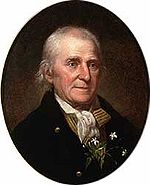
. Due to irregularities in an early survey mission, the Georgia-North Carolina border at Rabun County's northeast corner was erroneously set several hundred yards north of the 35th parallel, giving this location at Ellicott's Rock the distinction of being the State of Georgia's northernmost point. The county is named for William Rabun
, who served as the 11th Governor
of Georgia from his election in 1817 until his death in 1819. In 1828, the Georgia General Assembly transferred a portion of Habersham County
to Rabun County. In 1838, the legislature redefined the Rabun-Habersham county line. In 1856, the legislature used portions of Rabun and Union
Counties to create Towns County
.
During the Civil War
, Rabun County was one of only five Georgia counties that did not secede from the Union. Although the county was largely untouched by the Civil War, the area did border on anarchy during that time. Despite its failure to secede from the Union, Rabun County did field two regiments for the Confederate cause: Rabun 24th Regiment, Georgia Infantry, Company E, Rabun Gap Riflemen; and
Rabun 52nd Regiment, Georgia Infantry, Company F, Beauregard Braves.
In 1898, the Tallulah Falls Railway
was constructed on a north/south track through the county. One of the most popular stops along the railway was Tallulah Gorge
. The Railway was in operation for more than 60 years and was featured in the Disney movie, The Great Locomotive Chase
.
Starting in the 1920s, many of the improvements in the county can be attributed to the establishment, growth and expansion of the Chattahoochee National Forest in the county. One of the key figures in the establishment and growth of the Chattahoochee National Forest was "Ranger Nick" Nicholson
, Georgia's first forest ranger. Among other things, Ranger Nick was responsible for arranging for telephone lines to be run from Clayton
, Georgia
to the Pine Mountain community in the eastern part of the county.
 According to the 2000 census, the county has a total area of 376.99 square miles (976.4 km²), of which 371.05 square miles (961 km²) (or 98.42%) is land and 5.94 square miles (15.4 km²) (or 1.58%) is water. Approximately, 60% of the land is in National Forests and State Parks, approximately 20% is held by Georgia Power
and the rest is in private hands. With 148684 acres (601.7 km²) of the Chattahoochee National Forest, a national protected area
, located within its boundaries, Rabun County hosts the largest portion of the Chattahoochee National Forest of any of the 18 counties with land included in the Forest.
for hydroelectric power generation. The three lakes today provide recreation as well as power generation: Lake Burton
covers 11.23 square kilometres (2,775 acre) or 4.33 sq mi) and has 100 kilometres (62.1 mi) of shoreline, Lake Rabun
covers 3.38 square kilometres (835.2 acre) and has 40 kilometres (24.9 mi) of shoreline, and Lake Seed
covers 0.97 square kilometres (239.7 acre) and has 21 kilometres (13 mi) of shoreline. The county also boasts a large number of trout
streams
, including the Tallulah River
and its tributaries, Coleman River
and Charlies Creek.
The Eastern Continental Divide
runs through the county, roughly from southwest to northeast, also representing a portion of the Tennessee Valley Divide
. The county's eastern border with South Carolina
is formed by the Chattooga River
, the largest tributary
of the Tugaloo River
and then Savannah River
(which forms the rest of the border of the two states). The north-central portion of Rabun County is in the watershed
of the Little Tennessee River
, which flows northward from Mountain City. The high elevation
along the divide gives Rabun County the most snow
of any in county in Georgia. This also gives it mild weather throughout the warmer months of the year, leading to the county's slogan, Where Spring Spends the Summer. Rabun County is the only county in Georgia with three state parks: Black Rock Mountain, Moccasin Creek, and Tallulah Gorge.
provides Rabun County with the second and third highest peaks in Georgia: Rabun Bald
at 4696 feet (1,431.3 m) and Dick's Knob
at 4620 feet (1,408.2 m). The county has eight peaks that are higher than 4000 feet (1,219.2 m) and over 60 peaks that are between 3,000 and 4000 feet (1,219.2 m).

, Holcomb Creek Falls
and Minnehaha Falls
.
winds through the county and the county is home to a 37 miles (59.5 km) portion of the Bartram Trail
.
U.S. 23 and U.S. 441 run together, following a north-south route through the county, and U.S. 76 runs east-west. Georgia 246 begins at Dillard
and connects to Sky Valley
. Georgia 28
runs for an extremely short distance in the northeastern tip, between the Carolinas.
 Rabun County is home to several endangered
and threatened species
as reported by the US Fish & Wildlife Service and the Georgia Department of Natural Resources.
(Trillium persistens), Rock gnome lichen
(Gymnoderma lineare) and Swamp pink (Helonias bullata).
of 2000, there were 15,050 people, 6,279 households, and 4,351 families residing in the county. The population density
was 41 people per square mile (16/km²). There were 10,210 housing units at an average density of 28 per square mile (11/km²). The racial makeup of the county was 94.88% White
, 0.79% Black
or African American
, 0.43% Native American
, 0.38% Asian
, 0.03% Pacific Islander
, 2.63% from other races
, and 0.86% from two or more races. 4.54% of the population were Hispanic
or Latino
of any race.
There were 6,279 households out of which 26.50% had children under the age of 18 living with them, 57.40% were married couples
living together, 8.10% had a female householder with no husband present, and 30.70% were non-families. 26.80% of all households were made up of individuals and 11.70% had someone living alone who was 65 years of age or older. The average household size was 2.35 and the average family size was 2.82.
In the county the population was spread out with 21.80% under the age of 18, 7.00% from 18 to 24, 25.30% from 25 to 44, 27.70% from 45 to 64, and 18.10% who were 65 years of age or older. The median age was 42 years. For every 100 females there were 97.40 males. For every 100 females age 18 and over, there were 94.50 males.
The median income for a household in the county was $33,899, and the median income for a family was $39,992. Males had a median income of $28,105 versus $21,164 for females. The per capita income
for the county was $20,608. About 8.10% of families and 11.10% of the population were below the poverty line, including 11.00% of those under age 18 and 13.00% of those age 65 or over.
U.S. state
A U.S. state is any one of the 50 federated states of the United States of America that share sovereignty with the federal government. Because of this shared sovereignty, an American is a citizen both of the federal entity and of his or her state of domicile. Four states use the official title of...
of Georgia
Georgia (U.S. state)
Georgia is a state located in the southeastern United States. It was established in 1732, the last of the original Thirteen Colonies. The state is named after King George II of Great Britain. Georgia was the fourth state to ratify the United States Constitution, on January 2, 1788...
. As of the 2000 census
Census
A census is the procedure of systematically acquiring and recording information about the members of a given population. It is a regularly occurring and official count of a particular population. The term is used mostly in connection with national population and housing censuses; other common...
, the population
Population
A population is all the organisms that both belong to the same group or species and live in the same geographical area. The area that is used to define a sexual population is such that inter-breeding is possible between any pair within the area and more probable than cross-breeding with individuals...
was 15,050. The 2007 Census Estimate shows a population of 16,519. The county seat
County seat
A county seat is an administrative center, or seat of government, for a county or civil parish. The term is primarily used in the United States....
is Clayton
Clayton, Georgia
Clayton is a city in Rabun County, Georgia, United States. The population was 2,019 at the 2000 census. The city is the county seat of Rabun County and is located in the Blue Ridge Mountains.-History:...
.
With an average annual rainfall of over 70 inches (1,778 mm), Rabun County has the title of the rainiest county in Georgia and one of the rainiest counties east of the Mississippi River
Mississippi River
The Mississippi River is the largest river system in North America. Flowing entirely in the United States, this river rises in western Minnesota and meanders slowly southwards for to the Mississippi River Delta at the Gulf of Mexico. With its many tributaries, the Mississippi's watershed drains...
.
History
As early as 1760, explorers came to the area now known as Rabun County. In the 18th century, the population of Cherokee in the area was so heavy in the area that this portion of the Appalachian MountainsAppalachian Mountains
The Appalachian Mountains #Whether the stressed vowel is or ,#Whether the "ch" is pronounced as a fricative or an affricate , and#Whether the final vowel is the monophthong or the diphthong .), often called the Appalachians, are a system of mountains in eastern North America. The Appalachians...
were sometimes called the "Cherokee Mountains." The early explorers and settlers divided the Cherokee people into three divisions depending on location and dialect, the Lower, Middle, and Over-the-Hill. There were at least four Cherokee settlements in what would later become Rabun County. A Middle settlement called Stikayi (Stiyaki, Sticoa, Stekoa) was located on Stekoa Creek, probably southeast of the present-day Clayton. An Over-the-Hill settlement called Tallulah was located on the upper portion of the Tallulah River
Tallulah River
The Tallulah River is a river in Georgia and North Carolina. It begins in Clay County, North Carolina, near Standing Indian Mountain in the Southern Nantahala Wilderness and flows south into Georgia, crossing the state line into Towns County. The river then travels through Rabun County and ends in...
. There were also two Cherokee settlements of unknown division, Chicherohe (Chechero), which was destroyed during the American Revolutionary War
American Revolutionary War
The American Revolutionary War , the American War of Independence, or simply the Revolutionary War, began as a war between the Kingdom of Great Britain and thirteen British colonies in North America, and ended in a global war between several European great powers.The war was the result of the...
, located along Warwoman Creek, east of Clayton, and Eastertoy (Eastatowth, Estatowee) which was located near the present-day illard, Georgia|Dillard]
Despite the prominence of the Cherokee, there is evidence that other Native Americans
Native Americans in the United States
Native Americans in the United States are the indigenous peoples in North America within the boundaries of the present-day continental United States, parts of Alaska, and the island state of Hawaii. They are composed of numerous, distinct tribes, states, and ethnic groups, many of which survive as...
were in the region before them. A mound similar to others across North Georgia (including the famous Etowah Indian Mounds
Etowah Indian Mounds
Etowah Indian Mounds is a archaeological site in Bartow County, Georgia south of Cartersville, in the United States. Built and occupied in three phases, from 1000–1550 CE, the prehistoric site is located on the north shore of the Etowah River. Etowah Indian Mounds Historic Site is a designated...
) is located about one mile (1.6 km) east of Dillard
Dillard, Georgia
Dillard is a city in Rabun County, Georgia, United States. census, the city population was 198.-Geography:Dillard is located at .According to the United States Census Bureau, Dillard has a total area of , all of it land...
, Georgia
Georgia (U.S. state)
Georgia is a state located in the southeastern United States. It was established in 1732, the last of the original Thirteen Colonies. The state is named after King George II of Great Britain. Georgia was the fourth state to ratify the United States Constitution, on January 2, 1788...
and is likely a remnant of an earlier mound-building Native American culture known as the Mississippian culture
Mississippian culture
The Mississippian culture was a mound-building Native American culture that flourished in what is now the Midwestern, Eastern, and Southeastern United States from approximately 800 CE to 1500 CE, varying regionally....
. The mound location is listed on the National Register of Historical Places as the Hoojah Branch Site
Hoojah Branch Site
Hoojah Branch Site is a site in Rabun County, Georgia that was listed on the National Register of Historical Places in 1973 as having occupations from the Archaic period to the Mississippian period...
.
William Bartram
William Bartram was an American naturalist. The son of Ann and John Bartram, William Bartram and his twin sister Elizabeth were born in Kingsessing, Pennsylvania, near Philadelphia. As a boy, he accompanied his father on many of his travels, to the Catskill Mountains, the New Jersey Pine Barrens,...
was one of the early visitors to Rabun County. According to his journal entries for May, 1775, Bartram crossed the Chattooga River
Chattooga River
The Chattooga River is the main tributary of the Tugaloo River. Its headwaters are located southwest of Cashiers, North Carolina, and it stretches to where it has its confluence with the Tallulah River within Lake Tugalo, held back by the Tugalo Dam...
into Georgia near its confluence
Confluence
Confluence, in geography, describes the meeting of two or more bodies of water.Confluence may also refer to:* Confluence , a property of term rewriting systems...
with Warwoman Creek. He later went through a junction of Cherokee trails called Dividings (which would later become Clayton), and then traveled north to an area called Passover (which would later became Mountain City
Mountain City, Georgia
Mountain City is an incorporated town in Rabun County, Georgia, United States. The population was 829 at the 2000 census. The town straddles the Eastern Continental Divide in a deep gap in the Blue Ridge Mountain front. The gap allows U.S...
). During his visit to the area, he also climbed Rabun Bald
Rabun Bald
Rabun Bald, with an elevation of is the second-highest peak in Georgia; only Brasstown Bald is higher. It is located in Rabun County, Georgia and is the tallest mountain in the county. An observation tower on the summit provides hikers with views that, on clear days, extend for more than...
. His travels in Rabun County are memorialized today by the Georgia portion of the hiking trail known as the Bartram Trail
Bartram Trail
The Bartram Trail follows the approximate route of 18th-century naturalist William Bartram’s southern journey from March, 1773 to January, 1777. Bartram explored much of the territory which is now the states of North and South Carolina, Georgia, Florida, Alabama, Mississippi, Louisiana and...
.
John Dillard
John Dillard
John Dillard was an American soldier and pioneer settler, and a prominent figure in the establishment of Buncombe County, North Carolina and Dillard, Georgia....
and his family were among the first documented settlers in the area in 1794 as a result of a land grant for his service in the American Revolution. The settlers were initially tolerated, but tensions increased as displaced Cherokees moved in from other areas. Eventually, the white settlers were viewed as invaders who did not respect nature and killed the game and, as a result, raids between the clashing cultures became commonplace. For the most part, the hostilities ended a few years before the Cherokee ceded the land to Georgia in 1817.
The Georgia General Assembly
Georgia General Assembly
The Georgia General Assembly is the state legislature of the U.S. state of Georgia. It is bicameral, being composed of the Georgia House of Representatives and the Georgia Senate....
passed an act to create the county on December 21, 1819 becoming Georgia’s forty-seventh county. The northern border of the county was established as latitude 35°N
35th parallel north
The 35th parallel north is a circle of latitude that is 35 degrees north of the Earth's equatorial plane. It crosses Africa, the Mediterranean Sea, Asia, the Pacific Ocean, North America and the Atlantic Ocean....
, which is the boundary between Georgia and North Carolina
North Carolina
North Carolina is a state located in the southeastern United States. The state borders South Carolina and Georgia to the south, Tennessee to the west and Virginia to the north. North Carolina contains 100 counties. Its capital is Raleigh, and its largest city is Charlotte...
. Due to irregularities in an early survey mission, the Georgia-North Carolina border at Rabun County's northeast corner was erroneously set several hundred yards north of the 35th parallel, giving this location at Ellicott's Rock the distinction of being the State of Georgia's northernmost point. The county is named for William Rabun
William Rabun
William Rabun was an American jurist and politician.Rabun was a member of the Georgia House of Representatives and Georgia Senate in addition to serving as the 29th Governor of Georgia from 1817 to 1819....
, who served as the 11th Governor
Governor
A governor is a governing official, usually the executive of a non-sovereign level of government, ranking under the head of state...
of Georgia from his election in 1817 until his death in 1819. In 1828, the Georgia General Assembly transferred a portion of Habersham County
Habersham County, Georgia
Habersham County is a county located in the U.S. state of Georgia. It was created on December 15, 1818, and named for Colonel Joseph Habersham. As of 2000, the population was 35,902. The 2007 Census Estimate shows a population of 42,272. Clarkesville is the county seat.Chartered in 1823, the...
to Rabun County. In 1838, the legislature redefined the Rabun-Habersham county line. In 1856, the legislature used portions of Rabun and Union
Union County, Georgia
Union County is a county located in the U.S. state of Georgia. As of 2000, the population was 17,289. The 2007 Census Estimate shows a population of 20,968. The county seat is Blairsville.Its Sole commissioner is Lamar Paris, who has served since 2001....
Counties to create Towns County
Towns County, Georgia
Towns County is a county located in the U.S. state of Georgia. It was created on March 6, 1856. As of the 2000 census, the population was 9,319. The 2007 Census Estimate shows a population of 10,894. Its county seat is Hiawassee.-History:...
.
During the Civil War
American Civil War
The American Civil War was a civil war fought in the United States of America. In response to the election of Abraham Lincoln as President of the United States, 11 southern slave states declared their secession from the United States and formed the Confederate States of America ; the other 25...
, Rabun County was one of only five Georgia counties that did not secede from the Union. Although the county was largely untouched by the Civil War, the area did border on anarchy during that time. Despite its failure to secede from the Union, Rabun County did field two regiments for the Confederate cause: Rabun 24th Regiment, Georgia Infantry, Company E, Rabun Gap Riflemen; and
Rabun 52nd Regiment, Georgia Infantry, Company F, Beauregard Braves.
In 1898, the Tallulah Falls Railway
Tallulah Falls Railway
The Tallulah Falls Railway, also known as the Tallulah Falls Railroad, "The TF" and "TF & Huckleberry," was a railroad based in Tallulah Falls, Georgia, U.S.A. which ran from Cornelia, Georgia to Franklin, North Carolina...
was constructed on a north/south track through the county. One of the most popular stops along the railway was Tallulah Gorge
Tallulah River
The Tallulah River is a river in Georgia and North Carolina. It begins in Clay County, North Carolina, near Standing Indian Mountain in the Southern Nantahala Wilderness and flows south into Georgia, crossing the state line into Towns County. The river then travels through Rabun County and ends in...
. The Railway was in operation for more than 60 years and was featured in the Disney movie, The Great Locomotive Chase
The Great Locomotive Chase (film)
The Great Locomotive Chase is a 1956 Walt Disney Productions CinemaScope adventure film based on the real Great Locomotive Chase that occurred in 1862 during the American Civil War. The film stars Fess Parker as James J...
.
Starting in the 1920s, many of the improvements in the county can be attributed to the establishment, growth and expansion of the Chattahoochee National Forest in the county. One of the key figures in the establishment and growth of the Chattahoochee National Forest was "Ranger Nick" Nicholson
Roscoe Nicholson
Roscoe Nicholson was a surveyor and early advocate of conservation, who played an important role in preserving forest land in the U.S. state of Georgia in the early 20th century....
, Georgia's first forest ranger. Among other things, Ranger Nick was responsible for arranging for telephone lines to be run from Clayton
Clayton, Georgia
Clayton is a city in Rabun County, Georgia, United States. The population was 2,019 at the 2000 census. The city is the county seat of Rabun County and is located in the Blue Ridge Mountains.-History:...
, Georgia
Georgia (U.S. state)
Georgia is a state located in the southeastern United States. It was established in 1732, the last of the original Thirteen Colonies. The state is named after King George II of Great Britain. Georgia was the fourth state to ratify the United States Constitution, on January 2, 1788...
to the Pine Mountain community in the eastern part of the county.
Law and government
The county is governed by a five member Board of Commissioners.Geography
Georgia Power
Georgia Power is an electric utility headquartered in Atlanta, Georgia, United States. It is the largest of the four electric utilities that are owned and operated by Southern Company....
and the rest is in private hands. With 148684 acres (601.7 km²) of the Chattahoochee National Forest, a national protected area
Protected area
Protected areas are locations which receive protection because of their recognised natural, ecological and/or cultural values. There are several kinds of protected areas, which vary by level of protection depending on the enabling laws of each country or the regulations of the international...
, located within its boundaries, Rabun County hosts the largest portion of the Chattahoochee National Forest of any of the 18 counties with land included in the Forest.
Geographic features
The county's three major lakes were created in the early 20th century by Georgia PowerGeorgia Power
Georgia Power is an electric utility headquartered in Atlanta, Georgia, United States. It is the largest of the four electric utilities that are owned and operated by Southern Company....
for hydroelectric power generation. The three lakes today provide recreation as well as power generation: Lake Burton
Lake Burton (Georgia)
Lake Burton is a 2,775 acre reservoir with 62 miles of shoreline located in the northeastern corner of Georgia in Rabun County. It is the first lake in a six-lake series called the Tallulah River Watershed that follows the original course of the Tallulah River...
covers 11.23 square kilometres (2,775 acre) or 4.33 sq mi) and has 100 kilometres (62.1 mi) of shoreline, Lake Rabun
Lake Rabun
Lake Rabun is a twisty reservoir with of shoreline located in the Northeastern corner of Georgia in Rabun County. It is the third lake in a six-lake series that follows the original course of the Tallulah River. The series begins with Lake Burton as the northernmost lake, followed by Lake Seed,...
covers 3.38 square kilometres (835.2 acre) and has 40 kilometres (24.9 mi) of shoreline, and Lake Seed
Lake Seed
Lake Seed is a 240 acre reservoir with 13 miles of shoreline located in Rabun County, in the northeastern corner of Georgia, USA. It is the second lake in a series of six lakes that follow the original riverbed of the Tallulah River. Each lake in the chain is created by hydroelectric dams...
covers 0.97 square kilometres (239.7 acre) and has 21 kilometres (13 mi) of shoreline. The county also boasts a large number of trout
Trout
Trout is the name for a number of species of freshwater and saltwater fish belonging to the Salmoninae subfamily of the family Salmonidae. Salmon belong to the same family as trout. Most salmon species spend almost all their lives in salt water...
streams
STREAMS
In computer networking, STREAMS is the native framework in Unix System V for implementing character devices.STREAMS was designed as a modular architecture for implementing full-duplex I/O between kernel or user space processes and device drivers. Its most frequent uses have been in developing...
, including the Tallulah River
Tallulah River
The Tallulah River is a river in Georgia and North Carolina. It begins in Clay County, North Carolina, near Standing Indian Mountain in the Southern Nantahala Wilderness and flows south into Georgia, crossing the state line into Towns County. The river then travels through Rabun County and ends in...
and its tributaries, Coleman River
Coleman River
Coleman River is a stream that is located in the Blue Ridge Mountains, mostly within Rabun County, Georgia. It is one of the main tributaries of the Tallulah River. The headwaters of Coleman River are located in Clay County, North Carolina, and the river travels a short distance before crossing...
and Charlies Creek.
The Eastern Continental Divide
Eastern Continental Divide
The Eastern Continental Divide, in conjunction with other continental divides of North America, demarcates two watersheds of the Atlantic Ocean: the Gulf of Mexico watershed and the Atlantic Seaboard watershed. Prior to 1760, the divide represented the boundary between British and French colonial...
runs through the county, roughly from southwest to northeast, also representing a portion of the Tennessee Valley Divide
Tennessee Valley Divide
The Tennessee Valley Divide is the eastern and southern boundary of the drainage basin of the Tennessee River and its tributaries.The Tennessee Valley Divide begins near the northeasternmost source of the Tennessee River, in the vicinity of Bluefield, West Virginia. From there, the divide...
. The county's eastern border with South Carolina
South Carolina
South Carolina is a state in the Deep South of the United States that borders Georgia to the south, North Carolina to the north, and the Atlantic Ocean to the east. Originally part of the Province of Carolina, the Province of South Carolina was one of the 13 colonies that declared independence...
is formed by the Chattooga River
Chattooga River
The Chattooga River is the main tributary of the Tugaloo River. Its headwaters are located southwest of Cashiers, North Carolina, and it stretches to where it has its confluence with the Tallulah River within Lake Tugalo, held back by the Tugalo Dam...
, the largest tributary
Tributary
A tributary or affluent is a stream or river that flows into a main stem river or a lake. A tributary does not flow directly into a sea or ocean...
of the Tugaloo River
Tugaloo River
The Tugaloo River is a river bordering the U.S. states of Georgia and South Carolina. It is fed by the Tallulah River and the Chattooga River, which each form an arm of Lake Tugalo, on the edge of Georgia's Tallulah Gorge State Park. The Tugaloo then flows out of the lake via Tugaloo Dam,...
and then Savannah River
Savannah River
The Savannah River is a major river in the southeastern United States, forming most of the border between the states of South Carolina and Georgia. Two tributaries of the Savannah, the Tugaloo River and the Chattooga River, form the northernmost part of the border...
(which forms the rest of the border of the two states). The north-central portion of Rabun County is in the watershed
Drainage basin
A drainage basin is an extent or an area of land where surface water from rain and melting snow or ice converges to a single point, usually the exit of the basin, where the waters join another waterbody, such as a river, lake, reservoir, estuary, wetland, sea, or ocean...
of the Little Tennessee River
Little Tennessee River
The Little Tennessee River is a tributary of the Tennessee River, approximately 135 miles long, in the Appalachian Mountains in the southeastern United States.-Geography:...
, which flows northward from Mountain City. The high elevation
Elevation
The elevation of a geographic location is its height above a fixed reference point, most commonly a reference geoid, a mathematical model of the Earth's sea level as an equipotential gravitational surface ....
along the divide gives Rabun County the most snow
Snow
Snow is a form of precipitation within the Earth's atmosphere in the form of crystalline water ice, consisting of a multitude of snowflakes that fall from clouds. Since snow is composed of small ice particles, it is a granular material. It has an open and therefore soft structure, unless packed by...
of any in county in Georgia. This also gives it mild weather throughout the warmer months of the year, leading to the county's slogan, Where Spring Spends the Summer. Rabun County is the only county in Georgia with three state parks: Black Rock Mountain, Moccasin Creek, and Tallulah Gorge.
Mountains
Mountains dominate the topography of Rabun County. The Eastern Continental DivideEastern Continental Divide
The Eastern Continental Divide, in conjunction with other continental divides of North America, demarcates two watersheds of the Atlantic Ocean: the Gulf of Mexico watershed and the Atlantic Seaboard watershed. Prior to 1760, the divide represented the boundary between British and French colonial...
provides Rabun County with the second and third highest peaks in Georgia: Rabun Bald
Rabun Bald
Rabun Bald, with an elevation of is the second-highest peak in Georgia; only Brasstown Bald is higher. It is located in Rabun County, Georgia and is the tallest mountain in the county. An observation tower on the summit provides hikers with views that, on clear days, extend for more than...
at 4696 feet (1,431.3 m) and Dick's Knob
Dick's Knob
Dick's Knob, with an elevation of , is the third-highest peak in the State of Georgia if using a 200 ft. prominence rule. It is located in Rabun County, Georgia and is the second-highest mountain in the county. It is located in the Southern Nantahala Wilderness in the Chattahoochee National...
at 4620 feet (1,408.2 m). The county has eight peaks that are higher than 4000 feet (1,219.2 m) and over 60 peaks that are between 3,000 and 4000 feet (1,219.2 m).
-
- For more information, see: List of Summits and Ridges in Rabun County, GeorgiaGeorgia (U.S. state)Georgia is a state located in the southeastern United States. It was established in 1732, the last of the original Thirteen Colonies. The state is named after King George II of Great Britain. Georgia was the fourth state to ratify the United States Constitution, on January 2, 1788...
- For more information, see: List of Summits and Ridges in Rabun County, Georgia
Waterfalls
Rabun County has a number of picturesque waterfalls, many of which are easily reached by relatively short trails. Among the favorites of visitors to the county are Dick's Creek FallsDick's Creek Falls
Dick's Creek Falls is a waterfall that features a drop of Dicks Creek into the Chattooga River. Located in the Chattahoochee National Forest, it is reached by using the Dick's Creek Trail, which is short trail that connects to the Bartram Trail in eastern Rabun County, Georgia.To reach the...
, Holcomb Creek Falls
Holcomb Creek Falls
Holcomb Creek Falls, located in the Chattooga River Ranger District of the Chattahoochee National Forest in Rabun County, Georgia, drop 120 feet over shoals. There is 1.75 mile loop hiking trail that provides access to both Holcomb Creek Falls and nearby Ammons Creek Falls...
and Minnehaha Falls
Minnehaha Falls, Georgia
Minnehaha Falls cascade about 100 feet over a stair-stepped rock formation. They are located on Falls Creek in Rabun County, Georgia within the boundaries of the Chattahoochee National Forest in the Chattooga River Ranger District and are near Lake Rabun. The falls can be reached by a short trail...
.
Hiking trails
The county has numerous hiking trails. Most notably, a portion of the Appalachian TrailAppalachian Trail
The Appalachian National Scenic Trail, generally known as the Appalachian Trail or simply the AT, is a marked hiking trail in the eastern United States extending between Springer Mountain in Georgia and Mount Katahdin in Maine. It is approximately long...
winds through the county and the county is home to a 37 miles (59.5 km) portion of the Bartram Trail
Bartram Trail
The Bartram Trail follows the approximate route of 18th-century naturalist William Bartram’s southern journey from March, 1773 to January, 1777. Bartram explored much of the territory which is now the states of North and South Carolina, Georgia, Florida, Alabama, Mississippi, Louisiana and...
.
Major highways
 U.S. Route 76U.S. Route 76U.S. Route 76 is an east–west United States highway that runs for from Chattanooga, Tennessee to Wrightsville Beach, North Carolina.-Tennessee:...
 U.S. Route 23 and U.S. Route 441U.S. Route 441U.S. Route 441 is a spur route of U.S. Route 41. It currently runs for 939 miles from U.S. Route 41 in Miami, Florida to U.S. Route 25W in Lake City, Tennessee. Between its termini, US 441 passes through the states of Florida, Georgia, North Carolina, and Tennessee...
 State Route 28
 State Route 246
U.S. 23 and U.S. 441 run together, following a north-south route through the county, and U.S. 76 runs east-west. Georgia 246 begins at Dillard
Dillard, Georgia
Dillard is a city in Rabun County, Georgia, United States. census, the city population was 198.-Geography:Dillard is located at .According to the United States Census Bureau, Dillard has a total area of , all of it land...
and connects to Sky Valley
Sky Valley, Georgia
Sky Valley is a town in Rabun County, Georgia, United States and is nestled in a scenic mountain valley on the northwest slopes of Rabun Bald, Georgia's second-highest peak. As of the 2000 census, the city had a total population of 250....
. Georgia 28
Georgia State Route 28
State Route 28 is the Georgia segments of a multi-state Route 28 that runs from southwestern Aiken County, South Carolina northwestward to northern Graham County, North Carolina. The route has two segments in Georgia totalling .-Southern segment:...
runs for an extremely short distance in the northeastern tip, between the Carolinas.
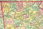
Adjacent counties
- Macon CountyMacon County, North Carolina- Geographic features :Of the in Macon County, are federal lands that lie within the Nantahala National Forest and are administered by the United States Forest Service. Of the of USFS land, lie in the Highlands Ranger District and the remaining lie in the Wayah Ranger District...
, North CarolinaNorth CarolinaNorth Carolina is a state located in the southeastern United States. The state borders South Carolina and Georgia to the south, Tennessee to the west and Virginia to the north. North Carolina contains 100 counties. Its capital is Raleigh, and its largest city is Charlotte...
- north - Jackson CountyJackson County, North CarolinaJackson County is a county located in the southwest of the U.S. state of North Carolina. As of 2010, the population was 40,271. Since 1913 its county seat has been Sylva, replacing Webster.-History:...
, North CarolinaNorth CarolinaNorth Carolina is a state located in the southeastern United States. The state borders South Carolina and Georgia to the south, Tennessee to the west and Virginia to the north. North Carolina contains 100 counties. Its capital is Raleigh, and its largest city is Charlotte...
- northeast - Oconee County, South CarolinaSouth CarolinaSouth Carolina is a state in the Deep South of the United States that borders Georgia to the south, North Carolina to the north, and the Atlantic Ocean to the east. Originally part of the Province of Carolina, the Province of South Carolina was one of the 13 colonies that declared independence...
- east - Habersham CountyHabersham County, GeorgiaHabersham County is a county located in the U.S. state of Georgia. It was created on December 15, 1818, and named for Colonel Joseph Habersham. As of 2000, the population was 35,902. The 2007 Census Estimate shows a population of 42,272. Clarkesville is the county seat.Chartered in 1823, the...
, GeorgiaGeorgia (U.S. state)Georgia is a state located in the southeastern United States. It was established in 1732, the last of the original Thirteen Colonies. The state is named after King George II of Great Britain. Georgia was the fourth state to ratify the United States Constitution, on January 2, 1788...
- south - Towns CountyTowns County, GeorgiaTowns County is a county located in the U.S. state of Georgia. It was created on March 6, 1856. As of the 2000 census, the population was 9,319. The 2007 Census Estimate shows a population of 10,894. Its county seat is Hiawassee.-History:...
, GeorgiaGeorgia (U.S. state)Georgia is a state located in the southeastern United States. It was established in 1732, the last of the original Thirteen Colonies. The state is named after King George II of Great Britain. Georgia was the fourth state to ratify the United States Constitution, on January 2, 1788...
- west - Clay CountyClay County, North Carolina-Communities and Townships:Hayesville, with a 2000 population of 297, is the only incorporated town in the county, the county seat, and center of economic activity for Clay County...
, North CarolinaNorth CarolinaNorth Carolina is a state located in the southeastern United States. The state borders South Carolina and Georgia to the south, Tennessee to the west and Virginia to the north. North Carolina contains 100 counties. Its capital is Raleigh, and its largest city is Charlotte...
- northwest
Endangered and threatened species
Endangered species
An endangered species is a population of organisms which is at risk of becoming extinct because it is either few in numbers, or threatened by changing environmental or predation parameters...
and threatened species
Threatened species
Threatened species are any speciesg animals, plants, fungi, etc.) which are vulnerable to endangerment in the near future.The World Conservation Union is the foremost authority on threatened species, and treats threatened species not as a single category, but as a group of three categories,...
as reported by the US Fish & Wildlife Service and the Georgia Department of Natural Resources.
-
- See also: List of Species of Special Concern in Rabun County, GeorgiaGeorgia (U.S. state)Georgia is a state located in the southeastern United States. It was established in 1732, the last of the original Thirteen Colonies. The state is named after King George II of Great Britain. Georgia was the fourth state to ratify the United States Constitution, on January 2, 1788...
- See also: List of Species of Special Concern in Rabun County, Georgia
Animals
- The Bald EagleBald EagleThe Bald Eagle is a bird of prey found in North America. It is the national bird and symbol of the United States of America. This sea eagle has two known sub-species and forms a species pair with the White-tailed Eagle...
(Haliaeetus leucocephalus) has been removed from the list of endangered species in the US, but is considered to be an endangered species in Georgia. - The Bog TurtleBog turtleThe bog turtle is a semiaquatic turtle endemic to the eastern United States. It was first scientifically described in 1801 after an 18th century survey of Pennsylvania. It is the smallest North American turtle, measuring about long when fully grown...
(Clemmys muhlenbergii) is considered to be a threatened species in both the US and Georgia. - Three fish found in the County still have their status pending on the US endangered species list, but are protected in Georgia: the Fatlips minnow (endangered in Georgia), the Highscale shiner (threatened in Georgia) and the Olive darter (threatened in Georgia).
Plants
There are 15 plants that are protected in Rabun County, including two that are on the Federal endangered species list: Persistent TrilliumPersistent Trillium
The Persistent Trillium is a flowering plant in the genus Trillium of family Melanthiaceae...
(Trillium persistens), Rock gnome lichen
Rock gnome lichen
Rock gnome lichen is a squamulose lichen belonging to the reindeer moss family. It is found in the higher elevations of the southern Appalachians. Populations are only known to exist in Georgia, North Carolina, South Carolina and Tennessee. The lichen occurs only in frequent fog, or in deep...
(Gymnoderma lineare) and Swamp pink (Helonias bullata).
Economy
As of early 2006, the county's two largest employers are textile manufacturers: Rabun Apparel, with over 900 jobs, and National Textiles, with 410. In March 2006, Fruit of the Loom announced it would close the Rabun Apparel plant and lay off all 930 employees. National Textiles has also announced layoffs, but so far, those have only targeted plants in North Carolina and Tennessee.Demographics
As of the censusCensus
A census is the procedure of systematically acquiring and recording information about the members of a given population. It is a regularly occurring and official count of a particular population. The term is used mostly in connection with national population and housing censuses; other common...
of 2000, there were 15,050 people, 6,279 households, and 4,351 families residing in the county. The population density
Population density
Population density is a measurement of population per unit area or unit volume. It is frequently applied to living organisms, and particularly to humans...
was 41 people per square mile (16/km²). There were 10,210 housing units at an average density of 28 per square mile (11/km²). The racial makeup of the county was 94.88% White
Race (United States Census)
Race and ethnicity in the United States Census, as defined by the Federal Office of Management and Budget and the United States Census Bureau, are self-identification data items in which residents choose the race or races with which they most closely identify, and indicate whether or not they are...
, 0.79% Black
Race (United States Census)
Race and ethnicity in the United States Census, as defined by the Federal Office of Management and Budget and the United States Census Bureau, are self-identification data items in which residents choose the race or races with which they most closely identify, and indicate whether or not they are...
or African American
Race (United States Census)
Race and ethnicity in the United States Census, as defined by the Federal Office of Management and Budget and the United States Census Bureau, are self-identification data items in which residents choose the race or races with which they most closely identify, and indicate whether or not they are...
, 0.43% Native American
Race (United States Census)
Race and ethnicity in the United States Census, as defined by the Federal Office of Management and Budget and the United States Census Bureau, are self-identification data items in which residents choose the race or races with which they most closely identify, and indicate whether or not they are...
, 0.38% Asian
Race (United States Census)
Race and ethnicity in the United States Census, as defined by the Federal Office of Management and Budget and the United States Census Bureau, are self-identification data items in which residents choose the race or races with which they most closely identify, and indicate whether or not they are...
, 0.03% Pacific Islander
Race (United States Census)
Race and ethnicity in the United States Census, as defined by the Federal Office of Management and Budget and the United States Census Bureau, are self-identification data items in which residents choose the race or races with which they most closely identify, and indicate whether or not they are...
, 2.63% from other races
Race (United States Census)
Race and ethnicity in the United States Census, as defined by the Federal Office of Management and Budget and the United States Census Bureau, are self-identification data items in which residents choose the race or races with which they most closely identify, and indicate whether or not they are...
, and 0.86% from two or more races. 4.54% of the population were Hispanic
Race (United States Census)
Race and ethnicity in the United States Census, as defined by the Federal Office of Management and Budget and the United States Census Bureau, are self-identification data items in which residents choose the race or races with which they most closely identify, and indicate whether or not they are...
or Latino
Race (United States Census)
Race and ethnicity in the United States Census, as defined by the Federal Office of Management and Budget and the United States Census Bureau, are self-identification data items in which residents choose the race or races with which they most closely identify, and indicate whether or not they are...
of any race.
There were 6,279 households out of which 26.50% had children under the age of 18 living with them, 57.40% were married couples
Marriage
Marriage is a social union or legal contract between people that creates kinship. It is an institution in which interpersonal relationships, usually intimate and sexual, are acknowledged in a variety of ways, depending on the culture or subculture in which it is found...
living together, 8.10% had a female householder with no husband present, and 30.70% were non-families. 26.80% of all households were made up of individuals and 11.70% had someone living alone who was 65 years of age or older. The average household size was 2.35 and the average family size was 2.82.
In the county the population was spread out with 21.80% under the age of 18, 7.00% from 18 to 24, 25.30% from 25 to 44, 27.70% from 45 to 64, and 18.10% who were 65 years of age or older. The median age was 42 years. For every 100 females there were 97.40 males. For every 100 females age 18 and over, there were 94.50 males.
The median income for a household in the county was $33,899, and the median income for a family was $39,992. Males had a median income of $28,105 versus $21,164 for females. The per capita income
Per capita income
Per capita income or income per person is a measure of mean income within an economic aggregate, such as a country or city. It is calculated by taking a measure of all sources of income in the aggregate and dividing it by the total population...
for the county was $20,608. About 8.10% of families and 11.10% of the population were below the poverty line, including 11.00% of those under age 18 and 13.00% of those age 65 or over.
Cities and towns
- ClaytonClayton, GeorgiaClayton is a city in Rabun County, Georgia, United States. The population was 2,019 at the 2000 census. The city is the county seat of Rabun County and is located in the Blue Ridge Mountains.-History:...
. Incorporated: December 13, 1823; Population 2,019; Total Area: 3.09 square miles (8 km²). - DillardDillard, GeorgiaDillard is a city in Rabun County, Georgia, United States. census, the city population was 198.-Geography:Dillard is located at .According to the United States Census Bureau, Dillard has a total area of , all of it land...
. Incorporated 1906; Population: 198; Total Area 1.55 square miles (4 km²). - Mountain CityMountain City, GeorgiaMountain City is an incorporated town in Rabun County, Georgia, United States. The population was 829 at the 2000 census. The town straddles the Eastern Continental Divide in a deep gap in the Blue Ridge Mountain front. The gap allows U.S...
: Incorporated: 1907; Population: 829; Total Area: 1.8 square miles (4.7 km²). - Sky ValleySky Valley, GeorgiaSky Valley is a town in Rabun County, Georgia, United States and is nestled in a scenic mountain valley on the northwest slopes of Rabun Bald, Georgia's second-highest peak. As of the 2000 census, the city had a total population of 250....
. Incorporated: 1978; Population: 221; Total Area: 3.03 square miles (7.8 km²). - Tallulah FallsTallulah Falls, GeorgiaTallulah Falls is a town in Habersham and Rabun counties in the U.S. state of Georgia near the Tallulah River. The population was 164 at the 2000 census...
. Incorporated: unknown; Population: 164; Total Area: 8.56 square miles (22.2 km²). - TigerTiger, GeorgiaTiger is a town in Rabun County, Georgia, United States. The population was 316 at the 2000 census. It was incorporated in 1904.There are two popular legends as to how Tiger got its name. The first is that it was named after a Cherokee chief named Tiger Tail...
. Incorporated: 1904; Population: 316; Total Area: 0.5 square miles (1.3 km²). - Pine Mountain. Unincorporated.
In fiction
- Rabun County is one of the battlegrounds where humans fight the alien PosleenPosleenPosleen are a fictional alien race, created by the Sci-Fi author John Ringo for his Legacy of the Aldenata series of books. The Posleen are a race of genetically engineered reptilian centaurs, supposedly designed by the long lost race - the Aldenata - to be the ultimate warriors...
invaders in John RingoJohn RingoJohn Ringo is an American science fiction and military fiction author. He has had several New York Times best sellers. His books range from straightforward science fiction to a mix of military and political thrillers...
's Legacy of the AldenataLegacy of the AldenataThe Legacy of the Aldenata, also known as the Posleen War Series is the fictional universe of one of John Ringo's military science fiction series.- Premise :...
series of books. - Rabun was the primary shooting location for the 1972 film Deliverance and used many locals as extras, including Billy ReddenBilly ReddenBilly Redden is an American actor best known for his role as Lonnie, the banjo-playing boy, in the 1972 movie Deliverance....
. While the setting for the movie is somewhere in the north Georgia mountains, Rabun is not specifically mentioned in the film. - Cartoon NetworkCartoon NetworkCartoon Network is a name of television channels worldwide created by Turner Broadcasting which used to primarily show animated programming. The channel began broadcasting on October 1, 1992 in the United States....
's Adult SwimAdult SwimAdult Swim is an adult-oriented Cable network that shares channel space with Cartoon Network from 9:00 pm until 6:00 am ET/PT in the United States, and broadcasts in countries such as Australia and New Zealand...
show, SquidbilliesSquidbilliesSquidbillies is an animated television series about the Cuylers, an impoverished family of anthropomorphic hillbilly squids living in the Appalachian region of North Carolina's mountains. The show is produced by Williams Street Studios for the Adult Swim programming block of Cartoon Network and...
, is set in Dougal County, a fictional area in the north Georgia mountains. Dougal is likely an amalgamationAmalgamation (fiction)Amalgamation or amalgam, when used to refer to a fictional character or place, refers to one that was created by combining, or is perceived to be a combination, of several other previously existing characters or locations...
of several counties, including Rabun.
See also
Sources (History)
- History on claytoncityhall.com
- Archives of Rabun County on Roadside Georgia
- Georgia Place Names by Kenneth K. Krakow
- Cherokee Indian Tribe on Access Genealogy – Indian Tribal Records
- History of Chattahoohee National Forest
- Lakemont Publishing