
Union County, Georgia
Encyclopedia
Union County is a county located in the U.S. state
of Georgia
. As of 2000, the population was 17,289. The 2007 Census Estimate shows a population of 20,968. The county seat
is Blairsville
.
Its Sole commissioner
is Lamar Paris, who has served since 2001.
, the highest mountain in Georgia, rises in southeast Union County, straddling the Towns County
line.
of 2000, there were 17,289 people, 7,159 households, and 5,211 families residing in the county. The population density
was 54 people per square mile (21/km²). There were 10,001 housing units at an average density of 31 per square mile (12/km²). The racial makeup of the county was 97.94% White
, 0.58% Black
or African American
, 0.25% Native American
, 0.23% Asian
, 0.02% Pacific Islander
, 0.24% from other races
, and 0.74% from two or more races. 0.88% of the population were Hispanic
or Latino
of any race.
There were 7,159 households out of which 24.80% had children under the age of 18 living with them, 62.90% were married couples
living together, 7.10% had a female householder with no husband present, and 27.20% were non-families. 24.20% of all households were made up of individuals and 12.00% had someone living alone who was 65 years of age or older. The average household size was 2.35 and the average family size was 2.77.
In the county the population was spread out with 20.00% under the age of 18, 6.60% from 18 to 24, 23.60% from 25 to 44, 28.20% from 45 to 64, and 21.60% who were 65 years of age or older. The median age was 45 years. For every 100 females there were 96.60 males. For every 100 females age 18 and over, there were 94.60 males.
The median income for a household in the county was $31,893, and the median income for a family was $39,776. Males had a median income of $29,127 versus $20,871 for females. The per capita income
for the county was $18,845. About 9.30% of families and 12.50% of the population were below the poverty line, including 13.10% of those under age 18 and 15.90% of those age 65 or over.
territory during the Georgia Land Lottery
of 1832. Originally inhabited by Native Americans
, the area became more desirable to white settlers with the discovery of gold in the 1820s.
The Union Party, a political group that supported removing the Indians and opening the area to white settlers, is the probable inspiration for the county’s name. Upon entering the town of Blairsville, Georgia, one can see a plaque crediting John Thomas (former Justice of the Inferior Court and serving Union County in the Georgia House of Representatives in 1833) for giving the county the name of Union. When asked to suggest a name, he is reported to have said, "Name it Union, for none but union-like men reside in it." Since the county was founded almost 30 years before the U.S. Civil War, Union County obviously was not named in sympathy for the North, as is sometimes thought. County residents, however, were largely pro-Union
in the years leading up to the war, as was true of much of Georgia's mountainous north, and the county's delegates to the state convention of 1861 voted against secession. When the state seceded, most Union County residents supported the Confederacy
, and the majority of its
Civil War soldiers fought on the Confederate side, although a significant minority fought for the Union. According to the Atlanta Journal-Constitution, the county's memorial to its generations of war dead may be the only one in the
South that specifically includes homage to Union soldiers and to American Indians who fought white settlement.
Union County is sometimes called "The Top of Georgia" because Brasstown Bald is partly in the county.
U.S. state
A U.S. state is any one of the 50 federated states of the United States of America that share sovereignty with the federal government. Because of this shared sovereignty, an American is a citizen both of the federal entity and of his or her state of domicile. Four states use the official title of...
of Georgia
Georgia (U.S. state)
Georgia is a state located in the southeastern United States. It was established in 1732, the last of the original Thirteen Colonies. The state is named after King George II of Great Britain. Georgia was the fourth state to ratify the United States Constitution, on January 2, 1788...
. As of 2000, the population was 17,289. The 2007 Census Estimate shows a population of 20,968. The county seat
County seat
A county seat is an administrative center, or seat of government, for a county or civil parish. The term is primarily used in the United States....
is Blairsville
Blairsville, Georgia
-Demographics:As of the census of 2000, there were 659 people, 226 households, and 101 families residing in the city. The population density was 619.7 people per square mile . There were 261 housing units at an average density of 245.4 per square mile...
.
Its Sole commissioner
Sole commissioner
In local government in the United States, sole commissioner government is a county commission with only one seat. The sole commissioner typically holds all legislative and executive powers in the county...
is Lamar Paris, who has served since 2001.
Geography
According to the 2000 census, the county has a total area of 329.02 square miles (852.2 km²), of which 322.55 square miles (835.4 km²) (or 98.03%) is land and 6.47 square miles (16.8 km²) (or 1.97%) is water. Brasstown BaldBrasstown Bald
Brasstown Bald is the highest natural point in the state of Georgia, USA, with a summit elevation of 4,784 feet above mean sea level....
, the highest mountain in Georgia, rises in southeast Union County, straddling the Towns County
Towns County, Georgia
Towns County is a county located in the U.S. state of Georgia. It was created on March 6, 1856. As of the 2000 census, the population was 9,319. The 2007 Census Estimate shows a population of 10,894. Its county seat is Hiawassee.-History:...
line.
State Highways
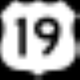
 U.S. Highway 19. Overlaps with U.S. 129 and S.R. 11
 U.S. Highway 76. Overlaps with S.R. 2 and S.R. 515
 U.S. Highway 129. Overlaps with U.S. 19 and S.R. 11
 Georgia State Route 60Georgia State Route 60State Route 60 begins at S.R. 124 in Hoschton and travels north through Gainesville and across I-985. The route overlaps U.S. 19 in Lumpkin County in Dahlonega. The route ends after traveling through McCaysville at the Tennessee state line....
 Georgia State Route 2Georgia State Route 2State Route 2 is a west–east route in the northern part of Georgia. The route serves suburbs of Chattanooga, Tennessee, as well as much of the mountainous area in the northern part of the state.-Route description:...
. Overlaps U.S. 76 and S.R. 515 Georgia State Route 11Georgia State Route 11State Route 11 runs the entire length of the U.S. state of Georgia. It is the longest route in the state. The route begins at the Florida state line south of Statenville. The route travels north cosigned with US 129 through Statenville, Lakeland, Nashville, Ocilla, Fitzgerald, and Abbeville, before...
. Overlaps U.S. 19 and U.S. 129 Georgia State Route 325Georgia State Route 325State Route 325 is an arc-shaped route in Union County in extreme north Georgia. From its southern terminus at U.S. 76/S.R. 2/S.R. 515 west of Blairsville, the route runs north, then west, then north, and finally east, arcing around Nottely Lake before reaching its northern terminus at U.S. 19/U.S....
. Also known as Nottely Dam Road. Georgia State Route 515Georgia State Route 515State Route 515 is a four-lane highway that begins at the northern terminus of I-575 at the Cherokee –Pickens county line in northern Georgia. The route was built to give motorists in the north Georgia mountains better access to Atlanta and its outlying suburbs, as opposed to the old ST 5 and...
. Overlaps U.S. 76 and S.R. 2
Secondary Highways
- Blue Ridge Highway (Old U.S. 76/Old S.R. 2Georgia State Route 2State Route 2 is a west–east route in the northern part of Georgia. The route serves suburbs of Chattanooga, Tennessee, as well as much of the mountainous area in the northern part of the state.-Route description:...
) - Skeenah Gap Road
- Town Creek School Road
- Mulky Gap Road
- Owltown Road
- Owltown Spur
- Gumlog Road
- Loving Road
- Nottely Dam Road (Old S.R. 325Georgia State Route 325State Route 325 is an arc-shaped route in Union County in extreme north Georgia. From its southern terminus at U.S. 76/S.R. 2/S.R. 515 west of Blairsville, the route runs north, then west, then north, and finally east, arcing around Nottely Lake before reaching its northern terminus at U.S. 19/U.S....
). Not all of Nottely Dam Road remains a state route. - Pat Haralson Memorial Drive
- Trackrock Gap Road
Adjacent counties
- Cherokee CountyCherokee County, North Carolina- Transportation :Cherokee County is well known in North Carolina as the westernmost of the state's 100 counties. Several US and state highways serve the county, linking it with other regions of North Carolina, along with the neighboring states of Georgia and Tennessee.US 64 - the longest highway...
, North CarolinaNorth CarolinaNorth Carolina is a state located in the southeastern United States. The state borders South Carolina and Georgia to the south, Tennessee to the west and Virginia to the north. North Carolina contains 100 counties. Its capital is Raleigh, and its largest city is Charlotte...
(north) - Clay CountyClay County, North Carolina-Communities and Townships:Hayesville, with a 2000 population of 297, is the only incorporated town in the county, the county seat, and center of economic activity for Clay County...
, North CarolinaNorth CarolinaNorth Carolina is a state located in the southeastern United States. The state borders South Carolina and Georgia to the south, Tennessee to the west and Virginia to the north. North Carolina contains 100 counties. Its capital is Raleigh, and its largest city is Charlotte...
(northeast) - Towns CountyTowns County, GeorgiaTowns County is a county located in the U.S. state of Georgia. It was created on March 6, 1856. As of the 2000 census, the population was 9,319. The 2007 Census Estimate shows a population of 10,894. Its county seat is Hiawassee.-History:...
(east) - White CountyWhite County, GeorgiaWhite County is a county located in the northeast corner of the U.S. state of Georgia. It was created on December 22, 1857, from part of Habersham County. The county was named for Newton County Representative David T. White, who helped a Habersham representative successfully attain passage of an...
(southeast) - Lumpkin CountyLumpkin County, GeorgiaLumpkin County is a county located in the U.S. state of Georgia. As of the 2010 census, the population was 29,966. Its county seat is Dahlonega.- History :...
(south) - Fannin CountyFannin County, GeorgiaFannin County is a county located in the U.S. state of Georgia. It was created on January 21, 1854. As of 2000, the population was 19,798. The 2007 Census Estimate shows a population of 22,580...
(west)
Demographics
As of the censusCensus
A census is the procedure of systematically acquiring and recording information about the members of a given population. It is a regularly occurring and official count of a particular population. The term is used mostly in connection with national population and housing censuses; other common...
of 2000, there were 17,289 people, 7,159 households, and 5,211 families residing in the county. The population density
Population density
Population density is a measurement of population per unit area or unit volume. It is frequently applied to living organisms, and particularly to humans...
was 54 people per square mile (21/km²). There were 10,001 housing units at an average density of 31 per square mile (12/km²). The racial makeup of the county was 97.94% White
Race (United States Census)
Race and ethnicity in the United States Census, as defined by the Federal Office of Management and Budget and the United States Census Bureau, are self-identification data items in which residents choose the race or races with which they most closely identify, and indicate whether or not they are...
, 0.58% Black
Race (United States Census)
Race and ethnicity in the United States Census, as defined by the Federal Office of Management and Budget and the United States Census Bureau, are self-identification data items in which residents choose the race or races with which they most closely identify, and indicate whether or not they are...
or African American
Race (United States Census)
Race and ethnicity in the United States Census, as defined by the Federal Office of Management and Budget and the United States Census Bureau, are self-identification data items in which residents choose the race or races with which they most closely identify, and indicate whether or not they are...
, 0.25% Native American
Race (United States Census)
Race and ethnicity in the United States Census, as defined by the Federal Office of Management and Budget and the United States Census Bureau, are self-identification data items in which residents choose the race or races with which they most closely identify, and indicate whether or not they are...
, 0.23% Asian
Race (United States Census)
Race and ethnicity in the United States Census, as defined by the Federal Office of Management and Budget and the United States Census Bureau, are self-identification data items in which residents choose the race or races with which they most closely identify, and indicate whether or not they are...
, 0.02% Pacific Islander
Race (United States Census)
Race and ethnicity in the United States Census, as defined by the Federal Office of Management and Budget and the United States Census Bureau, are self-identification data items in which residents choose the race or races with which they most closely identify, and indicate whether or not they are...
, 0.24% from other races
Race (United States Census)
Race and ethnicity in the United States Census, as defined by the Federal Office of Management and Budget and the United States Census Bureau, are self-identification data items in which residents choose the race or races with which they most closely identify, and indicate whether or not they are...
, and 0.74% from two or more races. 0.88% of the population were Hispanic
Race (United States Census)
Race and ethnicity in the United States Census, as defined by the Federal Office of Management and Budget and the United States Census Bureau, are self-identification data items in which residents choose the race or races with which they most closely identify, and indicate whether or not they are...
or Latino
Race (United States Census)
Race and ethnicity in the United States Census, as defined by the Federal Office of Management and Budget and the United States Census Bureau, are self-identification data items in which residents choose the race or races with which they most closely identify, and indicate whether or not they are...
of any race.
There were 7,159 households out of which 24.80% had children under the age of 18 living with them, 62.90% were married couples
Marriage
Marriage is a social union or legal contract between people that creates kinship. It is an institution in which interpersonal relationships, usually intimate and sexual, are acknowledged in a variety of ways, depending on the culture or subculture in which it is found...
living together, 7.10% had a female householder with no husband present, and 27.20% were non-families. 24.20% of all households were made up of individuals and 12.00% had someone living alone who was 65 years of age or older. The average household size was 2.35 and the average family size was 2.77.
In the county the population was spread out with 20.00% under the age of 18, 6.60% from 18 to 24, 23.60% from 25 to 44, 28.20% from 45 to 64, and 21.60% who were 65 years of age or older. The median age was 45 years. For every 100 females there were 96.60 males. For every 100 females age 18 and over, there were 94.60 males.
The median income for a household in the county was $31,893, and the median income for a family was $39,776. Males had a median income of $29,127 versus $20,871 for females. The per capita income
Per capita income
Per capita income or income per person is a measure of mean income within an economic aggregate, such as a country or city. It is calculated by taking a measure of all sources of income in the aggregate and dividing it by the total population...
for the county was $18,845. About 9.30% of families and 12.50% of the population were below the poverty line, including 13.10% of those under age 18 and 15.90% of those age 65 or over.
History
Union County was carved from Cherokee CountyCherokee County, Georgia
As of the census of 2000, there were 141,903 people, 49,495 households, and 39,200 families residing in the county. The population density was 335 people per square mile . There were 51,937 housing units at an average density of 123 per square mile...
territory during the Georgia Land Lottery
Georgia Land Lottery
The Georgia land lotteries were an early nineteenth century system of land distribution in Georgia. Under this system, qualifying citizens could register for a chance to win lots of land that had formerly belonged to the Creek Indians and the Cherokee Nation. The lottery system was utilized by the...
of 1832. Originally inhabited by Native Americans
Native Americans in the United States
Native Americans in the United States are the indigenous peoples in North America within the boundaries of the present-day continental United States, parts of Alaska, and the island state of Hawaii. They are composed of numerous, distinct tribes, states, and ethnic groups, many of which survive as...
, the area became more desirable to white settlers with the discovery of gold in the 1820s.
The Union Party, a political group that supported removing the Indians and opening the area to white settlers, is the probable inspiration for the county’s name. Upon entering the town of Blairsville, Georgia, one can see a plaque crediting John Thomas (former Justice of the Inferior Court and serving Union County in the Georgia House of Representatives in 1833) for giving the county the name of Union. When asked to suggest a name, he is reported to have said, "Name it Union, for none but union-like men reside in it." Since the county was founded almost 30 years before the U.S. Civil War, Union County obviously was not named in sympathy for the North, as is sometimes thought. County residents, however, were largely pro-Union
Union (American Civil War)
During the American Civil War, the Union was a name used to refer to the federal government of the United States, which was supported by the twenty free states and five border slave states. It was opposed by 11 southern slave states that had declared a secession to join together to form the...
in the years leading up to the war, as was true of much of Georgia's mountainous north, and the county's delegates to the state convention of 1861 voted against secession. When the state seceded, most Union County residents supported the Confederacy
Confederate States of America
The Confederate States of America was a government set up from 1861 to 1865 by 11 Southern slave states of the United States of America that had declared their secession from the U.S...
, and the majority of its
Civil War soldiers fought on the Confederate side, although a significant minority fought for the Union. According to the Atlanta Journal-Constitution, the county's memorial to its generations of war dead may be the only one in the
South that specifically includes homage to Union soldiers and to American Indians who fought white settlement.
Union County is sometimes called "The Top of Georgia" because Brasstown Bald is partly in the county.