
Puyallup River
Encyclopedia
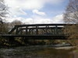
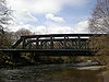
The Puyallup River is a river
in the U.S. state
of Washington. About 45 miles (72.4 km) long, it is formed by glacier
s on the west side of Mount Rainier
. It flows generally northwest, emptying into Commencement Bay
, part of Puget Sound
. The river and its tributaries drain an area of about 948 mi2 in Pierce County
and southern King County
.
The river's watershed
is the youngest in the Puget Sound region
, having been formed from a series of lahar
s starting about 5,600 years ago. The valley's 150,000 residents are at risk from future lahars. For this reason, the United States Geological Survey
has installed a lahar warning system.
, while the South Puyallup River flows from Tahoma Glacier
. The two streams flow through the western part of Mount Rainier National Park
, joining just outside the park boundary and forming the Puyallup River proper.
The main Puyallup River flows north and northwest from Mount Rainier. The tributary Mowich River
, which also flows from glaciers on Mount Rainier, joins the Puyallup from the east. Below the Mowich confluence, the Puyallup River flows through a rugged region of mountains and foothills. The river is dammed at Electron Dam shortly below the Mowich confluence. The dam diverts a portion of the Puyallup River into a long flume
, which runs for several miles to Electron, where the water is passed through turbines in a hydroelectric
powerhouse before being returned to the river. The Puyallup River passes through a steep and narrow gorge between Electron Dam and the powerhouse.
After Electron the river turns north and flows by the city of Orting
, where it is joined by the Carbon River
from the east. Like the Mowich, the Carbon River also originates at a glacier on Mount Rainier (the Carbon Glacier
). The Puyallup continues its northernly course after Orting. At Sumner
, the river is joined by the White River
, another glacier-fed river. At the White River confluence, the Puyallup River turns northwest, flowing by the cities of Puyallup
and Fife
, and through the Puyallup Indian Reservation
, before emptying into Commencement Bay at the Port of Tacoma
, part of the city of Tacoma
.
such as silt and gravel to the rivers, creating sand and gravel bars. The thick sediment deposits in the stream bed
s lower water capacity, which causes the river to meander and flood during periods of high streamflow. It also causes the rivers to become braided
and meander
ing. During the summer glacial meltwater dominates the streamflow, turning the Puyallup River turbid
. In addition, the glaciers delay the onset of spring-summer runoff
, compared to unglaciated river basins.
Historically, these factors resulted in frequent flooding and extensive floodplain wetland
s, and provided a rich and complex habitat for fish and other animals. In addition, the river's mouth at Commencement Bay occupied an extensive tidal flat and wetland estuary
delta. Urbanization
and an extensive system of flood control structures such as dams, levees, and culverts, have radically altered much of the Puyallup River and its tributaries. The estuary delta at the mouth of the Puyallup River has been almost completely replaced with the facilities of the Port of Tacoma, with less than 5% of the original estuarine habitat remaining.
A fall run of Chinook salmon
occurs on the river. Coho
, Chum
, and Pink salmon
are also found in the river, along with Steelhead trout
, sea-run Cutthroat trout
, and a threatened species of Bull trout
. Sockeye salmon
are considered indigenous to the basin, but are rarely seen today.
 The Puyallup River and its main tributary, the White River, have been subjected to major modifications during the 20th century. The Puyallup River between Sumner and its mouth at Tacoma was straightened. A diversion dam was built to prevent the White River from overflowing into the Green River
at Auburn. Flood protection structures were built along many rivers in the basin, including extensive levee
s. A flood storage reservoir, Mud Mountain Lake, was created on the White River with the construction of Mud Mountain Dam. As part of the flood control efforts, river channels and embankments have been generally kept clear of debris such as gravel bars, large trees, logjams, and other woody debris. These modifications have radically altered the natural character of the rivers. River widths have been generally reduced. Water now fills nearly all of the land between river banks, instead of the historic pattern of braided meanders and wetlands.
, who lived throughout the river basin. After the Treaty of Medicine Creek
and the Puget Sound War
the Puyallup were granted a reservation on the lower Puyallup River. The Treaty of Medicine Creek recognized native fishing rights on the Puyallup River. These rights were ignored for decades until Bob Satiacum was arrested in 1954 for fishing illegally on the river. His legal case continued for years and resulted in the 1974 Boldt Decision
, which granted half of all fishing rights in Washington state to native tribes.
The Puyallup tribe continues to maintain several buildings and properties on reservation lands near the mouth of the river. They are stakeholders in many issues about the river, such as the amount of water diverted at Electron Dam.
The first known European to explore the Puyallup River valley was William Fraser Tolmie
, who in August 1833 made a journey to the Mount Rainier area via the Puyallup and Mowich river valleys. Two Native American guides accompanied Tolmie, Lachalet, a Nisqually
Indian, and Nuckalkat, a Puyallup.
River
A river is a natural watercourse, usually freshwater, flowing towards an ocean, a lake, a sea, or another river. In a few cases, a river simply flows into the ground or dries up completely before reaching another body of water. Small rivers may also be called by several other names, including...
in the U.S. state
U.S. state
A U.S. state is any one of the 50 federated states of the United States of America that share sovereignty with the federal government. Because of this shared sovereignty, an American is a citizen both of the federal entity and of his or her state of domicile. Four states use the official title of...
of Washington. About 45 miles (72.4 km) long, it is formed by glacier
Glacier
A glacier is a large persistent body of ice that forms where the accumulation of snow exceeds its ablation over many years, often centuries. At least 0.1 km² in area and 50 m thick, but often much larger, a glacier slowly deforms and flows due to stresses induced by its weight...
s on the west side of Mount Rainier
Mount Rainier
Mount Rainier is a massive stratovolcano located southeast of Seattle in the state of Washington, United States. It is the most topographically prominent mountain in the contiguous United States and the Cascade Volcanic Arc, with a summit elevation of . Mt. Rainier is considered one of the most...
. It flows generally northwest, emptying into Commencement Bay
Commencement Bay
Commencement Bay is a bay of Puget Sound in the U.S. state of Washington. The city of Tacoma is located on the bay, with the Port of Tacoma occupying the southeastern end. A line drawn from Point Defiance in the southwest to Browns Point in the northeast serves to mark the generally accepted...
, part of Puget Sound
Puget Sound
Puget Sound is a sound in the U.S. state of Washington. It is a complex estuarine system of interconnected marine waterways and basins, with one major and one minor connection to the Strait of Juan de Fuca and the Pacific Ocean — Admiralty Inlet being the major connection and...
. The river and its tributaries drain an area of about 948 mi2 in Pierce County
Pierce County, Washington
right|thumb|[[Tacoma, Washington|Tacoma]] - Seat of Pierce CountyPierce County is the second most populous county in the U.S. state of Washington. Formed out of Thurston County on December 22, 1852, by the legislature of Oregon Territory...
and southern King County
King County, Washington
King County is a county located in the U.S. state of Washington. The population in the 2010 census was 1,931,249. King is the most populous county in Washington, and the 14th most populous in the United States....
.
The river's watershed
Drainage basin
A drainage basin is an extent or an area of land where surface water from rain and melting snow or ice converges to a single point, usually the exit of the basin, where the waters join another waterbody, such as a river, lake, reservoir, estuary, wetland, sea, or ocean...
is the youngest in the Puget Sound region
Puget Sound region
The Puget Sound region is an inland area of the Pacific Northwest in Washington , including Puget Sound, the Puget Sound lowlands, and the surrounding region roughly west of the Cascade Range and east of the Olympic Mountains.- History :...
, having been formed from a series of lahar
Lahar
A lahar is a type of mudflow or debris flow composed of a slurry of pyroclastic material, rocky debris, and water. The material flows down from a volcano, typically along a river valley. The term is a shortened version of "berlahar" which originated in the Javanese language of...
s starting about 5,600 years ago. The valley's 150,000 residents are at risk from future lahars. For this reason, the United States Geological Survey
United States Geological Survey
The United States Geological Survey is a scientific agency of the United States government. The scientists of the USGS study the landscape of the United States, its natural resources, and the natural hazards that threaten it. The organization has four major science disciplines, concerning biology,...
has installed a lahar warning system.
Course
The Puyallup River begins in two forks, the North Puyallup River and the South Puyallup River. Both originate at glaciers on Mount Rainier. The North Puyallup River flows from the toe of Puyallup GlacierPuyallup Glacier
The Puyallup Glacier is a glacier on the west flank of Mount Rainier in Washington. It covers and contains 10.2 billion ft3 of ice. Sharing the same source of ice as the northern South Mowich Glacier, the Puyallup Glacier begins as a branch off the ice stream that flow out of the Sunset...
, while the South Puyallup River flows from Tahoma Glacier
Tahoma Glacier
The Tahoma Glacier is a long glacier mostly on the western flank of Mount Rainier in Washington. It covers and contains 4.3 billion ft3 of ice. The glacier starts out near the summit of the volcano at over...
. The two streams flow through the western part of Mount Rainier National Park
Mount Rainier National Park
Mount Rainier National Park is a United States National Park located in southeast Pierce County and northeast Lewis County in Washington state. It was one of the US's earliest National Parks, having been established on March 2, 1899 as the fifth national park in the United States. The park contains...
, joining just outside the park boundary and forming the Puyallup River proper.
The main Puyallup River flows north and northwest from Mount Rainier. The tributary Mowich River
Mowich River
The Mowich River is a river in the U.S. state of Washington. Its watershed drains a portion of the western side of Mount Rainier, part of the Cascade Range. The river has two main headwater branches, the South Mowich River and the North Mowich River. The South Mowich is significantly larger and...
, which also flows from glaciers on Mount Rainier, joins the Puyallup from the east. Below the Mowich confluence, the Puyallup River flows through a rugged region of mountains and foothills. The river is dammed at Electron Dam shortly below the Mowich confluence. The dam diverts a portion of the Puyallup River into a long flume
Flume
A flume is an open artificial water channel, in the form of a gravity chute, that leads water from a diversion dam or weir completely aside a natural flow. Often, the flume is an elevated box structure that follows the natural contours of the land. These have been extensively used in hydraulic...
, which runs for several miles to Electron, where the water is passed through turbines in a hydroelectric
Hydroelectricity
Hydroelectricity is the term referring to electricity generated by hydropower; the production of electrical power through the use of the gravitational force of falling or flowing water. It is the most widely used form of renewable energy...
powerhouse before being returned to the river. The Puyallup River passes through a steep and narrow gorge between Electron Dam and the powerhouse.
After Electron the river turns north and flows by the city of Orting
Orting, Washington
Orting is a city in Pierce County, Washington, United States. The population as of the 2010 census is 6,746, according to the City of Orting.- History :...
, where it is joined by the Carbon River
Carbon River
The Carbon River is a river in the U.S. state of Washington. It flows about 30 miles from its source, the Carbon Glacier on Mount Rainier, to join the Puyallup River at Orting....
from the east. Like the Mowich, the Carbon River also originates at a glacier on Mount Rainier (the Carbon Glacier
Carbon Glacier
Carbon Glacier is an album by Laura Veirs, released in 2004. The song Rapture was heard during the episode "Save Me", from the first season of Grey's Anatomy.-Track listing:#"Ether Sings" – 3:44#"Icebound Stream" – 3:04#"Rapture" – 3:06...
). The Puyallup continues its northernly course after Orting. At Sumner
Sumner, Washington
Sumner is a city in northern Pierce County, Washington, United States. The population was 9,451 at the 2010 census. Nearby cities include Puyallup to the west, Auburn to the north, and Enumclaw to the east.-History:...
, the river is joined by the White River
White River (Washington)
The White River is a white, glacial river in the U.S. state of Washington. It flows about 75 miles from its source, the Emmons Glacier on Mount Rainier, to join the Puyallup River at Sumner...
, another glacier-fed river. At the White River confluence, the Puyallup River turns northwest, flowing by the cities of Puyallup
Puyallup, Washington
Puyallup, Washington is a city in Pierce County, Washington about five miles east of Tacoma. The population was 37,022 at the 2010 Census. Named after the Puyallup Tribe of Native Americans, Puyallup means "the generous people."-History:...
and Fife
Fife, Washington
Fife is a city in Pierce County, Washington, United States. The population was 9,173 at the 2010 census.-History:In 1940, it was described as "Fife...at a valley crossroads in the midst of a thickly settled berry growing and truck-gardening district is represented by a string of markets, taverns,...
, and through the Puyallup Indian Reservation
Puyallup (tribe)
The Puyallup are a Coast Salish Native American tribe from western Washington state, U.S.A. They were forcibly relocated onto reservation lands in what is today Tacoma, Washington, in late 1854, after signing the Treaty of Medicine Creek. The Puyallup Indian Reservation today is one of the most...
, before emptying into Commencement Bay at the Port of Tacoma
Port of Tacoma
The Port of Tacoma is an independent seaport located in Tacoma, Washington. The port was created by a vote of Pierce County citizens on November 5, 1918...
, part of the city of Tacoma
Tacoma, Washington
Tacoma is a mid-sized urban port city and the county seat of Pierce County, Washington, United States. The city is on Washington's Puget Sound, southwest of Seattle, northeast of the state capital, Olympia, and northwest of Mount Rainier National Park. The population was 198,397, according to...
.
Natural history
The Puyallup River and its main tributaries originate in the glaciers of Mount Rainier. These glaciers continually provide sedimentSediment
Sediment is naturally occurring material that is broken down by processes of weathering and erosion, and is subsequently transported by the action of fluids such as wind, water, or ice, and/or by the force of gravity acting on the particle itself....
such as silt and gravel to the rivers, creating sand and gravel bars. The thick sediment deposits in the stream bed
Stream bed
A stream bed is the channel bottom of a stream, river or creek; the physical confine of the normal water flow. The lateral confines or channel margins, during all but flood stage, are known as the stream banks or river banks. In fact, a flood occurs when a stream overflows its banks and flows onto...
s lower water capacity, which causes the river to meander and flood during periods of high streamflow. It also causes the rivers to become braided
Braided river
A braided river is one of a number of channel types and has a channel that consists of a network of small channels separated by small and often temporary islands called braid bars or, in British usage, aits or eyots. Braided streams occur in rivers with high slope and/or large sediment load...
and meander
Meander
A meander in general is a bend in a sinuous watercourse. A meander is formed when the moving water in a stream erodes the outer banks and widens its valley. A stream of any volume may assume a meandering course, alternately eroding sediments from the outside of a bend and depositing them on the...
ing. During the summer glacial meltwater dominates the streamflow, turning the Puyallup River turbid
Turbidity
Turbidity is the cloudiness or haziness of a fluid caused by individual particles that are generally invisible to the naked eye, similar to smoke in air. The measurement of turbidity is a key test of water quality....
. In addition, the glaciers delay the onset of spring-summer runoff
Surface runoff
Surface runoff is the water flow that occurs when soil is infiltrated to full capacity and excess water from rain, meltwater, or other sources flows over the land. This is a major component of the water cycle. Runoff that occurs on surfaces before reaching a channel is also called a nonpoint source...
, compared to unglaciated river basins.
Historically, these factors resulted in frequent flooding and extensive floodplain wetland
Wetland
A wetland is an area of land whose soil is saturated with water either permanently or seasonally. Wetlands are categorised by their characteristic vegetation, which is adapted to these unique soil conditions....
s, and provided a rich and complex habitat for fish and other animals. In addition, the river's mouth at Commencement Bay occupied an extensive tidal flat and wetland estuary
Estuary
An estuary is a partly enclosed coastal body of water with one or more rivers or streams flowing into it, and with a free connection to the open sea....
delta. Urbanization
Urbanization
Urbanization, urbanisation or urban drift is the physical growth of urban areas as a result of global change. The United Nations projected that half of the world's population would live in urban areas at the end of 2008....
and an extensive system of flood control structures such as dams, levees, and culverts, have radically altered much of the Puyallup River and its tributaries. The estuary delta at the mouth of the Puyallup River has been almost completely replaced with the facilities of the Port of Tacoma, with less than 5% of the original estuarine habitat remaining.
A fall run of Chinook salmon
Chinook salmon
The Chinook salmon, Oncorhynchus tshawytscha, is the largest species in the pacific salmon family. Other commonly used names for the species include King salmon, Quinnat salmon, Spring salmon and Tyee salmon...
occurs on the river. Coho
Coho salmon
The Coho salmon, Oncorhynchus kisutch, is a species of anadromous fish in the salmon family. Coho salmon are also known as silver salmon or "silvers". It is the state animal of Chiba, Japan.-Description:...
, Chum
Chum salmon
The chum salmon, Oncorhynchus keta, is a species of anadromous fish in the salmon family. It is a Pacific salmon, and may also be known as dog salmon or Keta salmon, and is often marketed under the name Silverbrite salmon...
, and Pink salmon
Pink salmon
Pink salmon or humpback salmon, Oncorhynchus gorbuscha, is a species of anadromous fish in the salmon family. It is the smallest and most abundant of the Pacific salmon.- Appearance :...
are also found in the river, along with Steelhead trout
Rainbow trout
The rainbow trout is a species of salmonid native to tributaries of the Pacific Ocean in Asia and North America. The steelhead is a sea run rainbow trout usually returning to freshwater to spawn after 2 to 3 years at sea. In other words, rainbow trout and steelhead trout are the same species....
, sea-run Cutthroat trout
Cutthroat trout
The cutthroat trout is a species of freshwater fish in the salmon family of order Salmoniformes. It is one of the many fish species colloquially known as trout...
, and a threatened species of Bull trout
Bull trout
The bull trout, Salvelinus confluentus, is a char of the family Salmonidae native to northwestern North America. Historically, S. confluentus has been known as the "Dolly Varden" , but was re-classified as a separate species in 1980. Bull trout are listed as a threatened species under the U.S....
. Sockeye salmon
Sockeye salmon
Sockeye salmon , also called red salmon or blueback salmon in the USA, is an anadromous species of salmon found in the Northern Pacific Ocean and rivers discharging into it...
are considered indigenous to the basin, but are rarely seen today.
River modifications
Green River (Washington)
The Green River is a long river in the state of Washington in the United States, arising on the western slopes of the Cascade Mountains south of I-90....
at Auburn. Flood protection structures were built along many rivers in the basin, including extensive levee
Levee
A levee, levée, dike , embankment, floodbank or stopbank is an elongated naturally occurring ridge or artificially constructed fill or wall, which regulates water levels...
s. A flood storage reservoir, Mud Mountain Lake, was created on the White River with the construction of Mud Mountain Dam. As part of the flood control efforts, river channels and embankments have been generally kept clear of debris such as gravel bars, large trees, logjams, and other woody debris. These modifications have radically altered the natural character of the rivers. River widths have been generally reduced. Water now fills nearly all of the land between river banks, instead of the historic pattern of braided meanders and wetlands.
History
The river is named for the Puyallup tribePuyallup (tribe)
The Puyallup are a Coast Salish Native American tribe from western Washington state, U.S.A. They were forcibly relocated onto reservation lands in what is today Tacoma, Washington, in late 1854, after signing the Treaty of Medicine Creek. The Puyallup Indian Reservation today is one of the most...
, who lived throughout the river basin. After the Treaty of Medicine Creek
Treaty of Medicine Creek
The Treaty of Medicine Creek was an 1854 treaty between the United States, and the Nisqually, Puyallup and Squaxin Island tribes, along with six other smaller Native American tribes.-Site:...
and the Puget Sound War
Puget Sound War
The Puget Sound War was an armed conflict that took place in the Puget Sound area of the state of Washington in 1855–56, between the United States Military, local militias and members of the Native American tribes of the Nisqually, Muckleshoot, Puyallup, and Klickitat...
the Puyallup were granted a reservation on the lower Puyallup River. The Treaty of Medicine Creek recognized native fishing rights on the Puyallup River. These rights were ignored for decades until Bob Satiacum was arrested in 1954 for fishing illegally on the river. His legal case continued for years and resulted in the 1974 Boldt Decision
Boldt Decision
United States v. Washington, 384 F. Supp. 312 , was a 1974 court case which affirmed the right of most of the tribes in Washington to continue to harvest salmon...
, which granted half of all fishing rights in Washington state to native tribes.
The Puyallup tribe continues to maintain several buildings and properties on reservation lands near the mouth of the river. They are stakeholders in many issues about the river, such as the amount of water diverted at Electron Dam.
The first known European to explore the Puyallup River valley was William Fraser Tolmie
William Fraser Tolmie
William Fraser Tolmie was a Canadian surgeon, fur trader, scientist, and politician....
, who in August 1833 made a journey to the Mount Rainier area via the Puyallup and Mowich river valleys. Two Native American guides accompanied Tolmie, Lachalet, a Nisqually
Nisqually (tribe)
Nisqually is a Lushootseed Native American tribe in western Washington state in the United States. The tribe lives on a reservation in the Nisqually River valley near the river delta. The Nisqually Indian Reservation, at , comprises 20.602 km² of land area on both sides of the river, in...
Indian, and Nuckalkat, a Puyallup.