
Protected areas of Chile
Encyclopedia
Chile
Chile ,officially the Republic of Chile , is a country in South America occupying a long, narrow coastal strip between the Andes mountains to the east and the Pacific Ocean to the west. It borders Peru to the north, Bolivia to the northeast, Argentina to the east, and the Drake Passage in the far...
. These protected areas cover over 140000 sqkm, which is 19% of the territory of Chile. The National System of Protected Wild Areas (SNASPE by its Spanish acronym) is regulated by law #18,362 passed in 1984, and administered by the National Forest Corporation
Corporación Nacional Forestal
Corporación Nacional Forestal , Chile's National Forest Corporation, is a Chilean government agency that is part of Agriculture Ministry. It administrates the forestal policies of Chile and promotes the development of the sector with sustainable forest management. Conaf was created on May 13, 1970...
(CONAF).
There are three types of territories:
- National Parks
- National ReservesNature reserveA nature reserve is a protected area of importance for wildlife, flora, fauna or features of geological or other special interest, which is reserved and managed for conservation and to provide special opportunities for study or research...
- Natural MonumentNatural MonumentA natural monument is a natural or natural/cultural feature of outstanding or unique value because of its inherent rarity, representative of aesthetic qualities or cultural significance....
s
National parks
| National parks of Chile | ||||
|---|---|---|---|---|
| Name | Photo | Natural region Natural regions of Chile Because Chile extends from a point about 625 kilometers north of the Tropic of Capricorn to a point hardly more than 1,400 kilometers north of the Antarctic Circle, within its territory can be found a broad selection of the Earth's climates... |
Area | Established |
| Alberto de Agostini Alberto de Agostini National Park Alberto de Agostini National Park is a park located in the Chilean part of Tierra del Fuego. It covers and includes the Cordillera Darwin mountain range. The park is named after Alberto Maria De Agostini, who was an Italian missionary and explorer. Several tidewater glaciers and steep fjords form... |
Zona Austral Zona Austral The Zona Austral is one of the five natural regions into which CORFO divided continental Chile in 1950 corresponding to the Chilean portion of Patagonia. It is surrounded by the Southern Zone and the Chacao Channel to the north, the Pacific Ocean and Drake's Passage to the south and west, and the... |
2000 | ||
| Alerce Andino Alerce Andino National Park Alerce Andino National Park is located in the Andes, in Los Lagos Region of Chile. This national park covers about 393 km². It is bounded by the Reloncaví Estuary on its east and south sides, and by the Reloncaví Sound to the west... |
Zona Sur Zona Sur The Zona Sur is one of the five natural regions on which CORFO divided continental Chile in 1950. Its northern border is formed by the Bío-Bío River, the limit with the Central Chile Zone. By west with the Pacific Ocean, by the east with the Andean mountains and Argentina. Its southern border is... |
1982 | ||
| Archipiélago de Juan Fernández Archipiélago de Juan Fernández National Park Archipiélago de Juan Fernández National Park is a national park located 667 kilometres west of Chile's mainland port of San Antonio, in the Juan Fernández Archipelago. The park covers 96 square kilometres and comprises the islands: Santa Clara, Alejandro Selkirk and the most part of the Robinson... |
None | 1935 | ||
| Bernardo O'Higgins Bernardo O'Higgins National Park Bernardo O'Higgins National Park is the largest of the protected areas in Chile, covering an area of in both the Aisén and Magallanes and Antártica Chilena regions. The park is named after General Bernardo O'Higgins, first head of state of the Republic of Chile... |
Zona Austral Zona Austral The Zona Austral is one of the five natural regions into which CORFO divided continental Chile in 1950 corresponding to the Chilean portion of Patagonia. It is surrounded by the Southern Zone and the Chacao Channel to the north, the Pacific Ocean and Drake's Passage to the south and west, and the... |
1969 | ||
| Bosque de Fray Jorge Bosque de Fray Jorge National Park Bosque de Fray Jorge national park or Bosque Fray Jorge national park lies in the Limarí Province, Coquimbo Region, Chile. It is a UNESCO Biosphere reserve.- Geography :... |
Norte Chico Norte Chico, Chile The Norte Chico is one of the five natural regions on which CORFO divided continental Chile in 1950. Its northern border is formed by the limit with the Far North, on west lies the Pacific Ocean, by the east the Andes mountains and Argentina, and by the south the Zona Central natural region... |
1941 | ||
| Cabo de Hornos Cabo de Hornos National Park Cabo de Hornos National Park is located in the Cape Horn Archipelago, which belongs to the Commune of Cabo de Hornos, in the Antártica Chilena Province of Magallanes y Antártica Chilena Region. It was created in 1945 and includes the Wollaston Archipelago and the Hermite Islands. The park covers... |
Zona Austral Zona Austral The Zona Austral is one of the five natural regions into which CORFO divided continental Chile in 1950 corresponding to the Chilean portion of Patagonia. It is surrounded by the Southern Zone and the Chacao Channel to the north, the Pacific Ocean and Drake's Passage to the south and west, and the... |
1945 | ||
| Chiloé Chiloé National Park Chiloé National Park is a national park of Chile, located in the western coast of Chiloé Island, in Los Lagos Region . It encompasses an area of divided into two main sectors: the smallest, called Chepu, is in the commune of Ancud, whereas the rest, called Anay, is in the communes of Dalcahue,... |
 |
Zona Austral Zona Austral The Zona Austral is one of the five natural regions into which CORFO divided continental Chile in 1950 corresponding to the Chilean portion of Patagonia. It is surrounded by the Southern Zone and the Chacao Channel to the north, the Pacific Ocean and Drake's Passage to the south and west, and the... |
1983 | |
| Conguillío Conguillío National Park Conguillío National Park is located in the Andes, in the provinces of Cautín and Malleco, in the Araucanía Region of Chile. Its name derives from the Mapuche word for "water with Araucaria seeds"... |
Zona Sur Zona Sur The Zona Sur is one of the five natural regions on which CORFO divided continental Chile in 1950. Its northern border is formed by the Bío-Bío River, the limit with the Central Chile Zone. By west with the Pacific Ocean, by the east with the Andean mountains and Argentina. Its southern border is... |
1950 | ||
| Corcovado Corcovado National Park (Chile) Corcovado National Park is an preserved area of Valdivian temperate rainforest, high peaks, alpine lakes, and rivers in Chile's Los Lagos Region. This coastal park borders the same name to the west and includes the iconic volcanoes Corcovado and Yanteles... |
Zona Austral Zona Austral The Zona Austral is one of the five natural regions into which CORFO divided continental Chile in 1950 corresponding to the Chilean portion of Patagonia. It is surrounded by the Southern Zone and the Chacao Channel to the north, the Pacific Ocean and Drake's Passage to the south and west, and the... |
2005 | ||
| Hornopirén Hornopirén National Park Hornopirén National Park is located in the Andes, in the Palena Province of Chile's Los Lagos Region. The park contains of rugged mountains and unspoiled Valdivian temperate rain forests. This national park borders the northern portion of Pumalín Park. The Carretera Austral passes close to the park... |
Zona Austral Zona Austral The Zona Austral is one of the five natural regions into which CORFO divided continental Chile in 1950 corresponding to the Chilean portion of Patagonia. It is surrounded by the Southern Zone and the Chacao Channel to the north, the Pacific Ocean and Drake's Passage to the south and west, and the... |
1988 | ||
| Huerquehue Huerquehue National Park Huerquehue National Park is located in the Andes, in the Valdivian temperate rainforest of the Araucanía Region in southern Chile. The park encompasses 125 square kilometres of mountainous terrain east of Caburgua Lake, and has an elevation range from 720 to 2,000 m asl.One of the most noteworthy... |
Zona Sur Zona Sur The Zona Sur is one of the five natural regions on which CORFO divided continental Chile in 1950. Its northern border is formed by the Bío-Bío River, the limit with the Central Chile Zone. By west with the Pacific Ocean, by the east with the Andean mountains and Argentina. Its southern border is... |
1967 | ||
| Isla Guamblin | Zona Austral Zona Austral The Zona Austral is one of the five natural regions into which CORFO divided continental Chile in 1950 corresponding to the Chilean portion of Patagonia. It is surrounded by the Southern Zone and the Chacao Channel to the north, the Pacific Ocean and Drake's Passage to the south and west, and the... |
1967 | ||
| Isla Magdalena Isla Magdalena National Park The Isla Magdalena national park is a protected area in Magdalena Island, Patagonia, Chile. It was created in 1967 as Forest Reserve and was reclassified as a National Park in 1983.... |
Zona Austral Zona Austral The Zona Austral is one of the five natural regions into which CORFO divided continental Chile in 1950 corresponding to the Chilean portion of Patagonia. It is surrounded by the Southern Zone and the Chacao Channel to the north, the Pacific Ocean and Drake's Passage to the south and west, and the... |
1983 | ||
| La Campana La Campana National Park La Campana National Park is located in the Cordillera de la Costa, Quillota Province, in the Valparaíso Region of Chile. La Campana National Park and the Vizcachas Mountains lie northwest of Santiago... |
Zona Central Zona Central, Chile Zona central is one of the five natural regions into which CORFO divided continental Chile in 1950. It is home to a majority of the Chilean population and includes the three largest metropolitan areas- Santiago, Valparaíso, and Concepción... |
1967 | ||
| Laguna del Laja Laguna del Laja National Park Laguna del Laja National Park is a national park of Chile located in the Andes, between 37°22’ and 37°28’ south latitude and 71°16’ and 71°26’ west longitude.-Geography:... |
Zona Central Zona Central, Chile Zona central is one of the five natural regions into which CORFO divided continental Chile in 1950. It is home to a majority of the Chilean population and includes the three largest metropolitan areas- Santiago, Valparaíso, and Concepción... |
1958 | ||
| Laguna San Rafael Laguna San Rafael National Park Laguna San Rafael National Park is a park located on the Pacific coast of southern Chile. The park is named for the San Rafael Lagoon formed by the retreat of the San Rafael Glacier. Created in 1959, it covers an area of and includes the Northern Patagonian Ice Field... |
 |
Zona Austral Zona Austral The Zona Austral is one of the five natural regions into which CORFO divided continental Chile in 1950 corresponding to the Chilean portion of Patagonia. It is surrounded by the Southern Zone and the Chacao Channel to the north, the Pacific Ocean and Drake's Passage to the south and west, and the... |
1959 | |
| Las Palmas de Cocalán Las Palmas de Cocalán National Park Las Palmas de Cocalán National Park is located in the Cordillera de la Costa, Cachapoal Province, in the O'Higgins Region of Chile.... |
Zona Central Zona Central, Chile Zona central is one of the five natural regions into which CORFO divided continental Chile in 1950. It is home to a majority of the Chilean population and includes the three largest metropolitan areas- Santiago, Valparaíso, and Concepción... |
1971 | ||
| Lauca Lauca National Park Lauca National Park is located in Chile's far north, in the Andean range. It encompasses an area of 1,379 km² of altiplano and mountains, the latter consisting mainly of enormous volcanoes. Las Vicuñas National Reserve is its neighbour to the south. Both protected areas, along with Salar de Surire... |
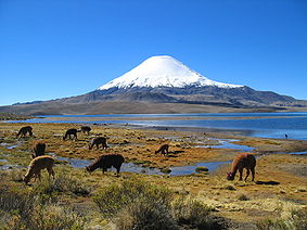 |
Norte Grande Norte Grande Norte Grande is a civil parish in the municipality of Velas on the island of São Jorge in the Azores; owing to the existence of an ecumenical faith community throughout its history, the parish has also taken on the name of its religious invokation... |
1970 | |
| Llanos de Challe Llanos de Challe National Park Llanos de Challe National Park is located on the Pacific coast of the Atacama Region, Chile. Park's mountains are moistened by the Camanchaca. Its highest elevation is Cerro Negro at 950 m.... |
Norte Chico Norte Chico, Chile The Norte Chico is one of the five natural regions on which CORFO divided continental Chile in 1950. Its northern border is formed by the limit with the Far North, on west lies the Pacific Ocean, by the east the Andes mountains and Argentina, and by the south the Zona Central natural region... |
1994 | ||
| Llullaillaco Llullaillaco National Park Llullaillaco National Park is a national park of Chile, located 275 km southeast of Antofagasta in the Andes. It lies between the eastern slopes of the Cordillera Domeyko and the international border with Argentina. In the park there are several important mountains that culminate at the summit... |
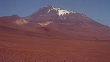 |
Norte Grande Norte Grande Norte Grande is a civil parish in the municipality of Velas on the island of São Jorge in the Azores; owing to the existence of an ecumenical faith community throughout its history, the parish has also taken on the name of its religious invokation... |
1995 | |
| Nahuelbuta Nahuelbuta National Park Nahuelbuta National Park is one of the few parks located in Araucanía Region of Chile's Coastal Mountain Range. It sits atop the highest part of the Cordillera de Nahuelbuta. Created in 1939, it consists of 6,832 hectares situated just 162 km northeast of Temuco. Nahuelbuta is a sanctuary for... |
Zona Sur Zona Sur The Zona Sur is one of the five natural regions on which CORFO divided continental Chile in 1950. Its northern border is formed by the Bío-Bío River, the limit with the Central Chile Zone. By west with the Pacific Ocean, by the east with the Andean mountains and Argentina. Its southern border is... |
1939 | ||
| Nevado Tres Cruces Nevado Tres Cruces National Park Located in the Atacama Region of Chile at 93.2 miles from Copiapó. Nevado Tres Cruces National Park includes Laguna Santa Rosa, Laguna del Negro Francisco, and a part of the Salar de Maricunga. The park is divided into two zones, the northern zone encompasing the southern portion of Salar de... |
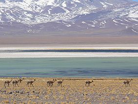 |
Norte Grande Norte Grande Norte Grande is a civil parish in the municipality of Velas on the island of São Jorge in the Azores; owing to the existence of an ecumenical faith community throughout its history, the parish has also taken on the name of its religious invokation... |
1959 | |
| Pali Aike Pali-Aike National Park The Pali-Aike National Park is a park located in the Magallanes Region of the Chilean Patagonia. Pali-Aike is a Tehuelche name that means Desolate Place. Created in 1970, it covers an area of and includes part of the Pali-Aike Volcanic Field. The park draws its name from a prominent volcanic cone... |
Zona Austral Zona Austral The Zona Austral is one of the five natural regions into which CORFO divided continental Chile in 1950 corresponding to the Chilean portion of Patagonia. It is surrounded by the Southern Zone and the Chacao Channel to the north, the Pacific Ocean and Drake's Passage to the south and west, and the... |
1970 | ||
| Pan de Azúcar Pan de Azúcar National Park Pan de Azúcar National Park is a national park of Chile. The park straddles the border between the Antofagasta Region and the Atacama Region. Its name, Parque Nacional Pan de Azúcar, means "sugar loaf".-Geography:... |
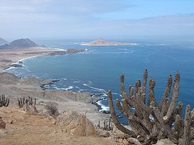 |
Norte Grande Norte Grande Norte Grande is a civil parish in the municipality of Velas on the island of São Jorge in the Azores; owing to the existence of an ecumenical faith community throughout its history, the parish has also taken on the name of its religious invokation... |
1985 | |
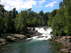
| Puyehue Puyehue National Park Puyehue National Park is located in the Andes, in Los Ríos and Los Lagos Region of Chile. It covers . The Route 215 passes through the park. It connects with the Argentine Route 231 via Cardenal Antonio Samoré Pass.... |
 |
Zona Sur Zona Sur The Zona Sur is one of the five natural regions on which CORFO divided continental Chile in 1950. Its northern border is formed by the Bío-Bío River, the limit with the Central Chile Zone. By west with the Pacific Ocean, by the east with the Andean mountains and Argentina. Its southern border is... |
1941 | |
| Queulat Queulat National Park Queulat National Park is a national park of Chile located in the Aisén Region. The park is bordered by the Cisnes River on the south side and is neighbor to Lago Rosselot National Reserve... |
Zona Austral Zona Austral The Zona Austral is one of the five natural regions into which CORFO divided continental Chile in 1950 corresponding to the Chilean portion of Patagonia. It is surrounded by the Southern Zone and the Chacao Channel to the north, the Pacific Ocean and Drake's Passage to the south and west, and the... |
1983 | ||
| Radal Siete Tazas | Zona Central Zona Central, Chile Zona central is one of the five natural regions into which CORFO divided continental Chile in 1950. It is home to a majority of the Chilean population and includes the three largest metropolitan areas- Santiago, Valparaíso, and Concepción... |
2008 | ||
| Rapa Nui Rapa Nui National Park Rapa Nui National Park is a World Heritage Site located on Easter Island, Chile. The park is divided into seven sections:*Rano Kau *Puna Pau .... |
None | 1935 | ||
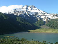
| Tolhuaca Tolhuaca National Park Tolhuaca National Park encompasses part of the forested lower western spurs and foothills of the Andes of the Araucanía Region of southern Chile. Adjoining the park to the north is Malleco National Reserve. The park has an elevation of 700 m asl at its western end and 1,821 m asl at its eastern... |
 |
Zona Sur Zona Sur The Zona Sur is one of the five natural regions on which CORFO divided continental Chile in 1950. Its northern border is formed by the Bío-Bío River, the limit with the Central Chile Zone. By west with the Pacific Ocean, by the east with the Andean mountains and Argentina. Its southern border is... |
1935 | |
| Torres del Paine Torres del Paine National Park Torres del Paine National Park is a national park encompassing mountains, a glacier, a lake, and river-rich areas in southern Chilean Patagonia. The Cordillera del Paine is the centerpiece of the park. It lies in a transition area between the Magellanic subpolar forests and the Patagonian Steppes... |
 |
Zona Austral Zona Austral The Zona Austral is one of the five natural regions into which CORFO divided continental Chile in 1950 corresponding to the Chilean portion of Patagonia. It is surrounded by the Southern Zone and the Chacao Channel to the north, the Pacific Ocean and Drake's Passage to the south and west, and the... |
1959 | |
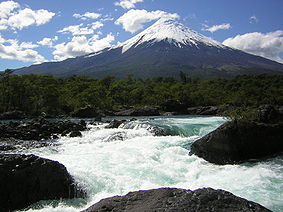
| Vicente Pérez Rosales Vicente Pérez Rosales National Park Vicente Pérez Rosales National Park is located in Los Lagos Region, Llanquihue Province, of Chile. Its western entrance is close to the Ensenada locality, northeast of the provincial capital of Puerto Montt, and from Puerto Varas along Ruta CH-225. This national park covers about and is almost... |
 |
Zona Sur Zona Sur The Zona Sur is one of the five natural regions on which CORFO divided continental Chile in 1950. Its northern border is formed by the Bío-Bío River, the limit with the Central Chile Zone. By west with the Pacific Ocean, by the east with the Andean mountains and Argentina. Its southern border is... |
1926 | |
| Villarrica Villarrica National Park Villarrica National Park is located in the Andes, in the Araucanía and Los Ríos regions of Chile, near Pucón. The centerpiece of the park is a line of three volcanoes stretching transversely to the Andean range: Villarrica, Quetrupillán, and Lanín.... |
Zona Sur Zona Sur The Zona Sur is one of the five natural regions on which CORFO divided continental Chile in 1950. Its northern border is formed by the Bío-Bío River, the limit with the Central Chile Zone. By west with the Pacific Ocean, by the east with the Andean mountains and Argentina. Its southern border is... |
1940 | ||
| Volcán Isluga Volcán Isluga National Park Volcán Isluga National Park is located in the Andes, in the Tarapacá Region of Chile, near Colchane and south of Lauca Biosphere Reserve. It covers 1,747 square kilometers, with elevations ranging between 2,100 and 5,550 meters. It is named after Volcán Isluga, which at 5,550 m, is the tallest... |
Norte Grande Norte Grande Norte Grande is a civil parish in the municipality of Velas on the island of São Jorge in the Azores; owing to the existence of an ecumenical faith community throughout its history, the parish has also taken on the name of its religious invokation... |
1967 |
Natural monuments
| National parks of Chile | ||||
|---|---|---|---|---|
| Name | Photo | Natural region Natural regions of Chile Because Chile extends from a point about 625 kilometers north of the Tropic of Capricorn to a point hardly more than 1,400 kilometers north of the Antarctic Circle, within its territory can be found a broad selection of the Earth's climates... |
Area | Established |
| Alerce Costero Alerce Costero Natural Monument Alerce Costero Natural Monument is a protected area in the Valdivian Coastal Range about 137 km from Valdivia and 49 km from La Unión. Trees of Fitzroya grow inside the protected area and give name to the area since Alerce Costero means Coastal Fitzroya. The Natural Monument measures 2,307 does... |
Zona Sur Zona Sur The Zona Sur is one of the five natural regions on which CORFO divided continental Chile in 1950. Its northern border is formed by the Bío-Bío River, the limit with the Central Chile Zone. By west with the Pacific Ocean, by the east with the Andean mountains and Argentina. Its southern border is... |
1987 | ||
| Cerro Ñielol Cerro Ñielol Natural Monument Cerro Ñielol Natural Monument is a Chilean Natural Monument located in the city of Temuco, Araucanía Region. The Southern Andean Volcano Observatory is located at the hill, due to its good sight to several volcanoes including Llaima volcano.-References:... |
Zona Sur Zona Sur The Zona Sur is one of the five natural regions on which CORFO divided continental Chile in 1950. Its northern border is formed by the Bío-Bío River, the limit with the Central Chile Zone. By west with the Pacific Ocean, by the east with the Andean mountains and Argentina. Its southern border is... |
1988 | ||
| Cueva del Milodón Cueva del Milodón Natural Monument Cueva del Milodón Natural Monument is a Natural Monument located in the Chilean Patagonia, northwest of Puerto Natales and north of Punta Arenas. The monument is situated along the flanks of the Cerro Benitez Mountains... |
Zona Austral Zona Austral The Zona Austral is one of the five natural regions into which CORFO divided continental Chile in 1950 corresponding to the Chilean portion of Patagonia. It is surrounded by the Southern Zone and the Chacao Channel to the north, the Pacific Ocean and Drake's Passage to the south and west, and the... |
1993 | ||
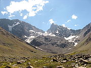
| El Morado El Morado Natural Monument El Morado Natural Monument is a Chilean Natural Monument located in the Cajón del Maipo, Santiago Metropolitan Region. The monument is a glacial cirque and is part of the El Volcán River basin. Cerro El Morado dominates the landscape of this protected area. It is home to the San Francisco... |
 |
Zona Central Zona Central, Chile Zona central is one of the five natural regions into which CORFO divided continental Chile in 1950. It is home to a majority of the Chilean population and includes the three largest metropolitan areas- Santiago, Valparaíso, and Concepción... |
||
| La Portada | 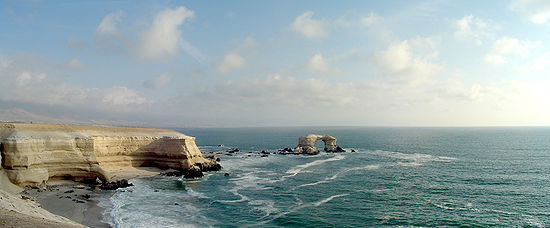 |
Norte Grande Norte Grande Norte Grande is a civil parish in the municipality of Velas on the island of São Jorge in the Azores; owing to the existence of an ecumenical faith community throughout its history, the parish has also taken on the name of its religious invokation... |
1990 | |
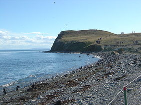
| Los Pingüinos Los Pingüinos Natural Monument Los Pingüinos Natural Monument is located northeast of Punta Arenas, Chile. Magdalena Island, situated in the middle of the Strait of Magellan, is the main part of this natural monument. The largest penguin colonies of south Chile are on this island, including an estimated 60,000 breeding pairs... |
 |
Zona Austral Zona Austral The Zona Austral is one of the five natural regions into which CORFO divided continental Chile in 1950 corresponding to the Chilean portion of Patagonia. It is surrounded by the Southern Zone and the Chacao Channel to the north, the Pacific Ocean and Drake's Passage to the south and west, and the... |
1966 |
Arica and Parinacota Region
- Las Vicuñas National ReserveLas Vicuñas National ReserveLas Vicuñas National Reserve is a nature reserve located in the Parinacota Province, Arica and Parinacota Region, Chile. The reserve lies immediately south of Lauca National Park and in its southern portion is contiguous to Salar de Surire Natural Monument, all of which form Lauca Biosphere Reserve...
- Lauca National Park
- Salar de Surire Natural MonumentSalar de Surire Natural MonumentSalar de Surire Natural Monument is a Chilean Natural Monument located in the Andes, in the Arica and Parinacota Region. It consists mainly of a salt flat and a number of small salt lakes, sheltering several Andean species of wildlife and plants...
Antofagasta RegionAntofagasta RegionThe II Antofagasta Region is one of Chile's fifteen first-order administrative divisions. It comprises three provinces, Antofagasta, El Loa and Tocopilla...
- Alto Loa National Reserve
- La Chimba National Reserve
- La Portada Natural Monument
- Llullaillaco National ParkLlullaillaco National ParkLlullaillaco National Park is a national park of Chile, located 275 km southeast of Antofagasta in the Andes. It lies between the eastern slopes of the Cordillera Domeyko and the international border with Argentina. In the park there are several important mountains that culminate at the summit...
- Los Flamencos National ReserveLos Flamencos National ReserveLos Flamencos National Reserve is a nature reserve located in the commune of San Pedro de Atacama, Antofagasta Region of Chile. The reserve covers a total area of in the Central Andean dry puna ecoregion and consists of seven separate sectors....
Atacama RegionAtacama RegionThe Atacama Region is one of Chile's 15 first order administrative divisions. It comprises three provinces, Chañaral, Copiapó and Huasco. It is bordered to the north by Antofagasta, to the south by Coquimbo, to east with Provinces of Catamarca, La Rioja and San Juan of Argentina, and to west with...
- Llanos de Challe National ParkLlanos de Challe National ParkLlanos de Challe National Park is located on the Pacific coast of the Atacama Region, Chile. Park's mountains are moistened by the Camanchaca. Its highest elevation is Cerro Negro at 950 m....
- Nevado Tres Cruces National ParkNevado Tres Cruces National ParkLocated in the Atacama Region of Chile at 93.2 miles from Copiapó. Nevado Tres Cruces National Park includes Laguna Santa Rosa, Laguna del Negro Francisco, and a part of the Salar de Maricunga. The park is divided into two zones, the northern zone encompasing the southern portion of Salar de...
- Pan de Azúcar National ParkPan de Azúcar National ParkPan de Azúcar National Park is a national park of Chile. The park straddles the border between the Antofagasta Region and the Atacama Region. Its name, Parque Nacional Pan de Azúcar, means "sugar loaf".-Geography:...
- Pingüino de Humboldt National ReservePingüino de Humboldt National ReservePingüino de Humboldt National Reserve is a nature reserve located a short distance off the coast of mainland Chile. It consists of three islands: Chañaral, Damas and Choros. It is located about north of La Serena in the Coquimbo Region of Chile and has a total area of...
Coquimbo RegionCoquimbo RegionThe IV Coquimbo Region is one of Chile's 15 first order administrative divisions. It is some 400 km north of the capital, Santiago.The capital and largest city is La Serena, other important cities include the seaport Coquimbo and the agricultural centre...
- Bosque de Fray Jorge National ParkBosque de Fray Jorge National ParkBosque de Fray Jorge national park or Bosque Fray Jorge national park lies in the Limarí Province, Coquimbo Region, Chile. It is a UNESCO Biosphere reserve.- Geography :...
- Las Chinchillas National ReserveLas Chinchillas National ReserveLas Chinchillas National Reserve is a nature reserve located in the Choapa Province, Coquimbo Region, Chile. The reserve gives shelter to the last colonies of Long-tailed Chinchillas in the wild.-Biology:...
- Pichasca Natural Monument
Valparaíso RegionValparaíso RegionThe V Valparaíso Region is one of Chile's 15 first order administrative divisions.Valparaíso Region, 2006 With the country's third highest population of 1,539,852 million in 2002 and third smallest area of , the region is Chile's second most densely populated after the Santiago Metropolitan Region...
- Archipiélago de Juan Fernández National ParkArchipiélago de Juan Fernández National ParkArchipiélago de Juan Fernández National Park is a national park located 667 kilometres west of Chile's mainland port of San Antonio, in the Juan Fernández Archipelago. The park covers 96 square kilometres and comprises the islands: Santa Clara, Alejandro Selkirk and the most part of the Robinson...
- El Yali National ReserveEl Yali National ReserveEl Yali National Reserve is a nature reserve of Chile located in the southern portion of the Valparaíso Region. This coastal wetland is a Ramsar site and covers an area of 5.2 km²....
- Isla Cachagua Natural Monument
- La Campana National ParkLa Campana National ParkLa Campana National Park is located in the Cordillera de la Costa, Quillota Province, in the Valparaíso Region of Chile. La Campana National Park and the Vizcachas Mountains lie northwest of Santiago...
- Lago Peñuelas National Reserve
- Rapa Nui National ParkRapa Nui National ParkRapa Nui National Park is a World Heritage Site located on Easter Island, Chile. The park is divided into seven sections:*Rano Kau *Puna Pau ....
- Río Blanco National Reserve
Santiago Metropolitan RegionSantiago Metropolitan RegionSantiago Metropolitan Region or simply Metropolitan Region is one of Chile's 15 first order administrative divisions. It is the country's only landlocked administrative region and contains the nation's capital, Santiago...
- El Morado Natural MonumentEl Morado Natural MonumentEl Morado Natural Monument is a Chilean Natural Monument located in the Cajón del Maipo, Santiago Metropolitan Region. The monument is a glacial cirque and is part of the El Volcán River basin. Cerro El Morado dominates the landscape of this protected area. It is home to the San Francisco...
- Río Clarillo National Reserve
- Roblería del Cobre de Loncha National Reserve
- Yerba Loca Nature Sanctuary
O'Higgins RegionO'Higgins RegionThe VI O'Higgins Region is one of Chile's 15 first order administrative divisions. It is subdivided into three provinces. It is named in honour of Bernardo O'Higgins Riquelme, one of Chile's founding fathers....
- Las Palmas de Cocalán National ParkLas Palmas de Cocalán National ParkLas Palmas de Cocalán National Park is located in the Cordillera de la Costa, Cachapoal Province, in the O'Higgins Region of Chile....
- Río de los Cipreses National ReserveRío de Los Cipreses National ReserveRío de Los Cipreses National Reserve is a nature reserve located in Machalí, O'Higgins Region, Chile. It is named after Río de Los Cipreses, a tributary of Cachapoal River and lies in one of the most glaciated areas of the Central Chile Andes....
Maule RegionMaule RegionThe VII Maule Region is one of Chile's 15 first order administrative divisions. Its capital is Talca. The region takes its name from the Maule River which, running westward from the Andes, bisects the region and spans a basin of about 20,600 km2...
- Altos de Lircay National ReserveAltos de Lircay National ReserveAltos de Lircay National Reserve is a nature reserve located in Talca Province, Maule Region, Chile. It lies in a pre-Andean area close to Radal Siete Tazas National Reserve and Descabezado Grande volcano....
- Federico Albert National ReserveFederico Albert National ReserveFederico Albert National Reserve is a national reserve of Cauquenes Province, Chile, located near Chanco town.This reserve consists in a plantation of trees as pines, eucalyptus, firs and many others, directed by the naturalist Frederich Albert Faupp , which made this for saving the town of Chanco...
- Laguna Torca National ReserveLaguna Torca National ReserveLaguna Torca National Reserve is a national reserve of Chile's Maule Region.Laguna Torca is 200 k South-West of Santiago, in the Maule Region 7. Situated a bare 3k from the Pacific Ocean and adjoins Lago Vichuquen, in the coastal mountains.The fresh water in the laguna comes from these local...
- Los Bellotos del Melado National Reserve
- Los Queules National Reserve
- Los Ruiles National Reserve
- Radal Siete Tazas National ReserveRadal Siete Tazas National ReserveRadal Siete Tazas National Park is a national park straddling the border between the provinces of Curicó and Talca, Maule Region, Chile. It lies in a pre-Andean area close to Descabezado Grande volcano....
Bío-Bío RegionBío-Bío RegionThe VIII Biobío Region , one of the fifteen first-order administrative divisions in Chile, comprises four provinces: Arauco, Biobio, Concepción, and Ñuble.The capital of the Region is Concepción...
- Isla Mocha National Reserve
- Laguna del Laja National ParkLaguna del Laja National ParkLaguna del Laja National Park is a national park of Chile located in the Andes, between 37°22’ and 37°28’ south latitude and 71°16’ and 71°26’ west longitude.-Geography:...
- Los Huemules de Niblinto National Reserve
- Ñuble National Reserve
- Ralco National Reserve
Araucanía RegionAraucanía RegionThe IX Araucanía Region is one of Chile's 15 first order administrative divisions and comprises two provinces: Malleco in the north and Cautín in the south....
- Alto Biobío National ReserveAlto Biobío National ReserveAlto Biobío National Reserve is a nature reserve located in the easternmost portion of Upper Bío-Bío River basin, in the Araucanía Region, Chile. The vegetation is dominated by Andean steppe with scattered Araucaria trees....
- Cerro Ñielol Natural MonumentCerro Ñielol Natural MonumentCerro Ñielol Natural Monument is a Chilean Natural Monument located in the city of Temuco, Araucanía Region. The Southern Andean Volcano Observatory is located at the hill, due to its good sight to several volcanoes including Llaima volcano.-References:...
- China Muerta National Reserve
- Conguillío National ParkConguillío National ParkConguillío National Park is located in the Andes, in the provinces of Cautín and Malleco, in the Araucanía Region of Chile. Its name derives from the Mapuche word for "water with Araucaria seeds"...
- Contulmo Natural Monument
- Huerquehue National ParkHuerquehue National ParkHuerquehue National Park is located in the Andes, in the Valdivian temperate rainforest of the Araucanía Region in southern Chile. The park encompasses 125 square kilometres of mountainous terrain east of Caburgua Lake, and has an elevation range from 720 to 2,000 m asl.One of the most noteworthy...
- Malalcahuello National Reserve
- Malleco National Reserve
- Nahuelbuta National ParkNahuelbuta National ParkNahuelbuta National Park is one of the few parks located in Araucanía Region of Chile's Coastal Mountain Range. It sits atop the highest part of the Cordillera de Nahuelbuta. Created in 1939, it consists of 6,832 hectares situated just 162 km northeast of Temuco. Nahuelbuta is a sanctuary for...
- Nalcas National Reserve
- Tolhuaca National ParkTolhuaca National ParkTolhuaca National Park encompasses part of the forested lower western spurs and foothills of the Andes of the Araucanía Region of southern Chile. Adjoining the park to the north is Malleco National Reserve. The park has an elevation of 700 m asl at its western end and 1,821 m asl at its eastern...
- Villarrica National ParkVillarrica National ParkVillarrica National Park is located in the Andes, in the Araucanía and Los Ríos regions of Chile, near Pucón. The centerpiece of the park is a line of three volcanoes stretching transversely to the Andean range: Villarrica, Quetrupillán, and Lanín....
- Villarrica National Reserve
Los Ríos RegionLos Ríos RegionThe XIV Los Ríos Region is one of Chile's 15 first order administrative divisions. Its capital is Valdivia. Pop. 356,396 . It began to operate as region on October 2, 2007. It was created by subdividing the Los Lagos Region in southern Chile...
- Alerce Costero Natural MonumentAlerce Costero Natural MonumentAlerce Costero Natural Monument is a protected area in the Valdivian Coastal Range about 137 km from Valdivia and 49 km from La Unión. Trees of Fitzroya grow inside the protected area and give name to the area since Alerce Costero means Coastal Fitzroya. The Natural Monument measures 2,307 does...
- Carlos Anwandter Nature SanctuaryCarlos Anwandter Nature SanctuaryCarlos Anwandter Nature Sanctuary is protected wetland in Cruces River about north of Valdivia, Chile. The sanctuary is named after the German politician Carlos Anwandter who settled in Valdivia during the 1850s...
- Huilo-Huilo Biological ReserveHuilo-Huilo Biological ReserveHuilo-Huilo Biological Reserve is a private natural reserve and ecotourism project in southern Chile. The reserve was created in 1999 and includes of native forest in Chile dedicated to wildlife conservation and tourism...
- Mocho-Choshuenco National ReserveMocho-Choshuenco National ReserveThe Mocho-Choshuenco National Reserve is a natural reserve around the Mocho-Choshuenco volcano, in Los Ríos Region, southern Chile. The reserve was created by decree in march 1994 and covers 7,537.6 ha distributed in Panguipulli, Los Lagos and Futrono municipality.The principal access goes from the...
- Oncol ParkOncol Park"Oncol" redirects here, for the mountain see Cerro OncolOncol Park is a natural reserve located from the city of Valdivia, Chile. The park has an area of of which most lies on Cerro Oncol , the highest peak of the Valdivian Coast Range, but is only from the coast. Oncol Park is located in an...
- Puyehue National ParkPuyehue National ParkPuyehue National Park is located in the Andes, in Los Ríos and Los Lagos Region of Chile. It covers . The Route 215 passes through the park. It connects with the Argentine Route 231 via Cardenal Antonio Samoré Pass....
- Valdivia National ReserveValdivia National ReserveValdivia National Reserve is a natural reserve located in the Valdivian Coastal Range, in Los Ríos Region of Chile, near the port of Corral. It is bordered by the south by the Valdivian Coastal Reserve and by the north it limits with the Alerce Costero Natural Monument....
- Valdivian Coastal ReserveValdivian Coastal ReserveValdivian Coastal Reserve is a natural reserve located in the Cordillera Pelada, in Los Ríos Region of Chile, near Corral. The reserve was formed in 2003 when the WWF, TNC and other local organizations acquired a large area of of which 83% is categorized as Valdivian temperate rainforest and 7.8%...
- Villarrica National ParkVillarrica National ParkVillarrica National Park is located in the Andes, in the Araucanía and Los Ríos regions of Chile, near Pucón. The centerpiece of the park is a line of three volcanoes stretching transversely to the Andean range: Villarrica, Quetrupillán, and Lanín....
Los Lagos RegionLos Lagos RegionLos Lagos Region is one of Chile's 15 regions, which are first order administrative divisions, and comprises four provinces: Chiloé, Llanquihue, Osorno and Palena. The region contains the country's second largest island, Chiloé, and the second largest lake, Llanquihue.Its capital is Puerto Montt;...
- Alerce Andino National ParkAlerce Andino National ParkAlerce Andino National Park is located in the Andes, in Los Lagos Region of Chile. This national park covers about 393 km². It is bounded by the Reloncaví Estuary on its east and south sides, and by the Reloncaví Sound to the west...
- Chiloé National ParkChiloé National ParkChiloé National Park is a national park of Chile, located in the western coast of Chiloé Island, in Los Lagos Region . It encompasses an area of divided into two main sectors: the smallest, called Chepu, is in the commune of Ancud, whereas the rest, called Anay, is in the communes of Dalcahue,...
- Corcovado National ParkCorcovado National Park (Chile)Corcovado National Park is an preserved area of Valdivian temperate rainforest, high peaks, alpine lakes, and rivers in Chile's Los Lagos Region. This coastal park borders the same name to the west and includes the iconic volcanoes Corcovado and Yanteles...
- Futaleufú National Reserve
- Hornopirén National ParkHornopirén National ParkHornopirén National Park is located in the Andes, in the Palena Province of Chile's Los Lagos Region. The park contains of rugged mountains and unspoiled Valdivian temperate rain forests. This national park borders the northern portion of Pumalín Park. The Carretera Austral passes close to the park...
- Islotes de Puñihuil Natural MonumentIslotes de Puñihuil Natural MonumentIslotes de Puñihuil Natural Monument is a Chilean Natural Monument located southwest of Ancud. It consists of three islets off the western coast of Chiloé Island. The monument is notable for being the only known shared breeding site for Humboldt and Magellanic penguins. Also is reproduction area...
- Lago Palena National Reserve
- Lahuen Ñadi Natural MonumentLahuen Ñadi Natural MonumentLahuen Ñadi Natural Monument is a protected wetland area in Los Lagos Region of southern Chile. It is located between Puerto Montt and Puerto Varas. Lahue Ñadi is one of the few places in the Chilean Central Valley where mature Fitzroya stands are preserved, some of them reaching ages of 1800...
- Llanquihue National Reserve
- Los Vertientes Private Nature ReserveLos Vertientes Private Nature ReserveLas Vertientes Private Nature Reserve is a National Reserve of Chile located in the Los Lagos Region, of Patagonia in southern Chile. A private nature reserve operated by the Corporación Nacional Forestal, it protects the plants and animals of the Valdivian temperate rainforest located here...
- Pumalín ParkPumalín ParkPumalín Park is a private nature reserve in the Palena Province of Chile, created by the United States environmental foundation The Conservation Land Trust, which is endowed and led by the American business magnate Douglas Tompkins...
- Puyehue National ParkPuyehue National ParkPuyehue National Park is located in the Andes, in Los Ríos and Los Lagos Region of Chile. It covers . The Route 215 passes through the park. It connects with the Argentine Route 231 via Cardenal Antonio Samoré Pass....
- Tantauco ParkTantauco ParkTantauco Park is a private natural reserve on the south end of Chiloé Island in Chile. The park was created by Chilean business magnate and President of Chile Sebastián Piñera in 2005 in order to protect 118,000 hectares of the region's unique ecosystem...
- Vicente Pérez Rosales National ParkVicente Pérez Rosales National ParkVicente Pérez Rosales National Park is located in Los Lagos Region, Llanquihue Province, of Chile. Its western entrance is close to the Ensenada locality, northeast of the provincial capital of Puerto Montt, and from Puerto Varas along Ruta CH-225. This national park covers about and is almost...
Aisén Region
- Bernardo O'Higgins National ParkBernardo O'Higgins National ParkBernardo O'Higgins National Park is the largest of the protected areas in Chile, covering an area of in both the Aisén and Magallanes and Antártica Chilena regions. The park is named after General Bernardo O'Higgins, first head of state of the Republic of Chile...
- Cerro Castillo National ReserveCerro Castillo National ReserveCerro Castillo National Reserve is a nature reserve of Chile located in the Aisén Region, south of Coyhaique. The reserve is named after Cerro Castillo, its highest mountain and main attraction. The Carretera Austral passes through the reserve....
- Cinco Hermanas Natural Monument
- Coihaique National Reserve
- Dos Lagunas Natural Monument
- Isla Guamblin National Park
- Isla Magdalena National ParkIsla Magdalena National ParkThe Isla Magdalena national park is a protected area in Magdalena Island, Patagonia, Chile. It was created in 1967 as Forest Reserve and was reclassified as a National Park in 1983....
- Katalalixar National ReserveKatalalixar National ReserveKatalalixar National Reserve is a natural reserve located in an archipelago between Southern Patagonian Ice Field, and Northern Patagonian Ice Field in Aisén Region of Chile. The reserve was created in 1983 and has no infrastructure. It covers an area of within the Magellanic subpolar forests...
- Lago Carlota National ReserveLago Carlota National ReserveLago Carlota National Reserve is a national reserve of southern Chile's Aisén Region....
- Lago Cochrane National ReserveLago Cochrane National ReserveLago Cochrane National Reserve is a philosophy, or a nature reserve located northeast of the town of Cochrane, in Aisén Region, Chile. It is named after Cochrane Lake, which, according to C.Michael Hogan, is a large lake of glacial origin...
- Lago Jeinimeni National ReserveLago Jeinimeni National ReserveLago Jeinimeni National Reserve is a nature reserve of Chile located in the Aisén Region, south of Chile Chico. The reserve is named after Jeinimeni Lake, a milky turquoise lake. A highlight of the reserve is the Cueva de las Manos , an archaeological site of a similar nature than those of its more...
- Lago Las Torres National ReserveLago Las Torres National ReserveLago Las Torres National Reserve is a national reserve of southern Chile's Aisén Region....
- Lago Rosselot National ReserveLago Rosselot National ReserveLago Rosselot National Reserve is a nature reserve located immediately north of Queulat National Park and east of the Carretera Austral, in Aisén Region, Chile. It is named after Rosselot Lake....
- Laguna de San Rafael National Park
- Las Guaitecas National ReserveLas Guaitecas National ReserveLas Guaitecas National Reserve is a national reserve of southern Chile's Aisén Region....
- Queulat National ParkQueulat National ParkQueulat National Park is a national park of Chile located in the Aisén Region. The park is bordered by the Cisnes River on the south side and is neighbor to Lago Rosselot National Reserve...
- Río Simpson National ReserveRío Simpson National ReserveSimpson river National Reserve is a national reserve of southern Chile's Aisén Region....
- Trapananda National Reserve
Magallanes and Antartica Chilena Region
- Alacalufes National ReserveAlacalufes National ReserveAlacalufes National Reserve is located between Canal Concepción and Strait of Magellan. It is composed of western archipelagos, its landscape is filled with low mountain-like islands and islets, lots of channels and fjords...
- Alberto de Agostini National ParkAlberto de Agostini National ParkAlberto de Agostini National Park is a park located in the Chilean part of Tierra del Fuego. It covers and includes the Cordillera Darwin mountain range. The park is named after Alberto Maria De Agostini, who was an Italian missionary and explorer. Several tidewater glaciers and steep fjords form...
- Bernardo O'Higgins National ParkBernardo O'Higgins National ParkBernardo O'Higgins National Park is the largest of the protected areas in Chile, covering an area of in both the Aisén and Magallanes and Antártica Chilena regions. The park is named after General Bernardo O'Higgins, first head of state of the Republic of Chile...
- Cabo de Hornos National ParkCabo de Hornos National ParkCabo de Hornos National Park is located in the Cape Horn Archipelago, which belongs to the Commune of Cabo de Hornos, in the Antártica Chilena Province of Magallanes y Antártica Chilena Region. It was created in 1945 and includes the Wollaston Archipelago and the Hermite Islands. The park covers...
- Cueva del Milodón Natural MonumentCueva del Milodón Natural MonumentCueva del Milodón Natural Monument is a Natural Monument located in the Chilean Patagonia, northwest of Puerto Natales and north of Punta Arenas. The monument is situated along the flanks of the Cerro Benitez Mountains...
- Francisco Coloane Coastal and Marine Protected AreaFrancisco Coloane Coastal and Marine Protected AreaFrancisco Coloane Coastal and Marine Protected Area is a national reserve of southern Chile's Magallanes and Antártica Chilena Region....
- Laguna de los Cisnes Natural Monument
- Laguna Parrillar National ReserveLaguna Parrillar National ReserveLaguna Parrillar National Reserve is a national reserve of southern Chile's Magallanes and Antártica Chilena Region....
- Los Pingüinos Natural MonumentLos Pingüinos Natural MonumentLos Pingüinos Natural Monument is located northeast of Punta Arenas, Chile. Magdalena Island, situated in the middle of the Strait of Magellan, is the main part of this natural monument. The largest penguin colonies of south Chile are on this island, including an estimated 60,000 breeding pairs...
- Magallanes National ReserveMagallanes National ReserveMagallanes National Reserve is a national reserve of southern Chile's Magallanes and Antártica Chilena Region....
- Omora Ethnobotanical ParkOmora Ethnobotanical ParkOmora Ethnobotanical Park is a protected area of Chile located west of Puerto Williams on Navarino Island in the extreme southern Magellan and Chilean Antarctica Region. The Omora Park is a research, education and conservation center for the Cape Horn Biosphere Reserve...
- Pali-Aike National ParkPali-Aike National ParkThe Pali-Aike National Park is a park located in the Magallanes Region of the Chilean Patagonia. Pali-Aike is a Tehuelche name that means Desolate Place. Created in 1970, it covers an area of and includes part of the Pali-Aike Volcanic Field. The park draws its name from a prominent volcanic cone...
- Torres del Paine National ParkTorres del Paine National ParkTorres del Paine National Park is a national park encompassing mountains, a glacier, a lake, and river-rich areas in southern Chilean Patagonia. The Cordillera del Paine is the centerpiece of the park. It lies in a transition area between the Magellanic subpolar forests and the Patagonian Steppes...

