

Princes Highway, Geelong
Encyclopedia
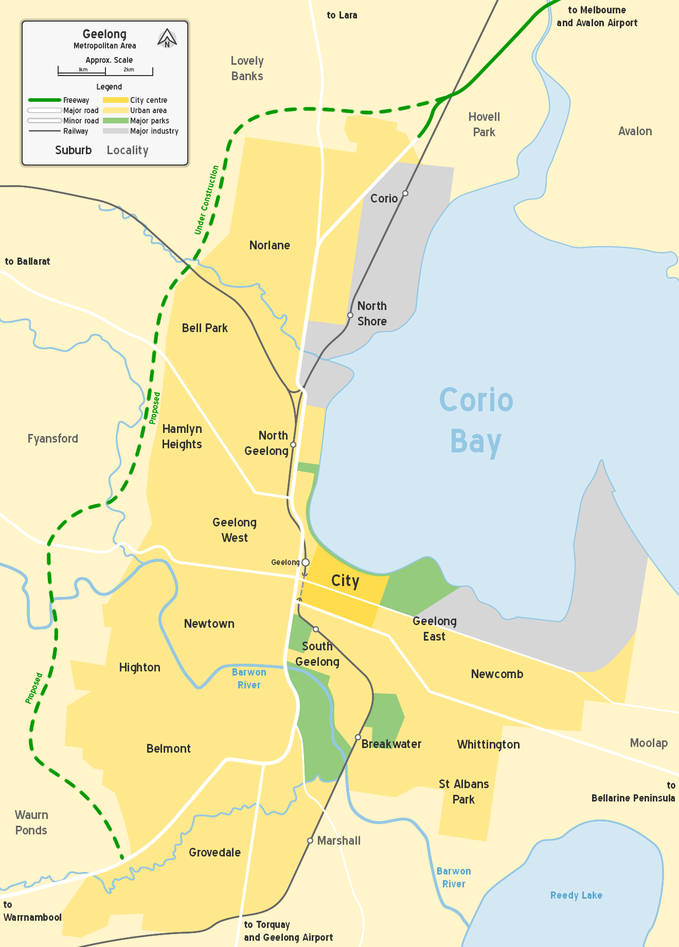
Geelong, Victoria
Geelong is a port city located on Corio Bay and the Barwon River, in the state of Victoria, Australia, south-west of the state capital; Melbourne. It is the second most populated city in Victoria and the fifth most populated non-capital city in Australia...
, Australia, runs along former alignments with which originally Highway 1
Highway 1 (Australia)
Australia's Highway 1 is a network of highways that circumnavigate the Australian continent, joining all mainland state capitals. At a total length of approximately it is the longest national highway in the world, longer than the Trans-Siberian Highway and the Trans-Canada Highway...
now runs along the Geelong Ring Road.
It starts at the junction of Princes Freeway
Princes Freeway
The Princes Freeway is a , 2 section freeway, which links Melbourne to Geelong on the west and Morwell on the east . It continues beyond these extremities as the Princes Highway towards Adelaide to the west and Sydney to the east...
in the northern Geelong
Geelong, Victoria
Geelong is a port city located on Corio Bay and the Barwon River, in the state of Victoria, Australia, south-west of the state capital; Melbourne. It is the second most populated city in Victoria and the fifth most populated non-capital city in Australia...
suburb of Corio
Corio, Victoria
Corio is a residential, industrial and one of the largest suburbs of Geelong, Victoria, Australia, located approximately 9 km north of the Geelong central business district...
, and runs along Geelong's northern and southern suburbs via the inner-city western bypass of the Geelong City Centre
Geelong, Victoria
Geelong is a port city located on Corio Bay and the Barwon River, in the state of Victoria, Australia, south-west of the state capital; Melbourne. It is the second most populated city in Victoria and the fifth most populated non-capital city in Australia...
, to the current Highway 1
Highway 1 (Australia)
Australia's Highway 1 is a network of highways that circumnavigate the Australian continent, joining all mainland state capitals. At a total length of approximately it is the longest national highway in the world, longer than the Trans-Siberian Highway and the Trans-Canada Highway...
segment of the Princes Highway
Princes Highway
The Princes Highway extends from Sydney to Port Augusta via the coast through the states of New South Wales, Victoria and South Australia, a distance of 1941 km or 1898 km via the former alignments of the highway ....
at Waurn Ponds
Waurn Ponds, Victoria
Waurn Ponds is a mainly residential southern suburb of Geelong, Victoria, Australia.The suburb is bounded by Rossack Drive, Princes Highway, the Geelong to Warnambool railway, Reservoir Road, Draytons Road, Pigdons Road, Deakin University and Honeys Road....
in Geelong's southern suburbs. The highway is six lane dual carriageway from Corio to Latrobe Terrace, continuing as a four lane dual carriageway to Waurn Ponds.
The 1989 re-alignment of the Princes Highway (as La Trobe Terrace) provides a dual carriageway, 4 lane limited access road to replace the original route along Moorabool Street in South Geelong and High Street in Belmont. Upon the completion of the final section (4B-C) of the Geelong Ring Road, another section of the Princes Highway will be superseded in Waurn Ponds.