
Monyash
Encyclopedia
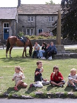
Monyash is a village
in the Derbyshire
Peak District
about five miles west of Bakewell
.
Monyash lies at an elevation of 300m above sea level, and has a population of about 280 people. The village is located in a shallow hollow in the limestone
plateau at the head of Lathkill Dale, which starts just outside of the village. Centred on a traditional village green, a crossroads of old routes leads respectively to Bakewell, Newhaven
, Youlgreave
and Buxton
.
of 1086 names the village as Maneis, a berwich of Bakewell and owned by the King. The name Maneis means "many springs or waters", after the pools of water, fed by springs, that lie on a narrow bed of clay in the middle of the village - an unusual feature in limestone country, that enabled life before piped water.
In an Anglo-Saxon
tumulus
on Benty Grange Farm, in the south of the parish, the famous Benty Grange helmet
was discovered in 1848. The village owes much of its existence to the presence of a small bed of impervious clay which capped the local limestone
and which held water in four "meres" (ponds); however, only one remains today, called Fere Mere, which is situated behind the Primary School. Up until the 20th century this pond provided the village's main supply of water.
The Domesday Book also refers to Monyash as "being a place of penal settlement for ill-behaved monks." In the Middle Ages
the monks of Roche Abbey
farmed at nearby One Ash Grange.
The village originated as a market centre. The remains of the market cross
date from 1340 when a grant was made to William de Lynford of Monyash to hold a weekly (Tuesday) market and an annual fair.
Monyash later became an important centre for lead mining
and was the site of a Barmote Court
. The National Gazetteer (1868) stated that "A court is held every six months for settling disputes relative to the lead mines in the hundred of High Peak". The mines, with their associated industries and occupations, resulted in the village having a population in 1851 of some 500 inhabitants, twice what it is today, and at this time there were five public houses. By 1881 the population had fallen to 399, and the last mine in the area to be worked - the Eagle Mine - closed in 1925. Today farming, local agriculture, and tourism are the main occupations.
, was founded in 1198. It has a Norman
piscina
and sedilia
. The chantry was rebuilt on the old foundations in 1887 as part of a major restoration work. The church contains a 15th century font.
John Gratton (1640–1711), who lived at One Ash Grange for 40 years, encouraged the development of the non-conformist movement, and from the late 18th century the village became a Quaker stronghold, often visited by the Radical Quaker statesman, John Bright
. Many of the lead mines were in fact operated by the London Lead Company, a Quaker firm. The old Quaker meeting house still stands on the road towards Flagg, adjacent to a Quaker cemetery.
The present Methodist Chapel was built in two parts. The orginal Primitive Methodist chapel was errected in 1835 and is now the church hall. A new Primitve Methodist Chapel was joined onto it in 1888.
On the village green are the 'King' and 'Queen' trees, planted to celebrate the Coronation of King George V
and Queen Mary
in 1910.
The Pinfold
, a pound
, is located on the edge of Monyash, on the road towards Flagg. Stray cattle and sheep were rounded up by the Pinder into this small walled enclosure, from which they could be retrieved, after payment of a fee.
Today there is only one remaining pub (the Bulls Head), which dates from the late 17th / early 18th century. There is also a cafe (The Old Smithy Tea Rooms), and there are Public Toilets on the Bakewell side of the village, nearer Lathkill Dale.
The village has a newly refurbished play area which was designed by children from the local school.
.
It has a School
, a pub (The Bulls Head), a Church, a Chapel
& a Quaker Meeting House.
The prehistoric Stone Circle Arbor Low
is also just 2.8 miles from the village.
Village
A village is a clustered human settlement or community, larger than a hamlet with the population ranging from a few hundred to a few thousand , Though often located in rural areas, the term urban village is also applied to certain urban neighbourhoods, such as the West Village in Manhattan, New...
in the Derbyshire
Derbyshire
Derbyshire is a county in the East Midlands of England. A substantial portion of the Peak District National Park lies within Derbyshire. The northern part of Derbyshire overlaps with the Pennines, a famous chain of hills and mountains. The county contains within its boundary of approx...
Peak District
Peak District
The Peak District is an upland area in central and northern England, lying mainly in northern Derbyshire, but also covering parts of Cheshire, Greater Manchester, Staffordshire, and South and West Yorkshire....
about five miles west of Bakewell
Bakewell
Bakewell is a small market town in the Derbyshire Dales district of Derbyshire, England, deriving its name from 'Beadeca's Well'. It is the only town included in the Peak District National Park, and is well known for the local confection Bakewell Pudding...
.
Monyash lies at an elevation of 300m above sea level, and has a population of about 280 people. The village is located in a shallow hollow in the limestone
Limestone
Limestone is a sedimentary rock composed largely of the minerals calcite and aragonite, which are different crystal forms of calcium carbonate . Many limestones are composed from skeletal fragments of marine organisms such as coral or foraminifera....
plateau at the head of Lathkill Dale, which starts just outside of the village. Centred on a traditional village green, a crossroads of old routes leads respectively to Bakewell, Newhaven
Newhaven, Derbyshire
Newhaven is a hamlet in the county of Derbyshire, England, east of Hartington and west of Cromford.The principal employer in the area is DSF Refractories & Minerals Ltd. The hamlet is located within the Peak District National Park....
, Youlgreave
Youlgreave
Youlgreave or Youlgrave is a village in the Derbyshire Peak District, lying on the River Bradford, four kilometres south of Bakewell. Both spellings are used on different local signposts and on different maps. The name possibly derives from "yellow grove" , though was historically called "Giolgrave"...
and Buxton
Buxton
Buxton is a spa town in Derbyshire, England. It has the highest elevation of any market town in England. Located close to the county boundary with Cheshire to the west and Staffordshire to the south, Buxton is described as "the gateway to the Peak District National Park"...
.
History
The Domesday BookDomesday Book
Domesday Book , now held at The National Archives, Kew, Richmond upon Thames in South West London, is the record of the great survey of much of England and parts of Wales completed in 1086...
of 1086 names the village as Maneis, a berwich of Bakewell and owned by the King. The name Maneis means "many springs or waters", after the pools of water, fed by springs, that lie on a narrow bed of clay in the middle of the village - an unusual feature in limestone country, that enabled life before piped water.
In an Anglo-Saxon
Anglo-Saxon
Anglo-Saxon may refer to:* Anglo-Saxons, a group that invaded Britain** Old English, their language** Anglo-Saxon England, their history, one of various ships* White Anglo-Saxon Protestant, an ethnicity* Anglo-Saxon economy, modern macroeconomic term...
tumulus
Tumulus
A tumulus is a mound of earth and stones raised over a grave or graves. Tumuli are also known as barrows, burial mounds, Hügelgrab or kurgans, and can be found throughout much of the world. A tumulus composed largely or entirely of stones is usually referred to as a cairn...
on Benty Grange Farm, in the south of the parish, the famous Benty Grange helmet
Benty Grange helmet
The Benty Grange helmet is an archaeological artefact excavated by Thomas Bateman in 1848 from an Anglo-Saxon tumulus at the Benty Grange Farm in the civil parish of Monyash in the English county of Derbyshire....
was discovered in 1848. The village owes much of its existence to the presence of a small bed of impervious clay which capped the local limestone
Limestone
Limestone is a sedimentary rock composed largely of the minerals calcite and aragonite, which are different crystal forms of calcium carbonate . Many limestones are composed from skeletal fragments of marine organisms such as coral or foraminifera....
and which held water in four "meres" (ponds); however, only one remains today, called Fere Mere, which is situated behind the Primary School. Up until the 20th century this pond provided the village's main supply of water.
The Domesday Book also refers to Monyash as "being a place of penal settlement for ill-behaved monks." In the Middle Ages
Middle Ages
The Middle Ages is a periodization of European history from the 5th century to the 15th century. The Middle Ages follows the fall of the Western Roman Empire in 476 and precedes the Early Modern Era. It is the middle period of a three-period division of Western history: Classic, Medieval and Modern...
the monks of Roche Abbey
Roche Abbey
Roche Abbey is a now-ruined abbey located near Maltby, South Yorkshire, England. It is situated in a valley alongside Maltby Beck and King's Wood.-Early history:...
farmed at nearby One Ash Grange.
The village originated as a market centre. The remains of the market cross
Market cross
A market cross is a structure used to mark a market square in market towns, originally from the distinctive tradition in Early Medieval Insular art of free-standing stone standing or high crosses, often elaborately carved, which goes back to the 7th century. Market crosses can be found in most...
date from 1340 when a grant was made to William de Lynford of Monyash to hold a weekly (Tuesday) market and an annual fair.
Monyash later became an important centre for lead mining
Derbyshire lead mining history
This article details some of the history of lead mining in Derbyshire, England.- Background :On one of the walls in Wirksworth church is a crude stone carving, found nearby at Bonsall and placed in the church in the 1870s. Probably executed in Anglo-Saxon times, it shows a man carrying a kibble or...
and was the site of a Barmote Court
Barmote Court
The Barmote Court is a court held in the lead mining districts of Derbyshire, England, for the purpose of determining the customs peculiar to the industry and also for the settlements of any disputes which may arise in connection therewith.The Barmote Courts were set up in 1288, their jurisdiction...
. The National Gazetteer (1868) stated that "A court is held every six months for settling disputes relative to the lead mines in the hundred of High Peak". The mines, with their associated industries and occupations, resulted in the village having a population in 1851 of some 500 inhabitants, twice what it is today, and at this time there were five public houses. By 1881 the population had fallen to 399, and the last mine in the area to be worked - the Eagle Mine - closed in 1925. Today farming, local agriculture, and tourism are the main occupations.
Buildings and structures
St Leonards Church, the parish churchChurch of England parish church
A parish church in the Church of England is the church which acts as the religious centre for the people within the smallest and most basic Church of England administrative region, known as a parish.-Parishes in England:...
, was founded in 1198. It has a Norman
Norman architecture
About|Romanesque architecture, primarily English|other buildings in Normandy|Architecture of Normandy.File:Durham Cathedral. Nave by James Valentine c.1890.jpg|thumb|200px|The nave of Durham Cathedral demonstrates the characteristic round arched style, though use of shallow pointed arches above the...
piscina
Piscina
A piscina is a shallow basin placed near the altar of a church, used for washing the communion vessels. The sacrarium is the drain itself. Anglicans usually refer to the basin, calling it a piscina. Roman Catholics usually refer to the drain, and by extension, the basin, as the sacrarium...
and sedilia
Sedilia
Sedilia , in ecclesiastical architecture, is the term used to describe stone seats, usually to be found on the south side of an altar, often in the chancel, for the use of the officiating priests...
. The chantry was rebuilt on the old foundations in 1887 as part of a major restoration work. The church contains a 15th century font.
John Gratton (1640–1711), who lived at One Ash Grange for 40 years, encouraged the development of the non-conformist movement, and from the late 18th century the village became a Quaker stronghold, often visited by the Radical Quaker statesman, John Bright
John Bright
John Bright , Quaker, was a British Radical and Liberal statesman, associated with Richard Cobden in the formation of the Anti-Corn Law League. He was one of the greatest orators of his generation, and a strong critic of British foreign policy...
. Many of the lead mines were in fact operated by the London Lead Company, a Quaker firm. The old Quaker meeting house still stands on the road towards Flagg, adjacent to a Quaker cemetery.
The present Methodist Chapel was built in two parts. The orginal Primitive Methodist chapel was errected in 1835 and is now the church hall. A new Primitve Methodist Chapel was joined onto it in 1888.
On the village green are the 'King' and 'Queen' trees, planted to celebrate the Coronation of King George V
George V of the United Kingdom
George V was King of the United Kingdom and the British Dominions, and Emperor of India, from 6 May 1910 through the First World War until his death in 1936....
and Queen Mary
Mary of Teck
Mary of Teck was the queen consort of the United Kingdom and the British Dominions, and Empress of India, as the wife of King-Emperor George V....
in 1910.
The Pinfold
Pinfold
Pinfold, in Medieval Britain, is an area where stray animals were rounded up if their owners failed to properly supervise their use of common grazing land...
, a pound
Pound (village)
The Village pound was a feature of most British medieval villages.A high walled and lockable structure it served several purposes; the most common use was to hold stray sheep, pigs and cattle until they were claimed by the owners, usually for the payment of a fine or levy. The pound could be as...
, is located on the edge of Monyash, on the road towards Flagg. Stray cattle and sheep were rounded up by the Pinder into this small walled enclosure, from which they could be retrieved, after payment of a fee.
Today there is only one remaining pub (the Bulls Head), which dates from the late 17th / early 18th century. There is also a cafe (The Old Smithy Tea Rooms), and there are Public Toilets on the Bakewell side of the village, nearer Lathkill Dale.
The village has a newly refurbished play area which was designed by children from the local school.
Festivals
Monyash also participates in the local custom of well dressingWell dressing
Well dressing is a summer custom practised in rural England in which wells, springs or other water sources are decorated with designs created from flower petals...
.
It has a School
School
A school is an institution designed for the teaching of students under the direction of teachers. Most countries have systems of formal education, which is commonly compulsory. In these systems, students progress through a series of schools...
, a pub (The Bulls Head), a Church, a Chapel
Chapel
A chapel is a building used by Christians as a place of fellowship and worship. It may be part of a larger structure or complex, such as a church, college, hospital, palace, prison or funeral home, located on board a military or commercial ship, or it may be an entirely free-standing building,...
& a Quaker Meeting House.
The prehistoric Stone Circle Arbor Low
Arbor Low
Arbor Low is a Neolithic henge monument in the Peak District, Derbyshire, England. Arbor Low is located in the White Peak zone of the Peak District in Derbyshire . The White Peak is a Carboniferous Limestone plateau lying between approximately 200-400m OD...
is also just 2.8 miles from the village.