

Midland Trail
Encyclopedia
For the trail's section in West Virginia see: The Midland Trail in West Virginia
.
 The Midland Trail, also called the Roosevelt Midland Trail, was a national auto trail
spanning the United States
from Washington, D.C.
west to Los Angeles, California
and San Francisco, California
( though the Lincoln Highway
guide published in 1916 states the original eastern terminus was in New York City
). First road signed in 1913, it was one of the first, if not the first, marked transcontinental auto trails in America.
and Clifton Forge, Virginia
to Charleston, West Virginia
and passing on through the Midland Trail in West Virginia
; through Morehead, KY to Lexington, Kentucky
; Louisville, Kentucky
; Vincennes, Indiana
; Salem, Illinois
; St. Louis, Missouri
; Sedalia, Missouri
; Kansas City, Missouri
and Topeka, Kansas
; to Limon, Colorado
and then on to Denver, Colorado
.
From Denver, the original routing split several ways to cross the rockies via Berthoud Pass
, Tennessee Pass
, Cochetopa Pass
, and Monarch Pass
. All routings converged in Grand Junction, Colorado
and continued into Utah
through Green River, Utah
and Salt Lake City. Past Salt Lake City, the routing moved southward across the Salt Lake Desert on the same routing as the Lincoln Highway
through Iosepa, Utah, Orr's Ranch, Fish Springs Ranch, and Ibapah, Utah
.
This part of the route was never popular, the state favoring the Victory Highway
routing to the north, which is the basic alignment later followed by Interstate 80
, and is now largely inaccessible as it is part of the Dugway Proving Grounds. In central Nevada
, the highway continued across the Great Basin Desert
through Ely
and Tonopah
then turning south at Goldfield
in the Amargosa Desert
and then west into California at Lida
and over the Inyo Mountains
and White Mountains
through Westgard Pass
.
At the junction in Big Pine, California
in the Owens Valley
, the original routing then split into four options:
to Mojave. The earlier alignment took a high line route to the west in the Sierra Nevada and Scodie Mountains
foothills around it following the Los Angeles Aqueduct
route past Jawbone Canyon
, thence following the Southern Pacific railroad tracks through Rosamond
and Lancaster
and on to Los Angeles, following the route that was later assigned to U.S. Route 6
—the Sierra Highway
) in 1937.
Various alignments of this portion of the trail followed the late 19th century Twenty-mule team roads built to haul gold from the Cerro Gordo Mines
across the Mojave Desert. and roads built for the early 20th century construction of the Los Angeles Aqueduct.
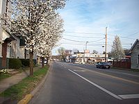
Midland Trail (West Virginia)
The Midland Trail is a National Scenic Byway which carries U.S. Highway 60 through a portion of Southern West Virginia between Charleston and Sam Black Church...
.
National auto trail
The system of auto trails was an informal network of marked routes that existed in the United States and Canada in the early part of the 20th century. Marked with colored bands on telephone poles, the trails were intended to help travellers in the early days of the automobile.Auto trails were...
spanning the United States
United States
The United States of America is a federal constitutional republic comprising fifty states and a federal district...
from Washington, D.C.
Washington, D.C.
Washington, D.C., formally the District of Columbia and commonly referred to as Washington, "the District", or simply D.C., is the capital of the United States. On July 16, 1790, the United States Congress approved the creation of a permanent national capital as permitted by the U.S. Constitution....
west to Los Angeles, California
Los Angeles, California
Los Angeles , with a population at the 2010 United States Census of 3,792,621, is the most populous city in California, USA and the second most populous in the United States, after New York City. It has an area of , and is located in Southern California...
and San Francisco, California
San Francisco, California
San Francisco , officially the City and County of San Francisco, is the financial, cultural, and transportation center of the San Francisco Bay Area, a region of 7.15 million people which includes San Jose and Oakland...
( though the Lincoln Highway
Lincoln Highway
The Lincoln Highway was the first road across the United States of America.Conceived and promoted by entrepreneur Carl G. Fisher, the Lincoln Highway spanned coast-to-coast from Times Square in New York City to Lincoln Park in San Francisco, originally through 13 states: New York, New Jersey,...
guide published in 1916 states the original eastern terminus was in New York City
New York City
New York is the most populous city in the United States and the center of the New York Metropolitan Area, one of the most populous metropolitan areas in the world. New York exerts a significant impact upon global commerce, finance, media, art, fashion, research, technology, education, and...
). First road signed in 1913, it was one of the first, if not the first, marked transcontinental auto trails in America.
Early routing
The early routing of the Midland Trail, from east to west, began in either New York City or Washington, D.C. and continued through RichmondRichmond, Virginia
Richmond is the capital of the Commonwealth of Virginia, in the United States. It is an independent city and not part of any county. Richmond is the center of the Richmond Metropolitan Statistical Area and the Greater Richmond area...
and Clifton Forge, Virginia
Clifton Forge, Virginia
Clifton Forge is a town in Alleghany County, Virginia, United States which is part of the Roanoke Region. The population was 3,884 at the 2010 census. The Jackson River flows through the town, which as a result was once known as Jackson's River Station....
to Charleston, West Virginia
Charleston, West Virginia
Charleston is the capital and largest city of the U.S. state of West Virginia. It is located at the confluence of the Elk and Kanawha Rivers in Kanawha County. As of the 2010 census, it has a population of 51,400, and its metropolitan area 304,214. It is the county seat of Kanawha County.Early...
and passing on through the Midland Trail in West Virginia
Midland Trail (West Virginia)
The Midland Trail is a National Scenic Byway which carries U.S. Highway 60 through a portion of Southern West Virginia between Charleston and Sam Black Church...
; through Morehead, KY to Lexington, Kentucky
Lexington, Kentucky
Lexington is the second-largest city in Kentucky and the 63rd largest in the US. Known as the "Thoroughbred City" and the "Horse Capital of the World", it is located in the heart of Kentucky's Bluegrass region...
; Louisville, Kentucky
Louisville, Kentucky
Louisville is the largest city in the U.S. state of Kentucky, and the county seat of Jefferson County. Since 2003, the city's borders have been coterminous with those of the county because of a city-county merger. The city's population at the 2010 census was 741,096...
; Vincennes, Indiana
Vincennes, Indiana
Vincennes is a city in and the county seat of Knox County, Indiana, United States. It is located on the Wabash River in the southwestern part of the state. The population was 18,701 at the 2000 census...
; Salem, Illinois
Salem, Illinois
Salem is a city located in the U.S. state of Illinois. It is the county seat of Marion County. The population was 7,485 at the 2010 census.Salem is the birthplace of William Jennings Bryan and his brother vice presidential candidate Charles W. Bryan, the G. I. Bill of Rights, and Miracle Whip salad...
; St. Louis, Missouri
St. Louis, Missouri
St. Louis is an independent city on the eastern border of Missouri, United States. With a population of 319,294, it was the 58th-largest U.S. city at the 2010 U.S. Census. The Greater St...
; Sedalia, Missouri
Sedalia, Missouri
Sedalia is a city located about south of the Missouri River in Pettis County, Missouri. U.S. Highway 50 and U.S. Highway 65 intersect in the city. As of 2006, the city had a total population of 20,669. It is the county seat of Pettis County. The Sedalia Micropolitan Statistical Area consists of...
; Kansas City, Missouri
Kansas City, Missouri
Kansas City, Missouri is the largest city in the U.S. state of Missouri and is the anchor city of the Kansas City Metropolitan Area, the second largest metropolitan area in Missouri. It encompasses in parts of Jackson, Clay, Cass, and Platte counties...
and Topeka, Kansas
Topeka, Kansas
Topeka |Kansa]]: Tó Pee Kuh) is the capital city of the U.S. state of Kansas and the county seat of Shawnee County. It is situated along the Kansas River in the central part of Shawnee County, located in northeast Kansas, in the Central United States. As of the 2010 census, the city population was...
; to Limon, Colorado
Limon, Colorado
Limon is a Statutory Town that is the most populous town in Lincoln County, Colorado, United States immediately east of Elbert County. The population was 2,071 at the 2000 census. Limon has been called the "Hub City" of Eastern Colorado because Interstate 70, U.S. Highways 24, 40, and 287, and...
and then on to Denver, Colorado
Colorado
Colorado is a U.S. state that encompasses much of the Rocky Mountains as well as the northeastern portion of the Colorado Plateau and the western edge of the Great Plains...
.
From Denver, the original routing split several ways to cross the rockies via Berthoud Pass
Berthoud Pass
Berthoud Pass is a high mountain pass in the Rocky Mountains of central Colorado in the United States.The pass is located west of Denver, and provides a high route between upper Clear Creek Canyon to the upper valley of the Fraser River in Middle Park to the north...
, Tennessee Pass
Tennessee Pass (Colorado)
Tennessee Pass elevation is a high mountain pass in the Rocky Mountains of central Colorado in the United States.The pass traverses the continental divide north of Leadville in a gap between the northern end of the Sawatch Range to the west and the northern end of the Mosquito Range to the east...
, Cochetopa Pass
Cochetopa Pass
Cochetopa Pass is a mountain pass in Colorado. It lies between the city of Gunnison and the town of Saguache. It lies on the Continental Divide, which separates the Gunnison and Rio Grande National Forests...
, and Monarch Pass
Monarch Pass
Monarch Pass is a high mountain pass in the Rocky Mountains of south-central Colorado in the United States.The pass is located on the continental divide at the southern end of the Sawatch Range along the border between Gunnison and Chaffee counties, approximately west of the town of Salida. The...
. All routings converged in Grand Junction, Colorado
Grand Junction, Colorado
The City of Grand Junction is the largest city in western Colorado. It is a city with a council–manager government form that is the county seat and the most populous city of Mesa County, Colorado, United States. Grand Junction is situated west-southwest of the Colorado State Capitol in Denver. As...
and continued into Utah
Utah
Utah is a state in the Western United States. It was the 45th state to join the Union, on January 4, 1896. Approximately 80% of Utah's 2,763,885 people live along the Wasatch Front, centering on Salt Lake City. This leaves vast expanses of the state nearly uninhabited, making the population the...
through Green River, Utah
Green River, Utah
Green River is a city in Emery County, Utah, United States. The population was 973 at the 2000 census.-Geography:Green River is located at , on the banks of the Green River, after which the city is named. The San Rafael Swell region is to the west of Green River, while Canyonlands National Park...
and Salt Lake City. Past Salt Lake City, the routing moved southward across the Salt Lake Desert on the same routing as the Lincoln Highway
Lincoln Highway
The Lincoln Highway was the first road across the United States of America.Conceived and promoted by entrepreneur Carl G. Fisher, the Lincoln Highway spanned coast-to-coast from Times Square in New York City to Lincoln Park in San Francisco, originally through 13 states: New York, New Jersey,...
through Iosepa, Utah, Orr's Ranch, Fish Springs Ranch, and Ibapah, Utah
Ibapah, Utah
Ibapah is a small unincorporated community in far western Tooele County, Utah, United States, near the Nevada state line. The town is located near the Deep Creek Mountains. The site was originally established in 1859 by Mormon missionaries sent to teach the local Native Americans farming methods...
.
This part of the route was never popular, the state favoring the Victory Highway
Victory Highway
The Victory Highway was an auto trail across the United States between New York City and San Francisco, roughly equivalent to the present U.S. Route 40.-History:...
routing to the north, which is the basic alignment later followed by Interstate 80
Interstate 80 in Utah
In the U.S. state of Utah, Interstate 80 runs east–west through northern part of the state, passing through the Bonneville Salt Flats, the Salt Lake City metropolitan area, the Wasatch Mountains and Echo canyon. In western Utah the highway was built along the corridor of the Victory...
, and is now largely inaccessible as it is part of the Dugway Proving Grounds. In central Nevada
Nevada
Nevada is a state in the western, mountain west, and southwestern regions of the United States. With an area of and a population of about 2.7 million, it is the 7th-largest and 35th-most populous state. Over two-thirds of Nevada's people live in the Las Vegas metropolitan area, which contains its...
, the highway continued across the Great Basin Desert
Great Basin Desert
The Great Basin Desert is an area of nearctic high deserts across parts of Nevada, California, and Utah that extends into the Colorado River watershed , but which is mostly a portion of the central Nevada desert basins of the Great Basin.It along with the Escalante Desert, Mohave Desert, the...
through Ely
Ely, Nevada
Ely is the largest city and county seat of White Pine County, Nevada, United States. Ely was founded as a stagecoach station along the Pony Express and Central Overland Route. Ely's mining boom came later than the other towns along US 50, with the discovery of copper in 1906...
and Tonopah
Tonopah, Nevada
Tonopah is a census-designated place located in and the county seat of Nye County, Nevada. It is located at the junction of U.S. Routes 6 and 95 approximately mid-way between Las Vegas and Reno....
then turning south at Goldfield
Goldfield, Nevada
Goldfield is an unincorporated community and the county seat of Esmeralda County, Nevada, United States, with a resident population of 440 at the 2000 census. It is located about southeast of Carson City, along U.S...
in the Amargosa Desert
Amargosa Desert
The Amargosa Desert is located in Nye County in western Nevada, United States, along the California–Nevada border. It is largely coincident with the geographic Amargosa Valley....
and then west into California at Lida
Lida, Nevada
Lida, Nevada is a small town in Esmeralda County, Nevada, near the border with California. It is located on State Route 266, north of Magruder Mountain....
and over the Inyo Mountains
Inyo Mountains
The Inyo Mountains are a short mountain range east of the Sierra Nevada mountains in eastern California in the United States. The range separates the Owens Valley to the west with Saline Valley to the east, extending for approximately 70 mi SSE from the southern end of the White Mountains,...
and White Mountains
White Mountains (California)
The White Mountains of California are a triangular fault block mountain range facing the Sierra Nevada across the upper Owens Valley. They extend for approximately as a greatly elevated plateau about wide on the south, narrowing to a point at the north, with elevations generally increasing...
through Westgard Pass
Westgard Pass
Westgard Pass is a narrow gap between the White and Inyo mountain ranges in the Basin and Range Province of California. Westgard Pass lies entirely within the Inyo National Forest, in northern Inyo County, California....
.
At the junction in Big Pine, California
Big Pine, California
Big Pine is a census-designated place in Inyo County, California, United States. Big Pine is located south-southeast of Bishop, at an elevation of 3990 feet . The population was 1,756 at the 2010 census, up from 1,350 at the 2000 census...
in the Owens Valley
Owens Valley
Owens Valley is the arid valley of the Owens River in eastern California in the United States, to the east of the Sierra Nevada and west of the White Mountains and Inyo Mountains on the west edge of the Great Basin section...
, the original routing then split into four options:
- The first through Mammoth LakesMammoth Lakes, California-History:The European history of Mammoth Lakes started in 1877, when four prospectors staked a claim on Mineral Hill, south of the current town, along Old Mammoth Road. In 1878, the Mammoth Mining Company was organized to mine Mineral Hill, which caused a gold rush. By the end of 1878, 1500 people...
, Mono LakeMono LakeMono Lake is a large, shallow saline lake in Mono County, California, formed at least 760,000 years ago as a terminal lake in a basin that has no outlet to the ocean...
, Yosemite, and StocktonStockton, CaliforniaStockton, California, the seat of San Joaquin County, is the fourth-largest city in the Central Valley of the U.S. state of California. With a population of 291,707 at the 2010 census, Stockton ranks as this state's 13th largest city...
to San Francisco. - The second second through Bridgeport, CaliforniaBridgeport, CaliforniaBridgeport is a census-designated place that is the county seat of Mono County, California. It lies at an elevation of 6463 feet in the middle of the Bridgeport Valley. Bridgeport is located at the intersection of highways US 395 and State Route 182. The population was 575 at the 2010...
, Lake TahoeLake TahoeLake Tahoe is a large freshwater lake in the Sierra Nevada of the United States. At a surface elevation of , it is located along the border between California and Nevada, west of Carson City. Lake Tahoe is the largest alpine lake in North America. Its depth is , making it the USA's second-deepest...
, and PlacervillePlacerville, CaliforniaPlacerville is the county seat of El Dorado County, California. The population was 10,389 at the 2010 census, up from 9,610 at the 2000 census. It is part of the Sacramento–Arden-Arcade–Roseville Metropolitan Statistical Area.-Geography:...
to Sacramento and then San Francisco. - The third south through IndependenceIndependence, CaliforniaIndependence is the county seat of Inyo County, California. Independence is located south-southeast of Bishop, at an elevation of 3930 feet . The population of this census-designated place was 669 at the 2010 census, up from 574 at the 2000 census....
and MojaveMojave, CaliforniaMojave is a census-designated place in Kern County, California, United States. Mojave is located east of Bakersfield, at an elevation of 2762 feet...
in the Mojave DesertMojave DesertThe Mojave Desert occupies a significant portion of southeastern California and smaller parts of central California, southern Nevada, southwestern Utah and northwestern Arizona, in the United States...
, and then west through Tehachapi PassTehachapi PassTehachapi Pass is a mountain pass crossing the Tehachapi Mountains in Kern County, California in the United States. The route over the pass connects the San Joaquin Valley to the Mojave Desert...
to the San Joaquin ValleySan Joaquin ValleyThe San Joaquin Valley is the area of the Central Valley of California that lies south of the Sacramento – San Joaquin River Delta in Stockton...
, and then northward through MercedMerced, CaliforniaMerced is a city in, and the county seat of, Merced County, California in the San Joaquin Valley of Northern California. As of the 2010 census, the city had a population of 78,958. Incorporated in 1889, Merced is a charter city that operates under a council-manager government...
and ModestoModesto, CaliforniaModesto is a city in, and is the county seat of, Stanislaus County, California. With a population of approximately 201,165 at the 2010 census, Modesto ranks as the 18th largest city in the state of California....
to San Francisco. - The fourth continuing southward from Mojave through Willow SpringsWillow Springs, Mono County, CaliforniaWillow Springs is an unincorporated community in Mono County, California. It is located on Virginia Creek south-southeast of Bridgeport, at an elevation of 6745 feet ....
to Los Angeles. By the time the Automobile Club of Southern CaliforniaAutomobile Club of Southern CaliforniaThe Automobile Club of Southern California is the Southern California affiliate of the American Automobile Association federation of motor clubs...
prepared their 1917 map of the state, the fourth routing, through Mojave and Willow Springs to Los AngelesLos ÁngelesLos Ángeles is the capital of the province of Biobío, in the commune of the same name, in Region VIII , in the center-south of Chile. It is located between the Laja and Biobío rivers. The population is 123,445 inhabitants...
, had become the main routing for the Midland Trail in California.
Realignment
Following a major realignment of the route and assumption into the state highway system around 1922, the main Midland Trail alignment in California bypassed early stagecoach-era stops at Freeman and Willow Springs and at the Neuralia railroad siding, and now routed through Red Rock CanyonRed Rock Canyon State Park (California)
Red Rock Canyon State Park features scenic desert cliffs, buttes and spectacular rock formations. The park is located where the southernmost tip of the Sierra Nevada converges with the El Paso Mountains....
to Mojave. The earlier alignment took a high line route to the west in the Sierra Nevada and Scodie Mountains
Scodie Mountains
The Scodie Mountains are located in the Sierra Nevada Mountains in California in the United States. The range lies in an east-west direction directly west of the town of Ridgecrest and southeast of Lake Isabella...
foothills around it following the Los Angeles Aqueduct
Los Angeles Aqueduct
The Los Angeles Aqueduct system comprising the Los Angeles Aqueduct and the Second Los Angeles Aqueduct, is a water conveyance system operated by the Los Angeles Department of Water and Power...
route past Jawbone Canyon
Jawbone Canyon
Jawbone Canyon is a geographic feature in the Mojave Desert and a Bureau of Land Management area located in Kern County, California. Located 20 miles north of Mojave on CA 14, the area is a popular destination for hikers and off road vehicle enthusiasts....
, thence following the Southern Pacific railroad tracks through Rosamond
Rosamond, California
Rosamond is a census-designated place in Kern County, California, USA, north of Palmdale, in the Antelope Valley, the westernmost desert valley of the Mojave Desert. Rosamond is also south of Mojave, , and north of Lancaster at an elevation of 2342 feet...
and Lancaster
Lancaster, California
Lancaster is a charter city in northern Los Angeles County, in the high desert, near the Kern County line. Lancaster currently ranks as the 30th largest city in California, and the 148th largest city in the United States. Lancaster is the principal city within the Antelope Valley...
and on to Los Angeles, following the route that was later assigned to U.S. Route 6
U.S. Route 6
U.S. Route 6 , also called the Grand Army of the Republic Highway, a name that honors an American Civil War veterans association, is a main route of the U.S. Highway system, running east-northeast from Bishop, California to Provincetown, Massachusetts. Until 1964, it continued south from Bishop to...
—the Sierra Highway
Sierra Highway
Sierra Highway or El Camino Sierra is a road in Southern California, United States. El Camino Sierra refers to the full length of a trail formed in the 19th century, rebuilt as highways in the early 20th century, that ran from Los Angeles to Lake Tahoe following parts of modern State Route 14, U.S....
) in 1937.
Various alignments of this portion of the trail followed the late 19th century Twenty-mule team roads built to haul gold from the Cerro Gordo Mines
Cerro Gordo Mines
The Cerro Gordo Mines were a collection of mines located in the Inyo Mountains, in Inyo County, California. Mining operations were undertaken from 1866 until 1957, producing high grade silver, lead, and zinc ore. Some ore was smelted on site, however the remote location led to larger scale...
across the Mojave Desert. and roads built for the early 20th century construction of the Los Angeles Aqueduct.
Routing
Using the present road names, the highway approximately used the following route:- U.S. Route 60U.S. Route 60U.S. Route 60 is an east–west United States highway, running from the Atlantic Ocean on the east coast in Virginia to western Arizona. Despite the final "0" in its number, indicating a transcontinental designation, the 1926 route formerly ended in Springfield, Missouri, at its intersection...
, Newport News, VirginiaNewport News, VirginiaNewport News is an independent city located in the Hampton Roads metropolitan area of Virginia. It is at the southeastern end of the Virginia Peninsula, on the north shore of the James River extending southeast from Skiffe's Creek along many miles of waterfront to the river's mouth at Newport News...
to Richmond, VirginiaRichmond, VirginiaRichmond is the capital of the Commonwealth of Virginia, in the United States. It is an independent city and not part of any county. Richmond is the center of the Richmond Metropolitan Statistical Area and the Greater Richmond area... - U.S. Route 1U.S. Route 1U.S. Route 1 is a major north–south U.S. Highway that serves the East Coast of the United States. It runs 2,377 miles from Fort Kent, Maine at the Canadian border south to Key West, Florida. U.S. 1 generally parallels Interstate 95, though it is significantly farther west between...
, State Route 54 (Virginia), U.S. Route 33U.S. Route 33U.S. Route 33 is a United States federal highway that runs northwest-southeast for 709 miles from northern Indiana to Richmond, Virginia, passing through Ohio and West Virginia en route. Although most odd-numbered U.S...
, State Route 22 (Virginia), and U.S. Route 250U.S. Route 250U.S. Route 250 is a route of the United States Numbered Highway System, and is a spur of U.S. Route 50. It currently runs for from Sandusky, Ohio to Richmond, Virginia. It passes through the states of Virginia, West Virginia, and Ohio. It goes through the cities of Richmond, Virginia,...
, Richmond to Staunton, VirginiaStaunton, VirginiaStaunton is an independent city within the confines of Augusta County in the commonwealth of Virginia. The population was 23,746 as of 2010. It is the county seat of Augusta County.... - Two alternate routes - U.S. Route 11U.S. Route 11U.S. Route 11 is a north–south United States highway extending 1,645 miles across the eastern United States. The southern terminus of the route is at U.S. Route 90 in the Bayou Sauvage National Wildlife Refuge in eastern New Orleans, Louisiana. The northern terminus is at the United...
and U.S. Route 60 or State Route 42 (Virginia), State Route 39 (Virginia), and U.S. Route 220U.S. Route 220U.S. Route 220 is a long U.S. Route in the eastern United States.US 220 is a spur route of U.S. Route 20 but at present, the two routes do not intersect nor do they connect via other spurs of US 20. The former U. S. Route 120, which was signed in Pennsylvania between 1926 and 1967, intersected...
, Staunton to Covington, VirginiaCovington, VirginiaCovington is an independent city in the U.S. state of Virginia, located at the confluence of Jackson River and Dunlap Creek. It is in Alleghany County where it is also the county seat. The population was 5,961 in 2010. The Bureau of Economic Analysis combines the city of Covington with Alleghany... - U.S. Route 60, Covington to Louisville, KentuckyLouisville, KentuckyLouisville is the largest city in the U.S. state of Kentucky, and the county seat of Jefferson County. Since 2003, the city's borders have been coterminous with those of the county because of a city-county merger. The city's population at the 2010 census was 741,096...
- U.S. Route 150U.S. Route 150U.S. Route 150 is a 571 mile long northwest-southeast United States highway, signed as east–west. It runs from U.S. Route 6 outside of Moline, Illinois to U.S. Route 25 in Mount Vernon, Kentucky .-Illinois:In the state of Illinois, U.S. 150 runs from the Quad City International Airport at U.S...
and U.S. Route 50U.S. Route 50U.S. Route 50 is a major east–west route of the U.S. Highway system, stretching just over from Ocean City, Maryland on the Atlantic Ocean to West Sacramento, California. Until 1972, when it was replaced by Interstate Highways west of the Sacramento area, it extended to San Francisco, near...
, Louisville to Kansas City, MissouriKansas City, MissouriKansas City, Missouri is the largest city in the U.S. state of Missouri and is the anchor city of the Kansas City Metropolitan Area, the second largest metropolitan area in Missouri. It encompasses in parts of Jackson, Clay, Cass, and Platte counties... - K-10 (Kansas) and U.S. Route 24U.S. Route 24U.S. Route 24 is one of the original United States highways of 1926. It originally ran from Pontiac, Michigan, in the east to Kansas City, Missouri, in the west. Today, the highway's eastern terminus is west of Clarkston, Michigan, at an intersection with I-75 and its western terminus is near...
, Kansas City to Limon, ColoradoLimon, ColoradoLimon is a Statutory Town that is the most populous town in Lincoln County, Colorado, United States immediately east of Elbert County. The population was 2,071 at the 2000 census. Limon has been called the "Hub City" of Eastern Colorado because Interstate 70, U.S. Highways 24, 40, and 287, and...
- U.S. Route 40U.S. Route 40U.S. Route 40 is an east–west United States highway. As with most routes whose numbers end in a zero, U.S. 40 once traversed the entire United States. It is one of the original 1920s U.S. Highways, and its first termini were San Francisco, California, and Atlantic City, New Jersey...
, Limon to Denver, ColoradoDenver, ColoradoThe City and County of Denver is the capital and the most populous city of the U.S. state of Colorado. Denver is a consolidated city-county, located in the South Platte River Valley on the western edge of the High Plains just east of the Front Range of the Rocky Mountains... - U.S. Route 40, Denver, former Colorado State Highway 11 (1923), (Kremmling, ColoradoKremmling, ColoradoKremmling is a Statutory Town in Grand County, Colorado, United States. The population was 1,578 at the 2000 census. The town sits along the upper Colorado River in the lower arid section of Middle Park between Byers Canyon and Gore Canyon...
-Wolcott, ColoradoWolcott, ColoradoWolcott is a census-designated place and a U.S. Post Office located in Eagle County, Colorado, United States. The population as of the 2010 Census was 15.The Wolcott Post Office has the ZIP Code 81655....
), U.S. Route 6U.S. Route 6U.S. Route 6 , also called the Grand Army of the Republic Highway, a name that honors an American Civil War veterans association, is a main route of the U.S. Highway system, running east-northeast from Bishop, California to Provincetown, Massachusetts. Until 1964, it continued south from Bishop to...
, and U.S. Route 89U.S. Route 89U.S. Route 89 is a north–south United States Highway with two sections, and one former section. The southern section runs for 848 miles from Flagstaff, Arizona, to the southern entrance of Yellowstone National Park...
, to Salt Lake CitySalt Lake City, UtahSalt Lake City is the capital and the most populous city of the U.S. state of Utah. The name of the city is often shortened to Salt Lake or SLC. With a population of 186,440 as of the 2010 Census, the city lies in the Salt Lake City metropolitan area, which has a total population of 1,124,197... - Old Lincoln HighwayLincoln HighwayThe Lincoln Highway was the first road across the United States of America.Conceived and promoted by entrepreneur Carl G. Fisher, the Lincoln Highway spanned coast-to-coast from Times Square in New York City to Lincoln Park in San Francisco, originally through 13 states: New York, New Jersey,...
, Salt Lake City to Ely, NevadaEly, NevadaEly is the largest city and county seat of White Pine County, Nevada, United States. Ely was founded as a stagecoach station along the Pony Express and Central Overland Route. Ely's mining boom came later than the other towns along US 50, with the discovery of copper in 1906...
- An alternate route, approved in 1922, followed U.S. Route 6 from Santaquin, UtahSantaquin, UtahSantaquin is a city in Utah County, Utah, United States. It is part of the Provo–Orem, Utah Metropolitan Statistical Area. The population was 4,834 at the 2000 census, while the 2008 estimates placed it at 8,400.-Geography:...
(south of Salt Lake City) to Ely.
- An alternate route, approved in 1922, followed U.S. Route 6 from Santaquin, Utah
- U.S. Route 6, Ely, NevadaEly, NevadaEly is the largest city and county seat of White Pine County, Nevada, United States. Ely was founded as a stagecoach station along the Pony Express and Central Overland Route. Ely's mining boom came later than the other towns along US 50, with the discovery of copper in 1906...
, U.S. Route 395U.S. Route 395 in CaliforniaIn the U.S. state of California, U.S. Route 395 is a route which traverses from Interstate 15 near the southern city limits of Hesperia, north to the Oregon state line in Modoc County near Goose Lake...
, State Route 14 (California), and San Fernando RoadSan Fernando RoadSan Fernando Road is a major street in the city and county of Los Angeles. It starts off in Castaic as The Old Road, passing through Santa Clarita and the Newhall Pass, whereupon its intersection with Sierra Highway near the junction of the Golden State and the Antelope Valley Freeways, it...
, San Fernando ValleySan Fernando ValleyThe San Fernando Valley is an urbanized valley located in the Los Angeles metropolitan area of southern California, United States, defined by the dramatic mountains of the Transverse Ranges circling it...
, to Los Angeles
Sources
- Rand McNallyRand McNallyRand McNally is an American publisher of maps, atlases, textbooks, and globes for travel, reference, commercial, and educational uses. It also provides online consumer street maps and directions, as well as commercial transportation routing software and mileage data...
Auto Road Atlas, 1926, accessed via the Broer Map Library: shows the entire route except in Missouri and Colorado - Clason Map CompanyClason Map CompanyThe Clason Map Company was a map company in the United States that went bankrupt in the Great Depression. It was owned by George Samuel Clason in Denver, Colorado. The company was the first to publish a road atlas of the United States and Canada....
, Touring Atlas of the United States, 1925 - Lincoln Highway Road Guide, 1917 (republished c1967)
- USGS Survey Maps, Mojave and Willow Springs quadrangles, 1913 and 1917 respectively
- Field checking conducted in 2005, 2006 and 2007