

List of World Heritage Sites in danger
Encyclopedia
The World Heritage ConventionFull title: Convention concerning the protection of the World Cultural and Natural Heritage laid down by the United Nations Educational, Scientific and Cultural Organization (UNESCO
) in 1972 provides the basis for the designation and management of World Heritage Site
s. According to article 11.4 of the convention, UNESCO, through the World Heritage Committee
, may place threatened World Heritage Sites whose conservation require major operations and for which "assistance has been requested" on a List of World Heritage in Danger. This action is intended to increase the international awareness to the threat and to encourage counteractive measures. Threats to a site can be either ascertained dangers which are proven imminent threats or potential dangers that could have adverse effects on the characteristics of a site.
In the case of natural sites, ascertained dangers include the serious decline in the population of an endangered or other valuable species or the deterioration of natural beauty or scientific value of a property by man-made activities such as logging
, pollution, human settlement, mining, agriculture and major public works. Ascertained dangers for cultural properties include serious deterioration of materials, structure, ornaments or architectural coherence and the loss of historical authenticity or cultural significance. Potential dangers for both cultural and natural sites include development projects, armed conflicts, insufficient management systems or changes in the legal protective status of the property. In the case of cultural sites gradual changes due to geology, climate or environment can also be potential dangers.
Before a property is inscribed on the List of World Heritage in Danger, its condition is assessed and a potential programme for corrective measures is developed in cooperation with the state party involved. The final decision about inscription lies in the hand of the committee. Financial support from the World Heritage Fund may be allocated by the committee for listed properties. The state of conservation is reviewed on a yearly basis. Depending on the outcome of the review, the committee may request additional measures or delete the property from the list if the threats ceased to exist or may consider deletion from both the List of World Heritage in Danger and the World Heritage List. Of the two former sites
, the Dresden Elbe Valley
has been delisted after placement on the List of World Heritage in Danger while the Arabian Oryx Sanctuary
has been directly delisted. As of 2011, there are 35 entries (17 natural, 18 cultural) on the List of World Heritage in Danger. Many of the listed sites are located in the developing world with 15 in Africa (of which five are in the Democratic Republic of the Congo
), 10 in AsiaIncludes the Jerusalem site, 7 in the Americas and 3 in Europe.Includes two sites in Georgia
The majority of endangered natural sites (12) is located in Africa.
While danger listing has sparked conservation efforts and released funding, resulting in a positive development of some sites such as Galápagos
or Yellowstone
, the list itself and UNESCO's implementation of it have been the focus of criticism. In particular state parties and other stakeholders of World Heritage Sites have questioned the authority of the Committee to declare a site in danger without their consent. Until UNESCO set a precedent in 1992 placing several sites on the danger list against their view, state parties would have first submitted a program of corrective measures before a site could listed. Instead of being used as intended, the List of World Heritage in Danger is perceived by some states as a black list and according to Christina Cameron, Professor at the School of Architecture, Canada Research Chair on Built Heritage, University of Montreal, has been used as political tool to get the attention of state parties. The International Union for Conservation of Nature (IUCN) notes that UNESCO has referenced the List of World Heritage in Danger (without actually listing the site) in a number of cases where the threat could be easily addressed by the state party. The Union also argues that listing a site as endangered over a long period of time is questionable and that other mechanisms for conservation should be sought in these cases.
was listed from 1993 to 2007 and again since 2010; the Río Plátano Biosphere Reserve
was listed from 1996 to 2007 and again since 2011. Both are therefore included in the list of currently listed sites (above).
UNESCO
The United Nations Educational, Scientific and Cultural Organization is a specialized agency of the United Nations...
) in 1972 provides the basis for the designation and management of World Heritage Site
World Heritage Site
A UNESCO World Heritage Site is a place that is listed by the UNESCO as of special cultural or physical significance...
s. According to article 11.4 of the convention, UNESCO, through the World Heritage Committee
World Heritage Committee
The World Heritage Committee establishes the sites to be listed as UNESCO World Heritage Sites. It is responsible for the implementation of the World Heritage Convention, defines the use of the World Heritage Fund and allocates financial assistance upon requests from States Parties...
, may place threatened World Heritage Sites whose conservation require major operations and for which "assistance has been requested" on a List of World Heritage in Danger. This action is intended to increase the international awareness to the threat and to encourage counteractive measures. Threats to a site can be either ascertained dangers which are proven imminent threats or potential dangers that could have adverse effects on the characteristics of a site.
In the case of natural sites, ascertained dangers include the serious decline in the population of an endangered or other valuable species or the deterioration of natural beauty or scientific value of a property by man-made activities such as logging
Logging
Logging is the cutting, skidding, on-site processing, and loading of trees or logs onto trucks.In forestry, the term logging is sometimes used in a narrow sense concerning the logistics of moving wood from the stump to somewhere outside the forest, usually a sawmill or a lumber yard...
, pollution, human settlement, mining, agriculture and major public works. Ascertained dangers for cultural properties include serious deterioration of materials, structure, ornaments or architectural coherence and the loss of historical authenticity or cultural significance. Potential dangers for both cultural and natural sites include development projects, armed conflicts, insufficient management systems or changes in the legal protective status of the property. In the case of cultural sites gradual changes due to geology, climate or environment can also be potential dangers.
Before a property is inscribed on the List of World Heritage in Danger, its condition is assessed and a potential programme for corrective measures is developed in cooperation with the state party involved. The final decision about inscription lies in the hand of the committee. Financial support from the World Heritage Fund may be allocated by the committee for listed properties. The state of conservation is reviewed on a yearly basis. Depending on the outcome of the review, the committee may request additional measures or delete the property from the list if the threats ceased to exist or may consider deletion from both the List of World Heritage in Danger and the World Heritage List. Of the two former sites
Former UNESCO World Heritage Sites
The designation of World Heritage Site is a highly prestigious affair. Such a designation bestows not only honor but also has economic implications as it enhances tourism. World Heritage sites may lose their designation when the UNESCO World Heritage Committee determines that the designated site is...
, the Dresden Elbe Valley
Dresden Elbe Valley
The Dresden Elbe Valley is a former World Heritage Site in Dresden, Germany. The valley, extending for some 20 kilometres and passingthrough the Dresden Basin and the city of Dresden, is one of two cultural landscapes along the Central European river Elbe...
has been delisted after placement on the List of World Heritage in Danger while the Arabian Oryx Sanctuary
Arabian Oryx Sanctuary
The Arabian Oryx Sanctuary is an animal sanctuary in the Omani Central Desert and Coastal Hills. Within its boundaries are found rare fauna, including a free-ranging herd of Arabian oryx, the first since the species' extinction in the wild in 1972, and subsequent reintroduction in 1982 at this...
has been directly delisted. As of 2011, there are 35 entries (17 natural, 18 cultural) on the List of World Heritage in Danger. Many of the listed sites are located in the developing world with 15 in Africa (of which five are in the Democratic Republic of the Congo
Democratic Republic of the Congo
The Democratic Republic of the Congo is a state located in Central Africa. It is the second largest country in Africa by area and the eleventh largest in the world...
), 10 in AsiaIncludes the Jerusalem site, 7 in the Americas and 3 in Europe.Includes two sites in Georgia
Georgia (country)
Georgia is a sovereign state in the Caucasus region of Eurasia. Located at the crossroads of Western Asia and Eastern Europe, it is bounded to the west by the Black Sea, to the north by Russia, to the southwest by Turkey, to the south by Armenia, and to the southeast by Azerbaijan. The capital of...
The majority of endangered natural sites (12) is located in Africa.
While danger listing has sparked conservation efforts and released funding, resulting in a positive development of some sites such as Galápagos
Galápagos Islands
The Galápagos Islands are an archipelago of volcanic islands distributed around the equator in the Pacific Ocean, west of continental Ecuador, of which they are a part.The Galápagos Islands and its surrounding waters form an Ecuadorian province, a national park, and a...
or Yellowstone
Yellowstone National Park
Yellowstone National Park, established by the U.S. Congress and signed into law by President Ulysses S. Grant on March 1, 1872, is a national park located primarily in the U.S. state of Wyoming, although it also extends into Montana and Idaho...
, the list itself and UNESCO's implementation of it have been the focus of criticism. In particular state parties and other stakeholders of World Heritage Sites have questioned the authority of the Committee to declare a site in danger without their consent. Until UNESCO set a precedent in 1992 placing several sites on the danger list against their view, state parties would have first submitted a program of corrective measures before a site could listed. Instead of being used as intended, the List of World Heritage in Danger is perceived by some states as a black list and according to Christina Cameron, Professor at the School of Architecture, Canada Research Chair on Built Heritage, University of Montreal, has been used as political tool to get the attention of state parties. The International Union for Conservation of Nature (IUCN) notes that UNESCO has referenced the List of World Heritage in Danger (without actually listing the site) in a number of cases where the threat could be easily addressed by the state party. The Union also argues that listing a site as endangered over a long period of time is questionable and that other mechanisms for conservation should be sought in these cases.
Legend
- Name; as listed by the World Heritage Committee
- Location; at city or provincial level and country name, with coordinates; column sorts by stateThe Jerusalem site is not associated with a state by UNESCO and sorts as "Jerusalem".
- Criteria; the site was listed under
- Area; in hectares and acres if provided by UNESCO
- Year (WHS); the year the site was inscribed on the World Heritage List
- Endangered; the year the site appeared on the List of World Heritage in Danger
- Reason; threats to the site which prompted UNESCO to list it as in danger
Currently listed sites
| Name | Image | Location | Criteria | Area ha (acre) |
Year (WHS) | Endangered | Reason | Refs |
|---|---|---|---|---|---|---|---|---|
| Abu Mena Abu Mena Abu Mena was a town, monastery complex and Christian pilgrimage center in Late Antique Egypt, about 45 km southwest of Alexandria. Its remains were designated a World Heritage Site in 1979... |
 |
Abusir Abusir (Lake Mariout) Abusir, or Abousir is a seaside town on the shore of Lake Mariout on the western extremity of Egypt's Nile delta. It is situated about SW of Alexandria. Ruins of an ancient temple and an ancient replica of the Lighthouse of Alexandria are to be seen here... ,  Egypt Egypt30°50′30"N 29°39′50"E |
Cultural: (iv) |
182 (449.7 acre) | 1979 | 2001 | Cave-ins in the area caused by the clay at the surface, which becomes semi-liquid when met with "excess water" | |
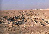
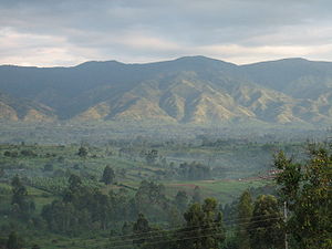
| Air and Ténéré Natural Reserves Aïr Mountains The Aïr Mountains is a triangular massif, located in northern Niger, within the Sahara desert... |
 |
Arlit Department Arlit Department Arlit is a department of the Agadez Region in Niger. Its capital lies at the city of Arlit.-Communes:It is divided administratively into the following communes:*Afassa*Aguelal*Arlit*Assarara*Elok*Gougaram*Iferouane*Imourarene*I-n-Azaoua*Inignaouei... ,  Niger Niger18°17′N 8°0′E |
Natural: (vii), (ix), (x) |
7736000 (19,116,055.4 acre) | 1991 | 1992 | Military conflict and civil disturbance in the region as well as a reduction of wildlife population and degradation of the vegetation cover | |
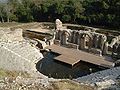
| Ashur Assur Assur , was one of the capitals of ancient Assyria. The remains of the city are situated on the western bank of river Tigris, north of the confluence with the tributary Little Zab river, in modern day Iraq, more precisely in the Al-Shirqat District .Assur is also... (Qal'at Sherqat) |
Salah ad Din, Iraq Iraq35°27′24"N 43°15′45"E |
Cultural: (iii), (iv) |
70 (173 acre) | 2003 | 2003 | A planned reservoir that would have partially flooded the site was suspended in the wake of the Iraq War by the new administration; lack of adequate protection | ||
| Bagrati Cathedral Bagrati Cathedral The Cathedral of the Dormition, or the Kutaisi Cathedral, more commonly known as Bagrati Cathedral , is the 11th-century cathedral church in the city of Kutaisi, the region of Imereti, Georgia... and Gelati Monastery Gelati Monastery The Monastery of Gelati is a monastic complex near Kutaisi, Imereti, western Georgia. It contains the Church of the Virgin founded by the King of Georgia David the Builder in 1106, and the 13th-century churches of St George and St Nicholas.... |
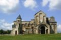 |
Imereti Imereti Imereti is a province in Georgia situated along the middle and upper reaches of the Rioni river. It consists of the following Georgian administrative-territorial units:#Kutaisi #Baghdati region#Vani region#Zestafoni region... ,  Georgia (country) Georgia (country)42°15′44"N 42°42′59"E |
Cultural: (iv) |
7.87 (19.4 acre) | 1994 | 2010 | Major reconstruction project that will lead to irreversible interventions and undermine the authenticity and integrity of the site | |
| Bam and its Cultural Landscape | 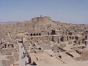 |
Kerman, Iran Iran29°07′00.68"N 58°22′06.51"E |
Cultural: (ii), (iii), (iv), (v) |
0— | 2004 | 2004 | Following the damage due to the 2003 Bam earthquake 2003 Bam earthquake The 2003 Bam earthquake was a major earthquake that struck Bam and the surroundingKerman province of southeastern Iran at 1:56 AM UTC on Friday, December 26, 2003. The most widely accepted estimate for the magnitude of the earthquake is a moment magnitude of 6.6; estimated by the United... |
|
| Belize Barrier Reef Reserve System |  |
Belize Belize District The Belize District is a district of the nation of Belize, with its district capital being the nation's largest city, Belize City.- Settlements :... , Stann Creek Stann Creek District Stann Creek District is a district in the south east region of Belize. According to the 2010 census, the district had a population of 32,166 people... and Toledo Toledo District Toledo District is the southernmost district in Belize, and Punta Gorda the District capital. Although the least developed region in the country, it features some of the most pristine rainforests, extensive cave networks, coastal lowland plains, and offshore cays...  Belize Belize17°19′N 87°32′W |
Natural: (vii), (ix), (x) |
96300 (237,962.3 acre) | 1996 | 2009 | Mangrove cutting and excessive development | |
| Chan Chan Archaeological Zone | 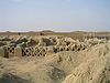 |
La Libertad La Libertad Region La Libertad is a region in northwestern Peru. Formerly it was known as the 'Department of La Libertad" , a political division that generally corresponds to a state in the United States of America... ,  Peru Peru8°6′40"S 79°04′30"W |
Cultural: (i), (iii) |
600 (1,482.6 acre) | 1986 | 1986 | Natural erosion | |
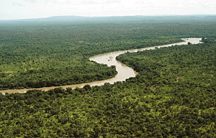
| Comoé National Park Comoé National Park Comoé National Park is a national park in north eastern Côte d'Ivoire as well as a UNESCO World Heritage Site since its inscription in 1983. It is in the Ivoirian Zanzan Region between the towns of Kong to the west of both the park and the Comoé River, and Bouna to the east of the park, and just... |
Zanzan Zanzan Zanzan is one of the 19 regions of Côte d'Ivoire, West Africa. The region's capital is Bondoukou. Covering 38,000 km², its population is 839,000.The region is divided into three departments: Bondoukou, Bouna, and Tanda.... ,  Côte d'Ivoire Côte d'Ivoire9°10′N 3°40′W |
Natural: (ix), (x) |
1150000 (2,841,709.4 acre) | 1983 | 2003 | Civil unrest, poaching and lack of effective management mechanisms | ||
| Coro and its Port | Falcón Falcón Falcón State is one of the 23 states into which Venezuela is divided. The state capital is Coro.-Demographics and geography:Falcón State covers a total surface area of 24,800 km² and, in 2010, had an estimated population of 950,057. The Paraguaná Peninsula is connected to the rest of the... ,  Venezuela Venezuela11°25′N 69°40′W |
Cultural: (iv), (v) |
107 (264.4 acre) | 1993 | 2005 | Damage to a great number of structures due to heavy rain between November 2004 and February 2005 as well as the construction of a new monument, a beach walkway and an entrance gate to the city in the buffer zone which could have considerable impact on the value of the site | ||
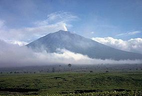
| Cultural Landscape and Archaeological Remains of the Bamiyan Valley | Bamyan, Afghanistan Afghanistan34°49′55"N 67°49′36"E |
Cultural: (i), (ii), (iii), (iv), (vi) |
159 (392.9 acre) | 2003 | 2003 | Fragile conservation state due to abandonment, military action and dynamite explosions; causing dangers such as risk of collapse of Buddha niches, further deterioration of cave murals, looting and illicit excavations | ||
| Everglades National Park Everglades National Park Everglades National Park is a national park in the U.S. state of Florida that protects the southern 25 percent of the original Everglades. It is the largest subtropical wilderness in the United States, and is visited on average by one million people each year. It is the third-largest... |
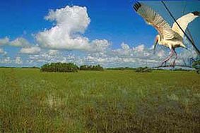 |
Florida Florida Florida is a state in the southeastern United States, located on the nation's Atlantic and Gulf coasts. It is bordered to the west by the Gulf of Mexico, to the north by Alabama and Georgia and to the east by the Atlantic Ocean. With a population of 18,801,310 as measured by the 2010 census, it... ,  United States United States25°19′N 80°56′W |
Natural: (viii), (ix), (x) |
592920 (1,465,135.9 acre) | 1979 | 1993–2007, 2010 | Damage due to Hurricane Andrew Hurricane Andrew Hurricane Andrew was the third Category 5 hurricane to make landfall in the United States, after the Labor Day Hurricane of 1935 and Hurricane Camille in 1969. Andrew was the first named storm and only major hurricane of the otherwise inactive 1992 Atlantic hurricane season... and deterioration of water flow and quality due to agricultural and urban development (1993); continued degradation of the site resulting in a loss of marine habitat and decline in marine species (2010) |
|
| Humberstone and Santa Laura Saltpeter Works Humberstone and Santa Laura Saltpeter Works Humberstone and Santa Laura Saltpeter Works are two former saltpeter refineries located in northern Chile. They were declared a UNESCO World Heritage Site in 2005.-Geography:... |
 |
Tarapacá Tarapacá Region The I Tarapacá Region is one of Chile's 15 first order administrative divisions. It borders the Chilean Arica and Parinacota Region to the north, Bolivia's Oruro Department on the east, the Antofagasta Region on the south and the Pacific Ocean on the west. The port city of Iquique The I Tarapacá... ,  Chile Chile20°12′30"S 69°47′40"W |
Cultural: (ii), (iii), (iv) |
0— | 2005 | 2005 | Fragile nature of structures due to lack of maintenance for 40 years; also damage, vandalism and some dismantling; looting | |
| Fort Lahore Fort The Lahore Fort, locally referred to as Shahi Qila is citadel of the city of Lahore, Punjab, Pakistan. It is located in the northwestern corner of the Walled City of Lahore... and Shalamar Gardens Shalimar Gardens (Lahore) The Shalimar Gardens , sometimes written Shalamar Gardens, is a Persian garden and it was built by the Mughal emperor Shah Jahan in Lahore, modern day Pakistan. Construction began in 1641 CE and was completed the following year... in Lahore Lahore Lahore is the capital of the Pakistani province of Punjab and the second largest city in the country. With a rich and fabulous history dating back to over a thousand years ago, Lahore is no doubt Pakistan's cultural capital. One of the most densely populated cities in the world, Lahore remains a... |
Punjab, Pakistan Pakistan31°35′25"N 74°18′35"E |
Cultural: (i), (ii), (iii) |
0— | 1981 | 2000 | Destruction of historic water tanks in 1999 to widen a road and deteriorating perimeter walls of the Garden, listed on request of the Pakistan government | ||
| Garamba National Park Garamba National Park Garamba National Park, located in the Democratic Republic of the Congo in Africa, was established in 1938. One of Africa's oldest National parks, it was designated a UNESCO World Heritage Site in 1980. Garamba is the home to the world's last known wild population of Northern White Rhinoceros... |
Orientale, Democratic Republic of the Congo Democratic Republic of the Congo4°0′N 29°15′E |
Natural: (vii), (x) |
500000 (1,235,525.8 acre) | 1980 | 1984–1992, 1996 | Reduction of Northern White Rhinoceros Northern White Rhinoceros The northern white rhinoceros, or northern square-lipped rhinoceros , is one of the two subspecies of the white rhinoceros. This subspecies is a grazer in grasslands and savanna woodlands. These animals are now feared to be extinct in the wild. There are currently seven left in captivity... population (1984); poaching of two white rhinos, killing of three rangers and no plan for corrective measures by the authorities (1996) |
|
|
| Historical Monuments of Mtskheta | 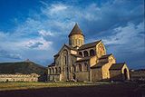 |
Mtskheta-Mtianeti Mtskheta-Mtianeti Mtskheta-Mtianeti is a region in eastern Georgia comprising the town of Mtskheta, which serves as a regional capital, together with its district and the adjoining mountainous areas.- External links :... , Georgia (country)41°51′N 44°43′E |
Cultural: (iii), (iv) |
0— | 1994 | 2009 | Concerns about the preservation of the site | |
| Historic Town of Zabīd Zabid Zabid is a town with an urban population of around 23,000 persons on Yemen's western coastal plain. The town, named after Wadi Zabid, the wadi to its south, is one of the oldest towns in Yemen... |
Al Hudaydah Al Hudaydah Governorate Al Hudaydah is a governorate of Yemen. Its capital is Al Hudaydah.This governorate borders the Red Sea and is part of the narrow Tihamah region... ,  Yemen Yemen14°12′N 43°19′E |
Cultural: (ii), (iv), (vi) |
0— | 1993 | 2000 | Deteriorating state of historic buildings, inscribed on request of the state party | ||
| Kahuzi-Biega National Park Kahuzi-Biéga National Park Kahuzi-Biéga National Park is in eastern Democratic Republic of the Congo, 50 km west of the town of Bukavu in the Kivu Region, near to the western side of Lake Kivu and the Rwandan border.... |
South Kivu and Maniema Maniema Maniema is a province of the Democratic Republic of the Congo. Its capital is Kindu.Following the 2005 Constitution , 25 new provinces were to be created from the 10 current provinces within 36 months . As of October 2010, this had not taken place... , Democratic Republic of the Congo2°30′S 28°45′E |
Natural: (x) |
600000 (1,482,631 acre) | 1980 | 1997 | Deforestation, hunting as well as war and civil strife | ||
| Los Katíos National Park Los Katíos National Park Los Katíos National Park is a national park located in northwest Colombia which covers 278 square miles . It is a part of the Darién Gap, shared by Panama and Colombia and is contiguous to Darién National Park in Panama. The Pan-American Highway when completed as proposed will pass near or through... |
Antioquia Antioquia Department Antioquia is one of the 32 departments of Colombia, located in the central northwestern part of Colombia with a narrow section that borders the Caribbean Sea. Most of its territory is mountainous with some valleys, much of which is part of the Andes mountain range... and Chocó Chocó Department Chocó is a department of Colombia known for its large Afro-Colombian population. It is in the west of the country, and is the only Colombian department to have coastlines on both the Pacific Ocean and the Atlantic Ocean. It also has all of Colombia's border with Panama. Its capital is... ,  Colombia Colombia7°40′N 77°0′W |
Natural: (ix), (x) |
72000 (177,915.7 acre) | 1994 | 2009 | Deforestation, illegal fishing and hunting | ||
| Manovo-Gounda St Floris National Park | Bamingui-Bangoran Bamingui-Bangoran Bamingui-Bangoran is one of the 14 prefectures of the Central African Republic. It covers an area of 58,200 km² and has a population of 38,437 . The population density of 0.66/km² is the lowest in the country... ,  Central African Republic Central African Republic9°0′N 21°30′E |
Natural: (ix), (x) |
1740000 (4,299,629.8 acre) | 1988 | 1997 | Illegal grazing and poaching, deteriorating security situation | ||
| Minaret and Archaeological Remains of Jam |  |
Ghōr, Afghanistan 34°23′48"N 64°30′58"E |
Cultural: (ii), (iii), (iv) |
70 (173 acre) | 2002 | 2002 | Lack of legal protection, lack of protection measure or management plan, poor condition of the site | |
| Medieval Monuments in Kosovo Medieval Monuments in Kosovo Medieval Monuments in Kosovo is a World Heritage Site consisting of four Serbian Orthodox Christian churches and monasteries which represent the fusion of the eastern Orthodox Byzantine and the western Romanesque ecclesiastical architecture to form the Palaiologian Renaissance style... |
Kosovo Kosovo Kosovo is a region in southeastern Europe. Part of the Ottoman Empire for more than five centuries, later the Autonomous Province of Kosovo and Metohija within Serbia... ,  Serbia Serbia42°39′40"N 20°15′56"E |
Cultural: (ii), (iii), (iv) |
2.88 (7.1 acre) | 2004 | 2006 | Lack of legal protection and management; political instability and security | ||
| Mount Nimba Strict Nature Reserve Mount Nimba Strict Nature Reserve Mount Nimba Strict Nature Reserve is a protected area and UNESCO World Heritage Site in both Guinea and Côte d'Ivoire. A further extension of the reserve to include areas in Liberia has also been proposed.... |
Lola Prefecture Lola Prefecture Lola is a prefecture located in the Nzérékoré Region of Guinea. The capital is Lola. The prefecture covers an area of 3,940 km.² and has an estimated population of 124,000.-Sub-prefectures:The prefecture is divided admininstratively into 9 sub-prefectures:... , Côte d'Ivoire* Guinea* Guinea*7°36′N 8°23′W |
Natural: (ix), (x) |
18000 (44,478.9 acre) | 1981 | 1992 | Iron ore mining concession on part of the World Heritage Site and influx of large number of refugees on the Guinean part of the site | ||
| Niokolo-Koba National Park Niokolo-Koba National Park The Niokolo-Koba National Park is a World Heritage Site and natural protected area in south eastern Senegal near the Guinea-Bissau border.-National Park:... |
 |
Tambacounda Region Tambacounda Region Tambacounda, formerly known as Sénégal Orientale, is a region of Senegal. It used to be part of the Mali Empire before the borders were created to separate Mali from Senegal. Tambacounda is physically the largest of Senegal's 11 regions, but is sparsely populated and its economy lags behind the... and Kédougou Region Kédougou Region Kédougou Region is a region of Senegal. It was created in 2008. Formerly it was a department in the Region of Tambacounda.Kedougou has a number of ecotourism attractions... ,  Senegal Senegal13°0′N 12°40′W |
Natural: (x) |
913000 (2,256,070.1 acre) | 1981 | 2007 | Degradation of property, low mammal population, management problems and impact of a proposed dam on the Gambia River Gambia River The Gambia River is a major river in West Africa, running from the Fouta Djallon plateau in north Guinea westward through Senegal and The Gambia to the Atlantic Ocean at the city of Banjul... |
|
| Okapi Wildlife Reserve Okapi Wildlife Reserve The Okapi Wildlife Reserve is a World Heritage Site in the Ituri Forest in the north-east of the Democratic Republic of the Congo, near the borders with Sudan and Uganda... |
 |
Orientale, Democratic Republic of the Congo 2°0′N 28°30′E |
Natural: (x) |
1372625 (3,391,827.2 acre) | 1996 | 1997 | Looting of park facilities and killing of elephants as a result of an armed conflict in the area | |
| Old City of Jerusalem and its Walls | 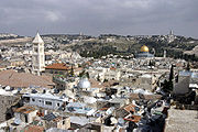 |
Jerusalem District Jerusalem District The Jerusalem District is one of six administrative districts of Israel. The district capital is Jerusalem. The Jerusalem District has a land area of 652 km². The population of 910,300 is 67.8% Jewish and 30.6% Arab... (no nation named by UNESCO)Site proposed by Jordan Jordan Jordan , officially the Hashemite Kingdom of Jordan , Al-Mamlaka al-Urduniyya al-Hashemiyya) is a kingdom on the East Bank of the River Jordan. The country borders Saudi Arabia to the east and south-east, Iraq to the north-east, Syria to the north and the West Bank and Israel to the west, sharing... . UNSECO has stated that "In line with relevant UN resolutions, East Jerusalem East Jerusalem East Jerusalem or Eastern Jerusalem refer to the parts of Jerusalem captured and annexed by Jordan in the 1948 Arab-Israeli War and then captured and annexed by Israel in the 1967 Six-Day War... remains part of the occupied Palestinian territory, and the status of Jerusalem must be resolved in permanent status negotiations between Israel and the Palestinians." 31°46′36"N 35°14′03"E |
Cultural: (ii), (iii), (vi) |
0— | 1981 | 1982 | Uncontrolled urban development, general deterioration of the state of conservation due to tourism and lack of maintenance | |
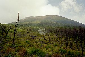
| Rainforests of the Atsinanana Rainforests of the Atsinanana The Rainforests of the Atsinanana is a World Heritage Site that was inscribed in 2007 and consists 13 specific areas located within six national parks in the eastern part of Madagascar... |
Eastern Madagascar, Madagascar Madagascar14°28′S 49°42′E |
Natural: (ix), (x) |
479660 (1,185,264.6 acre) | 2007 | 2010 | Illegal logging and hunting of endangered lemurs | ||
| Rice Terraces of the Philippine Cordilleras Rice Terraces of the Philippine Cordilleras The Rice Terraces of the Philippine Cordilleras were inscribed on the UNESCO World Heritage List in 1995. This inscription has five sites: the Batad Rice Terraces, Bangaan Rice Terraces , Mayoyao Rice Terraces , Hungduan Rice Terraces and Nagacadan Rice Terraces , all in the Ifugao Province, the... |
Ifugao Ifugao Ifugao is a landlocked province of the Philippines in the Cordillera Administrative Region in Luzon. Covering a total land area of 262,820 hectares, the province of Ifugao is located in a mountainous region characterized by rugged terrain, river valleys, and massive forests... ,  Philippines Philippines16°55′N 121°3′E |
Cultural: (iii), (iv), (v) |
500000 (1,235,525.8 acre) | 1995 | 2001 | Absence of systematic monitoring programme or a comprehensive management plan | ||
| Río Plátano Biosphere Reserve Río Plátano Biosphere Reserve The Río Plátano Biosphere Reserve is 5,250 km² of preserved land in the La Mosquitia region on the Caribbean coast of Honduras. Most of the land runs along the Río Plátano. The reserve has a number of endangered species and some of Honduras largest sections of forest. It has been a World... |
La Mosquitia La Mosquitia La Mosquitia refers to the northeastern part of Honduras along the Mosquito Coast. It is an underdeveloped region of tropical rainforest accessible primarily by water and air. Its population include indigenous groups such as the Miskito, the Pech, Rama, Sumo, and Tawakha. The Río Plátano Biosphere... ,  Honduras Honduras15°44′40"N 84°40′30"W |
Natural: (vii), (viii), (ix), (x) |
0— | 1982 | 1996–2007, 2011 | Logging, fishing and land occupation; poaching and the reduced capacity of the state to manage the site; largely due to the deterioration of law and to the presence of drug traffickers | ||
| Ruins of Kilwa Kisiwani Kilwa Kisiwani Kilwa Kisiwani is a community on an island off the coast of East Africa, in present day Tanzania.- History :A document written around AD 1200 called al-Maqama al Kilwiyya discovered in Oman, gives details of a mission to reconvert Kilwa to Ibadism, as it had recently been effected by the Ghurabiyya... and Ruins of Songo Mnara |
Kilwa District, Tanzania Tanzania8°57′28"S 39°31′22"E |
Cultural: (iii) |
0— | 1981 | 2004 | Continuing deterioration of the site due to various agents such as erosion or plants | ||
| Salonga National Park Salonga National Park Salonga National Park is a national park in the Democratic Republic of the Congo located in the Congo River basin. It is Africa's largest tropical rainforest reserve covering about 36,000 km². Animals in the park include bonobos, Salonga monkeys, Tshuapa red colobus, Zaire peacocks, forest... |
South Kivu and Maniema Maniema Maniema is a province of the Democratic Republic of the Congo. Its capital is Kindu.Following the 2005 Constitution , 25 new provinces were to be created from the 10 current provinces within 36 months . As of October 2010, this had not taken place... , Democratic Republic of the Congo2°0′S 21°0′E |
Natural: (vii), (ix) |
3600000 (8,895,785.9 acre) | 1984 | 1999 | Breakdown of civil order | |
|
| Samarra Archaeological City | Salah ad Din, Iraq 34°12′N 43°52′E |
Cultural: (ii), (iii), (iv) |
15058 (37,209.1 acre) | 2007 | 2007 | Security situation following the Iraq War and lack of state control for protection or management of the site | ||
| Simien National Park Semien Mountains National Park Simien Mountains National Park is one of the National Parks of Ethiopia. Located in the Semien Gondar Zone of the Amhara Region, its territory covers the Simien Mountains and includes Ras Dashan, the highest point in Ethiopia.... |
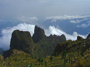 |
Amhara Region Amhara Region Amhara is one of the nine ethnic divisions of Ethiopia, containing the homeland of the Amhara people. Previously known as Region 3, its capital is Bahir Dar.... ,  Ethiopia Ethiopia23°11′N 38°4′E |
Natural: (vii), (x) |
22000 (54,363.1 acre) | 1978 | 1996 | Deterioration of population of Walia ibex Walia Ibex The walia ibex is a species of ibex that is endangered. It is sometimes considered a subspecies of the Alpine Ibex... |
|
| Tombs of Buganda Kings at Kasubi | Kampala District Kampala District Kampala District is a district in Uganda that is coterminous with the country's capital city, Kampala. The district is named after the city. The main language spoken is Luganda. However many other languages are spoken, including: English, Swahili, Runyankole/Rukiga, Acholi and... ,  Uganda Uganda0°19′45"N 32°33′12"E |
Cultural: (i), (iii), (iv), (vi) |
27 (66.7 acre) | 2001 | 2010 | Destruction of the Muzibu Azaala Mpanga, the main building of the site, by fire in March 2010 | ||
| Tropical Rainforest Heritage of Sumatra Tropical Rainforest Heritage of Sumatra The Tropical Rainforest Heritage of Sumatra site was inscribed as a UNESCO World Heritage site in 2004. It comprises three Indonesian national parks on the island of Sumatra: Gunung Leuser National Park, Kerinci Seblat National Park and the Bukit Barisan Selatan National Park... |
 |
Sumatra Sumatra Sumatra is an island in western Indonesia, westernmost of the Sunda Islands. It is the largest island entirely in Indonesia , and the sixth largest island in the world at 473,481 km2 with a population of 50,365,538... ,  Indonesia Indonesia02°30′S 101°30′E |
Natural: (vii), (ix), (x) |
2595124 (6,412,685.4 acre) | 2004 | 2011 | Poaching, illegal logging, agricultural encroachment, and plans to build roads through the site | |
| Virunga National Park Virunga National Park The Virunga National Park , formerly named Albert National Park, is a 7800 square km National Park that stretches from the Virunga Mountains in the South, to the Rwenzori Mountains in the North, in the eastern Democratic Republic of Congo, bordering Volcanoes National Park in Rwanda and Rwenzori... |
 |
North Kivu and Orientale, Democratic Republic of the Congo0°55′N 29°10′E |
Natural: (vii), (viii), (x) |
800000 (1,976,841.3 acre) | 1979 | 1994 | Deforestation and poaching as a result of the influx of refugees due to the Rwandan Civil War Rwandan Civil War The Rwandan Civil War was a conflict within the Central African nation of Rwanda between the government of President Juvénal Habyarimana and the rebel Rwandan Patriotic Front... |
Previously listed sites
There exist a number of sites that were previously listed as being in danger, but later removed from the list after improvements in management and conservation. The Everglades National ParkEverglades National Park
Everglades National Park is a national park in the U.S. state of Florida that protects the southern 25 percent of the original Everglades. It is the largest subtropical wilderness in the United States, and is visited on average by one million people each year. It is the third-largest...
was listed from 1993 to 2007 and again since 2010; the Río Plátano Biosphere Reserve
Río Plátano Biosphere Reserve
The Río Plátano Biosphere Reserve is 5,250 km² of preserved land in the La Mosquitia region on the Caribbean coast of Honduras. Most of the land runs along the Río Plátano. The reserve has a number of endangered species and some of Honduras largest sections of forest. It has been a World...
was listed from 1996 to 2007 and again since 2011. Both are therefore included in the list of currently listed sites (above).
| Name | Image | Location | Criteria | Area ha (acre) |
Year (WHS) | Endangered | Reason | Refs |
|---|---|---|---|---|---|---|---|---|
| Angkor Angkor Angkor is a region of Cambodia that served as the seat of the Khmer Empire, which flourished from approximately the 9th to 15th centuries. The word Angkor is derived from the Sanskrit nagara , meaning "city"... |
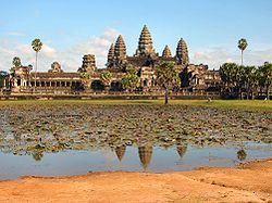 |
Cultural: (i), (ii), (iii), (iv) |
0 | 1992 | 1992–2004 | Inscription initially limited to a three year period (1993–1995) during which effective legal protection, boundary and buffer zones were to be established and international conservation efforts were to be monitored and coordinated; At the time of inscription, Cambodia was UN United Nations The United Nations is an international organization whose stated aims are facilitating cooperation in international law, international security, economic development, social progress, human rights, and achievement of world peace... -controlled following the civil war in the 1980s. |
||
| Bahla Fort Bahla Fort Bahla Fort is one of four historic fortresses situated at the foot of the Djebel Akhdar highlands in Oman. It was built in the 13th and 14th centuries, when the oasis of Bahla was prosperous under the control of the Banu Nebhan tribe. The fort's ruined adobe walls and towers rise some... |
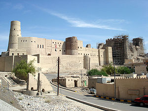 |
Cultural: (iv) |
0 | 1987 | 1988–2004 | Degradation of earth structures of the fort and of the oasis of Bahla | ||
| Butrint Butrint Butrint was an ancient Greek and later Roman city in Epirus. In modern times it is an archeological site in Sarandë District, Albania, some 14 kilometres south of Sarandë and close to the Greek border. It was known in antiquity as Βουθρωτόν Bouthroton or Βουθρώτιος Bouthrotios in Ancient Greek... |
 |
Cultural: (iii) |
3980 (9,834.8 acre) | 1992 | 1997–2005 | Damages due to management and conservation | ||
| Cologne Cathedral Cologne Cathedral Cologne Cathedral is a Roman Catholic church in Cologne, Germany. It is the seat of the Archbishop of Cologne and the administration of the Archdiocese of Cologne. It is renowned monument of German Catholicism and Gothic architecture and is a World Heritage Site... |
Cultural: (i), (ii), (iv) |
0 | 1996 | 2004–2006 | High-rise building plan near the cathedral threatening to inflict damage to the integrity of the property; delisted after the building plan was halted and a buffer zone introduced | |||
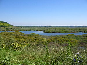
| Djoudj National Bird Sanctuary Djoudj National Bird Sanctuary The Djoudj National Bird Sanctuary lies on the southeast bank of the River Senegal in Senegal, in northern Biffeche, north east of St-Louis. It provides a range of wetland habitats which prove very popular with migrating birds, many of which have just crossed the Sahara. Of almost 400 species of... |
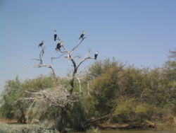 |
Natural: (vii), (x) |
16000 (39,536.8 acre) | 1981 | 1984–1988, 2000–2006 | Long term threat by construction plan for a down-stream dam (1984); delistedFrom the List of World Heritage in Danger (1988) as water supply to the park was insured by the construction of a sluice and a management plan was being prepared; relistedOn the List of World Heritage in Danger (2000) due to environmental and economical threats posed by the introduced species Salvinia molesta and Pistia stratiotes as well as issues with water management in the park | ||
| Dresden Elbe Valley Dresden Elbe Valley The Dresden Elbe Valley is a former World Heritage Site in Dresden, Germany. The valley, extending for some 20 kilometres and passingthrough the Dresden Basin and the city of Dresden, is one of two cultural landscapes along the Central European river Elbe... # |
 |
Cultural: (ii), (iii), (iv), (v) |
1930 (4,769.1 acre) | 2004 | 2006–2009 | Construction plans for the Waldschlösschen Bridge Waldschlösschen Bridge The Waldschlösschen Bridge is a bridge under construction across the river Elbe in Dresden. The bridge is intended to remedy inner-city traffic congestion... in the core area of the cultural landscape; removed from the list of World Heritage Sites in 2009 after construction commenced at the end of 2007 |
||
| Dubrovnik Dubrovnik Dubrovnik is a Croatian city on the Adriatic Sea coast, positioned at the terminal end of the Isthmus of Dubrovnik. It is one of the most prominent tourist destinations on the Adriatic, a seaport and the centre of Dubrovnik-Neretva county. Its total population is 42,641... |
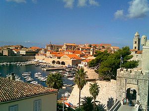 |
Cultural: (i), (iii), (iv) |
97 (239.7 acre) | 1979 | 1991–1998 | Croatian War of Independence Croatian War of Independence The Croatian War of Independence was fought from 1991 to 1995 between forces loyal to the government of Croatia—which had declared independence from the Socialist Federal Republic of Yugoslavia —and the Serb-controlled Yugoslav People's Army and local Serb forces, with the JNA ending its combat... |
||
| Galápagos Islands Galápagos Islands The Galápagos Islands are an archipelago of volcanic islands distributed around the equator in the Pacific Ocean, west of continental Ecuador, of which they are a part.The Galápagos Islands and its surrounding waters form an Ecuadorian province, a national park, and a... |
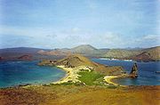 |
Natural: (vii), (viii), (ix), (x) |
14066514 (34,759,082.4 acre) | 1978 | 2007–2010 | Various threats including insufficient prevention of possibilities for the introduction of alien species, insufficient resource allocation for conservation agencies and park management, presence of a large number of illegal immigrants, rapid uncontrolled growth of tourism, fishing over-capacity and sports fishing | ||
| Group of Monuments at Hampi Hampi Hampi is a village in northern Karnataka state, India. It is located within the ruins of Vijayanagara, the former capital of the Vijayanagara Empire. Predating the city of Vijayanagara, it continues to be an important religious centre, housing the Virupaksha Temple, as well as several other... |
Cultural: (i), (iii), (iv) |
0 | 1986 | 1999–2006 | Partial construction of two cable-suspended bridges within the protected archaeological areas of Hampi threatening the integrity and authenticity of the site | |||
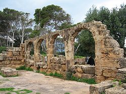
| Ichkeul National Park |  |
Natural: (x) |
12600 (31,135.3 acre) | 1980 | 1996–2006 | Construction of dams limiting the freshwater flow to the area and causing an increased salinity of the lake and the marshes as well as a decrease in the number of migrating bird populations | ||
| Iguaçu National Park Iguaçu National Park Iguaçu National Park is a national park in Paraná State, Brazil.Created by federal decree nr. 1035 of January 10, 1939, the Park comprises a total area of 185,262.5 hectares and a length of about 420km, 300km of which are natural borders by bodies of water and the Brazilian and Argentinean sides... |
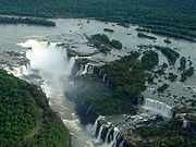 |
Natural: (vii), (x) |
170086 (420,291.3 acre) | 1986 | 1999–2001 | Illegally opened road ("Colon Road") through the park, dams on the Iguazu River Iguazu River The Iguazu River is a river in Brazil and Argentina. It is an important tributary of the Paraná River. The Iguazu River is long, with a drainage basin of .-Course:... and helicopter flights. |
||
| Kathmandu Valley Kathmandu Valley The Kathmandu Valley , located in Nepal, lies at the crossroads of ancient civilizations of Asia, and has at least 130 important monuments, including several places of pilgrimage for the Hindus and the Buddhists. There are seven UNESCO World Heritage Sites within this valley.-Etymology:The city of... |
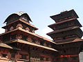 |
Cultural: (iii), (iv), (vi) |
167 (412.7 acre) | 1979 | 2003–2007 | Partial or substantial loss of the traditional elements of six out of seven monument zones and resulting general loss of authenticity and integrity of the whole property. | ||
| Natural and Culturo-Historical Region of Kotor Natural and Culturo-Historical Region of Kotor The Natural and Culturo-Historical Region of Kotor is a World Heritage Site located in Montenegro that was inscribed in 1979. It encompasses the old town of Kotor , the fortifications of Kotor, and the surrounding region of the inner Bay of Kotor.-Old town of Kotor:The old town of Kotor is... |
Cultural: (i), (ii), (iii), (iv) |
0 | 1979 | 1979–2003 | Damage following the earthquake from April 15, 1979 | |||
| Manas Wildlife Sanctuary | Natural: (vii), (ix), (x) |
39100 (96,618.1 acre) | 1985 | 1992–2011 | Poaching, damage to the park's infrastructure and decrease in the population of some species particularly the Greater One Horned Rhino following an invasion by militants of the Bodo tribe Bodo people The Bodos are an ethnic and linguistic community, early settlers of Assam in the North-East of India. According to the 1991 census, there were 1.2 million Bodos in Assam which makes for 5.3% of the total population in the state. Bodos belong to a larger ethnic group called the Bodo-Kachari. The... in 1992 |
|||
| Ngorongoro Conservation Area Ngorongoro Conservation Area The Ngorongoro Conservation Area is a conservation area and a UNESCO World Heritage Site situated west of Arusha in the Crater Highlands area of Tanzania. The conservation area is administered by the Ngorongoro Conservation Area Authority, an arm of the Tanzanian government, and its boundaries... |
Natural: (iv), (vii), (viii), (ix), (x) |
0 | 1978 | 1984–1989 | Declining conservation status | |||
| Plitvice Lakes National Park Plitvice Lakes Plitvice Lakes National Park is the oldest national park in Southeast Europe and the largest national park in Croatia. The national park was founded in 1949 and is situated in the mountainous karst area of central Croatia, at the border to Bosnia and Herzegovina... |
Natural: (vii), (viii), (ix) |
19200 (47,444.2 acre) | 1979 | 1992–1997 | Potential threat due to the Croatian War of Independence Croatian War of Independence The Croatian War of Independence was fought from 1991 to 1995 between forces loyal to the government of Croatia—which had declared independence from the Socialist Federal Republic of Yugoslavia —and the Serb-controlled Yugoslav People's Army and local Serb forces, with the JNA ending its combat... |
|||
| Royal Palaces of Abomey Royal Palaces of Abomey The Royal Palaces of Abomey are 12 palaces spread over a area at the heart of the Abomey town in Benin, formerly the capital of the West African Kingdom of Dahomey... |
Cultural: (iii), (iv) |
48 (118.6 acre) | 1985 | 1985–2007 | General state of deterioration due to the elements and inappropriate restoration which are in conflict with the authenticity of the site | |||
| Rwenzori Mountains National Park Rwenzori Mountains National Park Rwenzori Mountains National Park is a Ugandan national park and UNESCO World Heritage Site located in the Rwenzori Mountains. Almost in size, the park has Africa's third highest mountain peak and many waterfalls, lakes, and glaciers. The park is known for its beautiful plant life.-History:Rwenzori... |
 |
Natural: (vii), (ix) |
99600 (246,116.7 acre) | 1994 | 1999–2004 | Security situation and lack of monitoring of a major part of the park | ||
| Sangay National Park Sangay National Park Sangay National Park is a national park located in the Morona Santiago, Chimborazo and Tungurahua provinces of Ecuador. The park contains two active volcanoes and ecosystems ranging from tropical rainforests to glaciers.... |
Natural: (vii), (viii), (ix), (x) |
271925 (671,940.7 acre) | 1983 | 1992–2005 | Heavy poaching, illegal livestock grazing, encroachment and potential threat through a road construction project | |||
| Srebarna Nature Reserve Srebarna Nature Reserve The Srebarna Nature Reserve is a nature reserve in northeastern Bulgaria , near the village of the same name, 18 km west of Silistra and 2 km south of the Danube... |
 |
Natural: (x) |
638 (1,576.5 acre) | 1983 | 1992–2003 | Prevention of seasonal flooding and agricultural use causing a decline or disappearance of the water and passerine bird populations | ||
| Timbuktu Timbuktu Timbuktu , formerly also spelled Timbuctoo, is a town in the West African nation of Mali situated north of the River Niger on the southern edge of the Sahara Desert. The town is the capital of the Timbuktu Region, one of the eight administrative regions of Mali... |
 |
Cultural: (ii), (iv), (v) |
0 | 1988 | 1990–2005 | Threat of sand encroachment | ||
| Tipasa Tipasa Tipaza is a Berber-speaking town on the coast of Algeria, capital of the Tipaza province. The modern town, founded in 1857, is remarkable chiefly for its sandy beach, and ancient ruins.-Ancient history:... |
 |
Cultural: (iii), (iv) |
52 (128.5 acre) | 1982 | 2002–2006 | Inadequat maintenance affecting the integrity of the site and its buffer zone | ||
| Wieliczka Salt Mine |  |
Cultural: (iv) |
969 (2,394.4 acre) | 1978 | 1989–1998 | Humidity problem | ||
| Yellowstone National Park Yellowstone National Park Yellowstone National Park, established by the U.S. Congress and signed into law by President Ulysses S. Grant on March 1, 1872, is a national park located primarily in the U.S. state of Wyoming, although it also extends into Montana and Idaho... |
Natural: (vii), (viii), (ix), (x) |
898349 (2,219,866.8 acre) | 1978 | 1995–2003 | Ascertained dangers to Yellowstone cutthroat trout Yellowstone cutthroat trout The Yellowstone cutthroat trout is a subspecies of the cutthroat trout and is a freshwater fish in the salmon family of the order Salmoniformes. Native only to a few U.S... as well as sewage leakage and waste contamination in parts of the park; potential threats to water quantity and quality, past and proposed mining activities, a proposed control program to eradicate brucellosis Brucellosis Brucellosis, also called Bang's disease, Crimean fever, Gibraltar fever, Malta fever, Maltese fever, Mediterranean fever, rock fever, or undulant fever, is a highly contagious zoonosis caused by ingestion of unsterilized milk or meat from infected animals or close contact with their secretions... in the bison Bison Members of the genus Bison are large, even-toed ungulates within the subfamily Bovinae. Two extant and four extinct species are recognized... herds |
External links
- UNESCO World Heritage Sites: Official site
- UNESCO World Heritage Centre – World Heritage in Danger List: Official site
- UNESCO Heritage Centre – World Heritage List: Official site
- Worldheritage-Forum: Weblog and Information on World Heritage Issues