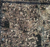
2003 Bam earthquake
Overview
The 2003 Bam earthquake was a major earthquake
that struck Bam
and the surrounding
Kerman province
of southeastern Iran
at 1:56 AM UTC
(5:26 AM Iran Standard Time) on Friday, December 26, 2003. The most widely accepted estimate for the magnitude of the earthquake is a moment magnitude
(Mw) of 6.6; estimated by the United States Geological Survey
. The earthquake was particularly destructive, with the death toll amounting to 26,271 people and injuring an additional 30,000.
Earthquake
An earthquake is the result of a sudden release of energy in the Earth's crust that creates seismic waves. The seismicity, seismism or seismic activity of an area refers to the frequency, type and size of earthquakes experienced over a period of time...
that struck Bam
Bam, Iran
Bam is a city in and the capital of Bam County, Kerman Province, Iran. At the 2006 census, its population was 73,823, in 19,572 families.The modern Iranian city of Bam surrounds the Bam citadel. Before the 2003 earthquake the official population count of the city was roughly 43,000. There are...
and the surrounding
Kerman province
Provinces of Iran
Iran is subdivided into thirty one provinces , each governed from a local center, usually the largest local city, which is called the capital of that province...
of southeastern Iran
Iran
Iran , officially the Islamic Republic of Iran , is a country in Southern and Western Asia. The name "Iran" has been in use natively since the Sassanian era and came into use internationally in 1935, before which the country was known to the Western world as Persia...
at 1:56 AM UTC
Coordinated Universal Time
Coordinated Universal Time is the primary time standard by which the world regulates clocks and time. It is one of several closely related successors to Greenwich Mean Time. Computer servers, online services and other entities that rely on having a universally accepted time use UTC for that purpose...
(5:26 AM Iran Standard Time) on Friday, December 26, 2003. The most widely accepted estimate for the magnitude of the earthquake is a moment magnitude
Moment magnitude scale
The moment magnitude scale is used by seismologists to measure the size of earthquakes in terms of the energy released. The magnitude is based on the seismic moment of the earthquake, which is equal to the rigidity of the Earth multiplied by the average amount of slip on the fault and the size of...
(Mw) of 6.6; estimated by the United States Geological Survey
United States Geological Survey
The United States Geological Survey is a scientific agency of the United States government. The scientists of the USGS study the landscape of the United States, its natural resources, and the natural hazards that threaten it. The organization has four major science disciplines, concerning biology,...
. The earthquake was particularly destructive, with the death toll amounting to 26,271 people and injuring an additional 30,000.
Unanswered Questions

