

List of North Carolina hurricanes
Encyclopedia
The list of North Carolina hurricanes includes 403 known tropical
or subtropical cyclone
s that have affected the U.S. state
of North Carolina
. Due to its location, many hurricanes have hit the state directly, and numerous hurricanes have passed near or through North Carolina in its history; the state is ranked fourth, after Florida
, Texas
, and Louisiana
, in the number of cyclones that produced hurricane force winds in a U.S. state. Hurricanes in North Carolina history are responsible for over $11 billion in damage (2008 USD) and almost 1,000 total fatalities.
along the coastline about once every four years. An estimated 17.5 percent of all North Atlantic tropical cyclones have affected the state. Additionally, the remnants of a few Pacific
tropical cyclones struck the state. Cape Hatteras
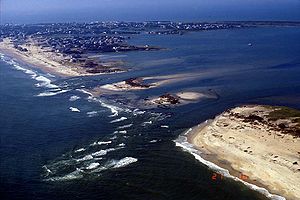
is most affected by storms within the state, though Cape Lookout
and Cape Fear are also regularly affected; the increased activity in three areas is because it protrudes from elsewhere along the Atlantic coastline. After Southern Florida, Cape Hatteras has the lowest return period, or the frequency at which a certain intensity or category of hurricane can be expected within 86 mi (139 km) of a given location, in the country. As the Outer Banks
are a narrow strip of low-lying land, hurricanes occasionally leave portions of the land partially or fully submerged. Additionally, the remnants of inland tropical cyclones have produced flooding and landslides in the state's western region.
Tropical cyclones have affected North Carolina in every month between May and December; about 35 percent of the storms struck the state in September, and 80 percent affected the state between August and October, which coincides with the peak of the hurricane season. The earliest storm to affect the state was Subtropical Storm Andrea
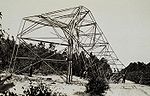
on May 7, 2007, and the latest was a tropical storm that moved across the Outer Banks on December 2, 1925. The strongest storm to strike the state was Hurricane Hazel
in 1954, which made landfall as a Category 4 hurricane on the Saffir-Simpson Hurricane Scale
.

The list of North Carolina hurricanes before 1900 encompasses 139 tropical cyclone
s that affected the U.S. state
of North Carolina
. Collectively, cyclones in North Carolina during the time period resulted in over 775 direct fatalities during the period. Seven cyclones affected the state in the 1893 season
, which was the year with the most tropical cyclones devastating the state during the time period. From the beginning of the official Atlantic hurricane record in 1851 to 1899, there were 12 years without a known tropical cyclone affecting the state.
Historical data prior to 1700 is sparse due to lack of significant European settlements along the coastline; the few storms listed are largely records from Roanoke Colony
and later the Province of Carolina
. Modern meteorologists believe early storms were tropical cyclones, though due to the time period confirmation is impossible. One theory explaining the disappearance of Roanoke Colony suggests a hurricane destroyed the village, though there is no evidence to prove the theory. It is considered unlikely due to lack of damage to a fence around the village, on which the villagers left an inscription.
Between 1900 and 1949, 75 tropical cyclones or their remnants affected the state. Collectively, cyclones in North Carolina during that time period resulted in 53 total fatalities during the period, as well as about $328 million in damage (2008 USD
). Tropical cyclone affected the state in all but nine seasons. In the 1916 season
, five storms affected the state, which was the season with the most storms devastating the state. The strongest hurricanes to affect the state during the time period were the 1933 Outer Banks hurricane and the 1944 Great Atlantic Hurricane
, which produced winds of Category 3 status on the Saffir-Simpson Hurricane Scale
within the state. The 1933 Outer Banks hurricane was the deadliest hurricane in the state during the time period, which killed 21 people. The remnants of a hurricane in 1940
dropped heavy rainfall in the state, which caused over $150 million in damage (2008 USD) from flooding and landslides.

A total of 79 tropical
or subtropical cyclone
s affected North Carolina between 1950 and 1979. Collectively, cyclones during the time period resulted in 37 total fatalities during the period, as well as about $3 billion in damage (2008 USD). A cyclone affected the state in every year during the time period, and in three seasons a total of five cyclones assailed the state. The strongest hurricane to hit the state during the time period was Hurricane Hazel
, which struck the state as a Category 4 hurricane on the Saffir-Simpson Hurricane Scale
. Hazel was both the costliest and deadliest cyclone during the period, causing over $1 billion in damage (2008 USD) and 19 deaths. Most storms affected the state in September, though cyclones lashed the state between May and October.
The period from 1980 to the present encompasses 110 tropical
or subtropical cyclone
s that affected the state. Collectively, cyclones in North Carolina during the time period resulted in over $10 billion in damage (2010 USD), primarily from hurricanes Fran
and Floyd
. Additionally, tropical cyclones in North Carolina were responsible for 77 direct fatalities and at least 44 indirect casualties during the period. Eight cyclones affected the state in the 1985 season
, which was the year with the most tropical cyclones striking the state. Every year included at least one tropical cyclone affecting the state.
The strongest hurricane to hit the state during the time period was Hurricane Fran in 1996, which struck near Wilmington
as a Category 3 hurricane on the Saffir-Simpson Hurricane Scale
; Hurricane Emily
in 1993 brushed the Outer Banks
also as a Category 3 hurricane. The deadliest hurricane during the period was Hurricane Floyd in 1999, which caused 35 fatalities and record–breaking flooding in the eastern portion of the state.
either made landfall
on the state or brought winds of Category 3
status to the state. Storms are listed since 1851, which is the official start of the Atlantic hurricane database.
Hurricane Irene Hit NC as category 1 but was disastrous in August 27-28
Tropical cyclone
A tropical cyclone is a storm system characterized by a large low-pressure center and numerous thunderstorms that produce strong winds and heavy rain. Tropical cyclones strengthen when water evaporated from the ocean is released as the saturated air rises, resulting in condensation of water vapor...
or subtropical cyclone
Subtropical cyclone
A subtropical cyclone is a weather system that has some characteristics of a tropical and an extratropical cyclone. As early as the 1950s, meteorologists were unclear whether they should be characterized as tropical or extratropical cyclones. They were officially recognized by the National...
s that have affected the U.S. state
U.S. state
A U.S. state is any one of the 50 federated states of the United States of America that share sovereignty with the federal government. Because of this shared sovereignty, an American is a citizen both of the federal entity and of his or her state of domicile. Four states use the official title of...
of North Carolina
North Carolina
North Carolina is a state located in the southeastern United States. The state borders South Carolina and Georgia to the south, Tennessee to the west and Virginia to the north. North Carolina contains 100 counties. Its capital is Raleigh, and its largest city is Charlotte...
. Due to its location, many hurricanes have hit the state directly, and numerous hurricanes have passed near or through North Carolina in its history; the state is ranked fourth, after Florida
Florida
Florida is a state in the southeastern United States, located on the nation's Atlantic and Gulf coasts. It is bordered to the west by the Gulf of Mexico, to the north by Alabama and Georgia and to the east by the Atlantic Ocean. With a population of 18,801,310 as measured by the 2010 census, it...
, Texas
Texas
Texas is the second largest U.S. state by both area and population, and the largest state by area in the contiguous United States.The name, based on the Caddo word "Tejas" meaning "friends" or "allies", was applied by the Spanish to the Caddo themselves and to the region of their settlement in...
, and Louisiana
Louisiana
Louisiana is a state located in the southern region of the United States of America. Its capital is Baton Rouge and largest city is New Orleans. Louisiana is the only state in the U.S. with political subdivisions termed parishes, which are local governments equivalent to counties...
, in the number of cyclones that produced hurricane force winds in a U.S. state. Hurricanes in North Carolina history are responsible for over $11 billion in damage (2008 USD) and almost 1,000 total fatalities.
Climatology
As to statistical hurricane research between 1886 and 1996 by the North Carolina State Climatology Office, a tropical cyclone makes landfallLandfall (meteorology)
Landfall is the event of a tropical cyclone or a waterspout coming onto land after being over water. When a waterspout makes landfall it is reclassified as a tornado, which can then cause damage inland...
along the coastline about once every four years. An estimated 17.5 percent of all North Atlantic tropical cyclones have affected the state. Additionally, the remnants of a few Pacific
Pacific hurricane
A Pacific hurricane or tropical storm is a tropical cyclone that develops in the northeastern part of the Pacific Ocean. For organizational purposes, the northern Pacific Ocean is divided into three regions: the eastern, , central , and western...
tropical cyclones struck the state. Cape Hatteras
Cape Hatteras
Cape Hatteras is a cape on the coast of North Carolina. It is the point that protrudes the farthest to the southeast along the northeast-to-southwest line of the Atlantic coast of North America...
is most affected by storms within the state, though Cape Lookout
Cape Lookout
Cape Lookout can refer to:*Cape Lookout , in the United States*Cape Lookout , in the United States*Cape Lookout...
and Cape Fear are also regularly affected; the increased activity in three areas is because it protrudes from elsewhere along the Atlantic coastline. After Southern Florida, Cape Hatteras has the lowest return period, or the frequency at which a certain intensity or category of hurricane can be expected within 86 mi (139 km) of a given location, in the country. As the Outer Banks
Outer Banks
The Outer Banks is a 200-mile long string of narrow barrier islands off the coast of North Carolina, beginning in the southeastern corner of Virginia Beach on the east coast of the United States....
are a narrow strip of low-lying land, hurricanes occasionally leave portions of the land partially or fully submerged. Additionally, the remnants of inland tropical cyclones have produced flooding and landslides in the state's western region.
Tropical cyclones have affected North Carolina in every month between May and December; about 35 percent of the storms struck the state in September, and 80 percent affected the state between August and October, which coincides with the peak of the hurricane season. The earliest storm to affect the state was Subtropical Storm Andrea
Subtropical Storm Andrea (2007)
Subtropical Storm Andrea was the first named storm and first subtropical cyclone of the 2007 Atlantic hurricane season. It developed out of a previously non-tropical low on May 9 about 150 miles northeast of Daytona Beach, Florida, three weeks before the official start of the season...
on May 7, 2007, and the latest was a tropical storm that moved across the Outer Banks on December 2, 1925. The strongest storm to strike the state was Hurricane Hazel
Hurricane Hazel
Hurricane Hazel was the deadliest and costliest hurricane of the 1954 Atlantic hurricane season. The storm killed as many as 1,000 people in Haiti before striking the United States near the border between North and South Carolina, as a Category 4 hurricane...
in 1954, which made landfall as a Category 4 hurricane on the Saffir-Simpson Hurricane Scale
Saffir-Simpson Hurricane Scale
The Saffir–Simpson Hurricane Scale , or the Saffir–Simpson Hurricane Wind Scale , classifies hurricanes — Western Hemisphere tropical cyclones that exceed the intensities of tropical depressions and tropical storms — into five categories distinguished by the intensities of their sustained winds...
.
Pre-1900
The list of North Carolina hurricanes before 1900 encompasses 139 tropical cyclone
Tropical cyclone
A tropical cyclone is a storm system characterized by a large low-pressure center and numerous thunderstorms that produce strong winds and heavy rain. Tropical cyclones strengthen when water evaporated from the ocean is released as the saturated air rises, resulting in condensation of water vapor...
s that affected the U.S. state
U.S. state
A U.S. state is any one of the 50 federated states of the United States of America that share sovereignty with the federal government. Because of this shared sovereignty, an American is a citizen both of the federal entity and of his or her state of domicile. Four states use the official title of...
of North Carolina
North Carolina
North Carolina is a state located in the southeastern United States. The state borders South Carolina and Georgia to the south, Tennessee to the west and Virginia to the north. North Carolina contains 100 counties. Its capital is Raleigh, and its largest city is Charlotte...
. Collectively, cyclones in North Carolina during the time period resulted in over 775 direct fatalities during the period. Seven cyclones affected the state in the 1893 season
1893 Atlantic hurricane season
The 1893 Atlantic hurricane season ran through the summer and the first half of fall in 1893. The 1893 season was fairly active, with 12 tropical storms forming, 10 of which became hurricanes. Of those, 5 became major hurricanes...
, which was the year with the most tropical cyclones devastating the state during the time period. From the beginning of the official Atlantic hurricane record in 1851 to 1899, there were 12 years without a known tropical cyclone affecting the state.
Historical data prior to 1700 is sparse due to lack of significant European settlements along the coastline; the few storms listed are largely records from Roanoke Colony
Roanoke Colony
The Roanoke Colony on Roanoke Island in Dare County, present-day North Carolina, United States was a late 16th-century attempt to establish a permanent English settlement in what later became the Virginia Colony. The enterprise was financed and organized by Sir Walter Raleigh and carried out by...
and later the Province of Carolina
Province of Carolina
The Province of Carolina, originally chartered in 1629, was an English and later British colony of North America. Because the original Heath charter was unrealized and was ruled invalid, a new charter was issued to a group of eight English noblemen, the Lords Proprietors, in 1663...
. Modern meteorologists believe early storms were tropical cyclones, though due to the time period confirmation is impossible. One theory explaining the disappearance of Roanoke Colony suggests a hurricane destroyed the village, though there is no evidence to prove the theory. It is considered unlikely due to lack of damage to a fence around the village, on which the villagers left an inscription.
1900–1949
Between 1900 and 1949, 75 tropical cyclones or their remnants affected the state. Collectively, cyclones in North Carolina during that time period resulted in 53 total fatalities during the period, as well as about $328 million in damage (2008 USD
United States dollar
The United States dollar , also referred to as the American dollar, is the official currency of the United States of America. It is divided into 100 smaller units called cents or pennies....
). Tropical cyclone affected the state in all but nine seasons. In the 1916 season
1916 Atlantic hurricane season
The 1916 Atlantic hurricane season ran through the summer and the first half of fall in 1916. The season is one of only two in which two major hurricanes were reported before the month of August, the other being the 2005 season.-Storms:...
, five storms affected the state, which was the season with the most storms devastating the state. The strongest hurricanes to affect the state during the time period were the 1933 Outer Banks hurricane and the 1944 Great Atlantic Hurricane
1944 Great Atlantic Hurricane
The Great Atlantic Hurricane in 1944 was an intense Atlantic hurricane sometimes compared to the New England Hurricane of 1938.-Meteorological history:...
, which produced winds of Category 3 status on the Saffir-Simpson Hurricane Scale
Saffir-Simpson Hurricane Scale
The Saffir–Simpson Hurricane Scale , or the Saffir–Simpson Hurricane Wind Scale , classifies hurricanes — Western Hemisphere tropical cyclones that exceed the intensities of tropical depressions and tropical storms — into five categories distinguished by the intensities of their sustained winds...
within the state. The 1933 Outer Banks hurricane was the deadliest hurricane in the state during the time period, which killed 21 people. The remnants of a hurricane in 1940
Georgia-South Carolina Hurricane of 1940
The Georgia – South Carolina Hurricane was a strong Category 1 hurricane that struck the Georgia and South Carolina coast between August 11 and August 12, 1940. After forming north of the Leeward Islands, the storm moved west-northwest, moving east of the Bahamas before resuming a west-northwest...
dropped heavy rainfall in the state, which caused over $150 million in damage (2008 USD) from flooding and landslides.
1950–1979
A total of 79 tropical
Tropical cyclone
A tropical cyclone is a storm system characterized by a large low-pressure center and numerous thunderstorms that produce strong winds and heavy rain. Tropical cyclones strengthen when water evaporated from the ocean is released as the saturated air rises, resulting in condensation of water vapor...
or subtropical cyclone
Subtropical cyclone
A subtropical cyclone is a weather system that has some characteristics of a tropical and an extratropical cyclone. As early as the 1950s, meteorologists were unclear whether they should be characterized as tropical or extratropical cyclones. They were officially recognized by the National...
s affected North Carolina between 1950 and 1979. Collectively, cyclones during the time period resulted in 37 total fatalities during the period, as well as about $3 billion in damage (2008 USD). A cyclone affected the state in every year during the time period, and in three seasons a total of five cyclones assailed the state. The strongest hurricane to hit the state during the time period was Hurricane Hazel
Hurricane Hazel
Hurricane Hazel was the deadliest and costliest hurricane of the 1954 Atlantic hurricane season. The storm killed as many as 1,000 people in Haiti before striking the United States near the border between North and South Carolina, as a Category 4 hurricane...
, which struck the state as a Category 4 hurricane on the Saffir-Simpson Hurricane Scale
Saffir-Simpson Hurricane Scale
The Saffir–Simpson Hurricane Scale , or the Saffir–Simpson Hurricane Wind Scale , classifies hurricanes — Western Hemisphere tropical cyclones that exceed the intensities of tropical depressions and tropical storms — into five categories distinguished by the intensities of their sustained winds...
. Hazel was both the costliest and deadliest cyclone during the period, causing over $1 billion in damage (2008 USD) and 19 deaths. Most storms affected the state in September, though cyclones lashed the state between May and October.
1980–Present
The period from 1980 to the present encompasses 110 tropical
Tropical cyclone
A tropical cyclone is a storm system characterized by a large low-pressure center and numerous thunderstorms that produce strong winds and heavy rain. Tropical cyclones strengthen when water evaporated from the ocean is released as the saturated air rises, resulting in condensation of water vapor...
or subtropical cyclone
Subtropical cyclone
A subtropical cyclone is a weather system that has some characteristics of a tropical and an extratropical cyclone. As early as the 1950s, meteorologists were unclear whether they should be characterized as tropical or extratropical cyclones. They were officially recognized by the National...
s that affected the state. Collectively, cyclones in North Carolina during the time period resulted in over $10 billion in damage (2010 USD), primarily from hurricanes Fran
Hurricane Fran
Hurricane Fran was a powerful Cape Verde-type hurricane of the 1996 Atlantic hurricane season that made landfall near Cape Fear in North Carolina at Category 3 strength. Throughout the eastern United States, early statistics on Fran reported 27 deaths and $3.2 billion in damage...
and Floyd
Hurricane Floyd
Hurricane Floyd was the sixth named storm, fourth hurricane, and third major hurricane in the 1999 Atlantic hurricane season. Floyd triggered the third largest evacuation in US history when 2.6 million coastal residents of five states were ordered from their homes as it approached...
. Additionally, tropical cyclones in North Carolina were responsible for 77 direct fatalities and at least 44 indirect casualties during the period. Eight cyclones affected the state in the 1985 season
1985 Atlantic hurricane season
The 1985 Atlantic hurricane season had the most U.S. landfalling tropical cyclones since 1916. The season officially began on June 1, 1985, and lasted until November 30, 1985...
, which was the year with the most tropical cyclones striking the state. Every year included at least one tropical cyclone affecting the state.
The strongest hurricane to hit the state during the time period was Hurricane Fran in 1996, which struck near Wilmington
Wilmington, North Carolina
Wilmington is a port city in and is the county seat of New Hanover County, North Carolina, United States. The population is 106,476 according to the 2010 Census, making it the eighth most populous city in the state of North Carolina...
as a Category 3 hurricane on the Saffir-Simpson Hurricane Scale
Saffir-Simpson Hurricane Scale
The Saffir–Simpson Hurricane Scale , or the Saffir–Simpson Hurricane Wind Scale , classifies hurricanes — Western Hemisphere tropical cyclones that exceed the intensities of tropical depressions and tropical storms — into five categories distinguished by the intensities of their sustained winds...
; Hurricane Emily
Hurricane Emily (1993)
Hurricane Emily was a Category 3 hurricane during the 1993 Atlantic hurricane season. On September 1, the storm brushed the Outer Banks of North Carolina before heading back out to sea...
in 1993 brushed the Outer Banks
Outer Banks
The Outer Banks is a 200-mile long string of narrow barrier islands off the coast of North Carolina, beginning in the southeastern corner of Virginia Beach on the east coast of the United States....
also as a Category 3 hurricane. The deadliest hurricane during the period was Hurricane Floyd in 1999, which caused 35 fatalities and record–breaking flooding in the eastern portion of the state.
North Carolina major hurricanes
The following major hurricanesTropical cyclone scales
Tropical systems are officially ranked on one of several tropical cyclone scales according to their maximum sustained winds and in what oceanic basin they are located...
either made landfall
Landfall (meteorology)
Landfall is the event of a tropical cyclone or a waterspout coming onto land after being over water. When a waterspout makes landfall it is reclassified as a tornado, which can then cause damage inland...
on the state or brought winds of Category 3
Saffir-Simpson Hurricane Scale
The Saffir–Simpson Hurricane Scale , or the Saffir–Simpson Hurricane Wind Scale , classifies hurricanes — Western Hemisphere tropical cyclones that exceed the intensities of tropical depressions and tropical storms — into five categories distinguished by the intensities of their sustained winds...
status to the state. Storms are listed since 1851, which is the official start of the Atlantic hurricane database.
| Storm | Saffir-Simpson Saffir-Simpson Hurricane Scale The Saffir–Simpson Hurricane Scale , or the Saffir–Simpson Hurricane Wind Scale , classifies hurricanes — Western Hemisphere tropical cyclones that exceed the intensities of tropical depressions and tropical storms — into five categories distinguished by the intensities of their sustained winds... Category |
Date of landfall | Year | Landfall intensity (in knots) |
Landfall location |
|---|---|---|---|---|---|
| Unnamed | 3 | August 19 | 1879 | 100 | Cape Lookout Cape Lookout Cape Lookout can refer to:*Cape Lookout , in the United States*Cape Lookout , in the United States*Cape Lookout... |
| San Ciriaco 1899 Hurricane San Ciriaco 1899 San Ciriaco hurricane, also known as the 1899 Puerto Rico Hurricane, was the longest-lived Atlantic hurricane and the eleventh deadliest tropical cyclone in the basin. It was an intense and long-lived Atlantic Cape Verde-type hurricane which crossed Puerto Rico over the two day period August 8... |
3 | August 18 | 1899 | 105 | Hatteras Hatteras, North Carolina Hatteras is an unincorporated community in Dare County, North Carolina, United States, on the Outer Banks island of Hatteras. North Carolina Highway 12 passes through the community linking it to Frisco and Ocracoke . It is south of the famous Cape Hatteras and the Cape Hatteras Lighthouse in Buxton... |
| Unnamed | 3 | September 16 | 1933 | 100 | Ocracoke Ocracoke, North Carolina Ocracoke is a census-designated place and unincorporated town located at the southern end of Ocracoke Island, located entirely within Hyde County, North Carolina. The population was 769 as of the 2000 census... |
| Great Atlantic Hurricane 1944 Great Atlantic Hurricane The Great Atlantic Hurricane in 1944 was an intense Atlantic hurricane sometimes compared to the New England Hurricane of 1938.-Meteorological history:... |
3 | September 14 | 1944 | 100 | Cape Hatteras Cape Hatteras Cape Hatteras is a cape on the coast of North Carolina. It is the point that protrudes the farthest to the southeast along the northeast-to-southwest line of the Atlantic coast of North America... |
| Hurricane Hazel Hurricane Hazel Hurricane Hazel was the deadliest and costliest hurricane of the 1954 Atlantic hurricane season. The storm killed as many as 1,000 people in Haiti before striking the United States near the border between North and South Carolina, as a Category 4 hurricane... |
4 | October 15 | 1954 | 115 | Near South Carolina South Carolina South Carolina is a state in the Deep South of the United States that borders Georgia to the south, North Carolina to the north, and the Atlantic Ocean to the east. Originally part of the Province of Carolina, the Province of South Carolina was one of the 13 colonies that declared independence... / North Carolina border |
| Hurricane Connie Hurricane Connie Hurricane Connie was the first in a series of hurricanes to strike North Carolina during the 1955 Atlantic hurricane season. Connie struck as a Category 1, causing major flooding and inflicting extensive damage to the Outer Banks and inland to Raleigh.... |
3 | August 12 | 1955 | 100 | Portsmouth Portsmouth, North Carolina Portsmouth was a fishing and shipping village located on the north end of the Core Banks on the Outer Banks in North Carolina. The site lies on Portsmouth Island in Carteret County, across Ocracoke Inlet from the village of Ocracoke. The town was established in 1753, and abandoned in 1971... |
| Hurricane Ione Hurricane Ione Hurricane Ione was a strong, Category 3 hurricane that affected North Carolina in September 1955, bringing high winds and significant rainfall. It came on the heels of Hurricanes Connie and Diane, and compounded problems already caused by the two earlier hurricanes... |
3 | September 19 | 1955 | 100 | Morehead City Morehead City, North Carolina Morehead City is a port city in Carteret County, North Carolina, United States. The population was 8,661 at the 2010 census. Morehead City celebrated the 150th anniversary of its founding on May 5, 2007... |
| Hurricane Helene Hurricane Helene (1958) Hurricane Helene was the strongest hurricane in the 1958 Atlantic hurricane season, reaching peak winds of and tied with Hurricane Ilsa as the strongest tropical cyclone of the season. The system moved to the north of the West Indies and skirted the coast of the Southeast United States before... |
3 | September 27 | 1958 | 100 | Offshore Outer Banks |
| Hurricane Donna Hurricane Donna Hurricane Donna in the 1960 Atlantic hurricane season was a Cape Verde-type hurricane which moved across the Leeward Islands, Puerto Rico, Hispanola, Cuba, The Bahamas, and every state on the East Coast of the United States... |
3 | September 12 | 1960 | 100 | Emerald Isle Emerald Isle, North Carolina Emerald Isle is a town in Carteret County, North Carolina, United States. It is part of the Crystal Coast and is located entirely on the Bogue Banks... |
| Hurricane Diana Hurricane Diana (1984) Hurricane Diana was the fourth tropical storm, the first hurricane, the first major hurricane, and the strongest storm of the 1984 Atlantic hurricane season. Diana was the first major hurricane to hit the U.S. East Coast in nearly 20 years. Watches and warnings were issued for the storm... |
3 | September 13 | 1984 | 100 | Cape Fear |
| Hurricane Gloria Hurricane Gloria Hurricane Gloria was a powerful Cape Verde-type hurricane that formed during the 1985 Atlantic hurricane season and prowled the Atlantic Ocean from September 16 to September 28. Gloria reached Category 4 status on the Saffir-Simpson Hurricane Scale near the Bahamas, but weakened significantly... |
3 | September 27 | 1985 | 100 | Hatteras Island Hatteras Island Hatteras Island is a barrier island located off the North Carolina coast. Dividing the Atlantic Ocean and the Pamlico Sound, it runs parallel to the coast, forming a bend at Cape Hatteras. It is part of North Carolina's Outer Banks and includes the towns of Rodanthe, Waves, Salvo, Avon, Buxton,... |
| Hurricane Emily Hurricane Emily (1993) Hurricane Emily was a Category 3 hurricane during the 1993 Atlantic hurricane season. On September 1, the storm brushed the Outer Banks of North Carolina before heading back out to sea... |
3 | August 31 | 1993 | 100 | Offshore Hatteras Island Hatteras Island Hatteras Island is a barrier island located off the North Carolina coast. Dividing the Atlantic Ocean and the Pamlico Sound, it runs parallel to the coast, forming a bend at Cape Hatteras. It is part of North Carolina's Outer Banks and includes the towns of Rodanthe, Waves, Salvo, Avon, Buxton,... |
| Hurricane Fran Hurricane Fran Hurricane Fran was a powerful Cape Verde-type hurricane of the 1996 Atlantic hurricane season that made landfall near Cape Fear in North Carolina at Category 3 strength. Throughout the eastern United States, early statistics on Fran reported 27 deaths and $3.2 billion in damage... |
3 | September 6 | 1996 | 100 | Cape Fear |
Hurricane Irene Hit NC as category 1 but was disastrous in August 27-28
Climatological statistics
| Month | Number of recorded storms affecting North Carolina |
|---|---|
| May | 8 |
| June | 28 |
| July | 34 |
| August | 101 |
| September | 142 |
| October | 80 |
| November | 9 |
| December | 1 |
| Period | Number of recorded storms affecting North Carolina |
|---|---|
| Pre–18th century | 9 |
| 18th century | 22 |
| 1800–1809 | 4 |
| 1810s | 3 |
| 1820s | 8 |
| 1830s | 10 |
| 1840s | 7 |
| 1850s | 12 |
| 1860s | 8 |
| 1870s | 12 |
| 1880s | 23 |
| 1890s | 21 |
| 1900–1909 | 14 |
| 1910s | 17 |
| 1920s | 12 |
| 1930s | 15 |
| 1940s | 17 |
| 1950s | 24 |
| 1960s | 23 |
| 1970s | 32 |
| 1980s | 32 |
| 1990s | 36 |
| 2000–2008 | 39 |
Deadly storms
The table lists hurricanes by death tolls of over 20 fatalities. Direct deaths are those that are directly caused by the storm passage, such as drownings or deaths from being struck by windblown objects. Indirect deaths, which are included in the toll of Hurricane Floyd, are those that are related to the storm, but not directly from its storm effects. Due to lack of data, many early hurricanes have overall death tolls that do not specify indirect or direct.| Name | Year | Number of deaths |
|---|---|---|
| "San Ciriaco 1899 Hurricane San Ciriaco 1899 San Ciriaco hurricane, also known as the 1899 Puerto Rico Hurricane, was the longest-lived Atlantic hurricane and the eleventh deadliest tropical cyclone in the basin. It was an intense and long-lived Atlantic Cape Verde-type hurricane which crossed Puerto Rico over the two day period August 8... " |
1899 | 20+ |
| "Outer Banks Hurricane" | 1933 | 21 |
| Unnamed | 1772 | 50 |
| Hurricane Floyd Hurricane Floyd Hurricane Floyd was the sixth named storm, fourth hurricane, and third major hurricane in the 1999 Atlantic hurricane season. Floyd triggered the third largest evacuation in US history when 2.6 million coastal residents of five states were ordered from their homes as it approached... |
1999 | 51 |
| Unnamed | 1883 | 53 |
| "Racer's Storm 1837 Racer's Storm The 1837 Racer's Storm was one of the most powerful and destructive hurricanes in the 19th century, causing heavy damage to many cities on its 2,000+ mile path... " |
1837 | 90 |
| "Independence Hurricane" | 1775 | 163 |
| Unnamed | 1857 | 424 |
See also
- Climate of North CarolinaClimate of North CarolinaNorth Carolina's climate varies from the Atlantic coast in the east to the Appalachian Mountain range in the west. The mountains often act as a "shield", blocking cold temperatures and storms from the Midwest from entering the Piedmont of North Carolina...
- Geography of North CarolinaGeography of North CarolinaThe Geography of North Carolina falls naturally into three divisions or sections—the Appalachian Mountains formed mostly by the Blue Ridge and Great Smoky Mountains, the Middle or Piedmont Plateau, and the Eastern or Tidewater section, also known as the Coastal Plain. North Carolina covers and is ...
- List of United States hurricanes
- List of wettest known tropical cyclones in North Carolina
- List of Atlantic hurricanes