
1916 Atlantic hurricane season
Encyclopedia
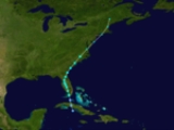
The 1916 Atlantic hurricane season ran through the summer and the first half of fall in 1916. The season is one of only two in which two major hurricanes were reported before the month of August, the other being the 2005 season
.
n coast. It quickly crossed the island and moved over the Straits of Florida
. On May 14, it slowly strengthened to a minimal tropical storm, and it made landfall
near Key Vaca
, Florida
with winds of 40 mph (65 km/h). It entered the Florida peninsula near Cape Sable
, moving northward across the state. Gale force winds were reported east of the center. It transitioned to an extratropical cyclone on May 16. Initially, the cyclone was not included in the Atlantic hurricane database.
. It moved to the north-northwest, brushing the coast of Honduras
before strengthening into a hurricane on July 2. The hurricane continued to intensify, reaching major hurricane strength in the northern Gulf of Mexico on July 4. It made landfall near Gulfport, Mississippi
with 120 mph (195 km/h) sustained winds on July 5. The damage was around $3 million with four deaths occurring. At the time, it was the earliest known major hurricane to make landfall in the U.S. in any season, but that record has since been broken by Hurricane Audrey
.
on July 10. It tracked northwestward, crossing the islands before reaching hurricane strength north of Puerto Rico
on July 15. The hurricane continued to the northwest, and reached a peak of 105 mph (170 km/h) on July 16. Cool and dry air weakened it to a 70 mph (110 km/h) tropical storm when it hit New Bedford, Massachusetts
on July 21. It caused little damage and no known deaths. Initially, the cyclone was recorded as a major hurricane, but it was subsequently downgraded by the Atlantic hurricane reanalysis
project.
, reached a peak intensity of 115 mph (185 km/h) winds on July 13. The hurricane moved ashore near Charleston, South Carolina
as a strong Category 2 hurricane on July 14. Seven deaths were reported, with $100,000 in damage. The heavy rains from this storm caused severe flooding of the French Broad River
at Asheville, North Carolina
.
with estimated winds of 60 mph (95 km/h). Tropical storm force winds affected southern Texas.
as a 90 mi/h hurricane, and continued to the west-northwest through the Caribbean Sea and Yucatán Channel. On August 16, it became a major hurricane. It made landfall on Padre Island
, Texas
on August 18 as a 135 mph (215 km/h) hurricane. The hurricane caused 15 fatalities, with $1.8 million (1916 USD) in damage.
on August 22. It was a small diameter hurricane that crossed Puerto Rico from Naguabo
to Aguada
. From the Humacao region to the Aguadilla region suffered hurricane force winds, with minor damages in the east and north of Puerto Rico. One death occurred and the damages were estimated at $1 million dollars (1916 USD, $20.9 million 2010 USD). In San Juan
winds were measured at 92 mph and the pressure was 29.82 inches. The worst damages occurred in Santurse
.
It crossed Hispaniola
on August 23, weakened to a tropical storm, and paralleled the north coast of Cuba. This fast moving storm turned northward, passing west of Miami, Florida
on August 25. It dissipated on August 26.
, and it quickly weakened on August 30. On September 1 it made landfall on northern Belize
as a tropical storm. The hurricane caused moderate damage, taking an unknown number of lives.
/South Carolina
border on September 6.
. It headed west-northward, strengthening into a hurricane on September 19 before passing north of the Lesser Antilles. The hurricane reached a peak of 120 mph (195 km/h) winds on September 22. It passed by Bermuda
on September 24, and became extratropical on the same day.
coast on October 4.
on October 6. It headed northwestward then northward, reaching hurricane strength in the eastern Caribbean. It approached the equivalent of Category 2 intensity as it passed over Saint Croix. While accelerating to the northeast, the hurricane reached major hurricane strength, but cooler waters caused it to become extratropical on October 15.
on October 18. This storm was a fast moving one so the damage was limited, but a ship sank offshore, killing 20 people.
on the 13th. The storm turned northward, reaching peak winds of 70 mph (110 km/h) over the Yucatán Channel
on November 14. It transitioned to an extratropical cyclone
on November 15, and it passed over Key West
.
2005 Atlantic hurricane season
The 2005 Atlantic hurricane season was the most active Atlantic hurricane season in recorded history, repeatedly shattering numerous records. The impact of the season was widespread and ruinous with an estimated 3,913 deaths and record damage of about $159.2 billion...
.
Storms
1916 was a fairly active season, especially for the time. Fifteen tropical cyclones formed during the course of the year. Ten hurricanes formed, and five of those were major hurricanes.Tropical Storm One
On May 13, a tropical depression formed south of the CubaCuba
The Republic of Cuba is an island nation in the Caribbean. The nation of Cuba consists of the main island of Cuba, the Isla de la Juventud, and several archipelagos. Havana is the largest city in Cuba and the country's capital. Santiago de Cuba is the second largest city...
n coast. It quickly crossed the island and moved over the Straits of Florida
Straits of Florida
The Straits of Florida, Florida Straits, or Florida Strait is a strait located south-southeast of the North American mainland, generally accepted to be between the Gulf of Mexico and the Atlantic Ocean, and between the Florida Keys and Cuba. The strait carries the Florida Current, the beginning of...
. On May 14, it slowly strengthened to a minimal tropical storm, and it made landfall
Landfall (meteorology)
Landfall is the event of a tropical cyclone or a waterspout coming onto land after being over water. When a waterspout makes landfall it is reclassified as a tornado, which can then cause damage inland...
near Key Vaca
Key Vaca
Key Vaca is an island in the middle Florida Keys, located entirely within the borders of the city of Marathon, Florida. It is often incorrectly identified as "Marathon Key."- Geography :Key Vaca is located between Fat Deer Key and Knight's Key...
, Florida
Florida
Florida is a state in the southeastern United States, located on the nation's Atlantic and Gulf coasts. It is bordered to the west by the Gulf of Mexico, to the north by Alabama and Georgia and to the east by the Atlantic Ocean. With a population of 18,801,310 as measured by the 2010 census, it...
with winds of 40 mph (65 km/h). It entered the Florida peninsula near Cape Sable
Cape Sable
Cape Sable, Florida is the southernmost point of the US mainland and mainland Florida. It is located in southwestern Florida, in Monroe County, and is part of the Everglades National Park. The cape is a peninsula issuing from the southeastern part of the Florida mainland, running west and curving...
, moving northward across the state. Gale force winds were reported east of the center. It transitioned to an extratropical cyclone on May 16. Initially, the cyclone was not included in the Atlantic hurricane database.
Hurricane Two
A tropical disturbance organized into a tropical storm on June 29 in the southwest Caribbean SeaCaribbean Sea
The Caribbean Sea is a sea of the Atlantic Ocean located in the tropics of the Western hemisphere. It is bounded by Mexico and Central America to the west and southwest, to the north by the Greater Antilles, and to the east by the Lesser Antilles....
. It moved to the north-northwest, brushing the coast of Honduras
Honduras
Honduras is a republic in Central America. It was previously known as Spanish Honduras to differentiate it from British Honduras, which became the modern-day state of Belize...
before strengthening into a hurricane on July 2. The hurricane continued to intensify, reaching major hurricane strength in the northern Gulf of Mexico on July 4. It made landfall near Gulfport, Mississippi
Gulfport, Mississippi
Gulfport is the second largest city in Mississippi after the state capital Jackson. It is the larger of the two principal cities of the Gulfport-Biloxi, Mississippi Metropolitan Statistical Area, which is included in the Gulfport-Biloxi-Pascagoula, Mississippi Combined Statistical Area. As of the...
with 120 mph (195 km/h) sustained winds on July 5. The damage was around $3 million with four deaths occurring. At the time, it was the earliest known major hurricane to make landfall in the U.S. in any season, but that record has since been broken by Hurricane Audrey
Hurricane Audrey
Hurricane Audrey was the first major hurricane of the 1957 Atlantic hurricane season. Audrey was the only storm to reach Category 4 status in June. A powerful hurricane, Audrey caused catastrophic damage across eastern Texas and western Louisiana. It then affected the South Central United States as...
.
Hurricane Three
The third tropical storm was first observed east of the Lesser AntillesLesser Antilles
The Lesser Antilles are a long, partly volcanic island arc in the Western Hemisphere. Most of its islands form the eastern boundary of the Caribbean Sea with the Atlantic Ocean, with the remainder located in the southern Caribbean just north of South America...
on July 10. It tracked northwestward, crossing the islands before reaching hurricane strength north of Puerto Rico
Puerto Rico
Puerto Rico , officially the Commonwealth of Puerto Rico , is an unincorporated territory of the United States, located in the northeastern Caribbean, east of the Dominican Republic and west of both the United States Virgin Islands and the British Virgin Islands.Puerto Rico comprises an...
on July 15. The hurricane continued to the northwest, and reached a peak of 105 mph (170 km/h) on July 16. Cool and dry air weakened it to a 70 mph (110 km/h) tropical storm when it hit New Bedford, Massachusetts
New Bedford, Massachusetts
New Bedford is a city in Bristol County, Massachusetts, United States, located south of Boston, southeast of Providence, Rhode Island, and about east of Fall River. As of the 2010 census, the city had a total population of 95,072, making it the sixth-largest city in Massachusetts...
on July 21. It caused little damage and no known deaths. Initially, the cyclone was recorded as a major hurricane, but it was subsequently downgraded by the Atlantic hurricane reanalysis
Atlantic hurricane reanalysis
Atlantic hurricane reanalysis is an ongoing project within the National Oceanic and Atmospheric Administration which seeks to correct and add new information about past Atlantic tropical cyclones...
project.
Hurricane Four
Hurricane Four, which developed on July 11 north of the BahamasThe Bahamas
The Bahamas , officially the Commonwealth of the Bahamas, is a nation consisting of 29 islands, 661 cays, and 2,387 islets . It is located in the Atlantic Ocean north of Cuba and Hispaniola , northwest of the Turks and Caicos Islands, and southeast of the United States...
, reached a peak intensity of 115 mph (185 km/h) winds on July 13. The hurricane moved ashore near Charleston, South Carolina
Charleston, South Carolina
Charleston is the second largest city in the U.S. state of South Carolina. It was made the county seat of Charleston County in 1901 when Charleston County was founded. The city's original name was Charles Towne in 1670, and it moved to its present location from a location on the west bank of the...
as a strong Category 2 hurricane on July 14. Seven deaths were reported, with $100,000 in damage. The heavy rains from this storm caused severe flooding of the French Broad River
French Broad River
The French Broad River flows from near the village of Rosman in Transylvania County, North Carolina, into the state of Tennessee. Its confluence with the Holston River at Knoxville is the beginning of the Tennessee River....
at Asheville, North Carolina
Asheville, North Carolina
Asheville is a city in and the county seat of Buncombe County, North Carolina, United States. It is the largest city in Western North Carolina, and the 11th largest city in North Carolina. The City is home to the United States National Climatic Data Center , which is the world's largest active...
.
Tropical Storm Five
A tropical storm formed in the southern Gulf of Mexico on August 4. On August 5, it struck the Mexican state of TamaulipasTamaulipas
Tamaulipas officially Estado Libre y Soberano de Tamaulipas is one of the 31 states which, with the Federal District, comprise the 32 Federal Entities of Mexico. It is divided in 43 municipalities and its capital city is Ciudad Victoria. The capital city was named after Guadalupe Victoria, the...
with estimated winds of 60 mph (95 km/h). Tropical storm force winds affected southern Texas.
Hurricane Six
The fourth hurricane of the season was observed east of the Lesser Antilles on August 12. It passed through the islands, strengthening to a hurricane late on August 12 while crossing. On August 15, the hurricane hit JamaicaJamaica
Jamaica is an island nation of the Greater Antilles, in length, up to in width and 10,990 square kilometres in area. It is situated in the Caribbean Sea, about south of Cuba, and west of Hispaniola, the island harbouring the nation-states Haiti and the Dominican Republic...
as a 90 mi/h hurricane, and continued to the west-northwest through the Caribbean Sea and Yucatán Channel. On August 16, it became a major hurricane. It made landfall on Padre Island
Padre Island
Padre Island is part of the U.S. state of Texas. The island is located on Texas' southern coast of the Gulf of Mexico and is famous for its white sandy beaches at the south end...
, Texas
Texas
Texas is the second largest U.S. state by both area and population, and the largest state by area in the contiguous United States.The name, based on the Caddo word "Tejas" meaning "friends" or "allies", was applied by the Spanish to the Caddo themselves and to the region of their settlement in...
on August 18 as a 135 mph (215 km/h) hurricane. The hurricane caused 15 fatalities, with $1.8 million (1916 USD) in damage.
Hurricane Seven
The hurricane appeared over the northern Lesser Antilles on August 21. It tracked westward, becoming a hurricane and reaching a peak of 110 mph (175 km/h) winds before hitting Puerto RicoPuerto Rico
Puerto Rico , officially the Commonwealth of Puerto Rico , is an unincorporated territory of the United States, located in the northeastern Caribbean, east of the Dominican Republic and west of both the United States Virgin Islands and the British Virgin Islands.Puerto Rico comprises an...
on August 22. It was a small diameter hurricane that crossed Puerto Rico from Naguabo
Nagüabo, Puerto Rico
Naguabo is a municipality in Puerto Rico located in the east coast of the island, north of Humacao; south of Río Grande and Ceiba; and east of Las Piedras. Naguabo is spread over 8 wards and Naguabo Pueblo...
to Aguada
Aguada
Aguada is a town and municipality of the Santander Department in northeastern Colombia.-References: Aguada is also a name of a town located in Puerto Rico....
. From the Humacao region to the Aguadilla region suffered hurricane force winds, with minor damages in the east and north of Puerto Rico. One death occurred and the damages were estimated at $1 million dollars (1916 USD, $20.9 million 2010 USD). In San Juan
San Juan, Puerto Rico
San Juan , officially Municipio de la Ciudad Capital San Juan Bautista , is the capital and most populous municipality in Puerto Rico, an unincorporated territory of the United States. As of the 2010 census, it had a population of 395,326 making it the 46th-largest city under the jurisdiction of...
winds were measured at 92 mph and the pressure was 29.82 inches. The worst damages occurred in Santurse
Santurce, San Juan, Puerto Rico
Santurce is a district of San Juan, Puerto Rico.-Summary:Santurce is one of the top ten most populated areas of the island holding Miramar, Loíza, Isla Grande, Barrio Obrero, and Condado as main cultural hot spots for art, music, cuisine, fashion, hotels, technology, multimedia, film, textile and...
.
It crossed Hispaniola
Hispaniola
Hispaniola is a major island in the Caribbean, containing the two sovereign states of the Dominican Republic and Haiti. The island is located between the islands of Cuba to the west and Puerto Rico to the east, within the hurricane belt...
on August 23, weakened to a tropical storm, and paralleled the north coast of Cuba. This fast moving storm turned northward, passing west of Miami, Florida
Miami, Florida
Miami is a city located on the Atlantic coast in southeastern Florida and the county seat of Miami-Dade County, the most populous county in Florida and the eighth-most populous county in the United States with a population of 2,500,625...
on August 25. It dissipated on August 26.
Hurricane Eight
On August 27 a tropical storm was observed east of the Lesser Antilles. It strengthened into a hurricane that night before crossing Dominica with 80 mph (130 km/h) winds on August 28. This fast-moving hurricane moved through the Caribbean SeaCaribbean Sea
The Caribbean Sea is a sea of the Atlantic Ocean located in the tropics of the Western hemisphere. It is bounded by Mexico and Central America to the west and southwest, to the north by the Greater Antilles, and to the east by the Lesser Antilles....
, and it quickly weakened on August 30. On September 1 it made landfall on northern Belize
Belize
Belize is a constitutional monarchy and the northernmost country in Central America. Belize has a diverse society, comprising many cultures and languages. Even though Kriol and Spanish are spoken among the population, Belize is the only country in Central America where English is the official...
as a tropical storm. The hurricane caused moderate damage, taking an unknown number of lives.
Tropical Storm Nine
The ninth tropical storm of the season formed over the eastern Bahamas on September 4. It tracked northward, and hit near the North CarolinaNorth Carolina
North Carolina is a state located in the southeastern United States. The state borders South Carolina and Georgia to the south, Tennessee to the west and Virginia to the north. North Carolina contains 100 counties. Its capital is Raleigh, and its largest city is Charlotte...
/South Carolina
South Carolina
South Carolina is a state in the Deep South of the United States that borders Georgia to the south, North Carolina to the north, and the Atlantic Ocean to the east. Originally part of the Province of Carolina, the Province of South Carolina was one of the 13 colonies that declared independence...
border on September 6.
Hurricane Ten
The tenth tropical storm of the season, which was first observed on September 13 to the northeast of the Lesser Antilles, tracked westward before turning northward. It reached a peak of 85 mph (140 km/h) winds on September 18 before dissipating on September 24 in the northeast Atlantic.Hurricane Eleven
On September 17 the eleventh tropical storm was seen east of BarbadosBarbados
Barbados is an island country in the Lesser Antilles. It is in length and as much as in width, amounting to . It is situated in the western area of the North Atlantic and 100 kilometres east of the Windward Islands and the Caribbean Sea; therein, it is about east of the islands of Saint...
. It headed west-northward, strengthening into a hurricane on September 19 before passing north of the Lesser Antilles. The hurricane reached a peak of 120 mph (195 km/h) winds on September 22. It passed by Bermuda
Bermuda
Bermuda is a British overseas territory in the North Atlantic Ocean. Located off the east coast of the United States, its nearest landmass is Cape Hatteras, North Carolina, about to the west-northwest. It is about south of Halifax, Nova Scotia, Canada, and northeast of Miami, Florida...
on September 24, and became extratropical on the same day.
Tropical Storm Twelve
A tropical storm formed on October 2 and struck the GeorgiaGeorgia (U.S. state)
Georgia is a state located in the southeastern United States. It was established in 1732, the last of the original Thirteen Colonies. The state is named after King George II of Great Britain. Georgia was the fourth state to ratify the United States Constitution, on January 2, 1788...
coast on October 4.
Hurricane Thirteen
A tropical storm appeared near the Windward IslandsWindward Islands
The Windward Islands are the southern islands of the Lesser Antilles, within the West Indies.-Name and geography:The Windward Islands are called such because they were more windward to sailing ships arriving in the New World than the Leeward Islands, given that the prevailing trade winds in the...
on October 6. It headed northwestward then northward, reaching hurricane strength in the eastern Caribbean. It approached the equivalent of Category 2 intensity as it passed over Saint Croix. While accelerating to the northeast, the hurricane reached major hurricane strength, but cooler waters caused it to become extratropical on October 15.
Hurricane Fourteen
A tropical depression organized to a tropical storm on October 11 in the western Caribbean. It moved westward, reaching hurricane strength on the 13th before hitting the Yucatán Peninsula on the 15th as a 110 mph (175 km/h) hurricane. It weakened over land, and it emerged over the southern Gulf of Mexico as a tropical storm. It quickly re-strengthened to a strong Category 2 hurricane, hitting PensacolaPensacola, Florida
Pensacola is the westernmost city in the Florida Panhandle and the county seat of Escambia County, Florida, United States of America. As of the 2000 census, the city had a total population of 56,255 and as of 2009, the estimated population was 53,752...
on October 18. This storm was a fast moving one so the damage was limited, but a ship sank offshore, killing 20 people.
Tropical Storm Fifteen
The last storm of the season was first seen on November 11 in the Caribbean Sea. It tracked west-northwestward, hitting HondurasHonduras
Honduras is a republic in Central America. It was previously known as Spanish Honduras to differentiate it from British Honduras, which became the modern-day state of Belize...
on the 13th. The storm turned northward, reaching peak winds of 70 mph (110 km/h) over the Yucatán Channel
Yucatán Channel
The Yucatán Channel is a strait between Mexico and Cuba. It connects the Yucatán Basin of the Caribbean Sea with the Gulf of Mexico. The strait is across between Cape Catoche in Mexico and Cape San Antonio, Cuba and reaches a maximum depth of .-References:...
on November 14. It transitioned to an extratropical cyclone
Extratropical cyclone
Extratropical cyclones, sometimes called mid-latitude cyclones or wave cyclones, are a group of cyclones defined as synoptic scale low pressure weather systems that occur in the middle latitudes of the Earth having neither tropical nor polar characteristics, and are connected with fronts and...
on November 15, and it passed over Key West
Key West, Florida
Key West is a city in Monroe County, Florida, United States. The city encompasses the island of Key West, the part of Stock Island north of U.S. 1 , Sigsbee Park , Fleming Key , and Sunset Key...
.
See also
- List of tropical cyclones
- List of Atlantic hurricane seasons