
.gif)
Hurricane Emily (1993)
Encyclopedia
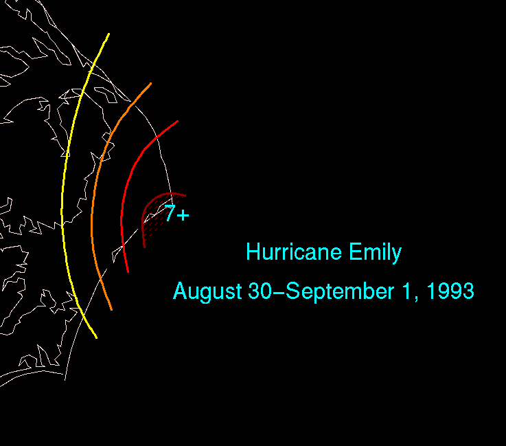
Hurricane Emily was a Category 3 hurricane
during the 1993 Atlantic hurricane season
. On September 1, the storm brushed the Outer Banks
of North Carolina
before heading back out to sea. Despite coming within miles of North Carolina as a major hurricane, the storm caused only three deaths and $50 million (2004 US dollars) in damages.
on August 17, and moved quickly west-northwestward. It organized into Tropical Depression Five on August 22 while 800 miles (1,287.5 km) east-northeast of Puerto Rico
. After moving quickly to the northwest, higher pressures to its north caused it to stall over the central Atlantic Ocean. With favorable conditions aloft and warm water temperatures, the depression strengthened into Tropical Storm Emily on August 25 as it drifted to the west-southwest, and briefly attained hurricane status the next day.
Emily dropped to tropical storm strength due to a slight increase in vertical shear, but again attained hurricane intensity late on August 27. A break in the subtropical ridge
caused the hurricane to turn to the northwest, during which Emily fluctuated in strength between 75 mi/h and 85 mi/h. As it approached the North Carolina
coastline, Hurricane Emily rapidly intensified to a 115 mi/h major hurricane over very warm water temperatures, shortly before turning to the north in response to a mid-latitude trough. Land was not spared entirely, and the western portion of Emily's 115 mi/h eyewall passed over the Outer Banks
on September 1. The hurricane accelerated to the east-northeast, and steadily weakened over the north Atlantic Ocean due to increased vertical shear. It turned to the south on the 3rd, and quickly weakened to a tropical depression by the next day. The depression again turned to the northeast and became extratropical
on September 6.
and Virginia
avoided substantial damage. Had Hurricane Emily continued its forward track, it would have caused much greater damage, possibly comparable to that of Hurricane Isabel
ten years later. Though its damage was minor, rough seas and wind caused three fatalities, all from drowning. Its name was not retired.
 In Cape Hatteras
, Emily damaged 553 homes beyond repair from its near-direct hit and strong winds. In addition, officials cut power to Hatteras Island
fearing that downed power lines could start a fire. The area most affected by Hurricane Emily was Buxton, North Carolina
, where a 10.2 feet (3.1 m) storm surge and a maximum of 7.5 inches (190.5 mm) of rain occurred. On Highway 12
, there were reports of sinkholes caused by heavy rains, some of which swallowed up three four-wheel-drive vehicles. Because Emily hit during Labor Day
weekend, the tourism industry suffered after Emily, losing $10 million when 160,000 were evacuated from northeastern North Carolina. Storm surge and flooding left 25% of the population of Cape Hatteras
homeless, causing Dare County
to issue a federal disaster declaration. Emily's high winds uprooted trees, downed power lines, tore off roofs, and, combined with its heavy flooding, caused $35 million (1993 US dollars) in damage, a lesser total than expected. In addition, Emily's limited effects only caused two deaths in North Carolina when two swimmers in Nags Head drowned.
, lightning from Emily set a roof on fire in the Lee Hall
section of the city while 5,000 residents were left without power. The Hampton Roads Bridge-Tunnel
also lost power because of the storm. Emily's light rains in the area were not enough to break a prolonged drought that hampered Virginia. Heavy surf resulted in one person drowning on the coast of Virginia in the days prior to the hurricane's arrival. In addition, a storm surge of 1.2 foot (0.36576 m) was reported at the Chesapeake Bay Bridge-Tunnel
.
through New York
, including 750 in Virginia, 100,000 in Maryland
, 1000 in Delaware
, and 20,000 from Fire Island, New York
. The hurricane remained far enough from these locations to cause little, if any damage. In Ocean City, Maryland
, 2.8 inches of rain were reported, while Sussex County Airport
reported only .01 inches of precipitation.
Saffir-Simpson Hurricane Scale
The Saffir–Simpson Hurricane Scale , or the Saffir–Simpson Hurricane Wind Scale , classifies hurricanes — Western Hemisphere tropical cyclones that exceed the intensities of tropical depressions and tropical storms — into five categories distinguished by the intensities of their sustained winds...
during the 1993 Atlantic hurricane season
1993 Atlantic hurricane season
The 1993 Atlantic hurricane season was a period in the annual formation of tropical cyclones. It officially began on June 1, 1993, and lasted until November 30, 1993. These dates conventionally delimit the period of each year when most tropical cyclones form in the Atlantic basin...
. On September 1, the storm brushed the Outer Banks
Outer Banks
The Outer Banks is a 200-mile long string of narrow barrier islands off the coast of North Carolina, beginning in the southeastern corner of Virginia Beach on the east coast of the United States....
of North Carolina
North Carolina
North Carolina is a state located in the southeastern United States. The state borders South Carolina and Georgia to the south, Tennessee to the west and Virginia to the north. North Carolina contains 100 counties. Its capital is Raleigh, and its largest city is Charlotte...
before heading back out to sea. Despite coming within miles of North Carolina as a major hurricane, the storm caused only three deaths and $50 million (2004 US dollars) in damages.
Meteorological history
A tropical wave moved off the coast of AfricaAfrica
Africa is the world's second largest and second most populous continent, after Asia. At about 30.2 million km² including adjacent islands, it covers 6% of the Earth's total surface area and 20.4% of the total land area...
on August 17, and moved quickly west-northwestward. It organized into Tropical Depression Five on August 22 while 800 miles (1,287.5 km) east-northeast of Puerto Rico
Puerto Rico
Puerto Rico , officially the Commonwealth of Puerto Rico , is an unincorporated territory of the United States, located in the northeastern Caribbean, east of the Dominican Republic and west of both the United States Virgin Islands and the British Virgin Islands.Puerto Rico comprises an...
. After moving quickly to the northwest, higher pressures to its north caused it to stall over the central Atlantic Ocean. With favorable conditions aloft and warm water temperatures, the depression strengthened into Tropical Storm Emily on August 25 as it drifted to the west-southwest, and briefly attained hurricane status the next day.
Emily dropped to tropical storm strength due to a slight increase in vertical shear, but again attained hurricane intensity late on August 27. A break in the subtropical ridge
Subtropical ridge
The subtropical ridge is a significant belt of high pressure situated around the latitudes of 30°N in the Northern Hemisphere and 30°S in the Southern Hemisphere. It is characterized by mostly calm winds, which acts to reduce air quality under its axis by causing fog overnight, and haze during...
caused the hurricane to turn to the northwest, during which Emily fluctuated in strength between 75 mi/h and 85 mi/h. As it approached the North Carolina
North Carolina
North Carolina is a state located in the southeastern United States. The state borders South Carolina and Georgia to the south, Tennessee to the west and Virginia to the north. North Carolina contains 100 counties. Its capital is Raleigh, and its largest city is Charlotte...
coastline, Hurricane Emily rapidly intensified to a 115 mi/h major hurricane over very warm water temperatures, shortly before turning to the north in response to a mid-latitude trough. Land was not spared entirely, and the western portion of Emily's 115 mi/h eyewall passed over the Outer Banks
Outer Banks
The Outer Banks is a 200-mile long string of narrow barrier islands off the coast of North Carolina, beginning in the southeastern corner of Virginia Beach on the east coast of the United States....
on September 1. The hurricane accelerated to the east-northeast, and steadily weakened over the north Atlantic Ocean due to increased vertical shear. It turned to the south on the 3rd, and quickly weakened to a tropical depression by the next day. The depression again turned to the northeast and became extratropical
Extratropical cyclone
Extratropical cyclones, sometimes called mid-latitude cyclones or wave cyclones, are a group of cyclones defined as synoptic scale low pressure weather systems that occur in the middle latitudes of the Earth having neither tropical nor polar characteristics, and are connected with fronts and...
on September 6.
Impact
Because Hurricane Emily did not make landfall, North CarolinaNorth Carolina
North Carolina is a state located in the southeastern United States. The state borders South Carolina and Georgia to the south, Tennessee to the west and Virginia to the north. North Carolina contains 100 counties. Its capital is Raleigh, and its largest city is Charlotte...
and Virginia
Virginia
The Commonwealth of Virginia , is a U.S. state on the Atlantic Coast of the Southern United States. Virginia is nicknamed the "Old Dominion" and sometimes the "Mother of Presidents" after the eight U.S. presidents born there...
avoided substantial damage. Had Hurricane Emily continued its forward track, it would have caused much greater damage, possibly comparable to that of Hurricane Isabel
Hurricane Isabel
Hurricane Isabel was the costliest and deadliest hurricane in the 2003 Atlantic hurricane season. The ninth named storm, fifth hurricane, and second major hurricane of the season, Isabel formed near the Cape Verde Islands from a tropical wave on September 6 in the tropical Atlantic Ocean...
ten years later. Though its damage was minor, rough seas and wind caused three fatalities, all from drowning. Its name was not retired.
North Carolina
Cape Hatteras
Cape Hatteras is a cape on the coast of North Carolina. It is the point that protrudes the farthest to the southeast along the northeast-to-southwest line of the Atlantic coast of North America...
, Emily damaged 553 homes beyond repair from its near-direct hit and strong winds. In addition, officials cut power to Hatteras Island
Hatteras Island
Hatteras Island is a barrier island located off the North Carolina coast. Dividing the Atlantic Ocean and the Pamlico Sound, it runs parallel to the coast, forming a bend at Cape Hatteras. It is part of North Carolina's Outer Banks and includes the towns of Rodanthe, Waves, Salvo, Avon, Buxton,...
fearing that downed power lines could start a fire. The area most affected by Hurricane Emily was Buxton, North Carolina
Buxton, North Carolina
Buxton is an unincorporated community of nearly 1,500 people on Hatteras Island near Cape Hatteras. It is located in Dare County in the U.S. state of North Carolina. North Carolina Highway 12 links the community to other Outer Banks communities such as Avon, Frisco, and Hatteras...
, where a 10.2 feet (3.1 m) storm surge and a maximum of 7.5 inches (190.5 mm) of rain occurred. On Highway 12
North Carolina State Highway 12
NC 12 is a North Carolina state highway that traverses the northeastern shoreline of North Carolina, linking the islands of the Outer Banks. It is a popular route for visitors touring the Outer Banks...
, there were reports of sinkholes caused by heavy rains, some of which swallowed up three four-wheel-drive vehicles. Because Emily hit during Labor Day
Labor Day
Labor Day is a United States federal holiday observed on the first Monday in September that celebrates the economic and social contributions of workers.-History:...
weekend, the tourism industry suffered after Emily, losing $10 million when 160,000 were evacuated from northeastern North Carolina. Storm surge and flooding left 25% of the population of Cape Hatteras
Cape Hatteras
Cape Hatteras is a cape on the coast of North Carolina. It is the point that protrudes the farthest to the southeast along the northeast-to-southwest line of the Atlantic coast of North America...
homeless, causing Dare County
Dare County, North Carolina
-National protected areas:* Alligator River National Wildlife Refuge * Cape Hatteras National Seashore * Fort Raleigh National Historic Site* Pea Island National Wildlife Refuge* Wright Brothers National Memorial-Demographics:...
to issue a federal disaster declaration. Emily's high winds uprooted trees, downed power lines, tore off roofs, and, combined with its heavy flooding, caused $35 million (1993 US dollars) in damage, a lesser total than expected. In addition, Emily's limited effects only caused two deaths in North Carolina when two swimmers in Nags Head drowned.
Virginia
In Newport NewsNewport News, Virginia
Newport News is an independent city located in the Hampton Roads metropolitan area of Virginia. It is at the southeastern end of the Virginia Peninsula, on the north shore of the James River extending southeast from Skiffe's Creek along many miles of waterfront to the river's mouth at Newport News...
, lightning from Emily set a roof on fire in the Lee Hall
Lee Hall, Virginia
Lee Hall is a former unincorporated town long located in the former Warwick County. Since 1958, Lee Hall has been a suburban community in the extreme western portion of the independent city of Newport News in the Commonwealth of Virginia....
section of the city while 5,000 residents were left without power. The Hampton Roads Bridge-Tunnel
Hampton Roads Bridge-Tunnel
The Hampton Roads Bridge-Tunnel is the -long Hampton Roads crossing for Interstate 64 and U.S. Route 60. It is a four-lane facility comprising bridges, trestles, man-made islands, and tunnels under the main shipping channels for Hampton Roads harbor in the southeastern portion of Virginia in the...
also lost power because of the storm. Emily's light rains in the area were not enough to break a prolonged drought that hampered Virginia. Heavy surf resulted in one person drowning on the coast of Virginia in the days prior to the hurricane's arrival. In addition, a storm surge of 1.2 foot (0.36576 m) was reported at the Chesapeake Bay Bridge-Tunnel
Chesapeake Bay Bridge-Tunnel
The Chesapeake Bay Bridge-Tunnel is a long fixed link crossing the mouth of the Chesapeake Bay and connecting the Delmarva Peninsula's Eastern Shore of Virginia with Virginia Beach and the metropolitan area of Hampton Roads, Virginia...
.
Mid-Atlantic and New England
Due to uncertainty of when and if Emily would make its northeast turn, thousands were evacuated from VirginiaVirginia
The Commonwealth of Virginia , is a U.S. state on the Atlantic Coast of the Southern United States. Virginia is nicknamed the "Old Dominion" and sometimes the "Mother of Presidents" after the eight U.S. presidents born there...
through New York
New York
New York is a state in the Northeastern region of the United States. It is the nation's third most populous state. New York is bordered by New Jersey and Pennsylvania to the south, and by Connecticut, Massachusetts and Vermont to the east...
, including 750 in Virginia, 100,000 in Maryland
Maryland
Maryland is a U.S. state located in the Mid Atlantic region of the United States, bordering Virginia, West Virginia, and the District of Columbia to its south and west; Pennsylvania to its north; and Delaware to its east...
, 1000 in Delaware
Delaware
Delaware is a U.S. state located on the Atlantic Coast in the Mid-Atlantic region of the United States. It is bordered to the south and west by Maryland, and to the north by Pennsylvania...
, and 20,000 from Fire Island, New York
Fire Island, New York
Fire Island is one of the outer barrier islands adjacent to the south shore of Long Island, New York. It is approximately long and varies between broad. Fire Island is part of Suffolk County. It comprises a number of hamlets, census-designated places , and villages, all of which lie within the...
. The hurricane remained far enough from these locations to cause little, if any damage. In Ocean City, Maryland
Ocean City, Maryland
Ocean City, sometimes known as OC, or OCMD, is an Atlantic Ocean resort town in Worcester County, Maryland, United States. Ocean City is widely known in the Mid-Atlantic region of the United States and is a frequent destination for vacationers in that area...
, 2.8 inches of rain were reported, while Sussex County Airport
Sussex County, Delaware
Sussex County is a county located in the southern part of the U.S. state of Delaware. As of 2010 the population was 197,145, an increase of 25.9% over the previous decade. The county seat is Georgetown. The Seaford Micropolitan Statistical Area includes all of Sussex County.Sussex County is...
reported only .01 inches of precipitation.
See also
- List of North Carolina hurricanes
- Other storms of the same name