

Jefferson County, Washington
Encyclopedia
Jefferson County is a county
located in the U.S. state
of Washington, named after Thomas Jefferson
. As of 2010, the population was 29,872. The county seat is at Port Townsend
, which is also the county's only incorporated city.
Jefferson County was formed out of Thurston County on December 22, 1852, by the legislature of Oregon Territory
, and included the northern 4854 square miles (12,571.8 km²) portion of the Olympic Peninsula
. On April 26, 1854, the legislature of Washington Territory
created Clallam County from the northwestern 2670 square miles (6,915.3 km²) portion of this original area.
The Hood Canal Bridge
connects Jefferson County to Kitsap County, Washington
. The Keystone
-Port Townsend
route of the Washington State Ferries
connects the county to Whidbey Island
in Island County, Washington
.
, the county has a total area of 2184 square miles (5,656.5 km²), of which 1814 square miles (4,698.2 km²) is land and 369 square miles (955.7 km²) (16.91%) is water.
The county is split in three parts by its landforms:
Because of the mountainous barrier
, there is no road lying entirely within Jefferson County that connects the eastern and western parts. The most direct land route between the two ends of the county involves a drive of approximately 100 miles (160.9 km) along U.S. Route 101
through neighbouring Clallam County. The mountains
also block the damp Chinook wind
s, which make the climate very much more wet in the West than the so-called Eastern "banana belt
" in the rain shadow
.
of 2000, there were 25,953 people, 11,645 households, and 7,580 families residing in the county. The population density
was 14 people per square mile (6/km²). There were 14,144 housing units at an average density of 8 per square mile (3/km²). The racial makeup of the county was 92.17% White
, 0.42% Black
or African American
, 2.31% Native American
, 1.19% Asian
, 0.13% Pacific Islander
, 0.76% from other races
, and 3.02% from two or more races. 2.06% of the population were Hispanic
or Latino
of any race. 17.4% were of German, 14.8% English
, 9.9% Irish
and 7.5% Norwegian ancestry according to Census 2000. 97.1% spoke English
and 1.0% Spanish
as their first language.
There were 11,645 households out of which 23.20% had children under the age of 18 living with them, 53.60% were married couples
living together, 8.20% had a female householder with no husband present, and 34.90% were non-families. 28.50% of all households were made up of individuals and 11.70% had someone living alone who was 65 years of age or older. The average household size was 2.21 and the average family size was 2.67.
In the county, the population was spread out with 19.80% under the age of 18, 5.00% from 18 to 24, 21.60% from 25 to 44, 32.50% from 45 to 64, and 21.10% who were 65 years of age or older. The median age was 47 years. For every 100 females there were 95.80 males. For every 100 females age 18 and over, there were 94.40 males.
The median income for a household in the county was $37,869, and the median income for a family was $45,415. Males had a median income of $37,210 versus $25,831 for females. The per capita income
for the county was $22,211. About 7.20% of families and 11.30% of the population were below the poverty line, including 16.60% of those under age 18 and 6.00% of those age 65 or over.
area, with even rural areas giving significant margins to John Kerry
against George W. Bush
in the 2004 U.S. presidential election.
The communities in the Eastern and Western halves of Jefferson County tend to not mingle much, because of the barrier dividing the county
. The communities also differ in amount and sources of family income, and population size and density, with the West being more dependent on logging
, somewhat less prosperous, and having fewer people for roughly the same area. Port Townsend, located in the relatively populous East is gradually developing into a retirement community. Areas of East Jefferson County located south of Port Townsend remain largely rural and can be divided into two parts, those communities located on the Hood Canal and those on the Admiralty Inlet. Because of persistent differences in local self-interest, the two sides of the county regularly experience political friction. Perennial discussions and attempts to separate the West half from the East gained little support during the twentieth century because of the perception that less prosperous West is subsidised by the East from which it would secede, leaving it worse rather than better-off, and giving adjoining counties little reason to wish to annex the West.
County seat Port Townsend
casts a significant number of votes, and voted for John Kerry by a margin of over 3-to-1. Areas outside of Port Townsend (such as Cape George
) gave Kerry 2-to-1 victory margins. Democrats also do well in the small towns of northern Jefferson County, with strong Democratic leans in Coyle, Discovery Bay
, Gardiner
, and Nordland, as well as in the towns just southeast of Port Townsend (Chimacum
, Irondale, Kala Point, and Port Hadlock). Democrats also perform strongly in the sparsely-populated western part of the county, where much of the population is Native American.
Republicans tend to win small victories in several parts of the county, such as the sparsely-populated area around Crocker Lake. Although it has trended Democratic in recent years, Port Ludlow
— an affluent area that casts a notable number of votes — still has a Republican lean (although the north part of Port Ludlow has become a marginally Democratic area).
County (United States)
In the United States, a county is a geographic subdivision of a state , usually assigned some governmental authority. The term "county" is used in 48 of the 50 states; Louisiana is divided into parishes and Alaska into boroughs. Parishes and boroughs are called "county-equivalents" by the U.S...
located in the U.S. state
U.S. state
A U.S. state is any one of the 50 federated states of the United States of America that share sovereignty with the federal government. Because of this shared sovereignty, an American is a citizen both of the federal entity and of his or her state of domicile. Four states use the official title of...
of Washington, named after Thomas Jefferson
Thomas Jefferson
Thomas Jefferson was the principal author of the United States Declaration of Independence and the Statute of Virginia for Religious Freedom , the third President of the United States and founder of the University of Virginia...
. As of 2010, the population was 29,872. The county seat is at Port Townsend
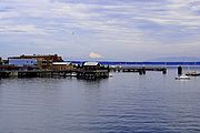
Port Townsend, Washington
Port Townsend is a city in Jefferson County, Washington, United States, approximately north-northwest of Seattle . The population was 9,113 at the 2010 census an increase of 9.3% over the 2000 census. It is the county seat and only incorporated city of Jefferson County...
, which is also the county's only incorporated city.
Jefferson County was formed out of Thurston County on December 22, 1852, by the legislature of Oregon Territory
Oregon Territory
The Territory of Oregon was an organized incorporated territory of the United States that existed from August 14, 1848, until February 14, 1859, when the southwestern portion of the territory was admitted to the Union as the State of Oregon. Originally claimed by several countries , the region was...
, and included the northern 4854 square miles (12,571.8 km²) portion of the Olympic Peninsula
Olympic Peninsula
The Olympic Peninsula is the large arm of land in western Washington state of the USA, that lies across Puget Sound from Seattle. It is bounded on the west by the Pacific Ocean, the north by the Strait of Juan de Fuca, and the east by Puget Sound. Cape Alava, the westernmost point in the contiguous...
. On April 26, 1854, the legislature of Washington Territory
Washington Territory
The Territory of Washington was an organized incorporated territory of the United States that existed from February 8, 1853, until November 11, 1889, when the final extent of the territory was admitted to the Union as the State of Washington....
created Clallam County from the northwestern 2670 square miles (6,915.3 km²) portion of this original area.
The Hood Canal Bridge
Hood Canal Bridge
The Hood Canal Bridge is a floating bridge located in the U.S. state of Washington that carries Washington State Route 104 across Hood Canal and connects the Olympic and Kitsap Peninsulas. At long, The Hood Canal Bridge (officially William A. Bugge Bridge) is a floating bridge located in the U.S....
connects Jefferson County to Kitsap County, Washington
Kitsap County, Washington
Kitsap County is a county located in the U.S. state of Washington, named after Chief Kitsap of the Suquamish tribe. As of 2011 state estimate, its population was 253,900. Its county seat is at Port Orchard, and its largest city is Bremerton....
. The Keystone
Keystone, Island County, Washington
Keystone is a small unincorporated community on Whidbey Island in Island County, Washington, in the northwestern United States. It is near the Keystone Ferry Landing, a dock for the Washington State Ferries route to Port Townsend that provides a maritime link for State Route 20 across Admiralty Inlet...
-Port Townsend
Port Townsend, Washington
Port Townsend is a city in Jefferson County, Washington, United States, approximately north-northwest of Seattle . The population was 9,113 at the 2010 census an increase of 9.3% over the 2000 census. It is the county seat and only incorporated city of Jefferson County...
route of the Washington State Ferries
Washington State Ferries
Washington State Ferries is a passenger and automobile ferry service owned and operated by the Washington State Department of Transportation that serves communities on Puget Sound and in the San Juan Islands. It is the most used ferry system in the world and the largest passenger and automobile...
connects the county to Whidbey Island
Whidbey Island
Whidbey Island is one of nine islands located in Island County, Washington, in the United States. Whidbey is located about north of Seattle, and lies between the Olympic Peninsula and the I-5 corridor of western Washington...
in Island County, Washington
Island County, Washington
Island County is a county located in the U.S. state of Washington. In 2010 census, its population was 78,506. Its county seat is Coupeville, while its largest city is Oak Harbor....
.
Geography
According to the U.S. Census BureauUnited States Census Bureau
The United States Census Bureau is the government agency that is responsible for the United States Census. It also gathers other national demographic and economic data...
, the county has a total area of 2184 square miles (5,656.5 km²), of which 1814 square miles (4,698.2 km²) is land and 369 square miles (955.7 km²) (16.91%) is water.
The county is split in three parts by its landforms:
- Eastern Jefferson County along the Strait of Juan de FucaStrait of Juan de FucaThe Strait of Juan de Fuca is a large body of water about long that is the Salish Sea outlet to the Pacific Ocean...
, Admiralty InletAdmiralty InletAdmiralty Inlet is a strait in the U.S. state of Washington connecting the eastern end of the Strait of Juan de Fuca to Puget Sound. It lies between Whidbey Island and the northeastern part of the Olympic Peninsula....
, and Puget SoundPuget SoundPuget Sound is a sound in the U.S. state of Washington. It is a complex estuarine system of interconnected marine waterways and basins, with one major and one minor connection to the Strait of Juan de Fuca and the Pacific Ocean — Admiralty Inlet being the major connection and... - Central Jefferson County, which is uninhabited and lies in the Olympic MountainsOlympic MountainsThe Olympic Mountains is a mountain range on the Olympic Peninsula of western Washington in the United States. The mountains, part of the Pacific Coast Ranges, are not especially high - Mount Olympus is the highest at - but the western slopes of the Olympics rise directly out of the Pacific...
within Olympic National ParkOlympic National ParkOlympic National Park is located in the U.S. state of Washington, in the Olympic Peninsula. The park can be divided into four basic regions: the Pacific coastline, alpine areas, the west side temperate rainforest and the forests of the drier east side. U.S...
and Olympic National ForestOlympic National ForestOlympic National Forest is a U.S. National Forest located in Washington, USA. With an area of 633,677 acres , it nearly surrounds Olympic National Park and the Olympic Mountain range. Olympic National Forest contains parts of Clallam, Grays Harbor, Jefferson, and Mason counties... - Western Jefferson County, along the Pacific OceanPacific OceanThe Pacific Ocean is the largest of the Earth's oceanic divisions. It extends from the Arctic in the north to the Southern Ocean in the south, bounded by Asia and Australia in the west, and the Americas in the east.At 165.2 million square kilometres in area, this largest division of the World...
.
Because of the mountainous barrier
Olympic Mountains
The Olympic Mountains is a mountain range on the Olympic Peninsula of western Washington in the United States. The mountains, part of the Pacific Coast Ranges, are not especially high - Mount Olympus is the highest at - but the western slopes of the Olympics rise directly out of the Pacific...
, there is no road lying entirely within Jefferson County that connects the eastern and western parts. The most direct land route between the two ends of the county involves a drive of approximately 100 miles (160.9 km) along U.S. Route 101
U.S. Route 101
U.S. Route 101, or U.S. Highway 101, is an important north–south U.S. highway that runs through the states of California, Oregon, and Washington, on the West Coast of the United States...
through neighbouring Clallam County. The mountains
Olympic Mountains
The Olympic Mountains is a mountain range on the Olympic Peninsula of western Washington in the United States. The mountains, part of the Pacific Coast Ranges, are not especially high - Mount Olympus is the highest at - but the western slopes of the Olympics rise directly out of the Pacific...
also block the damp Chinook wind
Chinook wind
Chinook winds , often called chinooks, commonly refers to foehn winds in the interior West of North America, where the Canadian Prairies and Great Plains meet various mountain ranges, although the original usage is in reference to wet, warm coastal winds in the Pacific Northwest.Chinook is claimed...
s, which make the climate very much more wet in the West than the so-called Eastern "banana belt
Banana belt
"Banana belt" is an informal geographic term used to describe a segment of a larger geographic region which enjoys warmer weather conditions than the region as a whole, especially in the wintertime...
" in the rain shadow
Rain shadow
A rain shadow is a dry area on the lee side of a mountainous area. The mountains block the passage of rain-producing weather systems, casting a "shadow" of dryness behind them. As shown by the diagram to the right, the warm moist air is "pulled" by the prevailing winds over a mountain...
.
Geographic features
- Admiralty InletAdmiralty InletAdmiralty Inlet is a strait in the U.S. state of Washington connecting the eastern end of the Strait of Juan de Fuca to Puget Sound. It lies between Whidbey Island and the northeastern part of the Olympic Peninsula....
- Destruction Island
- Discovery BayDiscovery Bay, WashingtonDiscovery Bay is:* A small bay adjoining the Strait of Juan de Fuca on the Olympic Peninsula in Washington State; this body of water was also historically called Port Discovery...
- Hood CanalHood CanalHood Canal is a fjord forming the western lobe, and one of the four main basins, of Puget Sound in the state of Washington. Hood Canal is not a canal in the sense of being a man-made waterway—it is a natural waterway.-Geography:...
- Mount Olympus, Washington, the highest point in Jefferson county
- Olympic MountainsOlympic MountainsThe Olympic Mountains is a mountain range on the Olympic Peninsula of western Washington in the United States. The mountains, part of the Pacific Coast Ranges, are not especially high - Mount Olympus is the highest at - but the western slopes of the Olympics rise directly out of the Pacific...
- Olympic PeninsulaOlympic PeninsulaThe Olympic Peninsula is the large arm of land in western Washington state of the USA, that lies across Puget Sound from Seattle. It is bounded on the west by the Pacific Ocean, the north by the Strait of Juan de Fuca, and the east by Puget Sound. Cape Alava, the westernmost point in the contiguous...
- Pacific OceanPacific OceanThe Pacific Ocean is the largest of the Earth's oceanic divisions. It extends from the Arctic in the north to the Southern Ocean in the south, bounded by Asia and Australia in the west, and the Americas in the east.At 165.2 million square kilometres in area, this largest division of the World...
- Point WilsonPoint WilsonPoint Wilson is at the end of the Quimper Peninsula, a northeast extension of the Olympic Peninsula and the northeastern most point of Jefferson County, Washington, United States, approximately two miles north of the Port Townsend business district....
- Port Townsend BayPort Townsend BayPort Townsend Bay, also called Port Townsend, is a marine inlet off Admiralty Inlet at the northeastern extreme of the Olympic Peninsula in the U.S. state of Washington. It was named Port Townsend by George Vancouver in 1792. The name Port Townsend Bay is sometimes used to distinguish the bay from...
- Protection IslandProtection Island (Washington)Protection Island is an island lying in the Strait of Juan de Fuca just north of Discovery Bay in northeastern Jefferson County, Washington, USA. The island has a land area of 1.534 km² . It is a Federally-protected National Wildlife Refuge; boats are not permitted within 200 yards for the...
- Puget SoundPuget SoundPuget Sound is a sound in the U.S. state of Washington. It is a complex estuarine system of interconnected marine waterways and basins, with one major and one minor connection to the Strait of Juan de Fuca and the Pacific Ocean — Admiralty Inlet being the major connection and...
- Queets RiverQueets RiverThe Queets River is a river in the U.S. state of Washington. It is located on the Olympic Peninsula, mostly within the Olympic National Park and empties into the Pacific Ocean.The Queets River is long. Its drainage basin is in area...
- Quimper PeninsulaQuimper PeninsulaThe Quimper Peninsula is a narrow peninsula forming the most northeastern extent of the Olympic Peninsula of Washington state in the northwestern United States of America....
- Strait of Juan de FucaStrait of Juan de FucaThe Strait of Juan de Fuca is a large body of water about long that is the Salish Sea outlet to the Pacific Ocean...
Major highways
- U.S. Route 101U.S. Route 101 in WashingtonIn the U.S. state of Washington, U.S. Route 101 is the westernmost state highway, serving the Olympic Peninsula. It runs from the Astoria-Megler Bridge north to the cities of Raymond, Aberdeen, Hoquiam, and Forks before turning east at the small community of Beaver to the most northern point of the...
 State Route 20
 State Route 104
Adjacent counties
- Island County, WashingtonIsland County, WashingtonIsland County is a county located in the U.S. state of Washington. In 2010 census, its population was 78,506. Its county seat is Coupeville, while its largest city is Oak Harbor....
- northeast - Kitsap County, WashingtonKitsap County, WashingtonKitsap County is a county located in the U.S. state of Washington, named after Chief Kitsap of the Suquamish tribe. As of 2011 state estimate, its population was 253,900. Its county seat is at Port Orchard, and its largest city is Bremerton....
- southeast - Mason County, Washington - south/southeast
- Grays Harbor County, WashingtonGrays Harbor County, WashingtonGrays Harbor County is a county in the state of Washington, in the United States of America. As of 2010, the population was 72,797. The county seat is at Montesano, and its largest city is Aberdeen. The county is named after a large estuarine bay near its southwestern corner...
- south/southwest - Clallam County, Washington - northwest
- San Juan County, Washington - northeast (water boundary only, in Strait of Juan de FucaStrait of Juan de FucaThe Strait of Juan de Fuca is a large body of water about long that is the Salish Sea outlet to the Pacific Ocean...
).
National protected areas
- Olympic National ForestOlympic National ForestOlympic National Forest is a U.S. National Forest located in Washington, USA. With an area of 633,677 acres , it nearly surrounds Olympic National Park and the Olympic Mountain range. Olympic National Forest contains parts of Clallam, Grays Harbor, Jefferson, and Mason counties...
(part) - Olympic National ParkOlympic National ParkOlympic National Park is located in the U.S. state of Washington, in the Olympic Peninsula. The park can be divided into four basic regions: the Pacific coastline, alpine areas, the west side temperate rainforest and the forests of the drier east side. U.S...
(part) - Protection Island National Wildlife RefugeProtection Island National Wildlife RefugeProtection Island National Wildlife Refuge is located near the mouth of Discovery Bay in the Strait of Juan de Fuca in Jefferson County, Washington...
- Quillayute Needles National Wildlife RefugeQuillayute Needles National Wildlife RefugeQuillayute Needles National Wildlife Refuge is the central refuge of the three which make up the Washington Maritime National Wildlife Refuge Complex, a group of 870 islands, rocks, and reefs extending for more than 100 miles along Washington's coast from Cape Flattery to Copalis Beach...
(part) - Pacific Northwest National Scenic Trail (part)
Demographics
As of the censusCensus
A census is the procedure of systematically acquiring and recording information about the members of a given population. It is a regularly occurring and official count of a particular population. The term is used mostly in connection with national population and housing censuses; other common...
of 2000, there were 25,953 people, 11,645 households, and 7,580 families residing in the county. The population density
Population density
Population density is a measurement of population per unit area or unit volume. It is frequently applied to living organisms, and particularly to humans...
was 14 people per square mile (6/km²). There were 14,144 housing units at an average density of 8 per square mile (3/km²). The racial makeup of the county was 92.17% White
Race (United States Census)
Race and ethnicity in the United States Census, as defined by the Federal Office of Management and Budget and the United States Census Bureau, are self-identification data items in which residents choose the race or races with which they most closely identify, and indicate whether or not they are...
, 0.42% Black
Race (United States Census)
Race and ethnicity in the United States Census, as defined by the Federal Office of Management and Budget and the United States Census Bureau, are self-identification data items in which residents choose the race or races with which they most closely identify, and indicate whether or not they are...
or African American
Race (United States Census)
Race and ethnicity in the United States Census, as defined by the Federal Office of Management and Budget and the United States Census Bureau, are self-identification data items in which residents choose the race or races with which they most closely identify, and indicate whether or not they are...
, 2.31% Native American
Race (United States Census)
Race and ethnicity in the United States Census, as defined by the Federal Office of Management and Budget and the United States Census Bureau, are self-identification data items in which residents choose the race or races with which they most closely identify, and indicate whether or not they are...
, 1.19% Asian
Race (United States Census)
Race and ethnicity in the United States Census, as defined by the Federal Office of Management and Budget and the United States Census Bureau, are self-identification data items in which residents choose the race or races with which they most closely identify, and indicate whether or not they are...
, 0.13% Pacific Islander
Race (United States Census)
Race and ethnicity in the United States Census, as defined by the Federal Office of Management and Budget and the United States Census Bureau, are self-identification data items in which residents choose the race or races with which they most closely identify, and indicate whether or not they are...
, 0.76% from other races
Race (United States Census)
Race and ethnicity in the United States Census, as defined by the Federal Office of Management and Budget and the United States Census Bureau, are self-identification data items in which residents choose the race or races with which they most closely identify, and indicate whether or not they are...
, and 3.02% from two or more races. 2.06% of the population were Hispanic
Race (United States Census)
Race and ethnicity in the United States Census, as defined by the Federal Office of Management and Budget and the United States Census Bureau, are self-identification data items in which residents choose the race or races with which they most closely identify, and indicate whether or not they are...
or Latino
Race (United States Census)
Race and ethnicity in the United States Census, as defined by the Federal Office of Management and Budget and the United States Census Bureau, are self-identification data items in which residents choose the race or races with which they most closely identify, and indicate whether or not they are...
of any race. 17.4% were of German, 14.8% English
English people
The English are a nation and ethnic group native to England, who speak English. The English identity is of early mediaeval origin, when they were known in Old English as the Anglecynn. England is now a country of the United Kingdom, and the majority of English people in England are British Citizens...
, 9.9% Irish
Irish people
The Irish people are an ethnic group who originate in Ireland, an island in northwestern Europe. Ireland has been populated for around 9,000 years , with the Irish people's earliest ancestors recorded having legends of being descended from groups such as the Nemedians, Fomorians, Fir Bolg, Tuatha...
and 7.5% Norwegian ancestry according to Census 2000. 97.1% spoke English
English language
English is a West Germanic language that arose in the Anglo-Saxon kingdoms of England and spread into what was to become south-east Scotland under the influence of the Anglian medieval kingdom of Northumbria...
and 1.0% Spanish
Spanish language
Spanish , also known as Castilian , is a Romance language in the Ibero-Romance group that evolved from several languages and dialects in central-northern Iberia around the 9th century and gradually spread with the expansion of the Kingdom of Castile into central and southern Iberia during the...
as their first language.
There were 11,645 households out of which 23.20% had children under the age of 18 living with them, 53.60% were married couples
Marriage
Marriage is a social union or legal contract between people that creates kinship. It is an institution in which interpersonal relationships, usually intimate and sexual, are acknowledged in a variety of ways, depending on the culture or subculture in which it is found...
living together, 8.20% had a female householder with no husband present, and 34.90% were non-families. 28.50% of all households were made up of individuals and 11.70% had someone living alone who was 65 years of age or older. The average household size was 2.21 and the average family size was 2.67.
In the county, the population was spread out with 19.80% under the age of 18, 5.00% from 18 to 24, 21.60% from 25 to 44, 32.50% from 45 to 64, and 21.10% who were 65 years of age or older. The median age was 47 years. For every 100 females there were 95.80 males. For every 100 females age 18 and over, there were 94.40 males.
The median income for a household in the county was $37,869, and the median income for a family was $45,415. Males had a median income of $37,210 versus $25,831 for females. The per capita income
Per capita income
Per capita income or income per person is a measure of mean income within an economic aggregate, such as a country or city. It is calculated by taking a measure of all sources of income in the aggregate and dividing it by the total population...
for the county was $22,211. About 7.20% of families and 11.30% of the population were below the poverty line, including 16.60% of those under age 18 and 6.00% of those age 65 or over.
Politics
Jefferson County is a staunchly DemocraticDemocratic Party (United States)
The Democratic Party is one of two major contemporary political parties in the United States, along with the Republican Party. The party's socially liberal and progressive platform is largely considered center-left in the U.S. political spectrum. The party has the lengthiest record of continuous...
area, with even rural areas giving significant margins to John Kerry
John Kerry
John Forbes Kerry is the senior United States Senator from Massachusetts, the 10th most senior U.S. Senator and chairman of the Senate Foreign Relations Committee. He was the presidential nominee of the Democratic Party in the 2004 presidential election, but lost to former President George W...
against George W. Bush
George W. Bush
George Walker Bush is an American politician who served as the 43rd President of the United States, from 2001 to 2009. Before that, he was the 46th Governor of Texas, having served from 1995 to 2000....
in the 2004 U.S. presidential election.
The communities in the Eastern and Western halves of Jefferson County tend to not mingle much, because of the barrier dividing the county
Olympic Mountains
The Olympic Mountains is a mountain range on the Olympic Peninsula of western Washington in the United States. The mountains, part of the Pacific Coast Ranges, are not especially high - Mount Olympus is the highest at - but the western slopes of the Olympics rise directly out of the Pacific...
. The communities also differ in amount and sources of family income, and population size and density, with the West being more dependent on logging
Logging
Logging is the cutting, skidding, on-site processing, and loading of trees or logs onto trucks.In forestry, the term logging is sometimes used in a narrow sense concerning the logistics of moving wood from the stump to somewhere outside the forest, usually a sawmill or a lumber yard...
, somewhat less prosperous, and having fewer people for roughly the same area. Port Townsend, located in the relatively populous East is gradually developing into a retirement community. Areas of East Jefferson County located south of Port Townsend remain largely rural and can be divided into two parts, those communities located on the Hood Canal and those on the Admiralty Inlet. Because of persistent differences in local self-interest, the two sides of the county regularly experience political friction. Perennial discussions and attempts to separate the West half from the East gained little support during the twentieth century because of the perception that less prosperous West is subsidised by the East from which it would secede, leaving it worse rather than better-off, and giving adjoining counties little reason to wish to annex the West.
County seat Port Townsend
Port Townsend, Washington
Port Townsend is a city in Jefferson County, Washington, United States, approximately north-northwest of Seattle . The population was 9,113 at the 2010 census an increase of 9.3% over the 2000 census. It is the county seat and only incorporated city of Jefferson County...
casts a significant number of votes, and voted for John Kerry by a margin of over 3-to-1. Areas outside of Port Townsend (such as Cape George
Cape George, Washington
Cape George is an unincorporated community on the Olympic Peninsula in Washington state. It lies along the eastern shore of Discovery Bay on the western coast of the Quimper Peninsula in eastern Jefferson County....
) gave Kerry 2-to-1 victory margins. Democrats also do well in the small towns of northern Jefferson County, with strong Democratic leans in Coyle, Discovery Bay
Discovery Bay, Washington
Discovery Bay is:* A small bay adjoining the Strait of Juan de Fuca on the Olympic Peninsula in Washington State; this body of water was also historically called Port Discovery...
, Gardiner
Gardiner, Washington
right|450px|Looking north from GardinerGardiner is an unincorporated community in Jefferson County, Washington, United States. Gardiner is located on the Miller Peninsula, at the northern coast of the Olympic Peninsula on Discovery Bay,...
, and Nordland, as well as in the towns just southeast of Port Townsend (Chimacum
Chimacum, Washington
Chimacum is an unincorporated community in eastern Jefferson County, Washington, United States. It lies on the Olympic Peninsula. It was named after the Chimakum group of Native Americans that lived there until the late 19th century.Chimacum is the home of Chimacum Schools' main campus, which...
, Irondale, Kala Point, and Port Hadlock). Democrats also perform strongly in the sparsely-populated western part of the county, where much of the population is Native American.
Republicans tend to win small victories in several parts of the county, such as the sparsely-populated area around Crocker Lake. Although it has trended Democratic in recent years, Port Ludlow
Port Ludlow, Washington
Port Ludlow is a census-designated place in Jefferson County, Washington, United States. It is also the name of the marine inlet on which the CDP is located. The CDP's population was 1,968 at the 2000 census. Originally a logging and sawmill community, its economy declined during the first half of...
— an affluent area that casts a notable number of votes — still has a Republican lean (although the north part of Port Ludlow has become a marginally Democratic area).
Census-recognized communities
- BrinnonBrinnon, Washington-Demographics:As of the census of 2000, there were 803 people, 413 households, and 258 families residing in the CDP. The population density was 81.3 people per square mile . There were 912 housing units at an average density of 92.4/sq mi...
- MarrowstoneMarrowstone, WashingtonMarrowstone is a census-designated place in Jefferson County, Washington, USA. The population was 837 at the 2000 census. All Marrowstone addresses are in Nordland, Washington, and the ZIP code for Marrowstone Island is 98358....
- Port Hadlock-IrondalePort Hadlock-Irondale, WashingtonPort Hadlock-Irondale is a census-designated place in Jefferson County, Washington, United States. The population was 3,476 at the 2000 census.-Geography:Port Hadlock-Irondale is located at...
- Port LudlowPort Ludlow, WashingtonPort Ludlow is a census-designated place in Jefferson County, Washington, United States. It is also the name of the marine inlet on which the CDP is located. The CDP's population was 1,968 at the 2000 census. Originally a logging and sawmill community, its economy declined during the first half of...
- Port TownsendPort Townsend, WashingtonPort Townsend is a city in Jefferson County, Washington, United States, approximately north-northwest of Seattle . The population was 9,113 at the 2010 census an increase of 9.3% over the 2000 census. It is the county seat and only incorporated city of Jefferson County...
- QuilceneQuilcene, WashingtonQuilcene is a census-designated place in Jefferson County, Washington, United States. The population was 591 at the 2000 census.The community is located on the scenic Olympic Peninsula along the seawater-filled glacial valley of the Hood Canal...
Other communities
- Adelma Beach
- Beckett PointBeckett Point, WashingtonBeckett Point is a small point jutting out into Discovery Bay located ten miles from the city of Port Townsend in Jefferson County, Washington, United States. The Point is owned by the Beckett Point Fisherman's Club, which leases out 96 homes...
- Cape GeorgeCape George, WashingtonCape George is an unincorporated community on the Olympic Peninsula in Washington state. It lies along the eastern shore of Discovery Bay on the western coast of the Quimper Peninsula in eastern Jefferson County....
- CenterCenter, WashingtonCenter is an unincorporated community in Jefferson County, Washington, United States. Center was so named because it was at one point considered to be the center of Jefferson County, although it is now significantly to the east. Center is not a town, but rather the name often applied to this...
- ChimacumChimacum, WashingtonChimacum is an unincorporated community in eastern Jefferson County, Washington, United States. It lies on the Olympic Peninsula. It was named after the Chimakum group of Native Americans that lived there until the late 19th century.Chimacum is the home of Chimacum Schools' main campus, which...
- ClearwaterClearwater, WashingtonClearwater is an unincorporated community in western Jefferson County, Washington, United States. Clearwater is located along the Clearwater River and is a primarily timberlands with limited private ownership. The community is just outside the boundaries of the Quinault Indian Reservation....
- Coyle
- Crocker Lake
- Dabob
- Discovery BayDiscovery Bay, WashingtonDiscovery Bay is:* A small bay adjoining the Strait of Juan de Fuca on the Olympic Peninsula in Washington State; this body of water was also historically called Port Discovery...
- East Quilcene
- Fort Flagler
- Fort Worden
- GardinerGardiner, Washingtonright|450px|Looking north from GardinerGardiner is an unincorporated community in Jefferson County, Washington, United States. Gardiner is located on the Miller Peninsula, at the northern coast of the Olympic Peninsula on Discovery Bay,...
- Glen Cove
- Indian IslandIndian Island, WashingtonIndian Island is an unincorporated community in Jefferson County, Washington, United States. It is located between Port Townsend Bay and Kilisut Harbor. Parts also border on Oak Bay and Scow Bay. Until the construction of the Port Townsend Ship Canal Indian Island was connected to the mainland...
- Kala Point
- KalalochKalaloch, WashingtonKalaloch is an unincorporated community in western Jefferson County, Washington, United States. The community is a resort on the bluffs just off of Highway 101 on the Olympic Peninsula in Washington overlooking the Pacific Ocean. A number of log cabins provide accommodations, as does the Kalaloch...
- Leland
- Mats Mats
- Mount Walker
- Oak Bay
- QueetsQueets, WashingtonQueets is an unincorporated community in western Jefferson County, Washington, United States. It is near the coast of the Pacific Ocean, located just north of the Grays Harbor County county line along the Queets River, at the northern edge of the Quinault Indian Reservation. The community is...
- Shine
External links
- Official Jefferson County Parks and Recreation Department Website The official government website for Jefferson County Parks and Recreation, a Division of Jefferson County Public Works Department.
- University of Washington Libraries Digital Collections – The Pacific Northwest Olympic Peninsula Community Museum A web-based museum showcasing aspects of the rich history and culture of Washington State's Olympic Peninsula communities. Features cultural exhibits, curriculum packets and a searchable archive of over 12,000 items that includes historical photographs, audio recordings, videos, maps, diaries, reports and other documents.
- Jefferson County Official Website
- Jefferson County Historical Society Research Center A searchable, online collection of 49,000 records maintained by the Jefferson County museum and research center, whose mission is to actively discover, collect, preserve, and promote the heritage of Jefferson County in the State of Washington.
- PortLudowToday-Digital Village A non profit organization providing a virtual collection of activities and current events surrounding this master planned community.