

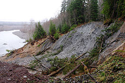
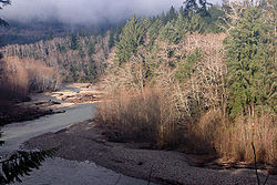
Queets River
Encyclopedia
River
A river is a natural watercourse, usually freshwater, flowing towards an ocean, a lake, a sea, or another river. In a few cases, a river simply flows into the ground or dries up completely before reaching another body of water. Small rivers may also be called by several other names, including...
in the U.S. state
U.S. state
A U.S. state is any one of the 50 federated states of the United States of America that share sovereignty with the federal government. Because of this shared sovereignty, an American is a citizen both of the federal entity and of his or her state of domicile. Four states use the official title of...
of Washington. It is located on the Olympic Peninsula
Olympic Peninsula
The Olympic Peninsula is the large arm of land in western Washington state of the USA, that lies across Puget Sound from Seattle. It is bounded on the west by the Pacific Ocean, the north by the Strait of Juan de Fuca, and the east by Puget Sound. Cape Alava, the westernmost point in the contiguous...
, mostly within the Olympic National Park
Olympic National Park
Olympic National Park is located in the U.S. state of Washington, in the Olympic Peninsula. The park can be divided into four basic regions: the Pacific coastline, alpine areas, the west side temperate rainforest and the forests of the drier east side. U.S...
and empties into the Pacific Ocean
Pacific Ocean
The Pacific Ocean is the largest of the Earth's oceanic divisions. It extends from the Arctic in the north to the Southern Ocean in the south, bounded by Asia and Australia in the west, and the Americas in the east.At 165.2 million square kilometres in area, this largest division of the World...
.
The Queets River is 52.8 miles (85 km) long. Its drainage basin
Drainage basin
A drainage basin is an extent or an area of land where surface water from rain and melting snow or ice converges to a single point, usually the exit of the basin, where the waters join another waterbody, such as a river, lake, reservoir, estuary, wetland, sea, or ocean...
is 204 square miles (528.4 km²) in area. Its main tributaries include the Clearwater River, Salmon River
Salmon River (Washington)
The Salmon River is a tributary of the Queets River in US state of Washington.The river flows roughly from east to south, with the North Fork Salmon River, Middle Fork Salmon River, South Fork Salmon River, combining to form the Salmon River, which empties into the Queets River. The river's length,...
, Sams River
Sams River
Sams River is a river in the U.S. state of Washington. A tributary of the Queets River, Sams River flows through Olympic National Park and Olympic National Forest. Part of the river's lower course forms the boundary between the national park and national forest.Sams River is long...
, Matheny Creek, and Tshetshy Creek, as well as the Clearwater's main tributaries, the Snahapish River
Snahapish River
The Snahapish River is a river in the U.S. state of Washington. It is a tributary of the Clearwater River, which in turn flows into the Queets River.The Snahapish River is long. Its drainage basin is in area.-Course:...
and Solleks River
Solleks River
The Solleks River is a river in the U.S. state of Washington. It is a tributary of the Clearwater River, which in turn flows into the Queets River.The Solleks River is long. Its drainage basin is in area.-Course:...
.
History
According to Queets and Quinault legend, river was originally called K'witzqu or quitzqu, pronounced "Kw-ā-tz", meaning "out of the dirt of the skin". The legend tells of Kwate, the changer, or s'qitu, the Great Spirit and Transformer, came to the mouth of the Queets River. After fording the cold river he rubbed his legs to restore circulation, small rolls of dirt formed under his hand. He threw them into the water and from them a man and a woman came forth, who became the ancestors of the Queets people. Kwate told them they would remain on the river and would be known as K'witzqu, because of the dirt from which your skin was made. According to William BrightWilliam Bright
William Bright was an American linguist who specialized in Native American and South Asian languages and descriptive linguistics....
the river's name comes from the Quinault word /q'ʷícx̣ʷ/, meaning "dirt".
The name "Queets River" first appeared on the Surveyor General's map of Washington Territory
Washington Territory
The Territory of Washington was an organized incorporated territory of the United States that existed from February 8, 1853, until November 11, 1889, when the final extent of the territory was admitted to the Union as the State of Washington....
and was later applied to other features. The word "Queets" was derived from the name of the Quai'tso tribe (Queets). Despite the name Queets River appearing on official maps, settlers called it Big River for many years, in contrast to its tributary the Clearwater River, which was called the Little River.
Course
The Queets River originates at the foot of the Humes Glacier on the southeast side of Mount OlympusMount Olympus (Washington)
Mount Olympus is the tallest and most prominent mountain in the Olympic Mountains of western Washington state. Located on the Olympic Peninsula, it is the central feature of Olympic National Park. Mount Olympus is the highest summit of the Olympic Mountains, however, peaks such as Mount Constance,...
in the Olympic Mountains. It is also fed by Jeffers Glacier
Jeffers Glacier
Jeffers Glacier is a glacier located in the Olympic Mountains in Olympic National Park. The body of ice, relatively small compared to the nearby Blue Glacier, is located southeast of Mount Olympus. Beginning at foot of a very steep headwall at about , the glacier flows and descends northeast to...
, on the south side of Mount Olympus, and Queets Glacier
Queets Glacier
Queets Glacier is a glacier located in the Olympic Mountains in Olympic National Park. The body of ice lies on the northwest side of Mount Queets. Starting at an elevation of about , the glacier descends northwest, bounded by two arêtes on either side. The ice reaches as low as before terminating...
, on the north side of Mount Queets. The river flows through a narrow canyon to just below Paull Creek, where the valley opens up a bit. From there the river flows generally west to just below Kilkelly Creek, then south to just below Alta Creek, where the valley opens up into a U-shaped valley
U-shaped valley
A U-shaped valley also known as a glacial trough is one formed by the process of glaciation. It has a characteristic U-shape, with steep, straight sides, and a flat bottom. Glaciated valleys are formed when a glacier travels across and down a slope, carving the valley by the action of scouring...
glacial river valley. The Queets then flows generally southwest, collecting numerous tributaries including the Clearwater River, Salmon River
Salmon River (Washington)
The Salmon River is a tributary of the Queets River in US state of Washington.The river flows roughly from east to south, with the North Fork Salmon River, Middle Fork Salmon River, South Fork Salmon River, combining to form the Salmon River, which empties into the Queets River. The river's length,...
, and Sams River before emptying into the Pacific Ocean near the community of Queets
Queets, Washington
Queets is an unincorporated community in western Jefferson County, Washington, United States. It is near the coast of the Pacific Ocean, located just north of the Grays Harbor County county line along the Queets River, at the northern edge of the Quinault Indian Reservation. The community is...
.
Nearly all of the river is within Olympic National Park. The last 4 miles (6.4 km) are outside the park, within the Quinault Indian reservation
Quinault (tribe)
The Quinault are a group of Native American peoples from western Washington in the United States.-Lands:The Quinault Indian Reservation, at , is located on the Pacific coast of Washington, primarily in northwestern Grays Harbor County, with small parts extending north into southwestern Jefferson...
. A short portion of the river near its mouth is within Grays Harbor County
Grays Harbor County, Washington
Grays Harbor County is a county in the state of Washington, in the United States of America. As of 2010, the population was 72,797. The county seat is at Montesano, and its largest city is Aberdeen. The county is named after a large estuarine bay near its southwestern corner...
while the rest is in Jefferson County
Jefferson County, Washington
Jefferson County is a county located in the U.S. state of Washington, named after Thomas Jefferson. As of 2010, the population was 29,872. The county seat is at Port Townsend, which is also the county's only incorporated city....
.
Natural history
The Queets River is unusual in being a large river flowing through a relatively low-gradient, heavily forested alluvialAlluvium
Alluvium is loose, unconsolidated soil or sediments, eroded, deposited, and reshaped by water in some form in a non-marine setting. Alluvium is typically made up of a variety of materials, including fine particles of silt and clay and larger particles of sand and gravel...
valley. The forests on the western side of the Olympic Mountains have one of the highest rates of biomass
Biomass
Biomass, as a renewable energy source, is biological material from living, or recently living organisms. As an energy source, biomass can either be used directly, or converted into other energy products such as biofuel....
production per unit area in North America. Discharge
Discharge (hydrology)
In hydrology, discharge is the volume rate of water flow, including any suspended solids , dissolved chemical species and/or biologic material , which is transported through a given cross-sectional area...
rates in the winter can be very high, sometimes with surges up to or over 100000 cuft/s. This combination results in frequent log jam
Log jam
A log jam is an accumulation of Large Woody Debris that can span an entire stream or river channel.-Effects on stream/river geomorphology:...
s and new channels. The river is not kept clear of woody debris, making it one of the few North American rivers of its size in which large log jams are common. The USGS operates a stream gage 4.6 miles (7.4 km) above the mouth of the Queets, 2.4 miles (3.9 km) downriver from the mouth of the Clearwater River. The mean annual discharge recorded over the lifetime of this gage up to 2009, is 4347 cuft/s. The peak maximum discharge was 133000 cuft/s, recorded on December 15, 1999. The maximum daily mean discharge was 91100 cuft/s, recorded on March 19, 1997. A minimum daily mean discharge of 281 cuft/s was recorded from September 25–28, 2005.
Recreation
National Park Service
The National Park Service is the U.S. federal agency that manages all national parks, many national monuments, and other conservation and historical properties with various title designations...
campground at the end of the Queets River Road. The Queets River Trail begins on the north bank of the river, across from the campground, and follows the river about 16 miles (25.7 km) upstream. Access to the trailhead requires fording the Queets River, which can be treacherous.
There are primitive campsites along the trail at the Lower Crossing Way Trail junction and Spruce Bottom.
The river is runnable by kayak or canoe from the campground to the Highway 101
U.S. Route 101
U.S. Route 101, or U.S. Highway 101, is an important north–south U.S. highway that runs through the states of California, Oregon, and Washington, on the West Coast of the United States...
bridge (roughly 19 miles (30.6 km)), but is replete with hazards, mainly in the form of log jam
Log jam
A log jam is an accumulation of Large Woody Debris that can span an entire stream or river channel.-Effects on stream/river geomorphology:...
s.
External links
- Upper Queets Valley Reopens Via Alternative Route, Olympic National Park, National Park Service