
.gif)
Hurricane Joyce (2000)
Encyclopedia
Hurricane Joyce was the fourteenth tropical cyclone
, tenth named storm, and sixth hurricane of the 2000 Atlantic hurricane season
. A Cape Verde-type storm
forming from a tropical wave
in late September, Joyce headed generally westward and eventually intensified into a hurricane. As it neared the southern Windward Islands
, it entrained dry air and weakened as it passed over the island chain. It then degenerated into an open wave, which was not anticipated by the National Hurricane Center
.
While weakening, Joyce passed over the southern Windward Islands
. It brought winds below gale-force to Barbados
and Tobago
without significant effects. Its remnants brought rain to the ABC Islands and then the Dominican Republic
, causing minor damage. No fatalities were reported.
that emerged from the coast of Africa on September 22. Influenced by a powerful ridge
that had developed in the wake of Hurricane Isaac
, the wave traveled a brisk and slightly undulating westward path at 14 to 18 mph (22.5 to 29 km/h). It would never change from that general path. While in the deep tropics of the open Atlantic, the wave began to show indications of a closed circulation. Satellite
data was ambiguous, but the evidence favored the existence of a tropical cyclone, and the system was designated Tropical Depression Fourteen. At the next advisory, the cyclone was upgraded and named "Joyce", although satellite data was still ambiguous about whether Joyce even had a circulation.
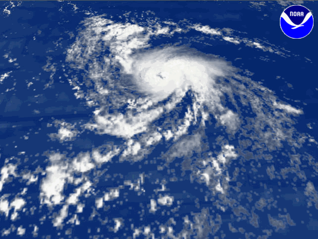
Joyce headed westward and steadily intensified. Deep convection
and outflow improved, and Joyce gradually developed an eye
. On September 27, it was upgraded to a hurricane with cold cloud tops. Early on September 28, Joyce peaked in intensity with winds of 90 mph (150 km/h), a central pressure
of 975 mbar (28.8 inHg), and a fleeting "pinhole" eye. At the time, it was located about midway between Africa and the Lesser Antilles
.
Wind shear
then increased, partially exposing Joyce's center of circulation, although bursts of convection remained. Convection and organization slowly deteriorated, and became, early on September 29, "pretty crummy" and without a well-defined center of circulation. Joyce did manage to remain at hurricane intensity through this time. Due to the disorganization, it was downgraded to a tropical storm later that day. Despite occasional bursts of convection, Joyce weakened into a tropical depression as it crossed the Windward Islands
on October 1. The weakening was confirmed by Hurricane Hunter reconnaissance flights. After crossing the Windward Islands, and entering the southeastern Caribbean Sea, Joyce unexpectedly degenerated into an open wave. Although Joyce's remnants were monitored for regeneration, any possible redevelopment never materialized.
Joyce dissipated in an area of low wind shear and warm sea surface temperatures. The National Hurricane Center
attributed the weakening to dry air from the Sahara. The dry air may have been caused by a lack of southwesterlies bring moisture from equatorial areas, and continental influence
from South America
.
, with errors ten to twenty percent smaller than the ten-year average. In general, Joyce persistently stayed south of where it was forecast to be. By contrast, intensity forecasts had large errors. Indeed, at 0900 UTC on October 2 Joyce was forecast to be a 70 mph (112.7 km/h) tropical storm three days out, when in reality the storm dissipated six hours later. These forecast errors were blamed on Joyce's surprise dissipation. Regarding potential impacts, Joyce's storm surge of 1 m (3.3 ft) on Trinidad
was accurately forecast.
On September 30, a tropical storm watch was issued for the Windward Islands
from St. Vincent and the Grenadines south to Trinidad and Tobago
. One hour later, the watch was extended to Saint Lucia
. Later that day, the watches were upgraded to warnings in Trinidad and Tobago and Grenada
. On October 1, Trinidad's warning was downgraded to a watch. After that, the watches and warnings were gradually discontinued, first in Barbados
and St. Vincent and the Grenadines, then Trinidad and Saint Lucia, then Tobago, and finally Grenada. In response to the approaching hurricane, emergency operations centers in Grenada and both main islands of Trinidad and Tobago were placed on alert.
 While weakening, Tropical Depression Joyce passed close to Tobago
, causing sustained wind
s of 30 miles per hour (48.3 km/h). Barbados experienced the highest sustained winds Joyce brought to any land area. There, the winds were 35 mph (56.3 km/h), gusting to 45 mph (72.4 km/h). Neither Barbados, Trinidad and Tobago, nor Grenada reported serious effects from Joyce. Joyce caused storm surge
of 1 metres (3 ft) on southeast Trinidadian shores. After degenerating into an open wave, Joyce's remnants passed over the ABC Islands, where locally heavy thunderstorms and light winds were reported on October 2. A tropical wave
related to Joyce's decay was blamed for flooding in the Dominican Republic
, where rain caused the Mao
, Amina, and Yaque del Norte River
s to burst their banks, flooding thousands of hectares of banana
and rice
crops. Damage was reported in communities in the northeastern part of the country. No other impact was reported, and no deaths were blamed on Joyce.
Officials from Trinidad and Tobago reported that Joyce made landfall
in that country. The National Hurricane Center
differs, not attributing any landfall to Joyce. If Joyce really made landfall on Tobago, it would have been the first tropical storm to do so since 1990's Arthur
. In addition, Joyce moved south of west for a time at a location where it is rare for tropical cyclones to do so.
Tropical cyclone
A tropical cyclone is a storm system characterized by a large low-pressure center and numerous thunderstorms that produce strong winds and heavy rain. Tropical cyclones strengthen when water evaporated from the ocean is released as the saturated air rises, resulting in condensation of water vapor...
, tenth named storm, and sixth hurricane of the 2000 Atlantic hurricane season
2000 Atlantic hurricane season
The 2000 Atlantic hurricane season was the first season without a tropical cyclone in July since 1987. The season officially began on June 1, 2000, and lasted until November 30, 2000. The June through November dates conventionally delimit the period of each year when most tropical cyclones form in...
. A Cape Verde-type storm
Cape Verde-type hurricane
A Cape Verde-type hurricane is an Atlantic hurricane that develops near the Cape Verde islands, off the west coast of Africa. The average hurricane season has about two Cape Verde-type hurricanes, which are usually the largest and most intense storms of the season because they often have plenty of...
forming from a tropical wave
Tropical wave
Tropical waves, easterly waves, or tropical easterly waves, also known as African easterly waves in the Atlantic region, are a type of atmospheric trough, an elongated area of relatively low air pressure, oriented north to south, which move from east to west across the tropics causing areas of...
in late September, Joyce headed generally westward and eventually intensified into a hurricane. As it neared the southern Windward Islands
Windward Islands
The Windward Islands are the southern islands of the Lesser Antilles, within the West Indies.-Name and geography:The Windward Islands are called such because they were more windward to sailing ships arriving in the New World than the Leeward Islands, given that the prevailing trade winds in the...
, it entrained dry air and weakened as it passed over the island chain. It then degenerated into an open wave, which was not anticipated by the National Hurricane Center
National Hurricane Center
The National Hurricane Center , located at Florida International University in Miami, Florida, is the division of the National Weather Service responsible for tracking and predicting weather systems within the tropics between the Prime Meridian and the 140th meridian west poleward to the 30th...
.
While weakening, Joyce passed over the southern Windward Islands
Windward Islands
The Windward Islands are the southern islands of the Lesser Antilles, within the West Indies.-Name and geography:The Windward Islands are called such because they were more windward to sailing ships arriving in the New World than the Leeward Islands, given that the prevailing trade winds in the...
. It brought winds below gale-force to Barbados
Barbados
Barbados is an island country in the Lesser Antilles. It is in length and as much as in width, amounting to . It is situated in the western area of the North Atlantic and 100 kilometres east of the Windward Islands and the Caribbean Sea; therein, it is about east of the islands of Saint...
and Tobago
Tobago
Tobago is the smaller of the two main islands that make up the Republic of Trinidad and Tobago. It is located in the southern Caribbean, northeast of the island of Trinidad and southeast of Grenada. The island lies outside the hurricane belt...
without significant effects. Its remnants brought rain to the ABC Islands and then the Dominican Republic
Dominican Republic
The Dominican Republic is a nation on the island of La Hispaniola, part of the Greater Antilles archipelago in the Caribbean region. The western third of the island is occupied by the nation of Haiti, making Hispaniola one of two Caribbean islands that are shared by two countries...
, causing minor damage. No fatalities were reported.
Meteorological history
Hurricane Joyce originated from a tropical waveTropical wave
Tropical waves, easterly waves, or tropical easterly waves, also known as African easterly waves in the Atlantic region, are a type of atmospheric trough, an elongated area of relatively low air pressure, oriented north to south, which move from east to west across the tropics causing areas of...
that emerged from the coast of Africa on September 22. Influenced by a powerful ridge
Ridge (meteorology)
A ridge is an elongated region of relatively high atmospheric pressure, the opposite of a trough....
that had developed in the wake of Hurricane Isaac
Hurricane Isaac (2000)
Hurricane Isaac was a tropical cyclone which was tied for the strongest tropical cyclone of the 2000 Atlantic hurricane season. The thirteenth tropical cyclone, ninth named storm, and the fifth hurricane of the season, Isaac developed from a tropical wave south of Cape Verde on September 21. On...
, the wave traveled a brisk and slightly undulating westward path at 14 to 18 mph (22.5 to 29 km/h). It would never change from that general path. While in the deep tropics of the open Atlantic, the wave began to show indications of a closed circulation. Satellite
Weather satellite
The weather satellite is a type of satellite that is primarily used to monitor the weather and climate of the Earth. Satellites can be either polar orbiting, seeing the same swath of the Earth every 12 hours, or geostationary, hovering over the same spot on Earth by orbiting over the equator while...
data was ambiguous, but the evidence favored the existence of a tropical cyclone, and the system was designated Tropical Depression Fourteen. At the next advisory, the cyclone was upgraded and named "Joyce", although satellite data was still ambiguous about whether Joyce even had a circulation.
Joyce headed westward and steadily intensified. Deep convection
Atmospheric convection
Atmospheric convection is the result of a parcel-environment instability, or temperature difference, layer in the atmosphere. Different lapse rates within dry and moist air lead to instability. Mixing of air during the day which expands the height of the planetary boundary layer leads to...
and outflow improved, and Joyce gradually developed an eye
Eye (cyclone)
The eye is a region of mostly calm weather found at the center of strong tropical cyclones. The eye of a storm is a roughly circular area and typically 30–65 km in diameter. It is surrounded by the eyewall, a ring of towering thunderstorms where the second most severe weather of a cyclone...
. On September 27, it was upgraded to a hurricane with cold cloud tops. Early on September 28, Joyce peaked in intensity with winds of 90 mph (150 km/h), a central pressure
Atmospheric pressure
Atmospheric pressure is the force per unit area exerted into a surface by the weight of air above that surface in the atmosphere of Earth . In most circumstances atmospheric pressure is closely approximated by the hydrostatic pressure caused by the weight of air above the measurement point...
of 975 mbar (28.8 inHg), and a fleeting "pinhole" eye. At the time, it was located about midway between Africa and the Lesser Antilles
Lesser Antilles
The Lesser Antilles are a long, partly volcanic island arc in the Western Hemisphere. Most of its islands form the eastern boundary of the Caribbean Sea with the Atlantic Ocean, with the remainder located in the southern Caribbean just north of South America...
.
Wind shear
Wind shear
Wind shear, sometimes referred to as windshear or wind gradient, is a difference in wind speed and direction over a relatively short distance in the atmosphere...
then increased, partially exposing Joyce's center of circulation, although bursts of convection remained. Convection and organization slowly deteriorated, and became, early on September 29, "pretty crummy" and without a well-defined center of circulation. Joyce did manage to remain at hurricane intensity through this time. Due to the disorganization, it was downgraded to a tropical storm later that day. Despite occasional bursts of convection, Joyce weakened into a tropical depression as it crossed the Windward Islands
Windward Islands
The Windward Islands are the southern islands of the Lesser Antilles, within the West Indies.-Name and geography:The Windward Islands are called such because they were more windward to sailing ships arriving in the New World than the Leeward Islands, given that the prevailing trade winds in the...
on October 1. The weakening was confirmed by Hurricane Hunter reconnaissance flights. After crossing the Windward Islands, and entering the southeastern Caribbean Sea, Joyce unexpectedly degenerated into an open wave. Although Joyce's remnants were monitored for regeneration, any possible redevelopment never materialized.
Joyce dissipated in an area of low wind shear and warm sea surface temperatures. The National Hurricane Center
National Hurricane Center
The National Hurricane Center , located at Florida International University in Miami, Florida, is the division of the National Weather Service responsible for tracking and predicting weather systems within the tropics between the Prime Meridian and the 140th meridian west poleward to the 30th...
attributed the weakening to dry air from the Sahara. The dry air may have been caused by a lack of southwesterlies bring moisture from equatorial areas, and continental influence
Continental climate
Continental climate is a climate characterized by important annual variation in temperature due to the lack of significant bodies of water nearby...
from South America
South America
South America is a continent situated in the Western Hemisphere, mostly in the Southern Hemisphere, with a relatively small portion in the Northern Hemisphere. The continent is also considered a subcontinent of the Americas. It is bordered on the west by the Pacific Ocean and on the north and east...
.
Forecasting, impact, and naming
Joyce's track was well forecastTropical cyclone track forecasting
Tropical cyclone track forecasting involves predicting where a tropical cyclone is going to track over the next five days, every 6 to 12 hours. The history of tropical cyclone track forecasting has evolved from a single station approach to a comprehensive approach which uses a variety of...
, with errors ten to twenty percent smaller than the ten-year average. In general, Joyce persistently stayed south of where it was forecast to be. By contrast, intensity forecasts had large errors. Indeed, at 0900 UTC on October 2 Joyce was forecast to be a 70 mph (112.7 km/h) tropical storm three days out, when in reality the storm dissipated six hours later. These forecast errors were blamed on Joyce's surprise dissipation. Regarding potential impacts, Joyce's storm surge of 1 m (3.3 ft) on Trinidad
Trinidad
Trinidad is the larger and more populous of the two major islands and numerous landforms which make up the island nation of Trinidad and Tobago. It is the southernmost island in the Caribbean and lies just off the northeastern coast of Venezuela. With an area of it is also the fifth largest in...
was accurately forecast.
On September 30, a tropical storm watch was issued for the Windward Islands
Windward Islands
The Windward Islands are the southern islands of the Lesser Antilles, within the West Indies.-Name and geography:The Windward Islands are called such because they were more windward to sailing ships arriving in the New World than the Leeward Islands, given that the prevailing trade winds in the...
from St. Vincent and the Grenadines south to Trinidad and Tobago
Trinidad and Tobago
Trinidad and Tobago officially the Republic of Trinidad and Tobago is an archipelagic state in the southern Caribbean, lying just off the coast of northeastern Venezuela and south of Grenada in the Lesser Antilles...
. One hour later, the watch was extended to Saint Lucia
Saint Lucia
Saint Lucia is an island country in the eastern Caribbean Sea on the boundary with the Atlantic Ocean. Part of the Lesser Antilles, it is located north/northeast of the island of Saint Vincent, northwest of Barbados and south of Martinique. It covers a land area of 620 km2 and has an...
. Later that day, the watches were upgraded to warnings in Trinidad and Tobago and Grenada
Grenada
Grenada is an island country and Commonwealth Realm consisting of the island of Grenada and six smaller islands at the southern end of the Grenadines in the southeastern Caribbean Sea...
. On October 1, Trinidad's warning was downgraded to a watch. After that, the watches and warnings were gradually discontinued, first in Barbados
Barbados
Barbados is an island country in the Lesser Antilles. It is in length and as much as in width, amounting to . It is situated in the western area of the North Atlantic and 100 kilometres east of the Windward Islands and the Caribbean Sea; therein, it is about east of the islands of Saint...
and St. Vincent and the Grenadines, then Trinidad and Saint Lucia, then Tobago, and finally Grenada. In response to the approaching hurricane, emergency operations centers in Grenada and both main islands of Trinidad and Tobago were placed on alert.
Tobago
Tobago is the smaller of the two main islands that make up the Republic of Trinidad and Tobago. It is located in the southern Caribbean, northeast of the island of Trinidad and southeast of Grenada. The island lies outside the hurricane belt...
, causing sustained wind
Wind
Wind is the flow of gases on a large scale. On Earth, wind consists of the bulk movement of air. In outer space, solar wind is the movement of gases or charged particles from the sun through space, while planetary wind is the outgassing of light chemical elements from a planet's atmosphere into space...
s of 30 miles per hour (48.3 km/h). Barbados experienced the highest sustained winds Joyce brought to any land area. There, the winds were 35 mph (56.3 km/h), gusting to 45 mph (72.4 km/h). Neither Barbados, Trinidad and Tobago, nor Grenada reported serious effects from Joyce. Joyce caused storm surge
Storm surge
A storm surge is an offshore rise of water associated with a low pressure weather system, typically tropical cyclones and strong extratropical cyclones. Storm surges are caused primarily by high winds pushing on the ocean's surface. The wind causes the water to pile up higher than the ordinary sea...
of 1 metres (3 ft) on southeast Trinidadian shores. After degenerating into an open wave, Joyce's remnants passed over the ABC Islands, where locally heavy thunderstorms and light winds were reported on October 2. A tropical wave
Tropical wave
Tropical waves, easterly waves, or tropical easterly waves, also known as African easterly waves in the Atlantic region, are a type of atmospheric trough, an elongated area of relatively low air pressure, oriented north to south, which move from east to west across the tropics causing areas of...
related to Joyce's decay was blamed for flooding in the Dominican Republic
Dominican Republic
The Dominican Republic is a nation on the island of La Hispaniola, part of the Greater Antilles archipelago in the Caribbean region. The western third of the island is occupied by the nation of Haiti, making Hispaniola one of two Caribbean islands that are shared by two countries...
, where rain caused the Mao
Mao River
-References:* The Columbia Gazetteer of North America. 2000.**...
, Amina, and Yaque del Norte River
Yaque del Norte River
The Yaque Del Norte River is the longest river in the Dominican Republic. The river rises in the centre of the country to the south of Santiago city in Santiago province. The river runs roughly due north, through Santiago, before turning west-north-west through the Cibao Valley. It enters the...
s to burst their banks, flooding thousands of hectares of banana
Banana
Banana is the common name for herbaceous plants of the genus Musa and for the fruit they produce. Bananas come in a variety of sizes and colors when ripe, including yellow, purple, and red....
and rice
Rice
Rice is the seed of the monocot plants Oryza sativa or Oryza glaberrima . As a cereal grain, it is the most important staple food for a large part of the world's human population, especially in East Asia, Southeast Asia, South Asia, the Middle East, and the West Indies...
crops. Damage was reported in communities in the northeastern part of the country. No other impact was reported, and no deaths were blamed on Joyce.
Officials from Trinidad and Tobago reported that Joyce made landfall
Landfall (meteorology)
Landfall is the event of a tropical cyclone or a waterspout coming onto land after being over water. When a waterspout makes landfall it is reclassified as a tornado, which can then cause damage inland...
in that country. The National Hurricane Center
National Hurricane Center
The National Hurricane Center , located at Florida International University in Miami, Florida, is the division of the National Weather Service responsible for tracking and predicting weather systems within the tropics between the Prime Meridian and the 140th meridian west poleward to the 30th...
differs, not attributing any landfall to Joyce. If Joyce really made landfall on Tobago, it would have been the first tropical storm to do so since 1990's Arthur
1990 Atlantic hurricane season
The 1990 Atlantic hurricane season was the most active Atlantic hurricane season since 1969. It officially began on June 1, 1990, and lasted until November 30, 1990. These dates conventionally delimit the period of each year when most tropical cyclones form in the Atlantic basin...
. In addition, Joyce moved south of west for a time at a location where it is rare for tropical cyclones to do so.
See also
- List of South America tropical cyclones
- Other tropical cyclones named Joyce
- Timeline of the 2000 Atlantic hurricane seasonTimeline of the 2000 Atlantic hurricane seasonThe Timeline of the 2000 Atlantic hurricane season documents all the storm formations, strengthening, weakening, landfalls, extratropical transitions, as well as dissipation...